AnonymeLivre Rare Book
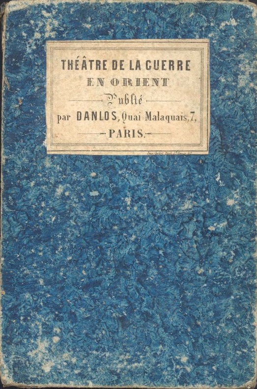
1852ref. 201871852 1852 P.,sans date vers 1852,pliées,bon etat,complet malgré une fente
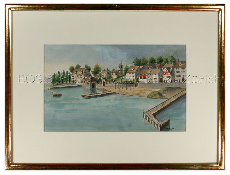
ref. 592DG20. Jh. Aquarell. Bildformat: 19 x 32 cm. Blattgrösse: 36 x 49 cm.
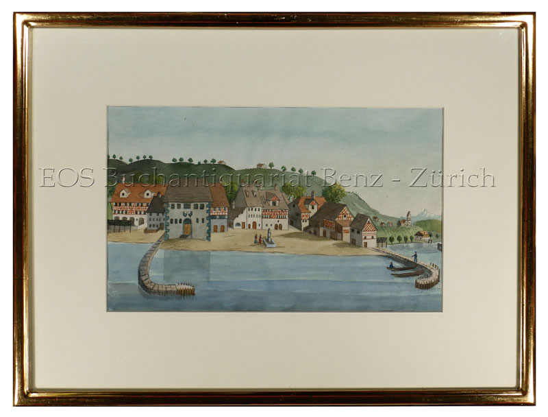
ref. 593DG20. Jh. Aquarell. Bildformat: 19 x 32 cm. Blattgrösse: 36 x 49 cm.
ref. 592DG20. Jh. Aquarell. Bildformat: 19 x 32 cm. Blattgrösse: 36 x 49 cm. + Wichtig: Für unsere Kunden in der EU erfolgt der Versand alle 14 Tage verzollt ab Deutschland / Postbank-Konto in Deutschland vorhanden +, bild
ref. 593DG20. Jh. Aquarell. Bildformat: 19 x 32 cm. Blattgrösse: 36 x 49 cm. + Wichtig: Für unsere Kunden in der EU erfolgt der Versand alle 14 Tage verzollt ab Deutschland / Postbank-Konto in Deutschland vorhanden +, bild
1600Pianta archeologica a proiezione verticale con alzato, priva di data ed indicazioni editoriali. Si tratta di una fedele replica della pianta archeologica pubblicata da Nicolas van Aelst ed incisa da Ambrogio Brambilla, probabilmente edita a Roma tra la fine del ’500 e l’inizio del secolo successivo. Caldana sottolinea che “l’anonimo incisore è bravo quasi quanto l’autore dell’originale, le differenze sono minime, salvo le misure che nella copia sono leggermente inferiori; imitata persino la calligrafia dei toponimi meno che per alcuni, scritti in lettere maiuscole”. Dal punto di vista editoriale, l’esistenza di un esemplare con l’imprint di Gian Giacomo de Rossi, descritto da Hülsen (1933) nella raccolta del castello di Wolfegg, certifica che il rame fosse in possesso della tipografia romana. Sempre Caldana sostiene, ma senza fondamento, che la pianta fu fatta incidere da Giuseppe de Rossi nel 1637, in occasione della ristampa della pianta di Roma moderna. Crediamo invece che il rame sia più antico e che, come per molte lastre del secolo precedente, solo successivamente venga acquisito dalla tipografia de Rossi. In alto, lungo il bordo superiore, è inciso il titolo: ANTIQUAE URBIS PERFECTA ET NOVA DELINEATIO. Lungo il margine inferiore si trova una legenda numerica di 90 rimandi a luoghi e monumenti notabili distribuita, su quindici colonne. Orientazione nei quattro lati al centro con il nome dei punti cardinali: SEPTENTRIO, MERIDIES, OCCIDENS, ORIENS il nord è a sinistra. Nella tavola sono presenti ulteriori indicazioni toponomastiche. Acquaforte e bulino, privo di indicazioni editoriali. Esemplare nel primo stato di due, avanti l'indirizzo di De Rossi. Magnifico esemplare di questa rara pianta archeologica di Roma. In perfetto stato di conservazione. Bibliografia Bifolco-Ronca, Cartografia e topografia italiana del XVI secolo, p. 2368, tav. 1217, I/II; Caldana (2013): n. I.28; Hülsen (1915): pp. 55-56, VIIIc, n. 41; Hülsen (1933): p. 106, VIIIc, n. 41a; Scaccia Scarafoni (1939): p. 28, n. 24. Archaeological map with vertical projection with elevation, without date and printing details. It is a faithful replica of the map published by Nicolas van Aelst and engraved by Ambrogio Brambilla, probably published in Rome between the end of the 16th century and the beginning of the following century. Caldana underlines that "the anonymous engraver is almost as good as the author of the original, the differences are minimal, except for the measurements that in the copy are slightly smaller; even the calligraphy of the place names is imitated, less so for some, written in capital letters". From the editorial point of view, the existence of a copy with the imprint of Gian Giacomo de Rossi, described by Hülsen (1933) in the collection of Wolfegg Castle, certifies that the copper was in the possession of the Roman printing house. Caldana also maintains, but without foundation, that the map was engraved by Giuseppe de Rossi in 1637, on the occasion of the reprinting of the modern Rome map. We believe instead that the copper is older and that, as for many plates of the previous century, it was only later acquired by de Rossi's printing house. At the top, along the upper edge, is engraved the title: ANTIQUAE URBIS PERFECTA ET NOVA DELINEATIO. Along the lower margin there is a numerical legend of 90 references to notable places and monuments distributed on fifteen columns. Orientation on the four sides in the centre with the name of the cardinal points: SEPTENTRIO, MERIDIES, OCCIDENS, ORIENS the north is on the left. In the map there are further toponymic indications. Etching and engraving; exemple in the first state of two, before the De Rossi's address. Magnificent example of this rare archaeological map of Rome. In perfect state of conservation. Literature Bifolco-Ronca, Cartografia e topografia italiana del XVI secolo, p. 2368, tav. 1217, I/II; Caldana (2013): n. I.28; Hülsen (1915): pp. 55-56, VIIIc, n. 41; Hülsen (1933): p. 106, VIIIc, n. 41a; Scaccia Scarafoni (1939): p. 28, n. 24.
1871Veduta a proiezione obliqua presa da un ideale punto al di sopra della Porta del Popolo.Non abbiamo trovato notizie bibliografiche su questo rarissimo documento, probabilmente la prima rappresentazione di Roma, subito dopo la proclamazione a capitale d'Italia (21 gennaio 1871) data che costituisce un termine post quem per il presente panorama.L'opera è dedicata a "tutti i Corpi Istituzionali del Regno ai Municipi ed alla Guardia Nazionale Pubblicato a memoria del voto compiuto 1870", ovvero a tutte le forse armate che contribuirono alla presa di Roma del 20 settembre 1870.Lo stemma sabaudo del Regno d'Italia, la dedica alla Guardia Nazionale ci inducono a pensare che l'opera sia stata stampata a Torino. Una rubrica di 150 rimandi - stampata tipograficamente - completa questo rarissimo panorama.Non possiamo escludere che si tratti di una veduta disegnata da un pallone areostatico.Acquaforte e acquatinta, leggere abrasioni nella parte superiore, piccoli restauri visibili al verso, nel complesso in buono stato di conservazione. Bird's eye view taken from an ideal point above the Porta del Popolo.We have not found bibliographic information on this very rare document, probably the first representation of Rome, immediately after the proclamation as the capital of Italy (January 21, 1871) date which is the terminus post quem for the present panorama.The work is dedicated to "tutti i Corpi Istituzionali del Regno ai Municipi ed alla Guardia Nazionale Pubblicato a memoria del voto compiuto 1870", that is to say to all the perhaps armed forces that contributed to the taking of Rome on September 20, 1870.The Savoy coat of arms of the Kingdom of Italy, the dedication to the National Guard lead us to think that the work was printed in Turin. A column of 150 references - typographically printed - completes this very rare panorama.We cannot exclude that it is a view drawn by an aerostatic balloon.Etching and aquatint, slight abrasions in the upper part, small restorations visible on the reverse side, overall in good condition.
1831Interessante e rara pianta topografica di Roma su cui sono riportati gli interventi progettati dall'Ammiistrazione Francese, che riguardano l'ampliamento del porto di Ripetta, la realizzazione di muraglioni sul Tevere, la sistemazione di piazza del Popolo e la salita al Pincio.La pianta dipende dall'opera di Philippe Camille De Tournon, che la realizzò sotto l'amministrazione francese nel 1814 circa, ma venne pubblicata 15 anni dopo.A sinistra "Spiegazione di alcuni segni che si veggono nella pianta" e l'Indice dei monumenti più notevoli; a destra, l'elenco dei XIV RioniAcquaforte e bulino, impressa su 20 tavole di circa 15,7 x 14,4 cm, montate su tela, in ottimo stato di conservazione. Custodia originale in cartoncino rosso.Non censita nei principali repertori. Interesting and rare topographical map of Rome on which are shown the interventions planned by the French Administration, concerning the enlargement of the port of Ripetta, the construction of embankments on the Tiber, the arrangement of Piazza del Popolo and the ascent to the Pincio. The plan is based on the work of Philippe Camille De Tournon, who created it under the French administration in about 1814, but it was published 15 years later. On the left "Explanation of some signs that can be seen in the plan" and the Index of the most remarkable monuments; on the right, the list of the XIV Rioni Etching and engraving, printed on 20 plates of about 15.7 x 14.4 cm, mounted on canvas, in excellent condition. Original case in red cardboard. Marigliani, 231.
1632Pianta della città pubblicata in GOTTFRIED, J. L. (ABELIN, J. P.). Inventarium Sveciae. Das ist: Gründliche, und warhaffte Beschreibung dess Königreichs Schweden und dessen incorpoirten Provintzen, darinnen von Natur und Eigenschafft dess Lands, Fruchtbarkeit, Metallen, Wassern, stehenden, fliessenden und Meeren, Innwohnerne und Völkern.... Frankfurt am Main (Wolffgang Hofmann) 1632.Si tratta di una copia della pianta di J. De Bry del 1597, senza alcun aggiornamento. In basso a destra troviamo il monogramma I.K. Fecit. Acquaforte, grandi margini, minimi restauri alla piega centrale, per il resto in buono stato di conservazione. Map of Rome published in GOTTFRIED, J. L. (ABELIN, J. P.). Inventarium Sveciae. Das ist: Gründliche, und warhaffte Beschreibung dess Königreichs Schweden und dessen incorpoirten Provintzen, darinnen von Natur und Eigenschafft dess Lands, Fruchtbarkeit, Metallen, Wassern, stehenden, fliessenden und Meeren, Innwohnerne Frankfurt am Völkern ... 1632. It is a close copy of Johannes De Bry's map of 1597, without any updating. At the bottom right we find the monogram I.K. Fecit. Etching, large margins, minimal restorations to the central fold, otherwise in good condition. Marigliani (2007), p. 179, n. 82.
1700Panorama della città nel classico stile olandese. Incisione in rame, in perfette condizioni. Sconosciuta ai repertori, rarissima. Panorama della città nel classico stile olandese. Incisione in rame, in perfette condizioni. Sconosciuta ai repertori, rarissima.
1840Immaginiaria e curiosa veduta panoramica di Roma, presa dal Gianicolo. Del panorama reale vengono rispettati e riprodotti soltanto i monumenti essenziali: ponte S. Angelo, che è anche l'unico ponte disegnato, Castel S. Angelo e qualche cupola a caratterizzare lo sfondo.Stampata in Francia, dall'editore e stampatore Gosselin.Litografia, finemente colorata a mano, piccoli strappi restaurati nella parte superiore destra, lievi fioriture ai margini, nel complesso in buono stato di conservazione. Immaginiaria e curiosa veduta panoramica di Roma, presa dal Gianicolo. Del panorama reale vengono rispettati e riprodotti soltanto i monumenti essenziali: ponte S. Angelo, che è anche l'unico ponte disegnato, Castel S. Angelo e qualche cupola a caratterizzare lo sfondo.Stampata in Francia, dall'editore e stampatore Gosselin.Litografia, finemente colorata a mano, piccoli strappi restaurati nella parte superiore destra, lievi fioriture ai margini, nel complesso in buono stato di conservazione.
1935Small mark inside rear cover and to last page. No inscriptions, no creasing to main covers, slight rubbing and creasing to oversize edges. A very clean very tight copy with bright unmarked boards. 32pp. A series of sepia photographs of the beautiful places of Scotland. Not dated, ca 1930s.
1964Michelin travel guide with text in French. With many town maps and illustrations in the text. 195 pages. 260mm x 120mm. Wear to cover edges and corners with small tear in the middle of the spine. Top page corners a little dog-eared. Some slight browning and soiling to covers.
1964Previous owners name and date at top of front free endpaper. Covers shelfworn and spine faded.
1788ref. 024356London: Printed for J. Walker 1788. Book. Very Good. Hardcover. First Edition. 12mo. A very good four volume set in contemporary full tree calf binding with double lettering pieces in red and green. Complete pp. iii-vii 1 222; 2 206; 2 238 & 2 198. No half-titles which may or may not be wanting but the pagination for the prelims to vol. I might suggest that one is required Very good bindings with a little rubbing a couple of volumes slightly chipped to the head/tail of the spines corners lightly bruised. Contents clean and tight manuscript Greek initials to title pages dated 1788 otherwise unmarked no foxing paper crisp. A very good set. A Rare Eighteenth Century Novel. We have managed to located just one other copy at auction in the last thirty years and that at Sotheby's sale of July 21 1993 where it made £1000 on the hammer though seemingly not such a nice copy. Referenced by: ESTC T068744. Printed for J. Walker Hardcover
1983ref. 11731Philoffset éditions 1983 252 pages in4. 1983. Reliure Editeur avec jaquette. 252 pages. Ouvrage présentant une collection de cartes postales anciennes de Marseille publié en 1983. Il s'inscrit dans une collection éditoriale dédiée aux loisirs culturels et à la découverte du patrimoine local
19371 volume reli? toile. 115 pages + 120 pages de cartes.
2003ref. 5321Taschen 2003 224 pages in-12 carré. 2003. Broché - illustrations couleurs. 224 pages.
ref. 63889, Hannibal Books, 2024 Hardcover,320 pagina's met prachtige illustraties, 29 25 cm. Nederlandstalige editie. ISBN 9789464666113.
ref. 63890, Hannibal Books, 2024 Hardcover, 320 pages with beautiful illustrations, 29 25 cm. English language edition. ISBN 9789464941043.
1936ref. 8741Librairie Plon 1936 267 pages in8. 1936. broché. 267 pages. Récit du voyage aérien d'Anne Morrow Lindbergh et de son mari Charles Lindbergh de l'Amérique à la Chine en passant par le cercle polaire illustré de photographies et de cartes établies par Charles Lindbergh. L'ouvrage publié en 1936 par la Librairie Plon décrit cette expédition aérienne à travers des régions extrêmes
ref. 63-6396New York: Harcourt Brace 1938. Dust Jacket Only. 12mo. DJ Good with marginal tears at tail of spine minor staining inside DJ corners clipped. Original First Edition. New York: Harcourt Brace, 1938. unknown
1935ref. B3841New York: Harcourt Brace and Company 1935. Dust jacket missing Very Good condition. Edition: Third Printing. Binding: Original full cloth with blue lettering flat spine. Size: Small 4to Illustration: With profuse black and white illustrations. Category: Book Arctic & Antarctic Harcourt, Brace and Company hardcover
1930Very Good German Original autograph letters signed, concert programs and one ticket of Bruno Walter and Jose Iturbi in 23 September 1932 by Anita Tiedcke, letters by and to Anita Tiedcke, Muhiddin Erel and Suna and Sevim Erels. Includes 54 concert programs, booklets and leaflets which some of them are handwritten, typewritten and mostly original prints. Some programs contains Anita Tiedcke's violin parts, early ones in Berlin (1930s), and later period ones in Istanbul. Especially typescript Istanbul programs (such as Aysegül Sarica's ones) are extremely rare and very important collection on Turkish history of classical music. One special designed hand written and drawn concert program titled "In Mozart Reich - Weihnachts Konzert gespielt von Nannerl u. Wolfgang Mozart. 24 autograph letters from and to all family members. Letters belong to Anita Tiedcke, are especially important for which include legal correspondences about Anita Tiedcke's conversion to Islam with her musician identity and musical history. Anita Tiedcke changed her name as 'Emine Erel' after conversion to Islam and marriage. Suna and Sevim Erels' letters also talk about music mostly. They are written in German usually, but some of them are in Turkish. Also the collection contains some book lists, catalogues. Anita Tiedcke completed her musical education at the Conservatory of Hamburg with the violonist Erika Besserer. After her marriage to Muhiddin Erel, she continued her musical studies in Istanbul and worked as an instructor at the Municipal Conservatory. In 1945, she was appointed as the mayor of the Istanbul Municipal Symphony Orchestra. The couple had two daughters, Suna and Sevin. Suna Erel was not content with the conservatory, but she also graduated from the Münch Hochschule für Musik Academy. Professor Suna Erel, who worked at Mimar Sinan University for many years, retired 8 years ago. For his achievements, the German government awarded Suna Erel the Beethoven medal. Muhiddin Erel was a Turkish professor and doctor. He was the founder of Ege University Medicine Faculty in 1955. Extremely rare and fine collection.
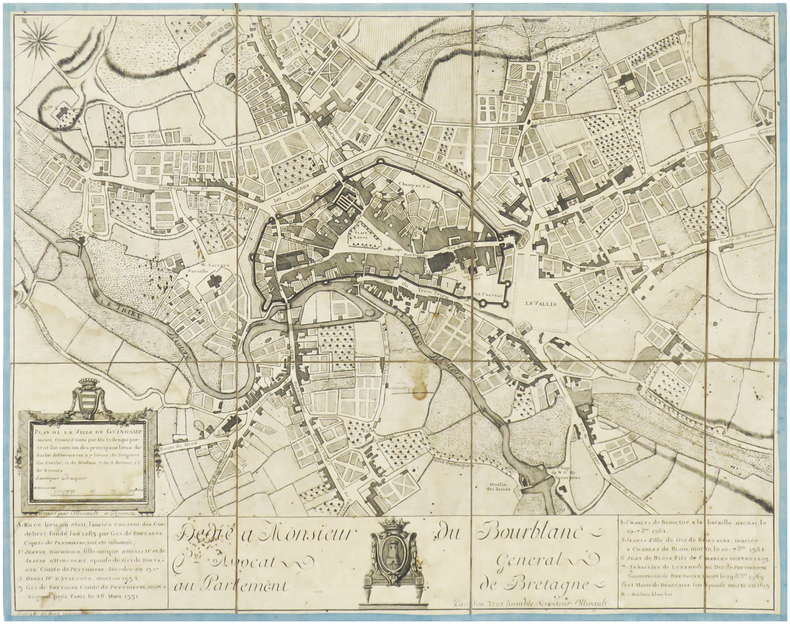
ref. LBW-3972Rennes, Ollivault, [circa 1770]. En 8 sections montées sur toile bordée de soie bleue et pliées, formant un plan de 371 x 475 mm.