12,365 results
1903130 pages. Index. Bibliography. Frontispiece. Ten plates at back. Sixteen informative pages of advertisements. Text in English, translated from the German. Seeks, in part, to to address errors of Carl Christian Rafn in his 1837 work "Antiquitates Americanae". Forest green cloth exterior adorned with attractive gilt lettering and decorations. Top edge gilt. Usual library markings. Binding intact. Average wear. A sound copy of this informative work. Book
1982No marks or inscriptions. No creasing to covers or to spine. A very clean very tight copy with bright unmarked boards and the tiniest of bumps to upper corner. 96pp.
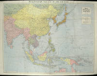
1940ref. 205763London.: Hutchinson & Co. Circa1940. Full colour folding map 70.7 x 93 cms; 76 x 101.2 cms sheet original folds short fold splits previous owner's neat title markings on the verso but the map in very good condition. A "Geographia" map of the war theatre in Asia and the Pacific including the northernmost coast of Australia. Showing railways and canals roads and steamer routes oilfields and pipe lines and a key to the unfederated states of Malaya. The Spratley Islands are marked as French and Thai territorial claims within French Indo China are marked. . Hutchinson & Co. unknown
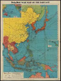
1944ref. 205765London.: George Philip & Son. 1944. Full colour folding map 101.5 x 76cm sheet inset maps legend folding into title wrapper 25.7 x 19.4 cm covers a little dusty and discoloured a few short fold splits without loss but the map in very good bright condition. Map of the Pacific Theatre of World War II with borders drawn as they stood in 1937 - complete with Chinese claims on Mongolia Tuva and Tibet. Shows transportation routes principal railways oil fields Allied naval bases territory occupied by the British Empire French Empire and the United States. This map shows only the northernmost section of Australia which allows for much better detail of the countries of East Asia. Small inset map of the Hawaiin Islands at mid right. Inset map of the Pacific Ocean at upper left. . George Philip & Son. unknown
1976Signed by author on front end paper. Also small neat sticker from previous owner on front end paper. No other marks or inscriptions. A very clean very tight copy with bright unmarked boards and no bumping to corners. Price clipped dust jacket not marked or torn or creased with traces of storage. 199pp.
1966No marks or inscriptions. Creasing to upper corners of covers. A fold-out relief map with unmarked covers. 1pp. Opens up to 120 x 8 inches. All the sights doen the Rhine with descriptions in English.
ref. 0331318040.Gpaperback. Good. Access codes and supplements are not guaranteed with used items. May be an ex-library book. paperback
ref. 366634US: Houghton Mifflin 1952. Houghton Mifflin 1952 First Edition NAP Fine/Very Good DJ Author: De Voto Bernard; Raisz Erwin maps. Light blue cloth with grey text bloacks and brown lettering. USA map end papers. Pages lightly tanned with many smaller maps in text. xxii647 pages with index. Bright glossy clipped dust jacket with small mended tears protected in clear dust jacket cover. HEAVY ITEM 1.89 Pounds. Size: 8 5/8 x 6 x 1 1/2 inches. First Edition NAP. Hardcover. Fine/Very Good DJ. No Exp. Houghton Mifflin Hardcover
1995No marks or inscriptions. Tiny crease to upper corner of rear covers and to lower part of spine. A very clean very tight copy with bright unmarked slightly indented boards and no bumping to corners. 288pp. Reproductions and discussion of the maps of every county of Britain done by John Speed, originally drawn and coloured just before and after the year 1600.
1994No marks or inscriptions. No creasing to covers or to spine. A very clean very tight copy with bright unmarked boards and no bumping to corners. 160pp. The history of Sydney and its harbour and everything you would want to know about it in modern times. Very well illustrated.
2011Book is brand new and in excellent condition in every respect. Binding is solid and square, covers have sharp corners, exterior shows no blemishes, text/interior is clean and free of marking of any kind. 336 pages with graphic endpapers, heavily illustrated throughout with large prints of paintings, sculpture, drawings, sketches, etc. Sections include: revolution by night ( Giorgio de Chirico, Max Ernest) The color of my dreams (Joan Miro, Andre Masson) Behind the screen (surrealism and film) Spaces of the unconscious, The surrealist object, Myths, maps, magic, The lure of the Pacific Northwest (Wolfgang Paalen's film, Kwakwaka'wakw headdress & Andre Breton, Anatomies of desire, etc.
1974ref. Q-030729031xRandom House 1974-01-01. Hardcover. New. In shrink wrap. Looks like an interesting title! Random House hardcover
1960Name to top of title page. No other marks or inscriptions. No creasing to covers. A very clean very tight booklet with bright unmarked boards, minor traces of storage and no bumping to corners. 32pp. Illustrated guide to York. Tucked in are two copies of a town plan and things to do leaflet. Undated ca 1960s.
ref. 1527718301.Gpaperback. Good. Access codes and supplements are not guaranteed with used items. May be an ex-library book. paperback
1961No marks or inscriptions and no creasing to covers. A lovely clean very tight copy with bright unmarked boards, minor rubbing to spine ends and no bumping to corners. 168pp. Comprehensive concise review of the Hull, its industry, sport, shops, suburbs, transport, shipping etc. Undated but Lord Mayors listed up to 1960.
2015ref. 010343Little Brown and Company New York 2015 2015. 1st Edition 1st Printing. Hardcover. Fine/Fine. 1st ed. 1st printing ; 417 pages : illustrations maps ; 25 cm ISBN 9780316196673 0316196673 OCLC 907513849 LCCN 2015933034 Classification - LC E183.8.C5 B667 2015 ; green boards in pictorial color dustjacket ; "From the bestselling author of Flags of our Fathers Flyboys and The Imperial Cruise a spellbinding history of turbulent U.S.-China relations from the 19th century to World War II and Mao's ascent. In each of his books James Bradley has exposed the hidden truths behind America's engagement in Asia. Now comes his most engrossing work yet. Beginning in the 1850s Bradley introduces us to the prominent Americans who made their fortunes in the China opium trade. As they--good Christians all--profitably addicted millions American missionaries arrived promising salvation for those who adopted Western ways. And that was just the beginning. From drug dealer Warren Delano to his grandson Franklin Delano Roosevelt from the port of Hong Kong to the towers of Princeton University from the era of Appomattox to the age of the A-Bomb The China Mirage explores a difficult century that defines U.S.-Chinese relations to this day" ; A spellbinding history of US-China relations from the nineteenth century to World War II and Mao's ascent by the author of Flags of Our Fathers and Flyboys. ; "Bradley is sharp and rueful and a voice for a more seasoned constructive vision of our international relations with East Asia." -Christian Science Monitor ; "A vivid bracing and careful study. . . . Bradley's valuable book offers a warning about past and future unnecessary entanglements." -History News Network ; "The China Mirage underscored the missed opportunities in our relationship with China-a lesson for our current leaders." -Portland Press Herald ; Contents: Old China new China -- Win the leaders; win China -- The Japanese Monroe Doctrine for Asia -- The noble Chinese peasant -- The China lobby -- The first wise man's new China -- Washington warriors -- Secret executive air war in Asia -- A war over oil -- Asleep at the wheel -- The mandate of heaven -- Who lost China -- The China marriage ; remainder mark at top of textblock else FINE/FINE Little, Brown and Company, New York, 2015 hardcover
1996No marks or inscriptions. No creasing to covers or to spine. A very clean very tight booklet with bright unmarked boards and no bumping to corners. 27pp.
1998No marks or inscriptions. A lovely clean very tight copy with bright unmarked boards and no bumping to corners. Dust jacket not price clipped or marked or torn with minor crease near top of sunned spine. 273pp. A study of the strongholds of the Edwardian Conquest in North Wales and the Norman defences in South Wales. Well illustrated.
1966178 pages. At the behest of the Federal Minister of Finance (Mitchell Sharp), this volume presents the results of an investigation into the Cape Breton Coal Problem plus recommended policies which might be appropriate to the situation. Confirms the steadily increasing amount of subsidy required to support the Cape Breton coal industry and stresses the urgency of adopting and implementing new policies. Contains illustrations, maps and graphs. Prior owner's signature and date upon title page. Minimal marginalia and underlining in blue ball point pen. Average wear overall with top of spine open. Book
1912120 pages consisting of 89 pages of colour maps of the world, several colour diagramatic graphs, etc., and 25 pages of textual data including distances, historical items, cities and towns. The Canadian Thresherman and Farmer was published in Winnipeg from 1910 to 1919 by E.H. Heath and billed itself as 'Canada's Farm Machinery Magazine'. One can well imagine this atlas was intended to offer a view of the distant world to isolated farmers toiling on the vast expanse of Canadian prairie. Includes a detailed two-page map and profile of the newly completed engineering marvel known as the Panama Canal. Occasional ink writing to contents. Hinges open. Name atop front free endpaper. Somewhat above-average wear to publisher's maroon cloth. A worthy and uncommon surviving copy of this vintage Canadian atlas. Book
1969No marks or inscriptions. Very minor creasing to covers, creasing to spine. A clean tight slightly cocked copy with a trace of damp to top right corner of front cover. 252pp. Coloured pull-out map in perfect condition.
1975206 pages including index. An operational and geographical study of the Canadian National and its equipment from its formation in 1919 through 1975. Told with knowledgeable text and over 400 fine black and white photos, maps and equipment rosters, enough to thrill and delight the hearts of al railroaders and railroad fans. Light wear to clean unmarked book. Dust jacket is price-clipped, moderately worn and bears several small tears each under one quarter inch in length. Very nice copy. Book
ref. 0282155023.Gpaperback. Good. Access codes and supplements are not guaranteed with used items. May be an ex-library book. paperback
2007ref. 49413Washington D. C.: Dumbarton Oaks Research Library and Collection 2007. Good to near fine condition. Quarto. li 394 xv 290 plates 3 folding maps in envelope on inside back cover. Original textured blue cloth with gilt lettering on covers and spines in photo-illustrated dustjackets brown lettering on spine. Frontispiece maps. The Pontos and its Empire of Trebizond 1204-1461 embraced the distinctive Black Sea coastlands mountains and pastures of northeastern Anatolia. "The purpose of this Study is twofold. First it is an essay in placing the material remains of the medieval peoples of a distinct region of Anatolia the Pontos in their historical and geographical setting. Second it is a record - all too often of what can no longer be recorded. In the two decades since Anthony Bryer A.A.M.B. and David Winfield D.C.W. first met in the east porch of the Hagia Sophia Trebizond on 19 August 1959 the Pontos has suffered a greater physical transformation than in its entire previous history." Preface. Illustrated with some five hundred b/w photographs on 290 plates three folding maps two in two colors and in-text drawings maps plans and tables. Contains list of figures abbreviations and an extensive bibliography at front appendix with measurements and indices at rear. Dustjackets with light creasing at top and bottom edges light creasing hear and small closed tear at top left of volume two. Interiors in near fine condition. Dumbarton Oaks Research Library and Collection unknown books
2007ref. 49413Washington D. C.: Dumbarton Oaks Research Library and Collection 2007. Good to near fine condition. Quarto. li 394 xv 290 plates 3 folding maps in envelope on inside back cover. Original textured blue cloth with gilt lettering on covers and spines in photo-illustrated dustjackets brown lettering on spine. Frontispiece maps. The Pontos and its Empire of Trebizond 1204-1461 embraced the distinctive Black Sea coastlands mountains and pastures of northeastern Anatolia. "The purpose of this Study is twofold. First it is an essay in placing the material remains of the medieval peoples of a distinct region of Anatolia the Pontos in their historical and geographical setting. Second it is a record - all too often of what can no longer be recorded. In the two decades since Anthony Bryer A.A.M.B. and David Winfield D.C.W. first met in the east porch of the Hagia Sophia Trebizond on 19 August 1959 the Pontos has suffered a greater physical transformation than in its entire previous history." Preface. Illustrated with some five hundred b/w photographs on 290 plates three folding maps two in two colors and in-text drawings maps plans and tables. Contains list of figures abbreviations and an extensive bibliography at front appendix with measurements and indices at rear. Dustjackets with light creasing at top and bottom edges light creasing hear and small closed tear at top left of volume two. Interiors in near fine condition. Dumbarton Oaks Research Library and Collection unknown