BUNTING Heinrich (1545 - 1606)MareMagnum

12,535 results
1581Carta storio-geografica che mostra le regioni toccate da San Paolo Apostolo durante la sua predicazione itinerante che interessò tutta l'area del Mediterraneo orientale: dalla Terra Santa all'Africa settentrionale , all'Asia Minore, alla Grecia, all'Italia meridionale e la Sicilia. Sulla mappa sono riportati i toponimi e i profili delle principali città, mentre nel mare - inciso con linee ondulate strette - sono raffigurati mostri marini.La mappa è inserita nell’ Itinerarium Sacrae Scriptura, per la prima volta edito nel 1581, e successivamente ristampato in ben dieci diverse edizioni. L’opera è corredata da diverse curiosità cartografiche decisamente insolite per l’epoca. Xilografia, testo tedesco al verso, piccole mancanze restaurate al margine inferiore bianco, per il resto in buone condizioni. Taken from the "Itinerarium Sacrae Scripturae", the map showing the Eastern Mediterranean with Southern Italy and Sicily, Greece, Cyprus, Asia Minor, the Holy Land and North Africa, with city profiles and sea monsters. Woodcut, very good condition.
1653Bella carta storico-geografica che riporta il percorso dei Diecimila secondo l’Anabasi di Senofonte, ovvero la marcia da Sardi a Cunassa, e il ritorno da Cunassa in Grecia, dei mercenari greci assoldati da Ciro il giovane per usurpare il trono di Persia al fratello Artaserse.Senofonte era uno dei Diecimila.La battaglia tra i due esericti fu combattuta a Cunassa, nel 401 a.C.Anche se l'armata dei mercenari fu vittoriosa nella battaglia sostenuta a Cunassa contro l'esercito dell'imperatore, Ciro non sopravvisse allo scontro, e la sua morte privò la spedizione di ogni senso: i Greci, penetrati troppo a fondo nel territorio nemico, dovettero così ritirarsi verso un porto sicuro, in un ripiegamento che si preannunciava lunghissimo e pieno di insidie.Esemplare tratto da Accuratissima Orbis antiqui delineatio ... L'atlante del Mondo Antico di J. Janssonius, che ebbe diverse edizioni dal 1652 al 1741. Joannes Janssonius, figlio dell'editore di Arnhem Jan Janssen, sposò Elisabeth Hondius, figlia di Jodocus Hondius, ad Amsterdam nel 1612. Dopo il suo matrimonio, si stabilì in questa città come libraio ed editore di materiale cartografico. Nel 1618 si stabilì ad Amsterdam accanto alla libreria di Willem Jansz. Blaeu, entrando in una seria competizione. Le sue attività non riguardavano solo la pubblicazione di atlanti e libri, ma anche di mappe singole e un vasto commercio di libri con filiali a Francoforte, Danzica, Stoccolma, Copenaghen, Berlino, Koningsbergen, Ginevra e Lione. Nel 1631 iniziò a pubblicare atlanti insieme a Henricus Hondius. Nei primi anni 1640 Henricus Hondius lasciò l'attività di pubblicazione di atlanti completamente a Janssonius. La concorrenza con Joan Blaeu, figlio e successore di Willem, nella produzione di atlanti spinse Janssonius ad ampliare il suo Atlas Novus finalmente in un'opera di sei volumi, in cui furono inseriti un atlante marino e un atlante del Vecchio Mondo. Dopo la morte di Joannes Janssonius, il negozio e la casa editrice furono continuati dagli eredi sotto la direzione di Johannes van Waesbergen (c. 1616-1681), genero di Joannes Janssonius. Le matrici degli atlanti di Janssonius furono in seguito vendute a Schenk e Valck. Acquaforte, impressa su carta vergata coeva, finemente acquarellata, in ottimo stato di conservazione. A map of Persia, indicating major settlements, regions, and mountain ranges, as well as the march of the Ten Thousand . The Ten Thousand were a group of mercenary units, mainly Greek, drawn up by Cyrus the Younger to attempt to wrest the throne of the Persian Empire from his brother, Artaxerxes II. Their march to the Battle of Cunaxa and back to Greece (401 BC-399 BC) was recorded by Xenophon (one of its leaders) in his work, The Anabasis. This map was compliled by the French cartographer Pierre du Val, and published in Jansson's Atlas of the Antique World , Accuratissima Orbis antiqui delineatio... which went through several editions 1652-1741. Joannes Janssonius (Arnhem, 1588-1664), son of the Arnhem publisher Jan Janssen, married Elisabeth Hondius, daughter of Jodocus Hondius, in Amsterdam in 1612. After his marriage, he settled down in this town as a bookseller and publisher of cartographic material. In 1618 he established himself in Amsterdam next door to Blaeu’s book shop. He entered into serious competition with Willem Jansz. Blaeu.. His activities not only concerned the publication of atlases and books, but also of single maps and an extensive book trade with branches in Frankfurt, Danzig, Stockholm, Copenhagen, Berlin, Koningsbergen, Geneva, and Lyon. In 1631 he began publishing atlases together with Henricus Hondius. In the early 1640s Henricus Hondius left the atlas publishing business completely to Janssonius. Competition with Joan Blaeu, Willem’s son and successor, in atlas production prompted Janssonius to enlarge his Atlas Novus finally into a work of six volumes, into which a sea atlas and an atlas of the Old World were inserted. After the death of Joannes Janssonius, the shop and publishing firm were continued by the heirs under the direction of Johannes van Waesbergen (c. 1616-1681), son-in-law of Joannes Janssonius. The copperplates from Janssonius’s atlases were afterwards sold to Schenk and Valck. Koeman, C. Atlantes Neerlandici, Ja 2.
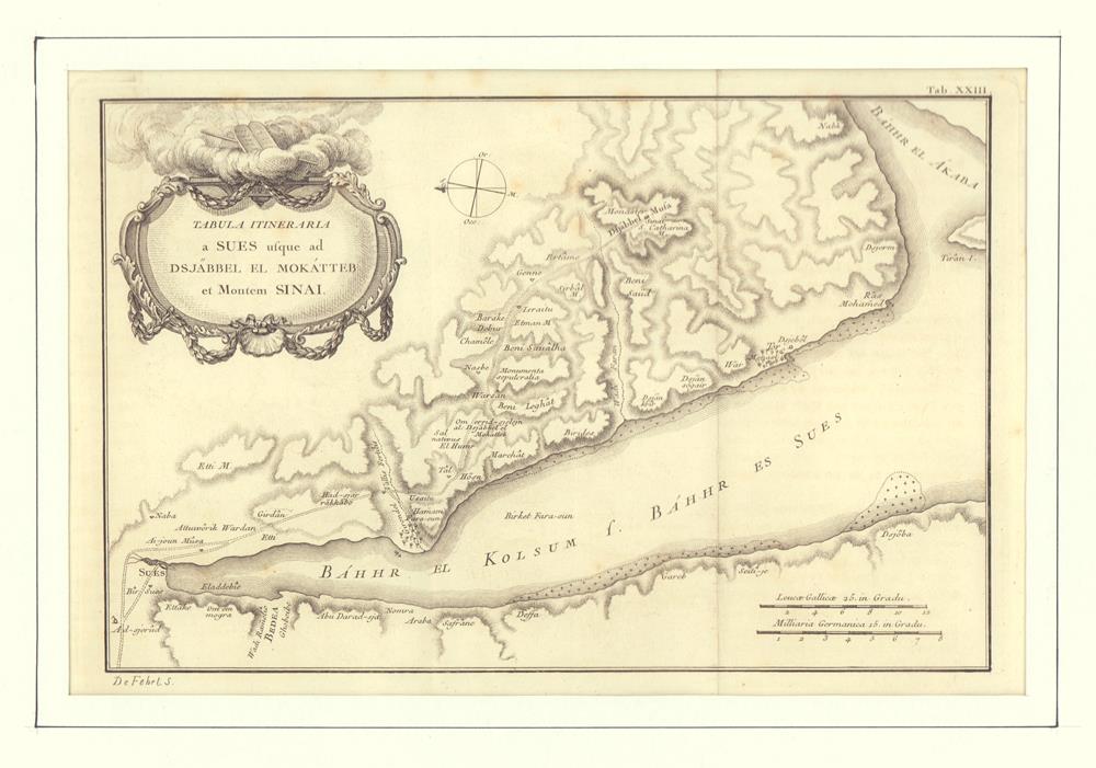
1776ref. 81153[ 1776]. 18,5 x 29 cm. Unter Passepartout.
1772ref. 78798Kopenhagen, André Philippe de Pretot, 1772. Blattmaß 28 x 40 cm; Bildmaß 18 x 28,5 cm.
1665Straordinaria mappa fisica ed idrografica del mondo, raffigurante le correnti oceaniche, profondità marine ed i vulcani. La carta è tratta dal Mundus Subterraneus del Kircher, studioso gesuita, uno dei primi scrittori sui fenomeni fisici della terra. Il Kircher teorizzava che tutti gli oceani della Terra erano connessi tra loro tramite dei tunnel sotterranei che univano oceani e mari. Tra il Mar Mediterraneo, il Mar Nero, il Mar Caspio e il Golfo Persico, Kircher ha teorizzato enormi gallerie e un complesso interscambio di flussi d'acqua. Questi tunnel sono particolarmente noti tra il Mar Nero e il Mar Caspio e tra il Mediterraneo e il Golfo Persico. L'Antartide è rappresentata lungo la parte meridionale della mappa. A nord è raffigurato un grande passaggio aperto a nord-ovest che corre lungo tutta la mappa. Mostra la Nuova Guinea e una suggestione dell'Australia collegata alla terraferma Australsis Incognita. L'Africa è mostrata con una precisione notevolmente maggiore rispetto a molte mappe disegnate centinaia di anni dopo - in particolare per quanto riguarda il Niger e i sistemi fluviali del Nilo. Il Nord America e il Sud America sono entrambi maldestramente raffigurati, il che indica una conoscenza relativamente sommaria del continente. La Corea viene mostrata come un'isola e il Giappone appare come un'unica isola. Incisione in rame, in eccellente stato di conservazione. Extraordinary map, both form the physical and hydrographic point of view, depicting ocean currents, volcanoes and deep-sea chasms. The map is taken from Kircher’s Mundus Subterraneus . The Jesuit scholar, Athanasius Kircher, was one of the first compilers of semi-scientific knowledge about the physical features of the world. This map expounds on Kircher's theories by noting the abysses and the currents they create as well as the locations of the world's known volcanoes. Between the Mediterranean Sea, the Black Sea, the Caspian Sea, and the Persian Gulf, Kircher theorized massive tunnels and a complex interchange of water flows. These tunnels are noted most particularly between the Black and Caspian Sea and between the Mediterranean and the Persian Gulf. Antarctica is shown along the southern part of the map. In the North a great open northwest passage is depicted running all the way across the map. Shows New Guinea and a suggestion of Australia attached to the 'Australsis Incognita' mainland. Africa is shown with considerably greater accuracy than many maps drawn hundreds of years later – particularly with regard to Niger and Nile River Systems. North America and South America are both wildly malformed, indicating a relatively sketchy knowledge of the continent. Korea is shown as an Island and Japan appears as only a single island.Published in a Dutch edition of Kircher's famous Subterranean World by Johann Waesberger.Copperplate, in excellent condition. Shirley, The Mapping of the World, 459.
1696Carta nautica del mondo tratta dalla Specula physico-mathematico-historica notabilium ac mirabilium sciendorum, in qua mundi mirabilis oeconomia ... nunc autem ad lucem protractus, ac ad varias perfacili methodo acquirendas scientias in epitomen collectus thesaurus curiosis omnibus cosmosophis inspectandus proponitur... / authore Joanne Zahndello Zahn, una cosmografia riccamente illustrata. Zahn era un monaco, studioso e scienziato, si dedicò a studi sulla camera oscura. La sua opera è sulla scia di Athanasius Kircher - studioso gesuita, uno dei primi scrittori sui fenomeni fisici della terra - che, nel suo Mundus Subterraneus (1665) teorizzava che tutti gli oceani della Terra erano connessi tra loro tramite dei tunnel sotterranei che univano oceani e mari. Tra il Mar Mediterraneo, il Mar Nero, il Mar Caspio e il Golfo Persico, Kircher ha teorizzato enormi gallerie e un complesso interscambio di flussi d'acqua. Questi tunnel sono particolarmente noti tra il Mar Nero e il Mar Caspio e tra il Mediterraneo e il Golfo Persico. L'Antartide è rappresentata lungo la parte meridionale della mappa. A nord è raffigurato un grande passaggio aperto a nord-ovest che corre lungo tutta la mappa. Mostra la Nuova Guinea e una suggestione dell'Australia collegata alla terraferma Australsis Incognita. L'Africa è mostrata con una precisione notevolmente maggiore rispetto a molte mappe disegnate centinaia di anni dopo - in particolare per quanto riguarda il Niger e i sistemi fluviali del Nilo. Il Nord America e il Sud America sono entrambi maldestramente raffigurati, il che indica una conoscenza relativamente sommaria del continente. La Corea viene mostrata come un'isola e il Giappone appare come un'unica isola. Incisione in rame, in ottimo stato di conservazione. A world chart from the Specula physico-mathematico-historica notabilium ac mirabilium sciendorum, in qua mundi mirabilis oeconomia ... nunc autem ad lucem protractus, ac ad varias perfacili methodo acquirendas scientias in epitomen collectus thesaurus curiosis omnibus cosmosophis inspectandus proponitur... / authore Joanne Zahn, a finely illustrated cosmography, designed to show the ocean currents, vortexes and volcanos. Johann Zahn (1631-1707), a German monk, also published a … read morebook on optics, 'Oculus Artificialis Teledioptricus Sive Telescopium' (1685), with extensive descriptions of both the camera obscura and the magic lantern, which he used for anatomical lectures.[«] SHIRLEY: World 583, "engravings of a high standard". The Mundi Mirabilis oeconomia was influenced by Kircher’s Mundus Subterraneus (1665). The Jesuit scholar, Athanasius Kircher, was one of the first compilers of semi-scientific knowledge about the physical features of the world. This map expounds on Kircher's theories by noting the abysses and the currents they create as well as the locations of the world's known volcanoes. Between the Mediterranean Sea, the Black Sea, the Caspian Sea, and the Persian Gulf, Kircher theorized massive tunnels and a complex interchange of water flows. These tunnels are noted most particularly between the Black and Caspian Sea and between the Mediterranean and the Persian Gulf. Antarctica is shown along the southern part of the map. In the North a great open northwest passage is depicted running all the way across the map. Shows New Guinea and a suggestion of Australia attached to the 'Australsis Incognita' mainland. Africa is shown with considerably greater accuracy than many maps drawn hundreds of years later – particularly with regard to Niger and Nile River Systems. North America and South America are both wildly malformed, indicating a relatively sketchy knowledge of the continent. Korea is shown as an Island and Japan appears as only a single island. Copperplate, very good condition. R. W. Shirley, "The Mapping of the world", 583.
1753Carta a proiezione polare dell'emisfero boreale, estratta dall'atlante geografico pubblicato per la prima volta nel 1753 da Leonhard Euler.Mostra un vasto sistema fluviale nella zona dei Grandi Laghi che forma un Passaggio a Nord-Ovest.La carta è pubblicata nel raro Atlas geographicus omnes orbis terrarum regiones in XLI tabulis exhibens : jussu Academiae regiae scient. et eleg. litt. Boruss. ad emendatiora, quae adhuc prodiere exempla descriptus atque ad usum potissimum scholarum et institutionem juventutis editus = Atlas geographique representant en XLI cartes toutes les regions de la terre : gravé par ordre de l'Académie royale des sciences et belles lettres de Prusse d'apres les meilleurs exemplaires qui ayent paru jusqu'icy a l'usage principalement des ecoles. Berolini : Ex officina Michaelis MDCCLIII (1753). Incisione in rame, bella coloritura coeva, in ottimo stato di conservazione. Hand colored copperplate engraving map of Northern Hemisphere, extracted from a geographical atlas first published in 1753 by Leonhard Euler. Relief shown pictorially. Shows extensive river system connecting it with the Great Lakes and thus forming a Northwest Passage.Published in the rare Atlas geographicus omnes orbis terrarum regiones in XLI tabulis exhibens : jussu Academiae regiae scient. et eleg. litt. Boruss. ad emendatiora, quae adhuc prodiere exempla descriptus atque ad usum potissimum scholarum et institutionem juventutis editus = Atlas geographique representant en XLI cartes toutes les regions de la terre : gravé par ordre de l'Académie royale des sciences et belles lettres de Prusse d'apres les meilleurs exemplaires qui ayent paru jusqu'icy a l'usage principalement des ecoles. Berolini : Ex officina Michaelis MDCCLIII.Copperplate with fine origibal colour, very good condition.
1753Carta a proiezione polare dell'emisfero australe, pubblicata per la prima volta nel 1753 da Leonhard Euler.Mostra la Tasmania e la Nuova Guinea ancora uniti all'Australia; il Sud Africa e il Sud America. Include un cartiglio decorativo con titolo e stemmi.La carta è pubblicata nel raro Atlas geographicus omnes orbis terrarum regiones in XLI tabulis exhibens : jussu Academiae regiae scient. et eleg. litt. Boruss. ad emendatiora, quae adhuc prodiere exempla descriptus atque ad usum potissimum scholarum et institutionem juventutis editus = Atlas geographique representant en XLI cartes toutes les regions de la terre : gravé par ordre de l'Académie royale des sciences et belles lettres de Prusse d'apres les meilleurs exemplaires qui ayent paru jusqu'icy a l'usage principalement des ecoles. Berolini : Ex officina Michaelis MDCCLIII (1753). Incisione in rame, bella coloritura coeva, in ottimo stato di conservazione. Hand colored copperplate engraving map of Southern Hemisphere on 2 sheets, extracted from a geographical atlas first published in 1753 by Leonhard Euler. Relief shown pictorially. Shows Tasmania and New Guinea still joined to Australia, South Africa, South America. Published in the rare Atlas geographicus omnes orbis terrarum regiones in XLI tabulis exhibens : jussu Academiae regiae scient. et eleg. litt. Boruss. ad emendatiora, quae adhuc prodiere exempla descriptus atque ad usum potissimum scholarum et institutionem juventutis editus = Atlas geographique representant en XLI cartes toutes les regions de la terre : gravé par ordre de l'Académie royale des sciences et belles lettres de Prusse d'apres les meilleurs exemplaires qui ayent paru jusqu'icy a l'usage principalement des ecoles. Berolini : Ex officina Michaelis MDCCLIII.Copperplate with fine origibal colour, very good condition.
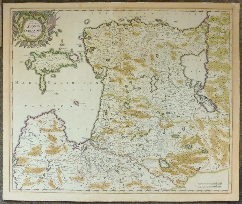
1680ref. 52698Amsterdam, [ca. 1680]. Plattenmaß: 59,5 x 48 cm [Blattmaß: 62,5 x 52,5 cm]. Mit kolorierter barocker Titelkartusche (oben links) u. zweifachem Maßstab.
48 x 57,5 cm. *Blatt 29 aus dem Homann-Atlas auf kräftigem Papier. Landkarten de
1712Brussels, 1712. Folio (512 x 315 mm). In contemporary half calf with seven raised bands. Spine and hindges with wear. Leather brittle and upper and lower 10 cm hindges detached. Two library labels pasted on to pasted down front end-paper. Upper margin of first three leaves blind-stamped. Handwritten (19th century hand) index mounted in on verso of first map and each map numbered. With 75 maps and plans, many double-page or folding: 24 cartes des Pays Bas, Carte générale de Brabant, Carte du Pays de Waes, Carte des Postes d'Allemagne, 48 plans des Villes, Sièges & Batailles (complete). 3 maps with minor marginal tear (outside plate), 2 with minor split to lower part of middle folding. A few maps at end with browning. A few plates (primarily 61, 50, 33, 25) heavily trimmed with slight loss to upper margin. An overall fine and clean copy.
ref. 20567Tablette recouverte de papier maroquiné rouge, décor de roulettes dorées sur les plats, ardoise façon vélin pour la marque de points d'un coté avec son crayon en étain, tableau imprimé des paiements du Boston au verso, Molette tournante pour le comptage des points (quelques usures sur les tranches). Dix-neuvième siècle, (100 x 155 mm). Bon état compte tenu de la fragilité de l'objet.
1977ref. 9738Genève, Slatkine, 1977. 4 volumes grand in-folio de [12]-10-[2]-134-[4]; [6]-p.135 à 368-LXVI-[2]; [8]-322-[2] et [6]- p. 323 à 578-[4]-II-7-8-129 (table analytique) pages, plein skyvertex vert, dos lisses ornés de roulettes, encadrements, fleurons, titre et tomaison dorés, étiquettes de titre et tomaison noires, triple roulettes dorées ornant les plats. Un coin un peu tapé, pour le reste en belle condition.
ref. 10278ou suite du tableau de la France pour servir de guide à ceux qui partent de Paris, pour les principales parties du monde. L’on y trouve la description historique des provinces & villes par où l’on passe, le commerce & le cours des monnoies des lieux qui ont le plus de correspondance avec Paris, les dépendances & la puissance de chaque souverain, les mœurs é religions des différentes nations. Tome premier in 12 plein cuir fauve raciné, fers, roulette dorés, pièces titre et tomaison manquantes, filets à froid encadrant les plats. Frontispice gravé, titre, XIII, 1 page d’errata, carte de l’Europe, dépliante (petit manque à un angle) 477 pages, 3 pages approbation 8 cartes dépliantes y compris l’Europe : Italie, Espagne, Pays Bas, Allemagne, Pologne, Suède, Iles britanniques. A Paris chez Leclerc 1767. Mouillures
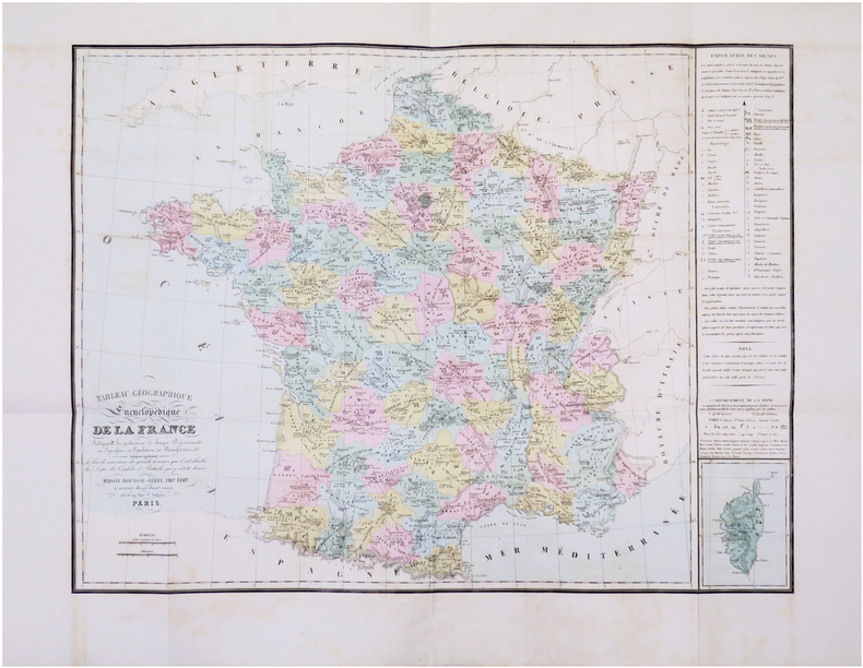
1867ref. LBW-8464Paris, Maison Bouasse-Lebel, Imp. Édit. et ancienne Maison Basset réunies, [1867]. 593 x 778 mm.
1824ref. LBW-6190Paris, chez l'auteur, 1824. 499 x 627 mm.
1880ref. LBW-8945Paris, J. Dosseray, [vers 1880]. 535 x 648 mm.
1824ref. 118011824 toilée. carte pliante, 108 x 94 cms. P. Goujon, 1824,
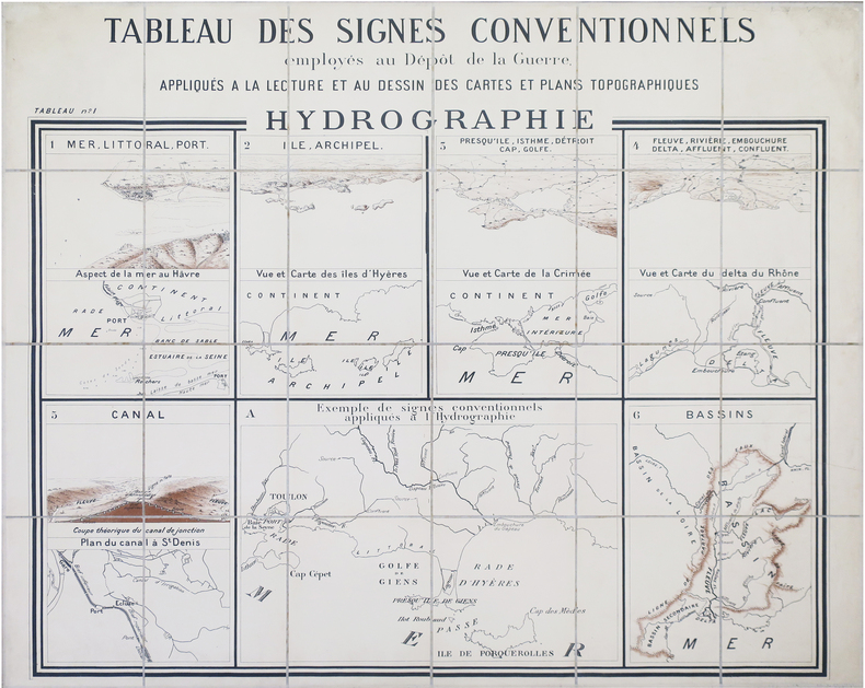
1880ref. LBW-8467Dépôt de la Guerre, [circa 1880]. En 24 sections montées sur toile et repliées, formant une carte de 0,94 x 1,13 m.
1712ref. 60165Brussels, 1712. Folio (512 x 315 mm). In contemporary half calf with seven raised bands. Spine and hindges with wear. Leather brittle and upper and lower 10 cm hindges detached. Two library labels pasted on to pasted down front end-paper. Upper margin of first three leaves blind-stamped. Handwritten (19th century hand) index mounted in on verso of first map and each map numbered. With 75 maps and plans, many double-page or folding: 24 cartes des Pays Bas, Carte générale de Brabant, Carte du Pays de Waes, Carte des Postes d'Allemagne, 48 plans des Villes, Sièges & Batailles (complete). 3 maps with minor marginal tear (outside plate), 2 with minor split to lower part of middle folding. A few maps at end with browning. A few plates (primarily 61, 50, 33, 25) heavily trimmed with slight loss to upper margin. An overall fine and clean copy.
1862ref. LBW-1122Paris, Jules Renouard, 1862. 520 x 716 mm.
1862ref. LBW-5394Paris, Jules Renouard, 1862. 530 x 711 mm.
1746ref. LBW-33181746. 168 x 212 mm.
ref. 46400522, Strasbourg, Treuttel , Paris, Onfroy, 1790; 2 vol.- Tableau des Révolutions de l'Europe, depuis le bouleversement de l'Empire Romain en Occident, jusqu'à nos jours. Paris, Schoell, 1807; 3 vol.- Abrégé de l'histoire des traités de paix entre les puissances de l'Europe depuis la paix de Westphalie. Bâle, Decker; Paris, Pougens; Strasbourg, König et Levrault, 1796-97; 4 vol.- Ensemble 9 vol. in-8, cart. bradel papier vert, dos ornés de fil. dor., pièces de mar. rouge et vert, tranches jaspées. (Cartonnages début XIX e siècle). "Nombreux tableaux hors-texte et 5 belles cartes sur doubles pages, soigneusement enluminées. Christophe-Guillaume Koch est une célébrité protestante alsacienne. Né à Bouxviller en 1737, d'une famille originaire de Strasbourg qui remplissait les fonctions de Conseiller à la Chambre des finances des Comtes de Hesse-Hanau, il fit ses études à Strasbourg sous la direction du célèbre professeur Schoepflin avec lequel il se lia d'amitié et dont il deviendra le collaborateur pour l'Alsatia diplomatica. Député à Paris en 1789 il soutint les droits civils et religieux des protestants d'Alsace. En 1791 il siégea à l'Assemblée législative. Arrêté comme concervateur il passa près d'un an dans diverses prisons jusqu'à la chue de Robespiere. Il mourut à Strasbourg en 1813. Voir Sitzmann pp. 52-54-Haag VI, 124-128. """" Le tableau des Révolutions d'Europe est le meilleur abrégé d'une histoire moderne depuis le V e siècle, qui existe en aucune langue"""" Schoell. Un des volumes porte l'ex-libris manuscrit du Comte Auguste de Belisle, un écrivain qui en 1824 publia des Contes en vers."
1617ref. LBW-1921[Arnhem, Joannes Jansson, 1617]. 130 x 166 mm.