Mosel, Wilhelm (Bearb.)Antiquariat.de

11,782 results
1995ref. 39156Hamburg, 1995. 99 S. Mit s/w-Abb. (= Schriftenreihen der Deutsch-Jüdischen Gesellschaft (DJG) Hamburg., Reihe 2, Heft 2). Gr.-8vo. OBrosch.
1903ref. 88235Hamburg, C. Adler, 1902/1903. Mehrfach gefalt. farbiger Straßenplan. Kartenmaß 38 x 52 cm, Blattmaß 52,5 x 70 cm, Falzmaß 19 cm.
1951ref. 88199[Hamburg, Hansa-Saat Ernst & von Spreckelsen, 1951]. Gefalt. zweifarbiger Stadtplan. Blattmaß 21 x 29, 5 cm, gefaltet auf 14,2 x 9,9 cm.
1987No marks or inscriptions. No creasing to covers or to spine. A very clean very tight copy with bright unmarked boards, minor traces of storage and no bumping to corners. 56pp. Features on old and traditional buildings within the site explaining their constructional methods and history. Well illustrated. Tucked in are five colour postcards from the Museum.
ref. 0976373343-11-1Toucan Maps Inc. 4th. Very Good. It's a well-cared-for item that has seen limited use. The item may show minor signs of wear. All the text is legible with all pages included. It may have slight markings and/or highlighting. Toucan Maps Inc. unknown
1972ref. 142887Couverture souple. Broché. 204 pages. 26 x 28 cm.
1938ref. 49584Chicago: Rand McNally Co. ca. 1938. Large colour map 26.5 x 19.5 in. which folds into 12 sections w/ several inset colour maps on verso colour-illustrated Art Deco cover art of couple driving from the front & back advertising Triton Oil minor shelfwear some dustsoiling still VG map. First edition thus including large Highway map on one side of Washington & Oregon along with smaller inset maps for Portland Everett Salem Seattle Spokane and Tacoma before World War II. Rand McNally Co., unknown
ref. DADAX0929591984National Geographic Maps 2015-10-01. 2015. paperback. New. 11.00x0.25x15.25. Buy with confidence. Excellent Customer Service & Return policy. National Geographic Maps paperback
2012ref. 1-1597752509Natl Geographic Society Maps 2012. Map. New. map edition. 1 pages. 30.50x1.60x1.60 inches. Natl Geographic Society Maps unknown
ref. A9781597752503Sheet map. New. unknown
ref. 1597756024.Gmap. Good. Access codes and supplements are not guaranteed with used items. May be an ex-library book. unknown
1610(Amsterdam, ca. 1610). (19x25,5 cm.). Engraved map of the south east of England in old handcolouring with The Isle of Wright, London, Cambridge etc. etc. Letterpress headline outside engraving ""Angleterre"". Coloured in full. Right and left sides shaved.
1610ref. 48922(Amsterdam, ca. 1610). (19x25,5 cm.). Engraved map of the south east of England in old handcolouring with The Isle of Wright, London, Cambridge etc. etc. Letterpress headline outside engraving ""Angleterre"". Coloured in full. Right and left sides shaved.
ref. 0540087580.Gspiral_bound. Good. Access codes and supplements are not guaranteed with used items. May be an ex-library book. unknown
1926Very slight marking to title page and crease to front cover. A very clean very tight copy with bright lightly marked covers. 72pp.
2012ref. 0165162012 Davidsfonds Uitgeverij Hardcover
1899554p. + Plus frontis and color folding map. Full page text half-tone engravings from photographs. Title page printed in red and black. Paper beginning to brown but not brittle. 4to. Original full cloth binding with pictorial design of British soldier, Boer soldier and an African tribesman. Binding slightly soiled. Nice copy. AFRICA/2
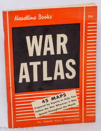
1940ref. 318067New York: The Foreign Policy Association 1940. Pamphlet. 96p. stapled wraps 5.5x7.5 inches maps small stain on top edge of textblock else very good condition. Headline Books No. 23. The Foreign Policy Association unknown books
1986ref. 88234(Hamburg, Vermessungsamt, 1986. Mehrfach gefalt., mehrfarbige Landkarte, Maßstab 1:20.000. Blattmaß 68,5 x 101 cm.
Format: 63 x 100 cm (Blattgröße: 75 x 104 cm). Mehrfach gefaltet. *Seltene großformatige Wandkarte des römischen Reiches, offenbar von 2 großen Steinplatten gedruckt. - Die Falze teils mit hinterlegten Einrissen. Insgesamt in guter Erhaltung mit Rand. Bücher de
1958ref. 87000(Hamburg, Hamburger Sparkasse von 1827, 1958). 14 Bll. mit 12 doppelblattgr. Karten jeweils im Maßstab 1:50 000. Falzmaß 19 x 10 cm. .
1947ref. 23719München 1947. Maßstab: 1:50.000. Mehrfarb. Karte. 62 x 89 cm. Gefaltet. Faltmaß 16 x 12 cm.
1960ref. 88237Hamburg, Paul O. R. Grothe, [ca. 1960. Mehrfach gefalt. farbige Landkarte, Maßstab 1:50.000. Kartenmaß 50 x 73 cm, Blattmaß 52 x 75 cm. Deckelmaß 18 cm. In OKartumschlag geheftet.
1840ref. 848CG(um 1840). Kol. Aquatinta. Bildausschnitt: 7,2 x 11 cm. Rahmengrösse: 16 x 21 cm. + Wichtig: Für unsere Kunden in der EU erfolgt der Versand alle 14 Tage verzollt ab Deutschland / Postbank-Konto in Deutschland vorhanden +, Abb.
2014Book and jacket appear in as new unread condition. 246pp. A complete walk along the Border from Gretna to Lamberton, just north of Berwick on Tweed, filled with information on nature, literature, history and the people who lived there.