Morris, Donald R [maps, Rafael PalaciosBiblio.com

12,245 results
ref. 2712New York : Konecky & Konecky 1965. 1965. Hardcover. Very Good/Very Good. 655 p. : ill. maps ; 24 cm. ; ISBN: 1568520271 ; OCLC: 32905083 ; grey textured cloth with gold lettering in colorful dustjacket ; spot on front cover ; spine creased else VG/VG New York : Konecky & Konecky, 1965. hardcover
1919Cover illustration of British soldier on skis in North Russia. Illustration of the French deliverers in Saverne (Zabert). War Reputations Lost and Won - article by Hamilton Fyfe. British Ships Against Bolshevism in the Baltic - 3 photos including the H.M.S. Calypso and Caradoc plus H.M.S. Angora and Wakeful. U Boat U44 Salvaged - 4 photos. Under the White Ensign in Kiel's Black Waters - 3 photos including the H.M.S. Hercules. Some of the Naval Inventions Employed in the War - article. Photos of the famous German Battle Cruiser Goeben. Two photos of Allenby and his men in Cairo. The Price in Blood and Treasure - article. Photo of earth removal at the base of the Vendome Monument in Paris. Several interesting photos of British mines and the mine-layer 'H.M.S. Wahine.' Four sensational photos of the Handley Page 'Giant'. How Paris & Dunkirk suffered by Bomb and Shell - two maps. Three photos of Holzminden, the worst camp of all. Hun Inhumanity to Helpless Men - some facts about German Prison Camps. Photos of Winners of the V.C. in the last weeks of the war. Demobilising the V.A.D.'s. Some soiling to covers. Average wear. Staples disintegrated. A sound copy. Book
1988No marks or inscriptions to contents. A very clean very tight copy with bright unmarked red cloth boards, discolouration to small part of upper rear corner and no bumping to corners. Dust jacket price clipped but not marked or torn or creased with general traces of storage. 256pp. Detailed guide to the Italian Lakes - Orta, Maggiore, Lugano, Como and Garda and the surrounding area. Well illustrated.
1987Ex library book with usual marks and stamps. Clean tight pages with bright unmarked tape-free red cloth boards and no bumping to corners. Dust jacket not price clipped or marked or torn with creasing. 231pp. An ideal detailed guide for the independent motoring traveller in Corsica.
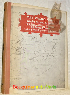
New Haven-London, Yale University Press, 1965. Folio; XII-291 pp., con 24 reproducciones de mapas entre el texto y en láminas aparte, algunas de ellas plegadas. Encuadernación original en media tela. Un estudio fundamental sobre los orígenes de la debatida cartografía referente a Vinlandia y las expediciones a las costas americanas en el medievo.
ref. 12085London, New Haven and London Yale University Press 1963, 295x240mm, 289pages, editor's binding with jacket. Book in good condition.
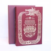
2002ref. 1419316London UK: The Folio Society 2002. First Edition Thus Fourth Printing. Hardcover. Large Octavo xxii 490 pages. In Very Good condition. Housed in publisher's Very Good red slip case. Mild rubbing to slipcase interior. Bound in cloth spine red with gilt lettering. Mild general shelf wear. Slightly discolored along a narrow near-horizontal line in upper center of spine. Top of textblock dyed red. Shelved in Folio Society. 1419316. Shelved Dupont Bookstore. The Folio Society hardcover books
2002ref. 1419316London UK: The Folio Society 2002. First Edition Thus Fourth Printing. Hardcover. Large Octavo xxii 490 pages. In Very Good condition. Housed in publisher's Very Good red slip case. Mild rubbing to slipcase interior. Bound in cloth spine red with gilt lettering. Mild general shelf wear. Slightly discolored along a narrow near-horizontal line in upper center of spine. Top of textblock dyed red. Shelved in Folio Society. 1419316. Shelved Dupont Bookstore. The Folio Society hardcover
1953ref. 309567NY: BALLANTINE BOOKS. Near Fine in Very Good dust jacket. 1953. First Edition. Hardcover. Near fine in a Vg. dj. Barely discernable 2"-inch tear at upper seam of rear panel of dj. A few short edge tears & small chips as well as traces of shelfsoiling to dj. Novel of the Virginia Calvary in the Shenandoah Valley during the Civil War. LR . BALLANTINE BOOKS. hardcover
1930No marks or inscriptions. Very clean map and covers with very minor creasing to oversize parts of covers. 1pp. Linen-backed map of London's roads. Opens up to 22 x 18 inches. Undated but the arterial roads were new around 1930.
2012ref. 1-0792250079National Geographic Maps 2012. Map. New. lam map edition. 1 pages. 39.37x2.17x2.17 inches. National Geographic Maps unknown
2015ref. 1-1597756318Natl Geographic Maps 2015. Paperback. New. lam map edition. 1 pages. 27.00x1.50x1.30 inches. Natl Geographic Maps paperback
194371 pages including index. A guide-book to the future of a vast region awaiting development after the war. A study of the past, present and future of international co-operation in this region. Presents a high challenge to the people of Canada and the US, and their governments. Author was regional chairman of the National Resources Planning Board. Light soiling. Unmarked. Some yellowing. Includes three fold-out maps. Moderate wear to illustrated boards. Nice copy. Book
1967Previous owner's name and date on front end paper. No other marks or inscriptions. A very clean very tight copy with bright unmarked boards and minor bumping to some corners. Price clipped dust jacket not marked or torn with traces of storage. 80pp. Captioned photographic study of old and new Suffolk - the two counties - plus seven page introduction.
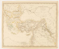
1840ref. 174957London.: Charles Knight & Co. circa1840s. Lithographed map with original outline hand-colour 31.9 x 39.1 cm small marginal tears neatly repaired with archival material but no loss small surface abrasion affecting the border at the foot edgewear and browning inked pagination in an early hand but in very good condition. A handsome map with fine topographical engraving also showing the borders with Hungary Russia and Persia. . Charles Knight & Co. unknown
1999No marks or inscriptions. No creasing to covers or to spine. A very clean very tight copy with bright unmarked boards and no bumping to corners. 181pp. The book which 'separates the myths about the Irish from the reality with a blend of caustic commentary, jokes that will make you laugh out loud and answers to questions you were too polite to ask'.
192762 x 43.5 cm one-sided colour pictorial map reduces to 22.5 x 10 cm when folded inside original blue card cover lettered in black. Illustrates the route of the CNR's Triangle Tour of British Columbia which included "Jasper National Park, Mount Robson Park, the Canadian Rockies, and the scenic seas of the North Pacific coast." Without saying so, the right side of the map switches scales so as not to display Lake Louise, a prime tourist attraction of rival railway Canadian Pacific. Includes eight sepia-tone photos of sights of interest along the way. Clean and unmarked with light wear. A well-preserved copy of this excellent piece of vintage Western Canadian tourist ephemera. Reference: Cornell University Library, Persuasive Maps: PJ Mode Collection 1219.01. Book
20034to [27 x 21 cm]; 292 pp, hundreds of illustrations, almost all in color, including many full-page, index. original pictorial heavy paper wraps, title on spine and cover, light corner wear, else fine, clean and unmarked, includes the loose list of prices realized. A picture of this book is available upon request by email. One of Sotheby's better sales of book and paintings on the middle east, describing 762 lots in detail, very well-illustrated. Sale L03622.
2003This is a very good softcover copy with just light wear. Completely clean inside and out. Spine not creased, binding firm. There are some handling marks here and there and a scratch to the right page-edge, and spine. This is a sale catalog for an auction held at Sotheby's in London on October 14-15, 2003. Sale number: L03622. The sale consisted of paintings, watercolors, drawings, books, maps and photpgraphs of the Near and Middle East. 762 lots in the sale. Many illustrated in color. 11" high X 8" wide, 292 pages. Prices realized sheets included.
20014to [27 x 21 cm]; 219, [iii] pp, hundreds of colored illustrations & maps, including many full-page, some black & white illustrations, bibliography, index. original pictorial heavy paper wraps, title on cover and spine, fine, clean, with the prices realized on loose sheets. A picture of this book is available upon request by email. A beautifully illustrated Sotheby's sale of books, maps and paintings on the middle east, describing 603 lots in detail, very well-illustrated, sale held in London 17 October 2001. A very useful reference. Includes large sections on Greece, Turkey, North Africa, etc. Sale L01956.
20004to [27 x 21 cm]; 225, [i] pp, hundreds of colored & uncolored illustrations & maps, including many full-page, bibliography, index. original pictorial heavy paper wraps, title on cover and spine, few minor notes, near fine, clean. A picture of this book is available upon request by email. A beautifully illustrated Sotheby's sale of books, maps and paintings on Africa, Australasia, Near & Middle East, Americas, Asia, Europe, wall maps, atlases, etc describing 447 lots in detail, very well-illustrated, sale held in London 2 December 1999. A very useful reference. Sale L09215.
20004to [27 x 21 cm]; 272 pp, hundreds of colored & uncolored illustrations & maps, including many full-page, bibliography, index. original pictorial heavy paper wraps, title on cover and spine, few minor notes, near fine, clean. A picture of this book is available upon request by email. A beautifully illustrated Sotheby's sale of books, maps and paintings on Africa, Australasia, Tahiti, South Seas, North & Central America, Caribbean, Europe, etc describing 454 lots in detail, very well-illustrated, sale held in London 14 December 2000. A very useful reference. Sale L00720.
Broch?. 64 pages. Couverture l?g?rement d?fra?chie.
1969Inscription on front end paper. No other marks or inscriptions. A very clean very tight copy with bright unmarked green cloth boards and a little bumping to upper edge and corners. Dust jacket not price clipped, front cover very slightly marked, rear cover soiled and with nicks and light creasing to edges. 296pp. Very detailed tourist guide to South Africa in 1969. Well illustrated, although strangely, there don't seem to be any black people living in the country !
2008ref. 3278London 2008. Slipcased. as New. Bartholomew John G maps. Used - VG: in very good condition with slipcase Hardcover ISBN 13 9780007801503 ISBN 10 0007801505 The Times Book Group. Illustrated hardback laminated board cover. 460mm x 320mm 18" x 13". 67pp 224pp plates. Colour maps. Heavy item - shipping supplement will apply for overseas. . unknown