SWIFT Jonathan:Livre Rare Book
12,235 results
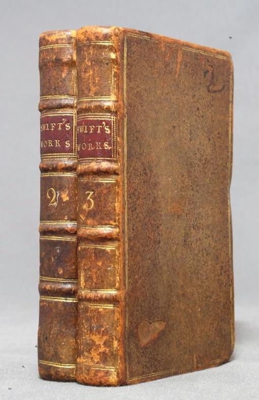
1751ref. 12758London, C. Bathurst, coll. The works of Dr. Jonathan Swift II et III, 1751. 2 volumes in-16 de XXIV-224-[4] et X-244 pages, plein veau brun, dos à 4 nerfs ornés d'encadrement, titre et tomaison dorés, pièces de titre bordeaux, double filet doré encadrant les plats, roulette à froid sur les coupes, tranches mouchetées.
1963ref. AUB-3922Namur, les éd. du Soleil Levant 1963. Bel exemplaire relié, cartonnage orné d'éd., in-12, 266 pages.
ref. 1566957370.Gmap. Good. Access codes and supplements are not guaranteed with used items. May be an ex-library book. unknown
1975No marks or inscriptions. No creasing to covers or to spine. A very clean very tight booklet with bright unmarked boards and no bumping to corners. 20pp. Attractive little booklet with colour and black & white ptotographs of Canterbury with history and description. Undated ca 1975.
1925Collection " Guide-Hachette " avec 1 Carte dépliante en couleurs , 1 carte schématique en noir et blanc et 37 gravures . A l'époque où l'automobile se développe ainsi que les voies de chemins de fer , Hachette lance une série de guides invitant à découvrir tous les départements de France . De très belles cartes réalisées par L'Institut Géographique de Paris permettent d'entreprendre les voyages . Actuellement très utiles aux généalogistes et historiens car nombres de villages ont disparus . Elles permettent de recenser les bois et forêts de l'époque , les lignes de chemins de fer , les petits et grands chemins et donnent de précieuses indications sur l'économie et la population . ( Commandez plusieurs départements dans notre librairie et ne payez qu'un seul frais de port ) . Cartes et plans .- 64 p. + Carte , 150 gr.
1997No marks or inscriptions to contents. No creasing to covers or to spine. A very clean very tight copy with bright laminated boards, tiny rub to spine foot, fine indenting to rear and no bumping to corners. 329pp. Lavish tourist guide to Cancun and surrounding area in Mexico.
1764(Købenahvn, 1764). Kobberstukket prospekt af Kancelli-bygningen. (16x24 cm.).
ref. 1553410882.Gmap. Good. Access codes and supplements are not guaranteed with used items. May be an ex-library book. unknown
1956Prepared for the Technical Assistant to CNO for Polar Projects. "While this work is primarily prepared for military planners, it also presents the foundation study for engineers undertaking any planned construction. It is hoped that the study leads to consideration of a transportation approach from the inland rather than depending entirely on the difficult and unreliable sea approach to certain areas requiring logistic support... Covers in detail the north Canadian mainland and Baffin Island." - from Preface. Includes several bibliographies covering the geographic areas studied. Black and white illustrations and maps. Above-average wear. Usual library markings. Binding intact. A worthy reference copy. Book
1975188 pages. Includes the following papers: A Brief History of Lower Fort Garry; The Big House, Lower Fort Garry; Industrial and Agricultural Activities at Lower Fort Garry; The Sixth Regiment of Foot at Lower Fort Garry; The Second Battalion, Quebec Rifles, at Lower Fort Garry. Includes a variety of black and white illustrations and maps. Unmarked. Moderate wear. Book
1985100 pages. Features: The Lachine Rapids and their mark on history; Indian trade silver in the McCord Museum collection; Lords of the Lakes - the North West Company 1784-1821; Wintering Dishes - recalling the famed Beaver Club dinners (with recipes!); Trade and Empire - Fishermen began fur trade in New France; The Challenge of Heritage Conservation (in English and French); Several articles in French; Domestic Interiors - Parks Canada's designated houses in Quebec; Exhibit of five centuries of old and rare maps; The Liliane Stewart Collection; Counterfeit Canadiana I; Paperweights. Light wear. Quality copy. Book
1976Features: Prehistoric Plainsmen; Fort Chipewyan; Saint Albert; Writing on Stone - Milk River Valley; The Ranching Saga of Southern Alberta; Home, House and Temple Among the Plains Indians; Oil City, Alberta; Some Early Travellers' Accounts of Alberta; The Mountains in Maps; The Frontier Art of R.B. Nevitt; Gerald Tailfeathers; Carl Rungius - An Artist's View of Nature; Architectural Heritage; Heritage Park; Ukrainian Vernacular Architecture; Medalta Pottery; Saddles; Hutterites - The Peaceful People; Cattle Brands; From an Alberta Kitchen; Beadwork by Alberta Native Peoples; The Doukhobors; Museums in Alberta; and more. Average wear. Date hand-written atop front cover. Sound copy. Magazine
194882 pages. Features: Ground Control Approach Radar for the RCAF; Pilot Error; Navigating from the Cockpit; Wings of Britain; Turbine Era is the Target; Gloom, Excitement in Jet Program; British Seek Transport Lead; Supersonic Fighters for British Arsenal; Aim to Reduce Lightplane Costs; Flight Simulator Trains Crews; Ottawa Report; Canadian Accident Analysis; Maintenance Section; Curved Maps for Navigation; and more. Many pages of great ads including the de Havilland Beaver. Small ink stamp atop front cover. Front cover partially loose. Average wear. Binding intact. A worthy vintage copy. Magazine
196730 pages. Features: Papineau House - Old Montreal Reborn; London Letter - Kremlin has largest collection of Tudor and Stuart Plate; Port Hope Pottery, by Kathleen M. Graham Stearns; Antique Safari - Maritimes Adventure, by Ann Newton; Collecting Maps, by Alexander E. Macdonald, M.D.; A Timeless Season - Roloff Beny in Canada; Musee Historique de Vaudreuil Soulanges. Bit of writing atop front cover. Average wear. A sound copy. Book
1969Features: Decorating with Antiques; Maps in the Round - Globes; Brighton Pavillion; Early Steamships on Lake Ontario; Maria Morris - Early Nova Scotia Artist; Scotland's Architectural Heritage. Average wear. Sound copy. Book
1992folio [39 x 28 cm]; unpaginated, national map, maps of each province, inset maps of main cities, all maps in color, mileage chart, legend, index of towns and cities. original pictorial printed heavy paper wraps with title historic map showing trading posts, etc on cover, name on margin, near fine and clean with the postcards intact. A picture of this book is available upon request by email. This copy has the 4 page insert of ads from The Bay that was included with the atlas.
1994359 pages including index. A world of exhilarating experiences lies in store for the traveler within these pages. Stunning colour photography reveals silent blue lakes, the majestic white peaks of the Rockies towering over green forests, the rugged coastline of Nova Scotia, the cafe life of Montreal, and much more. Includes hundreds of full-colour photos, accurate maps, trip-planning details, and fascinating text. Unmarked. Light wear. A nice copy of this attractive volume. Book
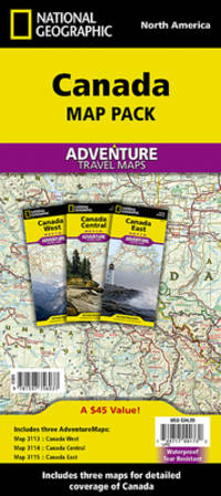
2010ref. ANAIS-1597756032Natl Geographic Society Maps 2022-01-01. 2022. map. Good. 9.5X6.5X1.5. Buy with confidence. Excellent Customer Service & Return policy. Natl Geographic Society Maps unknown
ref. 1597756032.Gmap. Good. Access codes and supplements are not guaranteed with used items. May be an ex-library book. unknown
1983Inscription opposite half-title page. No other marks. A very clean very tight copy with bright unmarked boards and no bumping to corners. Dust jacket price clipped but not marked or torn with crease to front dust flap. 240pp. The book follows the route of a traveller crossing Canada from East to West, exploring each of the provinces and territories in his path. It is a spectacular depiction of the land of Canada, its history and a verbal tribute to the country's people.
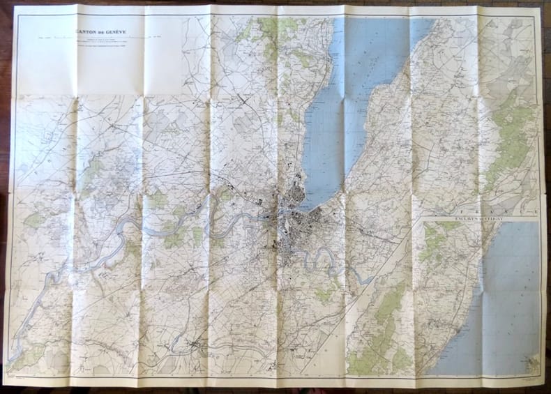
1946ref. 18657Berne, Service topographique fédéral, 1946. Carte au 1:25 000, au format ouvert de 111 x 79 cm. Tampon au premier plat.
1764ref. 34586(Købenahvn, 1764). Kobberstukket prospekt af Kancelli-bygningen. (16x24 cm.).
ref. vb3022Cartes postales "In-12 (15,5 x 8,7 cm), sans date ni mention d'éditeur, carnet de cartes postales détachables en noir et blanc représentant ""L'Homme le plus lourd de tous les siècles"" ; décolorations au premier plat, quatrième plat manquant, album incomplet (deux cartes postales manquantes), en l'état. Livraison a domicile (La Poste) ou en Mondial Relay sur simple demande."
ref. 36713Strasbourg, Editions du Spectacles, 1984. 15 x 22, 91 pp., 135 figures, broché, bon état.
1925ref. 022430Paris Librairie Hachette 1925 In 16 Collection " Guide-Hachette " avec 1 Carte dépliante en couleurs , 1 carte schématique en noir et blanc et 37 gravures . A l'époque où l'automobile se développe ainsi que les voies de chemins de fer , Hachette lance une série de guides invitant à découvrir tous les départements de France . De très belles cartes réalisées par L'Institut Géographique de Paris permettent d'entreprendre les voyages . Actuellement très utiles aux généalogistes et historiens car nombres de villages ont disparus . Elles permettent de recenser les bois et forêts de l'époque , les lignes de chemins de fer , les petits et grands chemins et donnent de précieuses indications sur l'économie et la population . ( Commandez plusieurs départements dans notre librairie et ne payez qu'un seul frais de port ) . Cartes et plans .- 64 p. + Carte , 150 gr.