Maps, PopoutBiblio.com

12,235 results
ref. GOR006768433Paperback. Very Good. paperback
ref. 1845878698.Gmap. Good. Access codes and supplements are not guaranteed with used items. May be an ex-library book. unknown
ref. 18102, Brussel, Gemeentekrediet, 1979 , Ingenaaid, In-4, 192 pp., talrijke ills. in zw/w en in kleur, goede staat. ISBN X.
1979ref. 0191081979 Gemeentekrediet Soft cover Signed by Author(s)
1936Plan 50x65 cm. Repli?.
ref. K42085Brunn:München.0. 13 Seiten.19 cm x 12 cm. Originalbroschur
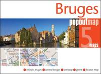
2014ref. SBBI-SBL-030166PopOut Maps 2014. map. Good. Our good condition books are generally good for reading but not for gifting or collecting. They could have imperfections such as creasing fanning inscriptions margin notes yellowing staining on edge or cover or pages bumps scuffs etc etc sometimes multiple of these. It's a wide category that encompasses anything that isn't almost-new down to anything that is slightly better than poor. We would NOT recommend gifting Good books - these should be considered reading copies. Our books are dispatched from a Yorkshire former cotton mill. We list via barcode/ISBN so please note that the images are stock images and may not be the exact copy you receive furthermore the details about edition and year might not be accurate as many publishers reuse the same ISBN for multiple editions and as we simply scan a barcode or enter an ISBN we do not check the validity of the edition data when listing. If you're looking for an exact edition please don't order at least not without checking with us first although we don't always have time to check. We aim to dispatch prompty the service used will depend on order value and book size. We can ship to most countries see our shipping policies. Payment is via Abe only. PopOut Maps unknown
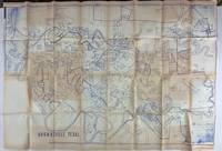
1980ref. 3562N.p. probably Brownsville Tx 1980. Very good. Blue-line map 42 x 62 inches. Uneven toning minor overall wear. A large-format plat map of the Texas border town of Brownsville likely created in the early 1980s. The date is based on the appearance of the Sunrise Mall which opened its doors in 1979 and the name of the airport which was changed in 1983; as such the present map was printed sometime between those two dates. The present map shows the original city parcel as well as many other notable modern developments including the Airport Industrial Park the Fourteenth Street Commercial Plaza and the Amigoland Theme Park the latter of which was never built. The Rio Grande can be seen winding its way through the bottom portion of the map. We locate no other copies of this map anywhere. It was likely produced for local developers and as such is quite rare. An ideal decorative Texas map. unknown books
1980ref. 3562N.p. probably Brownsville Tx 1980. Very good. Blue-line map 42 x 62 inches. Uneven toning minor overall wear. A large-format plat map of the Texas border town of Brownsville likely created in the early 1980s. The date is based on the appearance of the Sunrise Mall which opened its doors in 1979 and the name of the airport which was changed in 1983; as such the present map was printed sometime between those two dates. The present map shows the original city parcel as well as many other notable modern developments including the Airport Industrial Park the Fourteenth Street Commercial Plaza and the Amigoland Theme Park the latter of which was never built. The Rio Grande can be seen winding its way through the bottom portion of the map. We locate no other copies of this map anywhere. It was likely produced for local developers and as such is quite rare. An ideal decorative Texas map. unknown
Madrid, Dirección General del Instituto Geográfico y Catastral, 1950. 2ª edición. Mapa publicado por sectores (sector 178). Escala 1:50.000. 56x76 cms. Mapa entelado y plegado. Buen ejemplar.
1910ref. RO30010638inconnu. 1910. In-12. Broché. Bon état, Couv. convenable, Dos satisfaisant, Intérieur frais. Non paginé. Illustrations couleur se dépliant en accordéon, à l'intérieur d'une enveloppe illustrée en couleurs, au format carte postale. Inscriptions sur le devant de l'enveloppe: adresse de l'ancien propriétaire inscrite.. . . . Classification Dewey : 741.68-Illustrations des cartes postales
194438" wide by 25.5" high. Dated June, 1944. Moderate wear. Nice copy. Map
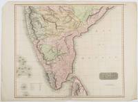
1816ref. 185242London.: Thomson. 1816. Engraved map with full handcolour 50.5 x 59.7 cms ; 53.9 x 73.8 cms sheet central fold a few minor edge tears one intruding into the top border the map unscathed marginal edgewear two corners with some loss but the map in very good crisp condition. An elegant map with great detail prepared for John Thomson's influential "New General Atlas" 1814-1821. Showing India from 20 degrees to 7 degrees north of the equator and includes the northern half of Ceylon with territorial interests attractively coloured. . Thomson. unknown
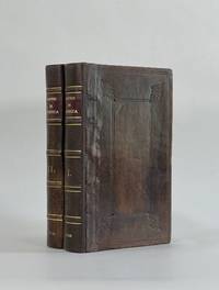
1708ref. 8917London: John Nicholson 1708. Full Leather. Very Good binding. Octavo. xxxviii 2 412; 2 382 2 ads 32 index pp. maps. First edition. Contemporary paneled-calf boards with modern reback. Title page to Volume 1 and four of the eight maps are lacking but are supplied in tasteful facsimile. The maps in facsimile are the North America New England Virginia and Maryland and Carolina. Bindings are solid and presently nicely; contents are clean and bright; but for the maps and title page this is an exceptional set. Of this work William Reese writes: "This basic 18th-century reference work on British America . . . offers an excellent comprehensive survey of Great Britain's American colonies at the point when those on the mainland of North America had grown past their initial phase and were expanding rapidly in population and productivity. . . . This important contemporary work would probably have been the first point of reference for any Englishman at the time" Reese Struggle for North America 1. Usually attributed to Oldmixon who penned the dedication but occasionally gets attributed to Moll according to Sabin. A significant work by the British historian. Howes O-61 "aa"; European Americana 1708/95; ESTC T45485; Sabin 57156. John Nicholson unknown
1965Traditional road map measuring 20" x 40" when unfolded. One side provides colour maps of the province. The back side provides very detailed information about campsites around the province and extensive information about B.C.'s native fish as well as hunting and fishing regulations, including fees. Unmarked with moderate wear. A sound vintage copy. Map
1962Traditional road map measuring 20" x 40" when unfolded. One side provides a colour map of the province. The back side provides very detailed information about campsites around the province and extensive information about B.C.'s native fish as well as hunting and fishing regulations, including fees. Unmarked with moderate wear. A sound vintage copy. Map
1957176 pages. Endpapers decorated with colour maps. Designed to tell the story of what British Columbia was and is. Tells stories of romance and adventure; of exploration and settlement; of the search for riches in furs, in gold, in fisheries, farming and forestry. Tells the story of development; of the building of a character and a homogeneous province; of a God-fearing pioneering people dedicated to progress, strengthened by their contest with a great land at first reluctant to yield its full resources. Contents: agriculture; historical background; committees; education; energy and power; fisheries; forestry and logging; government; mining; programme; recreation. Illustrated with a multitude of interesting old black and white photographs as well as some modern colour photos. Attractive colour-illustrated boards. Book
1976Catalogue No. En 64-14w/7N-7S. Folds open to reveal two large fold-out maps. Average wear. Minimal markings. A sound working copy. Book
193036 pages. Incudes 17 pages of maps of Provincial locales. Sepia-tone reproductions of photos of picturesque Provincial scenes. Unmarked. Average wear and external soiling. Binding intact. A sound copy of the lovely B.C. tourism memento. Book
1959Traditional road map measuring 31" x 24" when unfolded. Provides excellent colour map coverage of the Province as well as detailed, and now historic, information about campsites in regions around the province. Moderate wear. Four-inch opening along a fold. A quality vintage copy. Map
19689" x 4" - folds out to 24" x 18". Colour map on one side shows B.C. Ferry routes. Reverse side provides details of tourist destinations with colour photos, reservation details for the sailing to Prince Rupert, corporate contact details, and a brief statement by W.A.C. Bennett. Unmarked with moderate wear. A sound copy. Book
1903ref. 75062London: McCorquodale 1903. First edition of this atlas map folio 16 1/4 x 27 1/2 inches. 5 sheets of British Commission maps and index map; 13 sheets of United States Commission maps Alaska boundary atlas and index map. Total of 20 maps 19 folding and 5 in color Maps are 53 x 32 inches. All but the British index map folded and backed in linen. Quarter red morocco over red cloth. Gilt Royal Seal to front board and spine. Maps mounted on linen and sectioned as issued. Portfolio case with moderate rubbing chipping to leather. Does not include the 10 cards to accompany the U.S. Commission maps seems to be common that these smaller ones are missing. Old staining to cloth. Toning and edge wear to British Index map. Slight toning and offsetting to maps. Overall a very good copy; quite scarce. [McCorquodale] hardcover
2001No marks or inscriptions. No creasing to covers or to spine. A lovely clean very tight copy with bright unmarked boards and no bumping to corners. 48pp. Guide to the London Eye.
Format (Bildbereich): 21 x 26 cm. Leicht gebräunt, insgesamt gut erhalten. Landkarten de
1972No marks or inscriptions. A lovely clean very tight copy with bright unmarked boards and no bumping to corners. Price clipped dust jacket not marked or torn with light creasing/rubbing to edges. 143pp. The British Isles as it looked forty years ago.