12 788 résultats
réf. 9187760045.Ghardcover. Good. Access codes and supplements are not guaranteed with used items. May be an ex-library book. hardcover
réf. a74346Washington 1974 U. S. Department of Commerce. Oblong folio about 80pp. maps original printed wraps. A few Depository Library marks on covers maps clean. VG light vertical crease. . paperback
1987réf. 44496Anchorage AK: Salmon Atlas. VG. 1987. 1st Edition. Paperback. Paperback in Very Good condition. . 4to 11" - 13" tall. 92 maps covering the Kenai Peninsula Mat-Su the Anchorage area West Cook Inlet Prince William Sound and Kachemak Bay. . Quick Shipping All Books Mailed in Boxes Free Tracking Provided . Salmon Atlas paperback
réf. 1016083947.Ghardcover. Good. Access codes and supplements are not guaranteed with used items. May be an ex-library book. hardcover
2014réf. x-1442204133Rowman & Littlefield Pub Inc 2014. Paperback. New. reprint edition. 253 pages. 9.25x6.25x1.00 inches. Rowman & Littlefield Pub Inc paperback
réf. 0195211715.Ghardcover. Good. Access codes and supplements are not guaranteed with used items. May be an ex-library book. hardcover
réf. GECC-010789Good. Minor shelf wear and signs of use. Former library book which may include the usual institutional stamps stickers bookplates and barcodes. May include a card pocket. Pages are clean with no markings. Missing dustjacket. Ships quickly from Ontario! unknown
réf. 5746545-nnew. unknown
réf. PrakashN-9781538718735GRAND CENTRAL PUBLISHING. Hard Cover. New. ENGLISH GRAND CENTRAL PUBLISHING hardcover
1980réf. 122499New York: Times Books 1980. Hardcover. fine. Comprehensive edition. xl227pp. Folio. Illustrated with coloured maps and photos. Original black cloth with gilt lettering on front cover and spine in dust jacket. Fine condition. 1980 Times Books hardcover
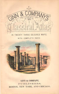
réf. 41183Boston New York & Chicago. Ginn & Company Publishers. 1886. 4to. 29cm colour vignette on title-page 23 double-page colour engraved maps 12 p. text 31 page index publisher's ads. on the front and rear endpapers original black stamped decorated green cloth with gilt Roman figure top and bottom spine edges worn internally sound and clean a very good to fine copy gar. ~ A new edition of "School and College Atlas of Ancient Geography" with cartography by Scottish geographer and cartographer Alexander Keith Johnston 1844-1879 and new preface text and orthography by Scottish geographer James Cranstoun. The maps were printed by W. & A.W. Johnston Edinburgh & London. Outstanding maps primarily of the Roman period named in Latin with scales in English and Roman. Includes: Imperium Romanum; Roma Vestus; Hispania; Gallia; Britannica; Germania; Macedonia; Italia Superior and Inferior; Graecia; Asia Minor; Syria et Palestina; Armenia; Persia et India: Egyptus; Africa. Boston, New York & Chicago. Ginn & Company, Publishers. [1886] unknown
1999réf. Q-0843713909Hammond World Atlas Corp 1999-07-01. Hardcover. New. New. In shrink wrap. Looks like an interesting title! Hammond World Atlas Corp hardcover
1994réf. 1162495Aachen : Schweers und Wall, 1994. VI, 138 S. : überw. Kt. ; 29 cm Pp.
2003réf. vb1129Desclée de Brouwer Broché 2003 In-8 (12,8 x 20,5 cm), broché, 243 pages ; pliure au dos, par ailleurs bon état. Livraison a domicile (La Poste) ou en Mondial Relay sur simple demande.
2012réf. 062249Bielefeld., Verlag für Regionalgeschichte., 2012. Herausgegeben von Uwe Ohainski und Arnd Reitemeier. 230 Seiten mit vielen Abbildungen (in Farbe und Schwarzweiß) im Text, 28 Tafelseiten im Anhang mit je einer Kommentar seiten, 7 weitere Kartenseiten im Anhang. Guter Zustand. Erschien vermutlich zur Ausstellung im Städtischen Museum Braunschweig: "Vermessen gannz furstenthumb Braunschweig. Der älteste Ämteratlas aus Niedersachsen". Quer - 2°. OPappband.
réf. 0260169811.Ghardcover. Good. Access codes and supplements are not guaranteed with used items. May be an ex-library book. hardcover
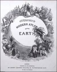
1840réf. 373393Henry George Collins London c.1840. Unframed Print. Very Good Condition. TITLE PAGE ONLY. Atlases of this era werent just functional they were status objects designed to project worldliness and imperial reach. The title page illustration operates like a microcosm of Victorian ideals: order exploration dominion and grandeur. Engraving 22 x 29 cms sheet 25 x 32 cms. Category: PRINTS : Antiquarian Interest; PRINTS : Historic Interest; This item may require more postage than the rates shown for delivery outside the UK. If extra postage is required we will contact you before processing your order and you will be given the details and option to decline the extra cost. Henry George Collins unknown
réf. 1887801928.Gpaperback. Good. Access codes and supplements are not guaranteed with used items. May be an ex-library book. paperback
réf. CS-14634International. Brand New. Brand New unknown
réf. CS-14636International. Brand New. Brand New unknown
réf. ria9780521088305_inpPaperback. New. New Book; Fast Shipping from UK; Not signed; Not First Edition; This book deals with various aspects of musical life at the Aragonese court of Naples from its establishment in 1442 to its demise in the opening years of the sixteenth century. paperback
réf. 0332966828.Ghardcover. Good. Access codes and supplements are not guaranteed with used items. May be an ex-library book. hardcover
réf. 0843709499.Gpaperback. Good. Access codes and supplements are not guaranteed with used items. May be an ex-library book. paperback
1876Good German Original color map on cloth. Some tears on foldings. Good. Folded. Oblong folio. (45 x 51 cm). In German. Shows Stolac, Metkovic, Ljubinje, Bilek, Niksic, Trebinje, Ragusa, Meleda Island, Cattaro, et alli. Ragusa is a Croatian city on the Adriatic Sea. It is one of the most prominent tourist destinations in the Mediterranean Sea, a seaport and the centre of Dubrovnik-Neretva County. A sheet of the collection of 'The general map of Central Europe'. appeared in the years between 1873-1876 with the work of Joseph Ritter von Scheda, (1815-1888) who was a general, geographer and cartographer.