Atlas, GalitBiblio.com

12 891 résultats
2015réf. x-1138789607Routledge 2015. Paperback. New. 208 pages. 9.49x6.69x0.39 inches. Routledge paperback
réf. 1138789607.Gpaperback. Good. Access codes and supplements are not guaranteed with used items. May be an ex-library book. paperback
2016réf. MSA11006Routledge. Very Good with no dust jacket. 2016. First Edition. Hardcover. 1138789593 . First edition. Hard cover published by Routledge in 2016. No dust jacket. Glossy blue covers with white lettering. Corners of covers are slightly bumped. Front cover has some scuffing down side edge. Book is in very good condition. Large 8vo 179 pages 1.1 lb.; Relational Perspectives Book Series; Large 8vo 9" - 10" tall; 179 pages . Routledge hardcover
réf. GOR010907226Paperback. Very Good. paperback
réf. 23976830-nnew. unknown
réf. 23976830like new. unknown
réf. 23976831-nnew. unknown
réf. A9781138789609Paperback / softback. New. paperback
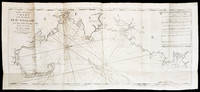
1794réf. 5887THE FIRST ENGLISH SEA ATLAS OF AMERICA Folio 47.7 x 31 cm 66 pp. with pagination errors with 26 engraved maps 21 of which are double-page or folding the first chart with letterpress text attached as called for numerous woodcuts in the text. Bound in contemporary sheep rebacked blind-tooled borders to upper and lower covers. Minor rubbing to covers. Some spotting to the fourth map Verner no. 62 and adjacent letterpress pages small tear to fold of map 10 Verner no. 60 two small circular mends to title page not affecting text otherwise remarkably well preserved. A spectacular copy of the final edition of the English Pilot The Fourth Book the first wholly English sea atlas of American waters. The work was sufficiently in demand to justify 37 legitimate editions from 1689 to 1794 and three pirated editions. All editions are rare. During the history of this title its charts underwent numerous changes. The first edition contained only 18 maps whereas this 1794 final edition contained 26. "The English Pilot was the first major sea-atlas produced in England. In its final form it consisted of five separate books and The Fourth Book was the first wholly English sea-atlas of American waters. Although the idea originated with John Seller he was involved in producing only the first two books. William Fisher and John Thornton produced The Fourth Book in 1689 and their successors Mount and Page continued to print it for over 100 years Seller's proposal for a 'Sea Waggoner' resulted in the production of The English Pilot which consisted of five separate volumes with a common generic title. Book One included the southern navigation and Book Two the northern. Book Three was concerned with the Orient Book Four with America and Book Five contained Africa. Each book or volume has its own independent publishing history and appeared in numerous editions. The five separate books constitute a set only by virtue of the general title and under that title The English Pilot is the first great sea-atlas produced in England. Of the five books the fourth has the longest publication history and is the best known" Verner p. v. Throughout its history The Fourth Book showed very few changes in textual matter and the content of the volume was established between the editions of 1706 and 1721. The present example of the 1794 edition is complete and contains the following maps see Verner pp. xv-xx for full list of editions and charts from 1689 to 1794: 1. A New and Correct Chart of the Western and Southern Oceans Showing the Variations of the Compass with letterpress text attached 2. A New and Correct Chart of the North Part of America from New Found Land to Hudson's Bay 3. A New Generall Chart for the West Indies of E. Wright's Projection 4. A New and Accurate Chart of the Vast Atlantic or Western Ocean by Eman. Bowen 5. Harbour of Casco Bay Capt. Cyprian Southicke 1720 Em. Bowen 6. A New and Correct Chart of the Coast Line of Newfoundland from Cape Raze to Cape Bionavista 7. Island of St. Peters 8. Chart of the South East Coast of Newfoundland 9. New and Correct Chart of the Sea Coast of New-England from Cape Cod to Casco Bay Henry Barnsley 10. A Map of the Coast of New England from Staten Island to the Island of Breton Capt. Cyprian Southack 11. A Chart of New York Harbour with the Banks 12. Virginia Maryland Pennsylvania East & West New Jersey 13. A Draught of Virginia by Mark Tiddeman 14. Barbados copperplate in text 15. A New Mapp of the Island of St. Christophers Survey taken by Mr. Andrew Norwood 16. A Large Draft of the Island of Antegua copperplate in the text 17. A Draught of South Carolina and Georgia from Sewee to St. Estaca by Andrew Hughes 18. A Correct Chart of the Caribee Islands 19. A Correct Chart of Hispaniola with the Windward Passage by C. Price 20. A Draught of the West End of the Island of Porto Rico 21. A New & Correct Chart of Cuba Streights of Bahama Windward Passage 22. A New and Correct Draught of the Bay of Matanzas by Rob.t Pearson 23. Bermudas copperplate in text 24. A New and Correct Chart of the Island of Jamaica 25. A Chart of the Coast of Guayana By R. Waddington 26. A New and Correct Chart of the Trading Part of the West Indies The English Pilot: The Fourth Book Amsterdam 1967 with an introduction by Coolie Verner. Printed for Mount and Davidson hardcover books
1794réf. 5887THE FIRST ENGLISH SEA ATLAS OF AMERICA Folio 47.7 x 31 cm 66 pp. with pagination errors with 26 engraved maps 21 of which are double-page or folding the first chart with letterpress text attached as called for numerous woodcuts in the text. Bound in contemporary sheep rebacked blind-tooled borders to upper and lower covers. Minor rubbing to covers. Some spotting to the fourth map Verner no. 62 and adjacent letterpress pages small tear to fold of map 10 Verner no. 60 two small circular mends to title page not affecting text otherwise remarkably well preserved. A spectacular copy of the final edition of the English Pilot The Fourth Book the first wholly English sea atlas of American waters. The work was sufficiently in demand to justify 37 legitimate editions from 1689 to 1794 and three pirated editions. All editions are rare. During the history of this title its charts underwent numerous changes. The first edition contained only 18 maps whereas this 1794 final edition contained 26. "The English Pilot was the first major sea-atlas produced in England. In its final form it consisted of five separate books and The Fourth Book was the first wholly English sea-atlas of American waters. Although the idea originated with John Seller he was involved in producing only the first two books. William Fisher and John Thornton produced The Fourth Book in 1689 and their successors Mount and Page continued to print it for over 100 years Seller's proposal for a 'Sea Waggoner' resulted in the production of The English Pilot which consisted of five separate volumes with a common generic title. Book One included the southern navigation and Book Two the northern. Book Three was concerned with the Orient Book Four with America and Book Five contained Africa. Each book or volume has its own independent publishing history and appeared in numerous editions. The five separate books constitute a set only by virtue of the general title and under that title The English Pilot is the first great sea-atlas produced in England. Of the five books the fourth has the longest publication history and is the best known" Verner p. v. Throughout its history The Fourth Book showed very few changes in textual matter and the content of the volume was established between the editions of 1706 and 1721. The present example of the 1794 edition is complete and contains the following maps see Verner pp. xv-xx for full list of editions and charts from 1689 to 1794: 1. A New and Correct Chart of the Western and Southern Oceans Showing the Variations of the Compass with letterpress text attached 2. A New and Correct Chart of the North Part of America from New Found Land to Hudson's Bay 3. A New Generall Chart for the West Indies of E. Wright's Projection 4. A New and Accurate Chart of the Vast Atlantic or Western Ocean by Eman. Bowen 5. Harbour of Casco Bay Capt. Cyprian Southicke 1720 Em. Bowen 6. A New and Correct Chart of the Coast Line of Newfoundland from Cape Raze to Cape Bionavista 7. Island of St. Peters 8. Chart of the South East Coast of Newfoundland 9. New and Correct Chart of the Sea Coast of New-England from Cape Cod to Casco Bay Henry Barnsley 10. A Map of the Coast of New England from Staten Island to the Island of Breton Capt. Cyprian Southack 11. A Chart of New York Harbour with the Banks 12. Virginia Maryland Pennsylvania East & West New Jersey 13. A Draught of Virginia by Mark Tiddeman 14. Barbados copperplate in text 15. A New Mapp of the Island of St. Christophers Survey taken by Mr. Andrew Norwood 16. A Large Draft of the Island of Antegua copperplate in the text 17. A Draught of South Carolina and Georgia from Sewee to St. Estaca by Andrew Hughes 18. A Correct Chart of the Caribee Islands 19. A Correct Chart of Hispaniola with the Windward Passage by C. Price 20. A Draught of the West End of the Island of Porto Rico 21. A New & Correct Chart of Cuba Streights of Bahama Windward Passage 22. A New and Correct Draught of the Bay of Matanzas by Rob.t Pearson 23. Bermudas copperplate in text 24. A New and Correct Chart of the Island of Jamaica 25. A Chart of the Coast of Guayana By R. Waddington 26. A New and Correct Chart of the Trading Part of the West Indies The English Pilot: The Fourth Book Amsterdam 1967 with an introduction by Coolie Verner. Printed for Mount and Davidson hardcover
réf. 9652241075.Gpaperback. Good. Access codes and supplements are not guaranteed with used items. May be an ex-library book. paperback
2004réf. Q-0974882011Your Business Press 2004-11-01. Paperback. New. New. In shrink wrap. Looks like an interesting title! Your Business Press paperback
2010réf. Q-0982591047Your Business Press 2010-08-06. Perfect Paperback. New. In shrink wrap. Looks like an interesting title! Your Business Press paperback
1111[1934] With 44 pages and 168 pages of advertisements, index, at the back. Covers worn all over, slight tears at base of spine.
1111[1933] With 162 pages of advertisements, and index, at the back. Covers worn all over, slight tears at base of spine.
1938Still has original bookmark attached. Date assumed from Lighting Up Tables which start April 1938. xiv, 31, 910, 102 pages. Signature at top of front free endpaper. Page 605-8 loose. Wear on extremities and some marks to covers.
réf. 1989647820.Gpaperback. Good. Access codes and supplements are not guaranteed with used items. May be an ex-library book. paperback
réf. 51418110like new. unknown
1986réf. 29304London [etc.] : Beazley [etc.], 1986. 116 pp. : ill., num. maps. 4°. Bound in orig. cardboard covers.
réf. 0843709529New. paperback. New. Satisfaction Guaranteed or your money back. paperback
2007réf. Q-0843709529Hammond World Atlas Corporation 2007-04-13. Paperback. New. New. In shrink wrap. Looks like an interesting title! Hammond World Atlas Corporation paperback
2007réf. DADAX0843709529Langenscheidt 2007-04-13. Revised 2007 Edition. paperback. New. 9.25x0.25x12.25. Buy with confidence. Excellent Customer Service & Return policy. Langenscheidt paperback
1897folio [37 x 31 cm or 14.5 x 12 inches]; 159 pp, 156 pages of colored maps, charts, including many double page, title printed in red and black. original blue pictorial gilt and blind-stamped cloth, gilt title lettering on cover, a little worn at spine ends, corners, very good+ clean and sound copy. A picture of this book is available upon request by email. This is not to be confused with the Columbian World's Fair atlas nor the Columbian Atlas of the World We Live In, which was in much smaller format. This atlas is quite large and filled with very detailed colored maps, starting with fine double-page maps of the world and of North America. The maps of the USA include the whole country, individual states and city maps showing streets (Boston, NY city, Brooklyn, Buffalo, Philadelphia, Baltimore, Washington DC, Cincinnati, Cleveland, Chicago, Detroit, St. Paul, Minneapolis, St. Louis, St. Joseph, Kansas city, New Orleans, San Francisco from Rand McNally Co, plus others as insets). Canadian maps include country, provinces and territories, some provinces showing counties. Other maps include: Mexico, Central America, West Indies, South America (plus other maps of regions of South America), Europe and individual countries, Polar area, Asia, double-page of Palestine with Jerusalem inset, Turkey and its provinces, Indochina, India, Japan, Persia, double of Africa showing colonial borders, South Africa, Egypt with Cairo inset, North Africa, Abyssinia, Australia, New Zealand, etc, plus other charts. Maps have city, province, county indexes in margins.
1980107p. Numerous color illustrations. 4to. Original full cloth binding. Original dust jacket. MED 2
2004100 pages. "Outlines the genesis of the Belgian coast, and the physical environment and natural surroundings... Read how man controls the sea and how he has learned to use the sea and the coast." - from page 3. Wonderful colour photos, maps and illustrations throughout. Average wear. Unmarked. A sound copy of the beautifully presented and highly informative atlas. Book