Livre Rare Book

5089 risultati
1691rif. 002926A Paris, Galerie-Neuve du Palais, G.de Luyne, T. Girard, Veuve M. Guérout, avec Privilège du Roy, 1691
1938rif. 12984COLLECTION OF EARLY BRITISH FANZINES: THE SATELLITE FANTAST NEW WORLDS GARGOYLE & ZENITH Various places 1938 to 1942 first editions mostly vg copies. 17 SATELLITES being volume 1 #1 thru volume 3 #5 the complete run; 14 FANTASTS being volume 1 #1 thru volume 3 #2 the complete run; 4 NEW WORLDS the complete run of the first incarnation; 5 ZENITHS & 3 GARGOYLES. All sets contain issue 1 #1 with original and no where else reprinted contributions by: Arthur C. Clarke C. S. Youd John Burke Ted Carnell John Russell Fearn Eric Maine William Temple et.al. A literal Who's Who of early British Fandom. All from the library of author and publisher of The Satellite John Burke. Rare! 43 different issues. Various unknown
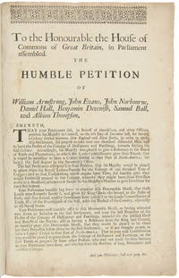
1715rif. 21151London 1715. Broadsheet. 1p. plus printed docket title on verso. Small folio. Bound to style in half calf over marbled paper-covered boards. Ornamental border. Minor foxing. Very good. A project for colonizing Maine in 1715. One of only two surviving copies. A rare early petition relating to British settlement in the eastern part of present-day Maine. The authors refer to petitioning "his Majesty in Council on the 6th Day of December last for having a Colony settled between New England and Nova Scotia" with "over one thousand disbanded men" and to be funded with the proceeds of a proposed coinage operation. The only copy of this document listed by OCLC and ESTC is at the New-York Historical Society which estimates merely that the document was printed during the 1700s. The historical context the text cited above and discovery of this broadsheet among similar petitions dating almost exclusively to 1714 and 1715 however make 1715 an extremely likely date of printing. In the Treaty of Utrecht 1713 the French ceded the land east of the Kennebec River presumably the area in question here to the British; this event and the reference to "disbanded soldiers" suggest that the War of the Spanish Succession had recently ended which it finally did in 1714. George I succeeded Queen Anne in late 1714 meaning that the petitioning of "December last" could not have been earlier than that year. With the new monarchy and a major upheaval in the House of Commons following the general election of 1715 petitionary literature distributed in the lobby of Parliament surged with this document almost certainly among the examples from that year. The petitioners evidently officers who had served in the recent war call attention to the fact that the lands they hope to settle "were formally survey'd and given by King Charles the Second to the Duke of York" and that the area has been confirmed as rich for farming. They ask that Parliament allow them to present their formal proposals for the settlement or "if not thought proper to have a Colony settled in that part of North-America" at least still to grant them a contract to coin 1000 tons' worth of half-pence and farthings. A very important Maine document one of only two surviving copies. unknown
1893rif. 160511893 PARIS, Alphonse Picard, CAEN,Henri Delesques, 1893, N° 1, 3, 5 & 6 - Broché - In-8 - Couverture imprimée avec médaille au nom d'Arcisse de CAUMONT - Importante iconographie : nombreuses planches PP Ht & illustrations en texte - 85 pages & Pagination 191 à 589 - Bon exemplaire, Intérieur très frais.
PARIS, Alphonse Picard, CAEN,Henri Delesques, 1893, N° 1, 3, 5 & 6 - Broché - In-8 - Couverture imprimée avec médaille au nom d'Arcisse de CAUMONT - Importante iconographie : nombreuses planches PP Ht & illustrations en texte - 85 pages & Pagination 191 à 589 - Bon exemplaire, Intérieur très frais. chaque fascicule peut-être vendu individuellement au prix de 20 € pièce
1535rif. 44940Paris, François Regnault, 1535. In-folio gothique (31 x 21 cm) de (28, le dernier blanc)-CXXXVII-(5) ff. (sig. +6, A8-B8, C5, a-r8, s6), veau brun, dos orné à nerfs, pièce de titre havane, roulette dorée sur les coupes, tranches mouchetées (reliure du XVIIIe siècle).
1912rif. 312798np 1912. 2 60 pp of typewritten text with a hand-drawn map of the Club property on the Dobsis Stream between "Dobsis" and "Pocumsas" lakes a folding cyanotype map of the region and 23 photographs of the Club and members. 1 vols. 8vo 8-1/2 x 6 inches. Reverse buckskin with title stamped in blind Dobsis Club 1872-1912 with metal ring binding. Signature "January 1 1912 Lillian W. Larrabbee" on title leaf. Typescript addendum of fishing catches 1919-1920 by H.S. Dennison loosely inserted. Green cloth folding box. 2 60 pp of typewritten text with a hand-drawn map of the Club property on the Dobsis Stream between "Dobsis" and "Pocumsas" lakes a folding cyanotype map of the region and 23 photographs of the Club and members. 1 vols. 8vo 8-1/2 x 6 inches. UNRECORDED. History of the Dobsis Club in the Grand Lake watershed formed in 1872 by Harvey Jewell Lyman B. Jewell E.W. Dennison Cutler Downer V.H. Blackston and F.A. Kennedy with famous Rangeley guide G. L. F. Ball as Manager. In 1879 club buildings were built by Ball on the spit of land between Sysladobsis or Dobsis and Pocumcus lakes. The first portion of the book transcribes Ball's letters 1872-1894 discussing his marriage money woes and fish hatchery business. Ball who had been a guide in the Rangeley region since the early 1860s worked for the club until 1898 and died the following year. The history includes a calendar of notable dates including construction poker hands an earthquake persons falling into the rivers and the disappearance of N.O. Shaw on 19 December 1907; his body was found the next June. Weather records include Ice Out dates earliest 22 April 1878 latest 16 May 1888 extremes of temperature in summer and winter. There is a long register of fishermen and visitors and logs of fishing catches and game bags. Many names from the Dennison clan appear over the years. The work is illustrated throughout with high quality photographs: portraits of members and views of the club sometimes two to a plate. The last entries for seven members visiting in Spring 1912 are in manuscript. The club appears to have continued in existence through the early 1940s. unknown books
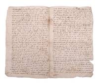
1680rif. 353098Likely Boston 1680. 4pp. Clerically signed Robert Warwick and Edward Gorges above an additional reaffirmation of grant dated June 1631 clerically countersigned by Thomas Wiggin James Parker James Watts and George Donglan. Docketed "Patent Saco: east of the river". Bifolium. Usual folds minor separations two repaired. 4pp. Clerically signed Robert Warwick and Edward Gorges above an additional reaffirmation of grant dated June 1631 clerically countersigned by Thomas Wiggin James Parker James Watts and George Donglan. Docketed "Patent Saco: east of the river". Bifolium. In 1629 less than a decade after the Pilgrims landed at Plymouth Rock the Council of New England an English joint stock company founded to establish colonial settlements in America issued a series of grants subdividing their royal charter that had ceded to them all land between "degrees 34 and 44" from sea to sea. These grants were important being among the earliest grants independently issued within the colonies. The present grant is of particular note for the history of Maine being the grant made to Thomas Lewis and Captain Richard Bonython for the land north of the Swanckadocke River i.e. the Saco River. The text of the grant reads in part: ".Whereas King James of famous memory late King of England Scotland France and Ireland by his Highness' letters patent and royal grant under the great seal of England bearing date the third day of November in the eighteenth year of his reign of England France and Ireland etc. for the causes therein expressed did absolutely give grant and confirm to the said Council for the affairs of New England in America and their successors forever all the land of New England lying and being from forty to forty-eight degrees of northerly latitude and in length by all that breadth aforesaid from sea to sea throughout the main land . that the said council for the affairs of New England in America as well for and in consideration that Thomas Lewis Gentleman has already been at the charge to transport himself and others to take a view of New England in America aforesaid for the bettering of his experience in advancing of a plantation and does now wholly intend by God's assistance with his associates to plant there both for the good of his Majesty's realms and dominions and for the propagation of Christian religion among those infidels and in consideration also that the said Thomas Lewis together with Captain Richard Bonighton and also with their associates and company have undertaken at their own proper costs and charges to transport fifty persons there within seven years next ensuing to plant and inhabit there to the advancement of the general plantation of that country and the strength and safety thereof among the natives or any other invaders also for the encouragement of the said Thomas Lewis and Captain Richard Bonighton and other considerations the said council thereunto moving have given granted enfeoffed and confirmed and by this present writing do fully clearly and absolutely give grant enfeof and confirm to the said Thomas Lewis and Captain Richard Bonighton their heirs and assigns for ever all that part of the main land in New England in America aforesaid commonly called or known by the name of Swanckadocke or by whatsoever other name or names the same is or shall be hereafter called or known by situated lying and being between the cape or bay commonly called Cape Elizabeth and the cape or bay commonly called Cape Porpoise containing in breadth from northeast to southwest along by the sea four miles in a straight line or accounting seventeen hundred and three score yards according to the standard of England to every mile and eight English miles upon the main land on the north side of the river Swanckadock after the same rate from the sea through all the breadth aforesaid ." The original vellum grant with seals is located in the archives of the Maine Historical Society. The present example is one of several extant early manuscript copies made during the subsequent conflicts and competing claims between the crown Massachusetts and Maine. In 1652 commissioners were appointed to determine the correct boundary between Massachusetts and several of the early patents with the former gradually extending their claim northward. In 1653 the settlers of Saco and other parts of Maine yielded to Massachusetts and the region was renamed Yorkshire or County of York. In 1664 after the Restoration the region was restored as an independent province but much of the region sold back to Massachusetts in 1678. After the charter of Massachusetts was annulled in 1684 and James II ascended to the crown in 1685 the region was once again assigned as part of the Province of Massachusetts Bay. Maine would remain part of Massachusetts until the final separation in 1820. The present undated copy likely dates from the period circa 1664 when a royal commission consisting of Richard Nicolls Sir Robert Carre George Cartwright and Samuel Maverick was sent to oversee the government of the colonies in New England. However it could also date as late as the period from the 1680s when Sir Edmund Andros became the Commissioner for the Dominion of New England. Documentary History of the State of Maine vol. 7 p. 117 unknown
1776rif. 3748Striking Casco Bay Chart from the Atlantic Neptune 1776 This is an exceptional chart of the coast of Maine between Cape Elizabeth and Popham from the early Revolutionary War period. It is from Des Barres' monumental Atlantic Neptune a sea atlas published by the British Admiralty during the last quarter of the 18th century. The Atlantic Neptune has been called "the most splendid collection of charts plans and views ever published." The present chart includes all of Casco Bay naming the larger islands and extends east to include Seguin "Segevin Island" and Georgetown Islands. Among the numerous geographic features named are Great Jebieg Chebeague Merrymeeting Bay Segadahock River Arrowsick Island and Halfway Road i.e. Rock. Roads are shown on the chart as are individual buildings. The chart is dated July___ 1776 i.e. with a prominent space after the month as if a date were going to be inserted. There is no type-stamped "15" at the upper right as called for in some copies of state "b" of the Stevens Catalogue. The chart was folded into four vertical panels about 30 1/4 x 12" to accommodate being "bound up in tall narrow form" Stevens' Catalogue p. vii. The chart paper has the LVG watermark consistent with the earlier issues of the chart. A scarce early state of a desirable chart. References: Stevens Catalogue of the Atlantic Neptune: 105 State: b. Sellers & Van Ee Maps and Charts of North America and the West Indies 1750-1789: 855. Condition: A wonderfully clean example of a striking chart of Casco Bay. ICN 3763. From The Atlantic Neptune.
1715rif. WRCAM39807London 1715. 1p. with printed docket title on verso. Small folio. Antique-style three-quarter calf and marbled boards spine gilt leather label. Ornamental upper border. Minor foxing. Very good. A rare and early petition relating to British settlement in the eastern part of present-day Maine. The authors refer to petitioning "his Majesty in Council on the 6th Day of December last for having a Colony settled between New England and Nova Scotia" with "over one thousand disbanded men" and to be funded with the proceeds of a proposed coinage operation. The only copy of this document listed by OCLC and ESTC is at the New-York Historical Society which estimates merely that the document was printed during the 1700s. The historical context the text cited above and discovery of this broadsheet among similar petitions dating almost exclusively to 1714 and 1715 however make 1715 an extremely likely date of printing. In the Treaty of Utrecht 1713 the French ceded the land east of the Kennebec River presumably the area in question here to the British; this event and the reference to "disbanded soldiers" suggest that the War of the Spanish Succession had recently ended which it finally did in 1714. George I succeeded Queen Anne in late 1714 which means the petitioning of "December last" could not have been earlier than that year. With the new monarchy and a major upheaval in the House of Commons following the general election of 1715 petitionary literature distributed in the lobby of Parliament surged with this document almost certainly among the examples from that year. The petitioners evidently officers who had served in the recent war call attention to the fact that the lands they hope to settle "were formally survey'd and given by King Charles the Second to the Duke of York" and that the area has been confirmed as rich for farming. They ask that Parliament allow them to present their formal proposals for the settlement or "if not thought proper to have a Colony settled in that part of North- America" at least still to grant them a contract to coin 1000 tons worth of half- pence and farthings. A very important Maine document one of only two surviving copies. hardcover books
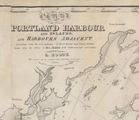
1828rif. 3754Important Early Chart of Portland Maine Harbor Lemuel Moody 1767-1846 was an enterprising sea captain and nautical entrepreneur in Portland Maine. Realizing "the great necessity of a correct Chart of Portland Harbour and the dangerous Rocks near Cape Elizabeth also of Winter Harbour and the numerous islands in Casco Bay" Moody decided to produce such a chart. By 1825 the Atlantic Neptune charts that included this area were more than 50 years old and in need of updating. Moody took advantage of the opportunity and produced this chart using the Atlantic Neptune charts as the foundation. In a notation on the original agreement for producing the chart Moody states that "I did the whole of the survey." This impressive chart of Casco Bay was his sole cartographic undertaking. The chart covers the area from Saco Bay to Seguin Island. A large inset at the upper left focuses on the immediate area around Portland harbor including a detailed layout of streets and wharves. Small drawings of several sailing ships decorate the chart. Of particular interest is one sailing vessel being towed by a steam-belching vessel southeast of Small Point an early record of steam-powered ships in Maine waters. One of the prominent landmarks that Moody included on the chart is the Portland Observatory an 86' high tower that still stands atop Portland's Munjoy Hill. The Observatory one of Moody's entrepreneurial undertakings was built in 1807 and served as a marine signaling tower. Using a telescope from the tower and a flag-based signaling system Moody would – for an annual fee – alert ship owners of the arrival of their vessels well in advance of their arrival in the harbor. The chart went through at least five states of which this is the second. The fortuitous survival of Moody's business records and the known construction dates of certain marine landmarks make it possible to identify the dates and production run of the various states of the chart with a fair degree of specificity. While all the charts produced include the initial publication date of 1825 in the title later states were known to have been printed in 1828 1832 1838 and 1857. The initial 1825/6 printing was 191 charts. For this second state only 49 charts were struck from the plates. The second state is distinguished by the addition of two light towers that were constructed in Cape Elizabeth in 1828. Known now appropriately enough as "Two Lights" the two structures still stand though one has been decommissioned as a navigation aid. The updates to the copperplate and printing of this state were by Andrew Allen of Boston. Moody's chart is very uncommon in any of its states. OCLC identifies three institutional holders as of September 2021: State Library of Massachusetts Osher Map Library and Boston Public Library. Additional examples are held at the Maine Historical Society Library of Congress Yale and at least one private collector. No examples of the chart were identified in the Antique Map Price Record during its run from 1983 to 2011. A very attractive example of an important and scarce early Maine chart. Reference: Phillips A List of Maps of the United States: p. 717 Mistakenly titled as Map of Portland Harbour and Islands… Acknowledgment: I am indebted to Ms. Frances Pollitt formerly of the Maine Historical Society for sharing her research on the dating and production of Moody's chart. Condition: Lined on reverse mending several tears. Very minor recreation of image loss and restoration of blank margin areas. ICN 7690.3. [Lemuel Moody.] .] Engd by D. G. Johnson. Entered According to Act of Congress July 13th, 1825. [but 1828.]
1828rif. 41555, , 1828-1877. Manuscrit in-folio à l’encre brune (42 x 27 cm) de (1)-160-(8) ff. en belle page, 187 grandes miniatures dans le texte finement coloriées à l'époque, demi-vélin à coins, dos lisse muet (reliure de l'époque).
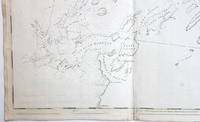
1767rif. 26308Newport R.I. 1767. Manuscript map in ink and wash on a single folio sheet 15 1/4 x 19 inches. Docketed in manuscript on verso "Map of Leveretts Patent alias Muscongus." With two manuscript documents one being 3pp. on folio sheets dated at Boston May 19 1787; the other being 3pp. on folio sheets dated at Providence R.I. on May 30 1787. Also with a half-page of manuscript dated Boston March 28 1768. All three documents relating to the lands depicted on the map. Map with minor separations along horizontal fold. The half-page document being only the beginning portion of a longer letter otherwise the manuscripts in near fine condition. A highly important manuscript map of Colonial Maine: heavily annotated by William Ellery a signer of the Declaration of Independence from Rhode Island. An attractive eighteenth century manuscript map of Penobscot Bay Maine heavily annotated by William Ellery a signer of the Declaration of Independence from Rhode Island who made claims to some of the lands depicted on the map. The map was drawn by British Rear-Admiral Jahleel Brenton who commanded the HMS Queen during the Revolution and whose family lost much of its property as a result of the Revolution. The map is skillfully rendered as would be expected of a British naval officer and is done on a scale of about three miles to the inch. The map depicts the coastline from the Damariscotta River in the southwest to the Penobscot River in the northeast and shows and names the many islands of the Bay as well as many inlets harbors rivers ponds etc. The location of a fort and settlements have also been added. This information was all added by William Ellery 1727-1820 a signer of the Declaration of Independence from Rhode Island. Ellery explains in a manuscript note in the lower right corner of the map dated at Newport Rhode Island in 1767: "This map of Leverett's Patent &c was copied from a copy by Jahleel Brenton Esq. one of the Proprietors; and presented by his son Samuel Brenton to William Ellery who wrote the References Names of Places &c. William Ellery." In the upper left corner of the sheet Ellery has added a long manuscript note explaining the survey and the boundaries of Leverett's Patent as depicted on the map. This map and the accompanying manuscript documents were found among William Ellery's papers and were part of Ellery and his brother Benjamin's attempts to claim lands in Maine that they believed belonged to their family. "Leverett's Patent" also known as the Waldo Patent or the Muscongus Patent was issued in 1629 to Thomas Leverett and John Beauchamp. It granted land and trading rights for a thirty-six square mile area along the Penobscot Bay in present-day Maine between the Muscongus River and Penobscot River. According to the documents present here Leverett inherited the full patent upon Beauchamp's death and at his own death divided the grant among his ten children who then divided the land again amongst the next generation. Around 1720 Gen. Samuel Waldo of Boston acquired a large portion of the patent and began recruiting immigrants from Germany to settle the area. The letter fragment present here dated March 28 1768 and addressed to Benjamin and William Ellery asserts that the Ellerys have an "undoubted right to a half share" of the Muscongus lands as a result of a purchase made by their grandfather. The unidentified author of the letter goes on to describe the Waldo heirs as "exceeding difficult to deal with." Also present are two manuscripts one being a 1787 copy of the original 1629 grant of the Muscongus Patent from the Council of Plymouth the other being a manuscript deed of sale signed by James Green for a portion of the original patent. A handsome colonial era manuscript map of the coast of Maine drawn by a British Rear-Admiral and used by a signer of the Declaration of Independence to defend his family's claims to the land. Significant manuscript maps of this early date are virtually unknown in the market. unknown books
MAYENNE, Imprimerie de l'Ouest, A. Nézan, 1895 - Tirage à 50 Exemplaires sur Japon, Celui-ci N° 2 - Complet en 2 volumes in-4, 25 x 17 cm- Reliure 1/2 basane fauve - dos à nerfs, orné - Gardes ornées - Édition augmentée de Généalogies inédites : de Montécler [Branche de Bourgon - Branche de Launay-Péan], et de Moré.- III-509 et III-549 pages - Dos insolé, sinon très bel exemplaire - Envoi rapide et soigné André René Le Paige, La Suze-sur-Sarthe,14 avril 1701, Le Mans, 2 juillet 1781. Chanoine de la cathédrale du Mans, estimant que la province du Maine manquait d'un bon ouvrage de statistique et d'économie civile, Le Paige se lança dans l'entreprise. Après avoir rassemblé un grand nombre de mémoires particuliers, qui lui furent adressés par les curés du diocèse et par les seigneurs de paroisse, en réponse à une circulaire qu'il avait publiée en 1772, il mit au jour son Dictionnaire topographique, historique, généalogique et bibliographique de la province et du diocèse du Maine en 1777. Ce livre contient des notions détaillées sur l'histoire naturelle, ecclésiastique, civile et littéraire, l'agriculture, l'industrie, le commerce et les arts de chaque commune. On y trouve sur le Mans, Laval, Mayenne, la Ferté-Bernard, Sablé, Mamers, etc., des notices et des faits qu'on chercherait vainement ailleurs. Cet ouvrage constitue un monument de l'histoire de la Province du Maine en général et de chaque commune en pârticulier.