3,685 results
1896ref. 26956PARIS 1896 une photographie originale albuminée en noir, format : 17 x 11,8 cm pour la photo, 19,8 x 14,6 cm avec le carton ou la photo est contrecollée, sans date (1895) sans nom de photographe
1896ref. 26957PARIS 1896 une photographie originale albuminée en noir, format : 17 x 11,8 cm pour la photo, 19,8 x 14,6 cm avec le carton ou la photo est contrecollée, sans date (1895) sans nom de photographe
1910ref. 28812st brévin-les-pins 1910 une carte-photo originale albuminée en noir, format : 13,8 x 9 cm, ST BREVIN-LES-PINS - "VILLA L'EMERAUDE" - AVENUE LOUIS FERRAND (VUE ANIMEE) , sans date (1910), photographe inconnu,
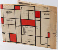
1956ref. 219672Japan. Showa 31 1956. Melbourne 1956 Olympics scrapbook 26 x 36.3cm 38pp 4 hole string binding hand-written title on front cover. Some largely even browning throughout endpapers a little marked but overall very good. This Japanese scrapbook filled with newspaper clippings from Japanese sources provides a detailed and engaging record of the 1956 Melbourne Olympic Games capturing the entire event from its earliest stages to its conclusion. The scrapbook begins with profiles of all Japanese athletes participating in the Games followed by reports on the opening ceremony individual sporting events and the triumphs and disappointments experienced by Japan's competitors. It also includes coverage of notable performances by international athletes and closes with accounts of the closing ceremony. The precise newspaper source for these articles is not identified. Each clipping has been neatly and carefully cut and mounted demonstrating the compiler's dedication and care. The scrapbook was assembled by S. Tanaka in December 1965. Wrapped in paper from a bookshop in Fukuoka it suggests that Tanaka may have been a sports enthusiast living in that region motivated to preserve the memories of Japan’s Olympic efforts. Beyond its sporting content the scrapbook offers insights into the Japanese media's portrayal of the Games and national pride during the post-war period. It serves as both a historical record and a personal testament to one individual's passion. . unknown
ref. 052110N. p. : N. p. 18-19th century. Soft cover. Very Good. 8vo - over 7¾ - 9¾" tall. Original b/w lithographer print of Medina. 215x175 cm. In Arabic. 1 p. A FINE LITHOGRAPHED MEDINA Medina al-Munawwara ali sâhibhâ afzal al-tahiyya. It shows Medina city with its building and walls besides its environment. Medina is the capital of the Al-Madinah Region in Saudi Arabia. At the city's heart is al-Masjid an-Nabawi 'The Prophet's Mosque' which is the burial place of the Islamic prophet Muhammad. Medina is one of the three holiest cities in Islam the other two being Mecca and Jerusalem. Medina was Muhammad's destination in his Hijrah migration from Makkah and became the capital of a rapidly increasing Muslim Empire under Muhammad's leadership serving as the power base of Islam and where Muhammad's Ummah Community composed of both locals and immigrants from Muhammad's original home of Mecca developed. Medina is home to three prominent mosques namely al-Masjid an-Nabawi Quba Mosque and Masjid al-Qiblatayn 'The mosque of the two Qiblas'. Muslims believe that the chronologically final surahs of the Quran were revealed to Muhammad in Medina and are called Medinan surahs in contrast to the earlier Meccan surahs. N. p. (18-19th century) paperback
ref. 8887P., Chez Chéreau (fin XVIIIème). (Galerie de ver).
ref. 8871Sans lieu ni date, (fin du XVIIIème).
ref. 8869P., Basset, (fin du XVIIIème).
ref. 8872P., Mondhard, (fin du XVIIIème).
ref. 8870P., Daumont,1760.
1780ref. 14868A Paris / A Rouen, chez Mondhard / chez Lucas, s.d. [circa 1780]. Dimensions (à vue) : 452 x 233 mm.
ref. 8888P., BAsset (fin XVIIIème). (Petits trous de ver).
ref. 67268190 x 230 mm. Original etching and engraving on laid paper with margins top margin small plate nr. 96. unknown
ref. 67270180 x 220 mm. Original etching and engraving on laid paper with margins bottom margin cut to the edge plate nr. 55. unknown
ref. 67265180 x 225 mm. Original etching and engraving on laid paper with margins bottom cut to the edge of the platemark. Bron: buitenplaatsen in Nederland: De buitenplaats was gelegen op kavel 9 van de Watergraafsmeer polder aan de Middenweg tussen het Rechthuis en de buitenplaats Frankendael. De buitenplaats werd in het begin van de 18e eeuw gebouwd door de zouthandelaar Maurits Dreyer en in 1719 verkocht aan Johan Clemens.Tussen 1801 en 1802 breidde Anthony Dull heemraad en schepen van W.G.M zijn buitenplaats Frankendael uit met terreinen op kavel 9 langs de Middenweg. Hiervoor kocht hij ook de hofstede IJsland die in 1801 nog voorzien was van een ""herenhuis timmermanswoning koetshuis ""een steene coupel colonnade menagerie broey- en moestuynen Bosch Boomgaarden Engelsch plantzoen vischrijke vyvers en een goudvischkom"" voor 9.000 gulden van Jan Gefken. Hij liet de bestaande gebouwen op de buitenplaats afbreken. unknown
ref. 67269Total 210 x 260 mm platemark 170 x 205 mm. Original etching and engraving on laid paper with broad margins plate nr. 4. unknown
ref. 67271180 x 220 mm. Original etching and engraving on laid paper with margins top margin cut to the edge plate nr. 36. unknown
ref. 67267190 x 230 mm. Original etching and engraving on laid paper with margins bottom margin small plate nr. 95. unknown
ref. 67266180 x 230 mm. Original etching and engraving on laid paper with margins plate nr. 100. unknown
ref. 67272190 x 210 mm. Original etching and engraving on laid paper with margins plate nr. 37. unknown
1911ref. 25256Nantes aux Bureaux de la Société Archéologique de Nantes et de la Loire-Inférieure 1911 -in-8 demi-basane 2 semestres reliés en un volume, reliure demi-basane marron foncé in-octavo à coins (half binding sheepskin in-8 with corners) (24,2 x 16 cm), RELIURE D'ÉPOQUE, dos à 4 nerfs (spine with raised bands) décoré "or" et à froid (gilt and blind stamping decoration),Titre et Année frappées "or" (gilt title) avec un filet "or" de part et d'autre, double filets à froid de part et d'autre des nerfs et en tête et en pied, papier marbré violet et crème aux plats, toutes tranches lisses, couvertures marron Editeur imprimées en noir conservées, orné d'un portrait hors-texte en noir, (XXXIII + 125) + ( DE XXXIV à XLIV + de la page 131 à la page 353 + XXII pages de liste des membres + 1 p. de Table ) pages, 1911 Nantes aux Bureaux de la Société Archéologique de Nantes et de la Loire-Inférieure Editeur,
ref. 8877Sans lieu ni date, (fin du XVIIIème).
ref. 8881P., Daumont (fin XVIIIème). (Galerie de ver).
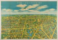
1801ref. 171034滿洲國國務院國都建設局.Manshūkoku Kokumuin Kokuto Kensetsukyoku. Fourth Edition. 康徳4年1937. Large folding double sided single sheet printed on both sides folded in 12 panels. One side features a handsome colour birds-eye view of Shinkyo with a photographic panorama showing construction in progress immediately below on the reverse a coloured plan text and black and white photographic illustrations. 54.5 x 78cm. A little minor wear and occasional browning a very good copy. This striking large coloured bird's-eye view of the city of Shinkyo the Chinese city known today as Changchun was published in this pamphlet explaining the first "five-year" stage of the project for the planning of Shinkyo. Shinkyo was established by the Japanese in the first part of the 20th century the area having been chosen for its strategic importance. It became a city in 1932. The Emperor Puyi lived there until the end of World War II. This attractive birds-eye view of the planned city shows Shinkyo's broad streets trees and attractive buildings. The planning of Shikyo was influenced by the changes that had been made to 19th century Paris by contemporary American town planning and the Garden City Movement. Today Changchun is a city of over 7 million people the capital of China's Jilin Province and known for its car manufacturing. On the reverse of the map two panels upper right section showing a photograph titled 國都新京建設の全貌Kokuto kensetsu no zenbō accompanying an overview of the planning of Shinkyo and the purpose of the city. Two panels in the upper middle section on reverse of the birds-eye view show a coloured plan of the future Shinkyo. It shows the city located within the nearby region and indicates government residential and industrial areas the race course airport railway lines parks etc. A comprehensive list of names of parks avenues plazas and roads is also provided along with the map. The other eight panels are a report of plans for the city covering information on the development of infrastructure constructions and highlights in the first five-year project financing for the construction and more. It is clear from the text and the images that this brochure was published to commend Shinkyo to readers as a city with a bright future - a city of economic and cultural importance - with the intention of attracting industry and people. . 滿洲國國務院國都建設局.[Manshūkoku Kokumuin Kokuto Kense unknown