3 788 résultats
réf. 138584aafVevey, G. Blanchoud Êdit, s.d. (ca. 1860), in-8° oblong, (17x24 cm.), titre illustré imprimé en bistre et noir + 45 magnifiques planches lithographiées rehaussées à la gouache, dont 5 panoramas sur double page, exemplaire sans rousseurs, cartonnage d'éditeur rouge, dos en toile, titre doré au centre du premier plat.
1878réf. 47603Providence RI 1878. During the 1870s excursion tours around Narragansett Bay were such a popular attraction that the Excursion View Company commissi . Providence RI 1878. During the 1870s excursion tours around Narragansett Bay were such a popular attraction that the Excursion View Company commissioned an artist to sketch the complete trip just as a passenger would see it. The drawings were transferred to lithographic stones and printed in color on a continuous roll which could be viewed in a wooden box by turning the knobs and moving the roll. This charming device uses two of these panoramic strips to take the viewer on a trip from Providence to Block Island and back again. The first scroll starts at Fox Point in Providence and travels south passing Squantum Point Silver Spring Pomham Rocks Light Riverside Sabin Point Light Annawanscut Nayatt Point Light Warren Hog Island and Bristol. It then proceeds around Bristol Point and heads northward into Mount Hope Bay passing Churchs Cove to Fall River Mass. and then southward again passing Globe Village and Bristol Ferry to Newport. The end of the first scroll shows Benton Reef at the southern tip of Newport Island and the Atlantic. The second scroll starts at Southeast Light on Block Island and travels northward along the coast to New Shorham Old Harbor. The viewer then passes Clay Head and Black Rock Fort Dumpling and Jamestown on the eastern shore on Conanicut Island Rose and Goulds Islands then around to the western shore of Conanicut Island into the West Passage heading south. Next past Dutch Island and Beaver Tail lighthouses Point Judith Lighthouse and north again to Narragansett Pier Bonnet Point South Ferry Wickford Quonsett Point East Greenwich Buttonwood Warwick Lighthouse Rocky Point Conimicut Point Lighthouse and Pawtuxet. This second scroll ends at the old Sassafras Point Lighthouse in Providence. Both strips show and identify many of the leading shoreline hotels of the day private homes rivers industries rocks forts and sailing vessels of all kinds. Many important paddle steamers are shown including the Bay State Florence City of Newport Rhode Island Canonicus Bristol Bay Queen Empire State and Providence. The lithographed illustration strips are in excellent original condition as is the box and its wooden scroll turners. Back in 1970 a company named Industrial National Bank unearthed a working specimen of this rarity. They were so impressed with it that they incorporated the views into a calendar for that year. Each month displays different illustrations along the way. With these vision views as they were called a passenger could relive his trip around Narragansett Bay long after he had returned home. At the time the Panorama was an exciting and elaborate souvenir but now the few existing rolls give us a fascinating look at the coastline as it appeared nearly a century ago. The calendar measures 16 x 12 ¾ inches. It is included with the Excursion View Box. Both items . Two chromolithographed strips each 30 feet in length and 3 3/4 inches wide. Contained in a double sided glazed walnut box measuring 5 x 6 x 13 1/2 inches. . unknown
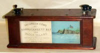
1878réf. 47603Providence RI 1878. During the 1870s excursion tours around Narragansett Bay were such a popular attraction that the Excursion View Company commissi . Providence RI 1878. During the 1870s excursion tours around Narragansett Bay were such a popular attraction that the Excursion View Company commissioned an artist to sketch the complete trip just as a passenger would see it. The drawings were transferred to lithographic stones and printed in color on a continuous roll which could be viewed in a wooden box by turning the knobs and moving the roll. This charming device uses two of these panoramic strips to take the viewer on a trip from Providence to Block Island and back again. The first scroll starts at Fox Point in Providence and travels south passing Squantum Point Silver Spring Pomham Rocks Light Riverside Sabin Point Light Annawanscut Nayatt Point Light Warren Hog Island and Bristol. It then proceeds around Bristol Point and heads northward into Mount Hope Bay passing Churchs Cove to Fall River Mass. and then southward again passing Globe Village and Bristol Ferry to Newport. The end of the first scroll shows Benton Reef at the southern tip of Newport Island and the Atlantic. The second scroll starts at Southeast Light on Block Island and travels northward along the coast to New Shorham Old Harbor. The viewer then passes Clay Head and Black Rock Fort Dumpling and Jamestown on the eastern shore on Conanicut Island Rose and Goulds Islands then around to the western shore of Conanicut Island into the West Passage heading south. Next past Dutch Island and Beaver Tail lighthouses Point Judith Lighthouse and north again to Narragansett Pier Bonnet Point South Ferry Wickford Quonsett Point East Greenwich Buttonwood Warwick Lighthouse Rocky Point Conimicut Point Lighthouse and Pawtuxet. This second scroll ends at the old Sassafras Point Lighthouse in Providence. Both strips show and identify many of the leading shoreline hotels of the day private homes rivers industries rocks forts and sailing vessels of all kinds. Many important paddle steamers are shown including the Bay State Florence City of Newport Rhode Island Canonicus Bristol Bay Queen Empire State and Providence. The lithographed illustration strips are in excellent original condition as is the box and its wooden scroll turners. Back in 1970 a company named Industrial National Bank unearthed a working specimen of this rarity. They were so impressed with it that they incorporated the views into a calendar for that year. Each month displays different illustrations along the way. With these vision views as they were called a passenger could relive his trip around Narragansett Bay long after he had returned home. At the time the Panorama was an exciting and elaborate souvenir but now the few existing rolls give us a fascinating look at the coastline as it appeared nearly a century ago. The calendar measures 16 x 12 ¾ inches. It is included with the Excursion View Box. Both items . Two chromolithographed strips each 30 feet in length and 3 3/4 inches wide. Contained in a double sided glazed walnut box measuring 5 x 6 x 13 1/2 inches. . unknown books
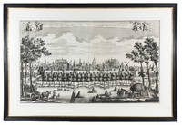
réf. 9933aafAugsburg, l'auteur, (Verlag Jeremias Wolff) s.d., ca. 1730-31, 100 x 35 cm, 125 x 55 avec cadre, Prächtige Kupferstich Vedute von ‘Freiburg im Üchtland’, nach Friedrich Bernhard Werner durch Wolffs Erben verlegt. ƒ Gerahmt.. - Encadrement baguette en bois ornée avec filet nacre, passepartout.
1728réf. 91I90T01U79OAmsterdam 1728. Leonardus Schenk Framed 82.5 x 121 cm. Large engraved wall print on 2 sheets together 57.5 x 97 cm showing the Leiden city wall between the Koepoort and Zijlpoort with various windmills and prominent buildings in the background identified by name. The title appears in a banderole at the head with putti on either side holding the arms of Leiden and Holland. Leonardus Schenk's name appears as engraver and publisher at the right end of the banderole. Large view of the city of Leiden by the Amsterdam engraver and publisher Leonardus Schenk. The viewer observes the city from the south from between the city's Koe and Zijl gates. In the background several windmills and a few characteristic buildings are identified by name in the engraving including the university the library the Pieterskerk the Town Hall the Mare kerk the "Burcht" the fort and the Hooglandse kerk. On the quay outside the wall groups of people walk sporadically passed by small boats on the nearby city moat. In the foreground we see a typical Dutch landscape with grazing cattle farm workers a loaded hay cart and haystacks in the field. We know of several other wall prints by Schenk depicting local situations with almost photographic detail. Thanks to this detail important socio-historical aspects have been passed on to later generations giving these prints an important cultural meaning today. A few spots formerly folded otherwise in very good condition.l Overvoorde Catalogus van de prentverzameling der Gemeente Leiden 1906 no. 640; Waller Biogr. woordenb. Noord Ned. graveurs p. 287. unknown
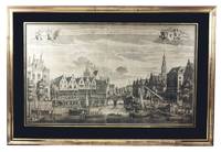
1728réf. A2RGD4WT38YEAmsterdam: Leonardus Schenk 1728. In black passepartout and gilt frame 82 x 121 cm. Large engraved wall print on 2 sheets together 58 x 97 cm the sheets overlapping each other slightly showing the traditional business centre of the city of Leiden. The title both in Dutch and French is printed in a banderole at the head with putti on each side supporting the arms of Leiden and Holland. Leonardus Schenk's name appears as engraver and publisher at the right tip of the banderole. A large engraved wall print in two sheets showing the trading and commercial centre of the city of Leiden at the convergence of the Oude Rijn and Nieuwe Rijn canals. Unlike most other Dutch towns Leiden had no central market square so that the waterways formed the major access routes for merchandise. On the banks of the canals there is a lively market that converges on the bridge central in the print. Market traders and customers come and go. Women from the coastal fishing villages of Katwijk and Noortwijk display fresh fish for sale. Right in the print we see the monumental "Waag" the weigh-house built in 1658 following a plan by the Dutch architect and engraver Pieter Post. The splendid relief designed by Rombout Verhulst that crowns the entrance is reproduced with a sharp eye for detail. In front of the building commercial goods are hoisted up from carts and a number of ships for transport to the weigh-house. Several other ships had moored and now continue to their destination. A boat flying the Dutch flag brings in a prominent party while a herald standing precariously at the bow trumpets for right of way. We know of several other wall prints by Schenk depicting local situations with almost photographic detail. Thanks to this detail important socio-historical aspects have been passed on to later generations giving these prints an important cultural meaning today. With some faint foxing otherwise in very good condition.l Overvoorde Catalogus van de prentverzameling der Gemeente Leiden 1906 no. 964; Waller Biogr. woordenb. Noord Ned. graveurs p. 287. Leonardus Schenk, unknown
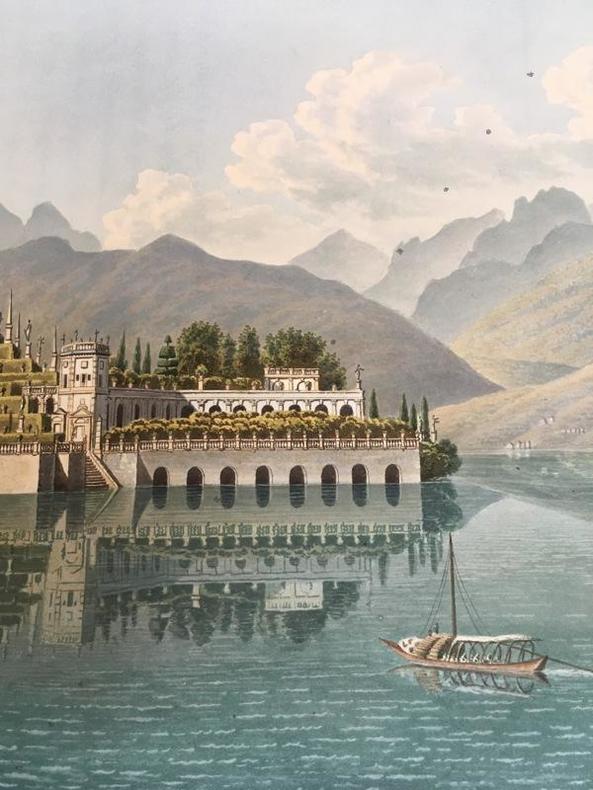
1811réf. 10857Paris, Didot l'aîné, 1811. In-folio de 48 feuillets et 35 planches hors-texte, demi-veau chamois à coins, dos à nerfs, coiffes, mors et coins frottés. Reliure moderne. Exemplaire non rogné. Quelques rousseurs aux feuillets initiaux et finaux. Voici la collation des 96 pages de texte: [8] pages soit 1ff. blanc, faux-titre, titre, 1 ff. de table des planches, 6p. pour le Tableau général du lac de Genève (dernière bl.), [8]p. pour la description des planches, 10p. pour le Tableau général du Valais (dernière bl.), [8]p. pour la description des planches, 4p. pour le Tableau général du Simplon, [34]p. pour la description des planches, 2p. pour le Tableau général du lac Majeur, [12]p. pour la description des planches, [2]p. pour 1 ff. blanc.
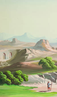
1910réf. J68AIMO7W1D1Palestine 1910. Rolled up and kept in a cardboard tube. An enormous panoramic view drawn in coloured gouaches on a single continuous roll of unwatermarked wove paper 70 x 583 cm the drawing running to the edges of the paper. A panoramic view of what appears to be a fantasy Middle Eastern landscape with spectacular mountains in the background a body of water near each end and a wide variety of buildings and ruins some clearly classical Roman and others Middle Eastern. The combination of classical Roman architecture with dromedaries and other Middle Eastern features places it very likely in Palestine but we have not been able to identify specific buildings. The most distinctive ruin a round Roman temple with five columns on the viewer's side an entablature above them and a vertical base below them looks more like the Temple of the Vesta at Tivoli than like any known in the Middle East the columns are not rendered in sufficient detail to determine their order but they are almost certainly not Ionic and are probably Corinthian. There are also classical Roman aqueducts. The six shepherds with their flocks all wear broad-brimmed hats and have staffs and two are blowing long slightly curved horns. Several more figures with broad-brimmed hats and staffs might be pilgrims one together with what is presumably his wife. With a 33 cm tear into the left end a few insignificant and much smaller tears and with pin holes about 1 cm from the edges from mounting on a wall but otherwise in very good condition and with the colours fresh and bright. A spectacular panoramic view of the Middle East including many classical Roman ruins. unknown
1730réf. E1Q9EQ01U79OAmsterdam: Reinier and Josua Ottens 1730. Mounted and framed. With title in banner at top centre arms of the city at top right city seal at top left and the primary locations with captions. Large engraved panorama on 4 sheets ca. 42 x 218 cm as assembled. Rare large engraved view of Amsterdam as seen from the inlet known as the IJ published by Reinier and Josua Ottens ca. 1730 with numerous ships on the IJ. It's the last state of the view by Jacob Savry published in 1647 and partly updated including the changes made by Visscher in his issue from 1653. Most obvious are the changes on the east part of the city with several new buildings including ''s Lands Zeemagazijn' now known as the Netherlands Maritime Museum.Washed and with one minor professional restoration near the title. Very good copy of a beautifully executed an detailed view of Amsterdam.l D'Ailly Profielen 186; De Vries Atlas van Amsterdam 14; cf. D'Ailly Profielen 55 & 74. Reinier and Josua Ottens, unknown
1599réf. DB9FTP3RHVIKAntwerp 1599. Pieter Bast Framed. Large engraved panorama on 2 sheets ca. 27 x 76 cm as assembled. Rare first state of a 16th-century view of Amsterdam as seen from the inlet known as the IJ made by Pieter Bast a Dutch engraver from Antwerp best known for his city map of Amsterdam and this view. "In its amplitude and the sheer audacity of the presentation this engraving is indisputably one of Bast's most significant creations. It is as much a portrait of the harbour of Amsterdam as of the city itself and underscores the unique importance of maritime trade as the principle source of the city's wealth and power". With its distinctive orientation he not only initiated the series of representations of Amsterdam as seen from the IJ but also "established the standard for an entire genre of Dutch maritime painting" Keyes. In 1611 a second state edition was published by Claesz Jansz. Visscher who drastically altered the composition. In very good condition.l Hollstein Dutch & Flemish I p. 168 8; Keyes Pieter Bast 8 and p. 19. unknown
réf. est144t8Dimension extérieur 50 x 61,5 cm, cuvette 40,3 x 52,4 cm. Magnifique eau-forte d'Albert Decaris, peintre, graveur et décorateur français du 20 ème siècle. Il est notamment réputé pour avoir gravé de nombreux timbres poste. En très bon état général, magnifique travail sur le noir et les contrastes. Tirage 66/150
réf. est145t8Dimension extérieur 76 x 56,3 cm, cuvette 66,8 x 49,5 cm. Très belle eau-forte réalisée par Albert Decaris, peintre, graveur et décorateur français du 20 ème siècle. Il est notamment réputé pour avoir gravé de nombreux timbres poste. Gravure en très bon état général, il exerce un vrai travail sur le noir et ses nuances.
réf. pho080Stereoscopic views, each 2 X 7,5 cms, prices : A. = 20, B. = 40, C. = 20, D. = 20, E. = 30, F. =20, G. = 20