12 492 résultats
1985réf. GE-258New York: Springer-Verlag 1985. Classic comprehensive text presents an outstanding compilation of research on the geology of carbonate oil and gas reservoirs including thirty-five case studies involving 41 reservoirs from a broad range of depositional settings tectonic provinces and burial/diagenetic histories. Includes coverage of sedimentological and diagenetic controls; petrophysics; production performance; reservoir summary of each case study; etc. 622 pgs. 386 Illustrations. Inscribed/signed by Choquette on the half-title pg. Prior owner's name blacked out on front endpaper. Minimal shelfwear. Signed by Author. First Edition. Hard Cover. Fine. 4to - over 9¾" - 12" tall. Springer-Verlag Hardcover
1983réf. 10452Amer Assn of Petroleum Geologists. Very Good with no dust jacket. Hardcover. Book is clean and tight. Wow so many color photos. Has index and list of contributors with photos. This thing weighs about 7 pounds when packed.; Memoir # 33; 9 X 1.75 X 11.5 inches; 708 pages . 1983. 0891813101 . Amer Assn of Petroleum Geologists hardcover
2000réf. mon0003812102National Academies Press 1/31/2025 12:00:01 A. paperback. Very Good. . Cover and edges may have some wear. National Academies Press paperback
2000réf. mon0003718484National Academies Press 1/31/2025 12:00:01 A. paperback. Like New. . National Academies Press paperback
1987réf. 7091276American Geophysical Union 1987. Volume 32. This is an ex-library book and may have the usual library/used-book markings inside.This book has hardback covers. In poor condition suitable as a reading copy. No dust jacket. Please note the Image in this listing is a stock photo and may not match the covers of the actual item1750grams ISBN:0875900607 American Geophysical Union hardcover
1826Monza tipografia Corbetta, 1826. (cm. 16,4 x 10,5). Brossura editoriale con fascetta applicata della Libreria di Lorenzo sonzogno... Milano ". pp. 125, (2) di catalogo. Dall'indice: glorie e lustro dei Saraceni - divisione dell'impero romano - ristabilimento dell'impero d'Occidente - stabilimento del feudalismo in Europa - fanatismo militare e religioso per l'acquisto di Terra Santa mediante le Crociate - formazione delle grandi monarchie - invenzioni per sempre memorabili
1950réf. LBW-7530Hambourg, Éditions Ewald Becker, [vers 1950]. En 4 feuilles jointes formant une carte de 1,70 x 1,66 m ; montée sur toile, entre deux baguettes de bois avec liens de cuir.
2008réf. RO30129007MILAN. 2008. In-8. Broché. Bon état, Couv. convenable, Dos satisfaisant, Intérieur frais. 31 pages - nombreuses illustrations en couleur dans le texte. . . . Classification Dewey : 550-Sciences de la Terre et des autres mondes
1700réf. LBW-1915Amsterdam, J. Covens & C. Mortier, vers 1700. 399 x 467 mm.
1762réf. 27432Paris chez l'Auteur ( Robert de Vaugondy) Editeur, 1762 carte ancienne colorée d'époque en vert , rouge et jaune, cartouche non coloré, gravée par E. DUSSY. Format total : 27 centimètres de haut par 39,8 centimètres de large, 1762 Paris : chez l'Auteur (Robert de Vaugondy) Editeur,
réf. carte16p2Dimension extérieur : 48,5 x 59 cm. Cuvette : 34 x 45 cm. Gravure d'époque, en très bon état pour une gravure début / milieu 18ème. Gravure sur cuivre.
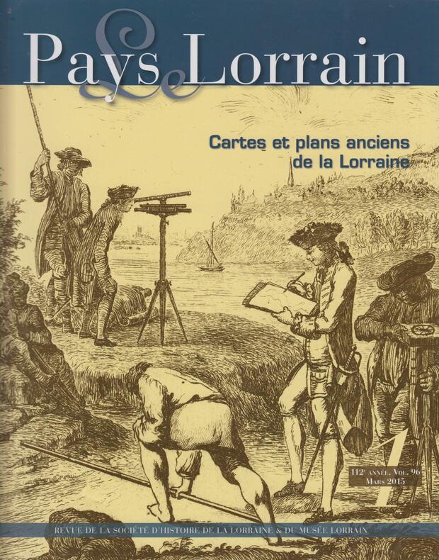
2015réf. SPN-943Nancy : Société d'Archéologie Lorraine / Musée Historique Lorrain, 2015. Revue 27,5x22cm, couverture illustrée en noir, 103 pages illustrées en noir et couleur.
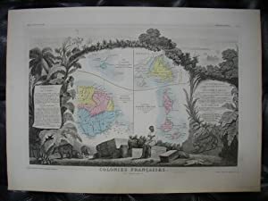
réf. 21494Paris Pelissier 1869 1 carte géographique gravée ancienne de l'ILE SAINT MARTIN, DE LA GUYANE FRANÇAISE, DE L'ILE DE TERRE NEUVE, DES ILES SAINT PIERRE ET MIQUELON, COLONIES FRANÇAISES (en Amérique), imprimée sur papier fort et coloriée à l'époque, de format : 36,5 x 51,5 cm. Carte originale gravée sur acier, illustrée d'un décor d'encadrement finement gravé figurant la géographie et l'histoire (paysages, et personnages), avec un cartouche donnant la description écrite de la statistique. Les fonds sur cette carte de l'ILE SAINT MARTIN, DE LA GUYANE FRANÇAISE, DE L'ILE DE TERRE NEUVE, DES ILES SAINT PIERRE ET MIQUELON, COLONIES FRANÇAISES (en Amérique) sont aquarellés chacun d'une couleur différente (original hand coloring). Carte dressée d'aprés les travaux du Cadastre de dêpot de la Guerre et des Ponts et Chaussées par V. Levasseur, ingénieur Géographe attaché au Génie du Cadastre de la Ville de Paris. Bel exemplaire ( Photographies sur demande / We can send pictures of this print on simple request ) Envoi dans un emballage de protection (tube carton)
1869réf. 261511869 Pelissier, Paris, 1869. 1 carte géographique gravée ancienne de l'ILE SAINT MARTIN, DE LA GUYANE FRANÇAISE, DE L'ILE DE TERRE NEUVE, DES ILES SAINT PIERRE ET MIQUELON, COLONIES FRANÇAISES (en Amérique), imprimée sur papier fort et coloriée à l'époque, de format : 36,5 x 51,5 cm.
1747réf. 20246PARIS SANSON 1747 une carte dépliante sur papier ligné filigrané, reliure bradel cartonné in-octavo (12,6 x 19 cm) recouvert d'un papier velin saumon, titre à l'encre brune sur une etiquette de papier ligné blanc au trois quart centre de la première de couverture, carte ancienne colorée d'époque en vert , rouge et jaune, cartouche non coloré. Format total dépliée : 47 centimètres de haut par 60 centimètres de large (Size: 23 x 18 inches), 1747,
1662réf. 280971662 une carte ancienne gravée sur cuivre (Copper etching) en noir . Format : 46,5 x 58 cm, par Nicolas SANSON carthographe, 1662 [s.n.] Editeur,
réf. 12029Paris, Atlas Portatif,c.1797, Size: 265mm x 215mm,contours coloriés, a grandes marges,pli central habituel; 10 3/8" x 8 1/2". Original Outline Coloring,
Roma,1880. In 16°, pp.11n.+3nn. bross. editoriale.
20038vo., First Edition, with 74 coloured and monochrome plates on 32 and pictorial endpapers; white cloth, backstrip lettered in silver, a fine copy in the dustwrapper.
2006Doctoral thesis. Minor shelfwear only; contents clean, sound, bright. TPW Used
2014brossura A ottant'anni dalla rotta di Caporetto, torna uno dei più importanti documenti storici sul momento di massima crisi dell'esercito italiano osservato dal Comando supremo. Quattro sono i grandi episodi militari compresi nel diario di Gatti: la decima battaglia dell'Isonzo (maggio), la battaglia dell'Ortigara (giugno), la conquista della Bainsizza (agosto), Caporetto (ottobre-novembre).
1997Una strenua lotta per la sopravvivenza nel tratto di mare più tempestoso del pianeta. Una storia straordinaria di solidarietà, vendetta, rum e follia.
1984réf. 4140936Palgrave Macmillan 1984. This is an ex-library book and may have the usual library/used-book markings inside.This book has soft covers. In good all round condition. Please note the Image in this listing is a stock photo and may not match the covers of the actual item450grams ISBN:0333301188 Palgrave Macmillan paperback
1991réf. 3944262Westview Press 1991. This is an ex-library book and may have the usual library/used-book markings inside.This book has hardback covers. In fair condition suitable as a study copy. Re-bound by library. Please note the Image in this listing is a stock photo and may not match the covers of the actual item550grams ISBN:0813382726 Westview Press hardcover
2016brossura La geologia è ovunque intorno a noi: siamo circondati dalle materie prime e dalle risorse che la Terra ci fornisce, dai gioielli alla benzina che alimenta i motori, all'acqua che beviamo. Con l'espansione della popolazione mondiale è aumentato l'impatto di fenomeni naturali pericolosi, quali le frane e le inondazioni, rendendo sempre più necessarie le competenze di geologi che siano anche esperti di problemi ambientali. E persino su altri pianeti, come Marte, i geologi sono impegnati nella ricerca di tracce di vita del passato in rocce che hanno miliardi di anni. Tutti questi settori richiedono una profonda comprensione dei principi e dei concetti di base delle Scienze della Terra. "Capire la Terra" tratta con completezza la composizione e l'origine dei materiali geologici, così come la genesi e l'evoluzione del rilievo terrestre, e spiega che la Terra si comporta come un sistema integrato.