Pierre FERRO - Henri KREABiblio.com
2.191 Ergebnisse
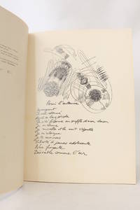
1962Best.-Nr. 58331Paris & Bruxelles Brussels & Liège: Editions de l'Essai 1962. Fine. Editions de l'Essai Paris & Bruxelles Brussels & Liège 1962 24 x 32 cm broché First edition one of 470 numbered copies on coated paper the only deluxe copies after 30 Coronado ""Lys de Gand"". Work illustrated with 21 drawings by Ferro. Light and minor foxing without significance on the title page. Editions de l'Essai unknown
1991Best.-Nr. ZB575588Iron & Steel Society 1991. 468 pp. hardcover ex library else text and binding clean and tight. - If you are reading this this item is actually physically in our stock and ready for shipment once ordered. We are not bookjackers. Buyer is responsible for any additional duties taxes or fees required by recipient's country. Photos available upon request. Iron & Steel Society hardcover
2009Best.-Nr. 1-0300134762Yale University Press 2009. Hardcover. New. 240 pages. 9.90x8.60x1.00 inches. Yale University Press hardcover
Best.-Nr. 3956500865.Ghardcover. Good. Access codes and supplements are not guaranteed with used items. May be an ex-library book. hardcover
Best.-Nr. 0947912460.Ghardcover. Good. Access codes and supplements are not guaranteed with used items. May be an ex-library book. hardcover
1968Best.-Nr. 97.49491986Like new! American Iron and Steel Institute
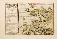
1700Best.-Nr. 70272Paris 1700-05. Pozzoli is a province of Naples and the main city of the Phlegrean Peninsula. It lies some two miles from the once fashionable resort of Baia. The map is well executed and detailed. Nicolas de Fer was the son of Antoine de Fer a Parisian map and print seller. This map from the Atlas Curieux. At the time of publication de Fer was the official cartographer to the French Dauphin but he later became cartographer to both the French and Spanish kings. Size: 270 x 405 mm. Copperplate engraving with later hand colour. Good condition. Slightly toned. unknown
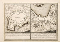
1705Best.-Nr. 65686Paris. 1705. An interesting and unusual map depicting the basic fortifications of two Portuguese towns. Published in the 'Atlas Curieux ou Le Monde'. Size: 275 x 395 mm. Copperplate engraving. Fine condition. unknown
1702Best.-Nr. 523961702. Copper engraving. Later colouring. Size: 33 x 22 cm. 13 x 8½ inches unknown
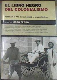
2005Best.-Nr. 80763La Esfera de los Libros S.L. 2005. tapa blanda. 2ª Mano - con marcas de uso/2ª Mano. La Esfera de los Libros S.L. 2005. Ex biblioteca marca tejuelo sello y expurgo 1056 p. ; 24x16 cm. tapa blanda La Esfera de los Libros S.L. unknown
Best.-Nr. 093626294X.Gpaperback. Good. Access codes and supplements are not guaranteed with used items. May be an ex-library book. paperback
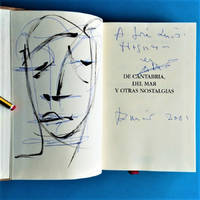
2001Best.-Nr. 23.576Santander: Estudio 2001. 1ª ed. Cartoné editorial. 14x21. Fotos. Estudio unknown
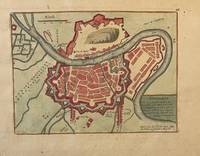
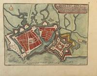
Best.-Nr. PR121919-036Original map of Grenoble France. Later colored with the river Iser les Recolets Tour de Natot Porte de Beaune.Engraving with later hand coloring on laid paper in good condition. Total size 270 x 390 mm. Numbered with 46 in the right top.NL Decoratieve historische kaart van Grenoble in Frankrijk. unknown
Best.-Nr. PR121919-035Original map of Le Havre in North of France. Later colored with citadelle la Corderie Fontaine Bassin des Capucins and compass.Engraving with later hand coloring on laid paper in good condition. Total size 280 x 380 mm. Numbered with 26 in the right top.NL Decoratieve historische kaart van Havre de Grâce de vroegere naam van het huidige Le Havre gelegen aan de monding van de Seine in Normandië Frankrijk. Komt waarschijnlijk uit de atlas Les Forces de L'Europe van Nicolas de Fer een bekende Franse cartograaf. Le Havre werd in 1517 gesticht door Frans I als strategische haven. De kaart toont een versterkt Le Havre zoals het eruitzag tijdens de 17e18e eeuw toen de stad een belangrijk militair en handelscentrum was. De citadel werd aangelegd om de monding van de Seine te verdedigen tegen Engelse invallen. unknown
Best.-Nr. 155581414X.Ghardcover. Good. Access codes and supplements are not guaranteed with used items. May be an ex-library book. hardcover
1977Best.-Nr. 58273NY: Scribner's Sons 1977. First Edition the author first book. 8vo pp.86. Foredge foxed o/w a fine copy in dj. Signed by the author. Laid in is a note from Ferro to poet William Jay Smith: "Mr. Smith I am indebted to you for your kind words and gratified that you enjoyed the book with my very best wishes. Robert Ferro." Summers page 270. from Wikipedia: "Robert Ferro October 21 1941 – July 11 1988 was an American novelist whose semi-autobiographical fiction explored the uneasy integration of homosexuality and traditional American upper middle class values. He died of AIDS a few months after his partner Michael Grumley in 1988 at his father's home in Ho-Ho-Kus New Jersey age 46.35 Grumley and Ferro are buried together under the Ferro-Grumley memorial in Rockland Cemetery Sparkill New York. Following their deaths the Ferro-Grumley Foundation which manages their estate created and endowed the annual Ferro-Grumley Award for LGBT fiction in conjunction with Publishing Triangle." Summers notes that Ferro was one of the original members of "The Violet Quill" which came together after the Stonewal Rebellion. l. Scribner's Sons unknown
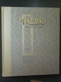
1911Best.-Nr. x1245Beaver Dam WI: Malleable Iron Range Company 1911. Handsome trade catalog of these popular coal/wood/corn cob-fired cooking appliances a few with gas attachments not much changed in design since 1899. Undated but circa 1911 - catalog 20 was issued in 1919. Light wear some bumping to the corners fraying to the edges. Text clean; 64 pages; b/w illustrations parts lists comments on quality. First Edition. Hard Cover. Very Good. 10¼" by 12". Malleable Iron Range Company Hardcover
Best.-Nr. 1880146908.Ghardcover. Good. Access codes and supplements are not guaranteed with used items. May be an ex-library book. hardcover
Best.-Nr. A9781138132849Hardback. New. hardcover
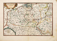
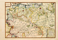
1705Best.-Nr. 66130Paris. c. 1705. An attractive and quite detailed map of the northern regions of Brabant in Belgium and south western Holland by the French cartographer Nicolas de Fer. A number of larger regional towns are highlighted as are local rivers woodlands hills and marshes. Published in the 'Atlas Curieux ou Le Monde'. Size: 275 x 405 mm. Copperplate engraving with later hand colour. Good condition. Some general age toning. unknown
Best.-Nr. 6500472Clarendon Press . Hardback. New. pp. 236 Clarendon Press hardcover
2008Best.-Nr. DADAX3030229505Springer 2020-08-26. 1st ed. 2019. paperback. New. 6.14x1.25x9.21. Buy with confidence. Excellent Customer Service & Return policy. Springer paperback
Best.-Nr. 658588847Springer . Hardback. Used. pp. 506 Springer hardcover
Best.-Nr. 2501RS101Capa de Antonio Soares. Conferencia realizada na Société Amicale Franco-Portugaise em 6 de Novembro de 1920. H. Antunes-Editor. Lisboa. Rio de Janeiro. 1921. De 17x135 cm. Com 56 págs. Brochado. Ilustrado em extratexto com dois retratos a preto e branco sobre papel couché e um fac-simile manuscrito. Capa de António Soares. Exemplar com dedicatória do autor na folha de guarda. SACO RS622-08 unknown
Best.-Nr. 1605PG006Capa de Jorge Barradas Portugália Editora. Lisboa. 1920. De 18x13 cm. Com 124 págs. Encadernação com lombada em pele. Exemplar com dedicatória a Pires de Lima na folha de anterrosto. I-64-E-16 unknown