Baltasar del HierroBiblio.com
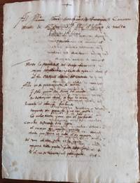
Manuscrito Al Excelentísimo Sr. D. Francisco de Reynoso camarero secreto de su santidad. Sobre el suceso de Malta. Epístola
1656Best.-Nr. 76350Malta 1656. unknown
11.895 Ergebnisse
Best.-Nr. 9892Paris, Imprimerie Goury, Avril 1910. 1 fort volume in folio, 45 pp. de texte, reliure percaline d'éditeur, couvertures illustrées conservées, richement illustré de reproductions photographiques à pleine page. Excellent état. Il existe une autre version de cet ouvrage, dont le texte est enrichi (202 pp.).
1656Best.-Nr. 76350Malta 1656. unknown
Best.-Nr. 17536Paris, Méquignon, 1783 ; in-8, veau fauve marbré, dos lisse décoré et doré, pièce de titre grenat, tranches rouges (rel. de l'époque) ; (2) ff. le premier blanc et titre, XVI, 286 pp.
1925Best.-Nr. 135951925 S.l.n.d. (ca. 1925), 1 vol. in-4° (318 x 235 mm) cartonnage souple marron, plat supérieur titré et illustré dun élément de ferronnerie, de 17 planches sur onglets maintenus par deux rivets.Petit accident recollé au dos
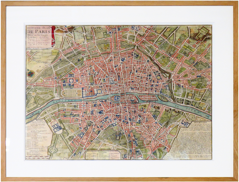
1722Best.-Nr. LBW-6646[Paris, 1722]. 445 x 555 mm.
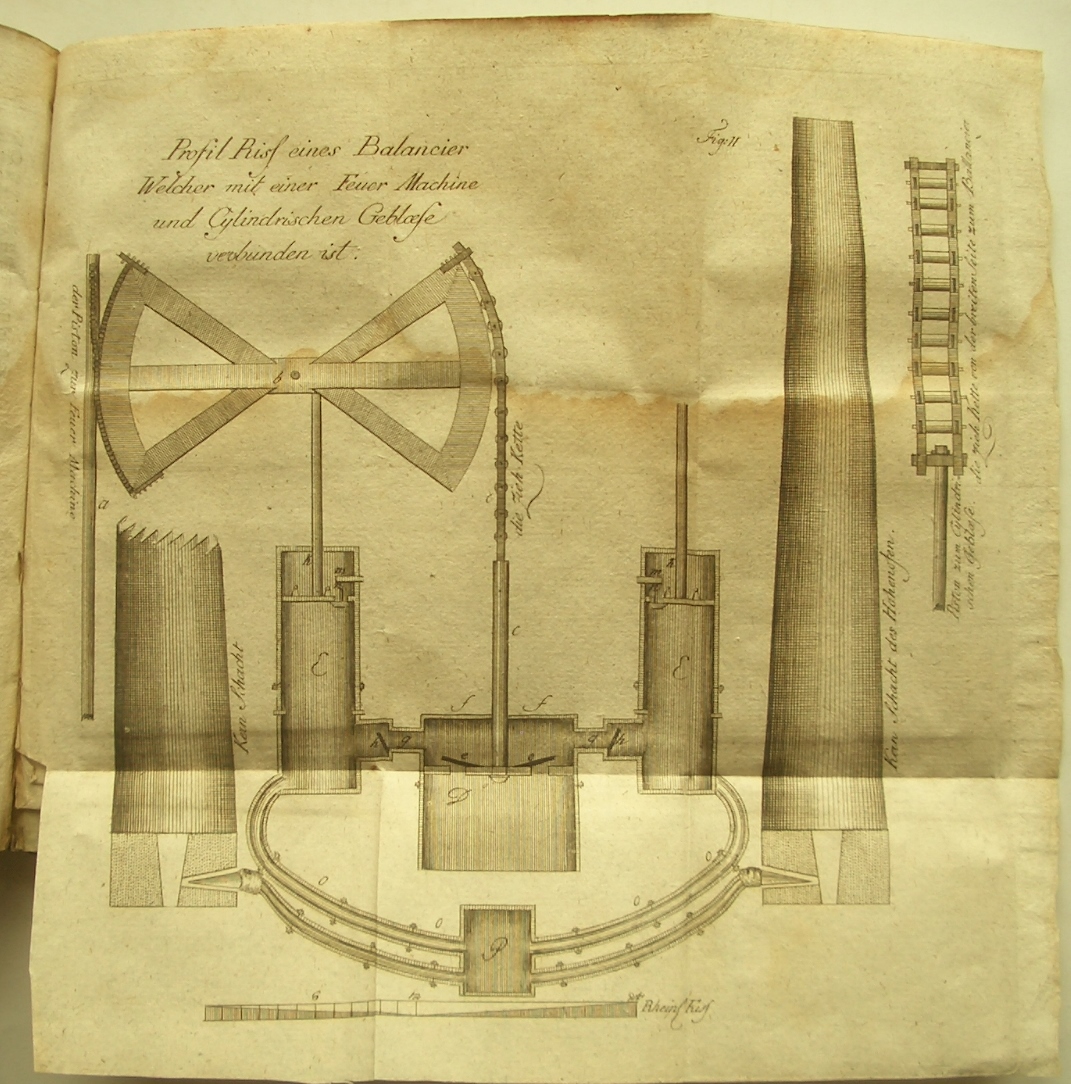
1792Best.-Nr. 6102Mit 28 Abb. auf 5 gefalt. gest. Tafeln. Berlin, A. Mylius, 1789. 8vo. (19,4 x 11,4 cm). 77 S. - Vorgebunden: Rösler, Karl Anton. Bergmännische Nachrichten über die Gebirge und den Bergbau zu Joachimsthal. Nebst einigen Nachrichten über die Gebirge auf der Straße von Prag bis Joachimsthal, hrsg. von Johann Mayer. Dresden, Walther, 1792. 8vo. 126 S. Marmorierter Pappband d. Zt. mit zwei farbigen Rückenschildern. [6 Warenabbildungen]
Best.-Nr. 054108Paris Dunod, Editeur 1870 in folio (37x28) 6 forts volumes reliure demi chagrin vert de l'époque, dos lisses ornés de faux-nerfs à froid et de fleurons dorés. Volumes illustrés nombreuses figures dans le le texte, et de nombreuses planches hors-texte. Contenant un choix des objets les plus intéressant des expositions industrielles, destiné aux ingénieurs, mécaniciens, conducteurs, constructeurs de machines, contre-maitres, chefs d'atelier, élèves des écoles, entrepreneurs ouvriers. Rare ensemble. Du tome 15: Années 1870 (15e année) au tome XVI de 1891 (3ème série, 36e année). Importante documentation. Ensemble 6 volumes en reliures uniformes de l'époque et en bel état ( Photographies sur demande / We can send pictures of this book on simple request )
1925Best.-Nr. 2081502112400132Not Available 1925. Soft Cover. Fine. The book is in fine condition. Not Available paperback
1866Best.-Nr. 2092902144201629Not Available 1866. Soft Cover. Fine. The book is in fine condition. Not Available paperback
1921Best.-Nr. 121011Pékin Beijing : édition officielle publiée à compte d’auteur par l’Administration même de la ligne et imprimé par l’Imprimerie Officielle de l’Etat la Calcographie de Pékin 1921. broché. Collectif. - Le Bureau d’administration des chemins de fer de Jingsui.Zhonghua Guoyou Tielu Jingsuixian Jianzhi Jilue. Précis d’établissement de la ligne férroviaire nationale chinoise de Jingsui Pékin-Suiyuan. - Edition de Prestige Commémorative. Pékin Beijing édition officielle publiée à compte d’auteur par l’Administration même de la ligne et imprimé par l’Imprimerie Officielle de l’Etat la Calcographie de Pékin1921 225x145mm 38 pages 18 portraits n/b une carte dépliante un plan dépliant trois tableaux statistiques dépliants et des illustrations n/b in texte écrit en chinois classique broché. Avec à la fin du livre : un feuillet de présentation officiel du cadeau commémoratif entouré d’une magnifique frise florale imprimée à l’encre verte la petite inscription horizontale tout en bas de la dernière page indique : Imprimé pour le compte de l’Etat par l’Imprimerie du Ministère des Finances. - Livre réellement confectionné par l’Imprimerie Officielle de l’Etat la Calcographie de Pékin qui imprimait les billets de banque les timbres fiscaux et les documents de haute sécurité de la République de Chine. Bel exemplaire. For shipments to the U.S.A. with a value exceeding 800 USD VAT is not included. Please contact us via our website if needed. édition officielle publiée à compte d’auteur par l’Administration même de la ligne et imprimé par l’Imprimerie Offici unknown
1705Best.-Nr. M4344Paris 1705. Excellent. Notes: This decorative map focuses on the French possessions in North America. The treatment of French Florida is intriguing. The map shows the United States of America and parts of Southern Canada East of the Mississippi river. "Territorial expansion of New France had reached the Mississipi River with the establishment of the first European settlement at Fort Maurepas by Pierre Le Moyne d'Iberville in 1699 sixteen years after La Salle had reached the mouth of the river. This attractive map from 'L'Atlas Curieux ou le Monde' paris 1705 although containing geographical errors has many interesting historical notes" -The Macdonald Stewart Foundation Size : 232x342 mm 9.125x13.5 Inches Coloring: Hand Colored in Outline Reference: The Macdonald Stewart Foundation "La Decouverte du Monde Cartographes et Cosmographes" Map # 44; McCorkle 702.2 Category: ; Maps North America Great Lakes; Maps Canada; Maps Canada East; Maps United States East; Maps United States South unknown
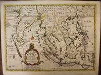
1700Best.-Nr. M6975London c. 1700. Very Good. Notes: A late 17th Century map of South East Asia by Edward Wells based upon the previous work by De Fer. The cartouche has the dedication in the coat of arms to the Duke of Gloucester. Size : 367x487 mm 14.45x19.17 Inches Coloring: Original Outline Coloring Category: Maps Asia South East; Maps Asia Central India & Sri Lanka / Ceylon; unknown
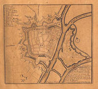
Best.-Nr. 51-3483Paris: Nicolas de Fer circa 1693. 4to. 23 x 29cm. 18th Century rose cardboard covers. 33 engraved views and plans and 2 hand-drawn plans of Versoi and the col of Grand-Saint-Bernard showing Saint-Rhémy et San Leonardo. Old manuscript table of contents. Most of the plates are 17th Century but 2 are 18th Century. Small losses and browning to most plates.Nicholas de Fer 1646 – 1720 was the son of cartographer Antoine de Fer. Nicholas was established as an engraver cartographer and map publisher in Paris with over 600 maps and atlases to his credit. His work earned a large following because of its considerable decorative appeal. In the late 17th century de Fer’s career culminated in his appointment as Geographer to the King of France. Upon his death in 1720 Nicolas was succeeded by two of his sons-in-law Guillaume Danet and Jacques-François Danet and their heirs who continued the de Fer publishing firm until c. 1760. Recueil de 35 cartes plans et vues de villes fortifiées gravées sur cuivre 33 et manuscrites 2. S.l.n.d. Paris 1693 e.a. In-4 oblong cartonnage rose pièce de titre manuscrite Reliure vers 1800.Le présent ensemble contient :– 27 cartes et plans de villes fortifiées extraites pour la plupart de l'atlas de Nicolas de Fer 1693 montrant Turin Endingen Mont Royal Mayence Ath Pignerol Mont-Melian Landau Casal Verceil Genève Maestricht Huningue Nice Charle-Roy Bonn Calais Coblentz Stetin Juliers Wismar Mons Verüe Berg S. Winox Kamieniec Podolski Donquerque Coni ;– 4 vues gravées de Montmélian Miolans Verue Verrua Savoia et du siège de Genève ;– 2 planches manuscrites : un plan de Versoi et une carte du col du Grand-Saint-Bernard montrant Saint-Rhémy et San Leonardo ;– 2 petites planches gravées postérieures.Exemplaire défraîchi : cartes jaunies présentant parfois des restaurations ; petits manques marginaux à quelques cartes quelques rousseurs et taches d'encre. Paris: Nicolas de Fer, circa 1693. unknown
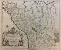
1719Best.-Nr. 291534Paris 1719. Map. Engraving with original hand outline color. Image measures 19 x 23". Sheet measures 20 x 28". Unusual map of Peru from the early 18th century. Includes part of Ecuador Bolivia and Brazil based on Jesuit activity in the area. Amazon rain forest is visualized with a dynamic design. Cartouche describes the mining industry. Nicolas de Fer 1646-1720 was a prolific cartographer engraver and publisher who took over the family map business from his mother when she retired in 1687. The business flourished and he gained a great reputation in his lifetime and was appointed 'Geographer to the King' in 1690. This map demonstrates his skill and provides a curious yet alluring mixture of history and geography. unknown
1719Best.-Nr. 291534Paris 1719. Map. Engraving with original hand outline color. Image measures 19 x 23". Sheet measures 20 x 28". Unusual map of Peru from the early 18th century. Includes part of Ecuador Bolivia and Brazil based on Jesuit activity in the area. Amazon rain forest is visualized with a dynamic design. Cartouche describes the mining industry. Nicolas de Fer 1646-1720 was a prolific cartographer engraver and publisher who took over the family map business from his mother when she retired in 1687. The business flourished and he gained a great reputation in his lifetime and was appointed 'Geographer to the King' in 1690. This map demonstrates his skill and provides a curious yet alluring mixture of history and geography. unknown books
1760Best.-Nr. M5799Paris: Desnos 1760. Very Good. Notes: French map of Poland Lithuania and the surrounding region. 1760 edition of rare Nicolas De Fer's map. Size : 480x590 mm 18.875x23.25 Inches Coloring: Hand Colored in Outline Category: Maps Europe Poland Lithuania Desnos unknown
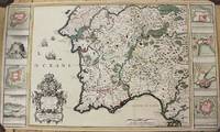
1704Best.-Nr. M10805Paris: St. Gaspar Baillieu 1704. Very Good backed on acid free tissue paper for long term preservation. Notes: Fine large scale map focused on Southern Portugal and Southern Spain. The map is surrounded by inset maps of Olivenca Castello Ferreire Aronches Badaioz Lisbonne Setubal Chateau St. Iulien Evora. Size : 561x940 mm 22.09x37.01 Inches Coloring: Original Hand Coloring Category: Maps Europe Spain; Maps Europe Portugal; St. Gaspar Baillieu unknown
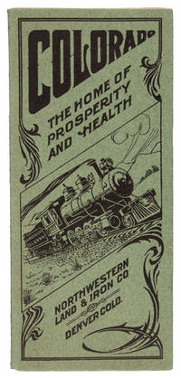
1909Best.-Nr. 48065N. P. Denver: Privately printed for The Northwestern Land & Iron Company n. d. ca 1909. 1909. COLORADO. First edition. 8vo. 9" x 8" pictorial sheet folds to 9" x 4" 16 pp. illustrated from photographs map town plat. A scarce and attractively illustrated promotional booklet advertising Milliken Colorado a newly developing railroad town in the agricultural country north of Denver. Issued by the Northwestern Land & Iron Company the 16-page pamphlet promotes Milliken as an ideal location for settlement investment farming and business emphasizing the region's fertile soil irrigation sugar-beet and truck-garden production healthful climate transportation facilities and proximity to the Rocky Mountains. Illustrated with photographs of Milliken and its surrounding agricultural country together with a town plat the booklet provides a remarkable visual record of the community at the moment of its creation. Milliken's development was closely tied to the ambitious Denver Laramie & Northwestern Railway which began service to the town in January 1910 and promoted a series of new communities and agricultural settlements along its projected route. The DL&NW was an ambitious but ultimately unsuccessful railroad venture and its associated land companies promoted new town sites and farming lands along the line in hopes of creating prosperous agricultural communities. The railroad entered receivership in 1912 and ceased operations in 1917. There is a space for postage and an address on the rear wrapper as well as an attached perforated sheet for inquiries about the advertised land. First two pages have a tiny clip to the top corners tiny tear to the fore-edge margin of page 5 else a very good copy of an attractive Colorado land promotional booklet. Privately printed for The Northwestern Land & Iron Company, n. d. (ca 1909). unknown
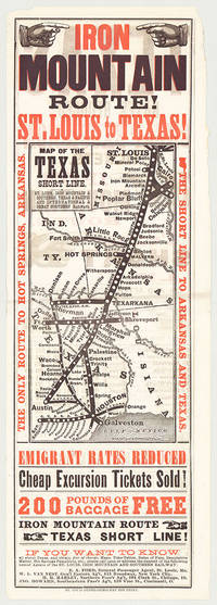
Best.-Nr. 5718St. Louis: St. Louis Globe-Democrat Job Print; Woodward Tiernan & Hale Map Engr's 1878. Broadsheet with map 20.75" x 6.5" plus margins printed in black and red. Map size 11" x 5". Faded purple stamp of agent Henry H. Hannan. CONDITION: Very good upper-half of right margin rough cut. A scarce and attractive promotional broadsheet with map issued by the St. Louis Iron Mountain & Southern Railway advertising special railway offers to emigrants headed to Texas. This broadsheet announces cheap excursion tickets free baggage up to 200 lbs. and reduced emigrant rates for departures from St. Louis on the Short Line Route which runs through Arkansas into Texas. A table of rates on the verso lists first class and emigrant rates. The Texas Short Line extends from St. Louis Missouri to Galveston and Austin and cuts diagonally across the map with various spurs along the way including intersections the Texas & Pacific R'y and the International & Great Northern R'y. Interested parties seeking assistance information on Texas maps time-tables rates of fare etc. are encouraged to call upon or address the nearest of the railroad's Agents located in Missouri Chicago New York City and Ohio whose names are provided on both recto and verso. The St. Louis Iron Mountain & Southern Railway began selling off land holdings in Arkansas in the mid-1870s and continued to do so into the early twentieth century. OCLC records some twenty maps published by the railroad company promoting land it owned in Arkansas issued during this time period. These lands extended from the northernmost point of the state around Little Rock to the line's southern terminus in Texarkana. The company offered various inducements for settlers deep discounts for putting money down as well as reduced freight should homesteaders wish to transport their belongings via the railway. As demonstrated by the present broadsheet the railroad also capitalized on emigration to Texas. OCLC records only three copies at Yale Princeton and University of Texas at Arlington. St. Louis: St. Louis Globe-Democrat Job Print; Woodward, Tiernan & Hale, Map Engr's, 1878 unknown
Best.-Nr. 5718St. Louis: St. Louis Globe-Democrat Job Print; Woodward Tiernan & Hale Map Engr's 1878. Broadsheet with map 20.75" x 6.5" plus margins printed in black and red. Map size 11" x 5". Faded purple stamp of agent Henry H. Hannan. CONDITION: Very good upper-half of right margin rough cut. A scarce and attractive promotional broadsheet with map issued by the St. Louis Iron Mountain & Southern Railway advertising special railway offers to emigrants headed to Texas. This broadsheet announces cheap excursion tickets free baggage up to 200 lbs. and reduced emigrant rates for departures from St. Louis on the Short Line Route which runs through Arkansas into Texas. A table of rates on the verso lists first class and emigrant rates. The Texas Short Line extends from St. Louis Missouri to Galveston and Austin and cuts diagonally across the map with various spurs along the way including intersections the Texas & Pacific R'y and the International & Great Northern R'y. Interested parties seeking assistance information on Texas maps time-tables rates of fare etc. are encouraged to call upon or address the nearest of the railroad's Agents located in Missouri Chicago New York City and Ohio whose names are provided on both recto and verso. The St. Louis Iron Mountain & Southern Railway began selling off land holdings in Arkansas in the mid-1870s and continued to do so into the early twentieth century. OCLC records some twenty maps published by the railroad company promoting land it owned in Arkansas issued during this time period. These lands extended from the northernmost point of the state around Little Rock to the line's southern terminus in Texarkana. The company offered various inducements for settlers deep discounts for putting money down as well as reduced freight should homesteaders wish to transport their belongings via the railway. As demonstrated by the present broadsheet the railroad also capitalized on emigration to Texas. OCLC records only three copies at Yale Princeton and University of Texas at Arlington. St. Louis: St. Louis Globe-Democrat Job Print; Woodward, Tiernan & Hale, Map Engr's, 1878 unknown books
1762Best.-Nr. 8659S.l. s.e. 1762 Un volume in-folio plein veau raciné de l'époque, dos à nerfs orné, pièce de titre en maroquin rouge, double-filet doré sur les coupes, réunissant: - M. de Réaumur, Nouvel Art d'adoucir le fer fondu et de faire des ouvrages de fer fondu aussi finis que de fer forgé. 1762. viii+124pp., 7pl.- M. le Marquis de Courtivron et M. Bouchu, De la forge des enclumes. 1762. 11pp., 1pl. - M. Duhamel du Monceau, Art des forges et fourneaux à fer. 1762. 198pp., 9pl.- M. de Réaumur et M. Duhamel du Monceau, Fabrique des ancres. 54pp., 6pl.Épidermures, manque à la coiffe supérieure, léger travail de vers sur les plats et premiers feuillets, mouillure claire en marge supérieure à la fin de l'ouvrage.
2013Best.-Nr. 2081502111904015Peking University Medical Press 2013. Soft Cover. Fine. The book is in fine condition. Peking University Medical Press paperback
Best.-Nr. 2091502135300807Not Available N.A. Soft Cover. Fine. Number of books: 1 Not Available paperback
1916Best.-Nr. 77991916. Chateaudun 5 ème Régiment du Génie - Cie 5t de Sapeurs de chemins de fer 1916 - Dans une chemise à l'en-tête de 5 ème Régiment du Génie - Chantier du Nouvel entrepot de munitions de Chateaudun - on trouve les documents suivants propres et en bon état - Un plan de 30 5 cm x 41 5 cm sur papier bleu plié légendé du Nouvel Entrepôt Général de Ports Secs au 1/400 et daté du 6/3/16 - Le même plan avec au dos le cachet et la signature du Capitaine Ott capitaine commandant du 5 ème Régt. Un papier y tient avec un trombone sur lequel il est écrit au crayon noir : A joindre au PV qui doit être envoyé par le Lt Lacan - Un Plan Parcellaire des terrains nécessaires pour l'établissement du nouvel Entrepôt de 39 cm x 65 cm sur papier calque légendé à l'échelle de 1/2500 - Un plan de 30 5 cm x 41 5 cm sur papier bleu plié légendé de la Modification de la gare deLa Fourchette à l'échelle de 0.001 p. m. et daté du 22/2/16 - Un Rapport sur la construction des voies et quais du nouvel entrepôt de réserve générale de Bourges sur papier ligné 20 cm x 31 cm manuscrit très lisible 8 pages signé - Un plan général au 1/1000 du Nouvel Entrepôt de Réserve Générale de Bourges de 60 cm x 180 cm plié - Un dossier : Chantier de ravitaillement et de transbordement de Piémont - vues photographiques du chantier comprenant : - Un extrait de la carte au 1/80000 daté et signé de LA Cheppe 12 août 1915 et nommé Chantier de ravitaillement et de transbordement de Piémont au km 196.775 de la ligne de Châlons s/Marne à Ste Menehould - 7 photos légendées de 12 cm x 16 5 cm en très bon état - Un dossier : Chantier de transbordement et d'évacuation de Cuperly - vues photographiques du chantier comprenant 5 photos légendées de 12 cm x 16 5 cm en très bon état - Un dossier : Construction du Nouvel Entrepot de Munitions de Chateaudun - Relevé des dépenses engagées daté du 1er Février 1917 sur papier ligné broché 20 cm x 31 cm manuscrit très lisible 41 pages - Un Plan Parcellaire des terrains soumis à l'occupation temporaire pour l'exploitation d'une ballastière sur la commune de Fréteval... 30 5 cm x 105 cm sur papier bleu plié légendé 1/1000 daté (illisible) et signé - Un Plan Parcellaire du Nouvel Entrepot de Munitions de Chateaudun 67 cm x 255 cm sur papier blanc plié légendé 1/1000 daté (illisible) et signé - une petite déchirure sans manque - 7 photos légendées de 12 cm x 16 5 cm en très bon état qui doivent être aussi de Piémont - Un Procès-Verbal de reconnaissance des travaux de la Ballastière de Golbey gare d'Epinal sur papier blanc 20 cm x 31 cm 8 pages daté du 21 novembre 1915 et signé par le Chef de Bataillon du Génie le Capitaine Commandant et l'Ingénieur Principal Il y est joint un plan de la Ballastière de Golbey en couleur à l'échelle de 0.001 p. m. Un Procès-Verbal d'Etat des Lieux (Chateaudun) de 20 cm x 31 cm 3 pages daté du 21 mai 1916 et annoté par Monsieur Rousseau chef de section à Vendôme - Un plan de 32 5 cm x 56 cm sur papier bleu plié légendé de Muizon et ses environs non daté non signé et sans échelle - Un plan de 31 cm x 50 5 cm sur papier bleu plié légendé nommé : renseignements pour la pose des épis dans le bois de Bougogne non daté signé et sans échelle - Un plan sur papier bleu plié légendé de Muizon et ses environs Avec le nom du Lieutenant Laval et marqué au crayon noir : à faire parvenir au Capitaine Commandant - Un plan de 31 cm x 71 cm sur papier bleu plié légendé de Ligne d'A.L.G.P. de Vaux-Varennes état des travaux à la date du 10 mars 1917 signé par le Capitaine Commandant daté du 11 mars 1917 sans échelle - Un plan de 31 cm x 139 cm sur papier bleu plié légendé de Réseau de circulation au nord de la Vesle état des travaux à la date du 10 mars 1917 signé par le Capitaine Commandant daté du 11 mars 1917 sans échelle - Un plan de 62 cm x 83 cm sur papier bleu plié légendé nommé : Voies ferrées normales exécutées par l'Autorité Militaire au nord de la ligne de Soissons à Reims entre Magneux et Muizon au 1/20000 - Un tableau des distances kilométriques au nord de la ligne de Soissons à Reims entre Magneux et Muizon sur papier calque 43 cm x 105 cm plié légendé plan au au 1/20000 - Un projet de la ligne de Bouvancourt au bois de Gernicourt sur papier calque 30 cm x 32 cm plié légendé plan au au 1/20000 - Un plan parcellaire du Chantier de ravitaillement et de transbordement de Piémont au km 196 770 de la ligne de Châlons sur Marne à Ste Menehould sur papier calque 31 cm x 83 cm plié légendé plan au au 1/1000 daté du 16 août 1915 le capitaine Ott étant commandant - Un plan parcellaire du Chantier de transbordement de Cuperly au km 193 283 de la ligne de Châlons sur Marne à Ste Menehould sur papier calque 31 cm x 78 cm plié légendé daté du 16 août 1915 le capitaine Ott étant commandant - Voies ferrées du Havre - Travaux exécutés par l'Autorité Militaire depuis le 2 août 1914 sur papier calque 60 cm x 107 cm plié légendé au 1/5000 daté du 1 janvier 1917 - Voies ferrées du Havre - Répertoire des travaux exécutés par l'Autorité Militaire depuis le 2 août 1914 sur papier calque 60 cm x 31 cm plié - Chantiers du Havre sur papier calque 47 cm x 120 cm plié légendé au 1/5000 - Port du Havre plan des voies ferrées sur papier 64 cm x 130 cm plié légendé au 1/5000 daté de janvier 1917 - 10 photos légendées de 12 cm x 16 5 cm en très bon état de la gare de La Fouchette certaines animées - Baraque de chantier démontable - ferrures diverses sur papier calque 31 cm x 130 cm plié légendé grandeur nature daté du 2 décembre 1915 à Golbey capitaine Ott commandant