1865Best.-Nr. 28408UNIEUX 1865 une page, format : 17,8 x 25 cm, sur papier vergé crème ligné et filigrané "au timbre imperial", manuscrite à l'encre brune, timbre fiscal gravé et illustré en noir : "timbre impérial 50 c." dans un cercle en noir + en dessous timbre impérial "à l'aigle couronné" gauffré à froid dans un cercle à froid, cachet bleu de la MAIRIE D'UNIEUX LOIRE avec gravure aigle couronné dans un cercle, CERTIFICAT ORIGINAL DE LA MAIRIE D'UNIEUX : ATTESTANT QUE LES 27 BARRES ET 30 BOTTES ACIER CÉMENTÉ AFFINÉ PESANT ENSEMBLE TROIS MILLE KILOS, EXPÉDIÉS LE 1ER SEPTEMBRE 1865 PAR MESSIEURS JACOB HOLTZER & CIE A UNIEUX (LOIRE) A L'ÉTABLISSEMENT IMPÉRIAL D'INDRET VIENNENT DES USINES DE MESSIEURS JACOB HOLTZER & CIE ET SONT BIEN RÉELLEMENT DE LEUR FABRICATION, MAIRIE D'UNIEUX, LE 27 OCTOBRE 1865, SIGNÉ : DUBOUCHET MAIRE D'UNIEUX,
1949Features include: The Donkey - A humble donkey co-operates to bring about the discomfiture of sundry Arab thieves; It Pays to Advertise - The Amazing result of the nefarious activities of a rascally 'wild-cat' company promoter and an unscrupulous newspaper reporter in Canada; Mr. Zaru - story from a ship; Into the Unknown - exploratino work in Tanganyika; Farm Life in South Africa - intended for aspiring British immigrants to South Africa; Through the Iron Curtain - an ambitious motor-cycle voyage through Yugoslavia, Bulgaria, and Turkey; Beyond the Barrier - Extraordinary incidents related by a famous stage magician, Jasper Maskelyne; A Matter of Boundaries - an amusing tale of a tribal land-dispute in Nigeria; The Little Gold Disc - A veteran seafarer's account of a remarkable experience on the China Coast; The Tiger That Thought; The Red Lacquer Pagoda; The Ship That Became a House; Guarding New Zealand's Forests - Illustrated in black and white. Chips from and tears to base of spine else average wear. Two inch opening at top of back cover. Magazine
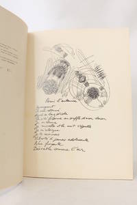
1962Best.-Nr. 58331Paris & Bruxelles Brussels & Liège: Editions de l'Essai 1962. Fine. Editions de l'Essai Paris & Bruxelles Brussels & Liège 1962 24 x 32 cm broché First edition one of 470 numbered copies on coated paper the only deluxe copies after 30 Coronado ""Lys de Gand"". Work illustrated with 21 drawings by Ferro. Light and minor foxing without significance on the title page. Editions de l'Essai unknown
Best.-Nr. 71122, Brepols, 2026 Hardback, xviii + 252 pages, Size:220 x 280 mm, Illustrations:71 b/w, 53 col., 15 tables b/w., Language: English. ISBN 9782503621999.
1999Best.-Nr. SONG8437605997Brand: Catedra 1999-01-01. edici. paperback. Used: Good. 4.53x0.39x7.09. Buy with confidence. Excellent Customer Service & Return policy. Brand: Catedra paperback
Best.-Nr. A9781631176227Hardback. New. hardcover
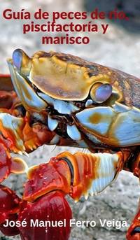
2019Best.-Nr. 2-0464224594Blurb 2019. Hardcover. New. 196 pages. Spanish language. 8.27x5.28x0.75 inches. Blurb hardcover
Best.-Nr. 3659097330.Gpaperback. Good. Access codes and supplements are not guaranteed with used items. May be an ex-library book. paperback
1885Best.-Nr. 25975Bernard & Cie Paris 1885 In-8 cachets de bibliothèque annulés - Inscription de la Bibliothèque au dos 110 pp et 6 planches dépliantes
Best.-Nr. 65588, Brepols, 2024 Paperback, xxvi + 358 pages, Size:216 x 280 mm, Illustrations:333 b/w, 77 col., 3 tables b/w., 8 tables col., 6 maps color, Language: English. ISBN 9782503608037.
2003Best.-Nr. Q-185974916XNew Holland Pub 2003-01-01. Hardcover. New. In shrink wrap. Looks like an interesting title! New Holland Pub hardcover
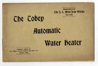
1898Best.-Nr. 100094New York: The J.L. Mott Iron Works 1898. 1898. Good. - Oblong octavo 5-7/8 inches high by 9 inches wide. Softcover bound in tan wraps titled in copper on the front cover. The covers are slightly soiled and the corners bumped. The edges of the rear cover are darkened. 16 pages with 3 pages of black & white illustrations depicting the heaters and the Tobey steam trap. The corners of the pages are bumped. Good. Established in 1828 by Jordan L. Mott in New York City the American hardware dealer and manufacturer The J.L. Mott Iron Works operated during the late 19th century through the 1920's. Mott's products were mentioned in Benson Lossing's "History of New York City". The company exhibited an elaborate 25 foot tall cast iron fountain at the 1876 Philadelphia Centennial Exposition. RARE. New York: The J.L. Mott Iron Works, 1898. paperback
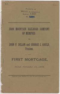
1888Best.-Nr. 46016N.Y.: Burgoyne Quick Printing Co. 1888. First edition. Stapled paper wrappers. Removed from a larger volume rear wrapper lacking minor soiling and browning ownership stamps and page renumbering in red. 17 pp. Sm. 4to. The Iron Mountain Railroad Company of Memphis was part of Jay Gould's extensive network of Railroads later taken over by his son named in this document George Jay Gould 1864-1923 Stamped on front wrapper & first leaf: Property of White & Kemble who'd published "Atlas and Digest of Railroad Mortgages" at the turn of the 20th century. We could locate no copies of this document in OCLC nor in other online sources. Burgoyne Quick Printing Co. unknown
1888Best.-Nr. 46016N.Y.: Burgoyne Quick Printing Co. 1888. First edition. Stapled paper wrappers. Removed from a larger volume rear wrapper lacking minor soiling and browning ownership stamps and page renumbering in red. 17 pp. Sm. 4to. The Iron Mountain Railroad Company of Memphis was part of Jay Gould's extensive network of Railroads later taken over by his son named in this document George Jay Gould 1864-1923 Stamped on front wrapper & first leaf: Property of White & Kemble who'd published "Atlas and Digest of Railroad Mortgages" at the turn of the 20th century. We could locate no copies of this document in OCLC nor in other online sources. Burgoyne Quick Printing Co. unknown books
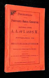
1889Best.-Nr. B68779Pittsburgh PA: National Lodge of the United States and Canada 1889. Softcover. Very good. RARE! Printed paper wraps octavo paginated 2568-2866 not illustrated. Book has rubbing and soil to wraps mild wear to spine head bunching to spine binding tight text clean and unmarked. The Amalgamated Association of Iron & Steel and Tin Workers was first organized in 1876 and instigated key strikes in the 1880s for better wages and working conditions. In 1887 AA joined with the American Federation of Labor AFL which led to increased power and membership. At its height AA had over 24000 members. AA organized the 1892 Homestead Strike and the length bitterness and violence of that strike nearly bankrupted AA and resulted in a massive loss of its membership. But AA was the seed organization that eventually became the United Steelworkers union in 1942. National Lodge of the United States and Canada unknown
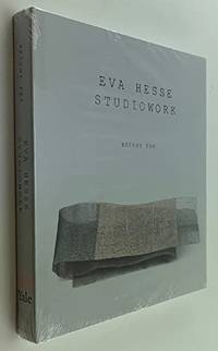
2009Best.-Nr. 19307Argues that Eva Hesse's 1936--1970 studioworks force us to ask fundamental questions not just about what an artwork is but about the work that art does in our culture. 240p. 200 color illustrations. Measures 8.25x9.75 inches. Brand new sealed copy! The Fruitmarket Gallery hardcover
Best.-Nr. 18-8266London: Gagosian Gallery 2008. Folio. ca 30 pp. Oblong. Hard Cover. Very Good. Illustrated paper covered boards. Color and B&W plates throughout. Some fold outs.ISBN: 1932598693 9781932598698. London: Gagosian Gallery, 2008. hardcover
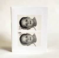
2009Best.-Nr. 026388Whitney Museum of American Art New York 2009. Book. New. Flexi-bound. 430 pages 375 illustrations in color. Still in shrink-wrap. Illustrated board. Introduction by Donna De Salvo Carter E. Foster Mark Godfrey. Text by Briony Fer. Whitney Museum of American Art, New York Paperback
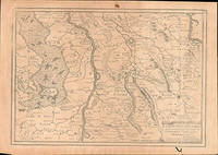
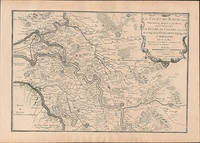
Best.-Nr. 51-6448Paris: chez l'auteur dans l'Isle du Palais sur le quay de l'orloge a la Sphére Royale avec privilége du Roy 1705-1717. Engraved map. One fold. Worm hole in lower margin 27.3 x 38 cm. Contemporary laid paper uniformly time aged.Published in "L'atlas curieux ou Le monde reÌpreseÌnteÌ dans des cartes geÌneÌrales et particulieres du ciel et de la terre : diviseÌ tant en ses quatre principales parties que par eÌtats et provinces et orneÌ par des plans et descriptions des villes capitales et principales et des plus superbes edifices qui les embelissent comme sont les eglises les palais les maisons de plaisance les iardins les fontaines &c. ". OCLC Number / Unique Identifier:79022119.LThe Atlas Curieux is geographic encyclopedia of images and maps of France with detailed views of the grand waterworks at Marly views of the great palaces and chateaux views and plans of the Paris Observatory and samples of military architecture. Issued in six annual parts from 1700-1705 the maps are based on the new observations of the Académie des Sciences and drawn up with the assistance of Philipe de La Hire.ibrary of Congress:The French cartographer and engraver Nicolas de Fer was a master at creating maps that were works of art. The maps that he published were printed during the Baroque period when the decorative arts were characterized by ornate detail. De Fer’s detailed maps and atlases were valued more for their decorative content than their geographical accuracy.Nicolas de Fer was born in 1646. His father Antoine de Fer owned a mapmaking firm. At the age of twelve Nicolas was apprenticed to a Parisian engraver named Louis Spirinx. The family business was starting to decline when his father died in 1673. Nicolas de Fer’s mother Genevieve took over the business after the death of her husband. In 1687 the business was passed on to Nicolas and the profits increased after he took over the firm. Nicolas de Fer was a prolific cartographer who produced atlases and hundreds of single maps. He eventually became the official geographer to King Louis XIV of France and King Philip V of Spain.One of de Fer’s major works is an atlas titled L’atlas curieux The curious atlas. Paris: chez l'auteur dans l'Isle du Palais sur le quay de l'orloge a la Sphére Royale avec privilége du Roy, 1705-1717 unknown
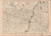
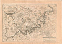
Best.-Nr. 51-6449Paris: chez l'auteur dans l'Isle du Palais sur le quay de l'orloge a la Sphére Royale avec privilége du Roy 1705-1717. Engraved map. One fold. Worm hole in lower margin 27.3 x 38 cm. Contemporary laid paper uniformly time aged.Published in "L'atlas curieux ou Le monde reÌpreseÌnteÌ dans des cartes geÌneÌrales et particulieres du ciel et de la terre : diviseÌ tant en ses quatre principales parties que par eÌtats et provinces et orneÌ par des plans et descriptions des villes capitales et principales et des plus superbes edifices qui les embelissent comme sont les eglises les palais les maisons de plaisance les iardins les fontaines &c. ". OCLC Number / Unique Identifier:79022119.LThe Atlas Curieux is geographic encyclopedia of images and maps of France with detailed views of the grand waterworks at Marly views of the great palaces and chateaux views and plans of the Paris Observatory and samples of military architecture. Issued in six annual parts from 1700-1705 the maps are based on the new observations of the Académie des Sciences and drawn up with the assistance of Philipe de La Hire.ibrary of Congress:The French cartographer and engraver Nicolas de Fer was a master at creating maps that were works of art. The maps that he published were printed during the Baroque period when the decorative arts were characterized by ornate detail. De Fer’s detailed maps and atlases were valued more for their decorative content than their geographical accuracy.Nicolas de Fer was born in 1646. His father Antoine de Fer owned a mapmaking firm. At the age of twelve Nicolas was apprenticed to a Parisian engraver named Louis Spirinx. The family business was starting to decline when his father died in 1673. Nicolas de Fer’s mother Genevieve took over the business after the death of her husband. In 1687 the business was passed on to Nicolas and the profits increased after he took over the firm. Nicolas de Fer was a prolific cartographer who produced atlases and hundreds of single maps. He eventually became the official geographer to King Louis XIV of France and King Philip V of Spain.One of de Fer’s major works is an atlas titled L’atlas curieux The curious atlas. Paris: chez l'auteur dans l'Isle du Palais sur le quay de l'orloge a la Sphére Royale avec privilége du Roy, 1705-1717 unknown
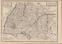
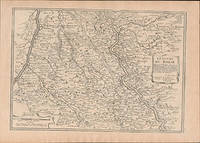
Best.-Nr. 51-6463Paris: chez l'auteur dans l'Isle du Palais sur le quay de l'orloge a la Sphére Royale avec privilége du Roy 1705-1717. Engraved map. 27.3 x 38cm. Contemporary laid paper uniformly time aged.Published in "L'atlas curieux ou le monde reÌpreseÌnteÌ dans des cartes geÌneÌrales et particulieres du ciel et de la terre : diviseÌ tant en ses quatre principales parties que par eÌtats et provinces et orneÌ par des plans et descriptions des villes capitales et principales et des plus superbes edifices qui les embelissent comme sont les eglises les palais les maisons de plaisance les iardins les fontaines &c. ". OCLC Number / Unique Identifier:79022119.LThe Atlas Curieux is geographic encyclopedia of images and maps of France with detailed views of the grand waterworks at Marly views of the great palaces and chateaux views and plans of the Paris Observatory and samples of military architecture. Issued in six annual parts from 1700-1705 the maps are based on the new observations of the Académie des Sciences and drawn up with the assistance of Philipe de La Hire.ibrary of Congress:The French cartographer and engraver Nicolas de Fer was a master at creating maps that were works of art. The maps that he published were printed during the Baroque period when the decorative arts were characterized by ornate detail. De Fer’s detailed maps and atlases were valued more for their decorative content than their geographical accuracy.Nicolas de Fer was born in 1646. His father Antoine de Fer owned a mapmaking firm. At the age of twelve Nicolas was apprenticed to a Parisian engraver named Louis Spirinx. The family business was starting to decline when his father died in 1673. Nicolas de Fer’s mother Genevieve took over the business after the death of her husband. In 1687 the business was passed on to Nicolas and the profits increased after he took over the firm. Nicolas de Fer was a prolific cartographer who produced atlases and hundreds of single maps. He eventually became the official geographer to King Louis XIV of France and King Philip V of Spain.One of de Fer’s major works is an atlas titled L’atlas curieux The curious atlas. Paris: chez l'auteur dans l'Isle du Palais sur le quay de l'orloge a la Sphére Royale avec privilége du Roy, 1705-1717 unknown
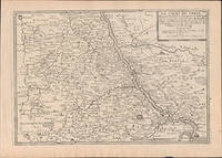
Best.-Nr. 51-6457Paris: chez l'auteur dans l'Isle du Palais sur le quay de l'orloge a la Sphére Royale avec privilége du Roy 1705-1717. Engraved map. 27.3 x 38 cm. Contemporary laid paper uniformly time aged.Published in "L'atlas curieux ou Le monde reÌpreseÌnteÌ dans des cartes geÌneÌrales et particulieres du ciel et de la terre : diviseÌ tant en ses quatre principales parties que par eÌtats et provinces et orneÌ par des plans et descriptions des villes capitales et principales et des plus superbes edifices qui les embelissent comme sont les eglises les palais les maisons de plaisance les iardins les fontaines &c. ". OCLC Number / Unique Identifier:79022119.LThe Atlas Curieux is geographic encyclopedia of images and maps of France with detailed views of the grand waterworks at Marly views of the great palaces and chateaux views and plans of the Paris Observatory and samples of military architecture. Issued in six annual parts from 1700-1705 the maps are based on the new observations of the Académie des Sciences and drawn up with the assistance of Philipe de La Hire.ibrary of Congress:The French cartographer and engraver Nicolas de Fer was a master at creating maps that were works of art. The maps that he published were printed during the Baroque period when the decorative arts were characterized by ornate detail. De Fer’s detailed maps and atlases were valued more for their decorative content than their geographical accuracy.Nicolas de Fer was born in 1646. His father Antoine de Fer owned a mapmaking firm. At the age of twelve Nicolas was apprenticed to a Parisian engraver named Louis Spirinx. The family business was starting to decline when his father died in 1673. Nicolas de Fer’s mother Genevieve took over the business after the death of her husband. In 1687 the business was passed on to Nicolas and the profits increased after he took over the firm. Nicolas de Fer was a prolific cartographer who produced atlases and hundreds of single maps. He eventually became the official geographer to King Louis XIV of France and King Philip V of Spain.One of de Fer’s major works is an atlas titled L’atlas curieux The curious atlas. Paris: chez l'auteur dans l'Isle du Palais sur le quay de l'orloge a la Sphére Royale avec privilége du Roy, 1705-1717 unknown
Best.-Nr. 51-6459Paris: chez l'auteur dans l'Isle du Palais sur le quay de l'orloge a la Sphére Royale avec privilége du Roy 1705-1717. Engraved map. 27.3 x 38 cm. Contemporary laid paper uniformly time aged.Published in "L'atlas curieux ou Le monde reÌpreseÌnteÌ dans des cartes geÌneÌrales et particulieres du ciel et de la terre : diviseÌ tant en ses quatre principales parties que par eÌtats et provinces et orneÌ par des plans et descriptions des villes capitales et principales et des plus superbes edifices qui les embelissent comme sont les eglises les palais les maisons de plaisance les iardins les fontaines &c. ". OCLC Number / Unique Identifier:79022119.LThe Atlas Curieux is geographic encyclopedia of images and maps of France with detailed views of the grand waterworks at Marly views of the great palaces and chateaux views and plans of the Paris Observatory and samples of military architecture. Issued in six annual parts from 1700-1705 the maps are based on the new observations of the Académie des Sciences and drawn up with the assistance of Philipe de La Hire.ibrary of Congress:The French cartographer and engraver Nicolas de Fer was a master at creating maps that were works of art. The maps that he published were printed during the Baroque period when the decorative arts were characterized by ornate detail. De Fer’s detailed maps and atlases were valued more for their decorative content than their geographical accuracy.Nicolas de Fer was born in 1646. His father Antoine de Fer owned a mapmaking firm. At the age of twelve Nicolas was apprenticed to a Parisian engraver named Louis Spirinx. The family business was starting to decline when his father died in 1673. Nicolas de Fer’s mother Genevieve took over the business after the death of her husband. In 1687 the business was passed on to Nicolas and the profits increased after he took over the firm. Nicolas de Fer was a prolific cartographer who produced atlases and hundreds of single maps. He eventually became the official geographer to King Louis XIV of France and King Philip V of Spain.One of de Fer’s major works is an atlas titled L’atlas curieux The curious atlas. Paris: chez l'auteur dans l'Isle du Palais sur le quay de l'orloge a la Sphére Royale avec privilége du Roy, 1705-1717 unknown
Best.-Nr. 51-6461Paris: chez l'auteur dans l'Isle du Palais sur le quay de l'orloge a la Sphére Royale avec privilége du Roy 1705-1717. Engraved map. 27.3 x 38cm. Contemporary laid paper uniformly time aged.Published in "L'atlas curieux ou le monde reÌpreseÌnteÌ dans des cartes geÌneÌrales et particulieres du ciel et de la terre : diviseÌ tant en ses quatre principales parties que par eÌtats et provinces et orneÌ par des plans et descriptions des villes capitales et principales et des plus superbes edifices qui les embelissent comme sont les eglises les palais les maisons de plaisance les iardins les fontaines &c. ". OCLC Number / Unique Identifier:79022119.LThe Atlas Curieux is geographic encyclopedia of images and maps of France with detailed views of the grand waterworks at Marly views of the great palaces and chateaux views and plans of the Paris Observatory and samples of military architecture. Issued in six annual parts from 1700-1705 the maps are based on the new observations of the Académie des Sciences and drawn up with the assistance of Philipe de La Hire.ibrary of Congress:The French cartographer and engraver Nicolas de Fer was a master at creating maps that were works of art. The maps that he published were printed during the Baroque period when the decorative arts were characterized by ornate detail. De Fer’s detailed maps and atlases were valued more for their decorative content than their geographical accuracy.Nicolas de Fer was born in 1646. His father Antoine de Fer owned a mapmaking firm. At the age of twelve Nicolas was apprenticed to a Parisian engraver named Louis Spirinx. The family business was starting to decline when his father died in 1673. Nicolas de Fer’s mother Genevieve took over the business after the death of her husband. In 1687 the business was passed on to Nicolas and the profits increased after he took over the firm. Nicolas de Fer was a prolific cartographer who produced atlases and hundreds of single maps. He eventually became the official geographer to King Louis XIV of France and King Philip V of Spain.One of de Fer’s major works is an atlas titled L’atlas curieux The curious atlas. Paris: chez l'auteur dans l'Isle du Palais sur le quay de l'orloge a la Sphére Royale avec privilége du Roy, 1705-1717 unknown
Best.-Nr. 51-6458Paris: chez l'auteur dans l'Isle du Palais sur le quay de l'orloge a la Sphére Royale avec privilége du Roy 1705-1717. Engraved map. 27.3 x 38 cm. Contemporary laid paper uniformly time aged.Published in "L'atlas curieux ou Le monde reÌpreseÌnteÌ dans des cartes geÌneÌrales et particulieres du ciel et de la terre : diviseÌ tant en ses quatre principales parties que par eÌtats et provinces et orneÌ par des plans et descriptions des villes capitales et principales et des plus superbes edifices qui les embelissent comme sont les eglises les palais les maisons de plaisance les iardins les fontaines &c. ". OCLC Number / Unique Identifier:79022119.LThe Atlas Curieux is geographic encyclopedia of images and maps of France with detailed views of the grand waterworks at Marly views of the great palaces and chateaux views and plans of the Paris Observatory and samples of military architecture. Issued in six annual parts from 1700-1705 the maps are based on the new observations of the Académie des Sciences and drawn up with the assistance of Philipe de La Hire.ibrary of Congress:The French cartographer and engraver Nicolas de Fer was a master at creating maps that were works of art. The maps that he published were printed during the Baroque period when the decorative arts were characterized by ornate detail. De Fer’s detailed maps and atlases were valued more for their decorative content than their geographical accuracy.Nicolas de Fer was born in 1646. His father Antoine de Fer owned a mapmaking firm. At the age of twelve Nicolas was apprenticed to a Parisian engraver named Louis Spirinx. The family business was starting to decline when his father died in 1673. Nicolas de Fer’s mother Genevieve took over the business after the death of her husband. In 1687 the business was passed on to Nicolas and the profits increased after he took over the firm. Nicolas de Fer was a prolific cartographer who produced atlases and hundreds of single maps. He eventually became the official geographer to King Louis XIV of France and King Philip V of Spain.One of de Fer’s major works is an atlas titled L’atlas curieux The curious atlas. Paris: chez l'auteur dans l'Isle du Palais sur le quay de l'orloge a la Sphére Royale avec privilége du Roy, 1705-1717 unknown