11 397 résultats
réf. 9781612093734NOVA SCIENCE PUBLISHERS INC
1890réf. 502San Francsico California: Pacific Rolling Mill Company 1890. 8vo. 250 x 170 mm. 10 x 7 inches. 100 pp. plus 4 leaves of ruled paper 2 with measurements in manuscript. Illustrated throughout with simple drawings of parts many stenciled with green wash; one plate folding. Bound in limp cloth covered boards title in gilt on front cover; a cloth binding shows some wear to gilt title two pencil drawings on front endpaper; other a very good sound copy. Straight forward price list of iron bar steel rail rolled and forged metal axles nuts bolts washers and dozens of other metal products. There is no introduction about the history of the firm just images of parts prices and a few lines of text describing specifications for some of the more complicated manufacture items. What distinguishes this rare trade catalogue is the design sense of many of the images and the application of stenciled color to highlight the object. The printed form of the parts are in outline and as one pages through the catalogue the images take on an abstract quality. Metal parts become contoured shapes with form being determined only by the light green wash applied to the physical part of the design. Although unintentional I am sure this late 19th century publication replete with many of the characteristics of period book design exhibits a very modernist feel one that is most unusual in publications of this nature. Although called the 7th edition this is only one of three issues of the PRMC's product guide and price list that is known. Organized in 1867 PRMC grew continuously and by 1892 was producing more than 40 thousand tons of iron and steel. "This giant enterprise is so closely identified with the manufacturing interests of the Pacific Coast that there is scarcely a manufacturing firm or corporation on the Coast that does not depend upon its output. The mills are located at Potrero Point in South San Francisco and cover an immense area" Master Hands. Romaine Guide to American Trade Catalogues p. 200 this edition and one from 1886 both known in only one copy each at California Historical Society. OCLC cites an edition from 1885 in one copy at San Francisco Public Library and this edition 1890 also in only one copy at California H. S. See: Master Hands in the Affairs of the Pacific Coast Historical Biographical and Descriptive. A Resumé of the Builders of Our Material Progress. San Francisco: Western Historical Publishing Company 1892 pp. 260. Pacific Rolling Mill Company unknown
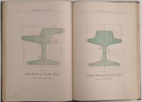
1890réf. 502San Francsico California: Pacific Rolling Mill Company 1890. 8vo. 250 x 170 mm. 10 x 7 inches. 100 pp. plus 4 leaves of ruled paper 2 with measurements in manuscript. Illustrated throughout with simple drawings of parts many stenciled with green wash; one plate folding. Bound in limp cloth covered boards title in gilt on front cover; a cloth binding shows some wear to gilt title two pencil drawings on front endpaper; other a very good sound copy. Straight forward price list of iron bar steel rail rolled and forged metal axles nuts bolts washers and dozens of other metal products. There is no introduction about the history of the firm just images of parts prices and a few lines of text describing specifications for some of the more complicated manufacture items. What distinguishes this rare trade catalogue is the design sense of many of the images and the application of stenciled color to highlight the object. The printed form of the parts are in outline and as one pages through the catalogue the images take on an abstract quality. Metal parts become contoured shapes with form being determined only by the light green wash applied to the physical part of the design. Although unintentional I am sure this late 19th century publication replete with many of the characteristics of period book design exhibits a very modernist feel one that is most unusual in publications of this nature. Although called the 7th edition this is only one of three issues of the PRMC's product guide and price list that is known. Organized in 1867 PRMC grew continuously and by 1892 was producing more than 40 thousand tons of iron and steel. "This giant enterprise is so closely identified with the manufacturing interests of the Pacific Coast that there is scarcely a manufacturing firm or corporation on the Coast that does not depend upon its output. The mills are located at Potrero Point in South San Francisco and cover an immense area" Master Hands. Romaine Guide to American Trade Catalogues p. 200 this edition and one from 1886 both known in only one copy each at California Historical Society. OCLC cites an edition from 1885 in one copy at San Francisco Public Library and this edition 1890 also in only one copy at California H. S. See: Master Hands in the Affairs of the Pacific Coast Historical Biographical and Descriptive. A Resumé of the Builders of Our Material Progress. San Francisco: Western Historical Publishing Company 1892 pp. 260. Pacific Rolling Mill Company unknown books
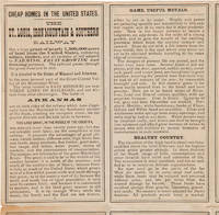
1880réf. 57333Chicago: Rand McNally & Co. ca. 1880. Folding Rand McNally Map and Promotional for Eastern Texas Missouri and Arkansas A scarce promotional for Missouri and Arkansas published by the St. Louis Iron Mountain and Southern Railway featuring a folding map by Rand McNally & Co. The map shows cities rivers railways and geographical features from eastern Texas through Louisiana Arkansas Missouri Mississippi and parts of Illinois Indiana and Alabama. The Iron Mountain Railway owned a large land grant in the central United States but it was not allowed to sell until the railway was completed; now that time had come and they were advertising it heavily. Some of the attractions promoted in the text include wild game hunting including squirrels resources such as zinc and coal good soil river and rail transportation telegraph service "cheap homes in Missouri and Arkansas" and low property taxes. They also exhort the nervous migrant: "This is the time to have decision of character or the opportunity will be lost to you and to your family forever. The strong-hearted Europeans who settled America did not know what they would reap from planting in strange soils and climates. Why should you hesitate about a country peopled an hundred years and well known Have manhood and come." The authors do not limit their reach to the United States either as they make sure to note after listing their prices that "One dollar in American is equal to about four shillings in English money." Also included is a panel of text with a table describing the climate of Little Rock and a list of instructions to railroad agents. The St. Louis Iron Mountain and Southern Railway originally established to deliver iron ore from Iron Mountain Missouri to St. Louis eventually stretched from eastern Texas through Missouri and Arkansas. In 1883 it was acquired by Jay Gould and in the 1900s merged into the Missouri Pacific and later Union Pacific Railroads. The folksong "Iron Mountain Baby" tells the true story of a Civil War veteran who walking along the railroad collecting building materials discovered a baby who had been apparently thrown from the train in a valise. When the child grew older the railway paid for his education. The Iron Mountain Baby's story became popular around the United States and has been recorded in numerous forms throughout the years including the 2014 stage musical adaptation Bright Star written by musician and comedian Steve Martin. Though the Iron Mountain Railway put out a number of such promotionals in the late 1870s and early 1880s they remain rather scarce; OCLC records this edition focusing on Arkansas and Missouri only at Harvard and the University of Arkansas at Mullins. Old folds. Minor tanning. Slight splitting along some folds and a few cross-folds. Very good. unknown
1880réf. 57333Chicago: Rand McNally & Co. ca. 1880. Folding Rand McNally Map and Promotional for Eastern Texas Missouri and Arkansas A scarce promotional for Missouri and Arkansas published by the St. Louis Iron Mountain and Southern Railway featuring a folding map by Rand McNally & Co. The map shows cities rivers railways and geographical features from eastern Texas through Louisiana Arkansas Missouri Mississippi and parts of Illinois Indiana and Alabama. The Iron Mountain Railway owned a large land grant in the central United States but it was not allowed to sell until the railway was completed; now that time had come and they were advertising it heavily. Some of the attractions promoted in the text include wild game hunting including squirrels resources such as zinc and coal good soil river and rail transportation telegraph service "cheap homes in Missouri and Arkansas" and low property taxes. They also exhort the nervous migrant: "This is the time to have decision of character or the opportunity will be lost to you and to your family forever. The strong-hearted Europeans who settled America did not know what they would reap from planting in strange soils and climates. Why should you hesitate about a country peopled an hundred years and well known Have manhood and come." The authors do not limit their reach to the United States either as they make sure to note after listing their prices that "One dollar in American is equal to about four shillings in English money." Also included is a panel of text with a table describing the climate of Little Rock and a list of instructions to railroad agents. The St. Louis Iron Mountain and Southern Railway originally established to deliver iron ore from Iron Mountain Missouri to St. Louis eventually stretched from eastern Texas through Missouri and Arkansas. In 1883 it was acquired by Jay Gould and in the 1900s merged into the Missouri Pacific and later Union Pacific Railroads. The folksong "Iron Mountain Baby" tells the true story of a Civil War veteran who walking along the railroad collecting building materials discovered a baby who had been apparently thrown from the train in a valise. When the child grew older the railway paid for his education. The Iron Mountain Baby's story became popular around the United States and has been recorded in numerous forms throughout the years including the 2014 stage musical adaptation Bright Star written by musician and comedian Steve Martin. Though the Iron Mountain Railway put out a number of such promotionals in the late 1870s and early 1880s they remain rather scarce; OCLC records this edition focusing on Arkansas and Missouri only at Harvard and the University of Arkansas at Mullins. Old folds. Minor tanning. Slight splitting along some folds and a few cross-folds. Very good. unknown books
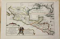
1705réf. M772Paris 1705. Excellent. Notes: This map covers the Gulf of Mexico through Central America and includes parts of Cuba and Jamaica. It extends through Mexico to show the southern tip of Baja California. This is an early map to show the correct location of the Mississippi River delta gleaned from the expeditions of La Salle and Iberville. Two French forts are located: LaSalle's Fort St. Louis in Texas Fortbati en 1685 and another near present-day New Orleans. One of the prominent features in northern Mexico is Les Fameuses Mines de Ste. Barbe the legendary Santa Barbara mines of the Chihuahua-Durango region. Size : 230x335 mm 9x13.125 Inches Coloring: Original Outline Coloring Category: Maps Central America Mexico unknown
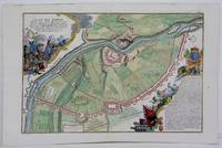
1705réf. M5280Paris 1705. Excellent. Size : 225x340 mm 8.875x13.375 Inches Coloring: Hand Colored Category: ; Maps Europe Estonia Latvia unknown
1781réf. ARC-113870Préface, dans laquelle le traducteur indique les problèmes rencontrés par la conversion des mesures suédoises en mesures françaises alors fort nombreuses (pp. I-XVI). Dissertation chimique de l'analyse du fer. Précédée d'un en tête gravé sur bois par Jean Beugnat, qui représente un laboratoire de chimie avec un fourneau et une cornue ; importantes notes de l'auteur et du traducteur (pp. 1-124). Appendice contenant des Observations particulières du Traducteur (pp. 125-186). Mémoire sur les moyens de perfectionner le travail des ancres de marine, par M. Grignon (pp. 187-197). Mémoire qui présente plusieurs moyens de perfectionner les opérations de métallurgie, par M. Grignon (pp. 198-219). Observations sur l'action réciproque que le feu et l'eau ont l'un sur l'autre, par M. Grignon (pp. 220-232). Mémoire contenant les détails, analyses et résultats des expériences faites en 1780 dans les forges du comté de Buffon en Bourgogne et dans la manufacture Royale d'Acier fin de Néronville en Gâtinois, par M. Grignon (pp. 234-284). Paris, Philippe-Denys Pierre, Méquignon, 1781 / 1783, 2 ouvrages en 1 volume, in-8, relié, VIII-285 pages. 1 feuillet non chiffré XVI-286 pages..
réf. 1181811846 - 1867, 235x150mm, 47 brochures (quelques une allemand), sous cartable veau blond à lacets, sur la création et la construction du réseau de chemin de fer Centre-Ouest-Suisse (Fribourg, Bulle, Romont, Lausanne, Lac de Bret, Genève-Versoix, Yerdon, Laupen, Morat, Berne)
réf. 9781617289873NOVA SCIENCE PUBLISHERS INC
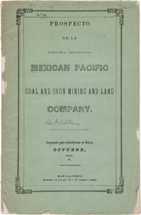
1856réf. 27974Nueva-York: Imprenta de Hallet 1856. Coal Mining in Mexico A Spanish-language prospectus for an American mining and land company on the Pacific coast of Mexico. Original printed wrappers. Rear wrapper detached spine mostly perished library blindstamp on front wrapper and withdrawal stamp on wrapper interior. Foxed. Good overall. SABIN 48572 note. unknown
1856réf. 27974Nueva-York: Imprenta de Hallet 1856. Coal Mining in Mexico A Spanish-language prospectus for an American mining and land company on the Pacific coast of Mexico. Original printed wrappers. Rear wrapper detached spine mostly perished library blindstamp on front wrapper and withdrawal stamp on wrapper interior. Foxed. Good overall. SABIN 48572 note. unknown books
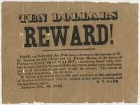
1843réf. BK0115Jackson Michigan 1843. Broadside 7 ¾ x 10 ½ inches. Single sheet printed in black. Old folds with short separations and small losses at several fold intersections and along the edges with general handling wear good overall. An early Jackson Michigan broadside issued by S. T. Carr offering ten dollars for the return of a wallet lost two days earlier on the road between the tavern of W. H. Monroe in Jackson and the Parma House. Carr describes the missing property in some detail: "A CALF-SKIN WALLET containing about sixty dollars in cash mostly in small bills one thirty dollar note and some papers of no value to any one except the owner. The inside of the wallet was marked S. T. Carr." Carr directed that the wallet be returned to him at Monroe's Exchange promising the reward "and no questions asked." Carr and W. H. Munroe appear together again two years later in the early history of Michigan's iron industry. In July 1845 they were among the Jackson men who organized an association to explore the mineral country south of Lake Superior. That fall Carr Munroe Philo M. Everett and E. S. Rockwell traveled north as an exploring party. Michigan mining histories record that Carr and Rockwell working with an Indigenous guide located the iron outcrop that became the Jackson mine; Carr continued the final search for the outcrop alone. The Jackson association subsequently became the Jackson Mining Company one of the earliest enterprises to develop the Marquette Iron Range.1 1 T. B. Brooks "Geological Survey of Michigan. Upper Peninsula 1869-1873 Accompanied by an Atlas of Maps" Legislature of Michigan and Julius Bien 1873 8. . unknown
1843réf. BK0115Jackson Michigan 1843. Broadside 7 ¾ x 10 ½ inches. Single sheet printed in black. Old folds with short separations and small losses at several fold intersections and along the edges with general handling wear good overall. An early Jackson Michigan broadside issued by S. T. Carr offering ten dollars for the return of a wallet lost two days earlier on the road between the tavern of W. H. Monroe in Jackson and the Parma House. Carr describes the missing property in some detail: "A CALF-SKIN WALLET containing about sixty dollars in cash mostly in small bills one thirty dollar note and some papers of no value to any one except the owner. The inside of the wallet was marked S. T. Carr." Carr directed that the wallet be returned to him at Monroe's Exchange promising the reward "and no questions asked." Carr and W. H. Munroe appear together again two years later in the early history of Michigan's iron industry. In July 1845 they were among the Jackson men who organized an association to explore the mineral country south of Lake Superior. That fall Carr Munroe Philo M. Everett and E. S. Rockwell traveled north as an exploring party. Michigan mining histories record that Carr and Rockwell working with an Indigenous guide located the iron outcrop that became the Jackson mine; Carr continued the final search for the outcrop alone. The Jackson association subsequently became the Jackson Mining Company one of the earliest enterprises to develop the Marquette Iron Range.1 1 T. B. Brooks "Geological Survey of Michigan. Upper Peninsula 1869-1873 Accompanied by an Atlas of Maps" Legislature of Michigan and Julius Bien 1873 8. . unknown books
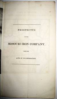
1837réf. 30091St. Louis 1837. 36pp folding plate frontis full-page map. Institutional rubberstamps at base of title page verso. Original printed wrappers light rubberstamp discard stamp on front wrapper. Otherwise Very Good. "Missouri Imprints Inventory No. 197 cites only one copy. This tract is probably the first description of Iron mines west of the Mississippi. The Iron Mountains were located in St. Francis and Madison Counties. A proposal is made to make iron rails for a railroad from the mountains to the Mississippi" Decker. AII MO 197 1. 37 Decker 214. Not in Eberstadt Soliday Graff. OCLC indicates a number of institutional copies. unknown
1837réf. 30091St. Louis 1837. 36pp folding plate frontis full-page map. Institutional rubberstamps at base of title page verso. Original printed wrappers light rubberstamp discard stamp on front wrapper. Otherwise Very Good. "Missouri Imprints Inventory No. 197 cites only one copy. This tract is probably the first description of Iron mines west of the Mississippi. The Iron Mountains were located in St. Francis and Madison Counties. A proposal is made to make iron rails for a railroad from the mountains to the Mississippi" Decker. AII MO 197 1. 37 Decker 214. Not in Eberstadt Soliday Graff. OCLC indicates a number of institutional copies. unknown books
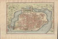
1715réf. 019811Paris. Very Good. 1715. Map. Lovely engraved map depicting Mexico City in the early 18th century. Map is on a 10 ¾" x 15 ¾" sheet that was taken from Nicolas de Fer's "L'Atlas Curieux" of 1715; no content on verso. Date of map was printed in upper margin along with the sheet number "125" and title; content in French. Hand-coloring is still bright. Map has very light toning to edges but is otherwise clean. This detailed map depicts Mexico City when it was surrounded by water and was linked to the mainland by the famous causeways originally designed by the Aztecs. Also pictured are aqueducts and farms and about 50 locations have been numbered on the map but the key is not present likely printed on another page in the Atlas. A beautiful map. . unknown
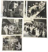
1937réf. 234531937. Iron lung transport press archive documenting the movement of respirator-dependent polio patients through rail terminals ships ramps aircraft hospitals and Coast Guard facilities during the years before the Salk vaccine changed American polio care in 1955. The iron lung developed in 1928 by Philip Drinker and Louis Agassiz Shaw kept patients breathing when polio paralyzed the muscles needed for respiration. Fred B. Snite Jr. appears in several views as the nationally followed Chicago patient who contracted polio in China in 1936 and returned to the United States after a highly publicized 9300-mile medical journey. The group is strongest as a record of medical transport itself: nurses in masks uniformed officers attendants ramps crowds and captioned press slips show how survival could depend on coordinated movement as much as bedside treatment. Photo archive of 5 large silver gelatin press photographs approx 8 x 10 inches Chicago Seattle Port Angeles and related transport locations 1937-1951. Snite's respirator is loaded at a Chicago railroad terminal with his head visible through the front window while men adjust the wheeled carriage; another scene places the iron lung at a ship or dockside ramp surrounded by masked nurses uniformed officers and hospital attendants. A Chicago caption dated February 8 1939 reads "Iron Lung Kid and Bride Entrain for South" identifying Snite and his bride leaving for Miami Florida after their winter vacation. Another verso caption dated June 22 1937 describes his return to Chicago after transport from China where he had been stricken. A January 14 1951 Coast Guard caption identifies an iron lung flown from Seattle to Port Angeles to aid Eldon Tetum a 36-year-old logger stricken with polio. Polio epidemics made the iron lung one of the most visible medical machines of the mid-twentieth century especially before vaccination reduced annual cases after 1955. These scenes connect celebrity medical news to emergency public health logistics showing how mechanical respiration required attendants vehicles terminals aircraft and institutional coordination outside the hospital room. Press stamps pasted captions adhesive staining and surface marks visible on versos; images remain strong and readable. Overall in good condition. unknown
1937réf. 234531937. Iron lung transport press archive documenting the movement of respirator-dependent polio patients through rail terminals ships ramps aircraft hospitals and Coast Guard facilities during the years before the Salk vaccine changed American polio care in 1955. The iron lung developed in 1928 by Philip Drinker and Louis Agassiz Shaw kept patients breathing when polio paralyzed the muscles needed for respiration. Fred B. Snite Jr. appears in several views as the nationally followed Chicago patient who contracted polio in China in 1936 and returned to the United States after a highly publicized 9300-mile medical journey. The group is strongest as a record of medical transport itself: nurses in masks uniformed officers attendants ramps crowds and captioned press slips show how survival could depend on coordinated movement as much as bedside treatment. Photo archive of 5 large silver gelatin press photographs approx 8 x 10 inches Chicago Seattle Port Angeles and related transport locations 1937-1951. Snite's respirator is loaded at a Chicago railroad terminal with his head visible through the front window while men adjust the wheeled carriage; another scene places the iron lung at a ship or dockside ramp surrounded by masked nurses uniformed officers and hospital attendants. A Chicago caption dated February 8 1939 reads "Iron Lung Kid and Bride Entrain for South" identifying Snite and his bride leaving for Miami Florida after their winter vacation. Another verso caption dated June 22 1937 describes his return to Chicago after transport from China where he had been stricken. A January 14 1951 Coast Guard caption identifies an iron lung flown from Seattle to Port Angeles to aid Eldon Tetum a 36-year-old logger stricken with polio. Polio epidemics made the iron lung one of the most visible medical machines of the mid-twentieth century especially before vaccination reduced annual cases after 1955. These scenes connect celebrity medical news to emergency public health logistics showing how mechanical respiration required attendants vehicles terminals aircraft and institutional coordination outside the hospital room. Press stamps pasted captions adhesive staining and surface marks visible on versos; images remain strong and readable. Overall in good condition. unknown books
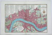
1705réf. M4627Paris 1705. Very Good. Size : 230x340 mm 9x13.375 Inches Coloring: Hand Colored Category: Maps City Maps; Maps Europe United Kingdom England London unknown
1705réf. M4703Paris 1705. Excellent. Size : 250x355 mm 9.875x14 Inches Coloring: Black & White Category: ; Maps Europe Germany unknown
1742réf. M4678Paris 1742. Very Good. Size : 575x430 mm 22.625x16.875 Inches Coloring: Original Outline Coloring Category: ; Maps Europe Spain; Maps Europe Portugal unknown
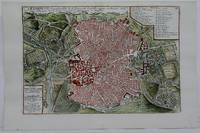
1705réf. M5230Paris 1705. Excellent. Size : 225x335 mm 8.875x13.125 Inches Coloring: Hand Colored Category: Maps City Maps; Maps Europe Portugal unknown
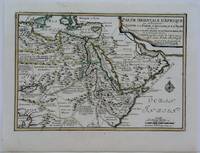
1703réf. M5175Paris 1703. Excellent. Size : 225x325 mm 8.875x12.75 Inches Coloring: Original Outline Coloring Category: Maps Africa North Egypt; Maps Asia Middle East Arabia unknown
1705réf. M6202Paris 1705. Excellent. Notes: An attractive map of the city of Narva besieged by a military encampment. The Battle of Narva was an early battle in the Great Northern War fought in November of 1700. The Swedish army under Charles XII of Sweden defeated a Russian force four times its size commanded by Peter the Great. Narva marked the peak of Swedish power on the continent with Russia eventually gaining decisive victories that were able to end the conflict. Size : 230x325 mm 9x12.75 Inches Coloring: Hand Colored Category: ; Maps Europe Estonia Latvia; Maps City Maps; Maps Military unknown