N De Fer; H Van LoonBiblio.com
11.397 Ergebnisse
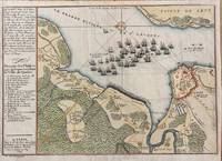
1694Best.-Nr. M7337Paris: N. de Fer c.1694. Very Good; . Notes: According to Kershaw this map was originally published in "Les Forces De L'Europe" "In August 1690 Sir William Phips left Boston to attack and capture Quebec. Previous military success at Port Royal had given the English an excess of confidence which Phips fully exploited in planning his expedition against Quebec but which quickly evaporated when the under-equipped force discovered the extent of the defenses at Quebec. The operation was disastrous and the English struggled back to Boston losing a number of ships on the way. The battle lines of the English fleet and the details of the French defences were recorded by Villenuve in manuscript form which were subsequently the source of a sequence of printed maps." Kershaw Size : 209x303 mm 8.23x11.93 Inches Coloring: Hand Colored Reference: Kershaw 279 Category: Maps Canada East Quebec Quebec City; Maps City Maps; N. de Fer unknown
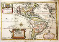
1717Best.-Nr. M11008Paris: Chez l'autheur dans l'Isle du Palais sur le Quay de l'Orloge a la Sphere Royale 1717. Very Good. Notes: Beautiful example of the map of the Americas by renowned 17th century French cartographer Nicolas De Fer. Size : 225x337 mm 8.86x13.27 Inches Coloring: Hand Colored Category: Maps North America; Maps South America Countries; Chez l'autheur dans l'Isle du Palais sur le Quay de l'Orloge a la Sphere Royale unknown
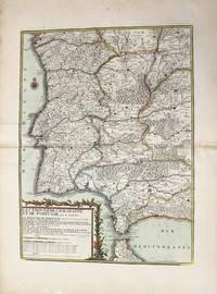
1790Best.-Nr. M10223Paris: Chez Desnos 1790. Very Good. Notes: Detailed map of Portugal and western Spain showing Gibraltar region. Size : 580x432 mm 22.83x17.01 Inches Coloring: Original Hand Coloring Category: Maps Europe Portugal; Maps Europe Spain; Chez Desnos unknown
1916Best.-Nr. 2210162Roanoke VA: Virginia Bridge & Iron Co. 1916. 1st Edition . Flexible leather. Good. 12mo - over 6¾ - 7¾" tall. See photos for condition details. Original flexible leather handbook produced by theVirginia Bridge & Iron Company. Brown leather exterior with gilt to front and spine. Exterior shows edge and corner chips/wear and chipping is also present at top and bottom of spine. Interior binding is good no hinge issues nothing torn or loose. Previous owners name is written on front pastedown and it was also found two more times on interior pages where it was written along the top edge. The blank pages in the back along with the graph paper pages are all handwriting free. Only handwriting found in book were the three signatures in the number 238 written along the page edge of the copyright page. This is the first edition which shows no copyright or print date other than the serial designation of 9-16 September 1916. This is an extremely rare publication with only a few third editions surviving this one being the first. Virginia Bridge & Iron Co. hardcover
1887Best.-Nr. 22569ABKöln 1887. Jeweils ca 51 x 68.5 cm, zwei Bögen ca 102 x 68.5 cm.
1891Best.-Nr. 108701891 ; dossier petit in-folio (22 x 32 cm) ; composé d’une chemise cartonnée bleu-clair imprimée, dos toile et rubans de fermeture ; 8 grandes planches dépliantes lithographiées.I- Epure et distribution des joints des membrures d’une poutre ; II- Ensemble du tablier. Elvation et plan ; III- Demi-élévation extérieure d’une poutre au 1/10e et détails ; IV- Coupe transversale et assemblages ; V- Garde-grèves ; VI- Platelage ; VII- Détails des appuis des poutres ; VIII- Détails des garde-corps.
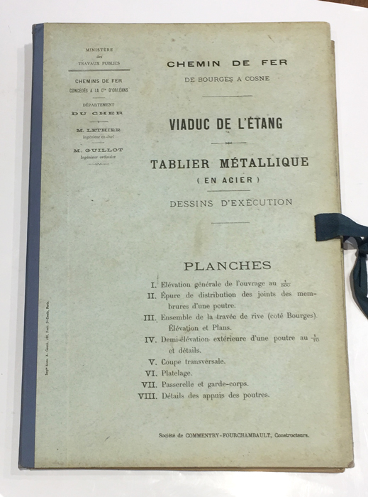
1891Best.-Nr. 108791891 ; dossier petit in-folio (22 x 32 cm), composé d’une chemise cartonnée bleu-clair imprimée, dos de toile bleue et rubans de fermeture ; 8 grandes planches dépliantes lithographiées.I- Elévation générale de l’ouvrage au 1/500e (216 m entre les culées). II- Epure de distribution des joints des membrures d’une poutre. III- Ensemble de la travée de rive (côté Bourges), élévation et plans. IV- Demi-élévation extérieure d’une poutre au 1/10e et détails. V- Coupe transversale. VI- Platelage. VII- Passerelle et garde-corps. VIII- Détails des appuis des poutres.
Best.-Nr. L136In-4 oblong, 128 pages, nombreuses illustrations, broché.
Best.-Nr. 242836Paris, A. Chaix, s.d. (1867) in-plano (121 x 86 cm), en feuille. Petites déchirures à certaines pliures.
1698Best.-Nr. 22511Paris Nicolas le Gras, Nicolas le Clerc et Barthelemy Girin 1698 -in-12 plein-veau 2 volumes, reliure plein veau havane moucheté in-douze (binding full calfskin in-12)(17,2 x 10,2 cm), dos à nerfs (spine with raised band), décoré or (gilt decoration), titre et tomaison frappés "or", pièce de titre sur fond rouge (label of title) avec filet "or" en encadrement, pièce de tomaison sur fond rouge (label of title) avec filet et roulette "or" en encadrement, roulette "or" en place des nerfs avec un filet à froid de part et d'autre, entre-nerfs à fleuron "or" dans un encadrement d'un filet "or" avec rinceaux "or" aux angles, restaurations anciennes aux coiffes mais fait proprement, plats ornés d'un filet à froid en encadrement, roulette "or" sur les coupes avec manques de dorures(fillets on the cuts), toutes tranches lisses jaspées rouges, orné d'un grand Plan dépliant de PARIS hors-texte gravé sur bois (engraving wood) en noir par DE FER, (VI + 402 pages + 33 Pages de tables) + ( 381 + 31 Pages de tables + 1ff. de privilège + 71 p. : "Le Nom de Toutes les Rues de Paris, par Ordre Alphabetique et les principaux quartiers ou elles se trouvent", 1698 à Paris Chez Nicolas le Gras, Nicolas le Clerc et Barthelemy Girin Editeurs,
1874Best.-Nr. 36149S.l.n.n. 1874 in-folio (26,5 x 39,5 cm) en feuilles, contrecollé sur carton fort à encadrement de filets noirs, mouillure marginale
Best.-Nr. N143Paris, Dunod, 1867-1868, 1873, 1874-1875. Trois volumes de texte in-8, 526-884-681 pages, reliure demi-basane grenat. Paris, Dunod, 1868, 1873, 1874. Atlas de XXXIII-CIX-XVI planches en trois volumes in-4 oblong reliés demi-basane grenat.
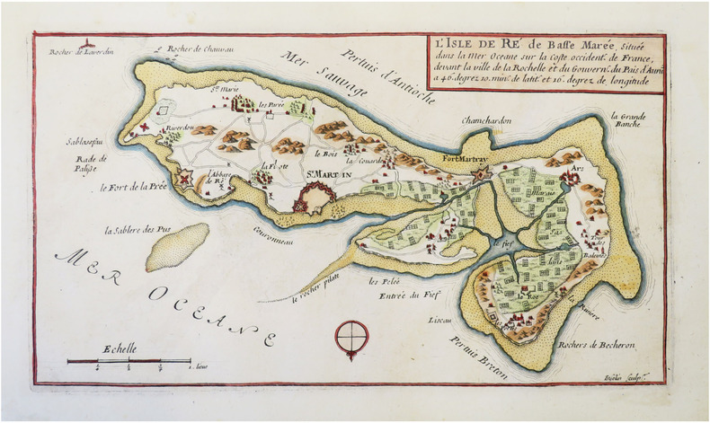
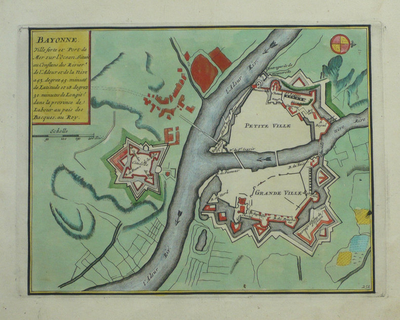
1705Best.-Nr. LBW-712Paris, 1705. 226 x 336 mm.
1760Best.-Nr. LBW-2640Paris, Desnos, 1760. 454 x 567 mm.
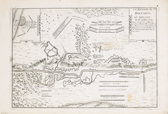
1714Best.-Nr. LBW-7131714. 227 x 329 mm.
1692Best.-Nr. LBW-8595[1692]. 148 x 272 mm ; contrecollé sur carton.
1720Best.-Nr. LBW-3721[Paris, circa 1720]. 434 x 533 mm.
1702Best.-Nr. LBW-1321Amsterdam Pierre Mortier 1702 215 x 276 mm.
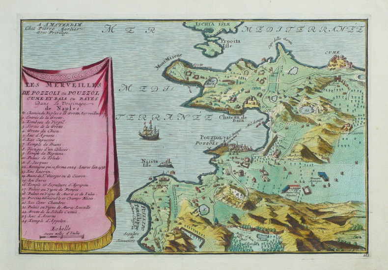
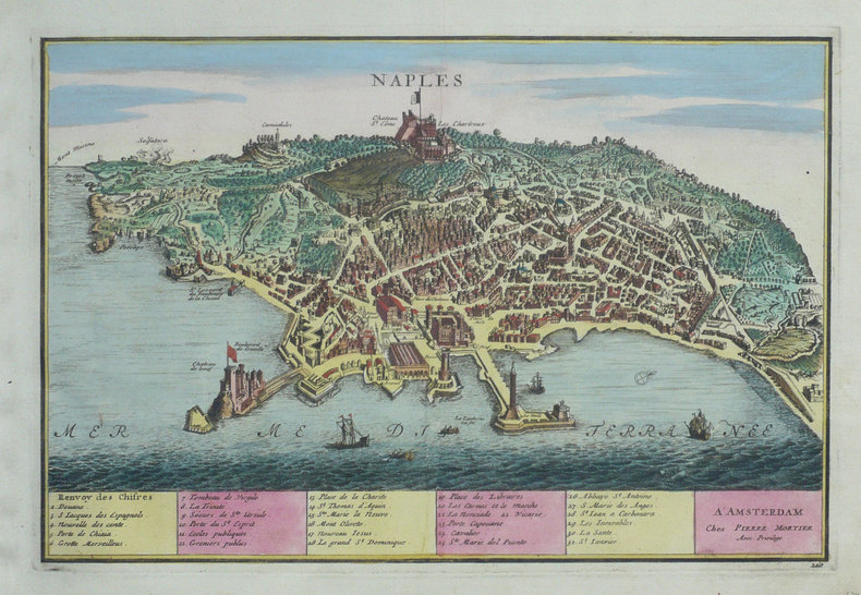
1702Best.-Nr. LBW-1344Amsterdam Pierre Mortier 1702 220 x 328 mm.
1702Best.-Nr. LBW-1356Amsterdam Pierre Mortier 1702 226 x 338 mm.
1702Best.-Nr. LBW-1302Amsterdam Pierre Mortier 1702 229 x 334 mm.
1702Best.-Nr. LBW-1354Amsterdam Pierre Mortier 1702 232 x 295 mm.
1702Best.-Nr. LBW-1301Amsterdam Pierre Mortier 1702 226 x 331 mm.
1702Best.-Nr. LBW-1289Amsterdam P. Mortier 1702 260 x 355 mm.
Best.-Nr. N144Paris, Baudry, 1870-1872-1878. Trois volumes in-8, 704-746-602 pages, reliés demi-basane. Paris, Baudry, 1872-1878. Deux Atlas in-8 et in-4 oblong de XXXV et XXXVIII ( plus XXXVI supplément au service de la voie), reliés demi-basane