11.841 risultati
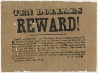
1843rif. BK0115Jackson Michigan 1843. Broadside 7 ¾ x 10 ½ inches. Single sheet printed in black. Old folds with short separations and small losses at several fold intersections and along the edges with general handling wear good overall. An early Jackson Michigan broadside issued by S. T. Carr offering ten dollars for the return of a wallet lost two days earlier on the road between the tavern of W. H. Monroe in Jackson and the Parma House. Carr describes the missing property in some detail: "A CALF-SKIN WALLET containing about sixty dollars in cash mostly in small bills one thirty dollar note and some papers of no value to any one except the owner. The inside of the wallet was marked S. T. Carr." Carr directed that the wallet be returned to him at Monroe's Exchange promising the reward "and no questions asked." Carr and W. H. Munroe appear together again two years later in the early history of Michigan's iron industry. In July 1845 they were among the Jackson men who organized an association to explore the mineral country south of Lake Superior. That fall Carr Munroe Philo M. Everett and E. S. Rockwell traveled north as an exploring party. Michigan mining histories record that Carr and Rockwell working with an Indigenous guide located the iron outcrop that became the Jackson mine; Carr continued the final search for the outcrop alone. The Jackson association subsequently became the Jackson Mining Company one of the earliest enterprises to develop the Marquette Iron Range.1 1 T. B. Brooks "Geological Survey of Michigan. Upper Peninsula 1869-1873 Accompanied by an Atlas of Maps" Legislature of Michigan and Julius Bien 1873 8. . unknown books
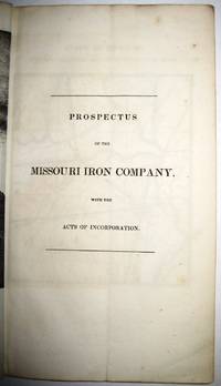
1837rif. 30091St. Louis 1837. 36pp folding plate frontis full-page map. Institutional rubberstamps at base of title page verso. Original printed wrappers light rubberstamp discard stamp on front wrapper. Otherwise Very Good. "Missouri Imprints Inventory No. 197 cites only one copy. This tract is probably the first description of Iron mines west of the Mississippi. The Iron Mountains were located in St. Francis and Madison Counties. A proposal is made to make iron rails for a railroad from the mountains to the Mississippi" Decker. AII MO 197 1. 37 Decker 214. Not in Eberstadt Soliday Graff. OCLC indicates a number of institutional copies. unknown
1837rif. 30091St. Louis 1837. 36pp folding plate frontis full-page map. Institutional rubberstamps at base of title page verso. Original printed wrappers light rubberstamp discard stamp on front wrapper. Otherwise Very Good. "Missouri Imprints Inventory No. 197 cites only one copy. This tract is probably the first description of Iron mines west of the Mississippi. The Iron Mountains were located in St. Francis and Madison Counties. A proposal is made to make iron rails for a railroad from the mountains to the Mississippi" Decker. AII MO 197 1. 37 Decker 214. Not in Eberstadt Soliday Graff. OCLC indicates a number of institutional copies. unknown books
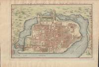
1715rif. 019811Paris. Very Good. 1715. Map. Lovely engraved map depicting Mexico City in the early 18th century. Map is on a 10 ¾" x 15 ¾" sheet that was taken from Nicolas de Fer's "L'Atlas Curieux" of 1715; no content on verso. Date of map was printed in upper margin along with the sheet number "125" and title; content in French. Hand-coloring is still bright. Map has very light toning to edges but is otherwise clean. This detailed map depicts Mexico City when it was surrounded by water and was linked to the mainland by the famous causeways originally designed by the Aztecs. Also pictured are aqueducts and farms and about 50 locations have been numbered on the map but the key is not present likely printed on another page in the Atlas. A beautiful map. . unknown
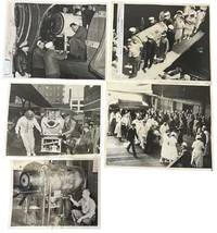
1937rif. 234531937. Iron lung transport press archive documenting the movement of respirator-dependent polio patients through rail terminals ships ramps aircraft hospitals and Coast Guard facilities during the years before the Salk vaccine changed American polio care in 1955. The iron lung developed in 1928 by Philip Drinker and Louis Agassiz Shaw kept patients breathing when polio paralyzed the muscles needed for respiration. Fred B. Snite Jr. appears in several views as the nationally followed Chicago patient who contracted polio in China in 1936 and returned to the United States after a highly publicized 9300-mile medical journey. The group is strongest as a record of medical transport itself: nurses in masks uniformed officers attendants ramps crowds and captioned press slips show how survival could depend on coordinated movement as much as bedside treatment. Photo archive of 5 large silver gelatin press photographs approx 8 x 10 inches Chicago Seattle Port Angeles and related transport locations 1937-1951. Snite's respirator is loaded at a Chicago railroad terminal with his head visible through the front window while men adjust the wheeled carriage; another scene places the iron lung at a ship or dockside ramp surrounded by masked nurses uniformed officers and hospital attendants. A Chicago caption dated February 8 1939 reads "Iron Lung Kid and Bride Entrain for South" identifying Snite and his bride leaving for Miami Florida after their winter vacation. Another verso caption dated June 22 1937 describes his return to Chicago after transport from China where he had been stricken. A January 14 1951 Coast Guard caption identifies an iron lung flown from Seattle to Port Angeles to aid Eldon Tetum a 36-year-old logger stricken with polio. Polio epidemics made the iron lung one of the most visible medical machines of the mid-twentieth century especially before vaccination reduced annual cases after 1955. These scenes connect celebrity medical news to emergency public health logistics showing how mechanical respiration required attendants vehicles terminals aircraft and institutional coordination outside the hospital room. Press stamps pasted captions adhesive staining and surface marks visible on versos; images remain strong and readable. Overall in good condition. unknown
1937rif. 234531937. Iron lung transport press archive documenting the movement of respirator-dependent polio patients through rail terminals ships ramps aircraft hospitals and Coast Guard facilities during the years before the Salk vaccine changed American polio care in 1955. The iron lung developed in 1928 by Philip Drinker and Louis Agassiz Shaw kept patients breathing when polio paralyzed the muscles needed for respiration. Fred B. Snite Jr. appears in several views as the nationally followed Chicago patient who contracted polio in China in 1936 and returned to the United States after a highly publicized 9300-mile medical journey. The group is strongest as a record of medical transport itself: nurses in masks uniformed officers attendants ramps crowds and captioned press slips show how survival could depend on coordinated movement as much as bedside treatment. Photo archive of 5 large silver gelatin press photographs approx 8 x 10 inches Chicago Seattle Port Angeles and related transport locations 1937-1951. Snite's respirator is loaded at a Chicago railroad terminal with his head visible through the front window while men adjust the wheeled carriage; another scene places the iron lung at a ship or dockside ramp surrounded by masked nurses uniformed officers and hospital attendants. A Chicago caption dated February 8 1939 reads "Iron Lung Kid and Bride Entrain for South" identifying Snite and his bride leaving for Miami Florida after their winter vacation. Another verso caption dated June 22 1937 describes his return to Chicago after transport from China where he had been stricken. A January 14 1951 Coast Guard caption identifies an iron lung flown from Seattle to Port Angeles to aid Eldon Tetum a 36-year-old logger stricken with polio. Polio epidemics made the iron lung one of the most visible medical machines of the mid-twentieth century especially before vaccination reduced annual cases after 1955. These scenes connect celebrity medical news to emergency public health logistics showing how mechanical respiration required attendants vehicles terminals aircraft and institutional coordination outside the hospital room. Press stamps pasted captions adhesive staining and surface marks visible on versos; images remain strong and readable. Overall in good condition. unknown books
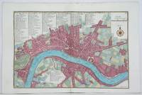
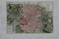
1705rif. M4627Paris 1705. Very Good. Size : 230x340 mm 9x13.375 Inches Coloring: Hand Colored Category: Maps City Maps; Maps Europe United Kingdom England London unknown
1705rif. M4703Paris 1705. Excellent. Size : 250x355 mm 9.875x14 Inches Coloring: Black & White Category: ; Maps Europe Germany unknown
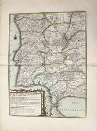
1742rif. M4678Paris 1742. Very Good. Size : 575x430 mm 22.625x16.875 Inches Coloring: Original Outline Coloring Category: ; Maps Europe Spain; Maps Europe Portugal unknown
1705rif. M5230Paris 1705. Excellent. Size : 225x335 mm 8.875x13.125 Inches Coloring: Hand Colored Category: Maps City Maps; Maps Europe Portugal unknown
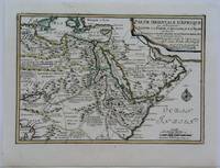
1703rif. M5175Paris 1703. Excellent. Size : 225x325 mm 8.875x12.75 Inches Coloring: Original Outline Coloring Category: Maps Africa North Egypt; Maps Asia Middle East Arabia unknown
1705rif. M6202Paris 1705. Excellent. Notes: An attractive map of the city of Narva besieged by a military encampment. The Battle of Narva was an early battle in the Great Northern War fought in November of 1700. The Swedish army under Charles XII of Sweden defeated a Russian force four times its size commanded by Peter the Great. Narva marked the peak of Swedish power on the continent with Russia eventually gaining decisive victories that were able to end the conflict. Size : 230x325 mm 9x12.75 Inches Coloring: Hand Colored Category: ; Maps Europe Estonia Latvia; Maps City Maps; Maps Military unknown
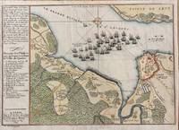
1694rif. M7337Paris: N. de Fer c.1694. Very Good; . Notes: According to Kershaw this map was originally published in "Les Forces De L'Europe" "In August 1690 Sir William Phips left Boston to attack and capture Quebec. Previous military success at Port Royal had given the English an excess of confidence which Phips fully exploited in planning his expedition against Quebec but which quickly evaporated when the under-equipped force discovered the extent of the defenses at Quebec. The operation was disastrous and the English struggled back to Boston losing a number of ships on the way. The battle lines of the English fleet and the details of the French defences were recorded by Villenuve in manuscript form which were subsequently the source of a sequence of printed maps." Kershaw Size : 209x303 mm 8.23x11.93 Inches Coloring: Hand Colored Reference: Kershaw 279 Category: Maps Canada East Quebec Quebec City; Maps City Maps; N. de Fer unknown
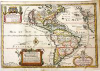
1717rif. M11008Paris: Chez l'autheur dans l'Isle du Palais sur le Quay de l'Orloge a la Sphere Royale 1717. Very Good. Notes: Beautiful example of the map of the Americas by renowned 17th century French cartographer Nicolas De Fer. Size : 225x337 mm 8.86x13.27 Inches Coloring: Hand Colored Category: Maps North America; Maps South America Countries; Chez l'autheur dans l'Isle du Palais sur le Quay de l'Orloge a la Sphere Royale unknown
1790rif. M10223Paris: Chez Desnos 1790. Very Good. Notes: Detailed map of Portugal and western Spain showing Gibraltar region. Size : 580x432 mm 22.83x17.01 Inches Coloring: Original Hand Coloring Category: Maps Europe Portugal; Maps Europe Spain; Chez Desnos unknown
1916rif. 2210162Roanoke VA: Virginia Bridge & Iron Co. 1916. 1st Edition . Flexible leather. Good. 12mo - over 6¾ - 7¾" tall. See photos for condition details. Original flexible leather handbook produced by theVirginia Bridge & Iron Company. Brown leather exterior with gilt to front and spine. Exterior shows edge and corner chips/wear and chipping is also present at top and bottom of spine. Interior binding is good no hinge issues nothing torn or loose. Previous owners name is written on front pastedown and it was also found two more times on interior pages where it was written along the top edge. The blank pages in the back along with the graph paper pages are all handwriting free. Only handwriting found in book were the three signatures in the number 238 written along the page edge of the copyright page. This is the first edition which shows no copyright or print date other than the serial designation of 9-16 September 1916. This is an extremely rare publication with only a few third editions surviving this one being the first. Virginia Bridge & Iron Co. hardcover
1887rif. 22569ABKöln 1887. Jeweils ca 51 x 68.5 cm, zwei Bögen ca 102 x 68.5 cm.
1891rif. 108701891 ; dossier petit in-folio (22 x 32 cm) ; composé d’une chemise cartonnée bleu-clair imprimée, dos toile et rubans de fermeture ; 8 grandes planches dépliantes lithographiées.I- Epure et distribution des joints des membrures d’une poutre ; II- Ensemble du tablier. Elvation et plan ; III- Demi-élévation extérieure d’une poutre au 1/10e et détails ; IV- Coupe transversale et assemblages ; V- Garde-grèves ; VI- Platelage ; VII- Détails des appuis des poutres ; VIII- Détails des garde-corps.
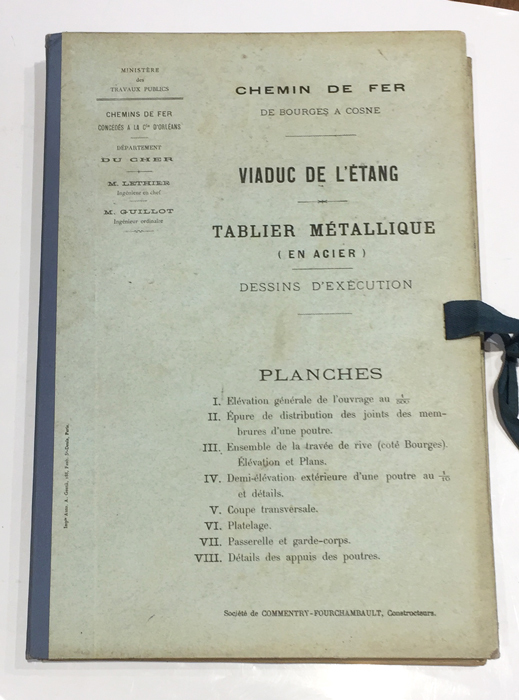
1891rif. 108791891 ; dossier petit in-folio (22 x 32 cm), composé d’une chemise cartonnée bleu-clair imprimée, dos de toile bleue et rubans de fermeture ; 8 grandes planches dépliantes lithographiées.I- Elévation générale de l’ouvrage au 1/500e (216 m entre les culées). II- Epure de distribution des joints des membrures d’une poutre. III- Ensemble de la travée de rive (côté Bourges), élévation et plans. IV- Demi-élévation extérieure d’une poutre au 1/10e et détails. V- Coupe transversale. VI- Platelage. VII- Passerelle et garde-corps. VIII- Détails des appuis des poutres.
rif. L136In-4 oblong, 128 pages, nombreuses illustrations, broché.
rif. 242836Paris, A. Chaix, s.d. (1867) in-plano (121 x 86 cm), en feuille. Petites déchirures à certaines pliures.
1698rif. 22511Paris Nicolas le Gras, Nicolas le Clerc et Barthelemy Girin 1698 -in-12 plein-veau 2 volumes, reliure plein veau havane moucheté in-douze (binding full calfskin in-12)(17,2 x 10,2 cm), dos à nerfs (spine with raised band), décoré or (gilt decoration), titre et tomaison frappés "or", pièce de titre sur fond rouge (label of title) avec filet "or" en encadrement, pièce de tomaison sur fond rouge (label of title) avec filet et roulette "or" en encadrement, roulette "or" en place des nerfs avec un filet à froid de part et d'autre, entre-nerfs à fleuron "or" dans un encadrement d'un filet "or" avec rinceaux "or" aux angles, restaurations anciennes aux coiffes mais fait proprement, plats ornés d'un filet à froid en encadrement, roulette "or" sur les coupes avec manques de dorures(fillets on the cuts), toutes tranches lisses jaspées rouges, orné d'un grand Plan dépliant de PARIS hors-texte gravé sur bois (engraving wood) en noir par DE FER, (VI + 402 pages + 33 Pages de tables) + ( 381 + 31 Pages de tables + 1ff. de privilège + 71 p. : "Le Nom de Toutes les Rues de Paris, par Ordre Alphabetique et les principaux quartiers ou elles se trouvent", 1698 à Paris Chez Nicolas le Gras, Nicolas le Clerc et Barthelemy Girin Editeurs,
1874rif. 36149S.l.n.n. 1874 in-folio (26,5 x 39,5 cm) en feuilles, contrecollé sur carton fort à encadrement de filets noirs, mouillure marginale
rif. N143Paris, Dunod, 1867-1868, 1873, 1874-1875. Trois volumes de texte in-8, 526-884-681 pages, reliure demi-basane grenat. Paris, Dunod, 1868, 1873, 1874. Atlas de XXXIII-CIX-XVI planches en trois volumes in-4 oblong reliés demi-basane grenat.
1705rif. LBW-712Paris, 1705. 226 x 336 mm.