12 218 résultats
1880réf. 52092New York: Printed For The American Iron Post and Construction Company n. d. ca 1880's. 1880. First edition. 11" x 8 1/2" pictorial printed one-sheet printed on both sides. The company promotes this iron post to be both stronger and cheaper than wooden posts. The company claims the posts are economical durable safe beautiful and strong. The posts are covered with a special coating to prevent rust fires do not affect them nor do floods carry them away and the posts and wire do not fill up with snow banks as with ordinary fences. The posts are manufactured by The American Iron Post and Construction Company at their manufacturing plant located in Wellsville Ohio and by special arrangement with the well-known iron firm of W. D. Wood & Company of Pittsburgh. The company further states "It is now conceded that in the great West the wire fence for the purpose of extensive cattle ranches for prairie farms and for railroads is superior to all others; and a want has been long felt for a post whose strength cheapness and durability would make this iron fence system complete -- one which the forest and prairie fires would not burn -- one which would do away with the expense and tedium of hole-digging -- one that could be cheaply and quickly put up and which would last a life-time." Faint fold creases else a near fine copy of an interesting and very scarce range item. Printed For The American Iron Post and Construction Company, n. d. (ca 1880's). unknown
réf. DADAX0415347793New unknown
réf. SONG0714113778Used: Good unknown
réf. 9781631176227NOVA SCIENCE PUBLISHERS INC
2013réf. 10268JRP Ringier 2013. Hardcover. Near Fine/Very Good. Folio in orange cloth. Boards crisp and unworn; interior clean and crisp; light wear to jacket small dampstain to jacket front panel at top. Due to size or weight of book additional charges for international and priority shipping may apply. Folio - over 12 - 15" tall. JRP | Ringier hardcover
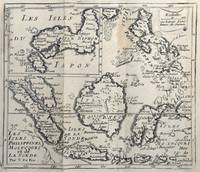
1678réf. 62465copper engraving. EXTREMELY RARE map from "Méthode pour apprendre facilemente la Géographie …par M. Robbe chez Henri van Bulderen…. 4th or earlier edition published in Paris; it is the basis for other later versions which do not show the name "N. de Fer" in the cartouche i.e. by Peeters and Afferden. Reference: Walter Japan OAG 51 - Quirino p. 87 knows only Peeters; Koeman: Pee 1 vol.III Peeters Koeman I AFF 1; Bonacker 27; Bagrow/Skelton 466 all Afferden. Condition: folds as issued slight offsetting stain on left margin not into plate; paper toning. published in Paris.
2026réf. x-1041154658Taylor & Francis Ltd 2026. Hardcover. New. 882 pages. 9.68x6.87x9.61 inches. Taylor & Francis Ltd hardcover
1971German Text. München, 1971; hardback, pp. 700, b/w ill. and plates, cm 32x38. deutsch hardback
réf. mon0003240680Iron and Steel Institute 1961T. hardcover. Good. . Iron and Steel Institute hardcover
1899réf. 2111902160200289Genpon 1899. Soft Cover. Fine. Number of pages: 130 pages Size: 24cmx16.2cm 130p Number of books: 1 Genpon paperback
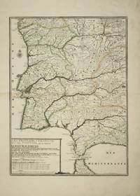
réf. 4614Paris: 1705. No binding. Good. 575 x 425 mm. early outline colour light browning to the left of the centrefold otherwise in good condition. This fine map of Portugal by Nicholas de Fer is engraved by P. Starckman. It was issued in the first edition of the ""Atlas ou Recueil de Cartes Geographiques"" 1709. Pastoureau 1984 De Fer II C no. 72. 1705 unknown
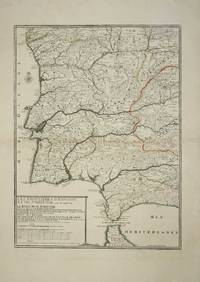
réf. 10370Paris: 1705. No binding. Good. 575 x 425 mm. early outline colour in good condition. This fine map of Portugal by Nicholas de Fer is engraved by P. Starckman. It was issued in the first edition of the ""Atlas ou Recueil de Cartes Geographiques"" 1709. Pastoureau De Fer II C no. 72. 1705 unknown
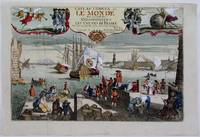
1725réf. M4694Paris 1725. Excellent. Notes: A decorative and beautifully hand coloured title page of the important atlas L'Atlas Curieux ou Le Monde" by Nicholas de Fer. Size : 220x335 mm 8.625x13.125 Inches Coloring: Hand Colored Category: Maps Misc Curiosities Title Pages Games etc. unknown
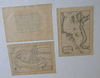
réf. 51-6467Paris: chez l'auteur dans l'Isle du Palais sur le quay de l'orloge a la Sphére Royale avec privilége du Roy 1705-1717. Engraved text broadside and 2 engraved maps.Each 27.3 x 38cm. Contemporary laid paper uniformly time aged.Published in "L'atlas curieux ou le monde reÌpreseÌnteÌ dans des cartes geÌneÌrales et particulieres du ciel et de la terre : diviseÌ tant en ses quatre principales parties que par eÌtats et provinces et orneÌ par des plans et descriptions des villes capitales et principales et des plus superbes edifices qui les embelissent comme sont les eglises les palais les maisons de plaisance les iardins les fontaines &c. ". OCLC Number / Unique Identifier:79022119.LThe Atlas Curieux is geographic encyclopedia of images and maps of France with detailed views of the grand waterworks at Marly views of the great palaces and chateaux views and plans of the Paris Observatory and samples of military architecture. Issued in six annual parts from 1700-1705 the maps are based on the new observations of the Académie des Sciences and drawn up with the assistance of Philipe de La Hire.Library of Congress:The French cartographer and engraver Nicolas de Fer was a master at creating maps that were works of art. The maps that he published were printed during the Baroque period when the decorative arts were characterized by ornate detail. De Fer’s detailed maps and atlases were valued more for their decorative content than their geographical accuracy.Nicolas de Fer was born in 1646. His father Antoine de Fer owned a mapmaking firm. At the age of twelve Nicolas was apprenticed to a Parisian engraver named Louis Spirinx. The family business was starting to decline when his father died in 1673. Nicolas de Fer’s mother Genevieve took over the business after the death of her husband. In 1687 the business was passed on to Nicolas and the profits increased after he took over the firm. Nicolas de Fer was a prolific cartographer who produced atlases and hundreds of single maps. He eventually became the official geographer to King Louis XIV of France and King Philip V of Spain.One of de Fer’s major works is an atlas titled L’atlas curieux The curious atlas. Paris: chez l'auteur dans l'Isle du Palais sur le quay de l'orloge a la Sphére Royale avec privilége du Roy, 1705-1717 unknown
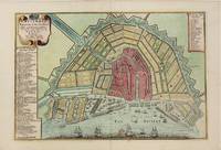
1705réf. M4585Paris 1705. Very Good. Size : 230x340 mm 9x13.375 Inches Coloring: Hand Colored Category: Maps City Maps; Maps Europe Benelux unknown
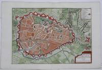
1705réf. M5243Paris 1705. Excellent. Size : 225x320 mm 8.875x12.625 Inches Coloring: Hand Colored Category: Maps City Maps; Maps Europe Benelux unknown
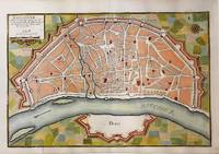
1705réf. M5135Paris 1705. Very Good. Notes: Copper engraved plan of Cologne Köln in Germany. It is beautifully hand coloured. Size : 235x350 mm 9.25x13.75 Inches Coloring: Hand Colored Category: Maps City Maps; Maps Europe Germany unknown
1703réf. M5179Paris 1703. Excellent. Size : 230x310 mm 9x12.25 Inches Coloring: Original Outline Coloring Category: ; Maps Asia Middle East Holy Land & Palestine unknown
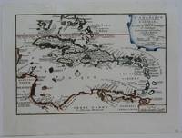
1702réf. M5228Paris 1702. Very Good small tear in the upper left margin professionally repaired not affecting the image. Size : 225x335 mm 8.875x13.125 Inches Coloring: Hand Colored in Outline Category: ; Maps West Indies Whole unknown
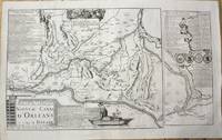
1705réf. M10253Paris 1705. Very Good. Notes: Map showing the Canal de Briare and the Canal D'Orleans with indexes and descriptive notes on both canals. Size : 385x651 mm 15.16x25.63 Inches Coloring: Black & White Category: Maps Europe France; unknown
1705réf. M5137Paris 1705. Excellent. Size : 235x350 mm 9.25x13.75 Inches Coloring: Black & White Category: Maps City Maps; Maps Europe Germany unknown
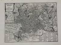
1700réf. M5227Paris c.1700. Very Good. Size : 240x310 mm 9.5x12.20 Inches Coloring: Black & White Category: Maps City Maps; Maps Europe Italy Rome unknown
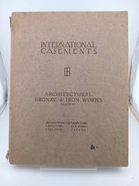
1922réf. 5564mInternational Casement Co. Good. Paperback. 1922. Solid and very well-preserved. Some wear along the spine crown otherwise clean l Casement Co Jamestown New York. Elegant October 1922 catalogue the 7th cata logue issued by International Casement Company of Jamestwon NY and featuring d ozens of black-and-white examples both line-drawn and photographed of some of the most rococo and lavishly-designed casement doors and windows of the period. Also featurig examples of International Transom Hardware Rod Gearing for Int ernational Transoms International Hardware for Wood Casement Sash Leaded G lass and Glazing Photographs and Measured Drawings of American Residences Equ ipped with International Casements Photographs and Measured Drawings of Churc hes College Buildings and Schools Equipped with International Casements Stee l Ceiling Lights for Banks and Public Buildings etc. Solid and very well-prese rved. Some wear along the spine crown otherwise clean as could be. Quarto lovel y crisp black-and-white photography throughout. The catalogue was designed and arranged by Albert W. Ford Architect and printed by Magill-Weinshimer Company Chicago. Attributes: Soft Cover . International Casement Co. paperback
réf. 109683aafBerlin, Ernst Wasmuth, Architektur Buchhandlung, 1887, gr. in-folio, 8 S., + 100 s./w. Tafeln von Schmiedekunst nicht gebunden, lose Blätter in Original H.-Leinenband. Buchdeckel mit Text und Abbildung.
1979réf. 6542Sans lieu, Les amis bibliophiles, 1979. In-4 en feuilles de 116-[4] p. sous couverture rempliée gaufrée grise et emboîtage pleine soie bordeaux orné de deux étiquettes de titre en papier fort, doit une au dos et une au premier plat. En parfait état.