Pratt, William V.; Fuqua Stephen O.MareMagnum

12.080 risultati
194160 pages. Features: Great color-photo ad for Fisher Body inside front cover features young lady with horse; Nice one-page ad for Long Distance with close-up image of young man; Photo and brief write-up of 72-year-old pancake-eating champion Charles Sharp of Iowa; Eye-catching one-page two-color ad for the February 1st issue of the Saturday Evening Post leads off with a profile of American Airlines President "C.R."Smith; Plymouth car ad; Debate on Lend-Lease - article with photos including Charles A. Lindbergh and Joseph P. Kennedy; British Drive Against Italy rescues lifeline of empire - new losses force Fascists to accept German domination; Amazing photo of a large (freight) trainload of Italian prisoners being moved to the rear; Blow-up in Rumania - failure of Iron Guard Revolt Strengthens Antonescu - article with photo of Horia Sima; Japan's Strong Men - Konoye strips Diet of powers as Matsuoka praises Axis goal; Nice color ad for Seagram's V.O. shows Canadian server crossing the border into the U.S.; Negroes in Uniform - article with photo of part of Uncle Sam's ninth cavalry Regiment; Nice ad for the 1941 De Soto which features Fluid Drive with Simplimatic Transmission; Great photo of 7 year-old Barbara Schulz of Evanston, IL who is chief taster for the Reed candy plant in Chicago; Nice photo ad for the Edison Voicewriter/Ediphone includes NBC's Bill Stern and "Ellen Randolph" (Gertrude Warner); Photo of basketball player Stanley "Stutz" Modzelewski; Photos of Bob Feller and Bobo Newson; Radio sensation Martin Block; ad promoting air travel shows plane flying over old-timer pouring hot water into the radiator of his snowbound car; Nice color-photo ad on back cover for Lucky Strike cigarettes features Connor Aycock, tobacco warehouse owner of Durham, NC; and much more. Center page holding by one staple. Average wear. Unmarked. A sound vintage copy. Book
194268 pages. Features: Brief obituaries for Capt. James H. Cook, M. Sayle Taylor, William Fortune, Madame Hranoush Bey, and Maj. Gen. Mason M. Patrick; Jap threat in Pacific Grows; Sea Strategy of the Japanese Thrust; Singapore Siege; Battle of Macassar Strait; Bloody Bataan; Defensive Tactics of Germans Wring Praise from the Reds; Photo (from last year) of crashed Russian pilot being interrogated by Germans; Hawaii is a testing ground for command; Churchill wins showdown by Parliament still testy; Charles Yoshii is the voice of Japan's Lord Haw Haw; Photos of Sir Stafford Cripps and James Maxton; Photo of Corinne Luchaire, pal of Nazis; Quisling becomes Premier of Norway; Photo of last Plymouth coming off line before plant converted to war production; Disney and Donald Duck are recruited to help Americans complete their income tax forms - and sooner; Iron Fireman ad features Howard A. Lincoln, President of Bemis & Call Co.; Great photo of a Vought-Sikorsky flying boat Excalibur taking off on maiden flight at Stratford, CT; Bomb shelter to be built for Liberty Bell; Two reasons for sugar rationing; Agriculture Department insists average Amercan woman is dumpy; The tall players for West Texas State College's basket ball team - article with photo of Charlie Halbert; Photo of Pastor boxing Lesnevich; Photo and article on Dr. Seuss (Ted Geisel); Photo of news headline where FDR asks parasites to leave Washington; Photo of Donald Forbes; Photos of Veronica Lake; Photos of Rev. Lawrence Lacour with his wife; Commissionner Alexander M. Damon and his wife retire from Salvation Army; Canadian Club whiskey color photo ad inside back cover looks at Mardi Gras in New Orleans; Nice color back cover ad for Chesterfield cigarettes features Lois January, star of state and screen. Somewhat above-average wear and external soiling. Unmarked. A worthy vintage copy. Book
2001rif. BN706352Wiley-Blackwell 2001. 2001. Hardcover. Service Efficient Network Interconnection via Satellite: EU Cost Action 253 Service Efficient Network Interconnection via Satellite: EU Cost Action 253 Y. Fun Hu Gerard Maral et Erina Ferro Wiley-Blackwell hardcover
1988rif. RO20199983DENOEL. 1988. In-Folio. Relié. Bon état, Couv. convenable, Dos satisfaisant, Intérieur frais. 157 pages - nombreuses photos, illustations et affiches publicitaires en noir et blanc et en couleurs dans et hors texte - 1er plat de la jaquette illustrée en couleur en bon etat - contre-plats illustrés en couleurs + la couverture seule du N°257 du 1er septembre 1930 de Modes et Travaux, 1er plat illustré en couleur avec un train Pullman inclus.. Avec Jaquette. . . Classification Dewey : 625-Chemins de fer, routes, autoroutes
rif. 35379127-nnew. unknown
rif. DADAX3161507851New unknown
188119 volumes broch?s de100 ? 300 pages. 23x30 cm.
rif. 51721045-nnew. unknown
rif. 51721045like new. unknown
rif. 24714374-nnew. unknown
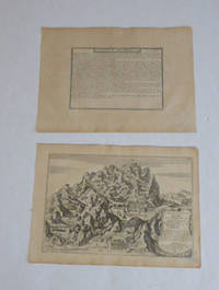
rif. 51-6469Paris: chez l'auteur dans l'Isle du Palais sur le quay de l'orloge a la Sphére Royale avec privilége du Roy 1705-1717. Engraved text broadside and engraved map.Each 27.3 x 38cm. Contemporary laid paper uniformly time aged.Published in "L'atlas curieux ou le monde reÌpreseÌnteÌ dans des cartes geÌneÌrales et particulieres du ciel et de la terre : diviseÌ tant en ses quatre principales parties que par eÌtats et provinces et orneÌ par des plans et descriptions des villes capitales et principales et des plus superbes edifices qui les embelissent comme sont les eglises les palais les maisons de plaisance les iardins les fontaines &c. ". OCLC Number / Unique Identifier:79022119.LThe Atlas Curieux is geographic encyclopedia of images and maps of France with detailed views of the grand waterworks at Marly views of the great palaces and chateaux views and plans of the Paris Observatory and samples of military architecture. Issued in six annual parts from 1700-1705 the maps are based on the new observations of the Académie des Sciences and drawn up with the assistance of Philipe de La Hire.Library of Congress:The French cartographer and engraver Nicolas de Fer was a master at creating maps that were works of art. The maps that he published were printed during the Baroque period when the decorative arts were characterized by ornate detail. De Fer’s detailed maps and atlases were valued more for their decorative content than their geographical accuracy.Nicolas de Fer was born in 1646. His father Antoine de Fer owned a mapmaking firm. At the age of twelve Nicolas was apprenticed to a Parisian engraver named Louis Spirinx. The family business was starting to decline when his father died in 1673. Nicolas de Fer’s mother Genevieve took over the business after the death of her husband. In 1687 the business was passed on to Nicolas and the profits increased after he took over the firm. Nicolas de Fer was a prolific cartographer who produced atlases and hundreds of single maps. He eventually became the official geographer to King Louis XIV of France and King Philip V of Spain.One of de Fer’s major works is an atlas titled L’atlas curieux The curious atlas. Paris: chez l'auteur dans l'Isle du Palais sur le quay de l'orloge a la Sphére Royale avec privilége du Roy, 1705-1717 unknown
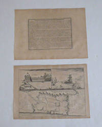
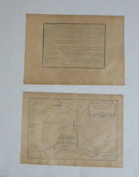
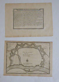
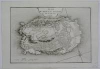
rif. 51-6472Paris: chez l'auteur dans l'Isle du Palais sur le quay de l'orloge a la Sphére Royale avec privilége du Roy 1705-1717. Engraved text broadside and engraved map.Each 27.3 x 38cm. Contemporary laid paper uniformly time aged.Map of the fortifications of Lisbon with the city divided into its Old and New Towns. The citadel of the city is prominently marked. Features two views of the Royal Palace and Belem Tower respectively.This map was published during the War of the Spanish Succession a conflict in which Portugal and Lisbon featured prominent hence the depiction of the fortifications of the city.Published in "L'atlas curieux ou le monde reÌpreseÌnteÌ dans des cartes geÌneÌrales et particulieres du ciel et de la terre : diviseÌ tant en ses quatre principales parties que par eÌtats et provinces et orneÌ par des plans et descriptions des villes capitales et principales et des plus superbes edifices qui les embelissent comme sont les eglises les palais les maisons de plaisance les iardins les fontaines &c. ". OCLC Number / Unique Identifier:79022119.LThe Atlas Curieux is geographic encyclopedia of images and maps of France with detailed views of the grand waterworks at Marly views of the great palaces and chateaux views and plans of the Paris Observatory and samples of military architecture. Issued in six annual parts from 1700-1705 the maps are based on the new observations of the Académie des Sciences and drawn up with the assistance of Philipe de La Hire.Library of Congress:The French cartographer and engraver Nicolas de Fer was a master at creating maps that were works of art. The maps that he published were printed during the Baroque period when the decorative arts were characterized by ornate detail. De Fer’s detailed maps and atlases were valued more for their decorative content than their geographical accuracy.Nicolas de Fer was born in 1646. His father Antoine de Fer owned a mapmaking firm. At the age of twelve Nicolas was apprenticed to a Parisian engraver named Louis Spirinx. The family business was starting to decline when his father died in 1673. Nicolas de Fer’s mother Genevieve took over the business after the death of her husband. In 1687 the business was passed on to Nicolas and the profits increased after he took over the firm. Nicolas de Fer was a prolific cartographer who produced atlases and hundreds of single maps. He eventually became the official geographer to King Louis XIV of France and King Philip V of Spain.One of de Fer’s major works is an atlas titled L’atlas curieux The curious atlas. Paris: chez l'auteur dans l'Isle du Palais sur le quay de l'orloge a la Sphére Royale avec privilége du Roy, 1705-1717 unknown
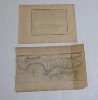
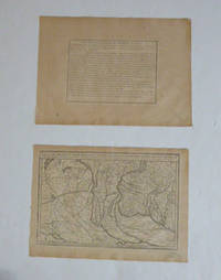
rif. 51-6470Paris: chez l'auteur dans l'Isle du Palais sur le quay de l'orloge a la Sphére Royale avec privilége du Roy 1705-1717. Engraved text broadside and engraved map.27.3 x 38cm. and 27.3 x 43cm. Missing piece in lower right corner. Fold mark on right side. Contemporary laid paper uniformly time aged.The Tagus is the longest river in the Iberian Peninsula. The river rises in the Montes Universales between Cuenca and Teruel in mid-eastern Spain flows 1007 km generally westward and empties into the Atlantic Ocean in Lisbon.Published in "L'atlas curieux ou le monde reÌpreseÌnteÌ dans des cartes geÌneÌrales et particulieres du ciel et de la terre : diviseÌ tant en ses quatre principales parties que par eÌtats et provinces et orneÌ par des plans et descriptions des villes capitales et principales et des plus superbes edifices qui les embelissent comme sont les eglises les palais les maisons de plaisance les iardins les fontaines &c. ". OCLC Number / Unique Identifier:79022119.LThe Atlas Curieux is geographic encyclopedia of images and maps of France with detailed views of the grand waterworks at Marly views of the great palaces and chateaux views and plans of the Paris Observatory and samples of military architecture. Issued in six annual parts from 1700-1705 the maps are based on the new observations of the Académie des Sciences and drawn up with the assistance of Philipe de La Hire.Library of Congress:The French cartographer and engraver Nicolas de Fer was a master at creating maps that were works of art. The maps that he published were printed during the Baroque period when the decorative arts were characterized by ornate detail. De Fer’s detailed maps and atlases were valued more for their decorative content than their geographical accuracy.Nicolas de Fer was born in 1646. His father Antoine de Fer owned a mapmaking firm. At the age of twelve Nicolas was apprenticed to a Parisian engraver named Louis Spirinx. The family business was starting to decline when his father died in 1673. Nicolas de Fer’s mother Genevieve took over the business after the death of her husband. In 1687 the business was passed on to Nicolas and the profits increased after he took over the firm. Nicolas de Fer was a prolific cartographer who produced atlases and hundreds of single maps. He eventually became the official geographer to King Louis XIV of France and King Philip V of Spain.One of de Fer’s major works is an atlas titled L’atlas curieux The curious atlas. Paris: chez l'auteur dans l'Isle du Palais sur le quay de l'orloge a la Sphére Royale avec privilége du Roy, 1705-1717 unknown
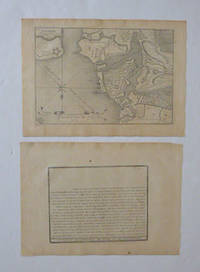
rif. 51-6466Paris: chez l'auteur dans l'Isle du Palais sur le quay de l'orloge a la Sphére Royale avec privilége du Roy 1705-1717. Engraved text broadside and engraved map.Each 27.3 x 38cm. Contemporary laid paper uniformly time aged.Published in "L'atlas curieux ou le monde reÌpreseÌnteÌ dans des cartes geÌneÌrales et particulieres du ciel et de la terre : diviseÌ tant en ses quatre principales parties que par eÌtats et provinces et orneÌ par des plans et descriptions des villes capitales et principales et des plus superbes edifices qui les embelissent comme sont les eglises les palais les maisons de plaisance les iardins les fontaines &c. ". OCLC Number / Unique Identifier:79022119.LThe Atlas Curieux is geographic encyclopedia of images and maps of France with detailed views of the grand waterworks at Marly views of the great palaces and chateaux views and plans of the Paris Observatory and samples of military architecture. Issued in six annual parts from 1700-1705 the maps are based on the new observations of the Académie des Sciences and drawn up with the assistance of Philipe de La Hire.Library of Congress:The French cartographer and engraver Nicolas de Fer was a master at creating maps that were works of art. The maps that he published were printed during the Baroque period when the decorative arts were characterized by ornate detail. De Fer’s detailed maps and atlases were valued more for their decorative content than their geographical accuracy.Nicolas de Fer was born in 1646. His father Antoine de Fer owned a mapmaking firm. At the age of twelve Nicolas was apprenticed to a Parisian engraver named Louis Spirinx. The family business was starting to decline when his father died in 1673. Nicolas de Fer’s mother Genevieve took over the business after the death of her husband. In 1687 the business was passed on to Nicolas and the profits increased after he took over the firm. Nicolas de Fer was a prolific cartographer who produced atlases and hundreds of single maps. He eventually became the official geographer to King Louis XIV of France and King Philip V of Spain.One of de Fer’s major works is an atlas titled L’atlas curieux The curious atlas. Paris: chez l'auteur dans l'Isle du Palais sur le quay de l'orloge a la Sphére Royale avec privilége du Roy, 1705-1717 unknown
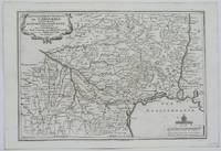
rif. 51-6476Paris: chez l'auteur dans l'Isle du Palais sur le quay de l'orloge a la Sphére Royale avec privilége du Roy 1705-1717. Engraved text broadside and map. Each 27.3 x 38cm. Contemporary laid paper uniformly time aged.This detailed map shows the vicinity of Milan and the important network of canals. The Naviglio Canal shown here connecting Lake Maggiore with Milan was the first artificial canal in Europe probably originating as a defensive ditch dug in the 12th century. It was one of the largest post-medieval engineering projects allowing development of commerce transport and agriculture in the region. Prominently depicted within a large area north of Pavia is the Enclos des Chartreux Certosa di Pavia monastery located within a large hunting park that belonged to the Visconti family of Milan.Evora is the capital of the province of Alentejo east of Lisbon It was captured by the Romans in 80 BC and has a Roman aqueduct and temple of Diana the goddess of hunting. There is also a 13th-century Gothic cathedral. From the 14th to the 16th centuries Evora was the residence of the Kings of Portugal.This map was published during the War of the Spanish Succession a conflict in which Portugal and Lisbon featured prominent hence the depiction of the fortifications of the city.Published in "L'atlas curieux ou le monde reÌpreseÌnteÌ dans des cartes geÌneÌrales et particulieres du ciel et de la terre : diviseÌ tant en ses quatre principales parties que par eÌtats et provinces et orneÌ par des plans et descriptions des villes capitales et principales et des plus superbes edifices qui les embelissent comme sont les eglises les palais les maisons de plaisance les iardins les fontaines &c. ". OCLC Number / Unique Identifier:79022119.LThe Atlas Curieux is geographic encyclopedia of images and maps of France with detailed views of the grand waterworks at Marly views of the great palaces and chateaux views and plans of the Paris Observatory and samples of military architecture. Issued in six annual parts from 1700-1705 the maps are based on the new observations of the Académie des Sciences and drawn up with the assistance of Philipe de La Hire.Library of Congress:The French cartographer and engraver Nicolas de Fer was a master at creating maps that were works of art. The maps that he published were printed during the Baroque period when the decorative arts were characterized by ornate detail. De Fer’s detailed maps and atlases were valued more for their decorative content than their geographical accuracy.Nicolas de Fer was born in 1646. His father Antoine de Fer owned a mapmaking firm. At the age of twelve Nicolas was apprenticed to a Parisian engraver named Louis Spirinx. The family business was starting to decline when his father died in 1673. Nicolas de Fer’s mother Genevieve took over the business after the death of her husband. In 1687 the business was passed on to Nicolas and the profits increased after he took over the firm. Nicolas de Fer was a prolific cartographer who produced atlases and hundreds of single maps. He eventually became the official geographer to King Louis XIV of France and King Philip V of Spain.One of de Fer’s major works is an atlas titled L’atlas curieux The curious atlas. Paris: chez l'auteur dans l'Isle du Palais sur le quay de l'orloge a la Sphére Royale avec privilége du Roy, 1705-1717 unknown
rif. 51-6471Paris: chez l'auteur dans l'Isle du Palais sur le quay de l'orloge a la Sphére Royale avec privilége du Roy 1705-1717. Engraved text broadside and engraved map.Each 27.3 x 38cm. Contemporary laid paper uniformly time aged.Published in "L'atlas curieux ou le monde reÌpreseÌnteÌ dans des cartes geÌneÌrales et particulieres du ciel et de la terre : diviseÌ tant en ses quatre principales parties que par eÌtats et provinces et orneÌ par des plans et descriptions des villes capitales et principales et des plus superbes edifices qui les embelissent comme sont les eglises les palais les maisons de plaisance les iardins les fontaines &c. ". OCLC Number / Unique Identifier:79022119.LThe Atlas Curieux is geographic encyclopedia of images and maps of France with detailed views of the grand waterworks at Marly views of the great palaces and chateaux views and plans of the Paris Observatory and samples of military architecture. Issued in six annual parts from 1700-1705 the maps are based on the new observations of the Académie des Sciences and drawn up with the assistance of Philipe de La Hire.Library of Congress:The French cartographer and engraver Nicolas de Fer was a master at creating maps that were works of art. The maps that he published were printed during the Baroque period when the decorative arts were characterized by ornate detail. De Fer’s detailed maps and atlases were valued more for their decorative content than their geographical accuracy.Nicolas de Fer was born in 1646. His father Antoine de Fer owned a mapmaking firm. At the age of twelve Nicolas was apprenticed to a Parisian engraver named Louis Spirinx. The family business was starting to decline when his father died in 1673. Nicolas de Fer’s mother Genevieve took over the business after the death of her husband. In 1687 the business was passed on to Nicolas and the profits increased after he took over the firm. Nicolas de Fer was a prolific cartographer who produced atlases and hundreds of single maps. He eventually became the official geographer to King Louis XIV of France and King Philip V of Spain.One of de Fer’s major works is an atlas titled L’atlas curieux The curious atlas. Paris: chez l'auteur dans l'Isle du Palais sur le quay de l'orloge a la Sphére Royale avec privilége du Roy, 1705-1717 unknown
rif. 51-6465Paris: chez l'auteur dans l'Isle du Palais sur le quay de l'orloge a la Sphére Royale avec privilége du Roy 1705-1717. Engraved text broadside and engraved map.Each 27.3 x 38cm. Contemporary laid paper uniformly time aged.Published in "L'atlas curieux ou le monde reÌpreseÌnteÌ dans des cartes geÌneÌrales et particulieres du ciel et de la terre : diviseÌ tant en ses quatre principales parties que par eÌtats et provinces et orneÌ par des plans et descriptions des villes capitales et principales et des plus superbes edifices qui les embelissent comme sont les eglises les palais les maisons de plaisance les iardins les fontaines &c. ". OCLC Number / Unique Identifier:79022119.LThe Atlas Curieux is geographic encyclopedia of images and maps of France with detailed views of the grand waterworks at Marly views of the great palaces and chateaux views and plans of the Paris Observatory and samples of military architecture. Issued in six annual parts from 1700-1705 the maps are based on the new observations of the Académie des Sciences and drawn up with the assistance of Philipe de La Hire.Library of Congress:The French cartographer and engraver Nicolas de Fer was a master at creating maps that were works of art. The maps that he published were printed during the Baroque period when the decorative arts were characterized by ornate detail. De Fer’s detailed maps and atlases were valued more for their decorative content than their geographical accuracy.Nicolas de Fer was born in 1646. His father Antoine de Fer owned a mapmaking firm. At the age of twelve Nicolas was apprenticed to a Parisian engraver named Louis Spirinx. The family business was starting to decline when his father died in 1673. Nicolas de Fer’s mother Genevieve took over the business after the death of her husband. In 1687 the business was passed on to Nicolas and the profits increased after he took over the firm. Nicolas de Fer was a prolific cartographer who produced atlases and hundreds of single maps. He eventually became the official geographer to King Louis XIV of France and King Philip V of Spain.One of de Fer’s major works is an atlas titled L’atlas curieux The curious atlas. Paris: chez l'auteur dans l'Isle du Palais sur le quay de l'orloge a la Sphére Royale avec privilége du Roy, 1705-1717 unknown
1705rif. M5133Paris 1705. Excellent. Size : 236x345 mm 9.25x13.625 Inches Coloring: Black & White Category: Maps Europe France unknown
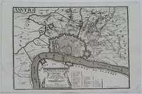
1705rif. M5141Paris 1705. Excellent. Size : 245x345 mm 9.625x13.625 Inches Coloring: Black & White Category: ; Maps Europe Benelux unknown
1706rif. M6385Paris 1706. Very Good margins extended. Size : 115x175 mm 4.5x6.875 Inches Coloring: Hand Colored Category: ; Maps Europe Greece Macedonia unknown
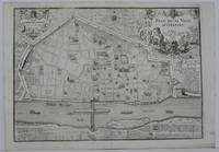
1705rif. M5143Paris 1705. Excellent. Size : 240x340 mm 9.5x13.375 Inches Coloring: Black & White Category: Maps City Maps; Maps Europe France unknown
1716rif. M5138Paris 1716. Excellent. Size : 235x325 mm 9.25x12.75 Inches Coloring: Black & White Category: ; Maps Europe Germany unknown
1705rif. M5145Paris 1705. Excellent. Size : 230x330 mm 9x13 Inches Coloring: Black & White Category: ; Maps Europe France unknown
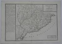
1702rif. M5130Paris 1702. Excellent. Size : 250x355 mm 9.875x14 Inches Coloring: Black & White Category: ; Maps Europe Spain unknown
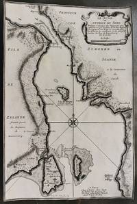
1700rif. M10800Paris 1700. Very Good margins are trimmed. Notes: Map of Oresund strait between Denmark and Sweden. Size : 328x218 mm 12.91x8.58 Inches Coloring: Black & White Category: Maps Europe Scandinavia Countries; unknown