Guilhermina Maria Lobato Fer de MirandaBiblio.com

12.121 Ergebnisse
Best.-Nr. ria9781799840961_inpHardcover. New. New Book; Fast Shipping from UK; Not signed; Not First Edition; There has been an evolution of the explanations on the results of research on human learning and how digital technologies have supported the design of more efficient learning environments. Previous theories such as Richard Mayer's cogni hardcover
Best.-Nr. 26642Bern, Schweizerischen Post- und Eisenbahndepartement - Département des Postes et Chemins de Fer 1877-1896, 350x220mm, 140pages, broché.
Best.-Nr. 92491Berne, 1924-1944, 290x200mm, demi-percaline. Etiquette manuscrite de titre en papier noir au dos, sauf pour un volume et un autre en partie manquante, plats papier marbré.
Best.-Nr. COS-4Paris, Bruxelles, Berlin Reimar Hobbing, 1912 ; 3 volumes in-4, cartonnage bleu de l’éditeur. Abondante iconographie, carte dépliante en fin du tome 1. Très bon état.
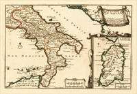
1705Best.-Nr. 15703Paris: N. de Fer 1705. Other. In excellent condition. 223 by 335mm 8 by 13 inches. 223 by 335mm 8 by 13 inches. Original antique hand-colored copper engraving published 1705. Depicting Kingdom of Naples this map is a fine example of 0s European cartography. Image: 223 by 335mm 8 by 13 inches. An attractive and historically significant 18th-century map for the discerning collector. Nicolas de Fer 16461720 was a prominent French cartographer engraver and publisher based in Paris. After inheriting his father's mapmaking business de Fer built it into one of the most productive cartographic firms in France eventually becoming Geographer to King Louis XIV of France and King Philip V of Spain. His output was prolificmore than 600 sheet maps town plans and atlasescovering Europe the Americas and beyond. De Fer's maps are known for their decorative cartouches attractive hand coloring and commercial appeal though they were sometimes criticized for prioritizing artistry over accuracy. His maps are particularly associated with the campaigns of the War of the Spanish Succession and are sought by collectors for their decorative quality.This decorative map show the Southern part of Italy with Sicily. Inside the map are many place names rivers mountains etc. engraved. In the upper right corner we see the title cartouche. In the lower right corner we see an inset map which shows the island Sardinia. At the bottom are two mileage scales.A fine example from Introduction à la Géographie Paris sought after by collectors of antique maps of Italy antique maps of Kingdom of Naples and antique hand-colored copper engravings for sale. In very good condition. Light age-toning to the sheet as expected for a 18th-century map. N. de Fer unknown
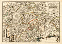
1705Best.-Nr. 15715Paris: N. de Fer 1705. Other. Full margins as published. 252 by 352mm 10 by 13 inches. 252 by 352mm 10 by 13 inches. Original antique hand-colored copper engraving published 1705. Depicting Tyrol & Trentino this map is a fine example of 0s European cartography. Image: 252 by 352mm 10 by 13 inches. An attractive and historically significant 18th-century map for the discerning collector. Nicolas de Fer 16461720 was a prominent French cartographer engraver and publisher based in Paris. After inheriting his father's mapmaking business de Fer built it into one of the most productive cartographic firms in France eventually becoming Geographer to King Louis XIV of France and King Philip V of Spain. His output was prolificmore than 600 sheet maps town plans and atlasescovering Europe the Americas and beyond. De Fer's maps are known for their decorative cartouches attractive hand coloring and commercial appeal though they were sometimes criticized for prioritizing artistry over accuracy. His maps are particularly associated with the campaigns of the War of the Spanish Succession and are sought by collectors for their decorative quality.Ornated in the lower left corner with a small milage scale.A fine example from Introduction à la Géographie Paris sought after by collectors of antique maps of Italy antique maps of Tyrol and antique hand-colored copper engravings for sale. In very good condition. Light age-toning to the sheet as expected for a 18th-century map. N. de Fer unknown
Best.-Nr. 32710583-nnew. unknown
2004Best.-Nr. Q-0471976474Wiley 2004-10-15. Hardcover. New. In shrink wrap. Looks like an interesting title! Wiley hardcover
Best.-Nr. CBS 9781447175988US Edition. New. Brand New! Fast Delivery US Edition and ship within 24-48 hours. Deliver by FedEx and Dhl & Aramex UPS & USPS and we do accept APO and PO BOX Addresses. Order can be delivered worldwide within 6-10 days and we do have flat rate for up to 2LB. Extra shipping charges will be requested if the Book weight is more than 5 LB. This Item May be shipped from India United states & United Kingdom. Depending on your location and availability. unknown
Best.-Nr. DADAX0199658323New unknown
2025Best.-Nr. x-1638040834Clemson Univ Pr 2025. Hardcover. New. 256 pages. 9.43x6.43x9.00 inches. Clemson Univ Pr hardcover
Best.-Nr. 650402937Taylor & Francis Group . Hardback. New. pp. 168 Taylor & Francis Group hardcover
Best.-Nr. 19441799-nnew. unknown
Bella cartella contenit. in solido carton., eleg. decor. alla cop., cm 33x24, 147 pp sciolte, 138 pregev. tavv con numer. ill. a colori. Modeste tracce d’uso est., peraltro ottimo esempl.
Best.-Nr. DADAX0333293924New unknown
Best.-Nr. DADAX0333611314New unknown
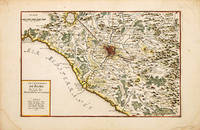
1700Best.-Nr. 70256Paris c. 1700-05. Nicolas de Fer was the son of Antoine de Fer a Parisian map and print seller. This map from the Atlas Curieux shows the environs of Rome. At the time of publication de Fer was the official cartographer to the French Dauphin but he later became cartographer to both the French and Spanish kings. Size: 290 x 440 mm. Copperplate engraving with later hand colour. Good condition some slight toning and creasing. unknown
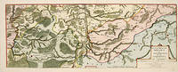
1705Best.-Nr. 52950Paris. 1705. An attractive map of part of Belgium showing forests and river valleys. 'de Fer's maps are popular despite or maybe because of their rather flamboyant decoration' Moreland & Bannister p130. Title at lower right. Atlas Curieux ou Le Monde. Copper engraving. Fine condition Later colouring. Size: 59 x 22 cm. Moreland and Bannister unknown
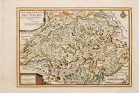
1717Best.-Nr. 53085Atlas Curieux ou le Monde. Paris 1717. Map of Switzerland with title at top left dedication and scales in lower corners Copper engraving. Fine condition Later colour. Size: 348 x 240 mm. 13½ x 9½ iinches unknown
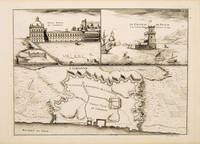
1710Best.-Nr. 53827Atlas Curieux ou le Monde. c. 1710. The lower half of this attractive engraving shows a map of the fortifications of Lisbon. The upper half has two views- To the left the 'Palais Royal de Lisbonne' and to the right 'Le Chateau de Belem'. Copper engraving. Fine condition. Uncoloured. Size: 330 x 240 mm. 13 x 9½ inches. unknown
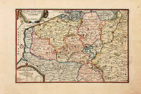
1717Best.-Nr. 78864Paris: 1717. Map of the Catholic Low Countries or current day Belgium. Published in "Atlas Curieux ou le Monde". Copper engraving. Hand coloured. Sheet size: 274 x 405 mm Plate size: 216 x 326 mm Very good condition. unknown
1898Best.-Nr. 096271UK: W. Griggs & Sons 1898. Hardcover. Very Good. 40cm x 29cm. Tight and clean copy . Ex library Scottish National Museum with withdrawn stamp and discreet stamps. Clean and tight copy. Beige cloth boards with gilt titles. W. Griggs & Sons hardcover
189114 volumes broch?s de 100 ? 200 pages. 23x28 cm.
800Ril. in cart., bordi in tela elegante cop. con motivi impr. in nero, cm 46x33, pp 8 di intr. e schede, 28 tavv di cui alcune ripieg. con numerosiss. ill. b/n.
2026Best.-Nr. x-1837422850Emerald Publishing Limited 2026. Hardcover. New. 276 pages. 5.98x0.59x9.02 inches. Emerald Publishing Limited hardcover