DE FER, NicolasBiblio.com
11.856 risultati
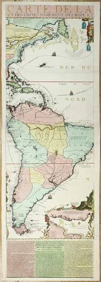
rif. 11134Paris: 1713. No binding. Very Good. 1175 x 380 mm. full early wash colour with accompanying title page included a key map bookplate of the Duke of York on the verso in very good condition. Three sheets of an exceedingly rare fifteen-sheet wall map by Nicolas de Fer accompanied by the title with key map all in fabulous original colour. When published in 1713 it was the most extravagant map of America yet produced. It encompasses not just the American continent but the whole of the Pacific Ocean also. The map is made up of ten sheets in two rows of five and accompanied by 5 further smaller sheets of descriptive text which are not always present along the bottom. Here we offer the two sheets encompassing the east coast of North America and much of South America. The end of the War of Spanish Succession 1701-14 was near by 1711 and with a weakened Spain France began to eye North America. This renewed interest led to 'Louisiana' and the founding of New Orleans in 1718. Nicholas de Fer 1646-1720 was born the youngest of eight children to the map seller Antoine de Fer fl.1644-d.1673 and grew to be one of the most well-known mapmakers in France in the seventeenth century. He was apprenticed in 1659 to the engraver Louis Spirinx at the age of twelve. Following the death of his father in 1673 Nicholas worked with his mother to continue the family business. On her retirement in 1687 she passed the business to Nicolas in exchange for a crown a week unlimited bread and a pint of wine per day Pastoureau. His earliest known work is a map of the Canal of Languedoc in 1669. Arguably his most famous production is his wall map of America published in 1698. It is renowned for the beaver scene. In 1690 he became cartographer to the Dauphin of France and eventually to Louis XIV himself. From 1690 he began publishing his own books such as 'Les Forces de l'Europe' and the 'Petit et Nouveau Atlas' in 1697. His first wall map in 1694 was naturally of the world and this was followed by a set of four continents. The British possessions are hemmed into the coast of North America and include Acadia. In South America the mythical Lake Parime is excluded but the Orinoco and Amazon Rivers are still connected. Sea routes to and from the tip of South America are displayed and a fabulous inset of the Rio de la Plata is found lower right. The scene accompanying this is the mountain of Potosi the source of fabulous silver reserves with an image of panning for gold in the water nearby. The whole is wonderfully engraved by P. Starckman and dedicated to Monseigneur le Comte de Toulouse. The text beneath describes the voyage of Jacques le Hermite 1582-1624 in 1623-5 to present day Argentina and Tierra del Fuego. Le Hermite himself died on the voyage in Callao on the Peruvian coast. The map was a model for the later reduction by Henri Abraham Chatelain published in 1719 and Hermann Moll. An extremely rare map no examples are traced in the Library of Congress or the British Library. This example is from the magnificent collection of the Duke of York 1763-1827 unfortunately distributed at Sotheby's in May 1827. The second son of King George III he early on entered the military. His unfortune experiences can often be laid at the poor state of the military forces. It however led to the mocking rhyme 'The Grand Old Duke of York'. He is now credited with reshaping the armed forces to be more professional and merit based. He became Commander-in-Chief during the Napoleonic Wars. His collection when auctioned was described as being '88 folio double book cases' which contained 5500 maps each of which bore his distinctive bookplate with manuscript volume and map number below. Provenance: With bookplate of Frederick Augustus Duke of York 1763-1827; Sotheby's May 1827; collection of Hein Wenzel Berlin with stamp; Richard B. Arkway Inc. 2000; Juan and Peggy Rada Collection. Harley & Walters 1978; Howgego 2003 1713 unknown
rif. __193410907XLean Enterprise Institute Inc. Paperback. New. 224 pages. 8.20x10.90x0.75 inches. Lean Enterprise Institute, Inc. paperback
rif. A9780313301070Hardback. New. Common core library reference sources are annotated to aid the user in finding the most useful resource and a keyword index helps students connect homework and term paper subjects with the reference works most likely to supply the needed information. hardcover
rif. 0464120985.Ghardcover. Good. Access codes and supplements are not guaranteed with used items. May be an ex-library book. hardcover
rif. A9780415211802Paperback / softback. New. Antonino Ferro sets out his new conceptual system for analysis considering not only the inner world of the patient but the continued interaction of that world with the inner world of the analyst. paperback
rif. 1846099870.Gpaperback. Good. Access codes and supplements are not guaranteed with used items. May be an ex-library book. paperback
rif. 1558062491.Gpaperback. Good. Access codes and supplements are not guaranteed with used items. May be an ex-library book. paperback
rif. 0947912460.Ghardcover. Good. Access codes and supplements are not guaranteed with used items. May be an ex-library book. hardcover
rif. SONG1558061452Brand: Iron Crown Enterprises 0000-00-00. paperback. Used: Good. 8.50x0.50x11.25. Buy with confidence. Excellent Customer Service & Return policy. Brand: Iron Crown Enterprises paperback
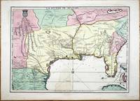
rif. 9768Paris: A Paris dans l'!sle sur Ie Quay de l'Orloge a la Sphere Royale avec Prive. Du Roy 1715. 1715. No binding. Good. EXTREMELY RARE FIRST STATE OF NICOLAS DE FER'S LANDMARK MAP IN FULL CONTEMPORARY WASH COLOUR. 465 x 640 mm. in full early wash colour faint water stain lower centrefold otherwise in excellent condition. EXTREMELY RARE FIRST STATE OF NICOLAS DE FER'S LANDMARK MAP IN FULL CONTEMPORARY WASH COLOUR. This printed map is derived from the manuscript of Guillaume de L'Isle in 1701 a significant map in the history of the depiction of the Mississippi Valley. Considerable advances were made in the understanding of this region particularly along the Gulf of Mexico in the first two decades of the 1700s. Much of this new information came at the hands of French explorers. In Paris the key mapmakers processing this information were Claude de L'Isle 1644-1720 his son Guillaume de L'Isle 1675-1726 and Nicolas de Fer 1646-1720. The three significant printed maps of the time are De L'Isle's Carte du Mexique et de la Floride 1703 La Riviere de Missisipi et ses Environs 1718 and this de Fer 1715. The de Fer is an important link in the understanding of the region. The most prominent unknown at the beginning of this period was the location of the mouth of the Mississippi River. Whilst René-Robert Cavalier de La Salle 1643-87 had proved that the Mississippi River flowed into the Gulf of Mexico the position of its mouth was ill conceived and displayed too far west on contemporary maps. 'During the 1690s attempts had been made to encourage an expedition to follow on La Salle's claims to the Mississippi valley. All of them foundered until a government-sponsored one by Louis Phélypeux Comte de Pontchartrain Minister of the Navy. He ordered Pierre le Moyne d'Iberville to command the voyage. He was the third of fourteen children of Charles Le Moyne 1626-83 who had arrived in Canada in 1641. Pierre 1661-1706 was born at Ville-Marie Canada and by the age of fourteen had sailed to France returning in 1678. In 1686 he was present with some of his brothers fighting the English in Hudson Bay under Pierre de Troyes. On another voyage to the same region he was trapped in the ice along with the English and there spent the winter of 1689-90 until freed in the spring. Most of his experience was in Canada although he did take part in an attack on Schenectady in New York 1690. Pontchartrain's instructions to d'Iberville were to establish a colony at the mouth of the Mississippi River and therefore enable control of the huge waterway. He sailed from Brest on 24 October 1698 with three vessels and 200 colonists arriving at Ship Island off present day Biloxi Mississippi 25 January 1699. Having put ashore the colonists he embarked in four small boats up the Mississippi delta until he reached the Iberville River which he entered. Crossing Lakes Maurepas and Pontchartrain he returned to the coast. He then began construction of Fort Maurepas on Biloxi Bay before leaving for France on 4 May 1699' Burden. 'D'Iberville returned to Biloxi promptly arriving 7 December 1699. In the New Year he constructed Fort Iberville eighteen leagues upriver from the mouth of the Mississippi … The most detailed record cartographically of d'Iberville's voyages can be found in Nicolas de Fer's Les Costes aux Environs de la Riviere de Misisipi 1701' Burden. The results of these explorations were recorded on Guillaume De L'Isle's 1701 manuscript. It was one of the first to display the Mississippi delta and to illustrate the extent of the Missouri River. Cumming described it as 'notable for its early representation of the Carolina Trading Path' from Charleston Carolina to the Mississippi river. De L'Isle never published a printed version of the manuscript. The second state of Claude and Guillaume De L'Isle's L'Amerique Septentrionale in 1700 records a delta but is not directly derived from the manuscript. The only printed version was this map issued by De Fer in 1715 with additional information. Jackson notes 'the s A Paris dans l'!sle sur Ie Quay de l'Orloge a la Sphere Royale avec Prive. Du Roy 1715. 1715 unknown
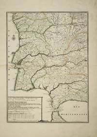
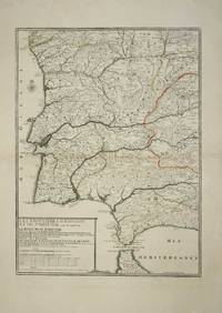
rif. 4614Paris: 1705. No binding. Good. 575 x 425 mm. early outline colour light browning to the left of the centrefold otherwise in good condition. This fine map of Portugal by Nicholas de Fer is engraved by P. Starckman. It was issued in the first edition of the ""Atlas ou Recueil de Cartes Geographiques"" 1709. Pastoureau 1984 De Fer II C no. 72. 1705 unknown
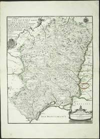
rif. 4160Paris: 1705. No binding. Good. 590 x 470 mm. early outline colour. Some light foxing to the lower margin otherwise in fine condition. The map displays the region to the west of the lower Rhone river valley. It shows Beziers in the west and Arles at the mouth of the river. It extends north up the river to Tournon. It was published in De Fer's folio atlas entitled 'Atlas ou Recueil de Cartes Geographiques'. The atlas followed a quarto one and was first issued in 1709. With two attractive cartouches the map extends from Lyon in the south to Chatillon in the north. Pastoureau 1984 Fer II C no. 30. 1705 unknown
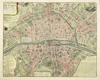
rif. 4582Paris: 1729. No binding. Very Good. 450 x 570 mm. with fine recent wash colour with folds as issued in fine condition. This plan of the modern Paris is from Nicholas Delamare's 'Traite de la Police'. It is a multi-volume work which began in 1707. It was a comprehensive study of the history of regulation and policing in the city of Paris. Accompanying the book were eight plans of Paris from its foundation to the time of publication. This the eighth is the most modern of them and represents the city at the time of publication. 1729 unknown
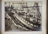
rif. 8031London: 1863-69. No binding. Very Good. PHOTOGRAPHIC RECORD OF SHIPBUILDING IN THE 1860s. Oblong quarto 235 x 310 mm. full contemporary calf gilt and blind panelled boards with ornate gilt corner feature rebacked preserving original spine gilt ruled raised bands with ornate gilt pattern gilt edged. With 89 albumen photographic prints. A fascinating PHOTOGRAPHIC RECORD OF SHIPBUILDING IN THE 1860s at the Thames Ironworks and Shipbuilding Company. They cover the period 1863-69 and likely record all of the significant work undertaken in this period. The Thames Iron Works were the largest shipbuilder on the river Thames. Its shipyard was located at the mouth of Bow Creek in the east end of London. Although principally a shipbuilder it expanded into civil engineering supplying materials for Isambard Kingdom Brunel marine engines cranes electrical engineering and even later into motor cars. Founded in 1837 the company was struggling until in 1857 Peter Rolt MP for Greenwich merchant and descendant of the Pett shipbuilding family took control. At the time of the earliest photographs in this album the huge site had the capacity to build 25000 tons of warships and 10000 tons of mail steamers. It is most famous for constructing HMS 'Warrior' the world's first iron hulled armour-plated warship. Launched on 29 December 1860 it overnight rendered obsolete all existing warships worldwide. It was at the time the world's largest. Following the success of HMS 'Warrior' and HMS 'Minotaur' photographed orders arrived from navies all over the world. The Company also built the Prussian Navy's first iron-hulled warship the SMS 'König Wilhelm I' photographed in 1868. It is interesting to note also that the 1860s was the decade of considerable loss of shipping which opened a huge debate led by Samuel Plimsoll MP on load lines on vessels. Many of the vessels photographed already show load lines following the recommendations of Lloyd register known as 'Lloyd's Rule'. The majority of the photographs feature the construction of vessels but towards the end particularly there are images of the various buildings Yards and Docks. There are also four of ship models a cross section a lighthouse destined for the West Indies a model steam engine six of plant works and three of paintings. Below is a list of the vessels illustrated which can be readily identified: RUS 'Pervenetz' Imperial Russian Navy 1863 'Alexandra' HMS 'Minotaur' Royal Navy 1863. This was the longest single-screw warship ever built HMS 'Valiant' Royal Navy 1863 'Napoleon III' 1863 'Izzeddin' paddle steamer 1864 'Nyanza' Peninsular and Oriental Company's Paddle Wheel Steamer 1864 'Sultan Mahmoud' Turkish Frigate 1865 'Charkieh' 1865 'Tanjore' Peninsular and Oriental Company's 1865 SNS 'Vitoria' Spanish Navy 1865 'Earl de Grey and Ripon' 1866 HMS 'Waterwitch' 1866. She was one of only three armoured gunboats built for the Royal Navy. Uniquely she was powered by Ruthven's 'hydraulic propeller' making her the first ship to employ waterjets 'Henry Morton' 1866 'Ottawa' 1866 'Adia' 1866 'Vanguard' 1866 'Anglia' 1866. An iron paddle tug 'Wilhelm I' 1868. For a time the largest and most powerful warship in the German navy 'Golden City' 1866 'Haswell' 1866 HMS 'Serapis' 1866 Royal Navy troopship 'Mauritius' 1867 'Kronprinz' 1867 'John Penn' 1867 HMS 'Royal Sovereign' 'Champion of the Seas'. Held the record for the fastest day's run in 24 hours: 465 nautical miles. It was not broken until 1984! HMS 'Volage' 1869 1863-69 unknown
rif. 10370Paris: 1705. No binding. Good. 575 x 425 mm. early outline colour in good condition. This fine map of Portugal by Nicholas de Fer is engraved by P. Starckman. It was issued in the first edition of the ""Atlas ou Recueil de Cartes Geographiques"" 1709. Pastoureau De Fer II C no. 72. 1705 unknown
rif. 1506524699.Ghardcover. Good. Access codes and supplements are not guaranteed with used items. May be an ex-library book. hardcover
rif. 1782203508.Gpaperback. Good. Access codes and supplements are not guaranteed with used items. May be an ex-library book. paperback
1970rif. 3093Naturegraph Publishers Healdsburg CA 1970; First Edition; Signed: 8vo 112 pages; illustrated. A complete photo-illustrated guide to Plains Indian sign language. Inscribed and signed by author Iron Eyes Cody. Very Good in color photo illustrated wraps. Miniscule spine rubbing. Naturegraph Publishers, paperback
rif. KIBO82730Ani Yayincilik n/a. n/a Ani Yayincilik unknown
rif. KIBO39561Pegem Akademi Yayincilik n/a. n/a Pegem Akademi Yayincilik unknown
2015rif. POLOYB17290Imge Kitabevi 2015. n/a Imge Kitabevi unknown
rif. KIBO82731Ani Yayincilik n/a. n/a Ani Yayincilik unknown
rif. ria9798765259535_inpHardcover. New. New Book; Fast Shipping from UK; Not signed; Not First Edition; In this book we follow stepping stones that will lead us slowly but surely to our ultimate goal and life's real purpose which is Integration and Initiation We need to understand how our Soul our Higher Consciousness is guiding us. E hardcover
rif. B9781020088612Hardback. New. hardcover
rif. B9781020592676Hardback. New. hardcover