Media, Iron StreamBiblio.com

2 162 résultats
réf. 1563094185.Gpaperback. Good. Access codes and supplements are not guaranteed with used items. May be an ex-library book. paperback
réf. DADAX0071844880McGraw-Hill Education 2015-09-09. 1. hardcover. New. 6.30x1.10x9.30. Buy with confidence. Excellent Customer Service & Return policy. McGraw-Hill Education hardcover
2017réf. 2-178220542XKarnac Books 2017. Paperback. New. translation edition. 158 pages. 7.50x5.00x0.50 inches. Karnac Books paperback
1916réf. 2210162Roanoke VA: Virginia Bridge & Iron Co. 1916. 1st Edition . Flexible leather. Good. 12mo - over 6¾ - 7¾" tall. See photos for condition details. Original flexible leather handbook produced by theVirginia Bridge & Iron Company. Brown leather exterior with gilt to front and spine. Exterior shows edge and corner chips/wear and chipping is also present at top and bottom of spine. Interior binding is good no hinge issues nothing torn or loose. Previous owners name is written on front pastedown and it was also found two more times on interior pages where it was written along the top edge. The blank pages in the back along with the graph paper pages are all handwriting free. Only handwriting found in book were the three signatures in the number 238 written along the page edge of the copyright page. This is the first edition which shows no copyright or print date other than the serial designation of 9-16 September 1916. This is an extremely rare publication with only a few third editions surviving this one being the first. Virginia Bridge & Iron Co. hardcover
2012réf. __4562048549Harashobo. 2012. Tankobon Hardcover. New. 7.87x5.43x1.34 inches. Harashobo. hardcover
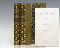
1883réf. 118143London: Chapman and Hall 1883. First edition of this highspot of African literature. Octavo 2 volumes bound in three quarters contemporary morocco over marbled boards with gilt titles and tooling to the spine in six compartments within raised gilt bands top edge gilt marbled endpapers. Published under the pseudonym 'Ralph Iron' the entire printing of this first edition has been estimated to be about 300 copies and most were destined to libraries. From the library of British-born South African financier mining magnate and politician Sir Lionel Phillips with his bookplates to the pastedowns. Lionel and Florence Phillips left South Africa a major legacy through their art collections. Florence campaigned for the founding of the Johannesburg Art Gallery and arranged its first collections including her lace collection while Lionel donated seven oils and a Rodin sculpture. Rare and with desirable provenance. The Story of an African Farm published in 1883 under the pseudonym Ralph Iron was South African author Olive Schreiner's first published novel. It was an immediate success and has become recognized as one of the first feminist novels. In writing the first great South African novel Schreiner drew on childhood memories of life on the isolated African veld to fashion a powerful indictment of the rigid Boer and English social conventions of her day. It was greeted by both praise and condemnation for its feminist views on women's status and on marriage and for its unorthodox critique of dishonesty and hypocrisy in the doctrines and practices of "respectable" Christian church people. Chapman and Hall hardcover
1706réf. M6389Paris 1706. Very Good margins extended. Size : 130x180 mm 5.125x7.125 Inches Coloring: Hand Colored Category: ; Maps Europe Portugal unknown
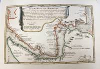
1700réf. M5178Paris 1700. Very Good. Size : 225x340 mm 8.875x13.375 Inches Coloring: Original Outline Coloring Category: Maps South America Countries; unknown
1706réf. M6386Paris 1706. Very Good margins extended. Size : 130x175 mm 5.125x6.875 Inches Coloring: Hand Colored Category: ; Maps Europe Portugal unknown
1715réf. M5226Paris 1715. Excellent. Size : 255x365 mm 10x14.375 Inches Coloring: Hand Colored Category: Maps City Maps; Maps Europe Portugal unknown
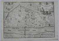
1705réf. M5143Paris 1705. Excellent. Size : 240x340 mm 9.5x13.375 Inches Coloring: Black & White Category: Maps City Maps; Maps Europe France unknown
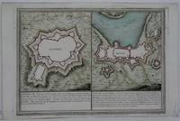
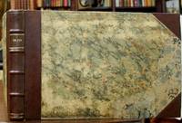
1705réf. B2350Paris: Nicolas de Fer c. 1705. Upper fore-corner of the Toulon Grenoble St. Esprit Verceil and Veue de Verue plates all repaired professionally; otherwise a very good copy text and maps are clean and crisp. Binding: Recent ½ calf with contemporary marbled boards spine in five compartments of raised bands gilt title on two endpapers renewed. With 172 engraved plates by Nicolas de Fer and 8 in-text plates including the title. Notes: Introduction a la Fortification was a famous atlas at its timefirst published in 1690-1695. The author Nicolas de Fer inherited his father’s cartography business. Being a prolific cartographer his reputation grew such that he became the official geographer of King Louis XIV of France and King Philip V of Spain. He made maps of both North America and Europe notably including maps of the War of Spanish Succession. Size: Oblong folio Illustration: With 172 engraved plates by Nicolas de Fer and 8 in-text plates including the title. Lacks 9 plates St. Malo Environs de St. Malo Gravelines Nieuport Combat de Leuse Liege Camp de Weil and Civita Vecchia; but has 5 extras not called for in the plate list Aire Hesdin Menin Batavia and Quebec. Pages: P. plate index title engraved maps and text plates. Category: Book Atlas & Cartography; Book Military Nicolas de Fer hardcover
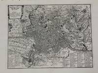
1700réf. M5227Paris c.1700. Very Good. Size : 240x310 mm 9.5x12.20 Inches Coloring: Black & White Category: Maps City Maps; Maps Europe Italy Rome unknown
1706réf. M6387Paris 1706. Very Good margins extended. Size : 130x175 mm 5.125x6.875 Inches Coloring: Hand Colored Category: ; Maps Europe Portugal unknown
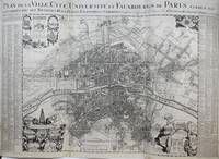
1720réf. M9651Paris: Nicolas de Fer c. 1720. Very Good backed on 19th century paper. Notes: A large-scale and detailed map of the city of Paris and its surroundings during the early 18th century. The map has ornate cartouches in all corners and indexes in the left and right margins. Nicolas de Fer 1646–1720 was a French cartographer and geographer. He also was an engraver and publisher. His work was most often praised for being beautiful and artistic. Size : 637x905 mm 25.08x35.63 Inches Coloring: Hand Colored Category: Maps City Maps; Maps Folding Maps; Maps Europe France Paris; Nicolas de Fer unknown
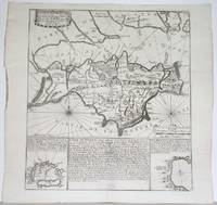
1715réf. M4751Paris 1715. Very Good slight wear at the center of the fold. Size : 350x320 mm 13.75x12.625 Inches Coloring: Black & White Category: ; Maps Europe United Kingdom unknown
1706réf. M6385Paris 1706. Very Good margins extended. Size : 115x175 mm 4.5x6.875 Inches Coloring: Hand Colored Category: ; Maps Europe Greece Macedonia unknown
1703réf. M5179Paris 1703. Excellent. Size : 230x310 mm 9x12.25 Inches Coloring: Original Outline Coloring Category: ; Maps Asia Middle East Holy Land & Palestine unknown
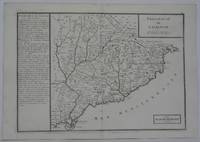
1702réf. M5130Paris 1702. Excellent. Size : 250x355 mm 9.875x14 Inches Coloring: Black & White Category: ; Maps Europe Spain unknown
1705réf. M5145Paris 1705. Excellent. Size : 230x330 mm 9x13 Inches Coloring: Black & White Category: ; Maps Europe France unknown
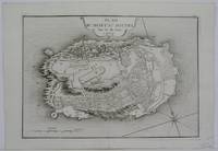
1705réf. M6202Paris 1705. Excellent. Notes: An attractive map of the city of Narva besieged by a military encampment. The Battle of Narva was an early battle in the Great Northern War fought in November of 1700. The Swedish army under Charles XII of Sweden defeated a Russian force four times its size commanded by Peter the Great. Narva marked the peak of Swedish power on the continent with Russia eventually gaining decisive victories that were able to end the conflict. Size : 230x325 mm 9x12.75 Inches Coloring: Hand Colored Category: ; Maps Europe Estonia Latvia; Maps City Maps; Maps Military unknown
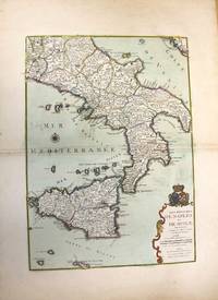
1708réf. M10188Paris: chez Benard c.1708. Very Good. Notes: A detailed map of Southern Italy and Sicily also shows Malta. With wide margins and a pair of coats of arms is placed on top of the cartouche. Size : 560x402 mm 22.05x15.83 Inches Coloring: Original Hand Coloring Category: Maps Europe Italy; Maps Mediterranean Islands; chez Benard unknown
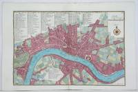
1705réf. M4627Paris 1705. Very Good. Size : 230x340 mm 9x13.375 Inches Coloring: Hand Colored Category: Maps City Maps; Maps Europe United Kingdom England London unknown
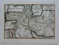
1703réf. M5176Paris 1703. Excellent. Size : 230x335 mm 9x13.125 Inches Coloring: Original Outline Coloring Category: Maps Asia Near East Turkey; Maps Asia Middle East Iran Iraq; Maps Asia Middle East Caucasus.; unknown
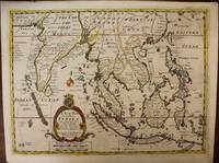
1700réf. M6975London c. 1700. Very Good. Notes: A late 17th Century map of South East Asia by Edward Wells based upon the previous work by De Fer. The cartouche has the dedication in the coat of arms to the Duke of Gloucester. Size : 367x487 mm 14.45x19.17 Inches Coloring: Original Outline Coloring Category: Maps Asia South East; Maps Asia Central India & Sri Lanka / Ceylon; unknown