Ferro, AntoninoBiblio.com

2 112 résultats
2011réf. DADAX0415555035Routledge 2011-07-07. 1. paperback. New. 6.14x0.53x9.21. Buy with confidence. Excellent Customer Service & Return policy. Routledge paperback
2008réf. DADAX0415429927Routledge 2008-11-12. 1. paperback. New. 6.15x0.55x9.22. Buy with confidence. Excellent Customer Service & Return policy. Routledge paperback
1997réf. DADAX0415140072Routledge 1997-02-13. 1. hardcover. New. 6.14x0.94x9.21. Buy with confidence. Excellent Customer Service & Return policy. Routledge hardcover
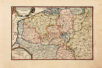
1717réf. 78864Paris: 1717. Map of the Catholic Low Countries or current day Belgium. Published in "Atlas Curieux ou le Monde". Copper engraving. Hand coloured. Sheet size: 274 x 405 mm Plate size: 216 x 326 mm Very good condition. unknown
2002réf. DADAX1583912223Routledge 2002-04-11. 1. paperback. New. 6.40x0.52x9.18. Buy with confidence. Excellent Customer Service & Return policy. Routledge paperback
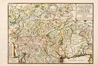
1705réf. 76910Paris c. 1705. Nicolas de Fer inherited a respectable cartographic business in Paris from his parents and turned it into a flourishing enterprise by the end of the seventeenth century. De Fer became "Geographer of his Catholic Majesty and his Highness the Dauphine". This wonderful map of northern Italy and of the Tirol is from his "Atlas Curieux ou Le Monde.". The region covered is highly mountainous and well forested. The map features Lake Garda in the south to Kufstein and Innsbrück in the north The Gulf of Venice and Friuli. Size: 275 x 400 mm. Coloured copperplate engraving. Very good condition. unknown
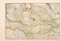
1705réf. 76949Paris: c. 1705. Nicolas de Fer's excellent map of the region of northern Italy covering Mantua Cremona Brescia Verona Parma and Mirandola. Major cities and towns are highlighted in red; rivers roads lakes and hills are also engraved. From the "Atlas Curieux ou Le Monde". Size: 270 x 400 mm. Coloured copperplate engraving. Good condition. unknown
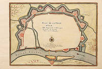
1705réf. 78550Paris: 1705. A beautiful city plan of Ulm in the federal German state of Baden-Württemberg. Copper engraving. Hand coloured. Size: 277 x 403 mm Good condition. unknown
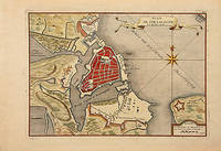
1716réf. 78549Paris: 1716. A beautiful city plan of Stralsund in Germany just off the island of Rugen in the Baltic Sea. Copper engraving. Hand coloured. Sheet size: 275 x 404 mm Plate size: 230 x 332 mm Good condition. unknown
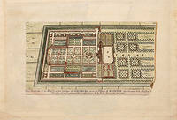
1705réf. 78538Paris: 1705. Nicolas de Fer's excellent plan of the Nieuburg House where the treaty of Ryswick in the Netherlands was signed in 1697 and not 1705 as stated in the print. From the "Atlas Curieux ou Le Monde". Copper engraving. Hand colouring. Size: 275 x 400 mm Good condition. unknown
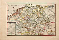
1705réf. 78548Paris: 1705. Nicolas de Fer's excellent map of the German states. From the "Atlas Curieux ou Le Monde". Copper engraving. Hand colouring. Size: 274 x 405 mm Good condition. unknown
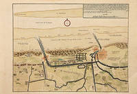
1717réf. 78680Paris: c. 1717. Map of the towns of Dunkirk and Mardick showing the new canal. Published in "Atlas Curieux ou le Monde". Copper engraving. Hand coloured. Size: 275 x 398 mm Very good condition. unknown
1997réf. SONG0415140080Routledge 1997-02-13. 1. paperback. Used: Good. 6.15x0.94x9.22. Buy with confidence. Excellent Customer Service & Return policy. Routledge paperback
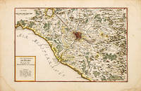
1700réf. 70256Paris c. 1700-05. Nicolas de Fer was the son of Antoine de Fer a Parisian map and print seller. This map from the Atlas Curieux shows the environs of Rome. At the time of publication de Fer was the official cartographer to the French Dauphin but he later became cartographer to both the French and Spanish kings. Size: 290 x 440 mm. Copperplate engraving with later hand colour. Good condition some slight toning and creasing. unknown
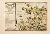
1700réf. 70272Paris 1700-05. Pozzoli is a province of Naples and the main city of the Phlegrean Peninsula. It lies some two miles from the once fashionable resort of Baia. The map is well executed and detailed. Nicolas de Fer was the son of Antoine de Fer a Parisian map and print seller. This map from the Atlas Curieux. At the time of publication de Fer was the official cartographer to the French Dauphin but he later became cartographer to both the French and Spanish kings. Size: 270 x 405 mm. Copperplate engraving with later hand colour. Good condition. Slightly toned. unknown
2011réf. SONG0415555035Routledge 2011-07-07. 1. paperback. Used: Good. 6.14x0.53x9.21. Buy with confidence. Excellent Customer Service & Return policy. Routledge paperback
réf. SONG1558061452Brand: Iron Crown Enterprises 0000-00-00. paperback. Used: Good. 8.50x0.50x11.25. Buy with confidence. Excellent Customer Service & Return policy. Brand: Iron Crown Enterprises paperback
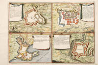
1705réf. 65687Paris 1705. An unusual and interesting plan of the fortifications of four villages in Portugal. Published in the 'Atlas Curieux ou Le Monde'. Size: 275 x 410 mm. Copperplate engraving with later hand colour. Good condition. unknown
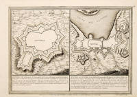
1705réf. 65686Paris. 1705. An interesting and unusual map depicting the basic fortifications of two Portuguese towns. Published in the 'Atlas Curieux ou Le Monde'. Size: 275 x 395 mm. Copperplate engraving. Fine condition. unknown
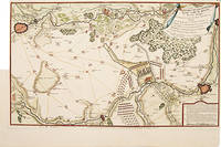
1717réf. 52957Paris. 1717. Detailed map of a battle in the July of 1712 with troop placementsand positions on the map. An explanation of the battle at lower right. Accompanying text on reverse. Published in de Fer's Atlas Curieux ou Le Monde. Copper engraving. Very good condition. Upper left top and right hand margin have been trimmed close to edge of plate Later colouring. Size: 52.5 x 31 cm. unknown
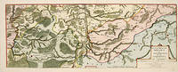
1705réf. 52950Paris. 1705. An attractive map of part of Belgium showing forests and river valleys. 'de Fer's maps are popular despite or maybe because of their rather flamboyant decoration' Moreland & Bannister p130. Title at lower right. Atlas Curieux ou Le Monde. Copper engraving. Fine condition Later colouring. Size: 59 x 22 cm. Moreland and Bannister unknown
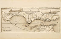
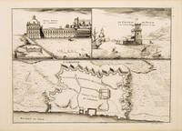
1710réf. 53828Atlas Curieux ou le Monde. c. 1710. The lower half of this attractive engraving shows the mouth of the Tagus from the sea to Lisbon showing the coastline settlement and fortification in detail. Title at top centre flanked by two views- To the left the 'Palais Royal de Lisbonne' and to the right 'Le Chateau de Belem'. Copper engraving. Fine condition. Uncoloured. Size: 405 x 175 mm. 16 x 7 inches. unknown
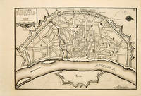
1717réf. 53083Atlas Curieux ou le Monde. Paris 1717. Plan of Cologne with north to the right showing fortifications and old town. Title at top left. Includes accompanying text Copper engraving. Excellent condition good margins. Uncoloured. Size: 34.8 x 24 cm. 13½ x 9½ inches unknown
1710réf. 53827Atlas Curieux ou le Monde. c. 1710. The lower half of this attractive engraving shows a map of the fortifications of Lisbon. The upper half has two views- To the left the 'Palais Royal de Lisbonne' and to the right 'Le Chateau de Belem'. Copper engraving. Fine condition. Uncoloured. Size: 330 x 240 mm. 13 x 9½ inches. unknown
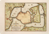
1705réf. 527391705. A plan of the town fortifications and surrounding area Copper engraving. Fine condition Later colouring. Size: 34 x 23 cm. 13½ x 9 inches unknown