Iron Crown EnterprisesBiblio.com

11.397 Ergebnisse
Best.-Nr. ANAIS-1558061649Berkley Pub Group. paperback. Good. 0x0x0. Buy with confidence. Excellent Customer Service & Return policy. Berkley Pub Group paperback
Best.-Nr. ANAIS-1558061452Berkley Pub Group. paperback. Good. 8.6x0.6x11.3. Buy with confidence. Excellent Customer Service & Return policy. Berkley Pub Group paperback
Best.-Nr. ANAIS-0300134762The Fruitmarket Gallery. hardcover. Good. 0x0x0. Buy with confidence. Excellent Customer Service & Return policy. The Fruitmarket Gallery hardcover
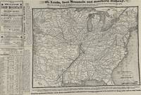
1878Best.-Nr. 69740Cincinnati Ohio: St. Louis Iron Mountain and Southern Railway Company 1878. Single sheet folded. 32 x 48 cm. Map 26 x 36 cm. Includes rates of fare "in effect May 1st 1878."/ Shows stations along the railroad and connecting lines./ Text on verso: "Eastern Missouri and Arkansas."/ Relief shown by hachures./ Stamped on verso: Henry H. Hannan land agent Swan Creek Ohio. Some erosion at fold affecting some lettering with loss of a few words of text. Map is unaffected. St. Louis, Iron Mountain, and Southern Railway Company] unknown
1990Best.-Nr. mon0000147516Iron Crown Enterprises 1990-09-01. Paperback. Acceptable. 0.7300 in x 8.4300 in x 5.8500 in. Some mild staining to the edges. Iron Crown Enterprises paperback
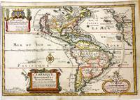
1717Best.-Nr. M11008Paris: Chez l'autheur dans l'Isle du Palais sur le Quay de l'Orloge a la Sphere Royale 1717. Very Good. Notes: Beautiful example of the map of the Americas by renowned 17th century French cartographer Nicolas De Fer. Size : 225x337 mm 8.86x13.27 Inches Coloring: Hand Colored Category: Maps North America; Maps South America Countries; Chez l'autheur dans l'Isle du Palais sur le Quay de l'Orloge a la Sphere Royale unknown
Best.-Nr. B9781022307193Paperback / softback. New. paperback
Best.-Nr. A9780367137090Paperback / softback. New. paperback
Best.-Nr. A9780415372053Paperback / softback. New. Examines psychoanalysis from two perspectives - as a cure for psychic suffering and as a series of stories told between patient and analyst. This book draws on and develops Bion's theories to present a different perspective on subjects such as: psychoanalysis as a particular form of literature; delusion and hallucination; and more. paperback
Best.-Nr. DADAX0415813441Routledge 2015-02-19. 1. paperback. New. 6.00x0.60x8.90. Buy with confidence. Excellent Customer Service & Return policy. Routledge paperback
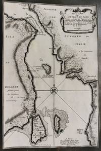
1700Best.-Nr. M10800Paris 1700. Very Good margins are trimmed. Notes: Map of Oresund strait between Denmark and Sweden. Size : 328x218 mm 12.91x8.58 Inches Coloring: Black & White Category: Maps Europe Scandinavia Countries; unknown
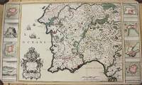
1704Best.-Nr. M10805Paris: St. Gaspar Baillieu 1704. Very Good backed on acid free tissue paper for long term preservation. Notes: Fine large scale map focused on Southern Portugal and Southern Spain. The map is surrounded by inset maps of Olivenca Castello Ferreire Aronches Badaioz Lisbonne Setubal Chateau St. Iulien Evora. Size : 561x940 mm 22.09x37.01 Inches Coloring: Original Hand Coloring Category: Maps Europe Spain; Maps Europe Portugal; St. Gaspar Baillieu unknown
1916Best.-Nr. 2210162Roanoke VA: Virginia Bridge & Iron Co. 1916. 1st Edition . Flexible leather. Good. 12mo - over 6¾ - 7¾" tall. See photos for condition details. Original flexible leather handbook produced by theVirginia Bridge & Iron Company. Brown leather exterior with gilt to front and spine. Exterior shows edge and corner chips/wear and chipping is also present at top and bottom of spine. Interior binding is good no hinge issues nothing torn or loose. Previous owners name is written on front pastedown and it was also found two more times on interior pages where it was written along the top edge. The blank pages in the back along with the graph paper pages are all handwriting free. Only handwriting found in book were the three signatures in the number 238 written along the page edge of the copyright page. This is the first edition which shows no copyright or print date other than the serial designation of 9-16 September 1916. This is an extremely rare publication with only a few third editions surviving this one being the first. Virginia Bridge & Iron Co. hardcover
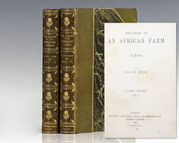
1883Best.-Nr. 118143London: Chapman and Hall 1883. First edition of this highspot of African literature. Octavo 2 volumes bound in three quarters contemporary morocco over marbled boards with gilt titles and tooling to the spine in six compartments within raised gilt bands top edge gilt marbled endpapers. Published under the pseudonym 'Ralph Iron' the entire printing of this first edition has been estimated to be about 300 copies and most were destined to libraries. From the library of British-born South African financier mining magnate and politician Sir Lionel Phillips with his bookplates to the pastedowns. Lionel and Florence Phillips left South Africa a major legacy through their art collections. Florence campaigned for the founding of the Johannesburg Art Gallery and arranged its first collections including her lace collection while Lionel donated seven oils and a Rodin sculpture. Rare and with desirable provenance. The Story of an African Farm published in 1883 under the pseudonym Ralph Iron was South African author Olive Schreiner's first published novel. It was an immediate success and has become recognized as one of the first feminist novels. In writing the first great South African novel Schreiner drew on childhood memories of life on the isolated African veld to fashion a powerful indictment of the rigid Boer and English social conventions of her day. It was greeted by both praise and condemnation for its feminist views on women's status and on marriage and for its unorthodox critique of dishonesty and hypocrisy in the doctrines and practices of "respectable" Christian church people. Chapman and Hall hardcover
1706Best.-Nr. M6389Paris 1706. Very Good margins extended. Size : 130x180 mm 5.125x7.125 Inches Coloring: Hand Colored Category: ; Maps Europe Portugal unknown
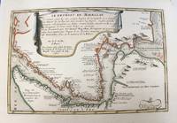
1700Best.-Nr. M5178Paris 1700. Very Good. Size : 225x340 mm 8.875x13.375 Inches Coloring: Original Outline Coloring Category: Maps South America Countries; unknown
1706Best.-Nr. M6386Paris 1706. Very Good margins extended. Size : 130x175 mm 5.125x6.875 Inches Coloring: Hand Colored Category: ; Maps Europe Portugal unknown
1715Best.-Nr. M5226Paris 1715. Excellent. Size : 255x365 mm 10x14.375 Inches Coloring: Hand Colored Category: Maps City Maps; Maps Europe Portugal unknown
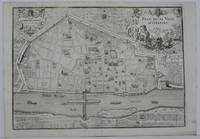
1705Best.-Nr. M5143Paris 1705. Excellent. Size : 240x340 mm 9.5x13.375 Inches Coloring: Black & White Category: Maps City Maps; Maps Europe France unknown
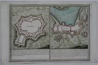
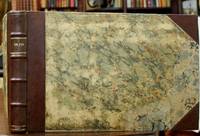
1705Best.-Nr. B2350Paris: Nicolas de Fer c. 1705. Upper fore-corner of the Toulon Grenoble St. Esprit Verceil and Veue de Verue plates all repaired professionally; otherwise a very good copy text and maps are clean and crisp. Binding: Recent ½ calf with contemporary marbled boards spine in five compartments of raised bands gilt title on two endpapers renewed. With 172 engraved plates by Nicolas de Fer and 8 in-text plates including the title. Notes: Introduction a la Fortification was a famous atlas at its timefirst published in 1690-1695. The author Nicolas de Fer inherited his father’s cartography business. Being a prolific cartographer his reputation grew such that he became the official geographer of King Louis XIV of France and King Philip V of Spain. He made maps of both North America and Europe notably including maps of the War of Spanish Succession. Size: Oblong folio Illustration: With 172 engraved plates by Nicolas de Fer and 8 in-text plates including the title. Lacks 9 plates St. Malo Environs de St. Malo Gravelines Nieuport Combat de Leuse Liege Camp de Weil and Civita Vecchia; but has 5 extras not called for in the plate list Aire Hesdin Menin Batavia and Quebec. Pages: P. plate index title engraved maps and text plates. Category: Book Atlas & Cartography; Book Military Nicolas de Fer hardcover
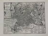
1700Best.-Nr. M5227Paris c.1700. Very Good. Size : 240x310 mm 9.5x12.20 Inches Coloring: Black & White Category: Maps City Maps; Maps Europe Italy Rome unknown
1706Best.-Nr. M6387Paris 1706. Very Good margins extended. Size : 130x175 mm 5.125x6.875 Inches Coloring: Hand Colored Category: ; Maps Europe Portugal unknown
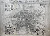
1720Best.-Nr. M9651Paris: Nicolas de Fer c. 1720. Very Good backed on 19th century paper. Notes: A large-scale and detailed map of the city of Paris and its surroundings during the early 18th century. The map has ornate cartouches in all corners and indexes in the left and right margins. Nicolas de Fer 1646–1720 was a French cartographer and geographer. He also was an engraver and publisher. His work was most often praised for being beautiful and artistic. Size : 637x905 mm 25.08x35.63 Inches Coloring: Hand Colored Category: Maps City Maps; Maps Folding Maps; Maps Europe France Paris; Nicolas de Fer unknown
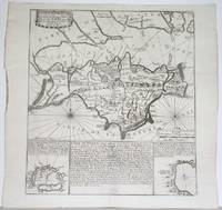
1715Best.-Nr. M4751Paris 1715. Very Good slight wear at the center of the fold. Size : 350x320 mm 13.75x12.625 Inches Coloring: Black & White Category: ; Maps Europe United Kingdom unknown
1706Best.-Nr. M6385Paris 1706. Very Good margins extended. Size : 115x175 mm 4.5x6.875 Inches Coloring: Hand Colored Category: ; Maps Europe Greece Macedonia unknown