N de FerBiblio.com
N de FerBiblio.com
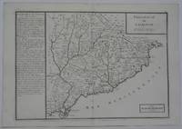
Principaute de Catalogne
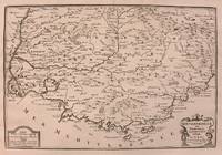
1702réf. M5130Paris 1702. Excellent. Size : 250x355 mm 9.875x14 Inches Coloring: Black & White Category: ; Maps Europe Spain unknown
11 397 résultats
1703réf. M5179Paris 1703. Excellent. Size : 230x310 mm 9x12.25 Inches Coloring: Original Outline Coloring Category: ; Maps Asia Middle East Holy Land & Palestine unknown
1702réf. M5130Paris 1702. Excellent. Size : 250x355 mm 9.875x14 Inches Coloring: Black & White Category: ; Maps Europe Spain unknown
1705réf. M5145Paris 1705. Excellent. Size : 230x330 mm 9x13 Inches Coloring: Black & White Category: ; Maps Europe France unknown
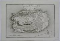
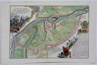
1705réf. M6202Paris 1705. Excellent. Notes: An attractive map of the city of Narva besieged by a military encampment. The Battle of Narva was an early battle in the Great Northern War fought in November of 1700. The Swedish army under Charles XII of Sweden defeated a Russian force four times its size commanded by Peter the Great. Narva marked the peak of Swedish power on the continent with Russia eventually gaining decisive victories that were able to end the conflict. Size : 230x325 mm 9x12.75 Inches Coloring: Hand Colored Category: ; Maps Europe Estonia Latvia; Maps City Maps; Maps Military unknown
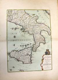
1708réf. M10188Paris: chez Benard c.1708. Very Good. Notes: A detailed map of Southern Italy and Sicily also shows Malta. With wide margins and a pair of coats of arms is placed on top of the cartouche. Size : 560x402 mm 22.05x15.83 Inches Coloring: Original Hand Coloring Category: Maps Europe Italy; Maps Mediterranean Islands; chez Benard unknown
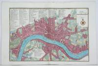
1705réf. M4627Paris 1705. Very Good. Size : 230x340 mm 9x13.375 Inches Coloring: Hand Colored Category: Maps City Maps; Maps Europe United Kingdom England London unknown
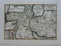
1703réf. M5176Paris 1703. Excellent. Size : 230x335 mm 9x13.125 Inches Coloring: Original Outline Coloring Category: Maps Asia Near East Turkey; Maps Asia Middle East Iran Iraq; Maps Asia Middle East Caucasus.; unknown
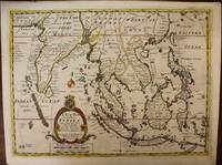
1700réf. M6975London c. 1700. Very Good. Notes: A late 17th Century map of South East Asia by Edward Wells based upon the previous work by De Fer. The cartouche has the dedication in the coat of arms to the Duke of Gloucester. Size : 367x487 mm 14.45x19.17 Inches Coloring: Original Outline Coloring Category: Maps Asia South East; Maps Asia Central India & Sri Lanka / Ceylon; unknown
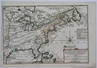
1705réf. M4344Paris 1705. Excellent. Notes: This decorative map focuses on the French possessions in North America. The treatment of French Florida is intriguing. The map shows the United States of America and parts of Southern Canada East of the Mississippi river. "Territorial expansion of New France had reached the Mississipi River with the establishment of the first European settlement at Fort Maurepas by Pierre Le Moyne d'Iberville in 1699 sixteen years after La Salle had reached the mouth of the river. This attractive map from 'L'Atlas Curieux ou le Monde' paris 1705 although containing geographical errors has many interesting historical notes" -The Macdonald Stewart Foundation Size : 232x342 mm 9.125x13.5 Inches Coloring: Hand Colored in Outline Reference: The Macdonald Stewart Foundation "La Decouverte du Monde Cartographes et Cosmographes" Map # 44; McCorkle 702.2 Category: ; Maps North America Great Lakes; Maps Canada; Maps Canada East; Maps United States East; Maps United States South unknown
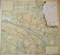
1735réf. M7483Paris c.1735. Very Good;. Notes: Large scale decorative 18th century map of Paris. Top right title in a cartouche adorns a fountain spewing water referring to the establishment of the network of fountains in the capital. Size : 565x590 mm 22.24x23.23 Inches Coloring: Hand Colored Reference: Jean Boutier #212A Category: Maps Europe France Paris;Maps City Maps; unknown
1716réf. M5138Paris 1716. Excellent. Size : 235x325 mm 9.25x12.75 Inches Coloring: Black & White Category: ; Maps Europe Germany unknown
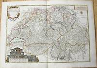
1764réf. M10199Paris c. 1764. Very Good. Notes: An important and decorative map of Switzerland published in mid 18th century. The map originally was drawn by De Fer and later updated and improved by Desnos. Size : 485x670 mm 19.09x26.38 Inches Coloring: Hand Colored Category: Maps Europe Switzerland; unknown
1705réf. M5243Paris 1705. Excellent. Size : 225x320 mm 8.875x12.625 Inches Coloring: Hand Colored Category: Maps City Maps; Maps Europe Benelux unknown
1742réf. M4678Paris 1742. Very Good. Size : 575x430 mm 22.625x16.875 Inches Coloring: Original Outline Coloring Category: ; Maps Europe Spain; Maps Europe Portugal unknown
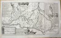
1705réf. M10253Paris 1705. Very Good. Notes: Map showing the Canal de Briare and the Canal D'Orleans with indexes and descriptive notes on both canals. Size : 385x651 mm 15.16x25.63 Inches Coloring: Black & White Category: Maps Europe France; unknown
1705réf. M5280Paris 1705. Excellent. Size : 225x340 mm 8.875x13.375 Inches Coloring: Hand Colored Category: ; Maps Europe Estonia Latvia unknown
1705réf. M5137Paris 1705. Excellent. Size : 235x350 mm 9.25x13.75 Inches Coloring: Black & White Category: Maps City Maps; Maps Europe Germany unknown
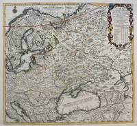
1711réf. M4915Paris 1711. Very Good upper and lower margin have been extended. Laid on acid free paper for long term preservation. Notes: Stolen Size : 520x565 mm 20.5x22.25 Inches Coloring: Original Outline Coloring Category: ; Maps Europe Poland Lithuania; Maps Europe Ukraine unknown
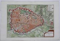
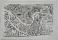
1705réf. M5136Paris 1705. Excellent. Size : 235x350 mm 9.25x13.75 Inches Coloring: Black & White Category: Maps City Maps; Maps Europe France unknown
1705réf. M4703Paris 1705. Excellent. Size : 250x355 mm 9.875x14 Inches Coloring: Black & White Category: ; Maps Europe Germany unknown
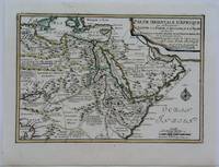
1703réf. M5175Paris 1703. Excellent. Size : 225x325 mm 8.875x12.75 Inches Coloring: Original Outline Coloring Category: Maps Africa North Egypt; Maps Asia Middle East Arabia unknown
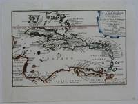
1702réf. M5228Paris 1702. Very Good small tear in the upper left margin professionally repaired not affecting the image. Size : 225x335 mm 8.875x13.125 Inches Coloring: Hand Colored in Outline Category: ; Maps West Indies Whole unknown
1705réf. M5140Paris 1705. Excellent. Size : 230x345 mm 9x13.625 Inches Coloring: Black & White Category: ; Maps Europe France unknown
1705réf. M5239Paris 1705. excellent. Notes: With a decorative water mark Size : 255x355 mm 10x14 Inches Coloring: Hand Colored Category: Maps City Maps; Maps Europe Portugal unknown
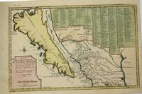
1705réf. M5240Paris c.1705. Very Good. Notes: “California with indented northern coast and labeled: Californias o Carolinas. New Mexico is shown covered with engraved key at may top right. Includes Father Kino’s Place name Co. S. Francisco Xavier at California’s northern tip” McLaughlin The title Ba. d. las 11000Virgenes is introduced for the first time. In the Southwest there are names such as Santa Fe Acoma and Casa Grande. The key covers 314 different places and their locations. Size : 230x345 mm 9x13.625 Inches Coloring: Hand Colored Reference: McLaughlin 134; Tooley Amer 62; Wagner 462. Category: Maps United States West California; Maps Central America Mexico; unknown