FER, Nicolas deBiblio.com
12 060 résultats
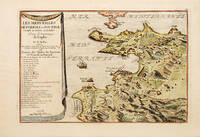
1700réf. 70272Paris 1700-05. Pozzoli is a province of Naples and the main city of the Phlegrean Peninsula. It lies some two miles from the once fashionable resort of Baia. The map is well executed and detailed. Nicolas de Fer was the son of Antoine de Fer a Parisian map and print seller. This map from the Atlas Curieux. At the time of publication de Fer was the official cartographer to the French Dauphin but he later became cartographer to both the French and Spanish kings. Size: 270 x 405 mm. Copperplate engraving with later hand colour. Good condition. Slightly toned. unknown
réf. SONG1599619431Used: Good unknown
réf. SONG071486109XUsed: Good unknown
réf. SONG0785145575Used: Good unknown
réf. SONG0671016962Used: Good unknown
réf. SONG0751400629Used: Good unknown
réf. SONG085635659XUsed: Good unknown
réf. SONG0801829046Used: Good unknown
réf. SONG187856109XUsed: Good unknown
réf. SONG0815804407Used: Good unknown
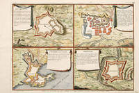
1705réf. 65687Paris 1705. An unusual and interesting plan of the fortifications of four villages in Portugal. Published in the 'Atlas Curieux ou Le Monde'. Size: 275 x 410 mm. Copperplate engraving with later hand colour. Good condition. unknown
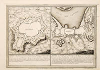
1705réf. 65686Paris. 1705. An interesting and unusual map depicting the basic fortifications of two Portuguese towns. Published in the 'Atlas Curieux ou Le Monde'. Size: 275 x 395 mm. Copperplate engraving. Fine condition. unknown
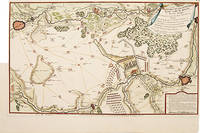
1717réf. 52957Paris. 1717. Detailed map of a battle in the July of 1712 with troop placementsand positions on the map. An explanation of the battle at lower right. Accompanying text on reverse. Published in de Fer's Atlas Curieux ou Le Monde. Copper engraving. Very good condition. Upper left top and right hand margin have been trimmed close to edge of plate Later colouring. Size: 52.5 x 31 cm. unknown
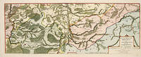
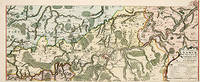
1705réf. 52950Paris. 1705. An attractive map of part of Belgium showing forests and river valleys. 'de Fer's maps are popular despite or maybe because of their rather flamboyant decoration' Moreland & Bannister p130. Title at lower right. Atlas Curieux ou Le Monde. Copper engraving. Fine condition Later colouring. Size: 59 x 22 cm. Moreland and Bannister unknown
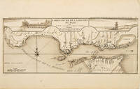
1710réf. 53828Atlas Curieux ou le Monde. c. 1710. The lower half of this attractive engraving shows the mouth of the Tagus from the sea to Lisbon showing the coastline settlement and fortification in detail. Title at top centre flanked by two views- To the left the 'Palais Royal de Lisbonne' and to the right 'Le Chateau de Belem'. Copper engraving. Fine condition. Uncoloured. Size: 405 x 175 mm. 16 x 7 inches. unknown
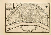
1717réf. 53083Atlas Curieux ou le Monde. Paris 1717. Plan of Cologne with north to the right showing fortifications and old town. Title at top left. Includes accompanying text Copper engraving. Excellent condition good margins. Uncoloured. Size: 34.8 x 24 cm. 13½ x 9½ inches unknown
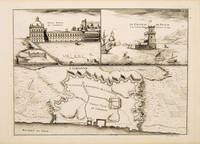
1710réf. 53827Atlas Curieux ou le Monde. c. 1710. The lower half of this attractive engraving shows a map of the fortifications of Lisbon. The upper half has two views- To the left the 'Palais Royal de Lisbonne' and to the right 'Le Chateau de Belem'. Copper engraving. Fine condition. Uncoloured. Size: 330 x 240 mm. 13 x 9½ inches. unknown
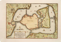
1705réf. 527391705. A plan of the town fortifications and surrounding area Copper engraving. Fine condition Later colouring. Size: 34 x 23 cm. 13½ x 9 inches unknown
1717réf. 52951Paris. 1717. An attractive map of part of Belgium showing forests and river valleys. 'de Fer's maps are popular despite or maybe because of their rather flamboyant decoration' Moreland & Bannister p130. Title at lower right. Atlas Curieux ou Le Monde. Copper engraving. Fine condition Original colour. Size: 59 x 23 cm. unknown
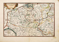
1702réf. 523961702. Copper engraving. Later colouring. Size: 33 x 22 cm. 13 x 8½ inches unknown
réf. 51721045like new. unknown
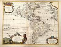
1705réf. M11362Paris c.1705. Very Good. Notes: Detailed French map of the Americas with decorative cartouches. Nicolas de Fer 1646–1720 was a French cartographer and geographer. He also was an engraver and publisher. His work was most often praised for being beautiful and artistic. Size : 464x600 mm 18.27x23.62 Inches Coloring: Hand Colored Category: Maps North America; Maps South America Continent; unknown
réf. 4104710-nnew. unknown
réf. 46417811like new. unknown