11 397 résultats
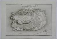
1716réf. M5138Paris 1716. Excellent. Size : 235x325 mm 9.25x12.75 Inches Coloring: Black & White Category: ; Maps Europe Germany unknown
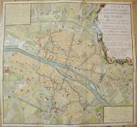
1735réf. M7483Paris c.1735. Very Good;. Notes: Large scale decorative 18th century map of Paris. Top right title in a cartouche adorns a fountain spewing water referring to the establishment of the network of fountains in the capital. Size : 565x590 mm 22.24x23.23 Inches Coloring: Hand Colored Reference: Jean Boutier #212A Category: Maps Europe France Paris;Maps City Maps; unknown
1705réf. M5145Paris 1705. Excellent. Size : 230x330 mm 9x13 Inches Coloring: Black & White Category: ; Maps Europe France unknown
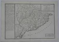
1702réf. M5130Paris 1702. Excellent. Size : 250x355 mm 9.875x14 Inches Coloring: Black & White Category: ; Maps Europe Spain unknown
1706réf. M6389Paris 1706. Very Good margins extended. Size : 130x180 mm 5.125x7.125 Inches Coloring: Hand Colored Category: ; Maps Europe Portugal unknown
1706réf. M6387Paris 1706. Very Good margins extended. Size : 130x175 mm 5.125x6.875 Inches Coloring: Hand Colored Category: ; Maps Europe Portugal unknown
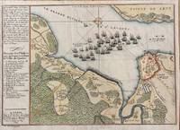
1694réf. M7337Paris: N. de Fer c.1694. Very Good; . Notes: According to Kershaw this map was originally published in "Les Forces De L'Europe" "In August 1690 Sir William Phips left Boston to attack and capture Quebec. Previous military success at Port Royal had given the English an excess of confidence which Phips fully exploited in planning his expedition against Quebec but which quickly evaporated when the under-equipped force discovered the extent of the defenses at Quebec. The operation was disastrous and the English struggled back to Boston losing a number of ships on the way. The battle lines of the English fleet and the details of the French defences were recorded by Villenuve in manuscript form which were subsequently the source of a sequence of printed maps." Kershaw Size : 209x303 mm 8.23x11.93 Inches Coloring: Hand Colored Reference: Kershaw 279 Category: Maps Canada East Quebec Quebec City; Maps City Maps; N. de Fer unknown
1909Very Good French In contemporary red cloth bdg. 3 in 1. 4to (28 x 20 cm). In French. 85, 56, 14 p. 66 protocol documents and Turkish - Russian correspondence. Diplomatic correspondence exchanges between the Imperial Ottoman government and the Imperial Russian Embassy in Constantinople. Considerations concerning the dispute between the Ottoman Empire government and the Russian Empire. With regard to the indemnity to be paid to the Russian subjects for the damage suffered by them during the War of 1877. And includes
1705réf. R300113009A PARIS CHEZ L'AUTEUR DANS L'ISLE DU PALAIS A LA SPHERE ROYALE. 1705. In-4. Cartonné. Etat d'usage, Plats abîmés, Dos satisfaisant, Intérieur frais. Atlas comportant 18 cartes en noir et blanc et 18 pages de texte (textes sur deux colonnes) - DESCRIPTIONS DES CARTES : Correspondance du globe terrestre a la sphère céleste situation des habitans du monde des cercles de longitude et de latitude et des diverses positions de la sphère - carte générale du globe terrestre et aquatiques ou mappemonde en deux plans hémisphere - L'Europe dressée sur diverse relations - L'Asie dressée sur divers relations - L'Afrique dressez sur les dernières relations - L'Amérique Méridionale - L'Amérique septentrionale et les terres polaires artiques - La France avec des acquisitions jusqu'a l'année 1705 - Les environs de Paris - Les XVII Provinces des Païs Bas divisées en Provinces Unies en Païs Bas catholiq et en Païs Bas François - Les Isles Britanniques ou sont les Royaumes d'Angleterre d'Escosse et d'Irlande avec les costes septentrionales de France et celles des Païs Bas - Suede Norvegue et Dannemarck - Allemagne divisée en dix cercles dressées sur les derniers memoires - Les Estats de la couronne de Pologne - Estats du Grand Duc de Moscovie suivant les derniere relations - Hongrie ou partie sepentrionale de la Turquie en Europe - L'Espagne divisée en Galice Asturies Biscaye Navarre Leon Vielle et Nouvelle Castille Arragon Andalousie Mursi Valence et Catalogne avec les Isles Majorque Minorque et Yvica - L'Italie divisée en ses principaux Estats - plats cartonnés - coins frottés - annotations sur la page de garde - 10 photos disponibles.. . . A l'italienne. Classification Dewey : 840.05-XVIII ème siècle
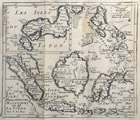
1678réf. 62465copper engraving. EXTREMELY RARE map from "Méthode pour apprendre facilemente la Géographie …par M. Robbe chez Henri van Bulderen…. 4th or earlier edition published in Paris; it is the basis for other later versions which do not show the name "N. de Fer" in the cartouche i.e. by Peeters and Afferden. Reference: Walter Japan OAG 51 - Quirino p. 87 knows only Peeters; Koeman: Pee 1 vol.III Peeters Koeman I AFF 1; Bonacker 27; Bagrow/Skelton 466 all Afferden. Condition: folds as issued slight offsetting stain on left margin not into plate; paper toning. published in Paris.
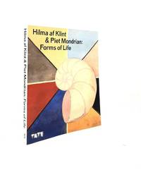
réf. 197945Tate Publishing 2023. 4to. Original pictorial card covers softback VG. Pp. 240 with coloured and b&w illus throughout no inscriptions. Tate Publishing, 2023 unknown
1984DISPONIBILITÀ GARANTITA AL 99%; SPEDIZIONE ENTRO 12 ORE DALL'ORDINE. OTTIME CONDIZIONI, LIEVISSIMI SEGNI DEL TEMPO. Descrizione bibliografica Titolo: Il peltro Collana: Volume 4 di Elite. Arti e Stili Autore: Nada Boschian Editore: Milano: Fabbri, 1984 Lunghezza: 153 pagine; 20 cm Soggetti: Storia, Metalli, Peltri, Arte, Cultura, Botteghe, Maestri, Leghe, Stagno, Rame, Ottone, Ferro, Piombo, Bronzo, Bismuto, 200 gradi, Temperatura di fusione, Origini, Corporazioni delle arti e dei mestieri, Crogiolo, Smerigliatura, Venezia, Mariegola dei Peltrai, Ossidazione, Miliazia, Lavorazione artistica, Artigianato, Accordi dei Garzoni, Antimonio, Lucentezza, Punzoni, Galvanoplastica, Collezionismo, Argento tibetano, Europa, Germania, Norimberga, Didascalie, Bibliografia, Divulgazione, History, Metals, Pewter, Art, Culture, Workshops, Masters, Alloys, Tin, Copper, Brass, Iron, Lead, Bronze, Bismuth, 200 degrees, Melting Point, Origins, Guilds of arts and crafts, Crucible, Grinding, Venice, Oxidation, Miliazia, Artistic workmanship, Handicrafts, Antimony, Gloss, Punches, Electroplating, Collecting, Tibetan silver, Europe, Germany, Nuremberg, Captions, Bibliography, Disclosure
1908réf. 25992Paris Octave Doin 1908 In-12 cachets de bibliothèque annulés - Inscription de la Bibliothèque au dos 315 pp - XII , un cahier légèrement déboité
1908Reliure moderne. 316 pages.
réf. 17318Paris : La Quinzaine littéraire, 1967 - journal agrafé au format 26 x 34 cm sous couverture illustrée en couleurs, 32 pages illustrées en noir - bon état -
2009réf. 32521Fides Couverture souple Montréal 2009
1950In 8°, br. edit., pp. XII,408,(4); prima ed., copia molto buona. (a006) (spedizione standard SEMPRE tracciata con raccomandata-piego di libri, eventuale FATTURA da richiedere all'ordine)
réf. RO80098881BOIVIN & Cie. Non daté. In-4. Broché. Etat d'usage, Couv. légèrement passée, Dos satisfaisant, Intérieur acceptable. 395 pages. Nombreuses figures et photos en noir et blanc, dans le texte. Quelques dos de livraisons, usés par des accrocs. 1er et dernier fascicules usés. Quelques couverture pliées ou abîmées.. . . . Classification Dewey : 625-Chemins de fer, routes, autoroutes
réf. N39P., E. Juven & Cie, 1899, 1900, 1901. Six volumes 18x27 cm, 500-540-520-520-520-520 pages, nombreux croquis, reproductions photographiques, cartonnage illustré à thème automobile.
1893Num?ro complet.
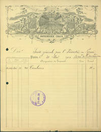
réf. 63-8138Paris: Imprimerie Chaix 1900. 21 x 27 cm. Receipt on Chaix letterhead filled out in ink stamped by recipient July 25 1919. Good with toning minor losses and tiny marginal tears to bottom edge. Engraved letterhead. En Francais. Paris: Imprimerie Chaix, 1900. unknown
1859réf. 182821859 une carte dépliante en couleurs entoilée in-octavo ( Format plié :16,7 x 11,2 cm), format déplié : 67 x 88,5 cm, avec son étui de percaline rouge décoré or et à froid, 1859 Paris Napoleon Chaix et Cie Editeur,
réf. 4033in 12 pleine toile bleue décorée,d’éditeur.Faux-titre, titre,II,282 pages,tranches rouges,89 illustrations dans et hors-texte de l’auteur.Hachette 1884 rousseurs,fortes à certaines pages .mors supérieur droit fendu. ponts anciens,ponts du moyen âge,ponts de fer,ponts de pierre,pont suspendu