11 895 résultats
1970réf. R240009101LAROUSSE. 1970. In-8. Broché. Bon état, Couv. convenable, Dos satisfaisant, Intérieur frais. 191 pages. Nombreuses illustrations en noir et blanc, et en couleur, dans le texte et hors texte.. . . . Classification Dewey : 625-Chemins de fer, routes, autoroutes
1982réf. RO90124869HARLEQUIN DUO SERIE LE TEMPS D'UN LIVRE n°79. 1982. In-16. Broché. Bon état, Couv. convenable, Dos satisfaisant, Intérieur frais. 153 pages.. . . . Classification Dewey : 843.085-Le roman sentimental
réf. CF179Chemins de l'Etat, Septembre 1931. In-8, 269pp., 115 fig. in-t., 10 photos h.t., br.
2006réf. LFA-126715876Un ouvrage de 244 pages, format 225 x 240 mm, broché couverture couleurs, illustré, publié en 2006, Cheminements, bon état
1965IL SAGGIATORE 1965 1247 PP. COMPLESSIVE. QUALCHE RARO FREGO A MATITA ROSSA E BLU TRA LE RIGHE DI TESTO (NELL'ORDINE DI UNA DECINA SULLE OLTRE 1200 PP.), FIRMA DI APPARTENENZA CON DATA ALL'ANTIPORTA DI ENTRAMBI I VOLUMI, SEGNI DEL TEMPO, NEL COMPLESSO OTTIME CONDIZIONI GENERALI, CONSIDERATI GLI OLTRE 50 ANNI DEI VOLUMI.
1983réf. 19965Genève, Association genevoise du Musée des tramways, 1983. Plaquette in-8 brochée sur agrafes de 44 pages illustrées. On joint un double flyer d'inscription à l'association.
1945IX edizione. Verona, 1945; br., pp. 550, ill. b/n. italiano
1853réf. GITa278Paris Hachette 1853. In-12 broché IV 150pp. Etat neuf, sans aucune rousseur.
2011Terni, 2011; ril., pp. 920, ill. col., cm 24x29. (Arte. 1).
1975Firenze, 1975; br., pp. 132, ill., 36 tavv. b/n, cm 17x25. (Accademia Toscana di Scienze e Lettere "La Colombaria". Serie Studi. 39).
1981English text. Firenze, 1981; clothbound, pp. 200, b/w plates, cm 21,5x31,5. english
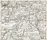
1700réf. 402AG1700. Paris c. 1700. Original copper engraved maps. 15.5 cm wide x 13 cm high. Mounted on paper. Very good condition. From a wonderful collection of Maps from an old english library South Shields - with a tiny library stamp to the mounting paper The stamp is NOT on the Map. Nicolas de Fer 164625 October 1720 was a French cartographer and geographer. De Fer was the youngest of three sons of Antoine de Fer who was also a cartographer. When he was 12 he became the apprentice of Parisian engraver Louis Spirinx and made his first map of the Canal du Midi at the age of 23. After the death of his father in June 1673 his mother Geneviève initially took over the map making company which had begun to decline. She passed it and the atelier called Quai de L'Horloge on to Nicolas in 1687 because of her old age. De Fer was so successful at improving the firm that in 1690 he became the official geographer to Louis Dauphin of France. With support from the Spanish and French Royal Families de Fer also became official geographer for Philip V and Louis XIV the kings of Spain and France respectively. Because of this his maps became Bourbon propaganda endorsing French King Louis XIV. His business flourished producing town plans atlases wall maps and more than 600 sheet maps. He made maps of places in Europe and North America including New Spain places fortified by Vauban the Low Countries and the War of the Spanish Succession. In 1698 de Fer published a map of North America which included a depiction of beavers building dams near Niagara Falls. Seventeen years later Herman Moll published a map which plagiarized elements of de Fer's work particularly the beaver scene. It became known as the "Beaver map". De Fer became the official geographer for His Catholic Majesty in 1720. Two of his sons-in-law Guillaume Danet and Jaques-François Bénard continued the company after de Fer's death on 25 October of that year until around 1760. Wikipedia unknown
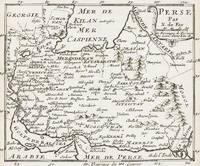
1700réf. 403AG1700. Paris c. 1700. Original copper engraved maps. 15.5 cm wide x 13 cm high. Mounted on paper. Very good condition. From a wonderful collection of Maps from an old english library South Shields - with a tiny library stamp to the mounting paper The stamp is NOT on the Map. Nicolas de Fer 164625 October 1720 was a French cartographer and geographer. De Fer was the youngest of three sons of Antoine de Fer who was also a cartographer. When he was 12 he became the apprentice of Parisian engraver Louis Spirinx and made his first map of the Canal du Midi at the age of 23. After the death of his father in June 1673 his mother Geneviève initially took over the map making company which had begun to decline. She passed it and the atelier called Quai de L'Horloge on to Nicolas in 1687 because of her old age. De Fer was so successful at improving the firm that in 1690 he became the official geographer to Louis Dauphin of France. With support from the Spanish and French Royal Families de Fer also became official geographer for Philip V and Louis XIV the kings of Spain and France respectively. Because of this his maps became Bourbon propaganda endorsing French King Louis XIV. His business flourished producing town plans atlases wall maps and more than 600 sheet maps. He made maps of places in Europe and North America including New Spain places fortified by Vauban the Low Countries and the War of the Spanish Succession. In 1698 de Fer published a map of North America which included a depiction of beavers building dams near Niagara Falls. Seventeen years later Herman Moll published a map which plagiarized elements of de Fer's work particularly the beaver scene. It became known as the "Beaver map". De Fer became the official geographer for His Catholic Majesty in 1720. Two of his sons-in-law Guillaume Danet and Jaques-François Bénard continued the company after de Fer's death on 25 October of that year until around 1760. Wikipedia unknown
198488 pages. Features: 1683 - Sobieski saves Vienna; 1700s - Iron Men and Wood Ships; 1798 - Uniforms of the US Marines; 1984 - Today's Soviet Tanks; and more. Clean and unmarked with moderate wear. A quality copy. Book
réf. W01OS-00438Centro Andaluz del Libro. Used - Very Good. Very Good condition. 4th edition. Spanish edition. Andalusia Spanish Cooking Cookbook Books in Spanish Centro Andaluz del Libro unknown
réf. 300021706Everest Sans date.
1972réf. RO20263906EVEREST. 1972. In-12. Broché. Etat d'usage, Couv. légèrement passée, Dos frotté, Quelques rousseurs. 183 pages illustrées de nombreuses photos en couleur et noir/blanc + plans couleur sur les contreplats/gardes - en anglais. . . . Classification Dewey : 420-Langue anglaise. Anglo-saxon
2008Paperback Like New. Ships directly from publishers, just release. Pls. allo w a minimum of 20 - 25 business days delivery time as this is a new released book.
EDOUARD CORNELY ET CIE. 1904. In-12 Carré. Broché. Etat d'usage. Couv. convenable. Dos satisfaisant. Intérieur frais. 315 pages - Traces de mouillure sur les plats et dos.
1904réf. R320101877EDOUARD CORNELY ET CIE. 1904. In-12. Broché. Etat d'usage, Couv. convenable, Dos satisfaisant, Intérieur frais. 315 pages - Traces de mouillure sur les plats et dos.. . . . Classification Dewey : 625-Chemins de fer, routes, autoroutes
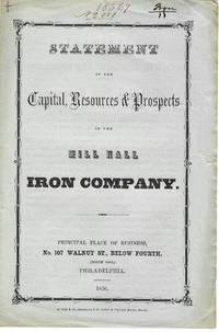
1856réf. 11228Philadelphia 1856. 4pp folded sheet original printed self wrappers with wrapper title. Light edge wear Very Good. The Statement says the Company can "not be surpassed by any similar one in the state with its facilities for getting coal agricultural produce and the means of sending their productions to the best markets." Its property 2000 acres of land is located in "Clinton county on Fishing and Bald Eagle creeks three miles from Lock Haven." It will manufacture iron lime mineral paint water cement and fire-brick. 383 NUC 0580427 2 locs. records the 1854 Act of Incorporation and By-Laws. FIRST EDITION. Not in Sabin Eberstadt Decker NUC. unknown
1856réf. 11228Philadelphia 1856. 4pp folded sheet original printed self wrappers with wrapper title. Light edge wear Very Good. The Statement says the Company can "not be surpassed by any similar one in the state with its facilities for getting coal agricultural produce and the means of sending their productions to the best markets." Its property 2000 acres of land is located in "Clinton county on Fishing and Bald Eagle creeks three miles from Lock Haven." It will manufacture iron lime mineral paint water cement and fire-brick. 383 NUC 0580427 2 locs. records the 1854 Act of Incorporation and By-Laws. FIRST EDITION. Not in Sabin Eberstadt Decker NUC. unknown books
1927Broch?. 64 pages. 17x24cm. Petit manque ? la couverture.
1865réf. pp6089Paris, Typographie de Henri Plon, imprimeur de l'empereur, 8 rue Garancière Reliure d'éditeur 1865 In-4 (32*22), reliure percaline verte de l'éditeur, contient une notice de 10pp. en fascicule ainsi qu'une planche dépliante de 34 feuilles présentant le profil géologique suivant le trcaé du Chemin de Fer, dressé suivant les indications de M. Triger par MM. Mille, Ingénieur en Chef des Ponts et Chaussées, Thoré, Ingénieur Ordinaire des Ponts et Chaussées et Guillier, Conducteur ; mors légèrement frottés, rares rousseurs, bel état. Livraison a domicile (La Poste) ou en Mondial Relay sur simple demande.
réf. 0267515073.Ghardcover. Good. Access codes and supplements are not guaranteed with used items. May be an ex-library book. hardcover