11 892 résultats
1967réf. ROD0120109DIVISION DES OUVRAGES D'ART. DECEMBRE 1967. In-4. Broché. Bon état, Couv. convenable, Dos satisfaisant, Intérieur frais. 45 pages dactylographiées agrafées.. . . . Classification Dewey : 625-Chemins de fer, routes, autoroutes
1962réf. RO30027602NON PRECISE. 1962. In-4. Broché. Bon état, Couv. légèrement passée, Dos satisfaisant, Papier jauni. 32 pages.. . . . Classification Dewey : 625-Chemins de fer, routes, autoroutes
1976réf. RO20034819SETRA. 1976. In-4. Broché. Bon état, Couv. convenable, Dos satisfaisant, Intérieur frais. 129 pages. Nombreuses illustrations et photos en noir et blanc dans le texte. . . . Classification Dewey : 625-Chemins de fer, routes, autoroutes
1976réf. RO30027688NON PRECISE. 1976. In-4. Broché. Bon état, Couv. convenable, Dos satisfaisant, Intérieur frais. 1 dossier de 200 pages environ. 1 dossier de 50 pages environ.. . . . Classification Dewey : 625-Chemins de fer, routes, autoroutes
1863réf. 1807A Strasbourg, Imprimerie de Veuve Berger-Levrault, 1863. In-4 - 19,5x25cm. Reliure de l'époque en demi-chagrin vert, dos lisse orné de filets à froid, tranches mouchetées. 2ff, 103pp. Ancien tampon de bibliothèque sur la page de titre. Rare ouvrage.
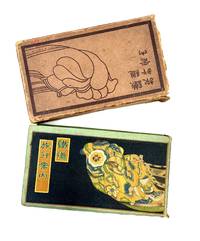
1924réf. 85112Hakubunkan 1924. Fine. Hakubunkan 1924 19.50 x 11 cm broché Work published by the Japanese Ministry of Railways admirably illustrated with 130 double-page color illustrations by Hatsusaburo Yoshida: 2 decorating the pastedowns traditional Japanese animated scenes 26 views and 104 bird's-eye view landscape maps. Numerous black maps including a large one at the end of the Japanese railways which is detached. Pale green cloth covers. Smooth spine with title. Boards printed in black with a sample of Japanese fabric a cartouche for the title. Cardboard slipcase repeating the board motifs in black. Small lacks to slipcase rubbing and corners bumped. Fine condition of the collection with occasional light foxing. A paper lack to the pastedowns at the end of the volume. Some pages with fine manuscript notes in ink. Celebrated as the Hiroshige of the Taisho era Yoshida 1884-1955 was a painter and cartographer. His bird's-eye view maps and views are enhanced by multiple colors and changes of season and weather. A major retrospective of his works took place in Japan at the Sakai Museum in 1999. Hakubunkan hardcover
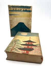
1926réf. 86404Tky Tokyo: Hakubunkan 1926. Fine. Hakubunkan Tky Tokyo 1926 19.50 x 11 cm relié Work published by the Japanese Ministry of Railways admirably illustrated with 166 illustrations. This new edition was entirely revised and the illustration is completely new. The Ministry of Railways published this collection from 1923 to 1928; from 1923 to 1925 the collection contained numerous bird's-eye view maps by Yoshida which were replaced by photographs and now only adorn the pastedowns. This is the first collection to use photography with 126 black and white photographs and 18 hand-colored ones. 22 color prints by Hatsusaburo Yoshida. 7 folding color maps and several black and white maps in-text. Cloth binding and cardboard slipcase. Pale green cloth covers. Smooth spine with title. Boards printed with a Japanese temple with full moon and trees on the first board and on the second. Illustrated cardboard slipcase with Mount Fuji and birds. Rubbing and dulled edges to the slipcase. Small cut to the cloth on the spine. Fine condition of the collection with some foxing. Spine darkened boards spotted. Handsome copy rare with its original slipcase. A vast undertaking this guide was intended as a monument to the glory of Japan. For the first time modern Japan meets traditional Japan. Celebrated as the Hiroshige of the Taisho era Yoshida 1884-1955 was a painter and cartographer. A major retrospective of his works took place in Japan at the Sakai Museum in 1999. The prints created for this collection are particularly beautiful. Hakubunkan hardcover
2018réf. TK253635Parasol Unit London 2018. 1st Edition. SOFTCOVER. No 473 of 500 numbered copies signed by Lisa Milroy at the rear colophon. Extra Large 4to. in colour printed stiff card covers 85pp on thick art paper colour photos etc __CONDITION : A well preserved AS NEW unmarked and unread copy. . To see more of our Art Monographs etc type DbbARTIST in the Keywords search box __We always ship in PROTECTIVE CARD PARCELS Parasol Unit, London paperback
1965réf. 1041641965 Annales Littéraire de l'Université de Besançon. Vol. 73 (Archéologie 18). "Les Belles Lettres", 1965 - Ouvrage imprimé avec le concours du Centre National de la Recherche Scientifique et de l'Académie nationale de Metz - In-8 broché, sous jaquette illustrée - 170 pages + 27 planches - 2 tableaux dépliants dans l'ouvrage
2012Roma, 2012; br., pp. 432, ill., 105 tavv. b/n, cm 16x24. (Officina. Etruscologia. 6).
195163p. Very XLib. Tall 8vo. Rebound with original wraps in stiff library boards. Lebanon County Historical Society, Vol. XII, No. 3A. PA PAMPH 20_2 BX4 x 2
réf. 0267515073.Ghardcover. Good. Access codes and supplements are not guaranteed with used items. May be an ex-library book. hardcover
1865réf. pp6089Paris, Typographie de Henri Plon, imprimeur de l'empereur, 8 rue Garancière Reliure d'éditeur 1865 In-4 (32*22), reliure percaline verte de l'éditeur, contient une notice de 10pp. en fascicule ainsi qu'une planche dépliante de 34 feuilles présentant le profil géologique suivant le trcaé du Chemin de Fer, dressé suivant les indications de M. Triger par MM. Mille, Ingénieur en Chef des Ponts et Chaussées, Thoré, Ingénieur Ordinaire des Ponts et Chaussées et Guillier, Conducteur ; mors légèrement frottés, rares rousseurs, bel état. Livraison a domicile (La Poste) ou en Mondial Relay sur simple demande.
1927Broch?. 64 pages. 17x24cm. Petit manque ? la couverture.
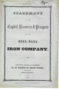
1856réf. 11228Philadelphia 1856. 4pp folded sheet original printed self wrappers with wrapper title. Light edge wear Very Good. The Statement says the Company can "not be surpassed by any similar one in the state with its facilities for getting coal agricultural produce and the means of sending their productions to the best markets." Its property 2000 acres of land is located in "Clinton county on Fishing and Bald Eagle creeks three miles from Lock Haven." It will manufacture iron lime mineral paint water cement and fire-brick. 383 NUC 0580427 2 locs. records the 1854 Act of Incorporation and By-Laws. FIRST EDITION. Not in Sabin Eberstadt Decker NUC. unknown books
1856réf. 11228Philadelphia 1856. 4pp folded sheet original printed self wrappers with wrapper title. Light edge wear Very Good. The Statement says the Company can "not be surpassed by any similar one in the state with its facilities for getting coal agricultural produce and the means of sending their productions to the best markets." Its property 2000 acres of land is located in "Clinton county on Fishing and Bald Eagle creeks three miles from Lock Haven." It will manufacture iron lime mineral paint water cement and fire-brick. 383 NUC 0580427 2 locs. records the 1854 Act of Incorporation and By-Laws. FIRST EDITION. Not in Sabin Eberstadt Decker NUC. unknown
EDOUARD CORNELY ET CIE. 1904. In-12 Carré. Broché. Etat d'usage. Couv. convenable. Dos satisfaisant. Intérieur frais. 315 pages - Traces de mouillure sur les plats et dos.
1904réf. R320101877EDOUARD CORNELY ET CIE. 1904. In-12. Broché. Etat d'usage, Couv. convenable, Dos satisfaisant, Intérieur frais. 315 pages - Traces de mouillure sur les plats et dos.. . . . Classification Dewey : 625-Chemins de fer, routes, autoroutes
2008Paperback Like New. Ships directly from publishers, just release. Pls. allo w a minimum of 20 - 25 business days delivery time as this is a new released book.
1972réf. RO20263906EVEREST. 1972. In-12. Broché. Etat d'usage, Couv. légèrement passée, Dos frotté, Quelques rousseurs. 183 pages illustrées de nombreuses photos en couleur et noir/blanc + plans couleur sur les contreplats/gardes - en anglais. . . . Classification Dewey : 420-Langue anglaise. Anglo-saxon
réf. 300021706Everest Sans date.
réf. W01OS-00438Centro Andaluz del Libro. Used - Very Good. Very Good condition. 4th edition. Spanish edition. Andalusia Spanish Cooking Cookbook Books in Spanish Centro Andaluz del Libro unknown
198488 pages. Features: 1683 - Sobieski saves Vienna; 1700s - Iron Men and Wood Ships; 1798 - Uniforms of the US Marines; 1984 - Today's Soviet Tanks; and more. Clean and unmarked with moderate wear. A quality copy. Book
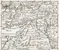
1700réf. 402AG1700. Paris c. 1700. Original copper engraved maps. 15.5 cm wide x 13 cm high. Mounted on paper. Very good condition. From a wonderful collection of Maps from an old english library South Shields - with a tiny library stamp to the mounting paper The stamp is NOT on the Map. Nicolas de Fer 164625 October 1720 was a French cartographer and geographer. De Fer was the youngest of three sons of Antoine de Fer who was also a cartographer. When he was 12 he became the apprentice of Parisian engraver Louis Spirinx and made his first map of the Canal du Midi at the age of 23. After the death of his father in June 1673 his mother Geneviève initially took over the map making company which had begun to decline. She passed it and the atelier called Quai de L'Horloge on to Nicolas in 1687 because of her old age. De Fer was so successful at improving the firm that in 1690 he became the official geographer to Louis Dauphin of France. With support from the Spanish and French Royal Families de Fer also became official geographer for Philip V and Louis XIV the kings of Spain and France respectively. Because of this his maps became Bourbon propaganda endorsing French King Louis XIV. His business flourished producing town plans atlases wall maps and more than 600 sheet maps. He made maps of places in Europe and North America including New Spain places fortified by Vauban the Low Countries and the War of the Spanish Succession. In 1698 de Fer published a map of North America which included a depiction of beavers building dams near Niagara Falls. Seventeen years later Herman Moll published a map which plagiarized elements of de Fer's work particularly the beaver scene. It became known as the "Beaver map". De Fer became the official geographer for His Catholic Majesty in 1720. Two of his sons-in-law Guillaume Danet and Jaques-François Bénard continued the company after de Fer's death on 25 October of that year until around 1760. Wikipedia unknown
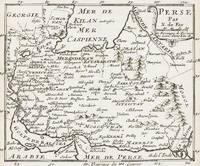
1700réf. 403AG1700. Paris c. 1700. Original copper engraved maps. 15.5 cm wide x 13 cm high. Mounted on paper. Very good condition. From a wonderful collection of Maps from an old english library South Shields - with a tiny library stamp to the mounting paper The stamp is NOT on the Map. Nicolas de Fer 164625 October 1720 was a French cartographer and geographer. De Fer was the youngest of three sons of Antoine de Fer who was also a cartographer. When he was 12 he became the apprentice of Parisian engraver Louis Spirinx and made his first map of the Canal du Midi at the age of 23. After the death of his father in June 1673 his mother Geneviève initially took over the map making company which had begun to decline. She passed it and the atelier called Quai de L'Horloge on to Nicolas in 1687 because of her old age. De Fer was so successful at improving the firm that in 1690 he became the official geographer to Louis Dauphin of France. With support from the Spanish and French Royal Families de Fer also became official geographer for Philip V and Louis XIV the kings of Spain and France respectively. Because of this his maps became Bourbon propaganda endorsing French King Louis XIV. His business flourished producing town plans atlases wall maps and more than 600 sheet maps. He made maps of places in Europe and North America including New Spain places fortified by Vauban the Low Countries and the War of the Spanish Succession. In 1698 de Fer published a map of North America which included a depiction of beavers building dams near Niagara Falls. Seventeen years later Herman Moll published a map which plagiarized elements of de Fer's work particularly the beaver scene. It became known as the "Beaver map". De Fer became the official geographer for His Catholic Majesty in 1720. Two of his sons-in-law Guillaume Danet and Jaques-François Bénard continued the company after de Fer's death on 25 October of that year until around 1760. Wikipedia unknown