Raiter Léon,Rainvyl Mad,Vorelli,Ketty Mary,Sandrey,Zetty Gaby,Fer Jane - Raiter Léon,Sunday Géo - Pothier FernandLivre Rare Book

12 027 résultats
1927réf. 12433All Music 1927
réf. 11600Slnd, (Tassin 1636 ou milieu XVIIe). Gravure de 33 x25 cm. Rose des vents accompagnée d'un monstre marin et d'un bateau, échelle verticale en lieues. Pâle mouillure dans le haut de la carte.
PARIS, Hachette & cie - 1891 - Grand In-8 - Broché - manque les plats - Très nombreuses illustrations en texte & HT PP NB - 146 pages - Très propre, à relier
1975Broch?. 163 pages.
LA VIE DU RAIL. 10 NOVEMBRE 1974. Bon état. Couv. convenable. Intérieur frais. 32 pages. Nombreuses photographies en noir et blanc dans et hors texte.
1906réf. 16021Hartford CN: The Case Lockwood & Brainard Co. Very Good. 1906. First Edition. Softcover. Agent's stamp on the front browning around the edges. Contents "fine". Lots of engravings & info on steam driven machinery. ; Small 4to 9" - 11" tall; 48 pages . The Case, Lockwood & Brainard Co. paperback
réf. 2n1617ca. 1694. Blattgröße: 365 cm x 275 cm. kräftige Abdrucke / saubere Blätter - unknown
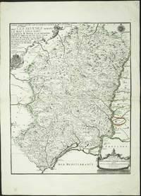
réf. 4160Paris: 1705. No binding. Good. 590 x 470 mm. early outline colour. Some light foxing to the lower margin otherwise in fine condition. The map displays the region to the west of the lower Rhone river valley. It shows Beziers in the west and Arles at the mouth of the river. It extends north up the river to Tournon. It was published in De Fer's folio atlas entitled 'Atlas ou Recueil de Cartes Geographiques'. The atlas followed a quarto one and was first issued in 1709. With two attractive cartouches the map extends from Lyon in the south to Chatillon in the north. Pastoureau 1984 Fer II C no. 30. 1705 unknown
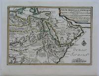
1703réf. M5175Paris 1703. Excellent. Size : 225x325 mm 8.875x12.75 Inches Coloring: Original Outline Coloring Category: Maps Africa North Egypt; Maps Asia Middle East Arabia unknown
réf. 51-6445Paris: chez l'auteur dans l'Isle du Palais sur le quay de l'orloge a la Sphére Royale avec privilége du Roy 1714-1717. Engraved map. 27.3 x 38cm. Contemporary laid paper uniformly time aged.Published in "L'atlas curieux ou Le monde reÌpreseÌnteÌ dans des cartes geÌneÌrales et particulieres du ciel et de la terre : diviseÌ tant en ses quatre principales parties que par eÌtats et provinces et orneÌ par des plans et descriptions des villes capitales et principales et des plus superbes edifices qui les embelissent comme sont les eglises les palais les maisons de plaisance les iardins les fontaines &c. ". OCLC Number / Unique Identifier:79022119.LThe Atlas Curieux is geographic encyclopedia of images and maps of France with detailed views of the grand waterworks at Marly views of the great palaces and chateaux views and plans of the Paris Observatory and samples of military architecture. Issued in six annual parts from 1700-1705 the maps are based on the new observations of the Académie des Sciences and drawn up with the assistance of Philipe de La Hire.ibrary of Congress:The French cartographer and engraver Nicolas de Fer was a master at creating maps that were works of art. The maps that he published were printed during the Baroque period when the decorative arts were characterized by ornate detail. De Fer’s detailed maps and atlases were valued more for their decorative content than their geographical accuracy.Nicolas de Fer was born in 1646. His father Antoine de Fer owned a mapmaking firm. At the age of twelve Nicolas was apprenticed to a Parisian engraver named Louis Spirinx. The family business was starting to decline when his father died in 1673. Nicolas de Fer’s mother Genevieve took over the business after the death of her husband. In 1687 the business was passed on to Nicolas and the profits increased after he took over the firm. Nicolas de Fer was a prolific cartographer who produced atlases and hundreds of single maps. He eventually became the official geographer to King Louis XIV of France and King Philip V of Spain.One of de Fer’s major works is an atlas titled L’atlas curieux The curious atlas. Paris: chez l'auteur dans l'Isle du Palais sur le quay de l'orloge a la Sphére Royale avec privilége du Roy, 1714-1717 unknown
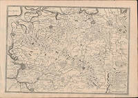
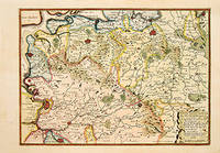
1705réf. 66130Paris. c. 1705. An attractive and quite detailed map of the northern regions of Brabant in Belgium and south western Holland by the French cartographer Nicolas de Fer. A number of larger regional towns are highlighted as are local rivers woodlands hills and marshes. Published in the 'Atlas Curieux ou Le Monde'. Size: 275 x 405 mm. Copperplate engraving with later hand colour. Good condition. Some general age toning. unknown
réf. 201710513Paris, Fleurus, 1983 ; in-4, 46 pp., cartonnage de l'éditeur. Très bon état.
2001réf. RO20185059GROUPE HORIZON. 2001. In-8. Broché. Bon état, Couv. convenable, Dos satisfaisant, Intérieur frais. Environs 40 pages - nombreuses photos en noir et blanc dans et hors texte.. . . . Classification Dewey : 625-Chemins de fer, routes, autoroutes
réf. 0282342125.Gpaperback. Good. Access codes and supplements are not guaranteed with used items. May be an ex-library book. paperback
réf. 0666118450.Ghardcover. Good. Access codes and supplements are not guaranteed with used items. May be an ex-library book. hardcover
1995réf. 076586Heritage House Publishing 1995. Oversized Hardcover. Very Good. Very good clean tight condition. Text free of marks. Professional book dealer since 1999. All orders are processed promptly and carefully packaged. Heritage House Publishing hardcover
2007réf. R110237712EDITIONS SCALA. 2007. In-4. Relié. Bon état, Couv. convenable, Dos satisfaisant, Intérieur frais. 311 pages. Nombreuses photographies en couleurs dans et hors texte de Georges Fessy.. Avec Jaquette. . . Classification Dewey : 625-Chemins de fer, routes, autoroutes
réf. 2322502057.Gpaperback. Good. Access codes and supplements are not guaranteed with used items. May be an ex-library book. paperback
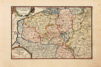
1717réf. 78864Paris: 1717. Map of the Catholic Low Countries or current day Belgium. Published in "Atlas Curieux ou le Monde". Copper engraving. Hand coloured. Sheet size: 274 x 405 mm Plate size: 216 x 326 mm Very good condition. unknown
2004réf. RO20063573IMP. MODERNE, d'Aurillac.. Août 2004. In-4. Broché. Très bon état, Couv. fraîche, Dos satisfaisant, Intérieur frais. 63 pages. Nombreuses photos et illustrations en couleurs dans le texte.. . . . Classification Dewey : 625-Chemins de fer, routes, autoroutes
2004réf. RO20063574IMP. MODERNE, d'Aurillac.. Juin - Juil. 2004. In-4. Broché. Très bon état, Couv. fraîche, Dos satisfaisant, Intérieur frais. 55 pages. Nombreuses photos et illustrations en couleurs et noir et blanc dans le texte.. . . . Classification Dewey : 625-Chemins de fer, routes, autoroutes
2004réf. RO20063575IMP. MODERNE, d'Aurillac.. Mai 2004. In-4. Broché. Parfait état, Couv. fraîche, Dos satisfaisant, Intérieur frais. 63 pages. Nombreuses photos et illustrations en couleurs dans le texte.. . . . Classification Dewey : 625-Chemins de fer, routes, autoroutes
2004réf. RO20063576IMP. MODERNE, d'Aurillac.. Avril 2004. In-4. Broché. Parfait état, Couv. fraîche, Dos satisfaisant, Intérieur frais. 46 pages. Nombreuses photos, cartes et illustrations en couleurs dans le texte.. . . . Classification Dewey : 625-Chemins de fer, routes, autoroutes
2004réf. RO20063577IMP. MODERNE, d'Aurillac.. Mars 2004. In-4. Broché. Parfait état, Couv. fraîche, Dos satisfaisant, Intérieur frais. 52 pages. Nombreuses photos et illustrations en couleurs dans le texte. Quelques cartes en couleurs et en noir et blanc dans le texte.. . . . Classification Dewey : 625-Chemins de fer, routes, autoroutes