12 027 résultats
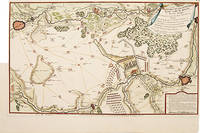
1880réf. DZN-1200Paris librairie militaire de J. Dumaine 1880, plaquette in-8 de 66 pages. Broché. Fortes mouillures, dos abimé et pages mal coupée; sans la carte en trois couleurs annoncée.
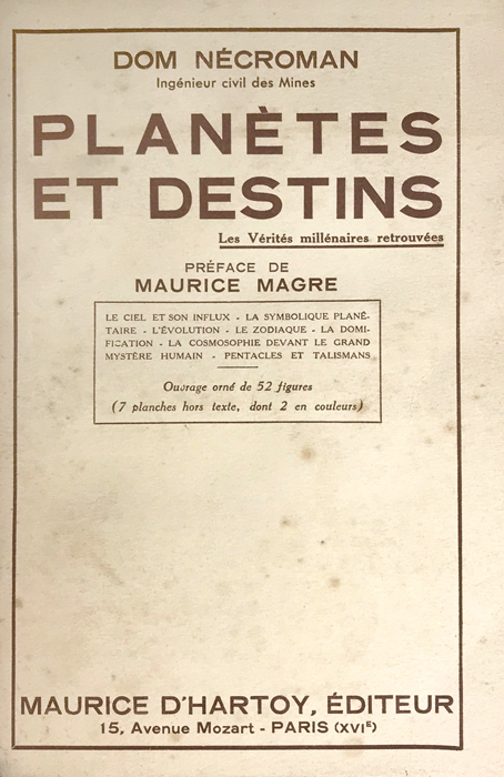
1933réf. 1070Paris, Maurice d’Hartoy, 1933 ; in-8, broché ; 295 pp., 7 planches hors-texte dépliantes (dont 2 en couleurs).
réf. 110061Fontainebleau, chez l’auteur 1954, 220x140mm, 77pages, broché. Bel exemplaire.
1999Mantova, Museo della Città, 16 settembre 2006 - 14 gennaio 2007. A cura di F. Rossi. Milano, 1999; br., pp. 116, ill. col., cm 24x28. (Arte Antica. Cataloghi). italiano 88-7624-90 Arte Antica. Cataloghi br.
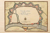
1706réf. M6385Paris 1706. Very Good margins extended. Size : 115x175 mm 4.5x6.875 Inches Coloring: Hand Colored Category: ; Maps Europe Greece Macedonia unknown
1706réf. M6382Paris 1706. Very Good margins extended. Size : 125x175 mm 4.875x6.875 Inches Coloring: Hand Colored Category: ; Maps Europe Spain unknown
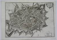
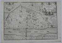
1705réf. M5142Paris 1705. Excellent. Size : 237x346 mm 9.375x13.625 Inches Coloring: Black & White Category: Maps City Maps; Maps Europe France unknown
réf. 51-6452Paris: chez l'auteur dans l'Isle du Palais sur le quay de l'orloge a la Sphére Royale avec privilége du Roy 1705-1717. Engraved map. 27.3 x 38 cm. Contemporary laid paper uniformly time aged.Published in "L'atlas curieux ou Le monde reÌpreseÌnteÌ dans des cartes geÌneÌrales et particulieres du ciel et de la terre : diviseÌ tant en ses quatre principales parties que par eÌtats et provinces et orneÌ par des plans et descriptions des villes capitales et principales et des plus superbes edifices qui les embelissent comme sont les eglises les palais les maisons de plaisance les iardins les fontaines &c. ". OCLC Number / Unique Identifier:79022119.LThe Atlas Curieux is geographic encyclopedia of images and maps of France with detailed views of the grand waterworks at Marly views of the great palaces and chateaux views and plans of the Paris Observatory and samples of military architecture. Issued in six annual parts from 1700-1705 the maps are based on the new observations of the Académie des Sciences and drawn up with the assistance of Philipe de La Hire.ibrary of Congress:The French cartographer and engraver Nicolas de Fer was a master at creating maps that were works of art. The maps that he published were printed during the Baroque period when the decorative arts were characterized by ornate detail. De Fer’s detailed maps and atlases were valued more for their decorative content than their geographical accuracy.Nicolas de Fer was born in 1646. His father Antoine de Fer owned a mapmaking firm. At the age of twelve Nicolas was apprenticed to a Parisian engraver named Louis Spirinx. The family business was starting to decline when his father died in 1673. Nicolas de Fer’s mother Genevieve took over the business after the death of her husband. In 1687 the business was passed on to Nicolas and the profits increased after he took over the firm. Nicolas de Fer was a prolific cartographer who produced atlases and hundreds of single maps. He eventually became the official geographer to King Louis XIV of France and King Philip V of Spain.One of de Fer’s major works is an atlas titled L’atlas curieux The curious atlas. Paris: chez l'auteur dans l'Isle du Palais sur le quay de l'orloge a la Sphére Royale avec privilége du Roy, 1705-1717 unknown
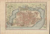
1715réf. 019811Paris. Very Good. 1715. Map. Lovely engraved map depicting Mexico City in the early 18th century. Map is on a 10 ¾" x 15 ¾" sheet that was taken from Nicolas de Fer's "L'Atlas Curieux" of 1715; no content on verso. Date of map was printed in upper margin along with the sheet number "125" and title; content in French. Hand-coloring is still bright. Map has very light toning to edges but is otherwise clean. This detailed map depicts Mexico City when it was surrounded by water and was linked to the mainland by the famous causeways originally designed by the Aztecs. Also pictured are aqueducts and farms and about 50 locations have been numbered on the map but the key is not present likely printed on another page in the Atlas. A beautiful map. . unknown
1705réf. 78550Paris: 1705. A beautiful city plan of Ulm in the federal German state of Baden-Württemberg. Copper engraving. Hand coloured. Size: 277 x 403 mm Good condition. unknown
1705réf. M5143Paris 1705. Excellent. Size : 240x340 mm 9.5x13.375 Inches Coloring: Black & White Category: Maps City Maps; Maps Europe France unknown
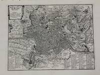
1700réf. M5227Paris c.1700. Very Good. Size : 240x310 mm 9.5x12.20 Inches Coloring: Black & White Category: Maps City Maps; Maps Europe Italy Rome unknown
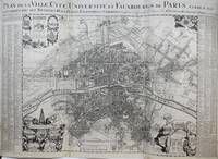
1720réf. M9651Paris: Nicolas de Fer c. 1720. Very Good backed on 19th century paper. Notes: A large-scale and detailed map of the city of Paris and its surroundings during the early 18th century. The map has ornate cartouches in all corners and indexes in the left and right margins. Nicolas de Fer 1646–1720 was a French cartographer and geographer. He also was an engraver and publisher. His work was most often praised for being beautiful and artistic. Size : 637x905 mm 25.08x35.63 Inches Coloring: Hand Colored Category: Maps City Maps; Maps Folding Maps; Maps Europe France Paris; Nicolas de Fer unknown
Feuille d?pliante31x1285 cm.
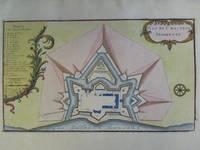
1705réf. M6202Paris 1705. Excellent. Notes: An attractive map of the city of Narva besieged by a military encampment. The Battle of Narva was an early battle in the Great Northern War fought in November of 1700. The Swedish army under Charles XII of Sweden defeated a Russian force four times its size commanded by Peter the Great. Narva marked the peak of Swedish power on the continent with Russia eventually gaining decisive victories that were able to end the conflict. Size : 230x325 mm 9x12.75 Inches Coloring: Hand Colored Category: ; Maps Europe Estonia Latvia; Maps City Maps; Maps Military unknown
1705réf. M5280Paris 1705. Excellent. Size : 225x340 mm 8.875x13.375 Inches Coloring: Hand Colored Category: ; Maps Europe Estonia Latvia unknown
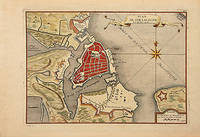
1716réf. 78549Paris: 1716. A beautiful city plan of Stralsund in Germany just off the island of Rugen in the Baltic Sea. Copper engraving. Hand coloured. Sheet size: 275 x 404 mm Plate size: 230 x 332 mm Good condition. unknown
1716réf. M5138Paris 1716. Excellent. Size : 235x325 mm 9.25x12.75 Inches Coloring: Black & White Category: ; Maps Europe Germany unknown
réf. 51-6444Paris: chez l'auteur dans l'Isle du Palais sur le quay de l'orloge a la Sphére Royale avec privilége du Roy 1714-1717. Engraved map. 27.3 x 38cm. Contemporary laid paper uniformly time aged.Published in "L'atlas curieux ou Le monde reÌpreseÌnteÌ dans des cartes geÌneÌrales et particulieres du ciel et de la terre : diviseÌ tant en ses quatre principales parties que par eÌtats et provinces et orneÌ par des plans et descriptions des villes capitales et principales et des plus superbes edifices qui les embelissent comme sont les eglises les palais les maisons de plaisance les iardins les fontaines &c. ". OCLC Number / Unique Identifier:79022119.LThe Atlas Curieux is geographic encyclopedia of images and maps of France with detailed views of the grand waterworks at Marly views of the great palaces and chateaux views and plans of the Paris Observatory and samples of military architecture. Issued in six annual parts from 1700-1705 the maps are based on the new observations of the Académie des Sciences and drawn up with the assistance of Philipe de La Hire.ibrary of Congress:The French cartographer and engraver Nicolas de Fer was a master at creating maps that were works of art. The maps that he published were printed during the Baroque period when the decorative arts were characterized by ornate detail. De Fer’s detailed maps and atlases were valued more for their decorative content than their geographical accuracy.Nicolas de Fer was born in 1646. His father Antoine de Fer owned a mapmaking firm. At the age of twelve Nicolas was apprenticed to a Parisian engraver named Louis Spirinx. The family business was starting to decline when his father died in 1673. Nicolas de Fer’s mother Genevieve took over the business after the death of her husband. In 1687 the business was passed on to Nicolas and the profits increased after he took over the firm. Nicolas de Fer was a prolific cartographer who produced atlases and hundreds of single maps. He eventually became the official geographer to King Louis XIV of France and King Philip V of Spain.One of de Fer’s major works is an atlas titled L’atlas curieux The curious atlas. Paris: chez l'auteur dans l'Isle du Palais sur le quay de l'orloge a la Sphére Royale avec privilége du Roy, 1714-1717 unknown
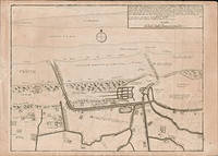
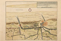
1717réf. 78680Paris: c. 1717. Map of the towns of Dunkirk and Mardick showing the new canal. Published in "Atlas Curieux ou le Monde". Copper engraving. Hand coloured. Size: 275 x 398 mm Very good condition. unknown
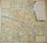
1735réf. M7483Paris c.1735. Very Good;. Notes: Large scale decorative 18th century map of Paris. Top right title in a cartouche adorns a fountain spewing water referring to the establishment of the network of fountains in the capital. Size : 565x590 mm 22.24x23.23 Inches Coloring: Hand Colored Reference: Jean Boutier #212A Category: Maps Europe France Paris;Maps City Maps; unknown
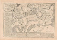
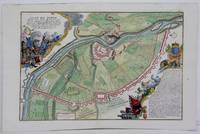
1717réf. 52957Paris. 1717. Detailed map of a battle in the July of 1712 with troop placementsand positions on the map. An explanation of the battle at lower right. Accompanying text on reverse. Published in de Fer's Atlas Curieux ou Le Monde. Copper engraving. Very good condition. Upper left top and right hand margin have been trimmed close to edge of plate Later colouring. Size: 52.5 x 31 cm. unknown
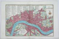
1705réf. M4627Paris 1705. Very Good. Size : 230x340 mm 9x13.375 Inches Coloring: Hand Colored Category: Maps City Maps; Maps Europe United Kingdom England London unknown
1700réf. 8374Paris 1700. Copper engraving 22.5 x 33.5 cms engraved by C. Inselin black and white slight soiling bottom right blank verso; the key lists 113 places of interest. This is the first version of the map before the date was amended. Howgego Printed Maps of London 44 1 unknown
réf. 2n1785De Fer Paris um 1700. Maße: 28 cm x 165 cm. - Nicolas de Fer war einer der führenden französischen Kartographen und Kartenverleger - unknown