Maria Pilar Queralt del HierroBiblio.com

2004rif. BN667747Editorial Presenca 2004. 2004. Inês de Castro - 5.ª Edição Inês de Castro - 5.ª Edição María Pilar Queralt del Hierro Editorial Presenca unknown
2011ill., br. Non molto tempo fa gli operai dell'allora Italsider vennero chiamati metalmezzadri. Era la generazione dei Cipputi, dei sindacati e degli scioperi che paralizzavano la produzione, della terra o del mare da coltivare, dopo il turno. L'Italsider non c'è più. C'è l'ILVA. Per i nuovi operai dell'ILVA, divisi in normalisti e turnisti, il sindacato è lontano; al suo posto ci sono i tornei di calcetto aziendali che favoriscono la comunicazione, ma non troppo. Rimane la paura di non tornare più a casa e i santi a cui affidarsi, una volta custoditi nei portafogli ora immagini su cellulari. Le immagini dei santi si affiancano a quelle delle mogli, dei figli e delle famiglie e di loro è tutto quello che oltrepassa i tornelli dell'ILVA. La vita scandita dai turni. Tra la fabbrica e la vita fuori, lo spogliatoio dove si svestono i panni civili e si indossa la tuta da operai. "Invisibili" di Fulvio Colucci e Giuse Alemanno è un lavoro a quattro mani che raccoglie e racconta storie di uomini la cui vita è indissolubilmente legata al lavoro... ma è anche il racconto delle contraddizioni di una città intera, la narrazione di un'umanità divisa fra la necessità e il rifiuto...
rif. 281Archives Générales Du Royaume 17 x 23,5 Bruxelles Archives Générales Du Royaume - Archives de l'Etat à Arlon. Broché, 40 p. Dossiers concernant les lignes ferrées vicinales. Exemplaire à l'état neuf.(C5) Livre
rif. 281Archives Générales Du Royaume 17 x 23,5 Bruxelles Archives Générales Du Royaume - Archives de l'Etat à Arlon. Broché, 40 p. Dossiers concernant les lignes ferrées vicinales. Exemplaire à l'état neuf.(C5) Livre
1831Firenze, 29 dicembre 1831, Notificazione di cm. 34 x 49 a firma S. Cantini, con stemma xil. imperiale.
1987Presentazione di Renzo Grandi. Bologna, 1987; br., pp. 100, ill. b/n e col., cm 21,5x28,5. italiano br.
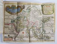
1717rif. 50277Paris: Guillaume Danet Son-in law of the author 1717. Second edition. Hardcover. Good- to very good condition. Octavo. 197 9pp. 5 folding maps. Original calf with gilt lettering tooling and ruling on spine; raised bands. Decorative endpapers. Title page with copperplate engravings of two hand-colored printed globes and black double-framing California depicted as an island in this and two other maps. Second edition augmented with longitudes and latitudes of major cities. Illustrated headpiece decorative initials and endpieces. All pages with double frames; marginalia. Introduction to geography by the French cartographer and engraver Nicolas de Fer 1646-1720 containing five folding copperplate engraved maps four of them hand-colored. The first showing a general map of the globe with America in one Europe Africa and Australia in the second globe both with North and South Poles. The margins are adorned with hand-colored portraits of significant explorers; Columbus Vespuci Shouten etc. The second map is the only one in black and white. It depicts "La Sphere Artificielle." The third map shows Europe the fourth Asia the Middle-East and Oceania with parts of Europe and Africa and finally North and South America depicted on the fifth. Contains list of cities and catalog of Fer publications at rear. At the age of twelve Fer became an apprentice of the Parisian engraver Louis Spirinx. After the death of Fer's father in 1673 he also was a cartographer Nicolas took over the business specializing in the production atlases geography and cartography-oriented publications. Well connected to the Royal Court Fer advanced to become the official geographer of the Philip V of Spain and Louis XIV of France. His numerous publications are considered artistic rather than accurate. Text in French. Binding rubbed along edges and boards with front joint mostly cracked but holding together. Small plate of previous owner glued to upper inside front cover. Inked and penciled notes on verso of decorative front endpaper. Starting at title page. Some creasing and small closed tears of maps. B/w map with two inch tear reinforced with tape on verso. Map of Europe with four inch closed tear. Map of America also reinforced with three and a half inch paper strip on verso. Page ninety-three with remnants of black glossy paper glued to gutter and part of text some loss of text. Binding in overall good- interior in good to very good condition. Guillaume Danet (Son-in law of the author) hardcover books
1693rif. 15226Paris:: De Fer 1693. 19 x 20cm. Single leaf. Illustrated title page. Trimmed just outside borders clean. Mounted on larger plain leaf. Suitable for framing. De Fer, unknown
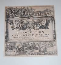
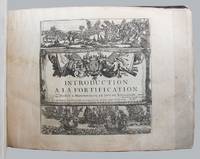
1695rif. 129558Paris: Chez l'auteur 1695. 188 engraved leaves printed on rectos only comprising the 167 plates 2 folding listed in the table of contents plus 5 plates not listed or numbered 9 plates numbered in French the pictorial title page naval and land battle scenes and 6 leaves of explanatory text for the first few plates plus a folding table of distances and a table of contents listing plates numbered 21-189 as issued; oblong 4to; early calf the spine with gilt lettered red leather title label and gilt decorated compartments between raised bands the boards rubbed with a few small surface grazes edges worn the leather lifting along fore-edge of upper board especially at bottom fore-corner small piece torn from head of spine the upper joint starting at extremities; inked ownership inscription near the bookplate of Alec Hill on the upper pastedown earlier small inked ownership inscription on upper free endpaper pencilled annotation at head of last leaf most plates neatly numbered in an early hand one plate Paris loose some damp stains occasionally large mostly to margins with a few encroaching onto plate surface several small edge chips and splits occasional slight creasing scattered light foxing and soiling; chez l'auteur Paris 1695. First edition. From the collection of Australian military historian and academic Alec Hill 1916-2008. Nicolas de Fer 1646-1720 inherited his father's cartography business which he developed into a flourishing enterprise producing town plans atlases and over 600 sheet maps and becoming one of the most prolific cartographic publishers of his era. In 1690 he was appointed official geographer to the Dauphin the heir to the French throne and when Louis XIV's grandson the Duke of Anjou acceded to the Spanish throne de Fer was proclaimed Geographer of the King of Spain as well. De Fer made maps of places throughout Europe and in North America including one in 1698 depicting beavers building dams near Niagara Falls. Introduction a la Fortification was issued in parts between 1690 and 1695 then re-issued in 1705 with the maps re-dated accordingly. Maps in this copy are dated from 1692 to 1695 with several undated. They depict fortified towns in France the Low Countries Germany Italy Spain and around the Mediterranean. The extra plates in this copy are Chartres Nouveau Canal Echelle Quebec and Batavia. The intricate folding Table Geografique enables the reader to calculate journey distances from Paris to all the principal towns in Europe. Chez l'auteur unknown
1717rif. 50277Paris: Guillaume Danet Son-in law of the author 1717. Second edition. Hardcover. Good- to very good condition. Octavo. 197 9pp. 5 folding maps. Original calf with gilt lettering tooling and ruling on spine; raised bands. Decorative endpapers. Title page with copperplate engravings of two hand-colored printed globes and black double-framing California depicted as an island in this and two other maps. Second edition augmented with longitudes and latitudes of major cities. Illustrated headpiece decorative initials and endpieces. All pages with double frames; marginalia. Introduction to geography by the French cartographer and engraver Nicolas de Fer 1646-1720 containing five folding copperplate engraved maps four of them hand-colored. The first showing a general map of the globe with America in one Europe Africa and Australia in the second globe both with North and South Poles. The margins are adorned with hand-colored portraits of significant explorers; Columbus Vespuci Shouten etc. The second map is the only one in black and white. It depicts "La Sphere Artificielle." The third map shows Europe the fourth Asia the Middle-East and Oceania with parts of Europe and Africa and finally North and South America depicted on the fifth. Contains list of cities and catalog of Fer publications at rear. At the age of twelve Fer became an apprentice of the Parisian engraver Louis Spirinx. After the death of Fer's father in 1673 he also was a cartographer Nicolas took over the business specializing in the production atlases geography and cartography-oriented publications. Well connected to the Royal Court Fer advanced to become the official geographer of the Philip V of Spain and Louis XIV of France. His numerous publications are considered artistic rather than accurate. Text in French. Binding rubbed along edges and boards with front joint mostly cracked but holding together. Small plate of previous owner glued to upper inside front cover. Inked and penciled notes on verso of decorative front endpaper. Starting at title page. Some creasing and small closed tears of maps. B/w map with two inch tear reinforced with tape on verso. Map of Europe with four inch closed tear. Map of America also reinforced with three and a half inch paper strip on verso. Page ninety-three with remnants of black glossy paper glued to gutter and part of text some loss of text. Binding in overall good- interior in good to very good condition. Guillaume Danet (Son-in law of the author) hardcover
rif. 0332085511.Ghardcover. Good. Access codes and supplements are not guaranteed with used items. May be an ex-library book. hardcover
1705rif. B2350Paris: Nicolas de Fer c. 1705. Upper fore-corner of the Toulon Grenoble St. Esprit Verceil and Veue de Verue plates all repaired professionally; otherwise a very good copy text and maps are clean and crisp. Binding: Recent ½ calf with contemporary marbled boards spine in five compartments of raised bands gilt title on two endpapers renewed. With 172 engraved plates by Nicolas de Fer and 8 in-text plates including the title. Notes: Introduction a la Fortification was a famous atlas at its timefirst published in 1690-1695. The author Nicolas de Fer inherited his father’s cartography business. Being a prolific cartographer his reputation grew such that he became the official geographer of King Louis XIV of France and King Philip V of Spain. He made maps of both North America and Europe notably including maps of the War of Spanish Succession. Size: Oblong folio Illustration: With 172 engraved plates by Nicolas de Fer and 8 in-text plates including the title. Lacks 9 plates St. Malo Environs de St. Malo Gravelines Nieuport Combat de Leuse Liege Camp de Weil and Civita Vecchia; but has 5 extras not called for in the plate list Aire Hesdin Menin Batavia and Quebec. Pages: P. plate index title engraved maps and text plates. Category: Book Atlas & Cartography; Book Military Nicolas de Fer hardcover
1962rif. 2081502111701624Not Available 1962. Soft Cover. Fine. The book is in fine condition. Not Available paperback
2017rif. 1-3639538331Editorial Académica Española 2017. Paperback. New. 176 pages. Spanish language. 8.66x5.91x0.40 inches. Editorial Académica Española paperback
2017rif. 1-3841759084Editorial Académica Española 2017. Paperback. New. 176 pages. Spanish language. 8.66x5.91x0.40 inches. Editorial Académica Española paperback
rif. 2406058603.Gpaperback. Good. Access codes and supplements are not guaranteed with used items. May be an ex-library book. paperback
rif. 32756516like new. unknown
rif. 32756516-nnew. unknown
1999Swedish text. Crafoord Auktioner, 1999; paperback, pp. 144, col. ill. and plates, cm 21x26,5. A paperback
rif. 011099Brüssel. 1904. Hardcover. Gut. --- 2 Bde. mit zahlr. Abb. In-4 410 pp. u. 269 pp. Hln.-Bde. der Zeit mit Rückentitelvergoldung Einb. wenig fleckig Titel mit Bibliotheksstempel schöne Exemplare selten! Brüssel. 1904 hardcover
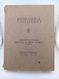
1922rif. 5564mInternational Casement Co. Good. Paperback. 1922. Solid and very well-preserved. Some wear along the spine crown otherwise clean l Casement Co Jamestown New York. Elegant October 1922 catalogue the 7th cata logue issued by International Casement Company of Jamestwon NY and featuring d ozens of black-and-white examples both line-drawn and photographed of some of the most rococo and lavishly-designed casement doors and windows of the period. Also featurig examples of International Transom Hardware Rod Gearing for Int ernational Transoms International Hardware for Wood Casement Sash Leaded G lass and Glazing Photographs and Measured Drawings of American Residences Equ ipped with International Casements Photographs and Measured Drawings of Churc hes College Buildings and Schools Equipped with International Casements Stee l Ceiling Lights for Banks and Public Buildings etc. Solid and very well-prese rved. Some wear along the spine crown otherwise clean as could be. Quarto lovel y crisp black-and-white photography throughout. The catalogue was designed and arranged by Albert W. Ford Architect and printed by Magill-Weinshimer Company Chicago. Attributes: Soft Cover . International Casement Co. paperback
2015rif. 2-0080974937Pergamon 2015. Paperback. New. 820 pages. 9.60x6.30x1.85 inches. Pergamon paperback
rif. 3847367986.Gpaperback. Good. Access codes and supplements are not guaranteed with used items. May be an ex-library book. paperback
1930rif. 2795Pièce unique. Circa 1920-1930. 29,5 x 18,5 cm. Oeuvre originale réalisée à l'encre, lavis d'encre et gouache blanche, sur papier légèrement brun.
rif. R320034780SNCF. NON DATE. In-12. Broché. Etat d'usage, Couv. convenable, Agraffes rouillées, Intérieur frais. 7 pages illustrées de quelques figures dans le texte.. . . . Classification Dewey : 625-Chemins de fer, routes, autoroutes