11 842 résultats
19801 planche d?pliante. 5,4 x 0,2 m
réf. 64953P., Girard et Boitte, sans date ( vers 1880), fort et grand in 8° relié percaline rouge de l'éditeur, dos lisse orné, 644 pages ; coiffes usées ; fente à un mors.
1994réf. RO80188340SNCF. 1994. In-8. Broché. Bon état, Couv. convenable, Dos satisfaisant, Intérieur frais. 78 Pages. Quelques photos en couleur dans et hors texte.. . . . Classification Dewey : 625-Chemins de fer, routes, autoroutes
réf. RO20189097SNCF. NON DATE. In-8. Broché. Bon état, Couv. convenable, Dos satisfaisant, Intérieur frais. 67 pages - couverture contre-pliée.. . . . Classification Dewey : 625-Chemins de fer, routes, autoroutes
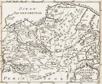
1700réf. 398AG1700. Paris c. 1700. Original copper engraved map. 16 cm wide x 13.2 cm high. Mounted on paper. Very good condition. From a wonderful collection of Maps from an old english library South Shields - with a tiny library stamp to the mounting paper The stamp is NOT on the Map. Nicolas de Fer 164625 October 1720 was a French cartographer and geographer. De Fer was the youngest of three sons of Antoine de Fer who was also a cartographer. When he was 12 he became the apprentice of Parisian engraver Louis Spirinx and made his first map of the Canal du Midi at the age of 23. After the death of his father in June 1673 his mother Geneviève initially took over the map making company which had begun to decline. She passed it and the atelier called Quai de L'Horloge on to Nicolas in 1687 because of her old age. De Fer was so successful at improving the firm that in 1690 he became the official geographer to Louis Dauphin of France. With support from the Spanish and French Royal Families de Fer also became official geographer for Philip V and Louis XIV the kings of Spain and France respectively. Because of this his maps became Bourbon propaganda endorsing French King Louis XIV. His business flourished producing town plans atlases wall maps and more than 600 sheet maps. He made maps of places in Europe and North America including New Spain places fortified by Vauban the Low Countries and the War of the Spanish Succession. In 1698 de Fer published a map of North America which included a depiction of beavers building dams near Niagara Falls. Seventeen years later Herman Moll published a map which plagiarized elements of de Fer's work particularly the beaver scene. It became known as the "Beaver map". De Fer became the official geographer for His Catholic Majesty in 1720. Two of his sons-in-law Guillaume Danet and Jaques-François Bénard continued the company after de Fer's death on 25 October of that year until around 1760. Wikipedia unknown
réf. 110357aafPhotographie E. Lorson Prés de la Gare Fribourg (Suisse) ‘Le Cliché est conservé’, vers 1878, 6x10.5 cm, manuscrit au dos ‘Freiburg in der Schweiz 1878’, sur carton.
1860réf. 10761ABPublié par Louis Bleuler au Chateau de Laufen près de Schaffhouse en Suisse (ca 1860?). 11.9 x 16.3 cm.
réf. 42506Lausanne, Lucien Vincent 1882, 225x145mm, 24Seiten, broschiert.
réf. R160080371SOLAR.. Non daté.. In-4. Relié. Bon état, Couv. convenable, Dos satisfaisant, Intérieur frais. Environ 400 pages. Nombreuses cartes en couleurs, hors texte.. . . . Classification Dewey : 625-Chemins de fer, routes, autoroutes
1980réf. R300274075Albin Michel. 1980. In-4. Relié. Bon état, Couv. convenable, Dos satisfaisant, Intérieur frais. 224 pages - nombreuses photos, illustrations et cartes en couleurs et en noir et blanc dans et hors texte. Texte sur plusieurs colonnes. Jaquette convenable.. Avec Jaquette. . . Classification Dewey : 625-Chemins de fer, routes, autoroutes
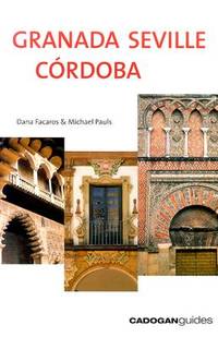
2004réf. DADAX1860111440Brand: Cadogan Guides 2004-03-01. 3rd. paperback. New. 5.50x0.75x8.25. Buy with confidence. Excellent Customer Service & Return policy. Brand: Cadogan Guides paperback
réf. 8471690888.Gpaperback. Good. Access codes and supplements are not guaranteed with used items. May be an ex-library book. paperback
2005réf. Q-8471690853Ediciones Miguel Sánchez 2005-12-28. Paperback. New. New. In shrink wrap. Looks like an interesting title! Ediciones Miguel Sánchez paperback
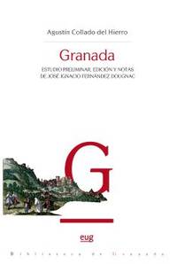
réf. SAL8433870278España: UNIVERSIDAD DE GRANADA. Rústica. Nuevo/Nuevo. ZONUNIV UNIVERSIDAD DE GRANADA paperback
1958français In-4 de 99 pp.; broché avec agrafes de l'éditeur. 5e édition. Un nom d'ancien propriétaire au coin supérieur du premier plat.
1959réf. R320061195SOCIETE NATIONALE DES CHEMINS DE FER FRANCAIS. 1959. In-4. Broché. Etat d'usage, Couv. convenable, Dos satisfaisant, Intérieur frais. 99 pages agraffées.. . . . Classification Dewey : 625-Chemins de fer, routes, autoroutes
1971Brescia, 1971, 8vo stralcio con copertina posticcia muta, pp. 45/54 con 42 figure ed un'illustrazione fotografica. - !! ATTENZIONE !!: Con il termine estratto (o stralcio) intendiamo riferirci ad un fascicolo contenente un articolo, completo in se, sia che esso sia stato stampato a parte utilizzando la stessa composizione sia che provenga direttamente da una rivista. Le pagine sono indicate come "da/a", ad esempio: 229/231 significa che il testo è composto da tre pagine. Quando la rivista di provenienza non viene indicata é perché ci è sconosciuta. - !! ATTENTION !!: : NOT A BOOK : “extract” or “excerpt” means simply a few pages, original nonetheless, printed in a magazine. Pages are indicated as in "from” “to", for example: 229/231 means the text comprises three pages (229, 230 and 231). If the magazine that contained the pages is not mentioned, it is because it is unknown to us.
1865réf. 3839Travaux Artistiques, plomb, zinc, cuivre, tôle. Album 1865. Mit lithogr. Titel u. 45 (6 doppelblattgr.) lithogr. Tafeln nach A[ntoni] Sanguineti. Paris, Imp. Becquet, 1865. 4to. (30,5 x 23,5 cm). Halbleinwandband d. Zt. mit Deckeltitel.
réf. 4707Santander, Union Arte, 33 X 36 cm., en feuilles, non paginé. Prologo y un poema de José Hierro. Six belles gravures de Joaquin Capa signées et numérotées à la main sont insérées chacune dans un feuillet comportant une strophe du poète. Elles représentent des motifs d'édifices religieux de Cantabrie et ont été gravées sur plaques de zinc. Sous chemise cartonnée muette et étui titré. Ce dernier comporte des traces mais est intact. Intérieur en bel état pour cet ensemble rare.
1705réf. M1429A detailed map of Normandy also showing the islands of Guernsey Jersey and part of Brittany. From "L'Atlas Curieux ou le Monde Represente ans des Cartes Generales et Particulieres du Ciel et de la Terre..."
1705réf. M5140Paris 1705. Excellent. Size : 230x345 mm 9x13.625 Inches Coloring: Black & White Category: ; Maps Europe France unknown
1705réf. M5133Paris 1705. Excellent. Size : 236x345 mm 9.25x13.625 Inches Coloring: Black & White Category: Maps Europe France unknown
1911réf. Boite9Paris Goulard 1911 Paris - Février 1911- In4 ( 27 x 22 cm )- broché - 71 pages avec de belles gravures dont certaines en couleur - Nous avons couvert par un plastique transparent d'ou les reflets .
1695réf. 32945(Paris, ca. 1695). 23x29,5 cm. Kobberstukket kort i fugleperspektiv over Göteborg og den nordlige del af sundet med byplan og fortifikationer. Med stor kartouche. Håndkoloreret.