SANREY BernardLivre Rare Book

11 856 résultats
réf. 7357chez l'auteur, sans date, broché, couverture illustrée, 16x24 cm, 48 pages, agrémenté de 35 reproductions de cartes postales anciennes.
réf. 4725P., Carilian-Goeury et Dalmont, 1839, un volume in 8 relié en demi-maroquin marron à coins, couvertures imprimées conservées (reliure postérieure), (quelques traces très pâles de mouillures dans les marges intérieures), (2), 19pp., 501pp., 1 TABLEAU DEPLIANT, 6 PLANCHES DEPLIANTES
1980réf. 007203Tielt 1980 Lannoo Hardcover 1° Edition
1980réf. 018127Tielt 1980 Lannoo Hardcover 1° Edition
1980réf. 020394Tielt 1980 Lannoo Hardcover 1° Edition
1980réf. 021140Tielt 1980 Lannoo Hardcover 1° Edition
réf. 19510Lausanne et Zürich François-Martin Wohlgroth propriétaire-éditeur s.d. (circa 1890) 5 ème ed. revue et augmentée - Cartonné percaline rouge 22 5 cm x 31 cm 254 pages photos noir & blanc in et hors-texte plans impression en noir et rouge et bleu parme pour les 40 dernières pages intitulées « Renseignements utiles aux voyageurs et touristes -Chemins de fer - Poste- Bateaux à vapeur » - Texte de Sylvain Noël nombreuses publicités - Très bon état
réf. 42597Lausanne, Fritz Ruedi 1910, 223mm, 32pages, broché. Bon état.
1930réf. 26233Paris Devambez 1930 -in-12 broché un petit album, broché (reliure à cordonnet doré) marron in-douze à l'italienne Editeur (paperback in-12 oblong Editor) (15,2 x 20 cm), dos muet, première de couverture titrée en noir et doré, illustrée d'une vue de paysage des Alpes en noir, blanc et doré, toutes tranches lisses, Titre imprimé en noir illustré d'une vignette orange dans un encadrement orange, Album de 24 planches photographiques en noir dans un encadrement en gris avec serpentes explicatives imprimées en marron, sans pagination (24 feuillets), sans date (1930) (Paris) : Devambez Editeur,
1885réf. 606342Wien, Hartleben, 1885. XIV, 344, 246 S. Originalleinen (leicht fleckig).
réf. 3943878074.Ghardcover. Good. Access codes and supplements are not guaranteed with used items. May be an ex-library book. hardcover
1927Ril. in tela tit. in oro al piatto., cm 32x25, pp XLV di t., 320 tavv. in b/n..
In 4°, legatura T.Tela edit. con titolo e disegno oro al piatto, pp. XXXIV + 320 tavole in b/n con innumerevoli illustrazioni di lavori in ferro battuto. Testo in tedesco. Ottimo esemplare.
18778vo. Pp. iv,163, 3 large fold. pls. of apparatus, tabs. Orig. printed wrs., uncut. Spine mended and a little external wear, good otherwise. - Interesting Austrian report on iron ore processing in the United States. Rare.
1913réf. 18097ABLpzg und Bln, Teubner 1913. 2., verbess. Aufl, Kl.8°. VI, 102 S. mit zahlr. Ill. und Abb., 2 Bll. und 16 S. Verlagsanzeigen. Beilage: Leben und Umwelt 4.Jg., Heft 1 (1947) u.a. mit dem Titel: Wiesinger, Kurt. Die entgleisungssichere Ultraschnellbahn. OHLwd. Einband und Schnitt nachgedunkelt. (=Aus Natur und Geisteswelt ... 144. Bändchen).
1882réf. 8034ABWiesbaden, Bergmann 1882. Dritte, wesentlich vermehrte Auflage. VIII, 292 S. Halbleinwand. Einband fleckig; Ecken bestoßen; gelockert, Tafeln teils lose. Ohne die beiden Bll. Verlagsanzeigen. 3
réf. 7343984-nnew. unknown
réf. 21718Berlin, Hobbing, 1911. 235 X 315 mm. 2 tomes reliés toile bleue d'éditeur avec titre doré. 647 pp. Nombreuses illustrations in et hors-texte, en noir et en couleurs. Reliure légèrement passée.
1920In-4 gr., cartella editoriale in mz. tela con legacci contenente, a fogli sciolti, pp. (8) di Prefazione e Indice, con 48 tavole fotografiche che illustrano scale, tavoli, mobili, ferri battuti, decoraz. barocche, appartenenti a collezioni pubbliche o a privati, di Danzica. Ben conservato.
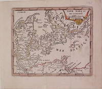
1725réf. 204942Paris: de Fer Nicolas 1725. unbound. very good. Map. Engraving with modern hand coloring. Image measures 5.25" x 6.25". Charming miniature map of Denmark with the Coat of Arms incorporated in the cartouche. Map includes both Schleswig and Holstein while today part of the former and all of the latter are northern Germany. Nicolas de Fer 1646-1720 was a French cartographer engraver and publisher. He became official geographer to the French Dauphin 1691 and to the Spanish King 1702. de Fer, Nicolas unknown books
1725réf. 204942Paris: de Fer Nicolas 1725. unbound. very good. Map. Engraving with modern hand coloring. Image measures 5.25" x 6.25". Charming miniature map of Denmark with the Coat of Arms incorporated in the cartouche. Map includes both Schleswig and Holstein while today part of the former and all of the latter are northern Germany. Nicolas de Fer 1646-1720 was a French cartographer engraver and publisher. He became official geographer to the French Dauphin 1691 and to the Spanish King 1702. de Fer, Nicolas unknown
réf. 0993149049.Gpaperback. Good. Access codes and supplements are not guaranteed with used items. May be an ex-library book. paperback
réf. 69-9256Yale University Press ; National Gallery of Art New Haven Washington 2006. 4to. Soft Cover. Very Good. 164pp. Black and White Plates. Text in English. Yale University Press ; National Gallery of Art, New Haven, Washington, 2006 paperback
1914réf. 80171914 Librairie Hachette, Paris, 1914. in-8. cartonnage de l'éditeur orné. 190 pages. Ouvrage illustré de 60 gravures.
1974réf. RO80122440CHEZ L'AUTEUR. 1974. In-4. Broché. Etat d'usage, Couv. légèrement passée, Dos satisfaisant, Intérieur acceptable. 99 pages. Nombreuses photos en noir et blanc, dans le texte. Ouvrage en anglais.. . . A l'italienne. Classification Dewey : 625-Chemins de fer, routes, autoroutes