11.856 resultados
1907ref. 16095Erie PA: Erie City Iron Works. Near Fine. 1907. First Edition. Softcover. Pencil notes inside the front cover. ; Oblong 48mo 3½" - 4" tall; 32 pages . Erie City Iron Works paperback
1725ref. 204942Paris: de Fer Nicolas 1725. unbound. very good. Map. Engraving with modern hand coloring. Image measures 5.25" x 6.25". Charming miniature map of Denmark with the Coat of Arms incorporated in the cartouche. Map includes both Schleswig and Holstein while today part of the former and all of the latter are northern Germany. Nicolas de Fer 1646-1720 was a French cartographer engraver and publisher. He became official geographer to the French Dauphin 1691 and to the Spanish King 1702. de Fer, Nicolas unknown
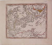
1725ref. 204942Paris: de Fer Nicolas 1725. unbound. very good. Map. Engraving with modern hand coloring. Image measures 5.25" x 6.25". Charming miniature map of Denmark with the Coat of Arms incorporated in the cartouche. Map includes both Schleswig and Holstein while today part of the former and all of the latter are northern Germany. Nicolas de Fer 1646-1720 was a French cartographer engraver and publisher. He became official geographer to the French Dauphin 1691 and to the Spanish King 1702. de Fer, Nicolas unknown books
1973ref. 39746St. Louis MO:: Int'l Assn of Bridge Structural and Ornamental Iron Workers 1973. paperback. VERY GOOD PLUS. Large light tan paperback 256 pages. Almost like new: last name written on front cover upper page edges very lightly foxed. "Foxing" is light tan spots caused by extended exposure to humid air. We provide professional service and individual attention to your order daily shipments and sturdy packaging. FREE TRACKING ON ALL SHIPMENTS WITHIN USA. Int'l Assn of Bridge, Structural and Ornamental Iron Workers, paperback
2003ref. 110850Zeitgeist Films 2003-09-02. DVD. Like New. 7x5x0. New in shrink wrap. Please email for photos. Zeitgeist Films unknown
ref. DADAX0415813441New unknown
ref. Juanpebooks091670WE ship worldwide. Brand new 100%guarentee unknown
ref. 648023853Springer . Papeback. New. pp. 132 Springer unknown
ref. 3639686276.Gpaperback. Good. Access codes and supplements are not guaranteed with used items. May be an ex-library book. paperback
ref. 46417811-nnew. unknown
1845ref. 14482ABAus 'Illustrirte Zeitung' Bd V (1845/46). Ca 12.5 x 21.5 cm. Aufgezogen.
ref. 9985Du n° 638 (16 mars 1958) au n° 715 (27 septembre 1959) soit 78 numéros reliés en 3 volumes in 4°, demi toile aubergine.
ref. 65584P., Flohic Editions, 1999, 2 forts volumes in 8°, cartonnages bleus illustrés en couleurs de l'éditeur, sous étui de plastique transparent, 971 pages en pagination continue ; très importante iconographie.
1909français Dédicacé par l'auteur Grand in-8 de 243 pp.; broché de l'éditeur. Envoi autographe signé de l'auteur en marge du faux-titre. Exemplaire non coupé.
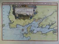
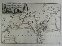
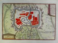
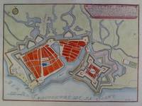
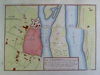
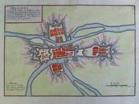
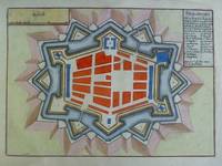
ref. 2n1783De Fer Paris um 1700. Maße: 27 cm x 195 cm. - Nicolas de Fer war einer der führenden französischen Kartographen und Kartenverleger - unknown
ref. 2n1782De Fer Paris um 1700. Maße: 285 cm x 203 cm. - Nicolas de Fer war einer der führenden französischen Kartographen und Kartenverleger - unknown
ref. 2n1770De Fer Paris 1692. Maße: 28 cm x 205 cm. - Nicolas de Fer war einer der führenden französischen Kartographen und Kartenverleger - unknown
ref. 2n1615ca. 1692. Blattgröße: 365 cm x 275 cm. - kräftiger Abdruck / sauberes Blatt - unknown
ref. 2n1775De Fer Paris 1705. Maße: 285 cm x 195 cm kleiner Einriß am oberen Blattrand. - Nicolas de Fer war einer der führenden französischen Kartographen und Kartenverleger - unknown
ref. 2n1616ca. 1692. Blattgröße: 365 cm x 275 cm. - kräftiger Abdruck / sauberes Blatt - unknown
ref. 2n1784De Fer Paris um 1700. Maße: 25 cm x 17 cm. - Nicolas de Fer war einer der führenden französischen Kartographen und Kartenverleger - unknown
ref. 2n1781De Fer Paris um 1700. Maße: 28 cm x 205 cm. - Nicolas de Fer war einer der führenden französischen Kartographen und Kartenverleger - unknown
ref. 2n1772De Fer Paris um 1700. Maße: 26 cm x 18 cm. - Nicolas de Fer war einer der führenden französischen Kartographen und Kartenverleger - unknown
ref. 2n1773De Fer Paris um 1700. Maße: 27 cm x 19 cm Blattrand mit kleinen Knickspuren. - Nicolas de Fer war einer der führenden französischen Kartographen und Kartenverleger - unknown
ref. 2n1776De Fer Paris um 1700. Maße: 285 cm x 205 cm. - Nicolas de Fer war einer der führenden französischen Kartographen und Kartenverleger - unknown