12.060 resultados
ref. 1847727921.Gsheet_music. Good. Access codes and supplements are not guaranteed with used items. May be an ex-library book. unknown
ref. 1844493296.Gpaperback. Good. Access codes and supplements are not guaranteed with used items. May be an ex-library book. paperback
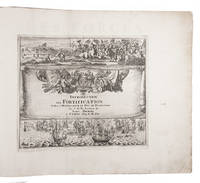
1702ref. 23526Paris 1702. Oblong 1mo 30 x 37 cm. chez l'auteur" = Nicolas de Fer a false imprint Contemporary tanned sheepskin sewn on 5 cords gold-tooled spine with the title in the 2nd of 6 compartments. Ad 1 with 10 letterpress title pages in red and black for the 10 parts; 5 engraved titles for parts 1-5 that for part 5 repeating that for part 2; plus 234 beautifully engraved plates a few folding with 366 maps and views of fortified cities. Ad 2 with an engraved title page 2 letterpress title pages in red and black and 40 engraved plates including 2 folding labelled A-S in part 1 and T-Oo in part 2. 2 works in 12 parts or volumes bound as 1. Splendid atlas of fortifications of the cities of Europe plus Malta and some other Mediterranean sites combined with a maritime atlas of the French coasts published by Pieter Mortier 1661-1711. Both are based on the similar publications of Nicolas de Fer 1646-1720 and falsely indicate that they were published by him.Ad 1: The atlas of fortified cities of Europe. Many of the plans show the work of the greatest 17th-century masters of the art and science of fortification including Samuel Marolois Simon Stevin and Sébastien Le Prestre de Vauban. The last two parts contain primarily smaller maps printed 4 to the page. Ad 2: The maritime atlas of the coasts of France. It also shows the fortifications along the coasts so it complements the fortifications atlas and was clearly designed to match it in format and style. With the caption of one plate cut off and 2 plates and 1 letterpress title-page somewhat browned. Further in good condition. A couple plates are bound in the wrong volume. A splendid fortifications atlas.l Ad 1: Muller Historieplaten 3034a; cf. Pastoureau Atlas français IX A & H pp. 203-209 213: Paris Fer ed. 1690-1695 & Amsterdam Mortier ed. 1702 with different title; Phillips pp. 256-7 other ed.; Ad 2: Muller Historieplaten 3034a; Pastoureau Les atlas français XVIe-XVIIe siècles Fer VIII B p. 203 cf. pp. 201-203; for Mortier see: Koeman III pp. 4-10 and IV p. 423. unknown
1986ref. USD_9780808917557Saunder 1986. 1St. Hardcover. Used - Like New/Used - Like New. _ Saunder hardcover
1992ref. AME_9780824787189marcel dekker 1992. 1st. Hardcover. New/New. _ marcel dekker hardcover
2008ref. AME_9783540852032Springer 2008. 1st. Paperback. New/New. _ Springer paperback
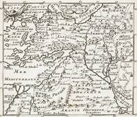
1700ref. 402AG1700. Paris c. 1700. Original copper engraved maps. 15.5 cm wide x 13 cm high. Mounted on paper. Very good condition. From a wonderful collection of Maps from an old english library South Shields - with a tiny library stamp to the mounting paper The stamp is NOT on the Map. Nicolas de Fer 164625 October 1720 was a French cartographer and geographer. De Fer was the youngest of three sons of Antoine de Fer who was also a cartographer. When he was 12 he became the apprentice of Parisian engraver Louis Spirinx and made his first map of the Canal du Midi at the age of 23. After the death of his father in June 1673 his mother Geneviève initially took over the map making company which had begun to decline. She passed it and the atelier called Quai de L'Horloge on to Nicolas in 1687 because of her old age. De Fer was so successful at improving the firm that in 1690 he became the official geographer to Louis Dauphin of France. With support from the Spanish and French Royal Families de Fer also became official geographer for Philip V and Louis XIV the kings of Spain and France respectively. Because of this his maps became Bourbon propaganda endorsing French King Louis XIV. His business flourished producing town plans atlases wall maps and more than 600 sheet maps. He made maps of places in Europe and North America including New Spain places fortified by Vauban the Low Countries and the War of the Spanish Succession. In 1698 de Fer published a map of North America which included a depiction of beavers building dams near Niagara Falls. Seventeen years later Herman Moll published a map which plagiarized elements of de Fer's work particularly the beaver scene. It became known as the "Beaver map". De Fer became the official geographer for His Catholic Majesty in 1720. Two of his sons-in-law Guillaume Danet and Jaques-François Bénard continued the company after de Fer's death on 25 October of that year until around 1760. Wikipedia unknown
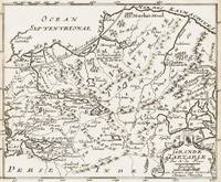
1700ref. 398AG1700. Paris c. 1700. Original copper engraved map. 16 cm wide x 13.2 cm high. Mounted on paper. Very good condition. From a wonderful collection of Maps from an old english library South Shields - with a tiny library stamp to the mounting paper The stamp is NOT on the Map. Nicolas de Fer 164625 October 1720 was a French cartographer and geographer. De Fer was the youngest of three sons of Antoine de Fer who was also a cartographer. When he was 12 he became the apprentice of Parisian engraver Louis Spirinx and made his first map of the Canal du Midi at the age of 23. After the death of his father in June 1673 his mother Geneviève initially took over the map making company which had begun to decline. She passed it and the atelier called Quai de L'Horloge on to Nicolas in 1687 because of her old age. De Fer was so successful at improving the firm that in 1690 he became the official geographer to Louis Dauphin of France. With support from the Spanish and French Royal Families de Fer also became official geographer for Philip V and Louis XIV the kings of Spain and France respectively. Because of this his maps became Bourbon propaganda endorsing French King Louis XIV. His business flourished producing town plans atlases wall maps and more than 600 sheet maps. He made maps of places in Europe and North America including New Spain places fortified by Vauban the Low Countries and the War of the Spanish Succession. In 1698 de Fer published a map of North America which included a depiction of beavers building dams near Niagara Falls. Seventeen years later Herman Moll published a map which plagiarized elements of de Fer's work particularly the beaver scene. It became known as the "Beaver map". De Fer became the official geographer for His Catholic Majesty in 1720. Two of his sons-in-law Guillaume Danet and Jaques-François Bénard continued the company after de Fer's death on 25 October of that year until around 1760. Wikipedia unknown
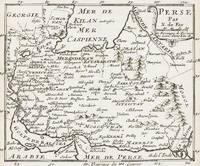
1700ref. 399AG1700. Paris c. 1700. Original copper engraved maps. 16 cm wide x 13.2 cm high. Mounted on paper. Very good condition. From a wonderful collection of Maps from an old english library South Shields - with a tiny library stamp to the mounting paper The stamp is NOT on the Map. Nicolas de Fer 164625 October 1720 was a French cartographer and geographer. De Fer was the youngest of three sons of Antoine de Fer who was also a cartographer. When he was 12 he became the apprentice of Parisian engraver Louis Spirinx and made his first map of the Canal du Midi at the age of 23. After the death of his father in June 1673 his mother Geneviève initially took over the map making company which had begun to decline. She passed it and the atelier called Quai de L'Horloge on to Nicolas in 1687 because of her old age. De Fer was so successful at improving the firm that in 1690 he became the official geographer to Louis Dauphin of France. With support from the Spanish and French Royal Families de Fer also became official geographer for Philip V and Louis XIV the kings of Spain and France respectively. Because of this his maps became Bourbon propaganda endorsing French King Louis XIV. His business flourished producing town plans atlases wall maps and more than 600 sheet maps. He made maps of places in Europe and North America including New Spain places fortified by Vauban the Low Countries and the War of the Spanish Succession. In 1698 de Fer published a map of North America which included a depiction of beavers building dams near Niagara Falls. Seventeen years later Herman Moll published a map which plagiarized elements of de Fer's work particularly the beaver scene. It became known as the "Beaver map". De Fer became the official geographer for His Catholic Majesty in 1720. Two of his sons-in-law Guillaume Danet and Jaques-François Bénard continued the company after de Fer's death on 25 October of that year until around 1760. Wikipedia unknown
1700ref. 403AG1700. Paris c. 1700. Original copper engraved maps. 15.5 cm wide x 13 cm high. Mounted on paper. Very good condition. From a wonderful collection of Maps from an old english library South Shields - with a tiny library stamp to the mounting paper The stamp is NOT on the Map. Nicolas de Fer 164625 October 1720 was a French cartographer and geographer. De Fer was the youngest of three sons of Antoine de Fer who was also a cartographer. When he was 12 he became the apprentice of Parisian engraver Louis Spirinx and made his first map of the Canal du Midi at the age of 23. After the death of his father in June 1673 his mother Geneviève initially took over the map making company which had begun to decline. She passed it and the atelier called Quai de L'Horloge on to Nicolas in 1687 because of her old age. De Fer was so successful at improving the firm that in 1690 he became the official geographer to Louis Dauphin of France. With support from the Spanish and French Royal Families de Fer also became official geographer for Philip V and Louis XIV the kings of Spain and France respectively. Because of this his maps became Bourbon propaganda endorsing French King Louis XIV. His business flourished producing town plans atlases wall maps and more than 600 sheet maps. He made maps of places in Europe and North America including New Spain places fortified by Vauban the Low Countries and the War of the Spanish Succession. In 1698 de Fer published a map of North America which included a depiction of beavers building dams near Niagara Falls. Seventeen years later Herman Moll published a map which plagiarized elements of de Fer's work particularly the beaver scene. It became known as the "Beaver map". De Fer became the official geographer for His Catholic Majesty in 1720. Two of his sons-in-law Guillaume Danet and Jaques-François Bénard continued the company after de Fer's death on 25 October of that year until around 1760. Wikipedia unknown
1989ref. 133052New York: CBS Music Video Enterprise 1989. Video VHS. Box has edgewear. "For Promotion Only" sticker. 95 minutes. CBS Music Video Enterprise unknown
1906ref. 52925Philadelphia PA: Penn Metal Ceiling & Roofing Co. 1906. Oblong folio. 14 x 10.25 in. 62 pp. With over 300 woodcut-engraved text illustrations diagrams and photo illustrations. Quarter-gray cloth over limp gray embossed printed softcovers Arts & Crafts style decoration & ornamental letters in embossed raised silver & white lettering slight shelfwear still a NF copy. First edition of this scarce and lavishly illustrated catalogue of Edwardian architectural and ornamental ironwork filled with designs and illustrations for metal ceiling and side wall paneling and tiles; ornamental rock-faced stone & pressed steel brick; decorative iron awnings; galvanized steel and iron crestings cornices mouldings metallic cresting blocks ornamental finials corrugated roofing and siding weathervanes ventilators and skylights. In addition this catalogue includes an illustrated section of the necessary tools paint brushes and edging tongs required to install maintain and paint the attached metal pieces. Sagendorph 1842-1909 a Rhode Island Civil War veteran founded the Penn Metal Ceiling & Roofing Co. in 1889 and quickly became one of the largest manufacturers of corrugated iron & steel roofing galvanized pipe pressed metal ceilings and more. Sagendorph who had founded his first manufacturing company in 1869 was also a noted inventor and manufacturers securing over 100 patents for sheet metal manufacturing machinery with emphasis on his methods of corrugating metal sheets by means of rolls. Worldcat locates 3 copies Cleveland Public Hagley Univ. of Chicago; See: Penn Metal Company Seventy-fifth Penn Metal Year 1869-1944. Penn Metal Ceiling & Roofing Co., paperback
1999ref. 68301New York: Cast Iron Gallery 1999. First Edition; First Printing. Softcover. Very Good in wrappers.; 4to - over 9¾" - 12" tall. Cast Iron Gallery unknown
1905ref. 46613Cincinnati OH: Iron Molders’ Journal Feb. - Dec. 1905. 5 vols. 4 79-158 4; 4 159-248 5; 4 753-824 4; 4 825-896 4; 4 897-967 5 pp. Numerous photos text illustrations illustrated ads. Blue-tinted printed & illustrated softcovers some dustsoiling edgewear some rubbing still a VG- set of these labor union journals in original condition. First editions of these exceedingly scarce original union journals from the International Molders and Foundry Workers Union of North America which was an affiliated Union with the AFL-CIO and is now part of the Glass Molders Pottery Plastics and Allied Workers International Union. Iron Molders’ Journal, paperback
1988ref. 57337New York: Crown Publishers 1988. First Edition; First Printing. Hardcover. Very Good in a Very Good dust jacket.; 8vo 8" - 9" tall. Crown Publishers hardcover
ref. 218412Paris: Librairie Générale de L'Architecxture et des Travaux Publics Ducher et Cie nd. Missing 6 20 26 30 32 50 83 of 84 plates 2 of plate 22. 2 page of text. 1 vols. Folio. In portfolio. Some foxing to plates else near fine. Missing 6 20 26 30 32 50 83 of 84 plates 2 of plate 22. 2 page of text. 1 vols. Folio. Librairie Générale de L'Architecxture et des Travaux Publics Ducher et Cie unknown
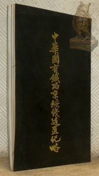
1921ref. 121011Pékin Beijing : édition officielle publiée à compte d’auteur par l’Administration même de la ligne et imprimé par l’Imprimerie Officielle de l’Etat la Calcographie de Pékin 1921. broché. Collectif. - Le Bureau d’administration des chemins de fer de Jingsui.Zhonghua Guoyou Tielu Jingsuixian Jianzhi Jilue. Précis d’établissement de la ligne férroviaire nationale chinoise de Jingsui Pékin-Suiyuan. - Edition de Prestige Commémorative. Pékin Beijing édition officielle publiée à compte d’auteur par l’Administration même de la ligne et imprimé par l’Imprimerie Officielle de l’Etat la Calcographie de Pékin1921 225x145mm 38 pages 18 portraits n/b une carte dépliante un plan dépliant trois tableaux statistiques dépliants et des illustrations n/b in texte écrit en chinois classique broché. Avec à la fin du livre : un feuillet de présentation officiel du cadeau commémoratif entouré d’une magnifique frise florale imprimée à l’encre verte la petite inscription horizontale tout en bas de la dernière page indique : Imprimé pour le compte de l’Etat par l’Imprimerie du Ministère des Finances. - Livre réellement confectionné par l’Imprimerie Officielle de l’Etat la Calcographie de Pékin qui imprimait les billets de banque les timbres fiscaux et les documents de haute sécurité de la République de Chine. Bel exemplaire. For shipments to the U.S.A. with a value exceeding 800 USD VAT is not included. Please contact us via our website if needed. édition officielle publiée à compte d’auteur par l’Administration même de la ligne et imprimé par l’Imprimerie Offici unknown
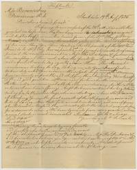
1825ref. BK0190Stockholm Sweden 1825. One large folded commercial sheet written on several panels with integral address panel to Messrs. Brown & Ives Providence Rhode Island endorsed "Pr. Brig Harvest" with Newport "SHIP" marking. Headed "Triplicate. Old folds and light handling wear very good. A commercial letter and account from the Stockholm mercantile house of Kantzow & Biel to Brown & Ives of Providence concerning the execution of a large order for Swedish iron. The firm reports that it is assembling a shipment of arranging its transport while the accounting on another portion of the same sheet records the value of the iron and related charges. The letter reports: "the contents giving us the desired opportunity of confirming you Your order for a Shipmt. of 200 Tons Iron to be ship'd & appointed and convoy which we shall of course prevail the commencement on." The letter dates from a period of rapid expansion in Swedish iron exports to the United States which had displaced Britain as Sweden's most important foreign market for bar iron. Britain had reduced its dependence on Swedish imports while American tariff legislation favored hammered iron from Sweden and Russia over British rolled iron. American demand became particularly important to the Swedish industry in the aftermath of the Napoleonic Wars. The United States purchased approximately three-fifths of Sweden's iron exports in 1822 with mainly American vessels engaged in the trade. The account also records a credit entered July 28 "By your proportion of dividend in payment from the Swedish Government". Brown & Ives had longstanding claims against Sweden arising from American property seized during the Napoleonic Wars including tobacco and rice belonging to the firm taken from the General Hamilton in 1810.1 The Swedish government finally settled the American claims in July 1825 following years of diplomatic representations concerning the confiscation and sale of American property at Stralsund. The credit recorded here appears to represent Brown & Ives's share of that indemnity entered less than two weeks after the settlement was formally concluded on July 16. The correspondence thus brings together two aspects of Swedish-American relations in the immediate postwar period: the expansion of an iron trade increasingly important to Sweden's economy and the settlement of commercial grievances dating back fifteen years. The shift reflected the changing geography of Atlantic commerce as Britain's increasingly mechanized iron industry reduced its dependence on Swedish imports while the rapidly industrializing United States emerged as Sweden's principal customer. However American iron production expanded enough to challenge Sweden's position in the American market particularly beginning in the 1830s and 1840s. 1 Calendar of the Miscellaneous Letters Received by the Department of State Government Printing Office 1897 47. . unknown
1885ref. 19428Wells Gardner Darton & Co. . Good. Hardcover. Beige pictorial cover is soiled and worn head cap is crushed tail cap is rubbed corners are frayed but cover is in good condition. Boards and spine are straight. Binding is tight. Lacking frontispiece front end sheet and rear end sheet. Pages are lightly toned clean and in very good condition. B&W illustrations. . 1885. Wells Gardner, Darton, & Co. hardcover
ref. DADAX8891843415RIZZOLI. New. 8.43x0.95x10.80. Buy with confidence. Excellent Customer Service & Return policy. RIZZOLI unknown
2025ref. __3735610390Kerber Christof Verlag 2025. Paperback. New. 290 pages. German language. 9.13x1.14x11.02 inches. Kerber Christof Verlag paperback
ref. RGW22847With 4 Share certificates for the Llynvi Coal & Iron Company Ltd dated 1871 to Mary Cavan creased on one corner 1885 correspondence and endorsements about the debentures. The principal sums were repaid in 1885. In 1884 it would appear the debentures were worth £41860. The works were started in 1798. This particular company was formed in 1872. It would appear Mary Cavan held nearly one third of the shares in The Llynvi Coal and Iron Company in 1871. Her husband Colonel Cavan had died in 1870. The Cavan family had a long history of investing in the South Wales iron industry. James Cavan had invested in the Llynvi Iron Works in 1845 and before that in the Cambrian Iron and Spelter Company.In 1886 the companyÕs ironworks at Maesteg ceased to work. Possibly the paying back of the debentures was a contributing factor to the closure. unknown
ref. 1933362006.Ghardcover. Good. Access codes and supplements are not guaranteed with used items. May be an ex-library book. hardcover
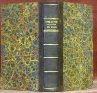
1823ref. 45312Lausanne : Lacombe 1823. demi-basane. FER Ph.Code civil du canton de Vaud. Nouvelle édition conforme quant au texte à l’édition officielle. Avec des notes indiquant la correspondance des articles entr’eux ainsi que les modifications exceptions et dérogations qu’une disposition a reçue par une autre et une table alphabétique et raisonnée des matières. Lausanne Lacombe1823 170x105mmXXII - 413 266 pages reliure demi-basane. Plats papier marbré. Titre doré au dos. No hidden customs fees for orders shipped to the U.S.A with a value of up to 800 USD PDDP shipping we pay the VAT in advance Lacombe unknown
ref. GRP69044693Yale University Press. Used - Good. Former library copy. Pages intact with minimal writing/highlighting. The binding may be loose and creased. Dust jackets/supplements are not included. Includes library markings. Stock photo provided. Product includes identifying sticker. Better World Books: Buy Books. Do Good. Yale University Press unknown