12.121 resultados
1916In 4? (cm 30), Brossura moderna in carta Varese, pagg.4 Stralcio da pag. 91 a pag. 94 con 1 ill. b.n. n.t relativa agli strumenti di ferro nella cava di marmo "Fantiscritti" in frazione Miseglia, ben conservato. Il Galli, archeologo, nacque a a Majera (Maier?) nel 1880.
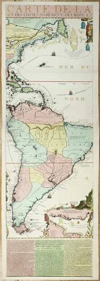
ref. 11134Paris: 1713. No binding. Very Good. 1175 x 380 mm. full early wash colour with accompanying title page included a key map bookplate of the Duke of York on the verso in very good condition. Three sheets of an exceedingly rare fifteen-sheet wall map by Nicolas de Fer accompanied by the title with key map all in fabulous original colour. When published in 1713 it was the most extravagant map of America yet produced. It encompasses not just the American continent but the whole of the Pacific Ocean also. The map is made up of ten sheets in two rows of five and accompanied by 5 further smaller sheets of descriptive text which are not always present along the bottom. Here we offer the two sheets encompassing the east coast of North America and much of South America. The end of the War of Spanish Succession 1701-14 was near by 1711 and with a weakened Spain France began to eye North America. This renewed interest led to 'Louisiana' and the founding of New Orleans in 1718. Nicholas de Fer 1646-1720 was born the youngest of eight children to the map seller Antoine de Fer fl.1644-d.1673 and grew to be one of the most well-known mapmakers in France in the seventeenth century. He was apprenticed in 1659 to the engraver Louis Spirinx at the age of twelve. Following the death of his father in 1673 Nicholas worked with his mother to continue the family business. On her retirement in 1687 she passed the business to Nicolas in exchange for a crown a week unlimited bread and a pint of wine per day Pastoureau. His earliest known work is a map of the Canal of Languedoc in 1669. Arguably his most famous production is his wall map of America published in 1698. It is renowned for the beaver scene. In 1690 he became cartographer to the Dauphin of France and eventually to Louis XIV himself. From 1690 he began publishing his own books such as 'Les Forces de l'Europe' and the 'Petit et Nouveau Atlas' in 1697. His first wall map in 1694 was naturally of the world and this was followed by a set of four continents. The British possessions are hemmed into the coast of North America and include Acadia. In South America the mythical Lake Parime is excluded but the Orinoco and Amazon Rivers are still connected. Sea routes to and from the tip of South America are displayed and a fabulous inset of the Rio de la Plata is found lower right. The scene accompanying this is the mountain of Potosi the source of fabulous silver reserves with an image of panning for gold in the water nearby. The whole is wonderfully engraved by P. Starckman and dedicated to Monseigneur le Comte de Toulouse. The text beneath describes the voyage of Jacques le Hermite 1582-1624 in 1623-5 to present day Argentina and Tierra del Fuego. Le Hermite himself died on the voyage in Callao on the Peruvian coast. The map was a model for the later reduction by Henri Abraham Chatelain published in 1719 and Hermann Moll. An extremely rare map no examples are traced in the Library of Congress or the British Library. This example is from the magnificent collection of the Duke of York 1763-1827 unfortunately distributed at Sotheby's in May 1827. The second son of King George III he early on entered the military. His unfortune experiences can often be laid at the poor state of the military forces. It however led to the mocking rhyme 'The Grand Old Duke of York'. He is now credited with reshaping the armed forces to be more professional and merit based. He became Commander-in-Chief during the Napoleonic Wars. His collection when auctioned was described as being '88 folio double book cases' which contained 5500 maps each of which bore his distinctive bookplate with manuscript volume and map number below. Provenance: With bookplate of Frederick Augustus Duke of York 1763-1827; Sotheby's May 1827; collection of Hein Wenzel Berlin with stamp; Richard B. Arkway Inc. 2000; Juan and Peggy Rada Collection. Harley & Walters 1978; Howgego 2003 1713 unknown
ref. 2n1615ca. 1692. Blattgröße: 365 cm x 275 cm. - kräftiger Abdruck / sauberes Blatt - unknown
ref. 2n1775De Fer Paris 1705. Maße: 285 cm x 195 cm kleiner Einriß am oberen Blattrand. - Nicolas de Fer war einer der führenden französischen Kartographen und Kartenverleger - unknown
ref. 1841aaum 1700. Maße: ca. 327 x 25 cm mehrfach gefaltet gering fleckig/Blatt mit kleinen Randläsuren. unknown
sous chemise cartonnée bleue marbrée, étiquette de titre en papier illustrée d'une locomotive contrecollée sur le premier plat s.d. [XIXème siècle], s.d. [XIXème siècle], , , sous chemise cartonnée bleue marbrée, étiquette de titre en papier illustrée d'une locomotive contrecollée sur le premier plat, Jolie carte dépliante dessinée par le géographe Frémin et gravée sur cuivre. Itinéraire rehaussé. Dimensions : environ 275 x 695 mm. Chemise usagée
sous chemise cartonnée noire marbrée, étiquette de titre en papier illustrée d'une locomotive contrecollée sur le premier plat s.d. [XIXème siècle], s.d. [XIXème siècle], , , sous chemise cartonnée noire marbrée, étiquette de titre en papier illustrée d'une locomotive contrecollée sur le premier plat, Jolie carte dépliante dessinée par le géographe Frémin et gravée sur cuivre. Itinéraire rehaussé. Dimensions : environ 275 x 695 mm. Rousseurs sur l'étiquette de titre et à certains endroits sur la carte
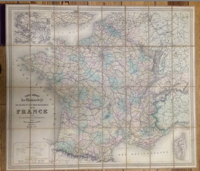
français Sans date (circa 1880). Carte en couleurs 85 x 95 cm. Légers plis. Quelques déchirures anciennement restaurées.
ref. 2n1616ca. 1692. Blattgröße: 365 cm x 275 cm. - kräftiger Abdruck / sauberes Blatt - unknown
18751 carte d?pliante entoil?e de 61 x 87 cm. Sous livret Reli? illustr?.
BERNAL. 1867. In-16 Carré. Cartonné. Etat d'usage. Couv. légèrement passée. Dos frotté. Pliures. Carte en couleurs dépliante de 90.5 cm / 62;5 cm. Quelques photos en noir et blanc encadrant la carte. Petites déchirures dans certaines pliures.
1886ref. 7472BBParis, 1886. 95,5 x 83 cm Stahlstichkarte. Orig.-Leinen mit Deckeltitelvergoldung., karte Einbandrücken etwas berieben.
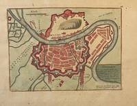
ref. PR121919-036Original map of Grenoble France. Later colored with the river Iser les Recolets Tour de Natot Porte de Beaune.Engraving with later hand coloring on laid paper in good condition. Total size 270 x 390 mm. Numbered with 46 in the right top.NL Decoratieve historische kaart van Grenoble in Frankrijk. unknown
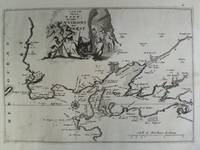
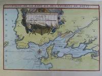
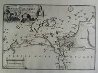
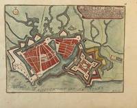
ref. PR121919-035Original map of Le Havre in North of France. Later colored with citadelle la Corderie Fontaine Bassin des Capucins and compass.Engraving with later hand coloring on laid paper in good condition. Total size 280 x 380 mm. Numbered with 26 in the right top.NL Decoratieve historische kaart van Havre de Grâce de vroegere naam van het huidige Le Havre gelegen aan de monding van de Seine in Normandië Frankrijk. Komt waarschijnlijk uit de atlas Les Forces de L'Europe van Nicolas de Fer een bekende Franse cartograaf. Le Havre werd in 1517 gesticht door Frans I als strategische haven. De kaart toont een versterkt Le Havre zoals het eruitzag tijdens de 17e18e eeuw toen de stad een belangrijk militair en handelscentrum was. De citadel werd aangelegd om de monding van de Seine te verdedigen tegen Engelse invallen. unknown
1701ref. 23030Paris: Nicolas De Fer 1701. First Edition. Very Good. Ginville Vincent de. Ginville Vincent de. First Edition. Paper size 42.5 cm x 28.5 cm. Plate mark 34 x 22.5 cm. Marginal paper clip stain inked '109' upper right corner some marginal chipping to the paper and old penciled price lower right. A few unobtrusive spots inside the plate marks. Copperplate engraving by Vincent de Ginville with later awfully bright hand color. This map would frame up nicely. There appears to be several versions of this map. The David Rumsey Collection has an example dated on the cartouch 1705 which he notes as being from Nicolas De Fer's Atlas Curieux published later. The Library of Congress has an example of the map offered here with the 1701 date and a separate page with explanations of the map. We don't know where this 1701 example came from separately issued or another atlas. The map highlights locations of Indian villages found by La Salle during his explorations of the coastal areas of the United States. We see the Gulf of Mexico Cap de la Floride and many inland village names. A nice map showing some early history of the southern United States. It includes parts of modern-day Louisiana Mississippi Alabama and Florida as well as the Bahamas and Cuba. Nicolas De Fer unknown
1701ref. 23030Paris: Nicolas De Fer 1701. First Edition. Very Good. Ginville Vincent de. Ginville Vincent de. First Edition. Paper size 42.5 cm x 28.5 cm. Plate mark 34 x 22.5 cm. Marginal paper clip stain inked '109' upper right corner some marginal chipping to the paper and old penciled price lower right. A few unobtrusive spots inside the plate marks. Copperplate engraving by Vincent de Ginville with later awfully bright hand color. This map would frame up nicely. There appears to be several versions of this map. The David Rumsey Collection has an example dated on the cartouch 1705 which he notes as being from Nicolas De Fer's Atlas Curieux published later. The Library of Congress has an example of the map offered here with the 1701 date and a separate page with explanations of the map. We don't know where this 1701 example came from separately issued or another atlas. The map highlights locations of Indian villages found by La Salle during his explorations of the coastal areas of the United States. We see the Gulf of Mexico Cap de la Floride and many inland village names. A nice map showing some early history of the southern United States. It includes parts of modern-day Louisiana Mississippi Alabama and Florida as well as the Bahamas and Cuba. Nicolas De Fer unknown books
2005ref. 20643Bibliothèque de l’Image 2005 In-8, cartonnage noir, sous jaquette illustrée, illustrations pleines pages en couleurs, 102 pp. Très bon état.
1994Firenze, 4 Ottobre 1994. Firenze, 1994; br., pp. 46, ill. col., cm 19x24. italiano
2010ref. DADAX1169718809Kessinger Publishing 2010-09-10. hardcover. New. 8.50x0.44x11.00. Buy with confidence. Excellent Customer Service & Return policy. Kessinger Publishing hardcover
ref. A9781169718807New. unknown
ref. B9781169718807New. unknown
ref. 1169718809.Ghardcover. Good. Access codes and supplements are not guaranteed with used items. May be an ex-library book. hardcover
1906ref. 71840United States Cast Iron Pipe & Foundry Company 1906. Hardcover. Used - Very Good. Chasmar Winchell Press NY & Pittsburgh. 156 pages. Illustrations of Croton & Wachusett Reservoir Dams Spot Pond Wellesley Charles River Chelsea Creek Mystic River Philadelphia New Orleans installations high pressure fire systems special castings Addyston Ohio Anniston & Bessemer Alabama Buffalo Burlington New Jersey Louisville Scottsdale Pennsylvania works. 10.75 x 8.5" gold stamped black cloth. Cover spotted tips rubbed VG. United States Cast Iron Pipe & Foundry Company hardcover
19941 lingua: inglese Brossura edit. illustrata, cm 28x22, pag. 351, con numerosissime illustraz. a colori e in b.n. - a cura di Elisabeth Schmuttermeier, E. Bryding Adams, Helmut Börsch Supan, Leon Botstein, Georg Himmelheber, Ursula Ilse Neumann, Brigitte Marquardt, Derek E. Ostergard, Albrecht Pyritz, Michael Stratton - Catalogo mostra New York, The Bard Graduate Center for Studies in the Decorative Arts, dal 25 maggio al 7 agosto 1994 - In collaborazione con il MAK Austrian Museum of Applied Arts, Vienna - Panoramica sulle sculture e altri oggetti d'arte in ghisa in Europa centrale dal 1800 al 1850 - Perfetto stato.
19591959 revised castings catalogue price list No. 1 attached on back pastedown. B. Finch & Co presentation label on front pastedown. Lower cover corners badly worn, wear to lower cover edges. Old telephone number in red written on front pastedown and number stamped at top corner of front free endpaper. Covers slightly cocked.