|
Canada / Department of Mines and Technical Surveys / Mines Branch and Geological Survey of Canada
Map 900A Seventh Edition CANADA / PRINCIPAL MINERAL AREAS / Scale: 1 inch to 120 miles
1957. A very large full-colour folding map measuring 82 x 94 cmsThe map is folded into twenty panels. Some very minor creasing at folds else no tears or markings and in excellent condition. <br/><br/>With an Index to principal oil and gas fields and Index to principal productive mines both accurate to December 1956. unknown
Bookseller reference : 9900044470
|
|
|
Canada Department of Mines.
Annual Report for 1928: Bulletin No. 62.
Ottawa:: F A Acland 1929. Paperbound: center-stapled format. BINDING/CONDITION: paperbound; center-stapled format; Good condition; no markings; light general wear; some fading. 8vo about 9.75 inches tall. Description: Contents for this bulletin are: General Activities of the Museum by W H Collins; The Ancient Education of a Carrier Indian by D Jenness; and A Study of the Canadian Races of Rock Ptarmigan Lagopus rupestris by P A Taverner. This last article includes a map. F A Acland unknown
Bookseller reference : 062000

|
|
|
Canada Department of Mines and Technical Surveys Surveys and Mapping Branch
Banks - Victoria N.W. 72/120. Northwest Territories District of Franklin. Canada Department of Mines and Technical Surveys Surveys and Mapping Branch. Sheets 88 S.W. and 88 S.E. Third Edition Preliminary. Scale 1 Inch equals 8 Miles
Canada Department of Mines and Technical Surveys Surveys and Mapping Branch. 1957. Map. Good. No Binding. Large folded base map; ex-corporate library; light creasing of edges of map w/ a couple of small nicks along edges of map; o/w in good condition. . Canada Department of Mines and Technical Surveys, Surveys and Mapping Branch. unknown
Bookseller reference : 013155
|
|
|
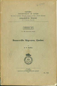
Canada Department Of Mines Geological Survey; B. R. MacKay
Beauceville Map-area Quebec
Ottawa: F. A. Acland 1921. 8vo. 105 pp. Soft Covers Good with covers detached & held together by tape yellowing throughout scribbling creasing edge wear. Photographs illustrations maps & charts. Memoir 127; No. 108 Geological Series. First Edition. Ottawa: F. A. Acland, 1921 paperback
Bookseller reference : 15-6872
|
|
|
Canada Department of Mines and Technical Surveys Surveys and Mapping Branch.
Campbell River - Rivers Inlet. N.T.S. No. 92 N.W. and Part of 102 N.E. Canada Department of Mines and Technical Surveys Surveys and Mapping Branch. Fourth Edition. Scale 1:500000.
Canada Department of Mines and Technical Surveys Surveys and Mapping Branch. 1965. Map. Very Good. No Binding. Large folded base map; ex-corporate library; in very good condition. . Canada Department of Mines and Technical Surveys, Surveys and Mapping Branch. unknown
Bookseller reference : 018866
|
|
|
Canada Department of Mines
CANADA DEPT OF MINES MINES BRANCH. ANNUAL REPORT OF THE DIVISION OF MINERAL RESOURCES AND STATISTICS ON THE MINERAL PRODUCTION OF CANADA DURING THE CALENDAR 1909 & 1910; Preliminary Report-1910; Annual Report-1911; Preliminary Reports 1912 1913-6 Vols.
Ottawa Canada: Government Printing Bureau 1911. Published between 1911 and 1914. Covers metallic ores including gold and silver; non-metallic ores and clay products. 291 328 pp. and 316 pp. for 3 full annual reports. Prelimnary reports are approximately 20 to 25 pp. One cover loose. Library stamp on front covers but overall clean tight copies. Many charts. Tan Printed Paper Wraps. Good to Very Good. 8vo - over 7�" - 9�" Tall. Government Printing Bureau Paperback
Bookseller reference : 005560
|
|
|
Canada Department of Mines and Technical Surveys Surveys and Mapping Branch.
Cape Tatnam N.W. 56/92 Manitoba - Ontario. Sheet 54 S.E. Canada Department of Mines and Technical Surveys Surveys and Mapping Branch. Aeronautical Edition. Scale 1:506880.
Canada Department of Mines and Technical Surveys Surveys and Mapping Branch. 1961. Map. Very Good. No Binding. Large folded aeronautical chart / base map; ex-corporate library; in very good condition. . Canada Department of Mines and Technical Surveys, Surveys and Mapping Branch. unknown
Bookseller reference : 018913
|
|
|
Canada Department of Mines
Catalogue of the Publications of the Mines Branch 1907-1911 Canada Department of Mines
Ottawa Canada: Government Printing Bureau 1912. Inserted is a listing of "Reports and Maps of Economic Interest" 5 pp. Report is 133 pp. Wraps beginning to loosen. Contents clean tight with only a library stamp on front cover. Tan Printed Wraps. Good Plus. 8vo - over 7�" - 9�" tall. Government Printing Bureau Paperback
Bookseller reference : 005554
|
|
|
Canada Department of Mines and Technical Surveys Johnson Helgi David M. Baird Allen V. Heyl and John J. Ronan contributors
Contributions to the Economic Geology of Western Newfoundland Geological Survey of Canada Bulletin 27
Ottawa: Queen's Printer 1954. Paper bound 40pp. frontispiece Of Flat Bay Brook Cairn Mountain. Library stamp to front cover. Preface pages loose. Articles by Helgi Johnson on 'The Strontium Deposits of Port Au Port Peninsula' and 'The Magnetite and Gypsum Deposits of the Sheep Brook-Lookout Brook Area by David M. Baird. Final article on 'The Iron Deposits of Indian Head Area' by Allen V. Heyl and John J. Ronan is missing. Fair. 100 grams. Ottawa: Queen's Printer, 1954 unknown
Bookseller reference : 13130
|
|
|
Canada Department of Mines and Technical Surveys Surveys and Mapping Branch
Cranbrook - Lethbridge British Columbia - Alberta. Canada Department of Mines and Technical Surveys Surveys and Mapping Branch. Sheet 82 S.E.
Canada Department of Mines and Technical Surveys Surveys and Mapping Branch. 1950. Map. Good. No Binding. Large folded base map; ex-corporate library; light creasing of edges of map; o/w in good condition. . Canada Department of Mines and Technical Surveys, Surveys and Mapping Branch. unknown
Bookseller reference : 017334
|
|
|
Canada Department of Mines and Technical Surveys Surveys and Mapping Branch.
Dease Lake N.W. 58/132 British Columbia. Canada Department of Mines and Technical Surveys Surveys and Mapping Branch. Sheet 104 N.E. Aeronautical Edition. Scale 1:506880.
Canada Department of Mines and Technical Surveys Surveys and Mapping Branch. 1956. Map. Very Good. No Binding. Large folded base map; ex-corporate library; in very good condition. . Canada Department of Mines and Technical Surveys, Surveys and Mapping Branch. unknown
Bookseller reference : 018863
|
|
|
Canada Department of Mines / Mines Branch. 1916.
Description of the Laboratories of the Mines Branch of the Department of Mines Ottawa.
Canada Department of Mines / Mines Branch Bulletin 13 1916 48 pp. 60 plates xxii. 1916. ORIGINAL PUBLICATION; Softcovers; ex-library; bumped corners w/ small portions of paper covering at head and tail of spine perished; minor creasing of wraps and a few dog-eared pages; o/w in good condition. Soft Cover. Good. Canada Department of Mines / Mines Branch Bulletin 13, 1916, 48 pp. + 60 plates + xxii. Paperback
Bookseller reference : BB9-64
|
|
|
Canada Department of Mines and Technical Surveys Mines Branch.
Direct Reduction of Iron Ore. Canada Department of Mines and Technical Surveys Mines Branch Information Circular IC 109 13 pp.
Canada Department of Mines and Technical Surveys Mines Branch. 1958. Journal. Very Good. Soft cover. ORIGINAL 1958 Publication; ex-library; softcovers; light creasing of corners of wraps and leaves o/w in very good condition. . Canada Department of Mines and Technical Surveys, Mines Branch. Paperback
Bookseller reference : 020036
|
|
|
Canada Dept. Of Mines and Technical Surveys: Dominion Observatories
DOMINION ASTROPHYSICAL OBSERVATORY VICTORIA B.C. STAR MAPS Plus 'Phases of the Moon.'
Ottawa: Edmond Cloutier Queen's Printer and Controller of Stationery 1956. Blue paper wraps. 12 plate of star maps printed on recto only in blue and white. Laid in is a stapled collation of pages about 15 on The Phases of the Moon illustrated plus a folded star map for Aug-Sept-Oct. Some pressure-marks to covers otherwise a nice clean copy. SCI 1847. No Previous Editions Noted. Paperbound. Near Fine. Illus. by Star Maps. 8vo - over 7�" - 9�" tall. Science. Edmond Cloutier, Queen's Printer and Controller of Stationery Paperback
Bookseller reference : 1847

|
|
|
Canada Department of Energy Mines and Resources.
Electoral Maps of Canada.
Canada Department of Energy Mines and Resources 1967 Folded Sheet. 1967. Folded sheet listing maps available; ex-corporate library; minor shelfwear; o/w in good condition. Map. Canada Department of Energy, Mines and Resources, 1967, Folded Sheet. unknown
Bookseller reference : GF7-8
|
|
|
Canada Department of Mines
Excursion in Eastern Quebec and the Maritime Provinces Part 1
Ottawa: Canada Department of Mines 1913. Card covers. Fair. Guide Book No. 1. Excursion A1. 207 p. 21 cm. 24 maps and 14 b&w photos. Grey card covers are detached from text block. Spine ends chipped. Ink notations or marks spine and front cover. Large damp stain lower front. 4 maps are detached and tucked in at rear. <br/><br/>Includes articles such as: Geology by G. A. Young; Physiography by J. W. Goldthwait Quebec and vicinity by Percy E. Raymond; Dalhousie and the Gaspe peninsula by John M. Clarke; The flora of the Gaspe sandstone by David White; the Goldbearing series of Nova Scotia by E. R. Fairbault; character and fauna of the Riversdale and Union formations by J. E. Hyde; the Hillsborough gypsum deposit by H. E. Kramm etc. Canada Department of Mines unknown
Bookseller reference : 106210

|
|
|
Canada Department Of Mines
Excursions in the Neighborhood of Montreal and Ottawa. Guide Book No. 3.
Ottawa: Canada Department of Mines 1913 First edition in paper covers. Photographs fold-out maps folding maps in back pocket Grenvill Sheet-Ontario and Quebec missing. Binding cracked but tight. Light wear to covers small spot on title page. Very Good. 1st Edition. Soft Cover. Very Good. BW12-2. Canada Department of Mines paperback
Bookseller reference : 250173

|
|
|
Canada Department of Mines and Technical Surveys Surveys and Mapping Branch.
Frobisher Bay N.W. 62/72. Sheet 25 N.W. and 25 N.E. Northwest Territories District of Franklin. Canada Department of Mines and Technical Surveys Surveys and Mapping Branch. Scale 1:500000.
Canada Department of Mines and Technical Surveys Surveys and Mapping Branch. 1959. Map. Good. No Binding. Large folded base map; ex-corporate library; light creasing of edge o/w in good condition. . Canada Department of Mines and Technical Surveys, Surveys and Mapping Branch. unknown
Bookseller reference : 021015
|
|
|
Canada Department of Mines
GEOLOGICAL SURVEY Summary Report 1930 Part C
Ottawa: Department of Mines Canada 1931. Paperback. Maps and tables. pp. 131c.8voLarger format pb - spine dry covers scuffed and sl soiled; gd <br/><br/>Geology and Mineral Deposits of a Part of Northwest Manitoba by J.F. Wright and Other Field Work. Department of Mines Canada paperback
Bookseller reference : 9900026049
|
|
|
Canada Department of Mines and REsources Mines and Geology Branch. 1947.
Geology and Economic Minerals of Canada. Third Edition.
Canada Department of Mines and Resources Economic Geology Series no. 1 1947 357 pages. 1947. ORIGINAL PUBLICATION; Softcovers; minor water damage w/ rear wraps rear endpages and four leaves of index w/ light stains; wrinkling to approx. last 40 leaves; lightly soiled wraps w/ chip missing from paper covering at head of spine. Soft Cover. Fair. Canada Department of Mines and Resources Economic Geology Series no. 1, 1947, 357 pages. Paperback
Bookseller reference : BG16-125
|
|
|
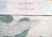
Canada Dept. of Mines and Resources
Glace Bay sheet Cape Breton County Nova Scotia 1" to 1 mile sheet 362A
Bureau of Geology and Topography Canada 1938. Folded map. V.g. A map of one of the coal-rich areas of northern Nova Scotia. Bureau of Geology and Topography, Canada unknown
Bookseller reference : 9182
|
|
|
Canada Department of Mines and Technical Surveys Surveys and Mapping Branch
Hadley Bay N.W. 72/112. Northwest Territories District of Franklin. Canada Department of Mines and Technical Surveys Surveys and Mapping Branch. Sheets 78 S.W. and 78 S.E. Third Edition Preliminary. Scale 1 Inch equals 8 Miles
Canada Department of Mines and Technical Surveys Surveys and Mapping Branch. 1957. Map. Good. No Binding. Large folded base map; ex-corporate library; light creasing of edges of map w/ a couple of small nicks along edges of map; o/w in good condition. . Canada Department of Mines and Technical Surveys, Surveys and Mapping Branch. unknown
Bookseller reference : 013156
|
|
|
Canada Department of Mines and Technical Surveys Surveys and Mapping Branch.
Henrietta - Maria. N. W. 54/84 Ontario - Northwest Territories. Canada Department of Mines and Technical Surveys Surveys and Mapping Branch. Aeronautical Edition. Scale 1:500000.
Canada Department of Mines and Technical Surveys Surveys and Mapping Branch. 1949. Map. Very Good. No Binding. Large folded base map; ex-corporate library; in very good condition. . Canada Department of Mines and Technical Surveys, Surveys and Mapping Branch. unknown
Bookseller reference : 018869
|
|
|
Canada Department of Mines and Technical Surveys Surveys and Mapping Branch.
Hudson Hope N.W. 56/124 British Columbia. Sheet 94 S.E. Canada Department of Mines and Technical Surveys Surveys and Mapping Branch. Scale 1:500000.
Canada Department of Mines and Technical Surveys Surveys and Mapping Branch. 1960. Map. Very Good. No Binding. Large folded base map; ex-corporate library; a couple of small tears along edges of sheet o/w in very good condition. . Canada Department of Mines and Technical Surveys, Surveys and Mapping Branch. unknown
Bookseller reference : 018978
|
|
|
Canada Department of Energy Mines and Resources.
Index Map of Canada According to the National Topographic System Revised 1960 . Carte - Index Du Canada Delon Le Systeme De Reference Cartographique National Revise En 1960 .
Canada Department of Energy Mines and Resources 1963 Folded Sheet. 1963. Large folded base map; ex-corporate library; minor shelfwear; o/w in good condition. Map. Canada Department of Energy, Mines and Resources, 1963, Folded Sheet. unknown
Bookseller reference : GF7-9
|
|
|
Canada Department of Energy Mines and Resources.
Index No. 2 Canada Maps of the National Topographic System / Cartes du Systeme de Reference Cartographique National 1:50000.
Canada Department of Energy Mines and Resources. 1970. Map. Very Good. No Binding. Folded base map showing topographic sheets available; ex-corporate library; in very good condition. . Canada Department of Energy, Mines and Resources. unknown
Bookseller reference : 018198
|
|
|
Canada Department of Energy Mines and Resources.
Index No. 3 Canada Maps of the National Topographic System / Cartes du Systeme de Reference Cartographique National 1:50000.
Canada Department of Energy Mines and Resources. 1970. Map. Very Good. No Binding. Folded base map showing topographic sheets available; ex-corporate library; in very good condition. . Canada Department of Energy, Mines and Resources. unknown
Bookseller reference : 018199
|
|
|
Canada Department of Energy Mines and Resources.
Index No. 1 Canada Maps of the National Topographic System / Cartes du Systeme de Reference Cartographique National 1:50000.
Canada Department of Energy Mines and Resources. 1969. Map. Very Good. No Binding. Folded base map showing topographic sheets available; ex-corporate library; in very good condition. . Canada Department of Energy, Mines and Resources. unknown
Bookseller reference : 018197
|
|
|
Canada Department of Energy Mines and Resources.
Index No. 4 Canada Maps of the National Topographic System / Cartes du Systeme de Reference Cartographique National 1:50000.
Canada Department of Energy Mines and Resources. 1969. Map. Very Good. No Binding. Folded base map showing topographic sheets available; ex-corporate library; in very good condition. . Canada Department of Energy, Mines and Resources. unknown
Bookseller reference : 018200
|
|
|
Canada Department of Mines and Technical Surveys Surveys and Mapping Branch.
McMurray Alberta - Saskatchewan Preliminary Edition. Sheet 74 S.W. Canada Department of Mines and Technical Surveys Surveys and Mapping Branch. Scale 1:506880.
Canada Department of Mines and Technical Surveys Surveys and Mapping Branch. 1945. Map. Very Good. No Binding. Large folded base map; ex-corporate library; in very good condition. . Canada Department of Mines and Technical Surveys, Surveys and Mapping Branch. unknown
Bookseller reference : 018915
|
|
|
Canada Department of Mines and Technical Surveys Surveys and Mapping Branch.
Merritt - Lac La Hache N.W. 50/124. Canada Department of Mines and Technical Surveys Surveys and Mapping Branch. Sheet N.T.S. No. 92 NE. .Third Edition. Scale 1:500000.
Canada Department of Mines and Technical Surveys Surveys and Mapping Branch. 1960. Map. Very Good. No Binding. Large folded base map; ex-corporate library; in very good condition. . Canada Department of Mines and Technical Surveys, Surveys and Mapping Branch. unknown
Bookseller reference : 018865
|
|
|
Canada Department of Mines
National Museum of Canada Bulletin No. 50 Annual Report for 1926
unknown
Bookseller reference : mon0001093726
|
|
|
Canada Department of Mines and Technical Surveys Surveys and Mapping Branch
Notre Dame - Bonavista N.W. 48/56. Canada Department of Mines and Technical Surveys Surveys and Mapping Branch. Sheet N.T.S. No. 2 S.W.
Canada Department of Mines and Technical Surveys Surveys and Mapping Branch. 1960. Map. Good. No Binding. Large folded base map; ex-corporate library; light creasing of edges of map w/ tear on lower edge of sheet does not touch map; o/w in good condition. . Canada Department of Mines and Technical Surveys, Surveys and Mapping Branch. unknown
Bookseller reference : 017333
|
|
|
Canada Department of Mines and Technical Surveys Surveys and Mapping Branch.
Peace River N.W. 56/120. Sheet N.T.S. No. 84 S.W. Canada Department of Mines and Technical Surveys Surveys and Mapping Branch. Scale 1:500000.
Canada Department of Mines and Technical Surveys Surveys and Mapping Branch. 1964. Map. Very Good. No Binding. Large folded base map; ex-corporate library; small tear at top of sheet o/w in very good condition. . Canada Department of Mines and Technical Surveys, Surveys and Mapping Branch. unknown
Bookseller reference : 018917
|
|
|
Canada Department of Mines and Technical Surveys Surveys and Mapping Branch.
Prince George - Dawson Creek British Columbia. N.W. 54/124. Sheet 93 N.E. Canada Department of Mines and Technical Surveys Surveys and Mapping Branch. Aeronautical Edition. Scale 1:506880.
Canada Department of Mines and Technical Surveys Surveys and Mapping Branch. 1958. Map. Good. No Binding. Large folded base map; ex-corporate library; light creasing of edges w/ small tear on lower edge; o/w in good condition. . Canada Department of Mines and Technical Surveys, Surveys and Mapping Branch. unknown
Bookseller reference : 018910
|
|
|
Canada Department of Mines and Technical Surveys Surveys and Mapping Branch
Prince of Wales Island N.W. 72/104. Northwest Territories District of Franklin. Canada Department of Mines and Technical Surveys Surveys and Mapping Branch. Sheets 68 S.W. and 68 S.E. Second Edition Preliminary. Scale 1 Inch equals 8 Miles
Canada Department of Mines and Technical Surveys Surveys and Mapping Branch. 1956. Map. Good. No Binding. Large folded base map; ex-corporate library; light creasing of edges of map w/ tear on lower edge of sheet does not touch map; o/w in good condition. . Canada Department of Mines and Technical Surveys, Surveys and Mapping Branch. unknown
Bookseller reference : 013157
|
|
|
Canada Department of Mines and Technical Surveys Surveys and Mapping Branch.
Prince Rupert - Stewart Canada and United States. N.W. 54/133; Sheet 103 N.E. and Part of 103 N.W. Canada Department of Mines and Technical Surveys Surveys and Mapping Branch. Aeronautical Edition. Scale 1:506880.
Canada Department of Mines and Technical Surveys Surveys and Mapping Branch. 1958. Map. Very Good. No Binding. Large folded base map; ex-corporate library; in very good condition. . Canada Department of Mines and Technical Surveys, Surveys and Mapping Branch. unknown
Bookseller reference : 018912
|
|
|
Canada Department of Mines and Technical Surveys Surveys and Mapping Branch.
Red Deer - Edmonton. N.W. 52/116. Canada Department of Mines and Technical Surveys Surveys and Mapping Branch. Third Edition. Scale 1:500000.
Canada Department of Mines and Technical Surveys Surveys and Mapping Branch. 1955. Map. Very Good. No Binding. Large folded base map; ex-corporate library; in very good condition. . Canada Department of Mines and Technical Surveys, Surveys and Mapping Branch. unknown
Bookseller reference : 018867
|
|
|
Canada Department of Mines and Technical Surveys Surveys and Mapping Branch.
Severn River N.W. 54/92 Manitoba - Ontario. Sheet 53 N.E. Canada Department of Mines and Technical Surveys Surveys and Mapping Branch. Aeronautical Edition. Scale 1:500000.
Canada Department of Mines and Technical Surveys Surveys and Mapping Branch. 1961. Map. Very Good. No Binding. Large folded aeronautical chart / base map; ex-corporate library; in very good condition. . Canada Department of Mines and Technical Surveys, Surveys and Mapping Branch. unknown
Bookseller reference : 018871
|
|
|
Canada Department of Mines and Technical Surveys Surveys and Mapping Branch.
Smithers - Fort St. James British Columbia. N.W. 54/128. Sheet 93 N.W. Canada Department of Mines and Technical Surveys Surveys and Mapping Branch. Aeronautical Edition. Scale 1:506880.
Canada Department of Mines and Technical Surveys Surveys and Mapping Branch. 1958. Map. Good. No Binding. Large folded base map; ex-corporate library; light creasing of edges w/ small tear on lower edge; o/w in good condition. . Canada Department of Mines and Technical Surveys, Surveys and Mapping Branch. unknown
Bookseller reference : 018911
|
|
|
Canada Department of Mines
STUDIES OF GEOPHYSICAL METHODS 1930 Memoir 170
Ottawa: F. A. Acland 1932. Hardcover edition; 118 pages. Dark red cloth hardcovers with gilt titles on spine and cover. Spine sunned. Bumped corners. Scuffed front and back cover. Light edgewear. The pages are yellowing but bright and unmarked. Includes many graphs/charts/maps in text. GOOD. Hardcover. Good/No Jacket. F. A. Acland Hardcover
Bookseller reference : 218259
|
|
|
Canada Department of Mines
STUDIES OF GEOPHYSICAL METHODS 1928 AND 1929
Ottawa: F. A. Acland 1931. 227 pages in very good condition. Pages are clean slightly yellowed filled with diagrams and tables. One black and white plate at the back of the book. 10 folded diagrams in a pocket attached to the back endpaper. Hinges feel loose. Maroon cloth with gilded text. Boards have many stains. Spine is lightly faded and bumped. VG-/ - -. Hardcover. Very Good-/No Jacket. F. A. Acland Hardcover
Bookseller reference : 401363
|
|
|
Canada Department of Mines
Summary Report of the Mines Branch of the Department of Mines for the Calendar Year Ending December 31 1912 together with the Report for the Calendar year Ending December 31 1913 and with the Report for the Calendar Year Ending December 31 1914
Ottawa: C.H.Parmelee. Good with no dust jacket. 1913. Hardcover. ix 174 pp 2 large folding maps x 214 pp ix 232 pp xii plates xx ads. Heavily illustrated with plates maps folding maps charts photos etc. Three years -- 1912 1913 and 1914 -- found as one with original blue card covers for 1913 and 1914 bound in. Black library buckram binding with gilt to the spine is clean bit worn spine tips worn. Interior has Library of Congress stamp and card pocket at rear first title page has stamps and punch stamps along with a long tear at th gutter rest is clean and unmarked quite sturdy.; 8vo - over 7�" - 9�" tall . C.H.Parmelee hardcover
Bookseller reference : 002756
|
|
|
Canada Department of Mines / Geological Survey. 1927
Summary Report 1926 Part B. INCLUDES G. S. Hume Turner Valley Oil Alberta; W. S. Dyer Cypress Hills Structure AND Oil and Gas Saskatchewan; P. S. Warren Oil Gas Saskatchewan; E. D. Ingall Deep Borings Prairir ProvinceNorthwest Territo
Canada Department of Mines / Geological Survey Summary Report 1926 1927 Part B 57 pp. 1927. Softcovers; ex-library; shelfwear w/ paper covering split at head and tail of spine; corners lightly bumped; o/w contents good. Soft cover. Canada Department of Mines / Geological Survey Summary Report, 1926 (1927), Part B, 57 pp. Paperback
Bookseller reference : BB9-61
|
|
|
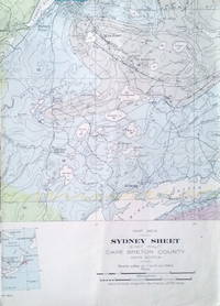
Canada Dept. of Mines and Resources
Sydney sheet East half Cape Breton County Nova Scotia 1" to 1 mile sheet 361A
Bureau of Geology and Topography Canada 1938. Folded map. V.g. A map of the coal- and limestone-rich areas of northern Nova Scotia. Bureau of Geology and Topography, Canada unknown
Bookseller reference : 9181
|
|
|
Canada Department of Mines and Technical Surveys Surveys and Mapping Branch.
Tete Jaune - Edson. N.W. 52/120. N.T.S. No. 83 S.W. Canada Department of Mines and Technical Surveys Surveys and Mapping Branch. Aeronautical Edition. Scale 1:500000.
Canada Department of Mines and Technical Surveys Surveys and Mapping Branch. 1963. Map. Very Good. No Binding. Large folded base map; ex-corporate library; in very good condition. . Canada Department of Mines and Technical Surveys, Surveys and Mapping Branch. unknown
Bookseller reference : 018868
|
|
|
Canada Department of Mines.
Transcontinental Excursion C1Toronto to Victoria and return via Canadian Pacific and Canadian Northern Railways - Guide Book No. 8 - Part II
Ottawa: Government Printing Bureau 1913. unknown. gebraucht gut Original-Karton Kanten etwas gestaucht Umschlag etwas fleckig sonst GUTES EXEMPLAR. 13x20cm. Auf Anfrage per E-Mail können Sie die bei uns bestellten Artikel auch in unserer Buchscheune 01796 Struppen Mo.-Fr. 9-16 Uhr oder im Antiquariat Schloss Pillnitz 01326 Dresden Mo.-So. 10-18 Uhr abholen. Government Printing Bureau unknown
Bookseller reference : C14987

|
|
|
Canada Department of Mines and Technical Surveys Surveys and Mapping Branch.
Vernon - Golden British Columbia - Alberta. Sheet 82 N.W. Canada Department of Mines and Technical Surveys Surveys and Mapping Branch. Scale 1:500000.
Canada Department of Mines and Technical Surveys Surveys and Mapping Branch. 1951. Map. Very Good. No Binding. Large folded base map; ex-corporate library; in very good condition. . Canada Department of Mines and Technical Surveys, Surveys and Mapping Branch. unknown
Bookseller reference : 018873
|
|
|
Canada Department of Mines and Technical Surveys Surveys and Mapping Branch.
Wabasca River N.W. 56/116. Sheet N.T.S. No. 84 S.E. Canada Department of Mines and Technical Surveys Surveys and Mapping Branch. Aeronautical Edition. Scale 1:500000.
Canada Department of Mines and Technical Surveys Surveys and Mapping Branch. 1963. Map. Good. No Binding. Large folded base map; ex-corporate library; light creasing of edges w/ a couple of small tears along edges o/w in good condition. . Canada Department of Mines and Technical Surveys, Surveys and Mapping Branch. unknown
Bookseller reference : 018916
|
|
|
Canada Department of Mines and Technical Surveys Surveys and Mapping Branch.
Winisk River N.W. 54/88 Ontario. Sheet 43 N.W. Canada Department of Mines and Technical Surveys Surveys and Mapping Branch. Aeronautical Edition. Scale 1:500000.
Canada Department of Mines and Technical Surveys Surveys and Mapping Branch. 1960. Map. Very Good. No Binding. Large folded base map; ex-corporate library; in very good condition. . Canada Department of Mines and Technical Surveys, Surveys and Mapping Branch. unknown
Bookseller reference : 018870
|
|
 Receive by email
 Download as PDF document
 RSS feed


