|
Eliot Charles W. editor
The Harvard Classics Vol. 33: Voyages and Travels Ancient and Modern with Introductions and Notes
P. F. Collier & Son Company 1910. Full red cloth binding. Clean and unmarked. 351pp. Accounts by Herodotus Tacitus Dranke Pretty Bigges Haies and Raleigh. Hardcover. Very Good/No Dust Jacket. 8vo - 8" - 9" Tall. P. F. Collier & Son Company Hardcover
Bookseller reference : 054090

|
|
|
Elisha Kent Kane
Artic Explorations: The Second Grinnell Expedition in Search of Sir John Franklin 1853 '54 '55
<p>excellent condition</p> Childs and Peterson, hardcover
Bookseller reference : 1009
|
|
|
Ellery Anderson W.
Expedition south
The Travel Book Club Cartonné avec jaquette In-8, (22.5x14.5 cm), cartonné sous jaquette illustrée, 207 pages, sans date, photographies en noir et blanc, portrait de l'auteur en frontispice, texte en anglais, cartes sur les pages de garde ; nom au stylo sur la page de garde, petites déchirures et traces sur la jaquette, assez bon état général. Livraison a domicile (La Poste) ou en Mondial Relay sur simple demande.
Bookseller reference : cv1312
|
|
|
Ellen Gatti
Exploring We Would Go
Robert Hale London 1950. First Edition. Hardcover. Fair/No Dust Jacket. 302 pages. Hinges are split at front and back making binding loose. Covers have moderate rubbing/wear. Edges of boards have moderate wear. No dust jacket with this book. Edges of pages are mildly foxed. Pages are reasonably tanned. Quantity Available: 1. Category: Exploration; Inventory No: 17020312. Robert Hale hardcover
Bookseller reference : 17020312
|
|
|
Ellis Henry. Richard H. Dillon Signed
Considerations on the Great Advantages Which Would Arise From the Discovery of the North West Passage
San Francisco: Sutro Library. 1975 Facsimile reprint in stapled card covers. Signed by Mr. Dillon who wrote the introduction. 8 pp. Fold-out map. Book. Sutro Library. unknown
Bookseller reference : 42503
|
|
|
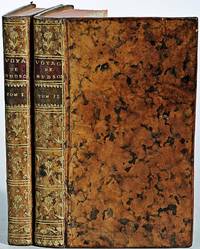
Ellis Henry 1721 1806
Voyage de la baye de Hudson. Fait en 1746 & 1747 pour la Découverte du Passage de Nord-Ouest. Contenant une description exacte des Côtes & l'Histoire Naturelle du Pays avec une Relation historique de toutes les Expéditions faites jusqu'ici
<p>2 volumes. 182 pages with fold out frontispiece map and three additional folding engravings; 319 pages with seven folding engravings. half-titles in each title pages improperly marked first volume as second and vice versa. Duodecimo 6 1/2" x 3 1/2" bound in original publisher's full uniform contemporary French sponged calf with gilt-tooled spines. First French edition after the 1748 English edition.<br /><br />Henry Ellis was a traveler hydrographer and colonial governor returned from Italy in 1746 just in time to find an expedition to search for a north-west passage on the point of sailing. He appears to have been in easy circumstances; his name stands in the list of subscribers to the north-west expedition and he had sufficient interest to get attached to it nominally as agent for the committee and really as hydrographer surveyor and mineralogist the expedition consisting of two vessels the <em>Dobbs</em> galley of 180 and <em>California</em> of 150 tons left Gravesend on 20 May 1746 joined the Hudson's Bay convoy in Hollesley Bay and finally sailed from Yarmouth on the 31st. They parted from the convoy on 18 June made Resolution Island on 8 July and after a tedious passage through Hudson's Straits rounded Cape Digges on 8 August and on the 11th 'made the land on the west side the Welcome in latitude 64° N.' Bad weather drove them to the southward and prevented their doing anything more that season. They wintered in Hayes River in a creek about three miles above Fort York where a quarrel with the agent of the Hudson's Bay Company gave an unwonted piquancy to the dark and weary days. They suffered much from scurvy the prevalence of which Ellis attributes to their having got two kegs of brandy from Fort York for their Christmas merrymaking and in a minor degree to the 'governor' not permitting the Indians to supply them with fresh provisions. On 29 May 1747 the ice broke up and they were able to warp to the mouth of their creek; on 9 June they got down to Fort York. There they were allowed to get some provisions and stores and on the 24th cleared the river and 'stood to the northward on the discovery'. On 1 July each of the two ships sent away her long-boat but owing apparently to some ill-feeling between the two captains without any prearranged plan for working in concert. The consequence was that they separately went over the same ground discovering naming and examining the several creeks and inlets on the west side of Hudson's Bay the double examination perhaps compensating for the confusion arising from the double naming. Before the season closed in they had satisfied themselves that the only possible exit from Hudson's Bay on the west must be through the Welcome and that very probably there was no way out except that on the east by which they had come in. The result may not seem much; but as it served to put an end to the idea that the passage must lie through Hudson's Bay it was at least so much gain to accurate knowledge. After 21 August the weather broke and they decided in council 'to bear away for England without further delay.' On the 29th they entered Hudson's Straits passed Resolution Island on 9 September and arrived at Yarmouth on 14 Octivwe. Ellis's share in the work of the expedition had really been very slender but the reputation of it has been commonly assigned to him by reason of the narrative which he published the following year under the title <em>A Voyage to Hudson's Bay by the DobbsGalley and California in the years 1746 and 1747 for Discovering a North-West Passage</em> 1748; a work which with many valuable observations on tides on the vagaries of the compass and on the customs of the Eskimos a people then practically unknown mingles a great deal of speculation on the certain existence of the passage on magnetism on fogs on rust and other matters all more or less ingenious but now known to be wildly erroneous. Such as it was the book commended its author to the scientific workers of the day and on 8 February 1748-9 he was elected a fellow of the Royal Society. Possibly in acknowledgment of his scientific labors but more probably by some family interest he was afterwards appointed successively governor of Georgia and of Nova Scotia from which employment he retired about 1770. He seems to have spent his later years as a wanderer on the continent was at Marseilles in 1775 and died at Naples on 21 January 1806.<br /><br /><strong>Condition:</strong><br /><br />Some dark spot to spine else a very good copy.</p> Ballard Fils hardcover
Bookseller reference : E0529
|
|
|
Ellis Henry 1721 1806
Voyage de la baye de Hudson. Fait en 1746 & 1747 pour la Découverte du Passage de Nord-Ouest. Contenant une description exacte des Côtes & l'Histoire Naturelle du Pays avec une Relation historique de toutes les Expéditions faites jusqu'ici
<p>2 volumes. 182 pages with fold out frontispiece map and three additional folding engravings; 319 pages with seven folding engravings. half-titles in each title pages improperly marked first volume as second and vice versa. Duodecimo 6 1/2" x 3 1/2" bound in original publisher's full uniform contemporary French sponged calf with gilt-tooled spines. First French edition after the 1748 English edition.<br /><br />Henry Ellis was a traveler hydrographer and colonial governor returned from Italy in 1746 just in time to find an expedition to search for a north-west passage on the point of sailing. He appears to have been in easy circumstances; his name stands in the list of subscribers to the north-west expedition and he had sufficient interest to get attached to it nominally as agent for the committee and really as hydrographer surveyor and mineralogist the expedition consisting of two vessels the <i>Dobbs</i> galley of 180 and <i>California</i> of 150 tons left Gravesend on 20 May 1746 joined the Hudson's Bay convoy in Hollesley Bay and finally sailed from Yarmouth on the 31st. They parted from the convoy on 18 June made Resolution Island on 8 July and after a tedious passage through Hudson's Straits rounded Cape Digges on 8 August and on the 11th 'made the land on the west side the Welcome in latitude 64° N.' Bad weather drove them to the southward and prevented their doing anything more that season. They wintered in Hayes River in a creek about three miles above Fort York where a quarrel with the agent of the Hudson's Bay Company gave an unwonted piquancy to the dark and weary days. They suffered much from scurvy the prevalence of which Ellis attributes to their having got two kegs of brandy from Fort York for their Christmas merrymaking and in a minor degree to the 'governor' not permitting the Indians to supply them with fresh provisions. On 29 May 1747 the ice broke up and they were able to warp to the mouth of their creek; on 9 June they got down to Fort York. There they were allowed to get some provisions and stores and on the 24th cleared the river and 'stood to the northward on the discovery'. On 1 July each of the two ships sent away her long-boat but owing apparently to some ill-feeling between the two captains without any prearranged plan for working in concert. The consequence was that they separately went over the same ground discovering naming and examining the several creeks and inlets on the west side of Hudson's Bay the double examination perhaps compensating for the confusion arising from the double naming. Before the season closed in they had satisfied themselves that the only possible exit from Hudson's Bay on the west must be through the Welcome and that very probably there was no way out except that on the east by which they had come in. The result may not seem much; but as it served to put an end to the idea that the passage must lie through Hudson's Bay it was at least so much gain to accurate knowledge. After 21 August the weather broke and they decided in council 'to bear away for England without further delay.' On the 29th they entered Hudson's Straits passed Resolution Island on 9 September and arrived at Yarmouth on 14 Octivwe. Ellis's share in the work of the expedition had really been very slender but the reputation of it has been commonly assigned to him by reason of the narrative which he published the following year under the title <i>A Voyage to Hudson's Bay by the DobbsGalley and California in the years 1746 and 1747 for Discovering a North-West Passage</i> 1748; a work which with many valuable observations on tides on the vagaries of the compass and on the customs of the Eskimos a people then practically unknown mingles a great deal of speculation on the certain existence of the passage on magnetism on fogs on rust and other matters all more or less ingenious but now known to be wildly erroneous. Such as it was the book commended its author to the scientific workers of the day and on 8 February 1748-9 he was elected a fellow of the Royal Society. Possibly in acknowledgment of his scientific labors but more probably by some family interest he was afterwards appointed successively governor of Georgia and of Nova Scotia from which employment he retired about 1770. He seems to have spent his later years as a wanderer on the continent was at Marseilles in 1775 and died at Naples on 21 January 1806.<br /><br /><b>Condition:</b><br /><br />Some dark spot to spine else a very good copy.</p> Ballard Fils hardcover books
Bookseller reference : E0529
|
|
|
Ellisson Joseph W.
Tusitala of the South Seas
1953 Hastings House Publ. 1953. Wear and small tears to the dustjacket. Last half of book has a lot of underlining in pencil. G/worn. 1953 Hastings House, Publ. unknown
Bookseller reference : ABE-133376132
|
|
|
Ellsberg Edward
HELL ON ICE: THE SAGA OF THE "JEANNETTE"
New York: Dodd Mead & Company. Good with no dust jacket. 1938. Hardback. 421 pages . Dodd, Mead & Company hardcover
Bookseller reference : 65551
|
|
|
ELLSBERG COMMANDER EDWARD
Hell On Ice: The Saga Of The " Jeannette'
Dodd Mead & Company New York: 1938. Hardcover no dustjacket. Good condition. Dodd, Mead & Company, New York: 1938 hardcover
Bookseller reference : 40606X1
|
|
|
EMcGregor Ewan; Boorman Charley
Long Way Round: Chasing Shadows Across the World
Atria 2004. First edition hard cover with dust jacket VG/VG. Clean tight unmarked copy. Dust jacket has faint damp stain to top of rear panel offered in new mylar. 310pp map illustrated endpapers color photographs. First Edition. Hardcover. Very Good/Very Good. 8vo - 8" - 9" Tall. Atria Hardcover
Bookseller reference : 23816 ISBN : 0743499336 9780743499330

|
|
|
Emersleben, Otto
Strom ohne Brücke Illustrationen von Gerhard Großmann
Berlin: Verlag Neues Leben, 1980. 224 Seiten , 22 cm, Pappeinband
Bookseller reference : 47778

|
|
|
Emerton J. H. James Henry Banks Nathan Chamberlin Ralph V. Ralph Vary Canadian Arctic Expedition
Insects. Part H : spiders mites and myripods 1919 Leather Bound
2019. Leather Bound. New. Leather Binding on Spine and Corners with Golden Leaf Printing on round Spine extra customization on request like complete leather Golden Screen printing in Front Color Leather Colored book etc. Reprinted in 2019 with the help of original edition published long back 1919. This book is printed in black & white sewing binding for longer life Printed on high quality Paper re-sized as per Current standards professionally processed without changing its contents. As these are old books we processed each page manually and make them readable but in some cases some pages which are blur or missing or black spots. If it is multi volume set then it is only single volume if you wish to order a specific or all the volumes you may contact us. We expect that you will understand our compulsion in these books. We found this book important for the readers who want to know more about our old treasure so we brought it back to the shelves. Hope you will like it and give your comments and suggestions. Lang: - eng. EXTRA 10 DAYS APART FROM THE NORMAL SHIPPING PERIOD WILL BE REQUIRED FOR LEATHER BOUND BOOKS. COMPLETE LEATHER WILL COST YOU EXTRA US$ 25 APART FROM THE LEATHER BOUND BOOKS. hardcover
Bookseller reference : LB1111007015508
|
|
|
Emerton J. H. James Henry Banks Nathan Chamberlin Ralph V. Ralph Vary Canadian Arctic Expedition
Insects. Part H : spiders mites and myripods 1919 FULL LEATHER BOUND
2019. SUPER DELUXE EDITION. New. Antique look with Golden Leaf Printing and embossing with round Spine completely handmade bindingextra customization on request like Color Leather Colored book special gold leaf printing etc. Reprinted in 2019 with the help of original edition published long back 1919. This book is printed in black & white sewing binding for longer life Printed on high quality Paper re-sized as per Current standards professionally processed without changing its contents. As these are old books we processed each page manually and make them readable but in some cases some pages which are blur or missing or black spots. If it is multi volume set then it is only single volume if you wish to order a specific or all the volumes you may contact us. We expect that you will understand our compulsion in these books. We found this book important for the readers who want to know more about our old treasure in old look so we brought it back to the shelves. Hope you will like it and give your comments and suggestions. Lang: - eng. EXTRA 10 DAYS APART FROM THE NORMAL SHIPPING PERIOD WILL BE REQUIRED. Normal Hardbound Edition is also available on request. unknown
Bookseller reference : SD1111007015508
|
|
|
Emerton J. H. James Henry Banks Nathan Chamberlin Ralph V. Ralph Vary Canadian Arctic Expedition
Insects. Part H : spiders mites and myripods 1919
2019. Paperback. New. Lang: - eng. Reprinted in 2019 with the help of original edition published long back 1919. This book is Printed in black & white sewing binding for longer life with Matt laminated multi-Colour Soft Cover HARDCOVER EDITION IS ALSO AVAILABLE Printed on high quality Paper re-sized as per Current standards professionally processed without changing its contents. As these are old books we processed each page manually and make them readable but in some cases some pages which are blur or missing or black spots. If it is multi volume set then it is only single volume if you wish to order a specific or all the volumes you may contact us. We expect that you will understand our compulsion in these books. We found this book important for the readers who want to know more about our old treasure so we brought it back to the shelves. Any type of Customisation is possible with extra charges. Hope you will like it and give your comments and suggestions. paperback
Bookseller reference : PB1111007015508
|
|
|
Emerton J. H. James Henry Banks Nathan Chamberlin Ralph V. Ralph Vary Canadian Arctic Expedition
Insects. Part H : spiders mites and myripods 1919 Hardcover
2019. Hardcover. New. Lang: - eng. Reprinted in 2019 with the help of original edition published long back 1919. This book is Printed in black & white Hardcover sewing binding for longer life with Matt laminated multi-Colour Dust Cover Printed on high quality Paper re-sized as per Current standards professionally processed without changing its contents. As these are old books we processed each page manually and make them readable but in some cases some pages which are blur or missing or black spots. If it is multi volume set then it is only single volume if you wish to order a specific or all the volumes you may contact us. We expect that you will understand our compulsion in these books. We found this book important for the readers who want to know more about our old treasure so we brought it back to the shelves. Any type of Customisation is possible with extra charges. Hope you will like it and give your comments and suggestions. hardcover
Bookseller reference : 1111007015508
|
|
|
Emile Schulthess Émile Egli
Afrique - désert-steppe-forêt vierge
Artis / Bruxelles 1964 in4. 1964. Cartonné jaquette. iconographie en couleurs
Bookseller reference : 100095787
|
|
|
Emin Pascha
Entdeckungsreisen in Zentralafrika. 1876 - 1892.
Lizenzausgabe für einen Buchclub, Gütersloh. 400 S., geprägter OLn m. OU. Mit 40 Abbildungen. Ordentliches Exemplar. Buchschnitt etwas verschmutzt. Good copy.
Bookseller reference : 6482
|
|
|
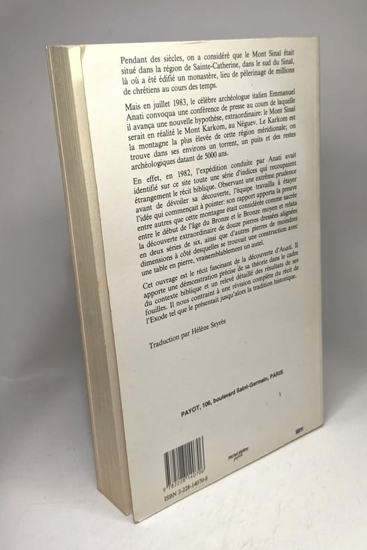
Emmanuel Anati
La montagne de Dieu Har Karkom
Payot 1986 311 pages 23x14x3cm. 1986. Broché. 311 pages.
Bookseller reference : 100105978
|
|
|
Emory William Hemsley 1811 1887; Philip St. George Cooke; Joseph Eggleston Johnston and James William Abert
Notes of a Military Reconnaissance from Fort Leavenworth in Missouri to San Diego in California – including parts of the Arkansas Del Norte and Gila Rivers
<p> 614 pages illustrated with 64 lithographed or engraved plates 3 battle-plans plus some figure drawings within the text. Octavo 8¾x5¼" bound in original publisher's black cloth and paper spine label. Thirtieth Congress - First Session. Ex. Doc. NO. 41. Cowan page 195; Graff 1249; Howes E145; Wagner-Camp 148:5; Zamorano Eighty 33 First edition House of Representatives issues of the report containing the reports of Lieutenant Abert Colonel Cooke and Captain Johnson as well as that of Emory; the Senate issue only contained the Emory report.</p><p><br />In 1844 Emory served in an expedition that produced a new map of Texan claims westward to the Rio Grande. He came to public attention as the author of the <i>Notes of a Military Reconnaissance from Fort Leavenworth in Missouri to San Diego California</i> published by the Thirtieth United States Congress in 1848. This report described terrain and rivers cities and forts and made observations about Indians Mexicans primarily in New Mexico Territory Arizona Territory and Southern California. It was and is considered one of the important chronicles and descriptions of the historic Southwest particularly noted for its maps. Emory was a reliable and conscientious cartographer. There is a story of testament as to Emory's dedication to accuracy that says John Bartlett his supervisor in the Corps of Topographical Engineers made him sign off on a misplaced boundary marker creating a sweet revenge for Emory who replaced him as Head of the International Boundary Commission in 1855. So accurate were his maps that when topographical engineers were surveying possible routes for the transcontinental railroad the most Southern route did not need to be surveyed thanks to the outstanding work by William H. Emory. But William H. Emory did more than just map the terrain; he also made notes about the plant life as well as the people who inhabited the sparsely populated southwest. Notating the social relations of some of the Native American people he wrote: "Women when captured are taken as wives by those who capture them but they are treated by the Indian wives of the capturers as slaves and made to carry wood and water; if they chance to be pretty or receive too much attention from their lords and masters they are in the absence of the latter unmercifully beaten and otherwise maltreated. The most unfortunate thing which can befall a captive woman is to be claimed by two persons. In this case she is either shot or delivered up for indiscriminate violence.<br /><br /><b>Condition:</b><br /><br />Binding worn at edges and spine ends cloth splitting along front joint; occasional light foxing lacking the two maps as noted very good.</p> Wendell & Van Benthuysen, Printers hardcover
Bookseller reference : E0530

|
|
|
Emory William Hemsley 1811 1887
Report on the United States and Mexican boundary survey: made under the direction of the secretary of the Interior
2 volumes in 3 with U S Geological Survey Bulletin 194 laid in. Volume I parts I and II: xvi258 pages with frontispiece 72 maps 1 folding and illustrations engraved on steel map and meteorological engraved on copper diagram 12 engravings on stone 20 wood cuts and errata; vii17421 plates with folding map in color 26 maps and illustrations and errata. Volume 2 part I: 27075 plate pages with index; Volume II part II: 6227 plates pages with index 3325 plate pages with index 3541 plate pages with index 85ii41 plate pages with index. U S Geological Survey Bulletin 194 map 40" x 26 1/4". Quarto 11" x 9" bound in quarter leather with raised spine bands and lettering in gilt with marbled boards. House of Representatives 34th Congress 1st Session. Ex. Doc. No. 135. Wheat TMW #1022 First edition with the scarce color geological map not issued in all copies.<br /><br />The folding map in volume one is one of the foundation maps for the western United States and represents the culmination of fifty years of government explorations. Starting with Lewis and Clark there were numerous official and unofficial surveys and explorations all adding to the pool of knowledge presented here. While large sections are still labeled "unexplored territory" Emory fitted these fragments together with the information gathered during his surveys into a reasonably correct cartographic picture of the West. This map shows large transitional territories of Nebraska Kansas New Mexico Utah Oregon Washington and Minnesota. It was drawn by Thomas Jekyll under the supervision of Lt. Nathaniel Michler of the Topographical Engineers. Lt. Michler worked with his counterpart representing Mexico Captain Francisco Jimenez to survey between Nogales and Yuma including the area south of Arivaca.<br /><br />The U S Geological survey Bulletin 194 was drawn by J.E. Weyss circa 1860. The map features the survey lines between Texas and New Mexico with good topographical detail. Information includes forts Raton Pass the Santa Fe and Albuquerque trails numerous explorers' routes Indian trails and more. The map is an interesting historical curiosity because it was not published when the survey was finished due to the outbreak of the Civil War. In 1902 the map was belatedly included in a Geological Survey Bulletin by Marcus Baker. Printed by the Norris Peters Co. Photo-Lithograph. It is a large and extremely detailed chart by J.H. Clark U.S. Commissioner.<br /><br /><i>Report on the United States and Mexican Boundary Survey</i> has been called "one of the masterworks of Western and American history." Published in the years 1857 to 1859 it was the official report of the U.S. Boundary Commission upon completing its work of surveying and mapping the United States-Mexico boundary. The boundary survey was a consequence of the U.S.-Mexican War and the Treaty of Guadalupe Hidalgo which concluded the war on February 2 1848. The treaty transferred to the United States nearly half of the territory of Mexico and delimited the boundary. Some of the land was settled by Mexican ranchers and farmers but much of the territory was unexplored and to Americans it was an unknown land. Commissions from both the U.S. and Mexico began the survey and demarcation of the line in 1849. In 1853 through negotiation of the Gadsden Treaty the United States purchased additional territory that now forms the southern parts of Arizona and New Mexico. The boundary survey was completed in 1855 and the U.S. and Mexican commissions finished their maps in 1857 while work on the U.S. final <i>Report</i> continued for another two years. The U.S.-Mexico boundary <i>Report</i> was published in two massive volumes sometimes in three and its contents make up an encyclopedia of the Southwest. It presents not only the results of the boundary survey but also the results of the scientific investigations connected with the survey. Major William H. Emory a Topographical Engineer Chief Astronomer and fourth U.S. Boundary Commissioner oversaw production of the <i>Report on the United States and Mexican Boundary Survey</i>. Although the title page bears his name the <i>Report</i> is the work of many contributors. In all of the essays the illustrations are closely tied to the text. The geological reports in Volume I Part II contain twenty-two drawings and diagrams that illustrate the features discussed. The authors of the geological chapters are Charles C. Parry and Arthur C. V. Schott who both participated in the field survey and James Hall the influential state geologist of New York. The geological reports include a catalog of fossils collected during the survey. Most of the fossils are shells and they were collected mainly by Schott and Emory. Timothy A. Conrad a paleontologist at the Smithsonian Institution identified and described the fossils. Twenty-one full-page black-and-white plates were drawn by paleontologist Fielding B. Meek and engraved by John E. Gavit to illustrate the descriptions. The main chapter "Botany of the Boundary" is by Princeton University botanist John Torrey who identified and classified the plants of the borderlands naming and describing many new genera and species. St. Louis physician and botanist George Engelmann was dedicated to one group of plants the cacti. Similar to Torrey's chapter it lists and describes the cacti of the borderlands and names many new species. The chapter on fishes by Smithsonian zoologist Charles F. Girard contains forty-one full-page black-and-white plates. Some of the plates indicate that they were drawn by John H. Richard of the Smithsonian Institution and engraved by William H. Dougal of Georgetown D.C. They depict specimens that were collected by boundary survey naturalists. Spencer F. Baird assistant secretary of the Smithsonian Institution prepared the chapter on "Reptiles of the Boundary." It is illustrated with forty-one full-page black-and-white plates some of which are signed by Richard and Dougal. The report on "Mammals of the Boundary" was also written by Baird with illustrations drawn by J. H. Richard and R. Metzeroth and engraved by Dougal and Metzeroth. There are twenty-seven full-page black-and-white plates showing the mammals. The chapter on birds also by Baird contains some of the most appealing illustrations in the <i>Report</i>. There are twenty-five full-page plates all in color drawn by Baird and lithographed by Bowen & Company of Philadelphia. The pictures of Indians have often been reproduced. They are full-page color illustrations nine of them altogether. All are by Schott engraved on stone by Sarony Major & Knapp of New York. The nine drawings complement the discussions of Indian culture in the chapters on geography. Views of cities and forts built by Spanish and Anglo settlers further reveal border life. Ten of these illustrations appear in Emory's geographical essays. Most of them have no artist's signatures but at least two are by Schott and one is by boundary commission draftsman Augustus de Vaudricourt. The remaining ninety-seven illustrations are topographical drawings or landscapes the largest subject category. They appear throughout the geographical and geological reports. Most were drawn by Schott or by John E. Weyss although many are unsigned. They were reproduced by a variety of techniques including engraving on steel engraving on stone and woodcut. Several different individuals or firms were responsible for the reproductions. Made while the surveys were in progress the views by Weyss and Schott and the final boundary maps are correlated. They offer parallel representations of the topography the boundary monuments and the location of the line. Trained as scientists and engineers the officers of the Topographical Corps regarded scientific observation as an important purpose of their work. Exploration of the new lands acquired in the U.S.-Mexican War and discovery of their resources were goals as important as marking the boundary. Scientific discovery was the first step in the process of incorporating the region into the United States.<br /><br /><b>Condition:</b><br /><br />Rebound in quarter leather with marbled boards. Some foxing through out tear at fold of map. USGS 194 map Issued folding with a few minor spots a hint of toning along the folds and some short fold separations some of which are closed with archival tape on verso else a very good set. C. Wendell, printer hardcover
Bookseller reference : E0150

|
|
|
Emory William Hemsley 1811 1887; Philip St. George Cooke; Joseph Eggleston Johnston and James William Abert
Notes of a Military Reconnaissance from Fort Leavenworth in Missouri to San Diego in California – including parts of the Arkansas Del Norte and Gila Rivers
<p> 614 pages illustrated with 64 lithographed or engraved plates 3 battle-plans plus some figure drawings within the text. Octavo 8¾x5¼" bound in original publisher's black cloth and paper spine label. Thirtieth Congress - First Session. Ex. Doc. NO. 41. Cowan page 195; Graff 1249; Howes E145; Wagner-Camp 148:5; Zamorano Eighty 33 First edition House of Representatives issues of the report containing the reports of Lieutenant Abert Colonel Cooke and Captain Johnson as well as that of Emory; the Senate issue only contained the Emory report.</p><p><br />In 1844 Emory served in an expedition that produced a new map of Texan claims westward to the Rio Grande. He came to public attention as the author of the <i>Notes of a Military Reconnaissance from Fort Leavenworth in Missouri to San Diego California</i> published by the Thirtieth United States Congress in 1848. This report described terrain and rivers cities and forts and made observations about Indians Mexicans primarily in New Mexico Territory Arizona Territory and Southern California. It was and is considered one of the important chronicles and descriptions of the historic Southwest particularly noted for its maps. Emory was a reliable and conscientious cartographer. There is a story of testament as to Emory's dedication to accuracy that says John Bartlett his supervisor in the Corps of Topographical Engineers made him sign off on a misplaced boundary marker creating a sweet revenge for Emory who replaced him as Head of the International Boundary Commission in 1855. So accurate were his maps that when topographical engineers were surveying possible routes for the transcontinental railroad the most Southern route did not need to be surveyed thanks to the outstanding work by William H. Emory. But William H. Emory did more than just map the terrain; he also made notes about the plant life as well as the people who inhabited the sparsely populated southwest. Notating the social relations of some of the Native American people he wrote: "Women when captured are taken as wives by those who capture them but they are treated by the Indian wives of the capturers as slaves and made to carry wood and water; if they chance to be pretty or receive too much attention from their lords and masters they are in the absence of the latter unmercifully beaten and otherwise maltreated. The most unfortunate thing which can befall a captive woman is to be claimed by two persons. In this case she is either shot or delivered up for indiscriminate violence.<br /><br /><b>Condition:</b><br /><br />Binding worn at edges and spine ends cloth splitting along front joint; occasional light foxing lacking the two maps as noted very good.</p> Wendell & Van Benthuysen, Printers hardcover books
Bookseller reference : E0530
|
|
|
Endlweber, Sonja und Günter Wamser
Im wilden Westen : die Abenteuerreiter unterwegs in den Rocky Mountains. - "Signiertes Exemplar" von der Autorin Sonja Endlweber Günter Wamser & Sonja Endlweber 1. Aufl.
Rauenberg : Verl. Abenteuerreiter 2009. 429 S. : Ill. ; 22 cm, 800 gr. Pp., gebundene Ausgabe, Hardcover/Pappeinband, Exemplar in sehr gutem Erhaltungszustand
Bookseller reference : 37636

|
|
|
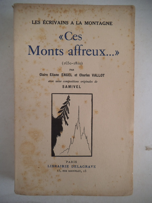
ENGEL Claire et Charles VALLOT
Ces monts affreux … 1650 1810
In 8 broché, couverture illustrée de SAMIVEL Faux-titre, titre illustré, 320 pages, 16 jolies compositions en noir, hors-texte, de SAMIVEL. Paris Librairie Delagrave 1934. Les écrivains de la Montagne. Petites rousseurs sur la couverture, Intérieur en très bon état.
Bookseller reference : 11370
|
|
|
Engel Claire Eliane
Mountaineering in the Alps. an Historical Survey
London: George Allen & Unwin. 1971 Revised and enlarged edition in hardcover with dust jacket. 318 pp. Photographs bibliography index. Slight warp to boards jacket has minor edgewear. Very Good/Very Good. Hardcover. Very Good/Very Good. BW7-12. London: George Allen & Unwin. hardcover
Bookseller reference : 245903 ISBN : 004796037X 9780047960376

|
|
|
Engel Samuel 1702 1784
Memoire Sur La Navigation Dans la Mer Du Nord depuis le 63 degre de latitude vers le Pole & depuis kle 10 au 100 degre Longitud
4282 pages lacking the map. Small quarto 10" x 7½" rebound in ¾ morocco & marbled boards spine lettered in gilt top edges gilt. Sabin 22572 First edition.<br /><br />Rare account of travels into the arctic most notably Nova Zemblya to the north of Europe. Twelve years earlier Engel wrote his notable work on explorations on the other side of the Arctic Circle Memoires et observations geographiques et critiques sur la situation des pays septentrionaux de l'Asie et de l'Amerique. Lausanne 1765. <br /><br />Condition:<br /><br />Rubbing to joints and extremities; some minor staining and soiling within hinge professionally repaired else a very good copy. Only five copies found on worldcat.<br /> F Sanuel Fetscherin hardcover
Bookseller reference : BOOKS000337
|
|
|
Engel Samuel 1702 1784
Memoire Sur La Navigation Dans la Mer Du Nord depuis le 63 degre de latitude vers le Pole & depuis kle 10 au 100 degre Longitud
4282 pages lacking the map. Small quarto 10" x 7½" rebound in ¾ morocco & marbled boards spine lettered in gilt top edges gilt. Sabin 22572 First edition.<br /><br />Rare account of travels into the arctic most notably Nova Zemblya to the north of Europe. Twelve years earlier Engel wrote his notable work on explorations on the other side of the Arctic Circle Memoires et observations geographiques et critiques sur la situation des pays septentrionaux de l'Asie et de l'Amerique. Lausanne 1765. <br /><br />Condition:<br /><br />Rubbing to joints and extremities; some minor staining and soiling within hinge professionally repaired else a very good copy. Only five copies found on worldcat.<br /> F Sanuel Fetscherin hardcover books
Bookseller reference : BOOKS000337
|
|
|
Engel, Elmar
Kanada-Story : mit 24 S. Abb. u. d. Fotomaterial d. Autors.
Herford : Busse, 1971. 211 S. Gr. 8°. Bibl.- Einbd.
Bookseller reference : 18666
|
|
|
Eric De Bisschop
Au delà des horizons lointains : Kaimiloa: D'Honolulu à Cannes par l'Australie et le Cap à bord d'une double pirogue polynésienne. Avec 13 gravures hors texte et 1 carte
Plon 1942 in8. 1942. Relié.
Bookseller reference : 100116268

|
|
|
Eric H. Taylor
Bill Peyto: A Man of Many Parts
Eastnor Publishing. 2008 First printing in tall paper covers. 198 pp. Illustrations index. Fine. Soft Cover. Fine. BG2-2 Left Pile Bin 201. Eastnor Publishing. paperback
Bookseller reference : 247044 ISBN : 0779500997 9780779500994

|
|
|
Eric Leyland
Electrical Engineer : Men of Action Series No. 9
London: Edmund Ward Publishers Ltd 1963. New Machines New technical developments new scientific discoveries are today 1963 revolutionizing industry and commerce and behind them all making this possible is electricity a foundation stone of modern life which many of us take for granted . Eric Leyland describes the whole process by which electricity is generated and distributed and TYPES of electricity and how it operates.He covers the SOURCES of power - water steam by use of coal oil and the Nuclear Reactors Plus some of the times Great projects like the Snowy Mountains scheme in Australia. All this with many photos and drawings as he brings to life the work of the Electrical Engineer. 96pp including appendix. A VERY Lovely Copy. Not Inscribed or Signed. This is the First Edition. Black Cloth. Fine/Near Fine Not Price Clipped. Illus. by Illustrated By B Gerry and Others. Crown 8vo. Hardback. Edmund Ward (Publishers) Ltd Hardcover
Bookseller reference : 003127
|
|
|
Ericksen Ray.
ERNEST GILES Explorer and Traveller 1835 - 1897
Carlisle: Hesperian Press. Fine. 1997. First thus. Paperback. 0859052400 . With illustrations and map a fine copy. ; 235 x 150mm; xii 307 pages . Hesperian Press paperback
Bookseller reference : 19725 ISBN : 0859052400 9780859052405

|
|
|
Ernest Henry Shackleton Raymond Edward Priestley British Antarctic Expedition
British Antarctic Expedition 1907-9 under the command of Sir E.H. Shackleton c.v.o. Reports on the scientific investigations . Volume 2
Nabu Press 2010-07-28. Paperback. Good. Nabu Press paperback
Bookseller reference : SONG1176226096 ISBN : 1176226096 9781176226098
|
|
|
Erskine, Charles
Twenty years before the mast : with the more thrilling scenes and incidents while circumnavigating the globe under the command of the late Admiral Charles Wilkes, 1838-1842
Lakeside Classics Series # 104.. This edition, edited by Thomas Philbrick, follows the text of the second edition published in Philadelphia by George W.Jacobs in1896. The present version corrects apparent typographical errors [and].small changes in punctuation etc. It describes an exciting and remarkable voyage taken in part to help the fast growing USA to understand better the seas that connected it to the rest of the world 390p. Illus. maps, index. The Lakeside Press Classics series was started in 1903 by Thomas E. Donnelley, [who] believed that a simple book, dignified and well designed, would be an appropriate holiday gift. Beautifully printed on fine paper in a handsome green cloth covered boards, with gilt title and decorations. Small format nice gift volume. Book
|
|
|
Erster Weltkrieg - Veltzke, Veit (Herausgeber)
Playing Lawrence on the other side. Die Expedition Klein und das deutsch-osmanische Bündnis im Ersten Weltkrieg. (Ausstellung des Preußen-Museums Nordrhein-Westfalen in Wesel vom 26.10.2014 bis 25.01.2015).
Berlin : Nicolai 2014. 296 Seiten. Mit zahlreichen teils farbig faks. Abbildungen. Farbig illustrierter OKart.-Einband. 28x24 cm
Bookseller reference : 136805

|
|
|
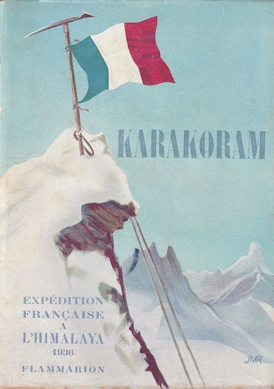
Escarra Jean - Ségogne Henry (De) - Neltner Louis - Charignon Jean.
KARAKORAM Expédition Française à l'Himalaya 1936.
Flammarion Flammarion, 1938. Broché au format In-8, sous jaquette illustré, 172 pages, exemplaire très propre. .
Bookseller reference : 8168
|
|
|
ESCARRA JEAN / CHARIGNON JEAN / NELTNER LOUIS / SEGOGNE HENRY DE
KARAKORAM: Expédition française à l'Himalaya, 1936.
FLAMMARION PARIS 1938Coll. LA VIE EN MONTAGNE. Photographies n&b h.t. 10e mille. 172 pp IN8 Broché Couverture illustrée,
Bookseller reference : 12649
|
|
|
Eskridge Robert Lee
Manga Reva: The Forgotten Islands
Indianapolis: Bobbs-Merrill Company 1931. 1st printing. Tight square and unmarked. Some pale spotting to upper page edges. Full blue cloth binding. Map endpapers. 286pp. Introduction by Eunice Tietjens. Mavelous illustrations by the author. In the scarce dust jacket that is moderately worn along edges with very small chips and retains original price on front flap. Eskridge sailed in the Vaihiria Chin Fu's old boat to Manga Reva called "The Forgotten Islands" by the French in the Gambier Archipelago the Polynisian Islands. First Edition. Hardcover. Very Good/Very Good. 8vo - 8" - 9" Tall. Bobbs-Merrill Company Hardcover
Bookseller reference : 062756

|
|
|
ESTRE (Henry d')
Bonaparte
Paris, Plon, 1942-1946 3 vol. in-12, III-245 pp., III-377 pp. et VI-471 pp., broché. Cachet sur la couverture du tome I. Papier cassant. Envoi au tome III.
Bookseller reference : 223527
|
|
|
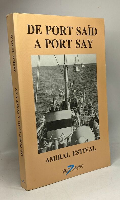
ESTIVAL BERNARD AMIRAL
De port Saïd à port Say
Les 7 vents 1991 in8. 1991. Broché. illustrations en noir et blanc
Bookseller reference : 100084411
|
|
|
ETIENNE Jean-Louis
"Transantarctica, la traversée du dernier continent; Collection : ""L'aventure continue""."
Paris, Robert Laffont, 1990 16 x 24, 295 pp., quelques illustrations en couleurs, broché, bon état.
Bookseller reference : 100.610 ISBN : 222105993
|
|
|
Etter Paul
Gipfelwärts
Neue Schweizer Bibliothek 1968 in8. 1968. Cartonné. illustrations en noir et blanc
Bookseller reference : 100084112

|
|
|
Ettlinger Catherine Editor
Heli-Hiking & Mountaineering. Canadian Mountain Holidays
Banff Alberta: Altitude Publishing Ltd. 2001 First edition in hardcover with dust jacket. 80 pp. Spectacular colour photography. Fine/Fine. Book. Altitude Publishing Ltd. hardcover
Bookseller reference : 43653 ISBN : 1551531135 9781551531137
|
|
|
Ettlinger Catherine Editor
Heli-Hiking & Mountaineering. Canadian Mountain Holidays
Banff Alberta: Altitude Publishing Ltd. 2001 First edition in hardcover with dust jacket. 80 pp. Spectacular colour photography. Back board has a small dent with a tear in the jacket at the site otherwise Fine/Fine. Book. Altitude Publishing Ltd. hardcover
Bookseller reference : 43286 ISBN : 1551531135 9781551531137
|
|
|
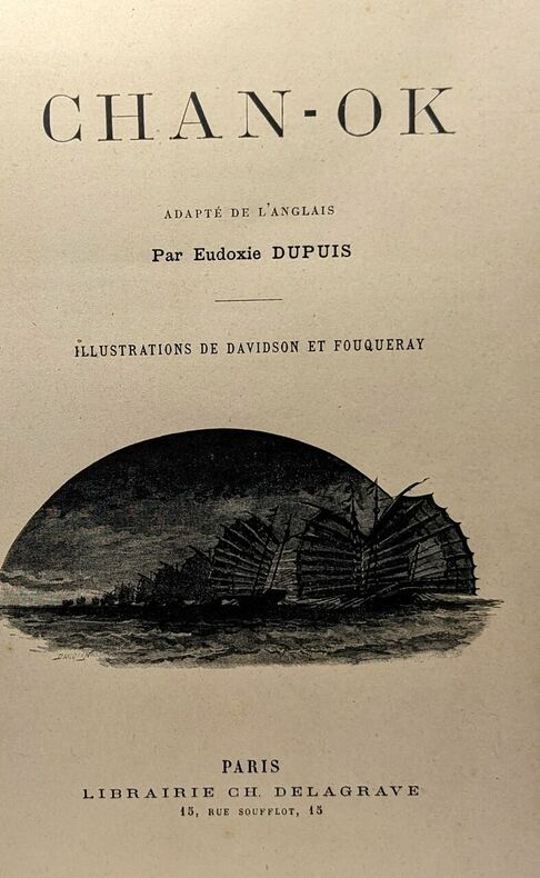
Eudoxie Dupuis
Chan-Ok - illustrations de Davidson et Fouqueray
Libaririe Ch. Delagrave in4. Sans date. Relié. illustrations en noir et blanc
Bookseller reference : 100082552
|
|
|
Evans Admiral Edward R. G. R.
SOUTH WITH SCOTT - Polar Exploration
London: Collins 1921. 318 pp. Collins Library of Classics edition. Burgundy cloth lettered in gilt on the spine; gray illustrated endpapers; illustrated with black and white plates and a fold-out map. Wear on the corners of the dustjacket with chipping at the head and foot of the spine; price intact; no interior markings. The Chapters are: South Polar Expedition - Outfit and Aims; Voyage of the Terra Nova; Assembling of Units - Departure from New Zealand; Through Stormy Seas; Antarctica - Through the Pack Ice to Land; Settling Down to the Polar Life; Arrangements for the Winter; The Winter Closes In; Preliminary Explorations; Spring Depot Journey; Preparations and Plans for the Summer Season; Southern Journey - Motor Sledges Advance; The Barrier Stage; On the Beardmore Glacier and Beyond; Return of the Last Supporting Party; The Pole Attained - Scott's Last Marches; The Second Winter - Finding of the Polar Party; Adventures of the Northern Party; and Narrative of the Terra Nova. Later Printing. Hardcover. Very Good/Good Only. 16mo. Collins Hardcover
Bookseller reference : 204540

|
|
|
Evans Admiral Sir Edward R. G
South with Scott
London: Collins N.d. B/w Frontispiece & Photographs. Blue cloth 284pp. Small area of cloth faded where DJ is defective spine ends and front lower edge. P/o details on Ffep. Light foxing to eps edges and scattered throughout. DJ unclipped small loss to spine ends and front lower edge. . Hard Cover. Good/Fair. Illus. by Herbert Ponting. 8vo - over 7�" - 9�" tall. Collins Hardcover
Bookseller reference : 006716

|
|
|
Evans Edward
British Polar Explorers
London: Collins 1946. 2nd impression. VG/VG dust jacket. 48 p. 8 color plates 14 b/w illus 8vo; Collins hardcover
Bookseller reference : 576
|
|
|
Everest Expeditions
Howard-Bury Lieut.-Col. C. K. MOUNT EVEREST: The Reconnaissance 1921 with Bruce Brigadier-General Hon. C. G. THE ASSAULT ON MOUNT EVEREST 1922 with Norton Lieutenant-Colonel E. F. THE FIGHT FOR EVEREST: 1924
London: Edward Arnold and Co 1922 1923 1925. Together 3 volumes. First editions. Each with a profusion of illustrations several in color and folding maps. 8vo original blue red and green cloth respectively lettered in gilt on spines and covers. xi 350; xi 335; xi 369. Index to each volume. A fresh and clean set very handsome and in very nice condition with minimal evidence of age or use. THE THREE BRITISH EVEREST EXPEDITIONS OF THE 1920’S SCARCE IN SUCH EXCELLENT CONDITION AND IN THE ORIGINAL CLOTH BINDINGS GILT. The British made it a point of national pride to scale the mighty Everest and the saga of their quest makes for fascinating reading. Despite the fact that each of the three expeditions here narrated were unable to conquer the mountain each expedition added to the knowledge and experience that would ultimately help others conquer the summit. Each volume includes a variety of interesting field notes on subjects like wildlife acclimatization Tibetan culture natural history geology and glaciology and organization of the expeditions altogether making an intriguing read.<br> Complete sets of these books have become especially difficult to come by. As the books were issued over a period of years it has become nearly impossible to gather together a group matching in condition as are these. A very desirable set. Edward Arnold and Co hardcover
Bookseller reference : 29264

|
|
|
Everest Expeditions; Howard Bury Lieut. Col. C. K.
MOUNT EVEREST. The Reconnaissance 1921
London: Edward Arnold and Co 1922. First edition of this primary work on the quest for the summit of Everest. With a profusion of illustrations and plates and with three large folding maps. Large 8vo bound in the publisher’s original blue cloth lettered in gilt on spine and upper cover. xi 356 pp. A very fresh and pleasing copy the blue cloth without fade the textblock is clean and fresh the plates and maps are all in fine order. THE FIRST GREAT BRITISH EVEREST EXPEDITION OF THE 1920’S A FINE FIRST EDITION SCARCE IN SUCH WELL PRESERVED CONDITION. The British made it a point of national pride to scale the mighty Everest and the saga of their quest makes for fascinating reading. Despite the fact that the expedition here narrated was unable to conquer the mountain it added significantly to the knowledge and experience that would ultimately help other British climbers conquer the summit in the early 1950’s. The volume includes a variety of interesting field notes on subjects like wildlife acclimatization Tibetan culture natural history geology and glaciology and organization of the expeditions altogether making an intriguing read.<br> A pleasing copy of this important book. Edward Arnold and Co hardcover
Bookseller reference : 30410
|
|
 Receive by email
 Download as PDF document
 RSS feed


