|
EARLE SYLVIA A.; GIDDINGS AL
Exploring The Deep Frontier: The Adventure Of Man In The Sea
National Geographic Society Washington:. Hardcover with dustjacket. Good condition. Dustjacket is torn in theback. ISBN: 0870443437. National Geographic Society, Washington: hardcover
Bookseller reference : 64853X1 ISBN : 0870443437 9780870443435

|
|
|
Easty John
MEMORANDUM OF THE TRANSACTIONS OF A VOYAGE FROM ENGLAND TO BOTANY BAY 1787-1793 A First Fleet Journal
Sydney: Trustees of the Public Library of New South Wales With Angus & Robertson. Near Fine in Very Good dust jacket. 1965. 1st Edition. Hardcover. Top edge of dustjacket shows wear but is now protected a very good copy in very good dustjacket. This journal is published by the Public Library of New South Wales through the William Dixson Foundation. In accord with the terms of Sir William Dixson's bequest the Printed text conforms as closely as possible to the original manuscript preserving the author's peculiarities of spelling and punctuation and the corrections and alterations which he made.; 295 x 210mm; x 186 pages . Trustees of the Public Library of New South Wales With Angus & Robertson hardcover
Bookseller reference : 22942

|
|
|
Eberl-Elber, Ralph
Westafrikas letztes Rätsel : Erlebnisbericht über die Forschungsreise 1935 durch Sierra Leone ; Mit 44 Textabb., 4 Kt. u. 197 Bildern nach Aufn. u. Zeichn. d. Verf.
Salzburg ; Graz ; Wien ; Leipzig ; Berlin : "Das Bergland-Buch", 1936. Mit 197 fotografischen Tafelabbildungen, 44 Illustrationen im Text u. 4 Kartenskizzen. 368 Seiten. Originalleinen. 23cm
Bookseller reference : 305109

|
|
|
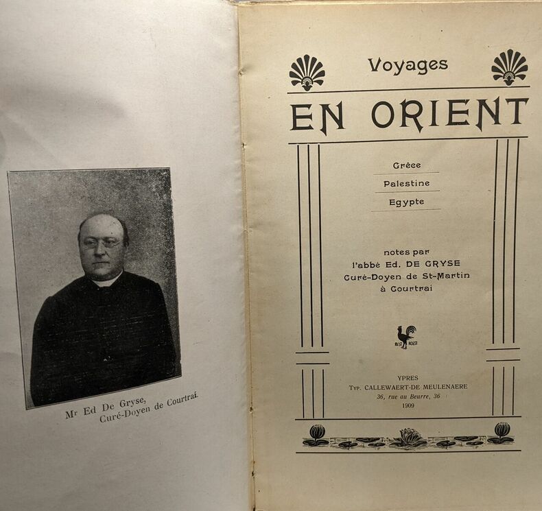
Ed. De Gryse
Voyages en Orient - Grèce - Palestine - Egypte - notes par l'abbé Ed. de Gryse Curé-Doyen de St-Martin à Courtrai
Callewaert-de meulenaere 1909 in8. 1909. Broché. illustrations en noir et blanc
Bookseller reference : 100084124
|
|
|
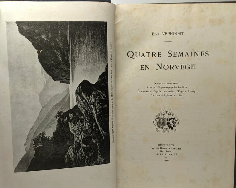
Edg. Verhoost
Quatre semaines en Norvège
Société Belge de Librairie 1910 in8. 1910. Relié. illustrations en noir et blanc
Bookseller reference : 100084457
|
|
|
Edited And Introduced By Andrew Gow and Julie Rak
Mountain Masculinity. The Life and Writing of Nello "Tex" Vernon-Wood in the Canadian Rockies 1906-1938
Edmonton Alberta: Athabasca University. 2008 First printing in trade paperback with French flaps. 226 pp. Appendix index. Minor shelfwear some crimping to the bottom edge of the front endpaper. Very Good. Trade Paperback. Very Good. BC2-5. Athabasca University. paperback
Bookseller reference : 247149

|
|
|
Edited by Edwin A. Churchill Emerson W. Baker Richard S. D'Abate Kristine L. Jones Victor A. Conrad & Harald EL. Prins E. L.
American Beginnings: Exploration Culture and Cartography in the Land of Norumbega
University of Nebraska Press 1994. 1st printing. Tight and unmarked. Full cloth binding. 388pp. Dust jacket now in a new mylar cover. First Edition. Hardcover. Very Good/Very Good. 4to - over 9" - 12" Tall. University of Nebraska Press Hardcover
Bookseller reference : 059988 ISBN : 0803245548 9780803245549
|
|
|
Edited By Christine Mazur Somon Statkewich and David Relkoff
Manitoba Climbers. A Century of Stories from the Birthplace of The Alpine Club of Canada. Inscribed Association Copy
Canmore Alberta: The Alpine Club of Canada. 2006 First printing in trade paperback. Inscribed by Christine Mazur to fellow author Will Gadd. 202 pp. Photographs. Tiny bumps to the front corners. Near Fine. Signed by the Editor. Trade Paperback. Near Fine. BC2-5 BW9-8. The Alpine Club of Canada. paperback
Bookseller reference : 247151 ISBN : 0920330509 9780920330500

|
|
|
Edmund Heller Frank Wigglesworth Clarke Creator Hopkins Stanford Galapagos Expedition Creator
Papers From The Hopkins-stanford Galapagos Expedition 1898-1899
Nabu Press 2011-07-19. Paperback. Good. Nabu Press paperback
Bookseller reference : SONG1173633669 ISBN : 1173633669 9781173633660
|
|
|
Edmund Hillary
The Boys Book of Exploration
Cassell London 1962. 3rd Edition. Hardcover. Very Good/Good. Dustjacket has been wrapped in plastic which has pulled tight and wrinkled jacket foxing on closed edges of pages. Quantity Available: 1. Category: Exploration; Inventory No: 09100379. Cassell hardcover
Bookseller reference : 09100379
|
|
|
Edward Ellsberg
Hell on Ice
New York: Dodd Mead 1938. Covers soiled name inside front cover; sound copy. Jacket worn and chipped at corners spine faded. "The Saga of the Jeannette" the first expedition to seek the North Pole vis the Behring Sea. Extra postage may be required outside the US. Blue Cloth. Good/Fair. Dodd Mead Hardcover
Bookseller reference : 006432
|
|
|
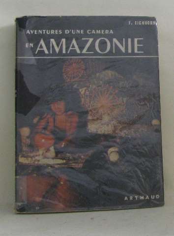
Eichhorn F
Aventures d'une caméra en amazonie
Arthaud 1954 200 pages in8. 1954. Broché. 200 pages.
Bookseller reference : 197241
|
|
|
Eiilison Les and Brian Smoot.
Wasatch Rock Climbs.
New York: The American Alpine Club Research Fund. 1984 First printing in small trade paperback. 302 pp. Photographs grade index. Minor creasing to the front cover. Very Good. . Soft Cover. Very Good. BW13-3. The American Alpine Club Research Fund. paperback
Bookseller reference : 248836 ISBN : 0930410203 9780930410209

|
|
|
Eileen Aldridge
Porcelain
London: Hamlyn 1969. Part of the Hamlyn all-colour paperbacks series .For the amateur collector this is an indispensable handbook tracing the development of porcelain from the exquisite Chinese wares in the Middle Ages through to trhe European equivalents in the 18th and 19th centuries. Details of factories Capodimonte Chelsea Wedgwood and Copenhagen also the painters patrons styles colours and marks. 160pp. e-mail for further details. Not Signed. This is the FIRST EDITION. Laminated Paper. Very Good AVERAGE/No Jacket. Illus. by Illustrated by Peter Morter and Design Bureau. 12mo - over 6�" - 7�" Thin. High Gloss Paperback. Hamlyn paperback
Bookseller reference : 002981
|
|
|
EJ. Hart E. J.
The Battle for Banff. Exploring the Herigage of the Banff-Bow Valley Part II 1930-1985
Banff: E.J.H. Literary Enterprises 1999 First printing of this edition in trade paperback. 368 pp. Illustrations notes index. Fine. Trade Paperback. Fine. BW12-8. E.J.H. Literary Enterprises paperback
Bookseller reference : 247041 ISBN : 0969973284 9780969973287

|
|
|
EJ. Hart E. J.
The Place of Bows. Exploring the Heritage of the Banff-Bow Valley. Part I to 1930
Banff: E.J.H. Literary Enterprises 1999 First printing of this edition in trade paperback. 344 pp. Illustrations notes index. Fine. Trade Paperback. Fine. BW12-8. E.J.H. Literary Enterprises paperback
Bookseller reference : 247039 ISBN : 096997325X 9780969973256

|
|
|
EJ. Hart. E. J.
Diamond Hitch. The Pioneer Guides and Outfitters of Banff and Jasper.
Banff: E.J.H. Literary Enterprises 2001 First printing of this edition in trade paperback. 272 pp. Illustrations notes index. Fine. 1st Edition. Trade Paperback. Fine. BW12-7. E.J.H. Literary Enterprises paperback
Bookseller reference : 247026 ISBN : 0969973276 9780969973270

|
|
|
Ekins H. R.
Around the World in Eighteen Days and How To Do It
New York: Longmans Green and Co. 1936. 1st printing. Inscribed by Ekins on verso of front flyleaf in 1955. Also laid-in a typed letter to same prior owner signed by Ekins. Full cloth binding. Map endpapers. 186pp. Photos. Lightly rubbed jacket with original price intact offered now in a new mylar cover. Inscribed and Signed By Author. First Edition. Hardcover. Collectible - Very Good/Very Good. 8vo - 8" - 9" Tall. Longmans, Green and Co. Hardcover
Bookseller reference : 061591

|
|
|
ELDER EXPEDITION LINDSAY David
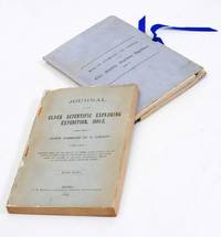
Journal of the Elder Scientific Exploring Expedition.
Adelaide: C.E. Bristow 1893. Wrappers and boards well repaired. Octavo complete with maps; original wrappers and boards preserved in a brown morocco bookform box. One of only 500 copies complete with folding maps: the first edition of the narrative of one of the last great Australian exploring expeditions written by its leader. Lindsay led this extensive expedition - it ran to eight men forty-four camels and five Afghan camel drivers - organised by the South Australian Branch of the Royal Geographical Society and equipped by Sir Thomas Elder to explore the unknown interior between South Australia and the west coast and to look for Leichhardt. C.E. Bristow unknown
Bookseller reference : 2712376
|
|
|
ELDER EXPEDITION LINDSAY David
Journal of the Elder Scientific Exploring Expedition 1891
Adelaide: House of Assembly 1893. A very good copy. Folio with two large colour folding maps; uncut in recent cloth. One of only 750 copies published: this rare printing is not recorded by Ferguson. Sir Thomas Elder who had earlier financed the first great desert journey of Ernest Giles in 1891 fitted out the expedition of David Lindsay the celebrated Northern Territory explorer and surveyor general. In 1883 Lindsay had led an expedition into Arnhem Land travelling to the Gulf of Carpentaria. He went on to explore extensively in the MacDonnell Ranges region before his last and most important work this scientifically equipped expedition made possible by the sole support of Sir Thomas Elder. The object of the expedition was to explore the unknown interior of Western Australia between the routes laid out by Forrest in 1874 and Giles in 1875 'for the purpose of completing the exploration of Australia'. Lindsay's expedition arrived in Geraldton in January 1892 besieged by internal conflict: the entire scientific team except for Lawrence Allen Wells resigned. This marked an abrupt end to David Lindsay's career as an explorer and closed down an expensive expedition that produced very few new discoveries. This is the official report by the leader of the expedition complete with maps. It predates the first public edition printed by C.E. Bristow. Published by order of the South Australian House of Assembly on 3 October 3 1893 at a cost of ninety seven pounds four shillings and seven pence plus over thirty-three pounds for the lithography of the large folding maps. In the summary of the work Lindsay states that the expedition travelled 2745 miles through unexplored country whilst 80000 square miles was explored and mapped. 'The abandoment of the expedition was a terrible disappointment to me. That men had so little sense of duty to their leader and to their generous employer should have been the primary cause of the break up of such a splendidly-equipped expedition.'. House of Assembly unknown
Bookseller reference : 2712386

|
|
|
ELDER EXPEDITION SOUTH AUSTRALIAN GOVERNMENT
South Australia. Journal of the Elder Exploring Expedition 1891
Adelaide: Government Printer 1893. Folio 78 pp. with two large folding maps each measuring 720 x 1530 mm. recent black cloth. First published report of the Elder Scientific Expedition of 1891 complete with the two magnificent lithographic maps of the central desert on the border of Western and South Australia. The expedition was privately funded by Sir Thomas Elder who had earlier bankrolled the first great desert journey of Ernest Giles. It was led by surveyor general David Lindsay a celebrated explorer of the Northern Territory. Lindsay took charge of the Elder Scientific Expedition with the stated intention of exploring the unknown interior of Western Australia between the routes laid out by Forrest in 1874 and Giles in 1875 'for the purpose of completing the exploration of Australia'. The expedition travelled 2745 miles through unexplored country mapping 80000 square miles. Sadly the men were besieged by internal conflict and all but one member of the scientific team resigned. This marked an abrupt end to Lindsay's career as an explorer. This report published by order of the South Australian parliament predates the first public edition printed by C. E. Bristow. The two maps are splendid indeed both illustrate the same geography however the second map is overlaid with geological types printed in six colours. Government Printer unknown
Bookseller reference : 4106152

|
|
|
Elder Scientific Exploring Expedition
Handbook of instructions for the guidance of the officers of the Elder Scientific Exploration Expedition to the unknown portions of Australia. 1891
2020. Paperback. New. Lang: - eng Pages 44. Reprinted in 2020 with the help of original edition published long back 1891. This book is Printed in black & white sewing binding for longer life with Matt laminated multi-Colour Soft Cover HARDCOVER EDITION IS ALSO AVAILABLE Printed on high quality Paper re-sized as per Current standards professionally processed without changing its contents. As these are old books we processed each page manually and make them readable but in some cases some pages which are blur or missing or black spots. If it is multi volume set then it is only single volume if you wish to order a specific or all the volumes you may contact us. We expect that you will understand our compulsion in these books. We found this book important for the readers who want to know more about our old treasure so we brought it back to the shelves. Any type of Customisation is possible with extra charges. Hope you will like it and give your comments and suggestions. paperback
Bookseller reference : PB1111009984549
|
|
|
Elder Scientific Exploring Expedition
Handbook of instructions for the guidance of the officers of the Elder Scientific Exploration Expedition to the unknown portions of Australia. 1891 Hardcover
2020. Hardcover. New. Lang: - eng Pages 44. Reprinted in 2020 with the help of original edition published long back 1891. This book is Printed in black & white Hardcover sewing binding for longer life with Matt laminated multi-Colour Dust Cover Printed on high quality Paper re-sized as per Current standards professionally processed without changing its contents. As these are old books we processed each page manually and make them readable but in some cases some pages which are blur or missing or black spots. If it is multi volume set then it is only single volume if you wish to order a specific or all the volumes you may contact us. We expect that you will understand our compulsion in these books. We found this book important for the readers who want to know more about our old treasure so we brought it back to the shelves. Any type of Customisation is possible with extra charges. Hope you will like it and give your comments and suggestions. hardcover
Bookseller reference : 1111009984549
|
|
|
Elder Scientific Exploration Expedition
The Scientific Results of the Elder Exploring Expedition. Contained in Transactions of the Royal Society of South Australia Volume 16 Part 1 1892 and Volume 16 Part 2 1893
First Edition. Paperback. Octavo iv 236 pages plus 7 plates and a very large folding map. Recent cloth bound as one volume with an endpocket for the 'geological map' and retaining the original wrappers the second rear one a little chipped; in fine condition. The map is in fact a superb chromolithographed 'Map showing the Route travelled by the Elder Exploring Expedition' and measures 370 x 990 mm with a chromolithographed 'Sketch Section from Warrina to Annean Station' 180 x 990 mm printed below it on the same sheet. The map gives detailed routes of other explorers including Stuart in 1858 Gregory in 1858 Delisser in 1865 Forrest in 1874 Giles in 1873 1875 and 1876 . and extensive annotations regarding the Elder Expedition 'The portion above delineating the course of the Ferdinand is from information obtained from the Everard Range blacks' 'Camels ate only poplars here' 'The country is entirely destitute of water between Queen Victoria's Spring and the Boundary Dam a distance of 325 miles'. It accompanies the report by Victor STREICH on Geology and Meteorology. Other major expedition reports are MAIDEN J.H.: Vegetable Exudations; BLACKBURN Reverend T.: Coleoptera and STIRLING E.C.: Vertebrata. The third and final part to this volume published in 1896 contains the reports on anthropology and botany - it has long been rare. paperback
Bookseller reference : 28438
|
|
|
Eleanor G. Luxton
Banff Canada's First National Partk. A History and a Memory of Rocky Mountains Park
Banff Alberta: Summerthought Ltd. 2008 First printing in trade paperback. 160 pp. Historic photographs index. Fine. . Trade Paperback. Fine. BW12-8. Summerthought Ltd. paperback
Bookseller reference : 247104 ISBN : 0978237544 9780978237547

|
|
|
Eleanor Hughes
Silver for Collectors.
London: Hamlyn 1974. Part of the Hamlyn all-colour paperbacks series Eleanor at the time of writing was the silver department's expert at Sotheby & Co so well qualified to write on this subject.160pp.inc index e-mail for further details. Not Signed. This is the FIRST EDITION. Laminated Paper. FINE AS NEW/No Jacket. Illus. by Illustrated by Peter Henville . 12mo - over 6�" - 7�" Thin. High Gloss Paperback. Hamlyn paperback
Bookseller reference : 003105
|
|
|
Eliot Charles W. editor
The Harvard Classics Vol. 33: Voyages and Travels Ancient and Modern with Introductions and Notes
P. F. Collier & Son Company 1910. Full red cloth binding. Clean and unmarked. 351pp. Accounts by Herodotus Tacitus Dranke Pretty Bigges Haies and Raleigh. Hardcover. Very Good/No Dust Jacket. 8vo - 8" - 9" Tall. P. F. Collier & Son Company Hardcover
Bookseller reference : 054090

|
|
|
Elisha Kent Kane
Artic Explorations: The Second Grinnell Expedition in Search of Sir John Franklin 1853 '54 '55
<p>excellent condition</p> Childs and Peterson, hardcover
Bookseller reference : 1009
|
|
|
Ellery Anderson W.
Expedition south
The Travel Book Club Cartonné avec jaquette In-8, (22.5x14.5 cm), cartonné sous jaquette illustrée, 207 pages, sans date, photographies en noir et blanc, portrait de l'auteur en frontispice, texte en anglais, cartes sur les pages de garde ; nom au stylo sur la page de garde, petites déchirures et traces sur la jaquette, assez bon état général. Livraison a domicile (La Poste) ou en Mondial Relay sur simple demande.
Bookseller reference : cv1312
|
|
|
Ellen Gatti
Exploring We Would Go
Robert Hale London 1950. First Edition. Hardcover. Fair/No Dust Jacket. 302 pages. Hinges are split at front and back making binding loose. Covers have moderate rubbing/wear. Edges of boards have moderate wear. No dust jacket with this book. Edges of pages are mildly foxed. Pages are reasonably tanned. Quantity Available: 1. Category: Exploration; Inventory No: 17020312. Robert Hale hardcover
Bookseller reference : 17020312
|
|
|
Ellis Henry. Richard H. Dillon Signed
Considerations on the Great Advantages Which Would Arise From the Discovery of the North West Passage
San Francisco: Sutro Library. 1975 Facsimile reprint in stapled card covers. Signed by Mr. Dillon who wrote the introduction. 8 pp. Fold-out map. Book. Sutro Library. unknown
Bookseller reference : 42503
|
|
|
Ellis Henry 1721 1806
Voyage de la baye de Hudson. Fait en 1746 & 1747 pour la Découverte du Passage de Nord-Ouest. Contenant une description exacte des Côtes & l'Histoire Naturelle du Pays avec une Relation historique de toutes les Expéditions faites jusqu'ici
<p>2 volumes. 182 pages with fold out frontispiece map and three additional folding engravings; 319 pages with seven folding engravings. half-titles in each title pages improperly marked first volume as second and vice versa. Duodecimo 6 1/2" x 3 1/2" bound in original publisher's full uniform contemporary French sponged calf with gilt-tooled spines. First French edition after the 1748 English edition.<br /><br />Henry Ellis was a traveler hydrographer and colonial governor returned from Italy in 1746 just in time to find an expedition to search for a north-west passage on the point of sailing. He appears to have been in easy circumstances; his name stands in the list of subscribers to the north-west expedition and he had sufficient interest to get attached to it nominally as agent for the committee and really as hydrographer surveyor and mineralogist the expedition consisting of two vessels the <em>Dobbs</em> galley of 180 and <em>California</em> of 150 tons left Gravesend on 20 May 1746 joined the Hudson's Bay convoy in Hollesley Bay and finally sailed from Yarmouth on the 31st. They parted from the convoy on 18 June made Resolution Island on 8 July and after a tedious passage through Hudson's Straits rounded Cape Digges on 8 August and on the 11th 'made the land on the west side the Welcome in latitude 64° N.' Bad weather drove them to the southward and prevented their doing anything more that season. They wintered in Hayes River in a creek about three miles above Fort York where a quarrel with the agent of the Hudson's Bay Company gave an unwonted piquancy to the dark and weary days. They suffered much from scurvy the prevalence of which Ellis attributes to their having got two kegs of brandy from Fort York for their Christmas merrymaking and in a minor degree to the 'governor' not permitting the Indians to supply them with fresh provisions. On 29 May 1747 the ice broke up and they were able to warp to the mouth of their creek; on 9 June they got down to Fort York. There they were allowed to get some provisions and stores and on the 24th cleared the river and 'stood to the northward on the discovery'. On 1 July each of the two ships sent away her long-boat but owing apparently to some ill-feeling between the two captains without any prearranged plan for working in concert. The consequence was that they separately went over the same ground discovering naming and examining the several creeks and inlets on the west side of Hudson's Bay the double examination perhaps compensating for the confusion arising from the double naming. Before the season closed in they had satisfied themselves that the only possible exit from Hudson's Bay on the west must be through the Welcome and that very probably there was no way out except that on the east by which they had come in. The result may not seem much; but as it served to put an end to the idea that the passage must lie through Hudson's Bay it was at least so much gain to accurate knowledge. After 21 August the weather broke and they decided in council 'to bear away for England without further delay.' On the 29th they entered Hudson's Straits passed Resolution Island on 9 September and arrived at Yarmouth on 14 Octivwe. Ellis's share in the work of the expedition had really been very slender but the reputation of it has been commonly assigned to him by reason of the narrative which he published the following year under the title <em>A Voyage to Hudson's Bay by the DobbsGalley and California in the years 1746 and 1747 for Discovering a North-West Passage</em> 1748; a work which with many valuable observations on tides on the vagaries of the compass and on the customs of the Eskimos a people then practically unknown mingles a great deal of speculation on the certain existence of the passage on magnetism on fogs on rust and other matters all more or less ingenious but now known to be wildly erroneous. Such as it was the book commended its author to the scientific workers of the day and on 8 February 1748-9 he was elected a fellow of the Royal Society. Possibly in acknowledgment of his scientific labors but more probably by some family interest he was afterwards appointed successively governor of Georgia and of Nova Scotia from which employment he retired about 1770. He seems to have spent his later years as a wanderer on the continent was at Marseilles in 1775 and died at Naples on 21 January 1806.<br /><br /><strong>Condition:</strong><br /><br />Some dark spot to spine else a very good copy.</p> Ballard Fils hardcover
Bookseller reference : E0529
|
|
|
Ellis Henry 1721 1806
Voyage de la baye de Hudson. Fait en 1746 & 1747 pour la Découverte du Passage de Nord-Ouest. Contenant une description exacte des Côtes & l'Histoire Naturelle du Pays avec une Relation historique de toutes les Expéditions faites jusqu'ici
<p>2 volumes. 182 pages with fold out frontispiece map and three additional folding engravings; 319 pages with seven folding engravings. half-titles in each title pages improperly marked first volume as second and vice versa. Duodecimo 6 1/2" x 3 1/2" bound in original publisher's full uniform contemporary French sponged calf with gilt-tooled spines. First French edition after the 1748 English edition.<br /><br />Henry Ellis was a traveler hydrographer and colonial governor returned from Italy in 1746 just in time to find an expedition to search for a north-west passage on the point of sailing. He appears to have been in easy circumstances; his name stands in the list of subscribers to the north-west expedition and he had sufficient interest to get attached to it nominally as agent for the committee and really as hydrographer surveyor and mineralogist the expedition consisting of two vessels the <i>Dobbs</i> galley of 180 and <i>California</i> of 150 tons left Gravesend on 20 May 1746 joined the Hudson's Bay convoy in Hollesley Bay and finally sailed from Yarmouth on the 31st. They parted from the convoy on 18 June made Resolution Island on 8 July and after a tedious passage through Hudson's Straits rounded Cape Digges on 8 August and on the 11th 'made the land on the west side the Welcome in latitude 64° N.' Bad weather drove them to the southward and prevented their doing anything more that season. They wintered in Hayes River in a creek about three miles above Fort York where a quarrel with the agent of the Hudson's Bay Company gave an unwonted piquancy to the dark and weary days. They suffered much from scurvy the prevalence of which Ellis attributes to their having got two kegs of brandy from Fort York for their Christmas merrymaking and in a minor degree to the 'governor' not permitting the Indians to supply them with fresh provisions. On 29 May 1747 the ice broke up and they were able to warp to the mouth of their creek; on 9 June they got down to Fort York. There they were allowed to get some provisions and stores and on the 24th cleared the river and 'stood to the northward on the discovery'. On 1 July each of the two ships sent away her long-boat but owing apparently to some ill-feeling between the two captains without any prearranged plan for working in concert. The consequence was that they separately went over the same ground discovering naming and examining the several creeks and inlets on the west side of Hudson's Bay the double examination perhaps compensating for the confusion arising from the double naming. Before the season closed in they had satisfied themselves that the only possible exit from Hudson's Bay on the west must be through the Welcome and that very probably there was no way out except that on the east by which they had come in. The result may not seem much; but as it served to put an end to the idea that the passage must lie through Hudson's Bay it was at least so much gain to accurate knowledge. After 21 August the weather broke and they decided in council 'to bear away for England without further delay.' On the 29th they entered Hudson's Straits passed Resolution Island on 9 September and arrived at Yarmouth on 14 Octivwe. Ellis's share in the work of the expedition had really been very slender but the reputation of it has been commonly assigned to him by reason of the narrative which he published the following year under the title <i>A Voyage to Hudson's Bay by the DobbsGalley and California in the years 1746 and 1747 for Discovering a North-West Passage</i> 1748; a work which with many valuable observations on tides on the vagaries of the compass and on the customs of the Eskimos a people then practically unknown mingles a great deal of speculation on the certain existence of the passage on magnetism on fogs on rust and other matters all more or less ingenious but now known to be wildly erroneous. Such as it was the book commended its author to the scientific workers of the day and on 8 February 1748-9 he was elected a fellow of the Royal Society. Possibly in acknowledgment of his scientific labors but more probably by some family interest he was afterwards appointed successively governor of Georgia and of Nova Scotia from which employment he retired about 1770. He seems to have spent his later years as a wanderer on the continent was at Marseilles in 1775 and died at Naples on 21 January 1806.<br /><br /><b>Condition:</b><br /><br />Some dark spot to spine else a very good copy.</p> Ballard Fils hardcover books
Bookseller reference : E0529
|
|
|
Ellisson Joseph W.
Tusitala of the South Seas
1953 Hastings House Publ. 1953. Wear and small tears to the dustjacket. Last half of book has a lot of underlining in pencil. G/worn. 1953 Hastings House, Publ. unknown
Bookseller reference : ABE-133376132
|
|
|
Ellsberg Edward
HELL ON ICE: THE SAGA OF THE "JEANNETTE"
New York: Dodd Mead & Company. Good with no dust jacket. 1938. Hardback. 421 pages . Dodd, Mead & Company hardcover
Bookseller reference : 65551
|
|
|
ELLSBERG COMMANDER EDWARD
Hell On Ice: The Saga Of The " Jeannette'
Dodd Mead & Company New York: 1938. Hardcover no dustjacket. Good condition. Dodd, Mead & Company, New York: 1938 hardcover
Bookseller reference : 40606X1
|
|
|
EMcGregor Ewan; Boorman Charley
Long Way Round: Chasing Shadows Across the World
Atria 2004. First edition hard cover with dust jacket VG/VG. Clean tight unmarked copy. Dust jacket has faint damp stain to top of rear panel offered in new mylar. 310pp map illustrated endpapers color photographs. First Edition. Hardcover. Very Good/Very Good. 8vo - 8" - 9" Tall. Atria Hardcover
Bookseller reference : 23816 ISBN : 0743499336 9780743499330

|
|
|
Emersleben, Otto
Strom ohne Brücke Illustrationen von Gerhard Großmann
Berlin: Verlag Neues Leben, 1980. 224 Seiten , 22 cm, Pappeinband
Bookseller reference : 47778

|
|
|
Emerton J. H. James Henry Banks Nathan Chamberlin Ralph V. Ralph Vary Canadian Arctic Expedition
Insects. Part H : spiders mites and myripods 1919 Leather Bound
2019. Leather Bound. New. Leather Binding on Spine and Corners with Golden Leaf Printing on round Spine extra customization on request like complete leather Golden Screen printing in Front Color Leather Colored book etc. Reprinted in 2019 with the help of original edition published long back 1919. This book is printed in black & white sewing binding for longer life Printed on high quality Paper re-sized as per Current standards professionally processed without changing its contents. As these are old books we processed each page manually and make them readable but in some cases some pages which are blur or missing or black spots. If it is multi volume set then it is only single volume if you wish to order a specific or all the volumes you may contact us. We expect that you will understand our compulsion in these books. We found this book important for the readers who want to know more about our old treasure so we brought it back to the shelves. Hope you will like it and give your comments and suggestions. Lang: - eng. EXTRA 10 DAYS APART FROM THE NORMAL SHIPPING PERIOD WILL BE REQUIRED FOR LEATHER BOUND BOOKS. COMPLETE LEATHER WILL COST YOU EXTRA US$ 25 APART FROM THE LEATHER BOUND BOOKS. hardcover
Bookseller reference : LB1111007015508
|
|
|
Emerton J. H. James Henry Banks Nathan Chamberlin Ralph V. Ralph Vary Canadian Arctic Expedition
Insects. Part H : spiders mites and myripods 1919 FULL LEATHER BOUND
2019. SUPER DELUXE EDITION. New. Antique look with Golden Leaf Printing and embossing with round Spine completely handmade bindingextra customization on request like Color Leather Colored book special gold leaf printing etc. Reprinted in 2019 with the help of original edition published long back 1919. This book is printed in black & white sewing binding for longer life Printed on high quality Paper re-sized as per Current standards professionally processed without changing its contents. As these are old books we processed each page manually and make them readable but in some cases some pages which are blur or missing or black spots. If it is multi volume set then it is only single volume if you wish to order a specific or all the volumes you may contact us. We expect that you will understand our compulsion in these books. We found this book important for the readers who want to know more about our old treasure in old look so we brought it back to the shelves. Hope you will like it and give your comments and suggestions. Lang: - eng. EXTRA 10 DAYS APART FROM THE NORMAL SHIPPING PERIOD WILL BE REQUIRED. Normal Hardbound Edition is also available on request. unknown
Bookseller reference : SD1111007015508
|
|
|
Emerton J. H. James Henry Banks Nathan Chamberlin Ralph V. Ralph Vary Canadian Arctic Expedition
Insects. Part H : spiders mites and myripods 1919
2019. Paperback. New. Lang: - eng. Reprinted in 2019 with the help of original edition published long back 1919. This book is Printed in black & white sewing binding for longer life with Matt laminated multi-Colour Soft Cover HARDCOVER EDITION IS ALSO AVAILABLE Printed on high quality Paper re-sized as per Current standards professionally processed without changing its contents. As these are old books we processed each page manually and make them readable but in some cases some pages which are blur or missing or black spots. If it is multi volume set then it is only single volume if you wish to order a specific or all the volumes you may contact us. We expect that you will understand our compulsion in these books. We found this book important for the readers who want to know more about our old treasure so we brought it back to the shelves. Any type of Customisation is possible with extra charges. Hope you will like it and give your comments and suggestions. paperback
Bookseller reference : PB1111007015508
|
|
|
Emerton J. H. James Henry Banks Nathan Chamberlin Ralph V. Ralph Vary Canadian Arctic Expedition
Insects. Part H : spiders mites and myripods 1919 Hardcover
2019. Hardcover. New. Lang: - eng. Reprinted in 2019 with the help of original edition published long back 1919. This book is Printed in black & white Hardcover sewing binding for longer life with Matt laminated multi-Colour Dust Cover Printed on high quality Paper re-sized as per Current standards professionally processed without changing its contents. As these are old books we processed each page manually and make them readable but in some cases some pages which are blur or missing or black spots. If it is multi volume set then it is only single volume if you wish to order a specific or all the volumes you may contact us. We expect that you will understand our compulsion in these books. We found this book important for the readers who want to know more about our old treasure so we brought it back to the shelves. Any type of Customisation is possible with extra charges. Hope you will like it and give your comments and suggestions. hardcover
Bookseller reference : 1111007015508
|
|
|
Emile Schulthess Émile Egli
Afrique - désert-steppe-forêt vierge
Artis / Bruxelles 1964 in4. 1964. Cartonné jaquette. iconographie en couleurs
Bookseller reference : 100095787
|
|
|
Emilio Castelar
Recuerdos de Italia - 3.a edicion - parte 1 y 2
A. de Carlos é Hijo / Madrid 1883 in8. 1883. Relié. 2 volume(s).
Bookseller reference : 100126444

|
|
|
Emin Pascha
Entdeckungsreisen in Zentralafrika. 1876 - 1892.
Lizenzausgabe für einen Buchclub, Gütersloh. 400 S., geprägter OLn m. OU. Mit 40 Abbildungen. Ordentliches Exemplar. Buchschnitt etwas verschmutzt. Good copy.
Bookseller reference : 6482
|
|
|
Emmerich, Ferdinand
Unter den Wilden der Südsee,
Leipzig, Stolpe (= Ferdinand Emmerich: Weltreisen und Forscher-Abenteuer Band 1), 1929. 8°, 253 S., (Schrift: Fraktur), farbig illustr. original Pappband (Hardcover), erste Auflage dieser Ausgabe Buchrücken mit montierter aber von Vorderdeckelinnenkante abgelöster Klarsichfolie, Vorderdeckel und Rückdeckel minimal beschabt, Seiten leicht nachgedunkelt, sonst altersgemäß gutes, sauberes Exemplar.
Bookseller reference : 20217CB

|
|
|
Emory William Hemsley 1811 1887; Philip St. George Cooke; Joseph Eggleston Johnston and James William Abert
Notes of a Military Reconnaissance from Fort Leavenworth in Missouri to San Diego in California – including parts of the Arkansas Del Norte and Gila Rivers
<p> 614 pages illustrated with 64 lithographed or engraved plates 3 battle-plans plus some figure drawings within the text. Octavo 8¾x5¼" bound in original publisher's black cloth and paper spine label. Thirtieth Congress - First Session. Ex. Doc. NO. 41. Cowan page 195; Graff 1249; Howes E145; Wagner-Camp 148:5; Zamorano Eighty 33 First edition House of Representatives issues of the report containing the reports of Lieutenant Abert Colonel Cooke and Captain Johnson as well as that of Emory; the Senate issue only contained the Emory report.</p><p><br />In 1844 Emory served in an expedition that produced a new map of Texan claims westward to the Rio Grande. He came to public attention as the author of the <i>Notes of a Military Reconnaissance from Fort Leavenworth in Missouri to San Diego California</i> published by the Thirtieth United States Congress in 1848. This report described terrain and rivers cities and forts and made observations about Indians Mexicans primarily in New Mexico Territory Arizona Territory and Southern California. It was and is considered one of the important chronicles and descriptions of the historic Southwest particularly noted for its maps. Emory was a reliable and conscientious cartographer. There is a story of testament as to Emory's dedication to accuracy that says John Bartlett his supervisor in the Corps of Topographical Engineers made him sign off on a misplaced boundary marker creating a sweet revenge for Emory who replaced him as Head of the International Boundary Commission in 1855. So accurate were his maps that when topographical engineers were surveying possible routes for the transcontinental railroad the most Southern route did not need to be surveyed thanks to the outstanding work by William H. Emory. But William H. Emory did more than just map the terrain; he also made notes about the plant life as well as the people who inhabited the sparsely populated southwest. Notating the social relations of some of the Native American people he wrote: "Women when captured are taken as wives by those who capture them but they are treated by the Indian wives of the capturers as slaves and made to carry wood and water; if they chance to be pretty or receive too much attention from their lords and masters they are in the absence of the latter unmercifully beaten and otherwise maltreated. The most unfortunate thing which can befall a captive woman is to be claimed by two persons. In this case she is either shot or delivered up for indiscriminate violence.<br /><br /><b>Condition:</b><br /><br />Binding worn at edges and spine ends cloth splitting along front joint; occasional light foxing lacking the two maps as noted very good.</p> Wendell & Van Benthuysen, Printers hardcover
Bookseller reference : E0530
|
|
|
Emory William Hemsley 1811 1887
Report on the United States and Mexican boundary survey: made under the direction of the secretary of the Interior
2 volumes in 3 with U S Geological Survey Bulletin 194 laid in. Volume I parts I and II: xvi258 pages with frontispiece 72 maps 1 folding and illustrations engraved on steel map and meteorological engraved on copper diagram 12 engravings on stone 20 wood cuts and errata; vii17421 plates with folding map in color 26 maps and illustrations and errata. Volume 2 part I: 27075 plate pages with index; Volume II part II: 6227 plates pages with index 3325 plate pages with index 3541 plate pages with index 85ii41 plate pages with index. U S Geological Survey Bulletin 194 map 40" x 26 1/4". Quarto 11" x 9" bound in quarter leather with raised spine bands and lettering in gilt with marbled boards. House of Representatives 34th Congress 1st Session. Ex. Doc. No. 135. Wheat TMW #1022 First edition with the scarce color geological map not issued in all copies.<br /><br />The folding map in volume one is one of the foundation maps for the western United States and represents the culmination of fifty years of government explorations. Starting with Lewis and Clark there were numerous official and unofficial surveys and explorations all adding to the pool of knowledge presented here. While large sections are still labeled "unexplored territory" Emory fitted these fragments together with the information gathered during his surveys into a reasonably correct cartographic picture of the West. This map shows large transitional territories of Nebraska Kansas New Mexico Utah Oregon Washington and Minnesota. It was drawn by Thomas Jekyll under the supervision of Lt. Nathaniel Michler of the Topographical Engineers. Lt. Michler worked with his counterpart representing Mexico Captain Francisco Jimenez to survey between Nogales and Yuma including the area south of Arivaca.<br /><br />The U S Geological survey Bulletin 194 was drawn by J.E. Weyss circa 1860. The map features the survey lines between Texas and New Mexico with good topographical detail. Information includes forts Raton Pass the Santa Fe and Albuquerque trails numerous explorers' routes Indian trails and more. The map is an interesting historical curiosity because it was not published when the survey was finished due to the outbreak of the Civil War. In 1902 the map was belatedly included in a Geological Survey Bulletin by Marcus Baker. Printed by the Norris Peters Co. Photo-Lithograph. It is a large and extremely detailed chart by J.H. Clark U.S. Commissioner.<br /><br /><i>Report on the United States and Mexican Boundary Survey</i> has been called "one of the masterworks of Western and American history." Published in the years 1857 to 1859 it was the official report of the U.S. Boundary Commission upon completing its work of surveying and mapping the United States-Mexico boundary. The boundary survey was a consequence of the U.S.-Mexican War and the Treaty of Guadalupe Hidalgo which concluded the war on February 2 1848. The treaty transferred to the United States nearly half of the territory of Mexico and delimited the boundary. Some of the land was settled by Mexican ranchers and farmers but much of the territory was unexplored and to Americans it was an unknown land. Commissions from both the U.S. and Mexico began the survey and demarcation of the line in 1849. In 1853 through negotiation of the Gadsden Treaty the United States purchased additional territory that now forms the southern parts of Arizona and New Mexico. The boundary survey was completed in 1855 and the U.S. and Mexican commissions finished their maps in 1857 while work on the U.S. final <i>Report</i> continued for another two years. The U.S.-Mexico boundary <i>Report</i> was published in two massive volumes sometimes in three and its contents make up an encyclopedia of the Southwest. It presents not only the results of the boundary survey but also the results of the scientific investigations connected with the survey. Major William H. Emory a Topographical Engineer Chief Astronomer and fourth U.S. Boundary Commissioner oversaw production of the <i>Report on the United States and Mexican Boundary Survey</i>. Although the title page bears his name the <i>Report</i> is the work of many contributors. In all of the essays the illustrations are closely tied to the text. The geological reports in Volume I Part II contain twenty-two drawings and diagrams that illustrate the features discussed. The authors of the geological chapters are Charles C. Parry and Arthur C. V. Schott who both participated in the field survey and James Hall the influential state geologist of New York. The geological reports include a catalog of fossils collected during the survey. Most of the fossils are shells and they were collected mainly by Schott and Emory. Timothy A. Conrad a paleontologist at the Smithsonian Institution identified and described the fossils. Twenty-one full-page black-and-white plates were drawn by paleontologist Fielding B. Meek and engraved by John E. Gavit to illustrate the descriptions. The main chapter "Botany of the Boundary" is by Princeton University botanist John Torrey who identified and classified the plants of the borderlands naming and describing many new genera and species. St. Louis physician and botanist George Engelmann was dedicated to one group of plants the cacti. Similar to Torrey's chapter it lists and describes the cacti of the borderlands and names many new species. The chapter on fishes by Smithsonian zoologist Charles F. Girard contains forty-one full-page black-and-white plates. Some of the plates indicate that they were drawn by John H. Richard of the Smithsonian Institution and engraved by William H. Dougal of Georgetown D.C. They depict specimens that were collected by boundary survey naturalists. Spencer F. Baird assistant secretary of the Smithsonian Institution prepared the chapter on "Reptiles of the Boundary." It is illustrated with forty-one full-page black-and-white plates some of which are signed by Richard and Dougal. The report on "Mammals of the Boundary" was also written by Baird with illustrations drawn by J. H. Richard and R. Metzeroth and engraved by Dougal and Metzeroth. There are twenty-seven full-page black-and-white plates showing the mammals. The chapter on birds also by Baird contains some of the most appealing illustrations in the <i>Report</i>. There are twenty-five full-page plates all in color drawn by Baird and lithographed by Bowen & Company of Philadelphia. The pictures of Indians have often been reproduced. They are full-page color illustrations nine of them altogether. All are by Schott engraved on stone by Sarony Major & Knapp of New York. The nine drawings complement the discussions of Indian culture in the chapters on geography. Views of cities and forts built by Spanish and Anglo settlers further reveal border life. Ten of these illustrations appear in Emory's geographical essays. Most of them have no artist's signatures but at least two are by Schott and one is by boundary commission draftsman Augustus de Vaudricourt. The remaining ninety-seven illustrations are topographical drawings or landscapes the largest subject category. They appear throughout the geographical and geological reports. Most were drawn by Schott or by John E. Weyss although many are unsigned. They were reproduced by a variety of techniques including engraving on steel engraving on stone and woodcut. Several different individuals or firms were responsible for the reproductions. Made while the surveys were in progress the views by Weyss and Schott and the final boundary maps are correlated. They offer parallel representations of the topography the boundary monuments and the location of the line. Trained as scientists and engineers the officers of the Topographical Corps regarded scientific observation as an important purpose of their work. Exploration of the new lands acquired in the U.S.-Mexican War and discovery of their resources were goals as important as marking the boundary. Scientific discovery was the first step in the process of incorporating the region into the United States.<br /><br /><b>Condition:</b><br /><br />Rebound in quarter leather with marbled boards. Some foxing through out tear at fold of map. USGS 194 map Issued folding with a few minor spots a hint of toning along the folds and some short fold separations some of which are closed with archival tape on verso else a very good set. C. Wendell, printer hardcover
Bookseller reference : E0150

|
|
|
Emory William Hemsley 1811 1887; Philip St. George Cooke; Joseph Eggleston Johnston and James William Abert
Notes of a Military Reconnaissance from Fort Leavenworth in Missouri to San Diego in California – including parts of the Arkansas Del Norte and Gila Rivers
<p> 614 pages illustrated with 64 lithographed or engraved plates 3 battle-plans plus some figure drawings within the text. Octavo 8¾x5¼" bound in original publisher's black cloth and paper spine label. Thirtieth Congress - First Session. Ex. Doc. NO. 41. Cowan page 195; Graff 1249; Howes E145; Wagner-Camp 148:5; Zamorano Eighty 33 First edition House of Representatives issues of the report containing the reports of Lieutenant Abert Colonel Cooke and Captain Johnson as well as that of Emory; the Senate issue only contained the Emory report.</p><p><br />In 1844 Emory served in an expedition that produced a new map of Texan claims westward to the Rio Grande. He came to public attention as the author of the <i>Notes of a Military Reconnaissance from Fort Leavenworth in Missouri to San Diego California</i> published by the Thirtieth United States Congress in 1848. This report described terrain and rivers cities and forts and made observations about Indians Mexicans primarily in New Mexico Territory Arizona Territory and Southern California. It was and is considered one of the important chronicles and descriptions of the historic Southwest particularly noted for its maps. Emory was a reliable and conscientious cartographer. There is a story of testament as to Emory's dedication to accuracy that says John Bartlett his supervisor in the Corps of Topographical Engineers made him sign off on a misplaced boundary marker creating a sweet revenge for Emory who replaced him as Head of the International Boundary Commission in 1855. So accurate were his maps that when topographical engineers were surveying possible routes for the transcontinental railroad the most Southern route did not need to be surveyed thanks to the outstanding work by William H. Emory. But William H. Emory did more than just map the terrain; he also made notes about the plant life as well as the people who inhabited the sparsely populated southwest. Notating the social relations of some of the Native American people he wrote: "Women when captured are taken as wives by those who capture them but they are treated by the Indian wives of the capturers as slaves and made to carry wood and water; if they chance to be pretty or receive too much attention from their lords and masters they are in the absence of the latter unmercifully beaten and otherwise maltreated. The most unfortunate thing which can befall a captive woman is to be claimed by two persons. In this case she is either shot or delivered up for indiscriminate violence.<br /><br /><b>Condition:</b><br /><br />Binding worn at edges and spine ends cloth splitting along front joint; occasional light foxing lacking the two maps as noted very good.</p> Wendell & Van Benthuysen, Printers hardcover books
Bookseller reference : E0530
|
|
|
Endlweber, Sonja und Günter Wamser
Im wilden Westen : die Abenteuerreiter unterwegs in den Rocky Mountains. - "Signiertes Exemplar" von der Autorin Sonja Endlweber Günter Wamser & Sonja Endlweber 1. Aufl.
Rauenberg : Verl. Abenteuerreiter 2009. 429 S. : Ill. ; 22 cm, 800 gr. Pp., gebundene Ausgabe, Hardcover/Pappeinband, Exemplar in sehr gutem Erhaltungszustand
Bookseller reference : 37636

|
|
 Receive by email
 Download as PDF document
 RSS feed


