|
MAPS. Periodical.
The Map Collector. Nos. 23 28 51
London. 1980-1990. Fine. 1990. Soft cover. Book 4to. 30cm colour printed stiff wraps fine N13PRICED INDIVIDUALLY NOT AS LOT. PLEASE INDICATE WHICH VOLUME . London. 1980-1990. paperback
Bookseller reference : 14438
|
|
|
MAPS. Reinhartz Dennis and Charles C. Colley Edited by
THE MAPPING OF THE AMERICAN SOUTHWEST.
College Station: A&M 1987. 2nd printing. Hardcover. FINE IN FINE DJ. 83pp. 24 illus. 7 color plates Appendix: Clean no names no writing. <br/><br/>Cartobibliography of the Works of Herman Moll. A&M hardcover
Bookseller reference : 9876
|
|
|
MAPS. Stieler Adolf
Petermann Vereinigte Staaten von Nord-Amerika in 6 blaettern; U.S.A. No. 87 Map of texas
Gotha Germany: Justus Perthes 1881. Flat. VERY GOOD . Extract from Stieler's Hand. Atlas. Shows states west of the Mississippi River - major portions of Colorado Kansas Missouri Arkansas Mississippi Louisiana Texas New Mexico and all of the Indian Territory. Measures 19 x 15 inches. Boundaries outlined in blue. <br/><br/>One of the most detailed maps of Texas for this period I have seen with roads streams springs lakes rivers settlements mt. peaks elevations forts camps routes such as Pope 1854 Michler 1853 Emory 1852 Hartz 1856 Johnston 1849 Smith 1849 San Carlos Trail Connelly Bryan 1849 Marcy 1849 mail routes and stations to name just a few in West Texas. Texas portion of this map shows all but the farthest area west of Pilares and southern portion below Brazoria and Monclova on the west. Wilhelm Perthes engaged the collaboration of the most eminent German geographers of the time including Heinrich Berghaus Christian Gottlieb Reichard Karl Spruler and Emil von Sydow. The business passed to his son Bernard Wilhelm Perthes 1821-1857. In 1863 the firm first issued the Almanach de Gotha a statistical Historical and genealogical Annual in French of the various countries of the world. Justus Perthes unknown
Bookseller reference : 11055
|
|
|
Maps.:
Kandahar and Makran.
War Office London 1957. Restricted survey map fabric folding to pocket size. Vg. War Office London 1957. unknown
Bookseller reference : 1746
|
|
|
Maps: Java
Automobielkaart van de Java Motor Club van Java en Madoera
Semarang Indonesia: Koninklijke Vereeniging Java Motor Club with the imprint 'Lith. G. Kolff. & Co Batavia' 1920. Very Good. Semarang Indonesia Koninklijke Vereeniging Java Motor Club with the imprint 'Lith. G. Kolff. & Co Batavia' 1920s. Printed in three sheets showing respectively the western central and eastern portions of the island namely Blad I - 'West-Java' 555 � 830 mm; Blad II - 'Midden-Java' 555 � 900 mm; and Blad III - 'Oost-Java' 555 � 825 mm. All are dissected into 16 20 and 16 panels respectively and mounted on linen with sheet titles and stamps of the Java Motor Club's Semarang headquarters on the verso and come in the original case cover title: 'Automobielkaart der Kon. Ver. Java Motor Club'. Acidic paper slightly tanned and lifting occasionally from the linen backing near the folds; some water damage to the first sheet causing slight cockling and some stains to the linen; a few pencil annotations from an early user on the verso of one map; erratum slip on another one; minor signs of use; case slightly worn and marked; overall in very good condition. A motoring map of Java and Madura in three sheets with details of the different grades of roads regional boundaries railroads sugar factories historical sites and more. A later edition of this map held by the National Library of Australia tentatively dated 1928 bears a small errata slip noting that the Madjenang-Loembir road while shown as complete is in fact not due to be completed until December 1929. This and other stretches of road such as the Poerworedjo-Djokjakarta road are shown as unfinished in our copy so it is safe to say that it is earlier by some years. Koninklijke Vereeniging Java Motor Club [with the imprint 'Lith. G. Kolff. & Co Batavia'] unknown
Bookseller reference : 106048

|
|
|
MAPS: ORANGE COUNTY CA
Plat Book of Orange County California.
Los Angeles/San Francisco/Sacramento: H. S. Crocker Company 1913. First edition of the first plat map atlas of Orange County. Folio 15 1/2 x 18 1/4 inches. Printed on rectos only. 62 4 pp. Pagination starts at p. 4 as issued. Publisher's half black morocco over blue cloth gilt cover lettering. Silver-fishing to front endpaper only maps are fine. Front hinge expertly repaired. OCLC only locates 4 copies. These 4 copies bear three different dates but are surely the same copy as the only findable date in the atlas is that given at the bottom of plate 8 1912. A very good copy of this very scarce book. Orange County is one of the newest counties in Southern California and one of the wealthiest. As of the 2010 census the population was 3010232 making it the third-most populous county in California the sixth-most populous in the United States and more populous than twenty-one U.S. states. The population in 1913 was about 40000. The growth of population in Southern California led the California legislature to divide Los Angeles County and create Orange County as a separate political entity on March 11 1889. The county is said to have been named for the citrus fruit in an attempt to promote immigration by suggesting a semi-tropical paradise�a place where anything could grow. The maps are as follows; 4; Orange County Supervisorial Districts 5; Orange County Judicial Townships 6; Orange County School Districts 7; Orange County Road Districts 8; Orange County Proposed Good Roads System September 1912 9; City of Santa Ana 10; City of Santa Ana 11; City of Santa Ana 12; City of Santa Ana 13; City of Santa Ana 14; City of Santa Ana 15; City of Santa Ana 16; City of Santa Ana 17; Nine Photographs of local businesses 18; City of Orange 19; Orange Road District 20; City of Fullerton 21; City of Fullerton 22; San Juan Capistrano 23; San Juan Road District 24; Nine Photographs 25; City of Anaheim 26; City of Anaheim 27; City of Anaheim 28; City of Anaheim 29; Anaheim Road District 30; Olive Road District and Part of Yorba Road District 31; Nine Photographs 32; Garden Grove Road District 33; Placentia and Vicinity 34; La Habra Road District 35; Buena Park Road District 36; Westminster Road District 37; City of Stanton 38; Los Alamitos Road District 39; Nine Photographs 40; Tustin Road District 41; Bolsa Road District 42; Newhope Road District 43; Irvine Subdivision 44; Trabuco Road District 45 ; Part of Yorba Road District 46; Silverado Road District 47; Delhi Road District 48; City of Newport Beach 49; Newport Road District 50; El Toro Road District 51; Four Photographs 52; Laguna 53; Part of Laguna Road District 54; Laguna Cliffs Number Two 55; McKnights Addition Section A Map of La Habra Road District and Town of Brea 56; Balboa Island 57; East Side Villa Tract and Vista del Mar Huntington Beach Sheet A 58; Part of Huntington Beach Sheet B 59; Part of Huntington Beach Sheet C 60; Part of Huntington Beach Sheet D 61; Part of Huntington Beach Sheet E 62; Anaheim Sanitarium Nine Photographs 63; Ten Printed Advertisements 64; Ten Printed Advertisements 65; Nine Printed Advertisements 66; Table of Contents Index of Views H. S. Crocker Company hardcover
Bookseller reference : 73652
|
|
|
MAPS; ENGLAND William Darton
THE COUNTIES OF ENGLAND: WITH GENERAL MAPS OF NORTH AND SOUTH WALES
London: Willaim Darton and Son 1835. Half Leather. Very Good binding. Darton's Counties of England complete with 42 decorative engraved map 3 of which are folding with original hand-coloring. The maps have attractive vignettes of sights within each county and references to the "Hundreds" and "Market Towns and Market Days". Some offsetting as is usual. This is a later state of "Complete Atlas of the English Counties" begun by Thomas Dix of North Walsham and completed by William Darton in 1822. Undated but the imprint on most maps reads "London: William Darton & Son 58 Holborn Hill" which was Darton's company name only between 1835 and 1837. Rebacked in calf with a new spine label. Very Good binding. Willaim Darton and Son unknown books
Bookseller reference : 291674

|
|
|
maps; French Revolution
Maps of Sites of the War and Counter-Revolution of France 1792-1794
unknown: unknown likely early 1800s. Ephemera. Very Good. A collection of 8 engraved maps 420 x 280 mm including wide margins numbered in Arabic or Roman numerals see below otherwise seemingly uniform. From an unknown source. It includes: 1 Bombardement de Lille par l'Armee Autrichienne en 1792 with the stamp of Depot de la Guerre Bibliotheque in the top margin; 2 Siege de la Citadelle d'Anvers par l'Armee Francaise en 1792; III Siege de Valenciennes par l'Armee Coalisee Anglaise Hannovrienne et Autrichienne en 1793; VIII Siege d'Ypres par l'Armee Francaise en 1794; IX Siege de Charleroy par les Francais en 1794; X Siege de Landrecies par les Francais en 1794; XI Siege du Quesnoy par les Francaise in 1794; and XIII Siege de Nieuport par l'Armee Francaise en 1794. A bit foxed; flattened crease down the middle from folding these were perhaps pulled from a book where they were mounted on stubs along the crease. <br/><br/> [unknown] unknown
Bookseller reference : D7401
|
|
|
maps; French Revolution
Maps of Sites of the War and Counter-Revolution of France 1792-1794
unknown: unknown likely early 1800s. Ephemera. Very Good. A collection of 8 engraved maps 420 x 280 mm including wide margins numbered in Arabic or Roman numerals see below otherwise seemingly uniform. From an unknown source. It includes: 1 Bombardement de Lille par l'Armee Autrichienne en 1792 with the stamp of Depot de la Guerre Bibliotheque in the top margin; 2 Siege de la Citadelle d'Anvers par l'Armee Francaise en 1792; III Siege de Valenciennes par l'Armee Coalisee Anglaise Hannovrienne et Autrichienne en 1793; VIII Siege d'Ypres par l'Armee Francaise en 1794; IX Siege de Charleroy par les Francais en 1794; X Siege de Landrecies par les Francais en 1794; XI Siege du Quesnoy par les Francaise in 1794; and XIII Siege de Nieuport par l'Armee Francaise en 1794. A bit foxed; flattened crease down the middle from folding these were perhaps pulled from a book where they were mounted on stubs along the crease. <br/><br/> [unknown] unknown books
Bookseller reference : D7401
|
|
|
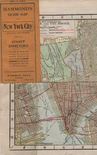
Maps; New York City
HAMMOND'S GUIDE MAP OF NEW YORK CITY: Manhattan and the Bronx
New York: Wehman Brothers Publishers 1913. Very good. Folding color map. Measuring approximately 18" x 36" when unfolded. In original printed card wrapper. Verso a thorough printed street index. Mild handling wear toning. A few tiny holes near fold corners. Overall well preserved; very good. <br/><br/>An impressive color map of the island of Manhattan and the Bronx. Scale is 1" equals 1/2 mile and includes railroads subways elevated railroads surface railroads and proposed railroads. An uncommon early 20th Century New York City street map. Wehman Brothers Publishers unknown
Bookseller reference : 15611
|
|
|
Maps; New York City
HAMMOND'S GUIDE MAP OF NEW YORK CITY: Manhattan and the Bronx
New York: Wehman Brothers Publishers 1913. Very good. Folding color map. Measuring approximately 18" x 36" when unfolded. In original printed card wrapper. Verso a thorough printed street index. Mild handling wear toning. A few tiny holes near fold corners. Overall well preserved; very good. <br/><br/>An impressive color map of the island of Manhattan and the Bronx. Scale is 1" equals 1/2 mile and includes railroads subways elevated railroads surface railroads and proposed railroads. An uncommon early 20th Century New York City street map. Wehman Brothers Publishers unknown books
Bookseller reference : 15611
|
|
|
MARIN KARMITZ
"Carte Postale du film "" Petits Freères "", de Jacques Doillon avec Stéphanie Touly, Ilies Sefraoui, Mustapha Goumane, Rachid Mansouri."
LIBRAIRIE DU GLORIT. Non daté. In-12. Broché. Bon état, Couv. convenable, Dos satisfaisant, Intérieur frais. Une carte postale, vierge, illustrée en couleurs. 14.5 x 10 cm.. . . . Classification : 220-Cartes Postales Publicitaires
Bookseller reference : RO80093904
|
|
|
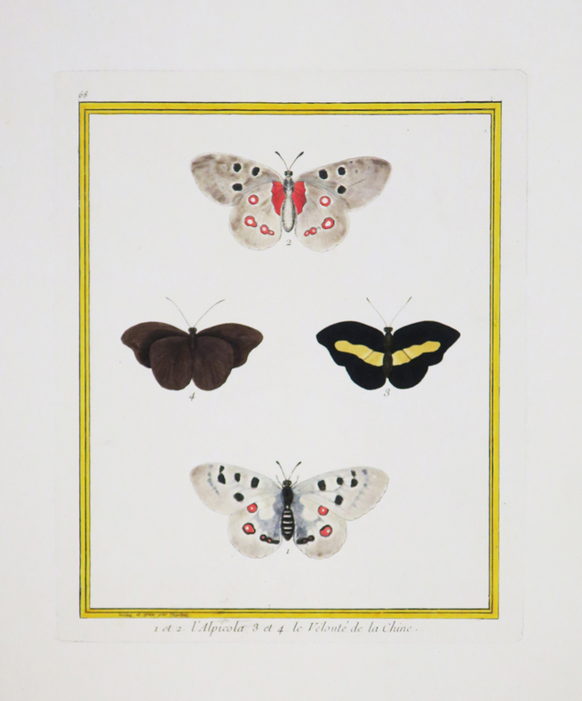
MARTINET (François-Nicolas) & BUFFON (Georges Louis Leclerc, comte de).
1 et 2. L'Alpicola. 3 et 4. Le Velouté de la Chine.
[Paris, 1771-1786]. 240 x 185 mm.
Bookseller reference : LBW-4392
|
|
|
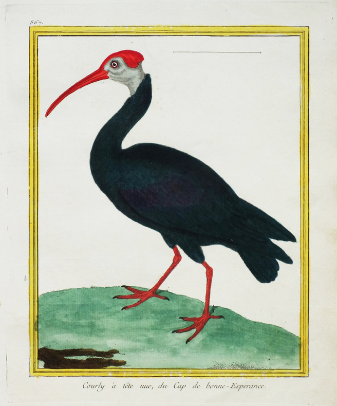
MARTINET (François-Nicolas) & BUFFON (George-Louis Leclerc de).
[AFRIQUE du SUD] Courly à tête nue, du Cap de Bonne-Espérance.
[Paris, 1771-1786]. 224 x 176 mm.
Bookseller reference : LBW-2673
|
|
|
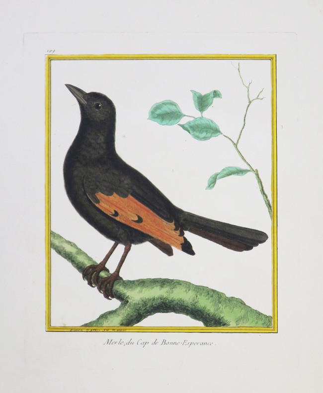
MARTINET (François-Nicolas) & BUFFON (Georges Louis Leclerc, comte de).
[AFRIQUE du SUD] Merle, du Cap de Bonne-Espérance.
[Paris, 1771-1786]. 222 x 177 mm.
Bookseller reference : LBW-4343
|
|
|
MARTINET (François-Nicolas) & BUFFON (Georges Louis Leclerc, comte de).
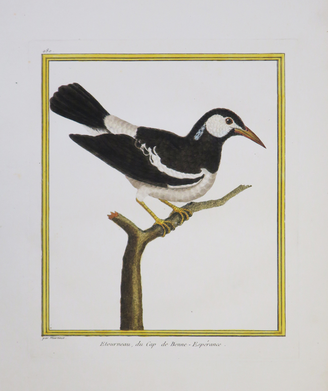
[AFRIQUE du SUD] Etourneau, du Cap de Bonne-Espérance.
[Paris, 1771-1786]. 236 x 190 mm.
Bookseller reference : LBW-4340
|
|
|
MARTINET (François-Nicolas) & BUFFON (Georges Louis Leclerc, comte de).
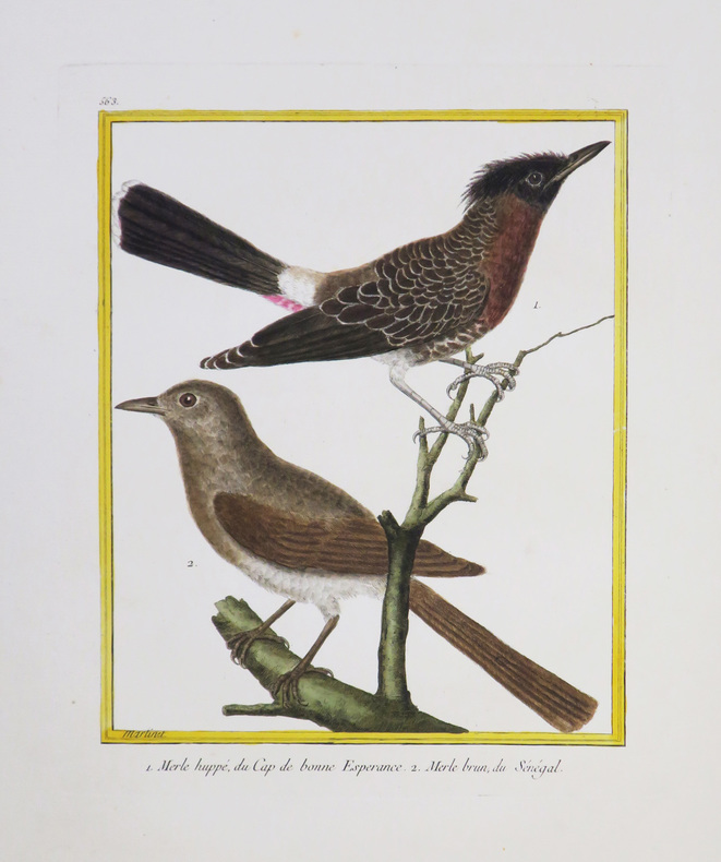
[AFRIQUE du SUD/SÉNÉGAL] Merle huppé, du Cap de Bonne Espérance - Merle brun, du Sénégal.
[Paris, 1771-1786]. 231 x 180 mm.
Bookseller reference : LBW-4338
|
|
|
MARTINET (François-Nicolas) & BUFFON (George-Louis Leclerc de).
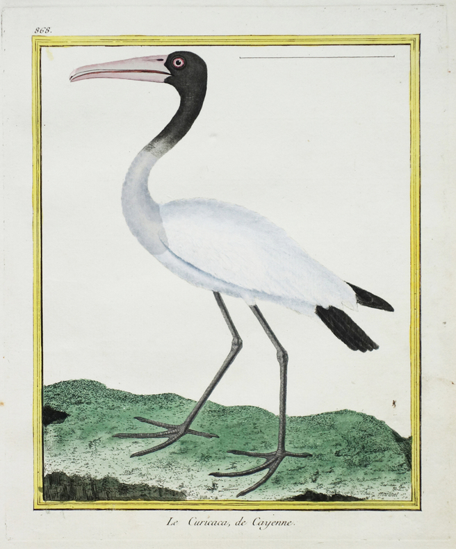
[CAYENNE] Le Curicaca de Cayenne.
[Paris, 1771-1786]. 228 x 178 mm.
Bookseller reference : LBW-2676
|
|
|
MARTINET (François-Nicolas) & BUFFON (Georges Louis Leclerc, comte de).
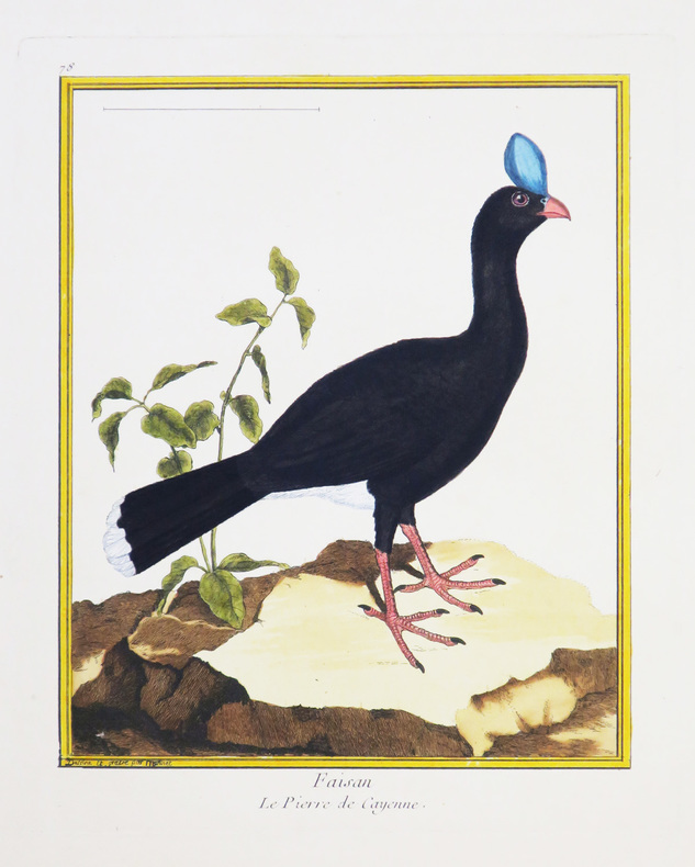
[CAYENNE] Faisan. Le pierre de Cayenne.
[Paris, 1771-1786]. 234 x 180 mm.
Bookseller reference : LBW-4334
|
|
|
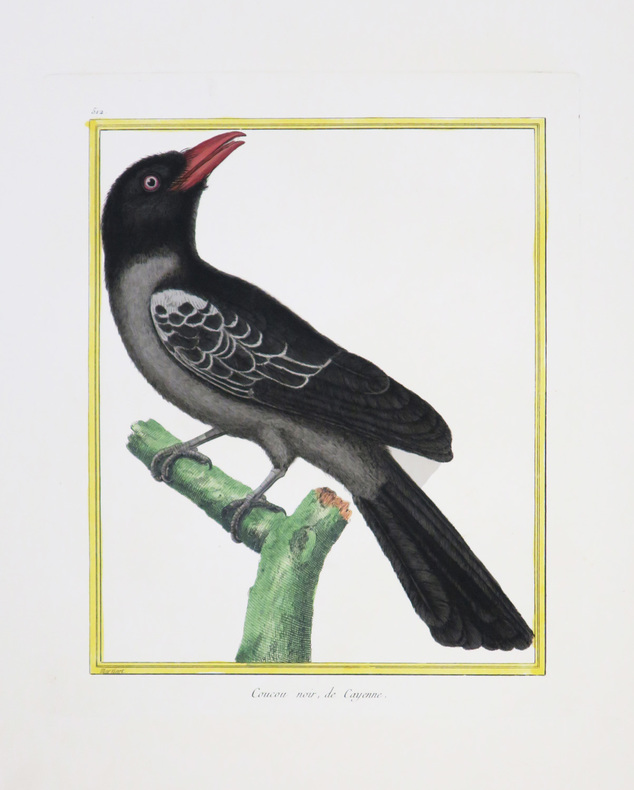
MARTINET (François-Nicolas) & BUFFON (Georges Louis Leclerc, comte de).
[CAYENNE] Coucou noir, de Cayenne.
[Paris, 1771-1786]. 231 x 180 mm.
Bookseller reference : LBW-4352
|
|
|
MARTINET (François-Nicolas) & BUFFON (Georges Louis Leclerc, comte de).
[CAYENNE] Choucas chauve, de Cayenne.
[Paris, 1771-1786]. 241 x 189 mm.
Bookseller reference : LBW-4347

|
|
|
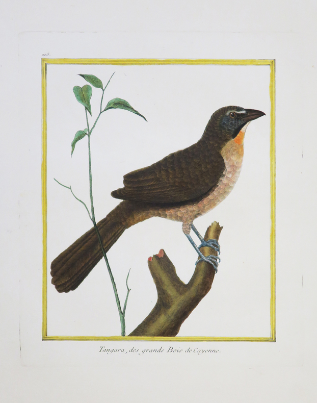
MARTINET (François-Nicolas) & BUFFON (Georges Louis Leclerc, comte de).
[CAYENNE] Tangara, des grands bois de Cayenne.
[Paris, 1771-1786]. 222 x 171 mm.
Bookseller reference : LBW-4351
|
|
|
MARTINET (François-Nicolas) & BUFFON (Georges Louis Leclerc, comte de).
[CANADA] Gélinote mâle, du Canada.
[Paris, 1771-1786]. 230 x 182 mm.
Bookseller reference : LBW-4339

|
|
|
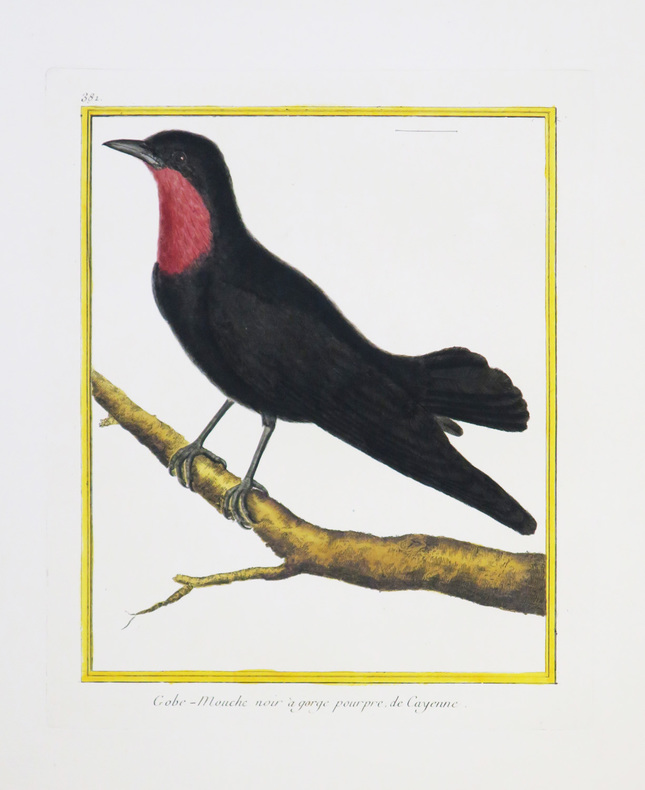
MARTINET (François-Nicolas) & BUFFON (Georges Louis Leclerc, comte de).
[CAYENNE] Gobe-mouche noir à gorge pourpre de Cayenne.
[Paris, 1771-1786]. 237 x 182 mm.
Bookseller reference : LBW-4335
|
|
|
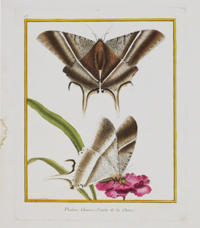
MARTINET (François-Nicolas) & BUFFON (Georges Louis Leclerc, comte de).
[CHINE] Phalène chauve-souris de la Chine.
[Paris, 1771-1786]. 242 x 189 mm.
Bookseller reference : LBW-4390
|
|
|
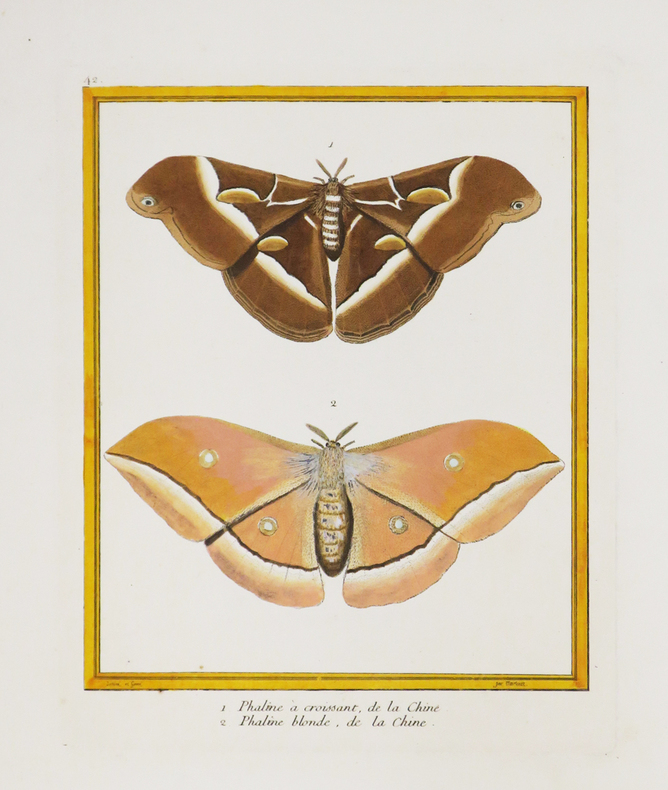
MARTINET (François-Nicolas) & BUFFON (Georges Louis Leclerc, comte de).
[CHINE] 1. Phaline à croissant, de la Chine. 2. Phaline blonde, de la Chine.
[Paris, 1771-1786]. 228 x 183 mm.
Bookseller reference : LBW-4389
|
|
|
MARTINET (François-Nicolas) & BUFFON (Georges Louis Leclerc, comte de).
[GUYANE] Faisan, de la Guiane.
[Paris, 1771-1786]. 230 x 179 mm.
Bookseller reference : LBW-4349

|
|
|
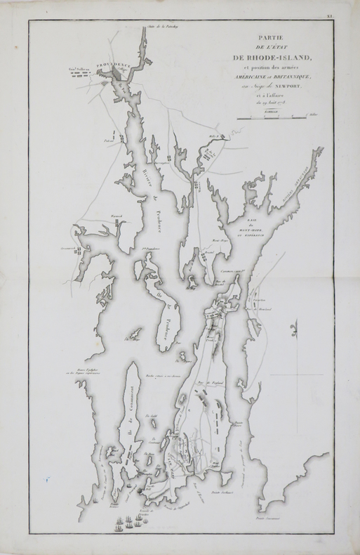
MARSHALL (John).
[GUERRE d'INDÉPENDANCE] Partie de l'état de Rhode-Island, et position des armées américaine et britannique, au siège de Newport, et à l'affaire du 29 août 1778.
[1807]. 423 x 250 mm.
Bookseller reference : LBW-4670
|
|
|
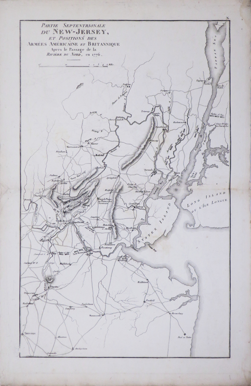
MARSHALL (John).
[GUERRE d'INDÉPENDANCE] Partie septentrionale du New-Jersey, et positions des armées américaine et britannique après le passage de la Rivière du Nord, en 1776.
[1807]. 400 x 249 mm.
Bookseller reference : LBW-4669
|
|
|
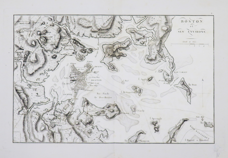
MARSHALL (John).
[GUERRE d'INDÉPENDANCE] Boston et ses environs.
[1807].203 x 320 mm.
Bookseller reference : LBW-4673
|
|
|
MARSHALL (John).
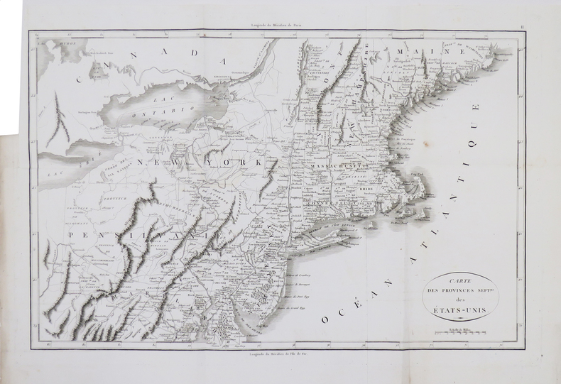
[GUERRE d'INDÉPENDANCE] Carte des provinces sept.les des États-Unis.
[1807]. 332 x 501 mm.
Bookseller reference : LBW-4668
|
|
|
MARSHALL (John).
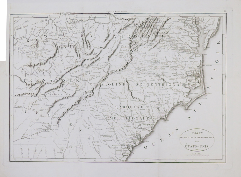
[GUERRE d'INDÉPENDANCE] Carte des provinces méridionales des États-Unis.
[1807]. 347 x 499 mm.
Bookseller reference : LBW-4667
|
|
|
MARSHALL (John).
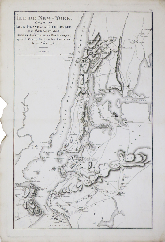
[GUERRE d'INDÉPENDANCE] Île de New-York, partie de Long-Island ou de l'Île Longue, et positions des armées américaine et britannique, après le combat livré sur les hauteurs, le 27 août 1776.
[1807]. 405 x 253 mm.
Bookseller reference : LBW-4672
|
|
|
MARSHALL (John).
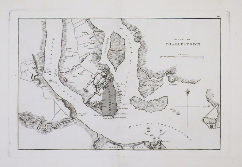
[GUERRE d'INDÉPENDANCE] Siège de Charlestown.
[1807]. 204 x 316 mm.
Bookseller reference : LBW-4671
|
|
|
MARSHALL (John).
[GUERRE d'INDÉPENDANCE] Mont-Vernon, habitation du Général Washington, située dans la Virginie.
[1807]. 156 x 196 mm.
Bookseller reference : LBW-4674

|
|
|
MARTINET (François-Nicolas) & BUFFON (George-Louis Leclerc de).
[INDE] Le Bec ouvert, de Pondichéry.
[Paris, 1771-1786]. 225 x 175 mm.
Bookseller reference : LBW-2772

|
|
|
MARTINET (François-Nicolas) & BUFFON (George-Louis Leclerc de).
[JAVA] Sarcelle, de Java.
[Paris, 1771-1786]. 219 x 172 mm.
Bookseller reference : LBW-2766

|
|
|
MARTINET Fils.
[LE HAVRE] I.RE Vue de la ville du Havre de Grâce.
[Paris, 1786]. 340 x 596 mm.
Bookseller reference : LBW-6804

|
|
|
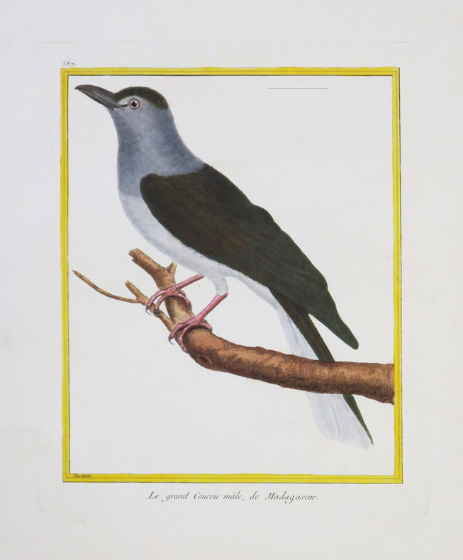
MARTINET (François-Nicolas) & BUFFON (Georges Louis Leclerc, comte de).
[MADAGASCAR] Le grand Coucou mâle, de Madagascar.
[Paris, 1771-1786]. 234 x 181 mm.
Bookseller reference : LBW-4331
|
|
|
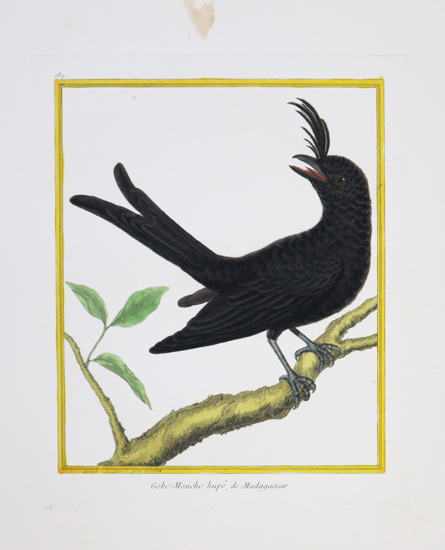
MARTINET (François-Nicolas) & BUFFON (Georges Louis Leclerc, comte de).
[MADAGASCAR] Gobe-mouche hupé, de Madagascar.
[Paris, 1771-1786]. 232 x 185 mm.
Bookseller reference : LBW-4353
|
|
|
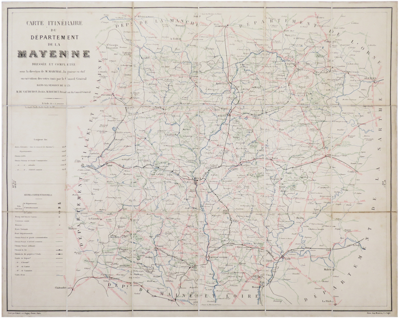
MARCHAL (Louis).
[MAYENNE] Carte itinéraire du département de la Mayenne.
1876. En 18 sections montées sur toile et reliées, formant une carte de 569 x 712 mm ; titre manuscrit au dos.
Bookseller reference : LBW-7026
|
|
|
MARTINET (François-Nicolas) & BUFFON (Georges Louis Leclerc, comte de).
[MOLUQUES] Calao des Moluques.
[Paris, 1771-1786]. 233 x 180 mm.
Bookseller reference : LBW-4342

|
|
|
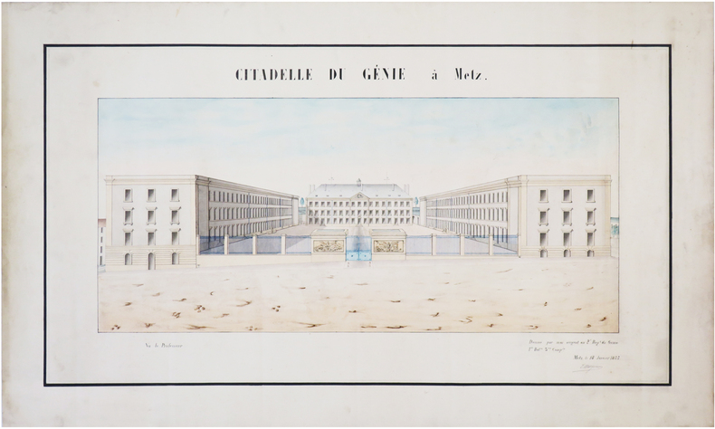
MARGUEROY (?).
[MOSELLE] Citadelle du Génie à Metz.
18 janvier 1855. 32 x 60 cm.
Bookseller reference : LBW-7455
|
|
|
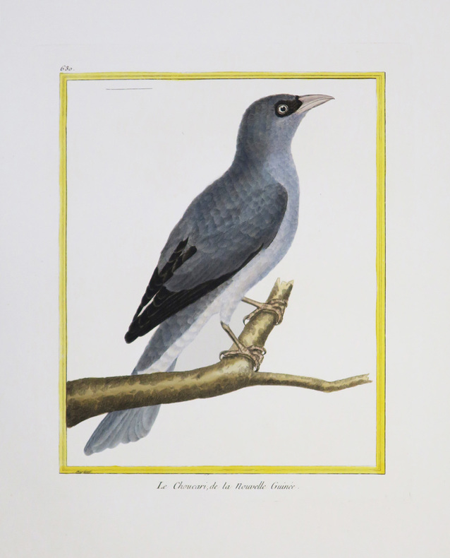
MARTINET (François-Nicolas) & BUFFON (Georges Louis Leclerc, comte de).
[NOUVELLE-GUINÉE] Le Choucari, de la Nouvelle Guinée.
[Paris, 1771-1786]. 231 x 177 mm.
Bookseller reference : LBW-4344
|
|
|
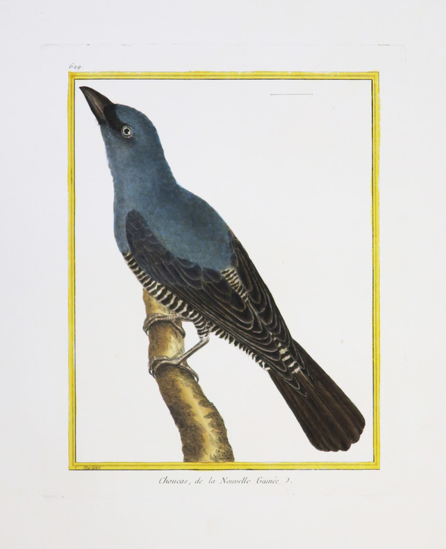
MARTINET (François-Nicolas) & BUFFON (Georges Louis Leclerc, comte de).
[NOUVELLE-GUINÉE] Choucas, de la Nouvelle Guinée.
[Paris, 1771-1786]. 230 x 175 mm.
Bookseller reference : LBW-4346
|
|
|
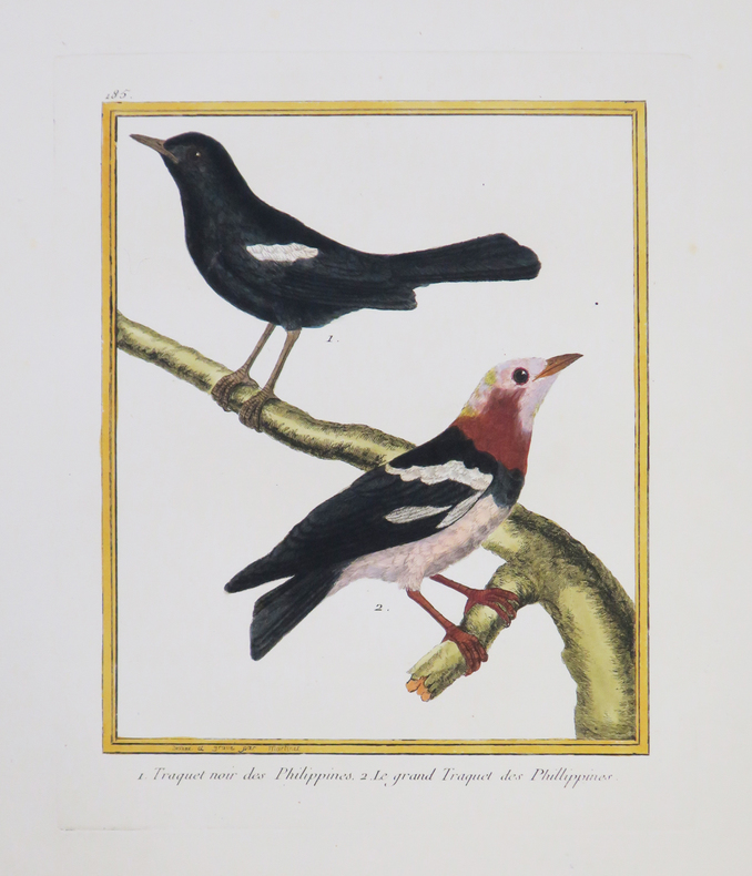
MARTINET (François-Nicolas) & BUFFON (George-Louis Leclerc de).
[PHILIPPINES] Traquet noir des Philippines - Le grand Traquet des Phillippines.
[Paris, 1771-1786]. 226 x 180 mm.
Bookseller reference : LBW-4329
|
|
|
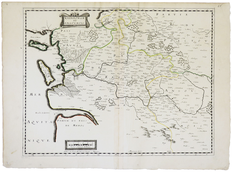
MARIETTE (Pierre).
[SAINTONGE] Xaintonge et Angoumois.
Paris, Pierre Mariette, [1650]. 382 x 490 mm.
Bookseller reference : LBW-2264
|
|
|
MARTINET (François-Nicolas) & BUFFON (Georges Louis Leclerc, comte de).
[SAINT-DOMINGUE] 1. Le Rocou, de St. Domingue. 2 et 3. Le Nacré, de St. Domingue. 3. Le Quinteraye, de St. Domingue.
[Paris, 1771-1786]. 237 x 179 mm.
Bookseller reference : LBW-4391

|
|
|
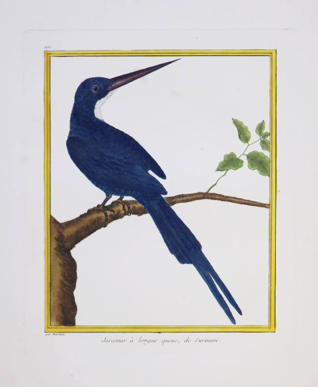
MARTINET (François-Nicolas) & BUFFON (Georges Louis Leclerc, comte de).
[SURINAM] Jacamar à longue queue, de Surinam.
[Paris, 1771-1786]. 232 x 179 mm.
Bookseller reference : LBW-4350
|
|
|
MARTINET (François-Nicolas) & BUFFON (Georges Louis Leclerc, comte de).
[SURINAM] 1 et 2. Le Parasol de Surinam. 3 et 4. Le Guidon de Surinam.
[Paris, 1771-1786]. 233 x 182 mm.
Bookseller reference : LBW-4388

|
|
 Receive by email
 Download as PDF document
 RSS feed


