|
|
|
VUILLEMIN, A.
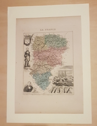
Carte du département de la MEUSE (extraite de l'Atlas La France et ses colonies, par Vuillemin et Migeon, édition 1875)
Paris J. Migeon 1875 1 carte géographique gravée ancienne du département de la MEUSE, imprimée sur papier fort et coloriée à l'époque (format : 26,5 x 35,5 cm). Carte illustrée gravée par Villerey. Les différents arrondissements de cette carte du département de la MEUSE sont aquarellés chacun d'une couleur différente (original hand coloring). Avec une notice rédigée par Ernest Poirée. Carte dressée d'après les cartes de Cassini, du dépôt de la Guerre, des Ponts & Chaussées, de la Marine par M. Vuillemin. Bel exemplaire ( Photographies sur demande / We can send pictures of this print on simple request ) Envoi dans emballage de protection (tube)
Bookseller reference : 21160
|
|
|
VUILLEMIN, A.
Carte du département du MORBIHAN (extraite de l'Atlas La France et ses colonies, par Vuillemin et Migeon, édition 1875)
Paris J. Migeon 1875 1 carte géographique gravée ancienne du département du MORBIHAN, imprimée sur papier fort et coloriée à l'époque (format : 26,5 x 35,5 cm). Carte illustrée gravée par Ch. Dyonnet. Les différents arrondissements de cette carte du département du MORBIHAN sont aquarellés chacun d'une couleur différente (original hand coloring). Avec une notice rédigée par Ernest Poirée. Carte dressée d'après les cartes de Cassini, du dépôt de la Guerre, des Ponts & Chaussées, de la Marine par M. Vuillemin. Bel exemplaire ( Photographies sur demande / We can send pictures of this print on simple request ) Envoi dans emballage de protection (tube)
Bookseller reference : 21161
|
|
|
VUILLEMIN, A.
Carte du département de la MOSELLE (extraite de l'Atlas La France et ses colonies, par Vuillemin et Migeon, édition 1875)
Paris J. Migeon 1875 1 carte géographique gravée ancienne du département de la MOSELLE, imprimée sur papier fort et coloriée à l'époque (format : 26,5 x 35,5 cm). Carte illustrée gravée par Alès. Les différents arrondissements de cette carte du département de la MOSELLE sont aquarellés chacun d'une couleur différente (original hand coloring). Avec une notice rédigée par Ernest Poirée. Carte dressée d'après les cartes de Cassini, du dépôt de la Guerre, des Ponts & Chaussées, de la Marine par M. Vuillemin. Bel exemplaire ( Photographies sur demande / We can send pictures of this print on simple request ) Envoi dans emballage de protection (tube)
Bookseller reference : 21162
|
|
|
VUILLEMIN, A.
Carte du département de la NIÈVRE (extraite de l'Atlas La France et ses colonies, par Vuillemin et Migeon, édition 1875)
Paris J. Migeon 1875 1 carte géographique gravée ancienne du département de la NIÈVRE, imprimée sur papier fort et coloriée à l'époque (format : 26,5 x 35,5 cm). Carte illustrée gravée par Villerey. Les différents arrondissements de cette carte du département de la NIÈVRE sont aquarellés chacun d'une couleur différente (original hand coloring). Avec une notice rédigée par Ernest Poirée. Carte dressée d'après les cartes de Cassini, du dépôt de la Guerre, des Ponts & Chaussées, de la Marine par M. Vuillemin. Bel exemplaire ( Photographies sur demande / We can send pictures of this print on simple request ) Envoi dans emballage de protection (tube)
Bookseller reference : 21163
|
|
|
VUILLEMIN, A.
Carte du département du NORD (extraite de l'Atlas La France et ses colonies, par Vuillemin et Migeon, édition 1875)
Paris J. Migeon 1875 1 carte géographique gravée ancienne du département du NORD, imprimée sur papier fort et coloriée à l'époque (format : 26,5 x 35,5 cm). Carte illustrée gravée par Alès. Les différents arrondissements de cette carte du département du NORD sont aquarellés chacun d'une couleur différente (original hand coloring). Avec une notice rédigée par Ernest Poirée. Carte dressée d'après les cartes de Cassini, du dépôt de la Guerre, des Ponts & Chaussées, de la Marine par M. Vuillemin. Bel exemplaire ( Photographies sur demande / We can send pictures of this print on simple request ) Envoi dans emballage de protection (tube)
Bookseller reference : 21164
|
|
|
VUILLEMIN, A.
Carte du département de l'OISE (extraite de l'Atlas La France et ses colonies, par Vuillemin et Migeon, édition 1875)
Paris J. Migeon 1875 1 carte géographique gravée ancienne du département de l'OISE, imprimée sur papier fort et coloriée à l'époque (format : 26,5 x 35,5 cm). Carte illustrée gravée par Alès. Les différents arrondissements de cette carte du département de l'OISE sont aquarellés chacun d'une couleur différente (original hand coloring). Avec une notice rédigée par Ernest Poirée. Carte dressée d'après les cartes de Cassini, du dépôt de la Guerre, des Ponts & Chaussées, de la Marine par M. Vuillemin. Bel exemplaire ( Photographies sur demande / We can send pictures of this print on simple request ) Envoi dans emballage de protection (tube)
Bookseller reference : 21165
|
|
|
VUILLEMIN, A.
Carte du département de l'ORNE (extraite de l'Atlas La France et ses colonies, par Vuillemin et Migeon, édition 1875)
Paris J. Migeon 1875 1 carte géographique gravée ancienne du département de l'ORNE, imprimée sur papier fort et coloriée à l'époque (format : 26,5 x 35,5 cm). Carte illustrée gravée par Alès. Les différents arrondissements de cette carte du département de l'ORNE sont aquarellés chacun d'une couleur différente (original hand coloring). Avec une notice rédigée par Ernest Poirée. Carte dressée d'après les cartes de Cassini, du dépôt de la Guerre, des Ponts & Chaussées, de la Marine par M. Vuillemin. Bel exemplaire ( Photographies sur demande / We can send pictures of this print on simple request ) Envoi dans emballage de protection (tube)
Bookseller reference : 21166
|
|
|
VUILLEMIN, A.
Carte du département du PAS de CALAIS (extraite de l'Atlas La France et ses colonies, par Vuillemin et Migeon, édition 1875)
Paris J. Migeon 1875 1 carte géographique gravée ancienne du département du PAS de CALAIS, imprimée sur papier fort et coloriée à l'époque (format : 26,5 x 35,5 cm). Carte illustrée gravée par Alès. Les différents arrondissements de cette carte du département du PAS de CALAIS sont aquarellés chacun d'une couleur différente (original hand coloring). Avec une notice rédigée par Ernest Poirée. Carte dressée d'après les cartes de Cassini, du dépôt de la Guerre, des Ponts & Chaussées, de la Marine par M. Vuillemin. Bel exemplaire ( Photographies sur demande / We can send pictures of this print on simple request ) Envoi dans emballage de protection (tube)
Bookseller reference : 21167
|
|
|
VUILLEMIN, A.
Carte du département du PUY de DÔME (extraite de l'Atlas La France et ses colonies, par Vuillemin et Migeon, édition 1875)
Paris J. Migeon 1875 1 carte géographique gravée ancienne du département du PUY de DÔME, imprimée sur papier fort et coloriée à l'époque (format : 26,5 x 35,5 cm). Carte illustrée gravée. Les différents arrondissements de cette carte du département du PUY de DÔME sont aquarellés chacun d'une couleur différente (original hand coloring). Avec une notice rédigée par Ernest Poirée. Carte dressée d'après les cartes de Cassini, du dépôt de la Guerre, des Ponts & Chaussées, de la Marine par M. Vuillemin. Bel exemplaire ( Photographies sur demande / We can send pictures of this print on simple request ) Envoi dans emballage de protection (tube)
Bookseller reference : 21168
|
|
|
VUILLEMIN, A.
Carte du département des BASSES PYRÉNÉES (extraite de l'Atlas La France et ses colonies, par Vuillemin et Migeon, édition 1875)
Paris J. Migeon 1875 1 carte géographique gravée ancienne du département des BASSES PYRÉNÉES, imprimée sur papier fort et coloriée à l'époque (format : 26,5 x 35,5 cm). Carte illustrée gravée par Villerey. Les différents arrondissements de cette carte du département des BASSES PYRÉNÉES sont aquarellés chacun d'une couleur différente (original hand coloring). Avec une notice rédigée par Ernest Poirée. Carte dressée d'après les cartes de Cassini, du dépôt de la Guerre, des Ponts & Chaussées, de la Marine par M. Vuillemin. Bel exemplaire ( Photographies sur demande / We can send pictures of this print on simple request ) Envoi dans emballage de protection (tube)
Bookseller reference : 21169
|
|
|
VUILLEMIN, A.
Carte du département des HAUTES PYRÉNÉES (extraite de l'Atlas La France et ses colonies, par Vuillemin et Migeon, édition 1875)
Paris J. Migeon 1875 1 carte géographique gravée ancienne du département des HAUTES PYRÉNÉES, imprimée sur papier fort et coloriée à l'époque (format : 26,5 x 35,5 cm). Carte illustrée gravée par Villerey. Les différents arrondissements de cette carte du département des HAUTES PYRÉNÉES sont aquarellés chacun d'une couleur différente (original hand coloring). Avec une notice rédigée par Ernest Poirée. Carte dressée d'après les cartes de Cassini, du dépôt de la Guerre, des Ponts & Chaussées, de la Marine par M. Vuillemin. Bel exemplaire ( Photographies sur demande / We can send pictures of this print on simple request ) Envoi dans emballage de protection (tube)
Bookseller reference : 21170
|
|
|
VUILLEMIN, A.
Carte du département des PYRÉNÉES ORIENTALES (extraite de l'Atlas La France et ses colonies, par Vuillemin et Migeon, édition 1875)
Paris J. Migeon 1875 1 carte géographique gravée ancienne du département des PYRÉNÉES ORIENTALES, imprimée sur papier fort et coloriée à l'époque (format : 26,5 x 35,5 cm). Carte illustrée gravée par Villerey. Les différents arrondissements de cette carte du département des PYRÉNÉES ORIENTALES sont aquarellés chacun d'une couleur différente (original hand coloring). Avec une notice rédigée par Ernest Poirée. Carte dressée d'après les cartes de Cassini, du dépôt de la Guerre, des Ponts & Chaussées, de la Marine par M. Vuillemin. Bel exemplaire ( Photographies sur demande / We can send pictures of this print on simple request ) Envoi dans emballage de protection (tube)
Bookseller reference : 21171
|
|
|
VUILLEMIN, A.
Carte du département du HAUT-RHIN avant 1870 (extraite de l'Atlas La France et ses colonies, par Vuillemin et Migeon, édition 1875)
Paris J. Migeon 1875 1 carte géographique gravée ancienne du département du HAUT-RHIN avant 1870, imprimée sur papier fort et coloriée à l'époque (format : 26,5 x 35,5 cm). Carte illustrée gravée par Villerey. Les différents arrondissements de cette carte du département du HAUT-RHIN avant 1870 sont aquarellés chacun d'une couleur différente (original hand coloring). Avec une notice rédigée par Ernest Poirée. Carte dressée d'après les cartes de Cassini, du dépôt de la Guerre, des Ponts & Chaussées, de la Marine par M. Vuillemin. Bel exemplaire ( Photographies sur demande / We can send pictures of this print on simple request ) Envoi dans emballage de protection (tube)
Bookseller reference : 21173
|
|
|
VUILLEMIN, A.
Carte du département du HAUT-RHIN (extraite de l'Atlas La France et ses colonies, par Vuillemin et Migeon, édition 1875)
Paris J. Migeon 1875 1 carte géographique gravée ancienne du département du HAUT-RHIN, imprimée sur papier fort et coloriée à l'époque (format : 26,5 x 35,5 cm). Carte illustrée gravée par Villerey. Le seul arrondissement de Belfort formant le département du HAUT-RHIN est aquarellé (original hand coloring). Carte dressée d'après les cartes de Cassini, du dépôt de la Guerre, des Ponts & Chaussées, de la Marine par M. Vuillemin. Bel exemplaire ( Photographies sur demande / We can send pictures of this print on simple request ) Envoi dans emballage de protection (tube)
Bookseller reference : 21174
|
|
|
VUILLEMIN, A.
Carte du département du RHÔNE (extraite de l'Atlas La France et ses colonies, par Vuillemin et Migeon, édition 1875)
Paris J. Migeon 1875 1 carte géographique gravée ancienne du département du RHÔNE, imprimée sur papier fort et coloriée à l'époque (format : 26,5 x 35,5 cm). Carte illustrée gravée par Alès. Les différents arrondissements de cette carte du département du RHÔNE sont aquarellés chacun d'une couleur différente (original hand coloring). Avec une notice rédigée par Ernest Poirée. Carte dressée d'après les cartes de Cassini, du dépôt de la Guerre, des Ponts & Chaussées, de la Marine par M. Vuillemin. Bel exemplaire ( Photographies sur demande / We can send pictures of this print on simple request ) Envoi dans emballage de protection (tube)
Bookseller reference : 21175
|
|
|
VUILLEMIN, A.
Carte du département de la HAUTE SAÔNE (extraite de l'Atlas La France et ses colonies, par Vuillemin et Migeon, édition 1875)
Paris J. Migeon 1875 1 carte géographique gravée ancienne du département de la HAUTE SAÔNE, imprimée papier fort et coloriée à l'époque (format : 26,5 x 35,5 cm). Carte illustrée gravée par Villerey. Les différents arrondissements de cette carte du département de la HAUTE SAÔNE sont aquarellés chacun d'une couleur différente (original hand coloring). Avec une notice rédigée par Ernest Poirée. Carte dressée d'après les cartes de Cassini, du dépôt de la Guerre, des Ponts & Chaussées, de la Marine par M. Vuillemin. Bel exemplaire ( Photographies sur demande / We can send pictures of this print on simple request ) Envoi dans emballage de protection (tube)
Bookseller reference : 21176
|
|
|
VUILLEMIN, A.
Carte du département de la SAÔNE et LOIRE (extraite de l'Atlas La France et ses colonies, par Vuillemin et Migeon, édition 1875)
Paris J. Migeon 1875 1 carte géographique gravée ancienne du département de la SAÔNE et LOIRE, imprimée sur papier fort et coloriée à l'époque (format : 26,5 x 35,5 cm). Carte illustrée gravée par Alès. Les différents arrondissements de cette carte du département de la SAÔNE et LOIRE sont aquarellés chacun d'une couleur différente (original hand coloring). Avec une notice rédigée par Ernest Poirée. Carte dressée d'après les cartes de Cassini, du dépôt de la Guerre, des Ponts & Chaussées, de la Marine par M. Vuillemin. Bel exemplaire ( Photographies sur demande / We can send pictures of this print on simple request ) Envoi dans emballage de protection (tube)
Bookseller reference : 21177
|
|
|
VUILLEMIN, A.
Carte du département de la SARTHE (extraite de l'Atlas La France et ses colonies, par Vuillemin et Migeon, édition 1875)
Paris J. Migeon 1875 1 carte géographique gravée ancienne du département de la SARTHE, imprimée sur papier fort et coloriée à l'époque (format : 26,5 x 35,5 cm). Carte illustrée gravée par P. Devilliers. Les différents arrondissements de cette carte du département de la SARTHE sont aquarellés chacun d'une couleur différente (original hand coloring). Avec une notice rédigée par Ernest Poirée. Carte dressée d'après les cartes de Cassini, du dépôt de la Guerre, des Ponts & Chaussées, de la Marine par M. Vuillemin. Bel exemplaire ( Photographies sur demande / We can send pictures of this print on simple request ) Envoi dans emballage de protection (tube)
Bookseller reference : 21178
|
|
|
VUILLEMIN, A.
Carte du département de la SAVOIE (extraite de l'Atlas La France et ses colonies, par Vuillemin et Migeon, édition 1875)
Paris J. Migeon 1875 1 carte géographique gravée ancienne du département de la SAVOIE, imprimée sur papier fort et coloriée à l'époque (format : 26,5 x 35,5 cm). Carte illustrée gravée par Th. Gobert. Les différents arrondissements de cette carte du département de la SAVOIE sont aquarellés chacun d'une couleur différente (original hand coloring). Avec une notice rédigée par Ernest Poirée. Carte dressée d'après les cartes de Cassini, du dépôt de la Guerre, des Ponts & Chaussées, de la Marine par M. Vuillemin. Bel exemplaire ( Photographies sur demande / We can send pictures of this print on simple request ) Envoi dans emballage de protection (tube)
Bookseller reference : 21179
|
|
|
VUILLEMIN A.
Carte du département de la SEINE (extraite de l'Atlas La France et ses colonies, par Vuillemin et Migeon, édition 1875)
Paris J. Migeon 1875 1 carte géographique gravée ancienne du département de la SEINE, imprimée sur papier fort et coloriée à l'époque (format : 26,5 x 35,5 cm). Carte illustrée gravée par Alès. Les différents arrondissements de cette carte du département de la SEINE sont aquarellés chacun d'une couleur différente (original hand coloring). Avec une notice rédigée par Ernest Poirée. Carte dressée d'après les cartes de Cassini, du dépôt de la Guerre, des Ponts & Chaussées, de la Marine par M. Vuillemin. Bel exemplaire ( Photographies sur demande / We can send pictures of this print on simple request ) Envoi dans emballage de protection (tube)
Bookseller reference : 21181
|
|
|
VUILLEMIN, A.
Carte du département de la SEINE et MARNE (extraite de l'Atlas La France et ses colonies, par Vuillemin et Migeon, édition 1875)
Paris J. Migeon 1875 1 carte géographique gravée ancienne du département de la SEINE et MARNE, imprimée sur papier fort et coloriée à l'époque (format : 26,5 x 35,5 cm). Carte illustrée gravée par Alès. Les différents arrondissements de cette carte du département de la SEINE et MARNE sont aquarellés chacun d'une couleur différente (original hand coloring). Avec une notice rédigée par Ernest Poirée. Carte dressée d'après les cartes de Cassini, du dépôt de la Guerre, des Ponts & Chaussées, de la Marine par M. Vuillemin. Bel exemplaire ( Photographies sur demande / We can send pictures of this print on simple request ) Envoi dans emballage de protection (tube)
Bookseller reference : 21183
|
|
|
VUILLEMIN, A.
Carte du département de la SEINE et OISE (extraite de l'Atlas La France et ses colonies, par Vuillemin et Migeon, édition 1875)
Paris J. Migeon 1875 1 carte géographique gravée ancienne du département de la SEINE et OISE, imprimée sur papier fort et coloriée à l'époque (format : 26,5 x 35,5 cm). Carte illustrée gravée par Alès. Les différents arrondissements (Mantes, Pontoise, Versailles, Rambouillet, Corbeil, Etampes) de cette carte du département de la SEINE et OISE sont aquarellés chacun d'une couleur différente (original hand coloring). Avec une notice rédigée par Ernest Poirée. Carte dressée d'après les cartes de Cassini, du dépôt de la Guerre, des Ponts & Chaussées, de la Marine par M. Vuillemin. Bel exemplaire ( Photographies sur demande / We can send pictures of this print on simple request ) Envoi dans emballage de protection (tube)
Bookseller reference : 21184
|
|
|
VUILLEMIN, A.
Carte du département des DEUX-SÈVRES (extraite de l'Atlas La France et ses colonies, par Vuillemin et Migeon, édition 1875)
Paris J. Migeon 1875 1 carte géographique gravée ancienne du département des DEUX-SÈVRES, imprimée sur papier fort et coloriée à l'époque (format : 26,5 x 35,5 cm). Carte illustrée gravée par Alès. Les différents arrondissements de cette carte du département des DEUX-SÈVRES sont aquarellés chacun d'une couleur différente (original hand coloring). Avec une notice rédigée par Ernest Poirée. Carte dressée d'après les cartes de Cassini, du dépôt de la Guerre, des Ponts & Chaussées, de la Marine par M. Vuillemin. Bel exemplaire ( Photographies sur demande / We can send pictures of this print on simple request ) Envoi dans emballage de protection (tube)
Bookseller reference : 21185
|
|
|
VUILLEMIN, A.
Carte du département de la SOMME (extraite de l'Atlas La France et ses colonies, par Vuillemin et Migeon, édition 1875)
Paris J. Migeon 1875 1 carte géographique gravée ancienne du département de la SOMME, imprimée sur papier fort et coloriée à l'époque (format : 26,5 x 35,5 cm). Carte illustrée gravée par Alès. Les différents arrondissements de cette carte du département de la SOMME sont aquarellés chacun d'une couleur différente (original hand coloring). Avec une notice rédigée par Ernest Poirée. Carte dressée d'après les cartes de Cassini, du dépôt de la Guerre, des Ponts & Chaussées, de la Marine par M. Vuillemin. Bel exemplaire ( Photographies sur demande / We can send pictures of this print on simple request ) Envoi dans emballage de protection (tube)
Bookseller reference : 21186
|
|
|
VUILLEMIN, A.
Carte du département du TARN (extraite de l'Atlas La France et ses colonies, par Vuillemin et Migeon, édition 1875)
Paris J. Migeon 1875 1 carte géographique gravée ancienne du département du TARN, imprimée sur papier fort et coloriée à l'époque (format : 26,5 x 35,5 cm). Carte illustrée gravée par Alès. Les différents arrondissements de cette carte du département du TARN sont aquarellés chacun d'une couleur différente (original hand coloring). Avec une notice rédigée par Ernest Poirée. Carte dressée d'après les cartes de Cassini, du dépôt de la Guerre, des Ponts & Chaussées, de la Marine par M. Vuillemin. Bel exemplaire ( Photographies sur demande / We can send pictures of this print on simple request ) Envoi dans emballage de protection (tube)
Bookseller reference : 21187
|
|
|
VUILLEMIN, A.
Carte du département du TARN et GARONNE (extraite de l'Atlas La France et ses colonies, par Vuillemin et Migeon, édition 1875)
Paris J. Migeon 1875 1 carte géographique gravée ancienne du département du TARN et GARONNE, imprimée sur papier fort et coloriée à l'époque (format : 26,5 x 35,5 cm). Carte illustrée gravée par Ch. Dyonnet. Les différents arrondissements de cette carte du département du TARN et GARONNE sont aquarellés chacun d'une couleur différente (original hand coloring). Avec une notice rédigée par Ernest Poirée. Carte dressée d'après les cartes de Cassini, du dépôt de la Guerre, des Ponts & Chaussées, de la Marine par M. Vuillemin. Bel exemplaire ( Photographies sur demande / We can send pictures of this print on simple request ) Envoi dans emballage de protection (tube)
Bookseller reference : 21188
|
|
|
VUILLEMIN, A.
Carte du département du VAR (extraite de l'Atlas La France et ses colonies, par Vuillemin et Migeon, édition 1875)
Paris J. Migeon 1875 1 carte géographique gravée ancienne du département du VAR, imprimée sur papier fort et coloriée à l'époque (format : 26,5 x 35,5 cm). Carte illustrée gravée par Alès. Les différents arrondissements de cette carte du département du VAR sont aquarellés chacun d'une couleur différente (original hand coloring). Avec une notice rédigée par Ernest Poirée. Carte dressée d'après les cartes de Cassini, du dépôt de la Guerre, des Ponts & Chaussées, de la Marine par M. Vuillemin. Bel exemplaire ( Photographies sur demande / We can send pictures of this print on simple request ) Envoi dans emballage de protection (tube)
Bookseller reference : 21189
|
|
|
VUILLEMIN, A.
Carte du département du VAUCLUSE (extraite de l'Atlas La France et ses colonies, par Vuillemin et Migeon, édition 1875)
Paris J. Migeon 1875 1 carte géographique gravée ancienne du département du VAUCLUSE, imprimée sur papier fort et coloriée à l'époque (format : 26,5 x 35,5 cm). Carte illustrée gravée par Ch. Dyonnet. Les différents arrondissements de cette carte du département du VAUCLUSE sont aquarellés chacun d'une couleur différente (original hand coloring). Avec une notice rédigée par Ernest Poirée. Carte dressée d'après les cartes de Cassini, du dépôt de la Guerre, des Ponts & Chaussées, de la Marine par M. Vuillemin. Bel exemplaire ( Photographies sur demande / We can send pictures of this print on simple request ) Envoi dans emballage de protection (tube)
Bookseller reference : 21190
|
|
|
VUILLEMIN, A.
Carte du département de la VENDÉE (extraite de l'Atlas La France et ses colonies, par Vuillemin et Migeon, édition 1875)
Paris J. Migeon 1875 1 carte géographique gravée ancienne du département de la VENDÉE, imprimée sur papier fort et coloriée à l'époque (format : 26,5 x 35,5 cm). Carte illustrée gravée par Alès. Les différents arrondissements de cette carte du département de la VENDÉE sont aquarellés chacun d'une couleur différente (original hand coloring). Avec une notice rédigée par Ernest Poirée. Carte dressée d'après les cartes de Cassini, du dépôt de la Guerre, des Ponts & Chaussées, de la Marine par M. Vuillemin. Bel exemplaire ( Photographies sur demande / We can send pictures of this print on simple request ) Envoi dans emballage de protection (tube)
Bookseller reference : 21191
|
|
|
VUILLEMIN, A.
Carte du département de la VIENNE (extraite de l'Atlas La France et ses colonies, par Vuillemin et Migeon, édition 1875)
Paris J. Migeon 1875 1 carte géographique gravée ancienne du département de la VIENNE, imprimée sur papier fort et coloriée à l'époque (format : 26,5 x 35,5 cm). Carte illustrée gravée par Couché. Les différents arrondissements de cette carte du département de la VIENNE sont aquarellés chacun d'une couleur différente (original hand coloring). Avec une notice rédigée par Ernest Poirée. Carte dressée d'après les cartes de Cassini, du dépôt de la Guerre, des Ponts & Chaussées, de la Marine par M. Vuillemin. Bel exemplaire ( Photographies sur demande / We can send pictures of this print on simple request ) Envoi dans emballage de protection (tube)
Bookseller reference : 21192
|
|
|
VUILLEMIN A.
Carte du département de la HAUTE-VIENNE (extraite de l'Atlas La France et ses colonies, par Vuillemin et Migeon, édition 1875)
Paris J. Migeon 1875 1 carte géographique gravée ancienne du département de la HAUTE-VIENNE, imprimée sur papier fort et coloriée à l'époque (format : 26,5 x 35,5 cm). Carte illustrée gravée. Les différents arrondissements de cette carte du département de la HAUTE-VIENNE sont aquarellés chacun d'une couleur différente (original hand coloring). Avec une notice rédigée par Ernest Poirée. Carte dressée d'après les cartes de Cassini, du dépôt de la Guerre, des Ponts & Chaussées, de la Marine par M. Vuillemin. Bel exemplaire ( Photographies sur demande / We can send pictures of this print on simple request ) Envoi dans emballage de protection (tube)
Bookseller reference : 21193
|
|
|
VUILLEMIN, A.
Carte du département des VOSGES (extraite de l'Atlas La France et ses colonies, par Vuillemin et Migeon, édition 1875)
Paris J. Migeon 1875 1 carte géographique gravée ancienne du département des VOSGES, imprimée sur papier fort et coloriée à l'époque (format : 26,5 x 35,5 cm). Carte illustrée gravée par Alès. Les différents arrondissements de cette carte du département des VOSGES sont aquarellés chacun d'une couleur différente (original hand coloring). Avec une notice rédigée par Ernest Poirée. Carte dressée d'après les cartes de Cassini, du dépôt de la Guerre, des Ponts & Chaussées, de la Marine par M. Vuillemin. Bel exemplaire ( Photographies sur demande / We can send pictures of this print on simple request ) Envoi dans emballage de protection (tube)
Bookseller reference : 21194
|
|
|
VUILLEMIN, A.
Carte du département de l'YONNE (extraite de l'Atlas La France et ses colonies, par Vuillemin et Migeon, édition 1875)
Paris J. Migeon 1875 1 carte géographique gravée ancienne du département de l'YONNE, imprimée sur papier fort et coloriée à l'époque (format : 26,5 x 35,5 cm). Carte illustrée gravée par Alès. Les différents arrondissements de cette carte du département de l'YONNE sont aquarellés chacun d'une couleur différente (original hand coloring). Avec une notice rédigée par Ernest Poirée. Carte dressée d'après les cartes de Cassini, du dépôt de la Guerre, des Ponts & Chaussées, de la Marine par M. Vuillemin. Bel exemplaire ( Photographies sur demande / We can send pictures of this print on simple request ) Envoi dans emballage de protection (tube)
Bookseller reference : 21195
|
|
|
VUILLEMIN, A.
Carte de PARIS, '' Tel qu'il était à l'avénement de Philippe Auguste en 1180 '' (extraite de l'Atlas La France et ses colonies, par Vuillemin et Migeon, édition 1875)
Paris J. Migeon 1875 1 carte géographique gravée ancienne de PARIS, '' Tel qu'il était à l'avénement de Philippe Auguste en 1180 '', imprimée sur papier fort et coloriée à l'époque (format : 26,5 x 35,5 cm). Carte illustrée gravée. Sur cette carte: Lutèce, Paris en 1150, et Paris en 1223 sont aquarellés chacun d'une couleur différente (original hand coloring). Avec une notice rédigée par Ernest Poirée. Carte dressée d'après les cartes de Cassini, du dépôt de la Guerre, des Ponts & Chaussées, de la Marine par M. Vuillemin. Bel exemplaire ( Photographies sur demande / We can send pictures of this print on simple request ) Envoi dans emballage de protection (tube)
Bookseller reference : 21196
|
|
|
VUILLEMIN, A.
Carte de de PARIS, et son mur d'enceinte (extraite de l'Atlas La France et ses colonies, par Vuillemin et Migeon, édition 1875)
Paris J. Migeon 1875 1 carte géographique gravée ancienne de PARIS, et son mur d'enceinte, imprimée sur papier fort et coloriée à l'époque (format : 26,5 x 35,5 cm). Carte illustrée gravée. Sur cette carte: Les 20 arrondissements de Paris sont aquarellés (original hand coloring). Avec une notice rédigée par Ernest Poirée. Carte dressée d'après les cartes de Cassini, du dépôt de la Guerre, des Ponts & Chaussées, de la Marine par M. Vuillemin. Bel exemplaire ( Photographies sur demande / We can send pictures of this print on simple request ) Envoi dans emballage de protection (tube)
Bookseller reference : 21197
|
|
|
VUILLEMIN, A.
Carte de l'ALGÉRIE (extraite de l'Atlas La France et ses colonies, par Vuillemin et Migeon, édition 1875)
Paris J. Migeon 1875 1 carte géographique gravée ancienne de l'ALGÉRIE, imprimée sur papier fort et coloriée à l'époque (format : 26,5 x 35,5 cm). Carte illustrée gravée par P. Devilliers. Les différentes provinces de cette carte de l'ALGÉRIE sont aquarellées chacune d'une couleur différente (original hand coloring). Avec une notice rédigée par Ernest Poirée. Carte dressée d'après les cartes de Cassini, du dépôt de la Guerre, des Ponts & Chaussées, de la Marine par M. Vuillemin. Bel exemplaire ( Photographies sur demande / We can send pictures of this print on simple request ) Envoi dans emballage de protection (tube)
Bookseller reference : 21198
|
|
|
VUILLEMIN A.
Carte de LA PROVINCE DE CONSTANTINE (extraite de l'Atlas La France et ses colonies, par Vuillemin et Migeon, édition 1875)
Paris J. Migeon 1875 1 carte géographique gravée ancienne sur double page de la PROVINCE DE CONSTANTINE, imprimée sur papier fort et coloriée à l'époque (format : 49 x 35,5 cm). Carte illustrée gravée. Les différents arrondissments de cette carte de la PROVINCE DE CONSTANTINE sont aquarellées chacune d'une couleur différente (original hand coloring). Avec une notice rédigée par Ernest Poirée. Carte dressée d'après les cartes de Cassini, du dépôt de la Guerre, des Ponts & Chaussées, de la Marine par M. Vuillemin. Bel exemplaire ( Photographies sur demande / We can send pictures of this print on simple request ) Envoi dans emballage de protection (tube)
Bookseller reference : 21200
|
|
|
VUILLEMIN, A.
Carte de LA PROVINCE D'ORAN (extraite de l'Atlas La France et ses colonies, par Vuillemin et Migeon, édition 1875)
Paris J. Migeon 1875 1 carte géographique gravée ancienne sur double page de la PROVINCE D'ORAN, imprimée sur papier fort et coloriée à l'époque (format : 49 x 35,5 cm). Carte illustrée gravée. Les différents arrondissments de cette carte de la PROVINCE D'ORAN sont aquarellées chacune d'une couleur différente (original hand coloring). Avec une notice rédigée par Ernest Poirée. Carte dressée d'après les cartes de Cassini, du dépôt de la Guerre, des Ponts & Chaussées, de la Marine par M. Vuillemin. Bel exemplaire ( Photographies sur demande / We can send pictures of this print on simple request ) Envoi dans emballage de protection (tube)
Bookseller reference : 21201
|
|
|
VUILLEMIN, A.
Carte de l'AFRIQUE FRANÇAISE (SÉNÉGAL) (extraite de l'Atlas La France et ses colonies, par Vuillemin et Migeon, édition 1875)
Paris J. Migeon 1875 1 carte géographique gravée ancienne de l'AFRIQUE FRANÇAISE (SÉNÉGAL), imprimée sur papier fort et coloriée à l'époque (format : 26,5 x 35,5 cm). Cette carte illustrée gravée par Villerey de l'AFRIQUE FRANÇAISE (SÉNÉGAL) est aquarellée, en coloris d'époque (original hand coloring). Avec une notice rédigée par Ernest Poirée. Carte dressée d'après les cartes de Cassini, du dépôt de la Guerre, des Ponts & Chaussées, de la Marine par M. Vuillemin. Bel exemplaire ( Photographies sur demande / We can send pictures of this print on simple request ) Envoi dans emballage de protection (tube)
Bookseller reference : 21202
|
|
|
VUILLEMIN, A.
Carte de l'ile de LA GUADELOUPE (extraite de l'Atlas La France et ses colonies, par Vuillemin et Migeon, édition 1875)
Paris J. Migeon 1875 1 carte géographique gravée ancienne de l'ile de LA GUADELOUPE, imprimée sur papier fort et coloriée à l'époque (format : 26,5 x 35,5 cm). Cette carte illustrée gravée par Dyonnet de l'ile de LA GUADELOUPE est aquarellée, en coloris d'époque (original hand coloring). Avec une notice rédigée par Ernest Poirée. Carte dressée d'après les cartes de Cassini, du dépôt de la Guerre, des Ponts & Chaussées, de la Marine par M. Vuillemin. Bel exemplaire ( Photographies sur demande / We can send pictures of this print on simple request ) Envoi dans emballage de protection (tube)
Bookseller reference : 21204
|
|
|
VUILLEMIN, A.
Carte de l'INDE FRANÇAISE (Pondichéry) (extraite de l'Atlas La France et ses colonies, par Vuillemin et Migeon, édition 1875)
Paris J. Migeon 1875 1 carte géographique gravée ancienne de l'INDE FRANÇAISE (Pondichéry), des établissements français dans l'Inde, imprimée sur papier fort et coloriée à l'époque (format : 26,5 x 35,5 cm). Cette carte illustrée gravée par Ch. Dyonnet de l'INDE FRANÇAISE (Pondichéry), des établissements français dans l'Inde est aquarellée, en coloris d'époque (original hand coloring). Avec une notice rédigée par Ernest Poirée. Carte dressée d'après les cartes de Cassini, du dépôt de la Guerre, des Ponts & Chaussées, de la Marine par M. Vuillemin. Bel exemplaire ( Photographies sur demande / We can send pictures of this print on simple request ) Envoi dans emballage de protection (tube)
Bookseller reference : 21205
|
|
|
VUILLEMIN, A.
Carte de l'ile de LA MARTINIQUE (Iles des Antilles) (extraite de l'Atlas La France et ses colonies, par Vuillemin et Migeon, édition 1875)
Paris J. Migeon 1875 1 carte géographique gravée ancienne de l'ile de LA MARTINIQUE (Iles des Antilles), imprimée sur papier fort et coloriée à l'époque (format : 26,5 x 35,5 cm). Cette carte illustrée gravée par Villerey de l'ile de LA MARTINIQUE (Iles des Antilles) est aquarellée, en coloris d'époque (original hand coloring). Avec une notice rédigée par Ernest Poirée. Carte dressée d'après les cartes de Cassini, du dépôt de la Guerre, des Ponts & Chaussées, de la Marine par M. Vuillemin. Bel exemplaire ( Photographies sur demande / We can send pictures of this print on simple request ) Envoi dans emballage de protection (tube)
Bookseller reference : 21206
|
|
|
VUILLEMIN (A.).
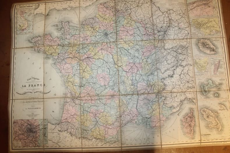
Carte physique, administrative et routière de la France et des pays limitrophes indiquant les rivières navigables, les canaux, les routes nationales et départementales, les distances en kilomètres d'après la carte des Postes, les Chemins de fer, le Cours des Bateaux à Vapeur sur l'Océan et la Mer Méditerranée; les Etablissements d'Eaux Minérales...
Paris, librairie de Théodore Lefèvre & Cie, Emile Guérin éditeur, 1893. Grande carte lithographiée en couleurs par Falconer ( 64 cm X 89 cm), en 18 parties montées sur toile au format in-8. Plusieurs cartouches indiquant les colonies françaises et les environs de Paris. En très bon état.
Bookseller reference : 22886
|
|
|
VUILLEMIN Alexandre ( 1812 - 1880 ) , Géographe
Carte du Département de l'AIN
Paris MIGEON 1882 In Plano Carte lithographiée en couleurs , dressée par Vuillemin d'après les cartes de Casini en 1853 , du dépôt de la guerre des Ponts et Chaussées et de la Marine . Extraite de l'Atlas : La France et ses Colonies . Edition de 1882 identique à celle de 1879 . Illustrée des villes , bourgs et cantons , communes ( parfois disparues ) , limites du département , limites des arrondissements , routes de 1ère et 2 ème classes , traverses , chemins de fer et stations , canaux , chemins de fer en construction ,entourée de personnages célèbres , de paysages , d'une vue de la ville principale , du blason , dont les textes sont écrits par Isidore . Format 22 cm x 18 cm ou sur marges de 34 cm x 24 cm , montée sur bristol crème de 42 cm x 30 cm . Envoyée en rouleau . - Cartes et Plans . - Une feuille , 250 gr.
Bookseller reference : 022718

|
|
|
VUILLEMIN Alexandre ( 1812 - 1880 ) , Géographe
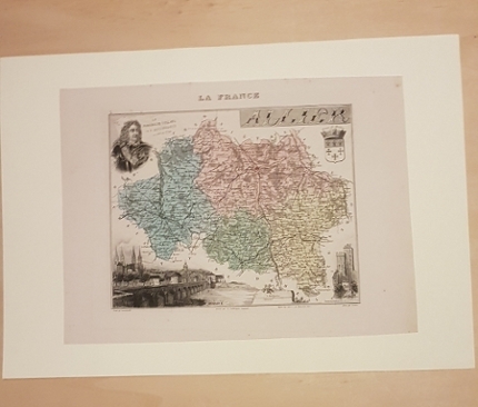
Carte du Département de l'AISNE
Paris MIGEON 1882 In Plano Carte lithographiée en couleurs , dressée par Vuillemin d'après les cartes de Casini en 1853 , du dépôt de la guerre des Ponts et Chaussées et de la Marine . Extraite de l'Atlas : La France et ses Colonies . Edition de 1882 identique à celle de 1879 . Illustrée des villes , bourgs et cantons , communes ( parfois disparues ) , limites du département , limites des arrondissements , routes de 1ère et 2 ème classes , traverses , chemins de fer et stations , canaux , chemins de fer en construction ,entourée de personnages célèbres , de paysages , d'une vue de la ville principale , du blason , dont les textes sont écrits par Isidore . Format 22 cm x 18 cm ou sur marges de 34 cm x 24 cm , montée sur bristol crème de 42 cm x 30 cm . Envoyée en rouleau . - Cartes et Plans . - Une feuille , 250 gr.
Bookseller reference : 022719
|
|
|
VUILLEMIN Alexandre ( 1812 - 1880 ) , Géographe
Carte du Département de l'ALLIER
Paris MIGEON 1882 In Plano Carte lithographiée en couleurs , dressée par Vuillemin d'après les cartes de Casini en 1853 , du dépôt de la guerre des Ponts et Chaussées et de la Marine . Extraite de l'Atlas : La France et ses Colonies . Edition de 1882 identique à celle de 1879 . Illustrée des villes , bourgs et cantons , communes ( parfois disparues ) , limites du département , limites des arrondissements , routes de 1ère et 2 ème classes , traverses , chemins de fer et stations , canaux , chemins de fer en construction ,entourée de personnages célèbres , de paysages , d'une vue de la ville principale , du blason , dont les textes sont écrits par Isidore . Format 22 cm x 18 cm ou sur marges de 34 cm x 24 cm , montée sur bristol crème de 42 cm x 30 cm . Envoyée en rouleau . - Cartes et Plans . - Une feuille , 250 gr.
Bookseller reference : 022720
|
|
|
VUILLEMIN Alexandre ( 1812 - 1880 ) , Géographe
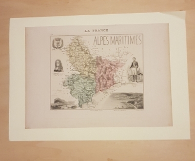
Carte du Département des ALPES MARITIMES
Paris MIGEON 1882 In Plano Carte lithographiée en couleurs , dressée par Vuillemin d'après les cartes de Casini en 1853 , du dépôt de la guerre des Ponts et Chaussées et de la Marine . Extraite de l'Atlas : La France et ses Colonies . Edition de 1882 identique à celle de 1879 . Illustrée des villes , bourgs et cantons , communes ( parfois disparues ) , limites du département , limites des arrondissements , routes de 1ère et 2 ème classes , traverses , chemins de fer et stations , canaux , chemins de fer en construction ,entourée de personnages célèbres , de paysages , d'une vue de la ville principale , du blason , dont les textes sont écrits par J. Bénard . Format 22 cm x 18 cm ou sur marges de 34 cm x 24 cm , montée sur bristol crème de 42 cm x 30 cm . Envoyée en rouleau . - Cartes et Plans . - Une feuille , 250 gr.
Bookseller reference : 022721
|
|
|
VUILLEMIN Alexandre ( 1812 - 1880 ) , Géographe
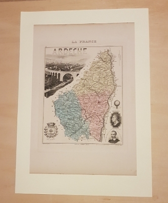
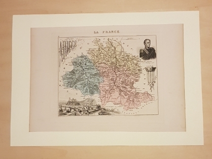
Carte du Département de l'ARDECHE
Paris MIGEON 1882 In Plano Carte lithographiée en couleurs , dressée par Vuillemin d'après les cartes de Casini en 1853 , du dépôt de la guerre des Ponts et Chaussées et de la Marine . Extraite de l'Atlas : La France et ses Colonies . Edition de 1882 identique à celle de 1879 . Illustrée des villes , bourgs et cantons , communes ( parfois disparues ) , limites du département , limites des arrondissements , routes de 1ère et 2 ème classes , traverses , chemins de fer et stations , canaux , chemins de fer en construction ,entourée de personnages célèbres , de paysages , d'une vue de la ville principale , du blason , dont les textes sont écrits par Isidore . Format 22 cm x 18 cm ou sur marges de 34 cm x 24 cm , montée sur bristol crème de 42 cm x 30 cm . Envoyée en rouleau . - Cartes et Plans . - Une feuille , 250 gr.
Bookseller reference : 022722
|
|
|
VUILLEMIN Alexandre ( 1812 - 1880 ) , Géographe
Carte du Département des ARDENNES
Paris MIGEON 1882 In Plano Carte lithographiée en couleurs , dressée par Vuillemin d'après les cartes de Casini en 1853 , du dépôt de la guerre des Ponts et Chaussées et de la Marine . Extraite de l'Atlas : La France et ses Colonies . Edition de 1882 identique à celle de 1879 . Illustrée des villes , bourgs et cantons , communes ( parfois disparues ) , limites du département , limites des arrondissements , routes de 1ère et 2 ème classes , traverses , chemins de fer et stations , canaux , chemins de fer en construction ,entourée de personnages célèbres , de paysages , d'une vue de la ville principale , du blason , dont les textes sont écrits par Isidore . Format 22 cm x 18 cm ou sur marges de 34 cm x 24 cm , montée sur bristol crème de 42 cm x 30 cm . Envoyée en rouleau . - Cartes et Plans . - Une feuille , 250 gr.
Bookseller reference : 022723

|
|
|
VUILLEMIN Alexandre ( 1812 - 1880 ) , Géographe
Carte du Département des ARDENNES
Paris MIGEON 1882 In Plano Carte lithographiée en couleurs , dressée par Vuillemin d'après les cartes de Casini en 1853 , du dépôt de la guerre des Ponts et Chaussées et de la Marine . Extraite de l'Atlas : La France et ses Colonies . Edition de 1882 identique à celle de 1879 . Illustrée des villes , bourgs et cantons , communes ( parfois disparues ) , limites du département , limites des arrondissements , routes de 1ère et 2 ème classes , traverses , chemins de fer et stations , canaux , chemins de fer en construction ,entourée de personnages célèbres , de paysages , d'une vue de la ville principale , du blason , dont les textes sont écrits par Isidore . Format 22 cm x 18 cm ou sur marges de 34 cm x 24 cm , montée sur bristol crème de 42 cm x 30 cm . Envoyée en rouleau . - Cartes et Plans . - Une feuille , 250 gr.
Bookseller reference : 022724
|
|
|
 Receive by email
 Download as PDF document
 RSS feed


