|
ANONYME
MOUNTAIN PARKS OF DENVER
The Denver Post. sans date. In-12. Broché. Bon état, Couv. convenable, Dos satisfaisant, Intérieur frais. Non paginé. Illustrations de Wiswall se dépliant en accordéon, à l'intérieur d'une enveloppe illustrée en couleurs, au format carte postale. Inscriptions sur le devant de l'enveloppe: adresse de l'ancien propriétaire inscrite.. . . . Classification Dewey : 741.68-Illustrations des cartes postales
Bookseller reference : RO30010635
|
|
|
ANONYME
NEW YORK CITY, THE GATEWAY OF AMERICA
Inconnu. sans date. In-12. Broché. Bon état, Couv. convenable, Dos satisfaisant, Intérieur frais. Non paginé. Illustrations couleur se dépliant en accordéon, à l'intérieur d'une enveloppe illustrée en couleurs, au format carte postale.. . . . Classification Dewey : 741.68-Illustrations des cartes postales
Bookseller reference : RO30010641
|
|
|
anonyme
Ricordo Di Milano
Milano, , Original publishers paper-covered boards, 36 pages, 18 views in colour, 20 x 14.5 cm, good condition .
Bookseller reference : 64743
|
|
|
ANONYME
SALT LAKE CITY, SOUVENIR HOLDER
Inconnu. sans date. In-12. Broché. Bon état, Couv. convenable, Dos satisfaisant, Intérieur frais. Non paginé. Illustrations de la ville se dépliant en accordéon, à l'intérieur d'une enveloppe illustrée en couleurs, au format carte postale. Inscriptions sur le devant de l'enveloppe: adresse de l'ancien propriétaire inscrite.. . . . Classification Dewey : 741.68-Illustrations des cartes postales
Bookseller reference : RO30010636
|
|
|
anonyme
Tableau de l’univers
ou suite du tableau de la France pour servir de guide à ceux qui partent de Paris, pour les principales parties du monde. L’on y trouve la description historique des provinces & villes par où l’on passe, le commerce & le cours des monnoies des lieux qui ont le plus de correspondance avec Paris, les dépendances & la puissance de chaque souverain, les mœurs é religions des différentes nations. Tome premier in 12 plein cuir fauve raciné, fers, roulette dorés, pièces titre et tomaison manquantes, filets à froid encadrant les plats. Frontispice gravé, titre, XIII, 1 page d’errata, carte de l’Europe, dépliante (petit manque à un angle) 477 pages, 3 pages approbation 8 cartes dépliantes y compris l’Europe : Italie, Espagne, Pays Bas, Allemagne, Pologne, Suède, Iles britanniques. A Paris chez Leclerc 1767. Mouillures
Bookseller reference : 10278

|
|
|
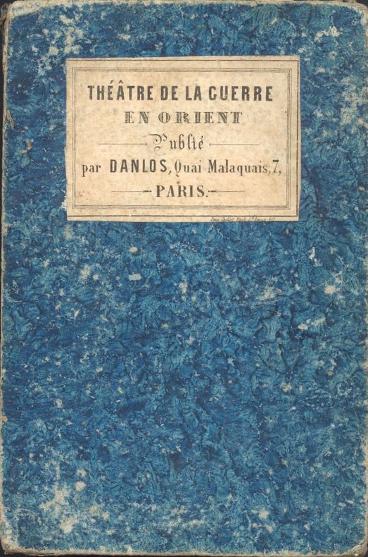
Anonyme
Theatre de la guerre d’orient,2 cartes coloriées depliantes sous chemise cartonnée Sebastopol crimée,Turquie
1852 1852 P.,sans date vers 1852,pliées,bon etat,complet malgré une fente
Bookseller reference : 20187
|
|
|
Anonyme ;
Carte du réseau télégraphique de Chappe ;
Carte manuscrite de la France avec les départements de la rive gauche du Rhin et des Alpes comportant les lignes et les stations du système télégraphique de Chappe. Taille 61 x 60,5 cm ; en fonction de l'état de développement du réseau où les lignes de Paris-Lille, Paris-Brest, Paris-Béhobie, Paris-Strasbourg et Lyon-Toulon sont achevées, mais pas encore Paris-Lyon ni les lignes vers le reste de l'Europe impériale, la carte doit dater du début du consulat (vers 1800).
Bookseller reference : 128

|
|
|
ANONYME.
[AUBERVILLIERS] Commune d'Aubervilliers.
[1895]. 155 x 227 mm.
Bookseller reference : LBW-5161

|
|
|
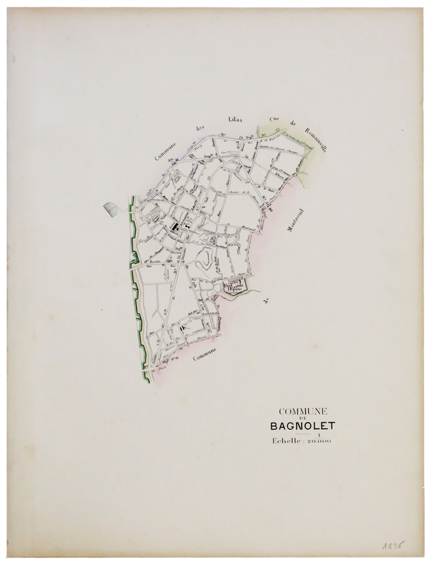
ANONYME.
[BAGNOLET] Commune de Bagnolet.
[1895]. 195 x 135 mm.
Bookseller reference : LBW-5149
|
|
|
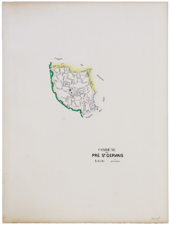
ANONYME.
[LE PRÉ-SAINT-GERVAIS] Commune du Pré St. Gervais.
[1895]. 151 x 108 mm.
Bookseller reference : LBW-5204
|
|
|
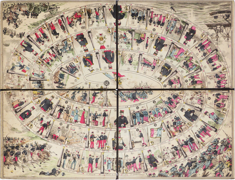
ANONYME.
[Le Régiment. Nouveau jeu militaire].
[vers 1860]. 564 x 735 mm ; en quatre sections montées sur carton fort et pouvant être repliées (montage de l'éditeur).
Bookseller reference : LBW-8554
|
|
|
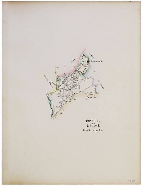
ANONYME.
[LES LILAS] Commune des Lilas.
[1895]. 145 x 110 mm.
Bookseller reference : LBW-5207
|
|
|
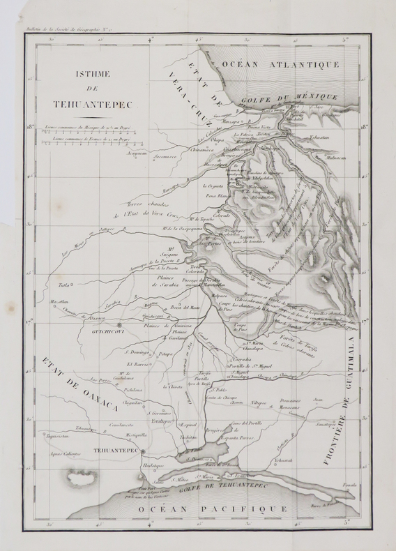
ANONYME.
[MEXIQUE] Isthme de Tehuantepec.
[1829]. 287 x 201 mm.
Bookseller reference : LBW-4791
|
|
|
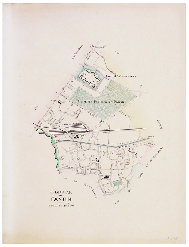
ANONYME.
[PANTIN] Commune de Pantin.
[1895]. 225 x 179 mm.
Bookseller reference : LBW-5208
|
|
|
ANONYME.
[ROMAINVILLE] Commune de Romainville.
[1895]. 209 x 140 mm.
Bookseller reference : LBW-5209

|
|
|
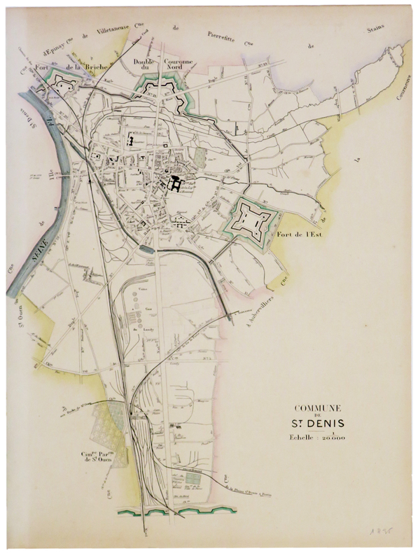
ANONYME.
[SAINT-DENIS] Commune de St. Denis.
[1895]. 303 x 243 mm.
Bookseller reference : LBW-5210
|
|
|
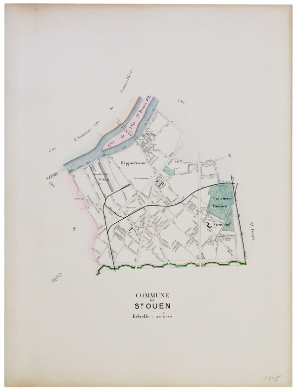
ANONYME.
[SAINT-OUEN] Commune de St. Ouen.
[1895]. 208 x 180 mm.
Bookseller reference : LBW-5211
|
|
|
ANONYME.
[SAINT-PÉTERSBOURG] A view of the Exchange at Petersburg in Russia - Vue de la Bourse & du port de Pétersbourg en Russie.
1755. 231 x 376 mm.
Bookseller reference : LBW-5404

|
|
|
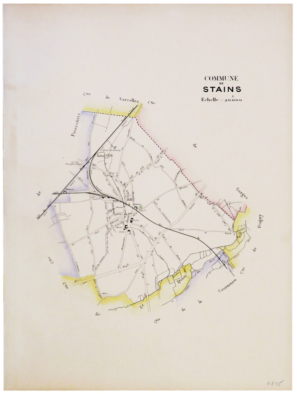
ANONYME.
[STAINS] Commune de Stains.
[1895]. 210 x 193 mm.
Bookseller reference : LBW-5175
|
|
|
ANONYME.
[TARRAGONE] Plan du siège de Tarragone par l'armée de Sa Majesté en Arragon en 1811.
598 x 874 mm.
Bookseller reference : LBW-3453

|
|
|
ANONYME.
[ÉPINAY-sur-SEINE ] Commune d'Épinay.
[1895]. 153 x 235 mm.
Bookseller reference : LBW-5205

|
|
|
ANONYME.
[ÎLE de RÉ] L'Isle de Ré extraite et développée de dessus la carte de MM de l'Académie Royale par Jh R.... en 1815.
Saint-Martin-de-Ré, Les Éditions des Deux Îles, [vers 1980]. 590 x 872 mm, sur papier Arches.
Bookseller reference : LBW-8234

|
|
|
Anonyme.
Fribourg. Album de 12 cartes postales.
Fribourg, Librairie - Papeterie Josué Labastrou sans date, vers 1935, 140x200mm, broché. Format oblong. Très bel exemplaire.
Bookseller reference : 112770

|
|
|
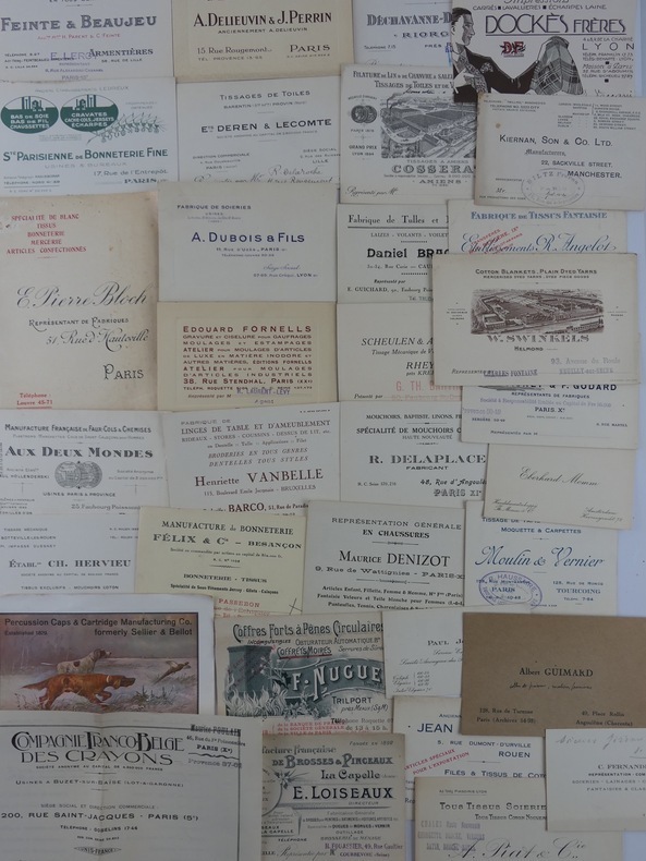
Anonyme.
Important lot de cartes de visite commerciales, années 20, françaises et étrangères, concernant tous métiers autour de la passementerie.
Paris, Environ 580 cartes de visite: tissus, soieries, fantaisies pour dames, lainages, manufactures françaises et étrangères, bonneteries, coiffes, cuirs, dentelles, mouchoirs, bijouteries, papetiers, chaussures, caoutchouc, boutons de manchette, cravates, parapluies, émailleries, étuis à cigarette, cannes, guirlandes, brosseries, brosses à barbe, sociétés d'import et d'export etc. etc. Ensemble en bon état.
Bookseller reference : 66778
|
|
|
ANONYME.
Jeu des omnibus et Dames Blanches.
[1832]. 445 x 457 mm.
Bookseller reference : LBW-8534

|
|
|
ANONYME.
Le Train. Carte des Chemins de fer de l'Europe centrale 1866, annexée à l'Indicateur Le Train. Itinéraire des eaux minérales, des bains de mers et des stations d'hiver de l'Europe.
Paris, sans mention d'éditeur (gravé par L. Kautz), 1866. Dimensions : 10 x 15,7 cm pliée ; 55 x 45 cm dépliée. Carte dépliante dans une reliure en demi-toile rouge, premier plat titré.
Bookseller reference : 2488

|
|
|
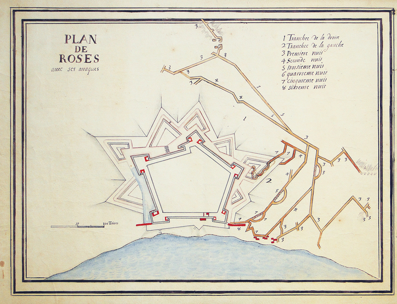
ANONYME.
Plan de Roses avec ses attaques.
[début du XVIIIe siècle]. 370 x 475 mm.
Bookseller reference : LBW-3460
|
|
|
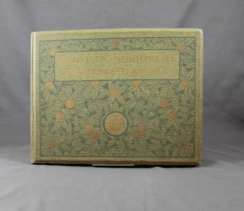
Anonyme:
Chemins de fer Paris-Lyon-Méditerrannée et Cie Générale transatlantique.
Paris, P.L.M., sans date. In-4 oblong (328 x 255) de [16] pages suivies de 22 planches, pleine percaline verte d’éditeur, dos lisse muet, plats ornés. Bel état.
Bookseller reference : 2209
|
|
|
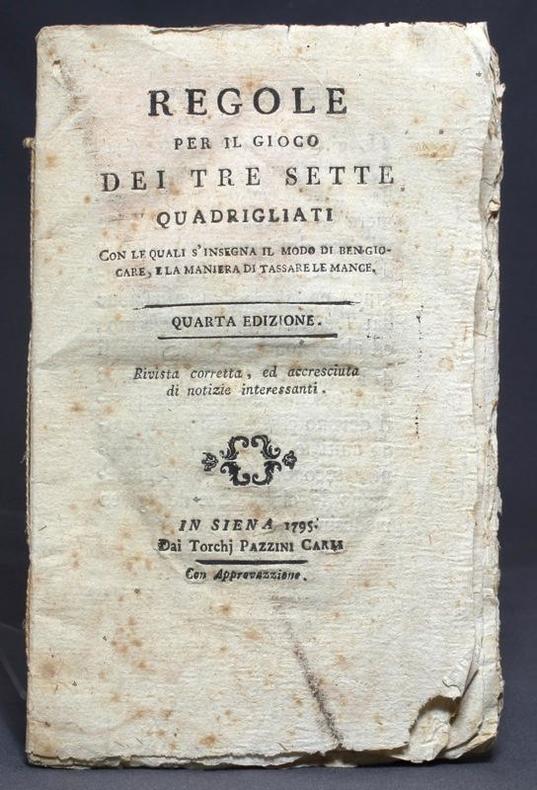
Anonyme:
Regole per il gioco dei tre sette quadrigliati. Con le quali s'insegna il modo di ben giocare e la maniera di tassare le mance. Quarta edizione. Rivista corretta, ed accresciuta di notizie interessanti.
In Siena, Dai Torchj Pazzini Carli, 1795. In-12 broché de 32 pages, tel que paru, non rogné et sans couverture d'attente. Une taches et quelques rousseurs à la page de titre.
Bookseller reference : 12410
|
|
|
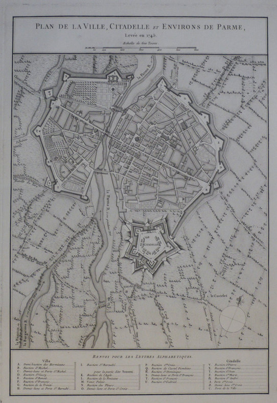
ANONYME;
[PARME] Plan de la ville, citadelle et environs de Parme, levée en 1745.
circa 1750 460 x 312 mm.
Bookseller reference : LBW-1193
|
|
|
ANONYME;
[SAINT-PETERSBOURG] Vue perspective des bords de la Neva en descendant la rivière entre le Palais d'hyver de sa Majesté Impériale et les batimens de l'Académie des sciences à Petersburg.
circa 1760 225 x 377 mm.
Bookseller reference : LBW-854

|
|
|
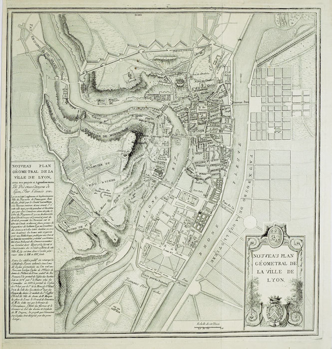
ANONYME;
Nouveau plan géométral de la ville de Lyon.
1789 443 x 422 mm.
Bookseller reference : LBW-545
|
|
|
ANONYME]
Le Livre Illustré des Patiences. 60 jeux de patiences avec figures indiquant la place des cartes. Troisième édition.
Paris HAAR & STEINERT, A. EICHLER , Succr, sans date (vers 1890) 0 un volume in-8° (150 x 210mm), X 114 pp. Cartonnage éditeur pleine percaline vert kaki, les plats sont ornés de compositions ornementales inspirées de la Renaissance (palmettes et entrelacs), titre entouré des quatre couleurs et encadré d'un filet or, dos lisse titré noir, tranches rouges. Magnifique page de titre illustrée et tirée en trois couleurs placée dans une cartouche avec un encadrement style Renaissance. Texte et figures en deux tons encadrés d'un double filet rouge. Très bel exemplaire. Dédicace ancienne en regard du titre.
Bookseller reference : 022671
|
|
|
Anonymous
LONDON MAP
8vo
|
|
|
ANSON (George);
Carte de la mer du Sud ou mer Pacifique.
1749 280 x 543 mm.
Bookseller reference : LBW-899
|
|
|
ANTHONY [APPLEMORE MORNINGTON] BRYER, (1937-2016).
[TREBIZOND EMPIRE / BYZANTINE / CARTOGRAPHY] The littoral of the Empire of Trebizond in two fourteenth century portolano maps. Separatum "Arkheion Pontou".
Very Good English Original wrappers. Roy. 8vo. ('4 x 17 cm). In English. pp. 97-127, 9 b/w plates. This offprint from the Greek journal published in a long run from 1928 to 1961 in 24 volumes, examines the 14th-century coastline of the Byzantine Empire of Trebizond with toponyms and topography on two portolan maps of the period. "Bryer was a British historian of the Byzantine Empire and founder of the Centre for Byzantine, Ottoman, and Modern Greek Studies at the University of Birmingham. Part of his childhood was spent in Jerusalem and he was acquainted with Sir Steven Runciman, historian, and Byzantine Scholar. He initially remained at Balliol for his doctorate on the Empire of Trebizond, which he completed in 1967, but in 1964 he moved to the University of Birmingham where he created a program in Byzantine studies. In 1975 he founded the journal Byzantine and Modern Greek Studies. From 1976, he was the founding Director of the Centre for Byzantine Studies, and in 1980 he was appointed Professor of Byzantine Studies, a post which he held until 1999." (Wikipedia). Not in OCLC.
|
|
|
Antoine COURT de GEBELIN
Le TAROT
Un ouvrage de 195 pages, format 170 x 240 mm, illustré, broché couverture rempliée, publié en 1983, Berg International Editeurs bon état
Bookseller reference : LFA-126722102
|
|
|
ANTRESSANGLE (Gilbert).
Ardètcho moun païs (Ardèche, mon pays). Regard sur le patrimoine. Préface de Michel Teston.
Guilherand, Impressions Modernes, 2002, Broché, couverture illustrée. in-8, titre illustré, 182 pages, nombreuses photos (reproduction de cartes postales anciennes) avec un texte d'accompagnement, envoi autographe signé de l'auteur.
Bookseller reference : 20334
|
|
|
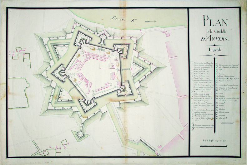
ANVERS. MANUSCRIT.
Plan de la citadelle d'Anvers.
1793-1795. En deux feuilles jointes de 635 x 955 mm.
Bookseller reference : LBW-4209
|
|
|
ANVILLE (Jean Baptiste Bourguignon d').
[AFRIQUE ORIENTALE] Carte de l'Éthiopie orientale située sur la mer des Indes entre le Cap Guardafouin, & le Cap de Bonne Espérance.
Août 1727. 644 x 415 mm.
Bookseller reference : LBW-8135

|
|
|
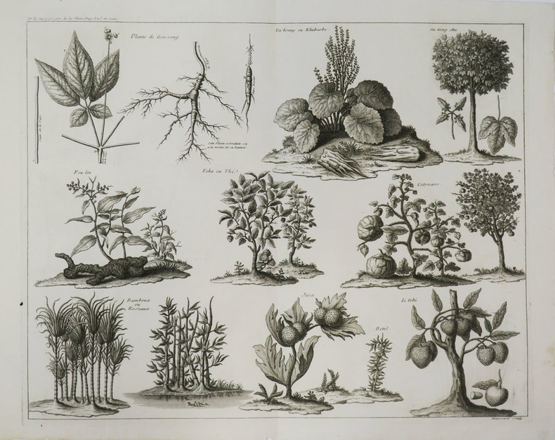
ANVILLE (Jean Baptiste Bourguignon d').
[BOTANIQUE].
[1785]. 366 x 458 mm.
Bookseller reference : LBW-3647
|
|
|
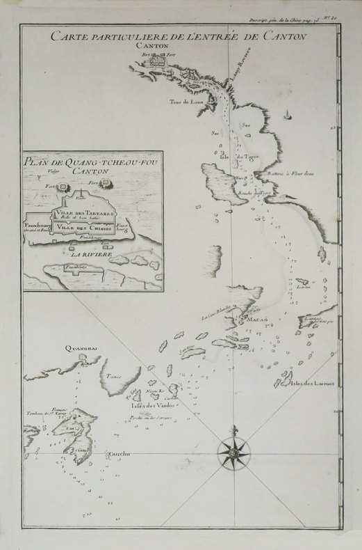
ANVILLE (Jean Baptiste Bourguignon d').
[CANTON] Carte particulière de l'entrée de Canton.
[1785]. 391 x 247 mm.
Bookseller reference : LBW-3631
|
|
|
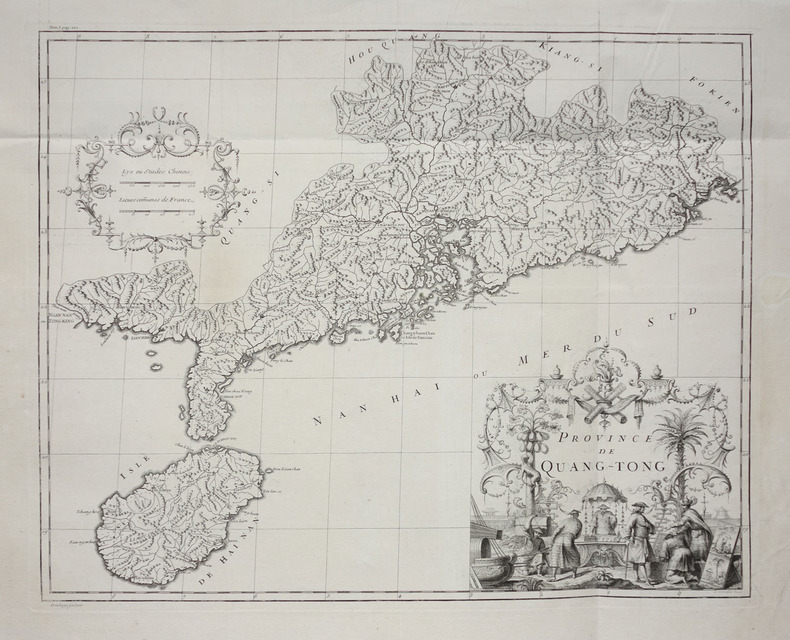
ANVILLE (Jean Baptiste Bourguignon d').
[CANTON] Province de Quang-Tong.
[Paris, 1735]. 421 x 529 mm.
Bookseller reference : LBW-2732
|
|
|
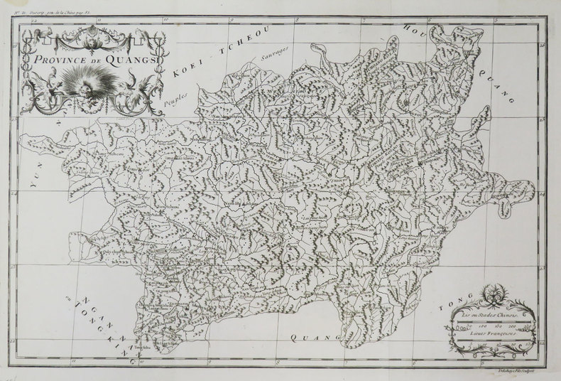
ANVILLE (Jean Baptiste Bourguignon d').
[GUANGXI] Province de Quang-Si.
[1785]. 263 x 405 mm.
Bookseller reference : LBW-3656
|
|
|
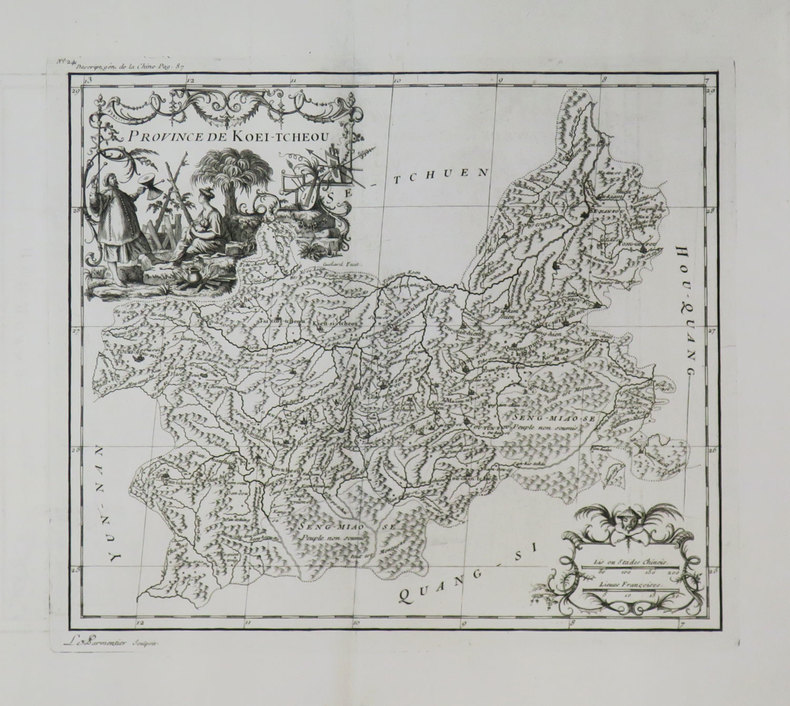
ANVILLE (Jean Baptiste Bourguignon d').
[GUIZHOU] Province de Koei-Tcheou.
[1785]. 258 x 302 mm.
Bookseller reference : LBW-2731
|
|
|
ANVILLE (Jean Baptiste Bourguignon d').
[HUBEI & HUNAN] Province de Hou-Quang.
[1785]. 489 x 408 mm.
Bookseller reference : LBW-3422

|
|
|
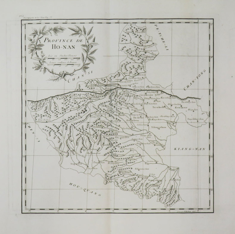
ANVILLE (Jean Baptiste Bourguignon d').
[HUNAN] Province de Ho-Nan.
[1785]. 324 x 322 mm.
Bookseller reference : LBW-3660
|
|
|
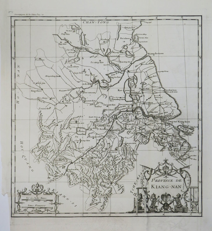
ANVILLE (Jean Baptiste Bourguignon d').
[JIANGSU & ZHEJIANG] Province de Kiang-Nan.
[1785]. 338 x 275 mm.
Bookseller reference : LBW-3662
|
|
|
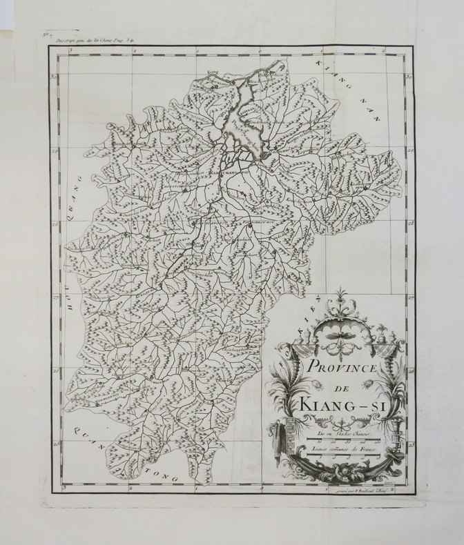
ANVILLE (Jean Baptiste Bourguignon d').
[JIANGXI] Province de Kiang-Si.
[1785]. 338 x 275 mm.
Bookseller reference : LBW-3661
|
|
|
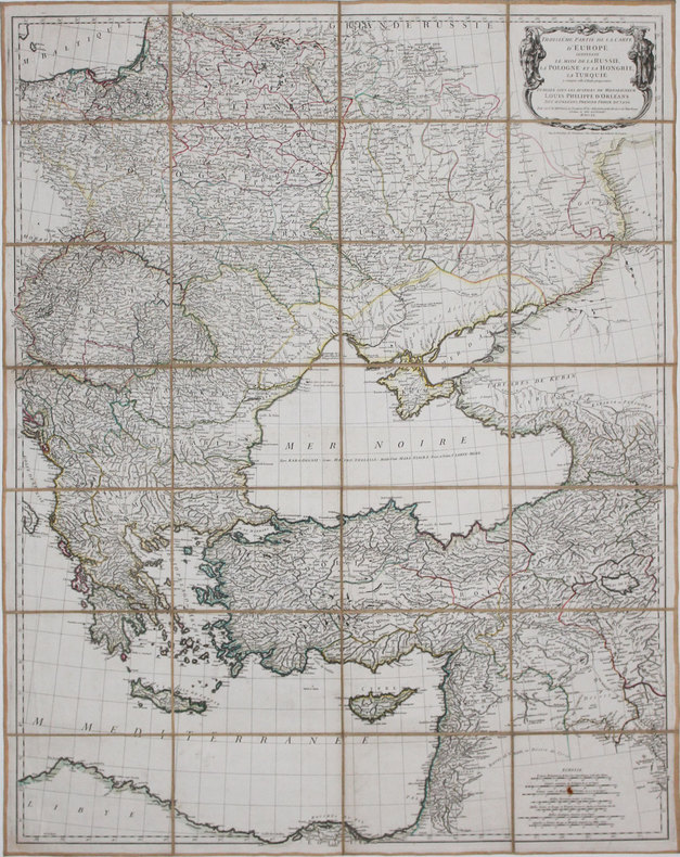
ANVILLE (Jean Baptiste Bourguignon d').
[MER NOIRE] Troisième partie de la carte d'Europe contenant le midi de la Russie, la Pologne et la Hongrie, la Turquie y compris celle d'Asie presqu'entière.
1760. En 28 sections montées sur toile et pliées, formant une carte de 0,85 x 1,07 m.
Bookseller reference : LBW-3692
|
|
 Receive by email
 Download as PDF document
 RSS feed


