|
FER (Nicolas de).
[ESTONIE] Plan de Narva.
Paris, 1705. 226 x 336 mm.
Bookseller reference : LBW-712
|
|
|
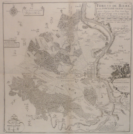
FER (Nicolas de).
[FONTAINEBLEAU] Forest de Bière ou de Fontaine-bleau contenant 13212 arpens en bois tant bien que mal planté non compris les rochers et bruyères.
Paris, G. Danet, 1705 [circa 1720]. 429 x 420 mm.
Bookseller reference : LBW03934
|
|
|
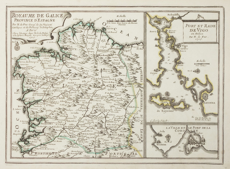
FER (Nicolas de).
[GALICE] Royaume de Galice province d'Espagne.
Paris, chez l'auteur, 1705. 236 x 327 mm.
Bookseller reference : LBW-2894
|
|
|
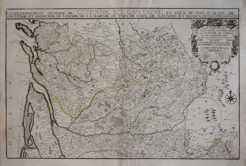
FER (Nicolas de).
[GUYENNE & GASCOGNE] Le gouvernement général de Guienne et Gascogne et ceux du Pays d'Aunis, de Saintonge et Angoumois, du Limosin, de la Marche, du Pays de Foix, de Navarre et Béarn.
Paris, J.F. Bénard, 1711. 472 x 713 mm.
Bookseller reference : LBW-3044
|
|
|
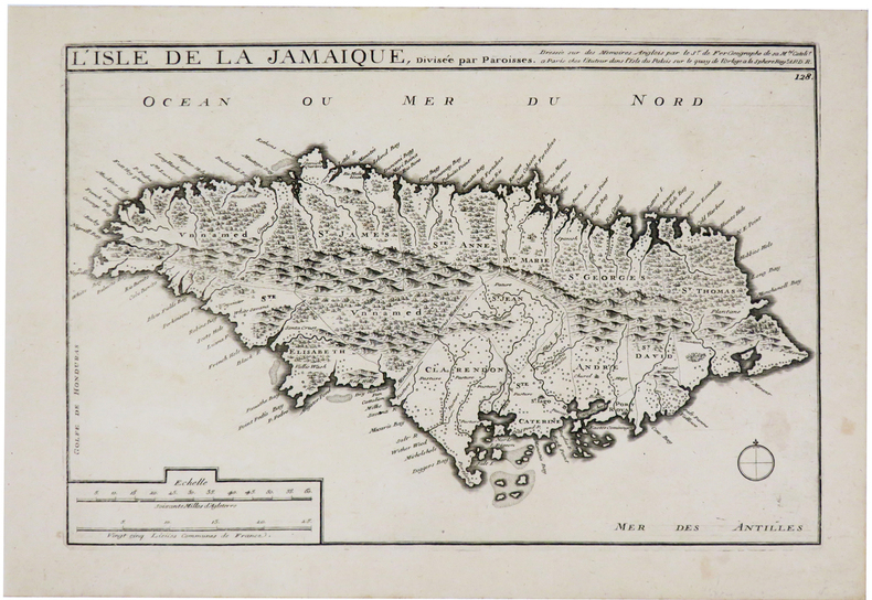
FER (Nicolas de).
[JAMAIQUE] L'isle de la Jamaique.
Paris, chez l'auteur, [1704]. 232 x 344 mm + feuillet de texte.
Bookseller reference : LBW0249a
|
|
|
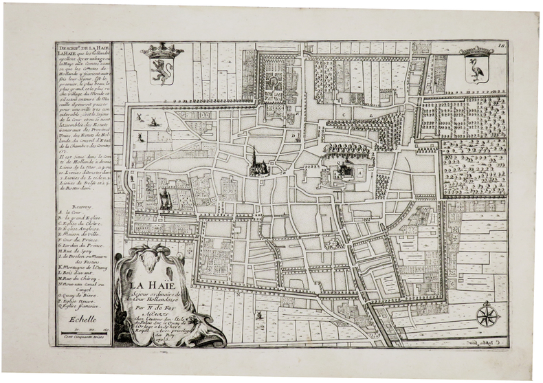
FER (Nicolas de).
[LA HAYE] La Haïe séjour ordinaire de la Cour hollandoise.
Paris, chez l'auteur, 1705. 223 x 332 mm + feuillet de texte descriptif.
Bookseller reference : LBW-6120
|
|
|
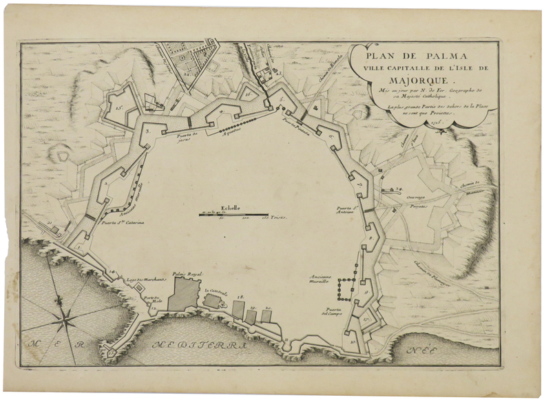
FER (Nicolas de).
[MAYORQUE] Plan de Palma ville capitalle de l'isle de Majorque.
1715. 234 x 342 mm.
Bookseller reference : LBW024fa
|
|
|
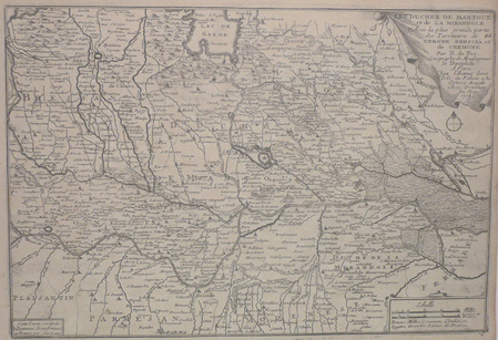
FER (Nicolas de);
[MANTOUE] Les duchez de Mantoue et de la Mirandole avec la plus grande partie des territoire de Verone, Brescia et de Cremone.
Paris chez l'auteur 1705 237 x 349 mm.
Bookseller reference : LBW027ce
|
|
|
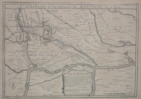
FER (Nicolas de);
[MANTOUE] Le Seraglio et les environs de Mantoue.
Paris 1705 235 x 330 mm.
Bookseller reference : LBW027cf
|
|
|
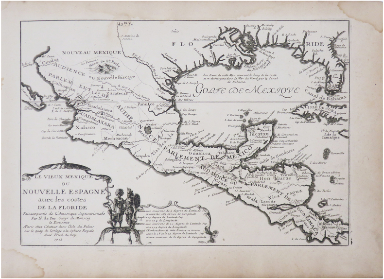
FER (Nicolas de).
[MEXIQUE/AMÉRIQUE CENTRALE] Le vieux Mexique ou Nouvelle Espagne avec les costes de la Floride faisant partie de l'Amérique septentrionale.
Paris, chez l'auteur, 1705. 226 x 326 mm.
Bookseller reference : LBW-7877
|
|
|
FER (Nicolas de);
[MILANAIS] Les environs de Milan.
Paris chez l'auteur 1705 230 x 345 mm.
Bookseller reference : LBW027d0

|
|
|
FER (Nicolas de);
[NAPLES] Le royaume de Naples.
Paris chez l'auteur 1705 225 x 335 mm.
Bookseller reference : LBW002bb
|
|
|
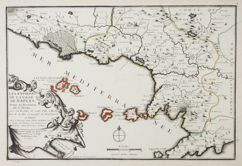
FER (Nicolas de).
[NAPLES] Les environs de la ville de Naples, dans la province de Labour, avec la routte de cette ville à Rome.
Paris, chez l'auteur, 1705. 226 x 340 mm.
Bookseller reference : LBW-2899
|
|
|
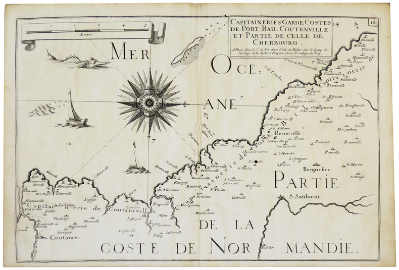
FER (Nicolas de).
[NORMANDIE] Capitaineries garde costes de Port Bail Coutenville et partie de celle de Cherbourg.
Paris, Sr. de Fer, [1690]. 222 x 329 mm.
Bookseller reference : LBW-5651
|
|
|
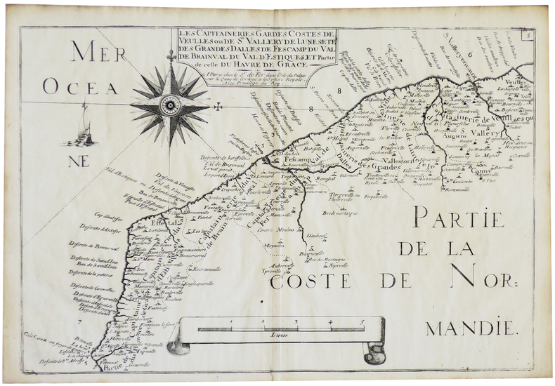
FER (Nicolas de).
[NORMANDIE] Les Capitaineries gardes costes de Veulles ou de S.t Valléry de Lune, Sète des Grandes Dalles de Fescamp du Val de Brainval du Val d'Estiques et partie de celle du Havre de Grâce.
Paris, Sr. de Fer, [1690]. 221 x 329 mm.
Bookseller reference : LBW-5661
|
|
|
FER (Nicolas de).
[PICARDIE] Le Cours des rivières d'Oyse, d'Aisne et de Marne, aux environs desquelles se trouve la généralité de Soissons, subdivisée en ses sept élections ... Corrigée et augmentée sur les nouvelles observations de Mrs de l'Académie Royale des Sciences.
Paris, Desnos, 1760. 454 x 567 mm.
Bookseller reference : LBW-2640
|
|
|
FER (Nicolas de).
[PÉROU] Le Pérou dans l'Amérique méridionale, dressé sur les divers relations des flibustiers et nouveaux voyageurs.
Paris, J.F. Bénard, 1719. 480 x 572 mm.
Bookseller reference : LBW-8219

|
|
|
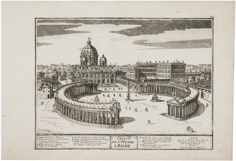
FER (Nicolas de).
[ROME] L'Église de S.t Pierre à Rome.
Paris, Sr. de Fer, 1705. 223 x 302 mm + feuillet de texte descriptif.
Bookseller reference : LBW-6117
|
|
|
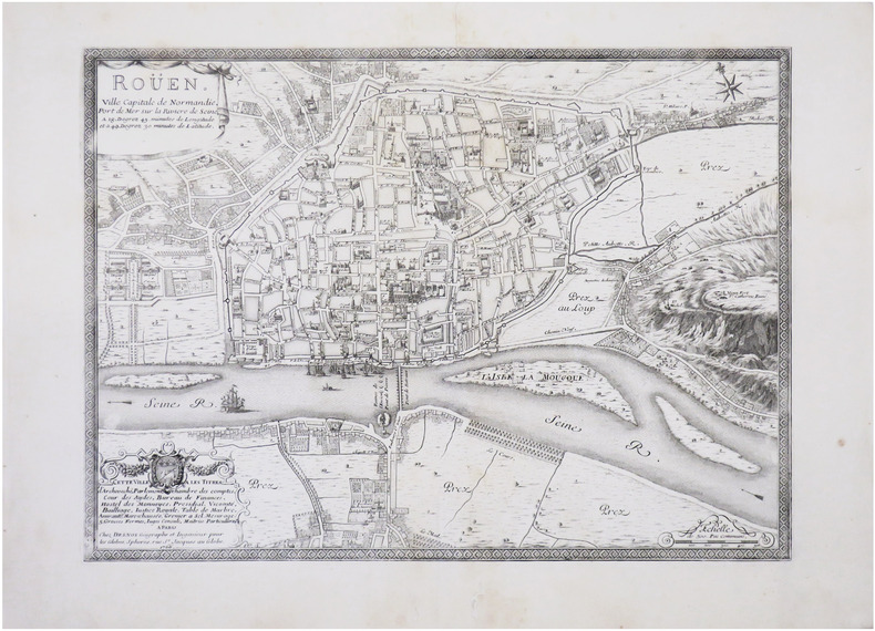
FER (Nicolas de) & DESNOS (Louis-Charles).
[ROUEN] Roüen, ville capitale de Normandie, port de mer sur la rivière de Seine.
Paris, Desnos, 1766. 398 x 547 mm.
Bookseller reference : LBW-8594
|
|
|
FER (Nicolas de).
[SERBIE/BELGRADE] Plan de Belgrade comme il étoit lorsque les Impériaux en ont formé le siège sous les ordres du prince Eugenne, au mois de juin 1717.
Paris, 1717. 377 x 482 mm.
Bookseller reference : LBW-6013

|
|
|
FER (Nicolas de).
[SERBIE/BELGRADE] Les environs de Belgrade où les marches et les campemens des Impériaux et des Turcs sont marquez.
Paris, 1717. 365 x 490 mm.
Bookseller reference : LBW-6014

|
|
|
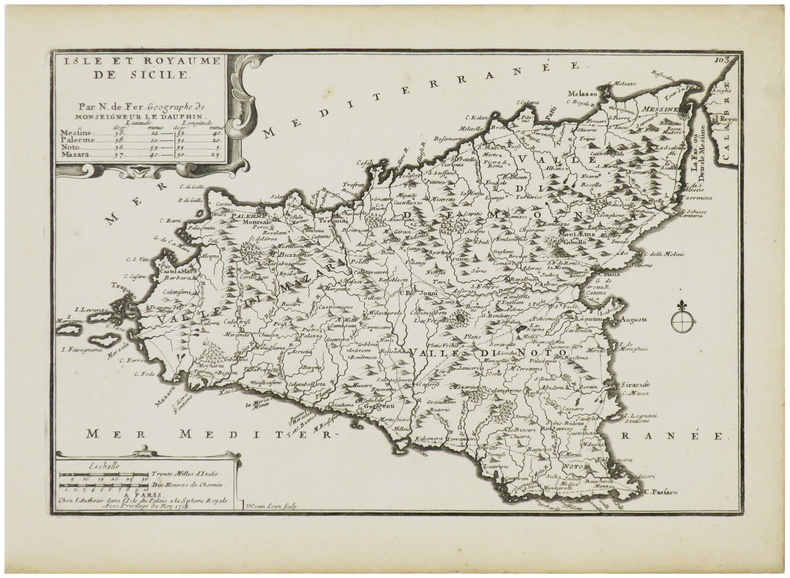
FER (Nicolas de).
[SICILE] Isle et royaume de Sicile.
Paris, chez l'autheur, 1705. 226 x 335 mm + feuillet de texte.
Bookseller reference : LBW-2898
|
|
|
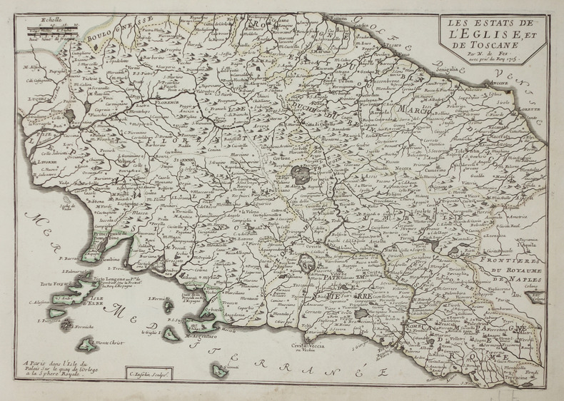
FER (Nicolas de).
[TOSCANE & ROME] Les Estats de l'Eglise, et de Toscane.
Paris, 1705. 233 x 337 mm + feuillet de texte.
Bookseller reference : LBW-2900
|
|
|
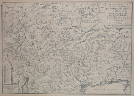
FER (Nicolas de);
[TRENTO] Les éveschés de Trente et de Brixen, le comté de Tirol et les états de la République de Venise dans le fond du golfe.
Paris chez l'auteur 1705 248 x 347 mm.
Bookseller reference : LBW027cd
|
|
|
FER (Nicolas de).
[UKRAINE] La journée de Poltawa en Ukraine, le 8e juillet 1709.
1714. 227 x 329 mm.
Bookseller reference : LBW-713

|
|
|
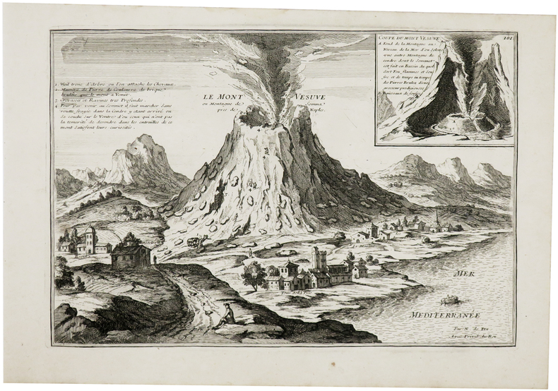
FER (Nicolas de).
[VÉSUVE] Le Mont Vésuve ou montagne de Somma près de Naples.
1703. 227 x 336 mm + feuillet de texte descriptif.
Bookseller reference : LBW-6115
|
|
|
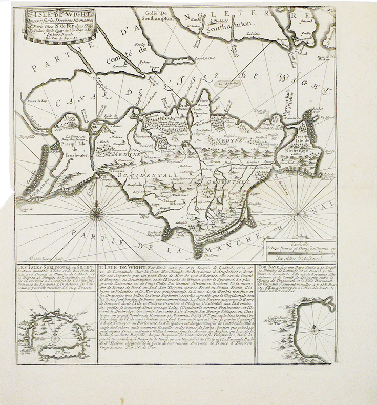
FER (Nicolas de).
[WIGHT] L'Isle de Wight dressée sur les derniers mémoires.
[vers 1705]. 352 x 317 mm.
Bookseller reference : LBW-1813
|
|
|
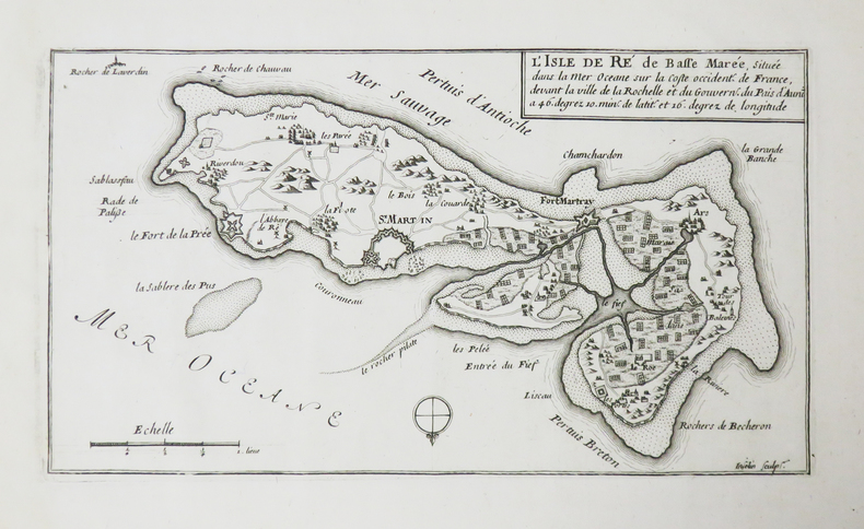
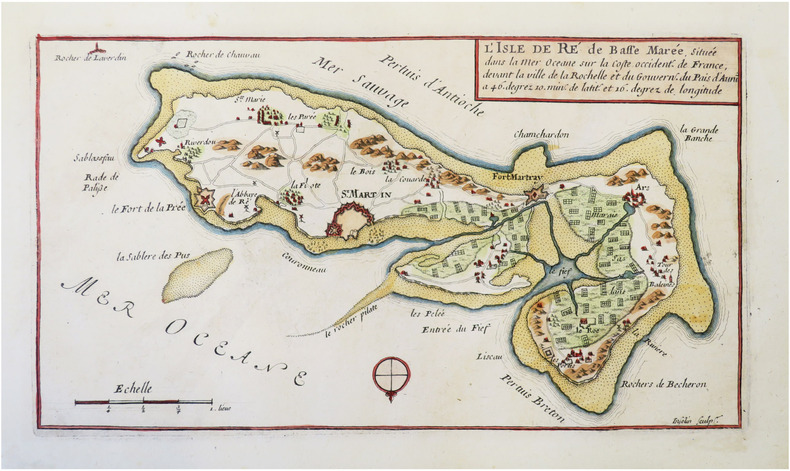
FER (Nicolas de).
[ÎLE de RÉ] L'Isle de Ré de basse marée, située dans la mer Océane sur la coste occident. de France, devant la ville de la Rochelle et du gouvern. du pais d'Aunis.
[1690-1695]. 151 x 270 mm.
Bookseller reference : LBW-4833
|
|
|
FER (Nicolas de).
[ÎLE de RÉ] L'Isle de Ré de basse marée, située dans la mer Océane sur la coste occident.e de France, devant la ville de la Rochelle et du gouvern.t du pais d'Aunis.
[1692]. 148 x 272 mm ; contrecollé sur carton.
Bookseller reference : LBW-8595
|
|
|
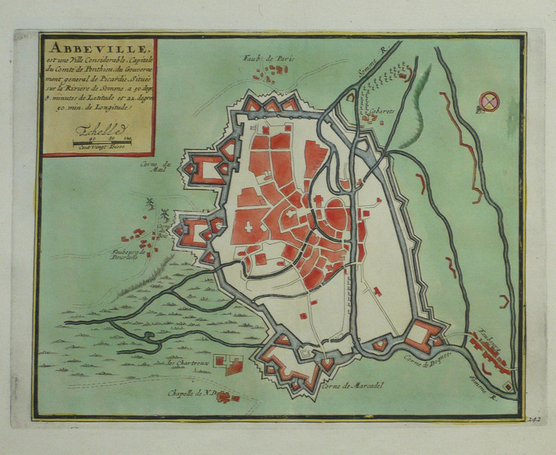
FER (Nicolas de);
Abbeville, est une ville considérable, capitale du comté de Ponthieu, du gouvernement général de Picardie, située sur la rivière de Somme.
Amsterdam Pierre Mortier 1702 216 x 273 mm.
Bookseller reference : LBW-1327
|
|
|
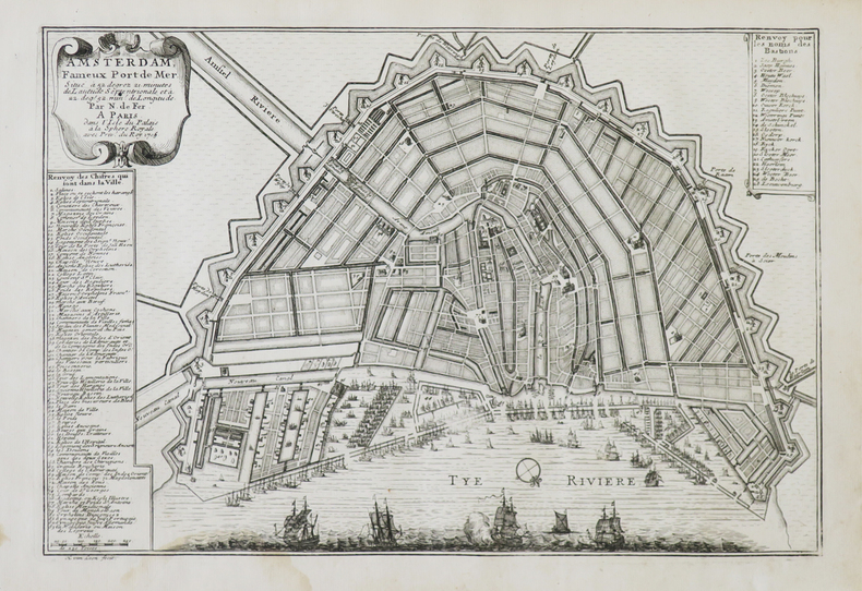
FER (Nicolas de).
Amsterdam fameux port de mer.
Paris, 1705. 221 x 332 mm.
Bookseller reference : LBW-708
|
|
|
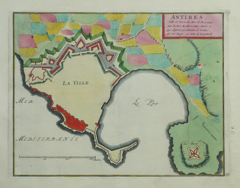
FER (Nicolas de);
Antibes, ville et port de mer de Provence sur la mer Méditerranée.
Amsterdam Pierre Mortier 1702 219 x 280 mm.
Bookseller reference : LBW-1319
|
|
|
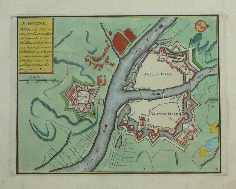
FER (Nicolas de);
Bayonne ville forte et port de mer sur l'Océan, située aux conflans des rivières de l'Adour et de la Nive.
Amsterdam Pierre Mortier 1702 215 x 276 mm.
Bookseller reference : LBW-1321
|
|
|
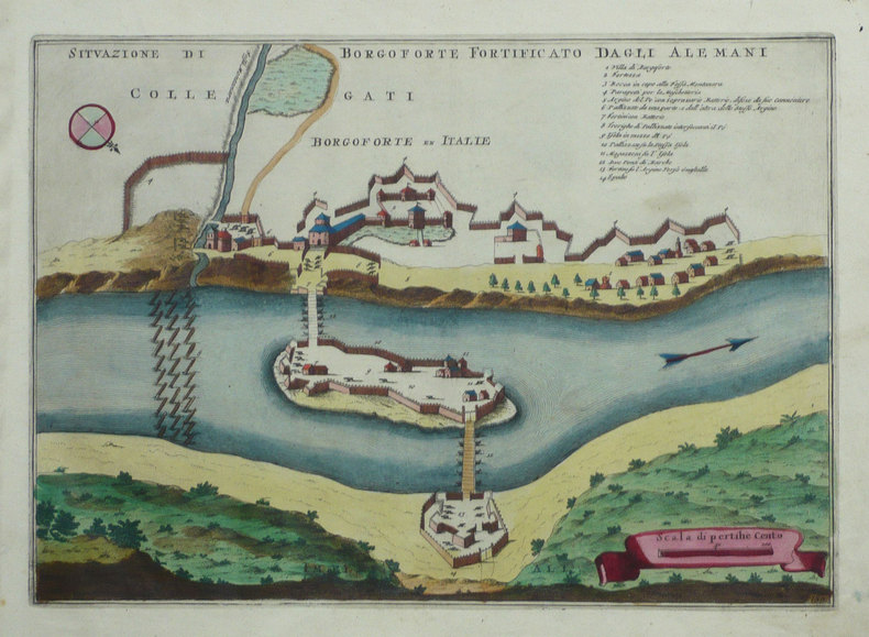
FER (Nicolas de);
Borgoforte en Italie.
Amsterdam Pierre Mortier 1702 231 x 326 mm.
Bookseller reference : LBW-1351
|
|
|
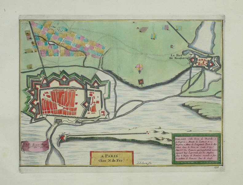
FER (Nicolas de);
Calais ville forte de Picardie.
Amsterdam Pierre Mortier 1702 200 x 276 mm.
Bookseller reference : LBW-1329
|
|
|
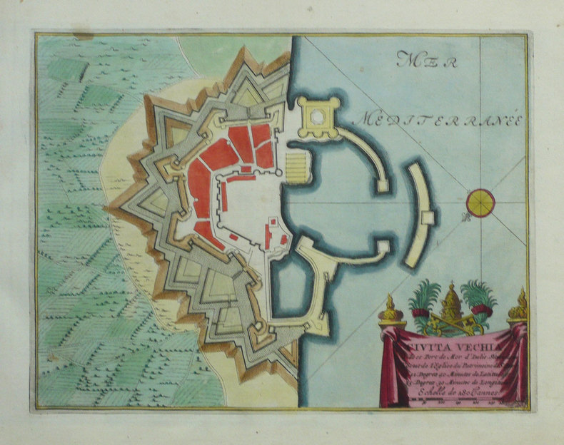
FER (Nicolas de);
Civita Vechia ville et port de mer d'Italie.
Amsterdam Pierre Mortier 1702 220 x 287 mm.
Bookseller reference : LBW-1352
|
|
|
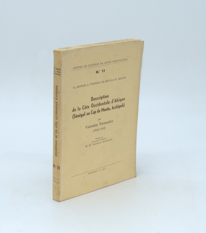
FERNANDES Valentim ,
Description de la côte occidentale d'Afrique (Sénégal au Cap de Monte, Archipels) 1506-1510, édité par Th. MONOD, A. TEIXERA DA MOTA, et R. MAUNY
Bissau , Centro de Estudos da Guiné Portuguesa ,1951 ,N°11 , in-8 , broché , 223 p., illustré de 7 cartes dont 5 dépliantes , texte en portugais avec sa traduction française en vis-à-vis .
Bookseller reference : PHO-1390
|
|
|
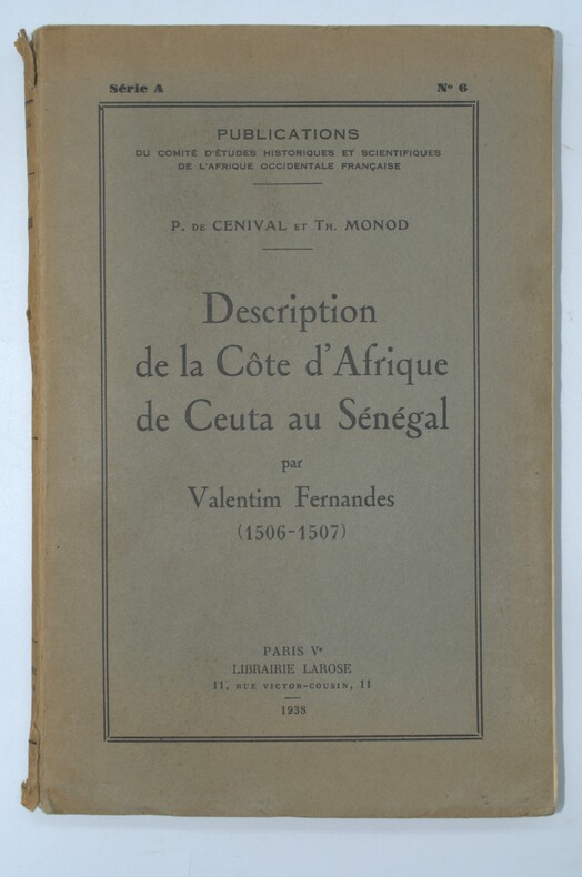
FERNANDÉS (Valentim ) ,MONOD & CENIVAL (éditeurs)
Description de la côte d'Afrique de Ceuta au Sénégal par Valentim Fernandes
Librairie Larose, Paris ,1938, in-8 , broché , 214pp.-1f. (table) , texte en portugais avec sa traduction en regard , portugais une carte dépliante in-fine , dos usé.
Bookseller reference : PHO-1391
|
|
|
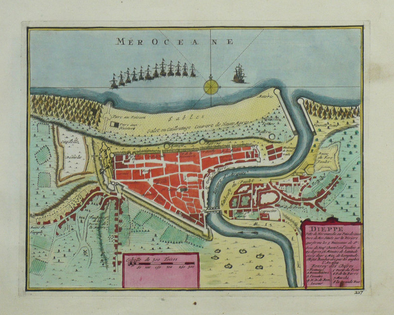
FER (Nicolas de);
Dieppe ville de Normandie au Pays de Caux.
Amsterdam Pierre Mortier 1702 211 x 268 mm.
Bookseller reference : LBW-1338
|
|
|
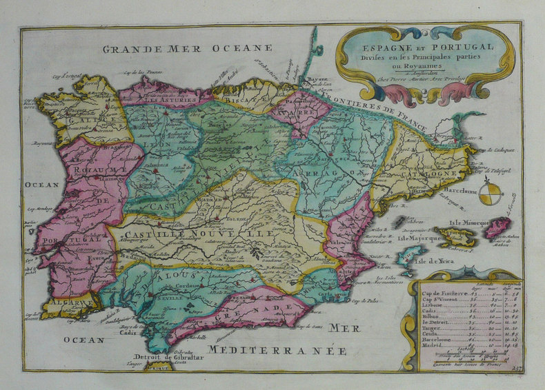
FER (Nicolas de);
Espagne et Portugal divisés en ses principales parties ou royaumes.
Amsterdam Pierre Mortier 1702 217 x 312 mm.
Bookseller reference : LBW-1306
|
|
|
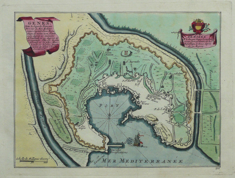
FER (Nicolas de).
Gênes, ditte la superbe, fameux port sur la mer Méditerranée.
[Amsterdam, Pierre Mortier, 1702]. 202 x 266 mm.
Bookseller reference : LBW-1350
|
|
|
FER (Nicolas de);
Havre de Grâce.
Amsterdam Pierre Mortier 1702 196 x 274 mm.
Bookseller reference : LBW-1337

|
|
|
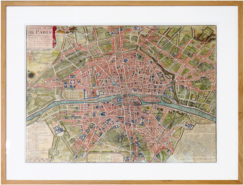
FER (Nicolas de).
Huitième Plan de Paris divisé en ses vingts quartiers.
[Paris, 1722]. 445 x 555 mm.
Bookseller reference : LBW-6646
|
|
|
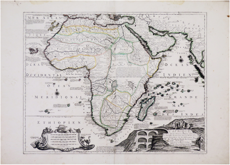
FER (Nicolas de).
L'Afrique dressée selon les dernières relations et suivant les nouvelles découvertes dont les points principaux sont placez sur les observations de M.rs de l'Académie Royale des Sciences.
Paris, S.r Danet, 1722. 462 x 597 mm.
Bookseller reference : LBW-8066
|
|
|
FERRAN (Pierre).-
L'amour à la carte.
1980 Paris, Horay, 1980, in 12 carré broché, ; couverture illustrée en couleurs.
Bookseller reference : 82198
|
|
|
FER (Nicolas de);
L'Italie.
Paris chez l'auteur 1700 220 x 328 mm.
Bookseller reference : LBW0029b
|
|
|
FER (Nicolas de);
Le Port Louis autrefois Blavet est une ville considérable de Bretagne, située sur la coste méridionale de cette provinces.
Amsterdam Pierre Mortier 1702 216 x 289 mm.
Bookseller reference : LBW-1330

|
|
|
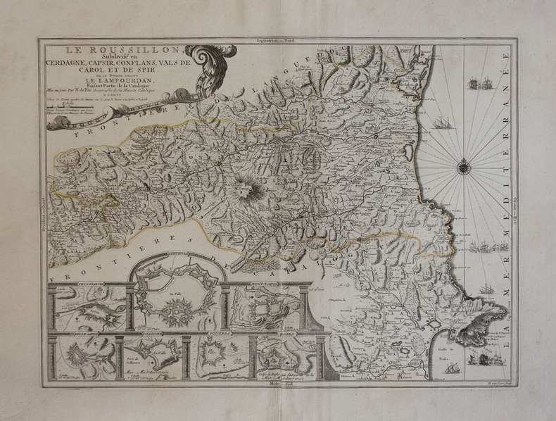
FER (Nicolas de).
Le Roussillon, subdivisé en Cerdagne, Cap Sir, Conflans, Vals de Carol et de Spir, où se trouve encore le Lampourdan, faisant partie de la Catalogne.
Paris, G. Danet, [circa 1725]. 398 x 544 mm.
Bookseller reference : LBW-3045
|
|
|
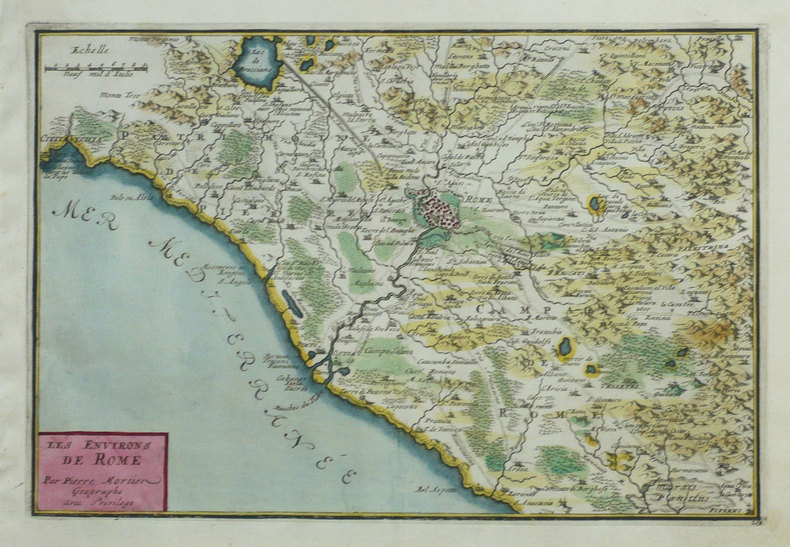
FER (Nicolas de);
Les Environs de Rome.
Amsterdam Pierre Mortier 1702 230 x 340 mm.
Bookseller reference : LBW-1353
|
|
|
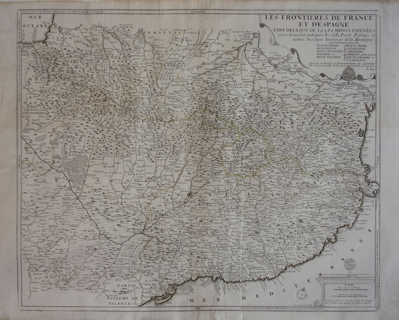
FER (Nicolas de).
Les frontières de France et d'Espagne, tant deça que de là les Monts Pirénées.
Paris, G. Danet, [circa 1725]. 501 x 608 mm.
Bookseller reference : LBW-3046
|
|
 Receive by email
 Download as PDF document
 RSS feed


