|
|
|
JAILLOT (Bernard Jean Hyacinthe).
La Province de Berry. La généralité de Bourges, où sont les eslections de Bourges, d'Yssoudun, de Châteauroux, du Blanc, de La Chastre, de St. Amand et de La Charité.
Paris, chez l'auteur, 1707. 461 x 671 mm.
Referentie van de boekhandelaar : LBW-413
|
|
|
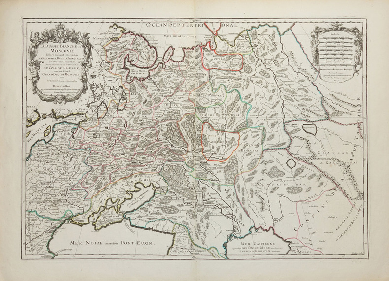
JAILLOT (Alexis-Hubert) & SANSON d'ABBEVILLE (Nicolas).
La Russie blanche ou Moscovie divisée suivant l'estendüe des royaumes, duchés, principautés, provinces et peuples qui sont présentement sous la domination du Czar de Russie, connû sous le nom de grand duc de Moscovie.
Paris, H. Jaillot, 1717. 450 x 645 mm.
Referentie van de boekhandelaar : LBW-2261
|
|
|
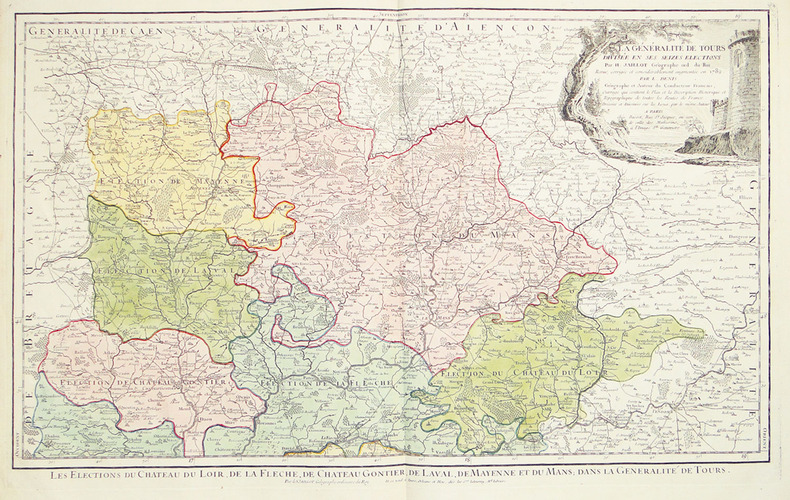
JAILLOT (Alexis-Hubert).
La Généralité de Tours divisée en ses seizes élections. Revue, corrigée et considérablement augmentée en 1782.
Paris, Basset, 1782. 458 x 739 mm.
Referentie van de boekhandelaar : LBW-2734
|
|
|
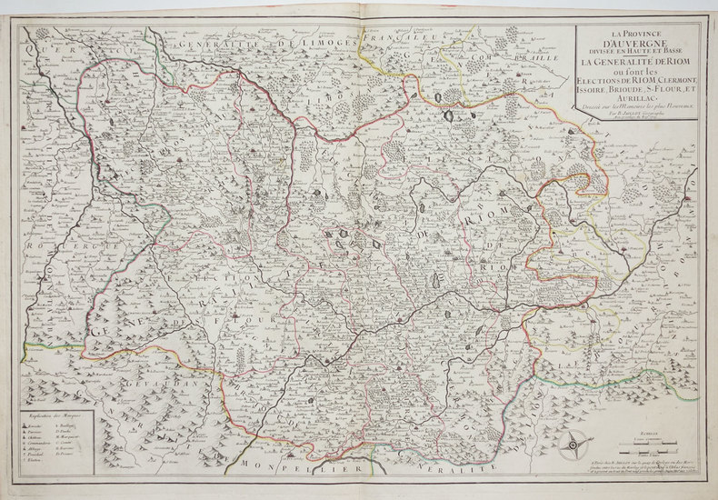
JAILLOT (Bernard Jean Hyacinthe).
La Province d'Auvergne divisée en Haute et Basse. La généralité de Riom où sont les élections de Riom, Clermont, Issoire, Brioude, S. Flour, et Aurillac.
Paris, B. Jaillot, 1715. 469 x 709 mm.
Referentie van de boekhandelaar : LBW-3323
|
|
|
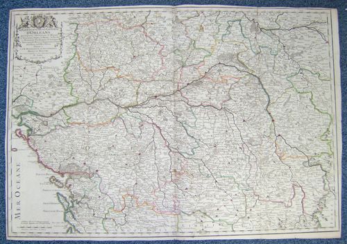
JAILLOT, B.
Le Gouvernement Général d'Orléans [ Carte ] qui comprend l'Orléanois, le Blaisois, la Touraine, l'Anjou, le Maine, le Perche, la Beauce, le Vendosmois, le Gastinois, le Nivernois, le Berry, l'Angoumois, l'Aunis & le Haut et le Bas Poitou.
Le Gouvernement Général d'Orléans [ Carte ] qui comprend l'Orléanois, le Blaisois, la Touraine, l'Anjou, le Maine, le Perche, la Beauce, le Vendosmois, le Gastinois, le Nivernois, le Berry, l'Angoumois, l'Aunis & le Haut et le Bas Poitou, dedié à S.A.R. Monseigneur le Duc d'Orléans Regent du Royaume, carte au format 778 x 545 mm., frontière des provinces rehaussées en couleurs, Chez le Sieur Jaillot, joignant les Grands Augustins, Paris, 1721
Referentie van de boekhandelaar : 26468
|
|
|
JAILLOT (Bernard Jean Hyacinthe).
Les eslections de Tours, d'Amboise, de Loches, de Richelieu, de Loudun, de Chinon, de Baugé, de Saumur, de Montreuil Bellay et d'Angers, dans la généralité de Tours.
Paris, Sr. Jaillot, 1709. 455 x 736 mm.
Referentie van de boekhandelaar : LBW-395
|
|
|
JAILLOT (Bernard Jean Hyacinthe).
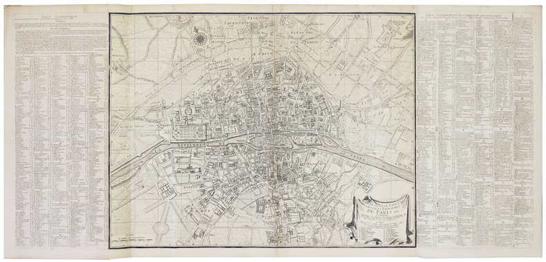
Plan de la ville, cité, université, et faubourgs de Paris.
Paris, Sr. Jaillot, [circa 1735]. En trois feuilles jointes de 470 x 1030 mm.
Referentie van de boekhandelaar : LBW-848
|
|
|
JAILLOT.
Postcharte von Frankreich auf das Jahr 1787 durch Jaillot.
(Paris ?), ca. 1800. 61,5x54 cm. Engraved postal-map, 2 cartouches and with German text. Place-names in French. Lightly browned. Traces of folding.
Referentie van de boekhandelaar : 25396
|
|
|
JAILLOT Géographe Ordinaire du Roy
Généralité de La Rochelle divisée en Cinq Elections Sçavoir La Rochelle dans le Pays d'Aunis, St Jean d'Angély, Saintes, Marennes en Saintonges, Cognac en Angoumois. [ Carte 72 x 52 cm de 1722 ]
Dressée sur les Mémoires les plus nouveaux par le Sr. Jaillot Géographe Ordinaire du Roy 1722, 1 carte au format 72 x 52 cm, frontières rehaussées en couleurs, Chez l'Auteur, le Sr. Jaillot, Géographe ordinaire du Roy joignant les Grands Augustins, aux 2 Globes, Paris, 1722 Avec l'Isle de Ré et l'Isle d'Oléron (mouill. en tête, petit accroc sans mq. en marge en queue, petit frott. central). Français

|
|
|
JAILLOT, B.
Le Gouvernement Général d'Orléans [ Carte ] qui comprend l'Orléanois, le Blaisois, la Touraine, l'Anjou, le Maine, le Perche, la Beauce, le Vendosmois, le Gastinois, le Nivernois, le Berry, l'Angoumois, l'Aunis & le Haut et le Bas Poitou.
Le Gouvernement Général d'Orléans [ Carte ] qui comprend l'Orléanois, le Blaisois, la Touraine, l'Anjou, le Maine, le Perche, la Beauce, le Vendosmois, le Gastinois, le Nivernois, le Berry, l'Angoumois, l'Aunis & le Haut et le Bas Poitou, dedié à S.A.R. Monseigneur le Duc d'Orléans Regent du Royaume, carte au format 778 x 545 mm., frontière des provinces rehaussées en couleurs, Chez le Sieur Jaillot, joignant les Grands Augustins, Paris, 1721 Etat satisfaisant (anc. mouill. importante mais assez discrète). Rare. Prix en l'état. Français

|
|
|
JAILLOT, Bernard Antoine
Gouvernement Général de Guienne et Gascogne dédié au Roy, Dressé sur les Mémoires et Nouvelles Observations de Messieurs de l'Accadémie Royalle des Sciences. [ Carte - Partie Nord ]
Gouvernement Général de Guienne et Gascogne dédié au Roy, Dressé sur les Mémoires et Nouvelles Observations de Messieurs de l'Accadémie Royalle des Sciences, par son très humble et très Obeissant, très fidel sujet et Serviteur Bernard Antoine Jaillot, Geogr. Ordr. de Sa Majesté, Quay des Grands Augustins, carte au format 100 x 50,5 cm, en deux feuilles jointes, frontières et villes rehaussée à l'aquarelle, Paris, 1733 Partie Nord seule (en deux feuilles) de la Carte de la Gascogne en 4 feuilles. Elle se développe de l'Isle de Ré à Biscarosse et de Montluçon de Bourbonnais à Marvejols. Bon état. Français

|
|
|
JAILLOT.
Postcharte von Frankreich auf das Jahr 1787 durch Jaillot.
(Paris ?), ca. 1800. 61,5x54 cm. Engraved postal-map, 2 cartouches and with German text. Place-names in French. Lightly browned. Traces of folding.
|
|
|
JAIS Pierre - LEBEL Michel
Tout le monde peut jouer au Bridge. Illustr?.
Broch?. 190 pages.
|
|
|
Jakubicska, Stephan.
Neuester Grundriss der Haupt und Residenzstadt Wien und der Umliegenden Gegenden [...]. Vienne et ses Environs. Wien, Artaria und Comp., 1803.
635 x 1302 mm. Mehrfarbige Kupferstichkarte, 44 Segmente auf Leinen aufgezogen mit Legende auf der linken Seite. Gefaltet in marmoriertem Umschlag und Schuber der Zeit mit goldgepr. Rückenschildchen "Grundriss von Wien". Der "inhaltlich vorzügliche" (Austria Picta) Grundrissplan von Wien, hier im seltenen Mehrfarben-Kupferstichdruck. Erstmals 1789 erschienen und noch mehrfach wiederaufgelegt. "Unter den Karten, die Artaria und Comp. [...] verlegte, bildet die von Stephan Jakubicska gezeichnete und Sebastian Mansfeld gestochene Umgebungskarte von Wien zweifelsohne den qualitativen Höhepunkt [...] Als Grundlage für die Arbeit dienten zweifelsohne die entsprechenden Sektionen der sog. Josephinischen Landesaufnahme [...] Es handelt sich hiermit um die einzige Karte, die auf Grund der streng geheimgehaltenen Josephinischen Landesaufnahme entworfen und im gleichen Maßstab (1:28.800) und in der gleichen Ausführung (Geländedarstellung) wie diese an die Öffentlichkeit gelangte [...] Jakubicskas Karte stellt jedoch keine bloße Kopie der Josephinischen Landesaufnahme dar: zum einen sind die [...] eingetretenen Veränderungen in der Topographie berücksichtigt [...], zum anderen hat Jakubicska die Karte nach Südosten orientiert, um im üblichen Quer-(Imperialfolio-)Format auch die kaiserliche Sommerresidenz Laxenburg unterzubringen" (Dörflinger, S. 285f.). - Mit den oft fehlenden ergänzenden Kartensegmenten von Baden und Trumau, die die Karte ab der dritten Ausgabe 1799 nach Südwesten erweiterten. Die vorliegende Neuausgabe von 1803 unterscheidet sich "von ihrer Vorgängerin durch einen geringfügig geänderten Titel [...], durch den zusätzlichen französischen Titel [...] und durch die Einzeichnung der 'Cavallerie Lager' und 'Infanterie Lager' bei Münchendorf", die in der Folgeausgabe von 1805 wieder entfernt wurden (Dörflinger, S. 371). - Alte hs. Bibliothekssignatur auf der Karte verso sowie auf dem Umschlag. Der Schuber unbedeutend berieben; die Karte ausgezeichnet erhalten. Dörflinger, Österr. Karten im frühen 19. Jh., S. 371. Vgl. Dörflinger, Österr. Karten des 18. Jhs., Art 11. Austria Picta, 108.
|
|
|
JALLIFFIER R & A BUCHNER
Cartes et croquis des campagnes de 1589 à 1789
Petit in 4 pleine toile rouge d’éditeur titre doré sur le premier plat faux-titre,titre illustré,30 cartes en couleurs,sommaires explicatifs en regard,texte sur 2 colonnes Garnier frères éditeur sans date, Bon exemplaire
Referentie van de boekhandelaar : 6199

|
|
|
JALLIFFIER (R.), BUCHNER (A.)
Cartes et croquis des campagnes de 1789 à nos jours. Avec sommaires explicatifs. 5e édition refondue et complétée.
Paris, Garnier Frères, s.d.; petit in-4, 61 pp., 60 cartes en coul., percaline ocre (rel. de l'éditeur).
Referentie van de boekhandelaar : 96254
|
|
|
JAMAS (Abel).
[MARNE] Champagne. Département de la Marne.
[vers 1896]. 395 x 260 mm.
Referentie van de boekhandelaar : LBW-8241

|
|
|
James, Henry
A Little Tour in France
A clean, unmarked book with a tight binding. Bluecover with pasted-down illustration. 9"w x 7 3/4"h. 256 pages.

|
|
|
James, Louis
Budapest (with free CD packed with travel tips)
No marks or inscriptions. No creasing to covers or to spine. A lovely clean crisp tight copy with bright covers and no bumping to corners. 192pp. The book comes with a free CD in a wallet attached to the rear cover, which is packed with practical travel tips - from hotels and eating out to foreign exchange and booking information.

|
|
|
JANSSON (Johannes).
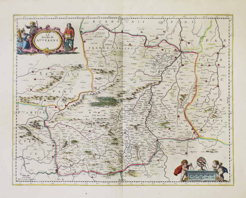
[AUVERGNE] Le duché de Auvergne.
Amsterdam, [1652-1658]. 380 x 494 mm.
Referentie van de boekhandelaar : LBW-5000
|
|
|
JANSSON (Johannes).
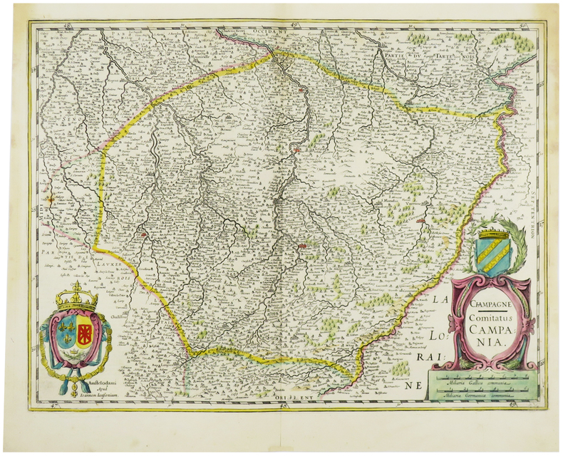
[CHAMPAGNE] Champagne - Comitatus Campania.
Amsterdam, [1633-1636]. 375 x 496 mm.
Referentie van de boekhandelaar : LBW-6202
|
|
|
JANNOT (J.-B.).
[CHOCOLAT MENIER] Le Tour du Monde en 120 images. Grand concours du Chocolat Menier.
Paris, Agence Française de Propagande, [1956]. 712 x 720 mm.
Referentie van de boekhandelaar : LBW-7927

|
|
|
JANSSON (Johannes).
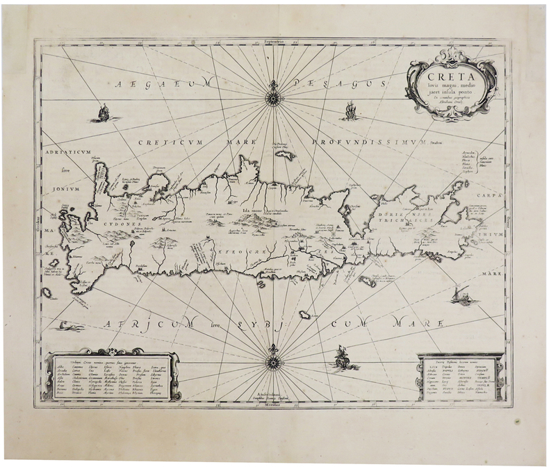
[CRETE] Creta iovis magni, medio jacet insula ponto.
[Amsterdam, 1657-1658]. 377 x 487 mm.
Referentie van de boekhandelaar : LBW-2753
|
|
|
JANSSON (Joannes).
[ESTONIE/LETTONIE] Nova totius Livoniae accurata descriptio.
[Amsterdam, 1658]. 389 x 514 mm.
Referentie van de boekhandelaar : LBW-2759

|
|
|
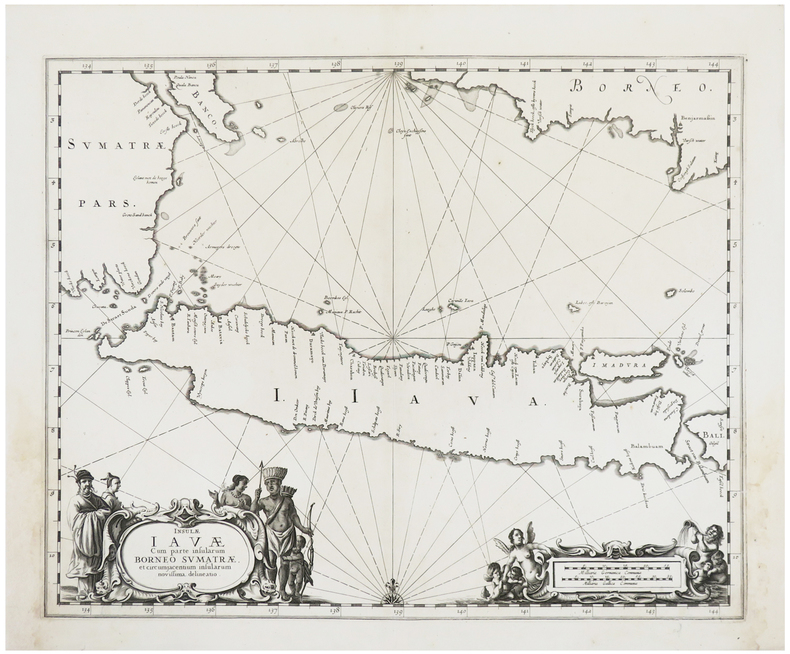
JANSSON (Johannes).
[JAVA] Insulæ Javæ cum parte insularum Borneo Sumatræ, et circumjacentium insularum novissima delineatio.
[Amsterdam, 1657-1658]. 420 x 516 mm.
Referentie van de boekhandelaar : LBW-2961
|
|
|
JANSSON (Johannes).
[LAC LÉMAN] Lacus Lemanni vicinorumq. locorum nova et accurata descriptio.
[Amsterdam, 1631-1633]. 372 x 492 mm.
Referentie van de boekhandelaar : LBW-8673

|
|
|
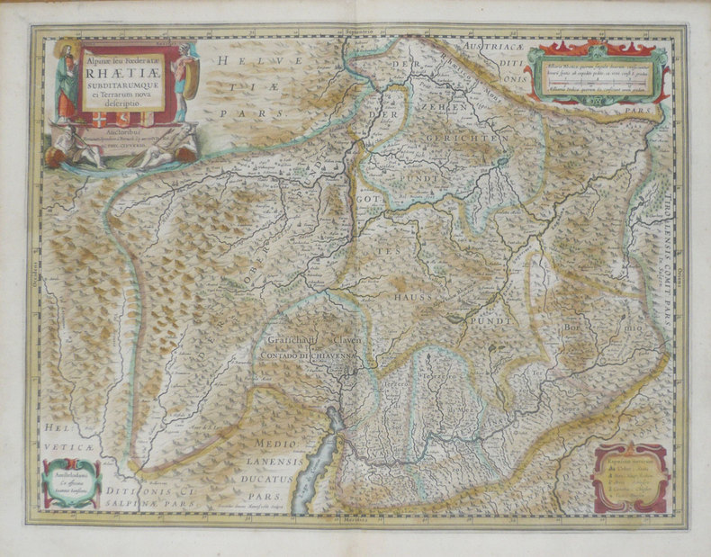
JANSSON (Joannes);
[LOMBARDIE] Alpinae seu foederatae Rhaetiae subditarumque ei terrarum nova descriptio.
Amsterdam vers 1640 397 x 488 mm.
Referentie van de boekhandelaar : LBW-1393
|
|
|
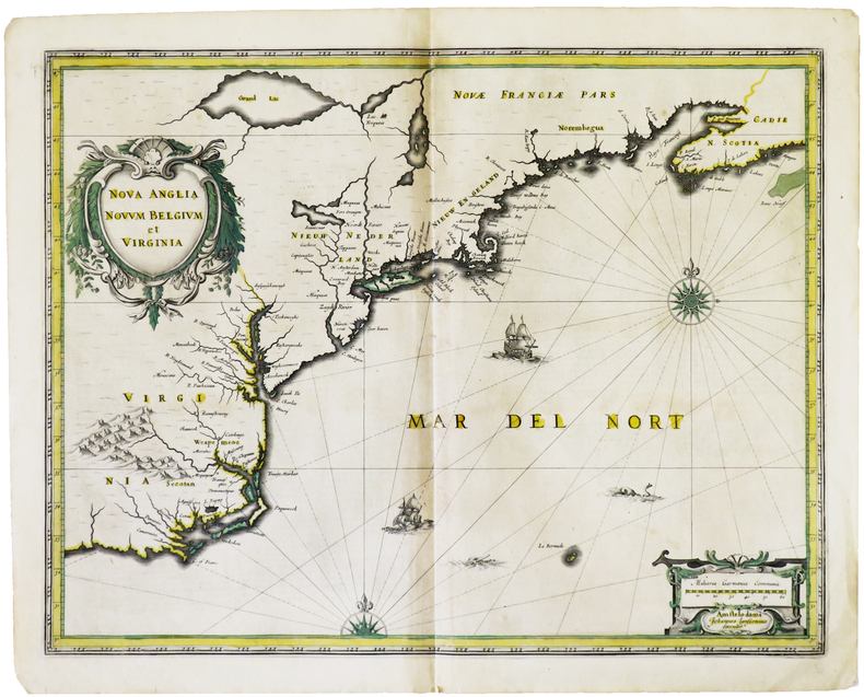
JANSSON (Johannes).
[MANHATTAN] Nova Anglia Novum Belgium et Virginia.
Amsterdam, [1636]. 387 x 503 mm.
Referentie van de boekhandelaar : LBW-4982
|
|
|
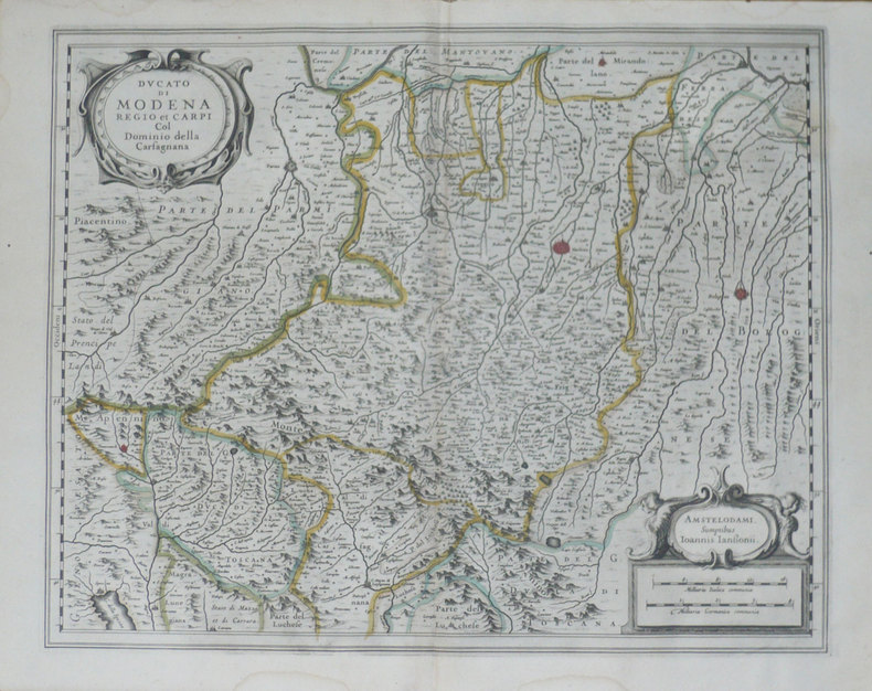
JANSSON (Joannes);
[MODENE] Ducato di Modena Regio et Carpi col dominio della Carfagnana.
Amsterdam 1638 397 x 488 mm.
Referentie van de boekhandelaar : LBW-1397
|
|
|
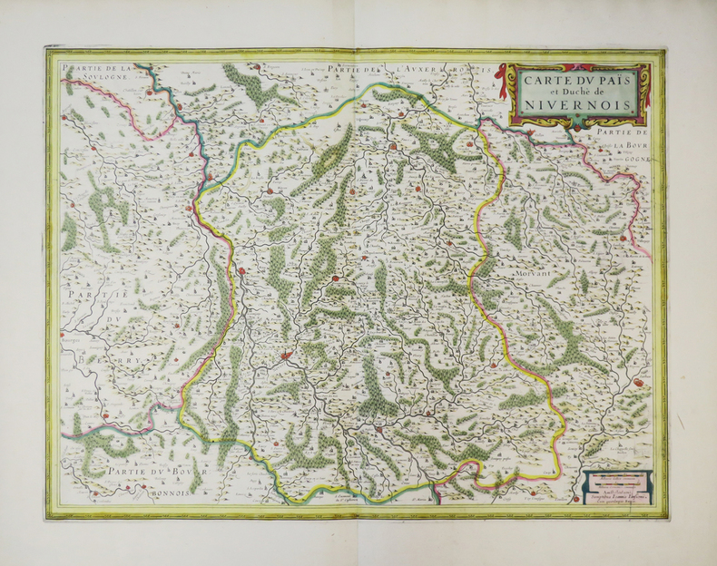
JANSSON (Joannes).
[NIVERNAIS] Carte du païs et duché de Nivernois.
Amsterdam, [circa 1650]. 376 x 495 mm.
Referentie van de boekhandelaar : LBW-3815
|
|
|
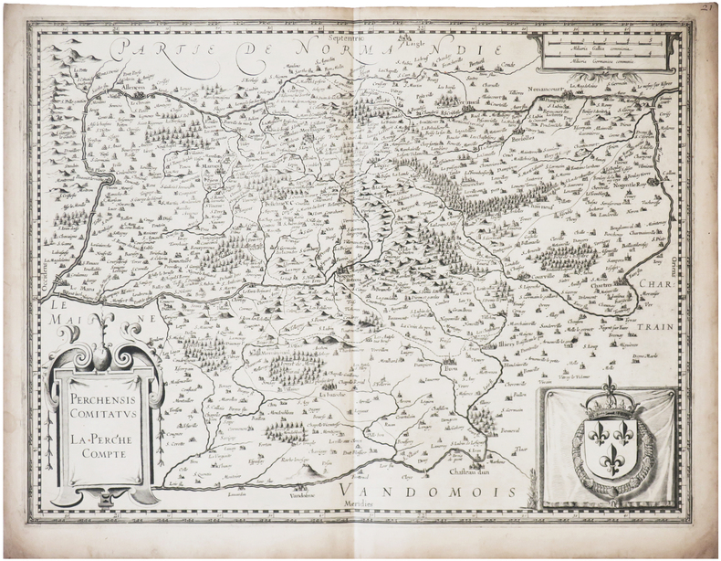
JANSSON (Johannes).
[PERCHE] Perchensis comitatus - La Perche compté.
[Amsterdam, circa 1630]. 368 x 491 mm.
Referentie van de boekhandelaar : LBW-8705
|
|
|
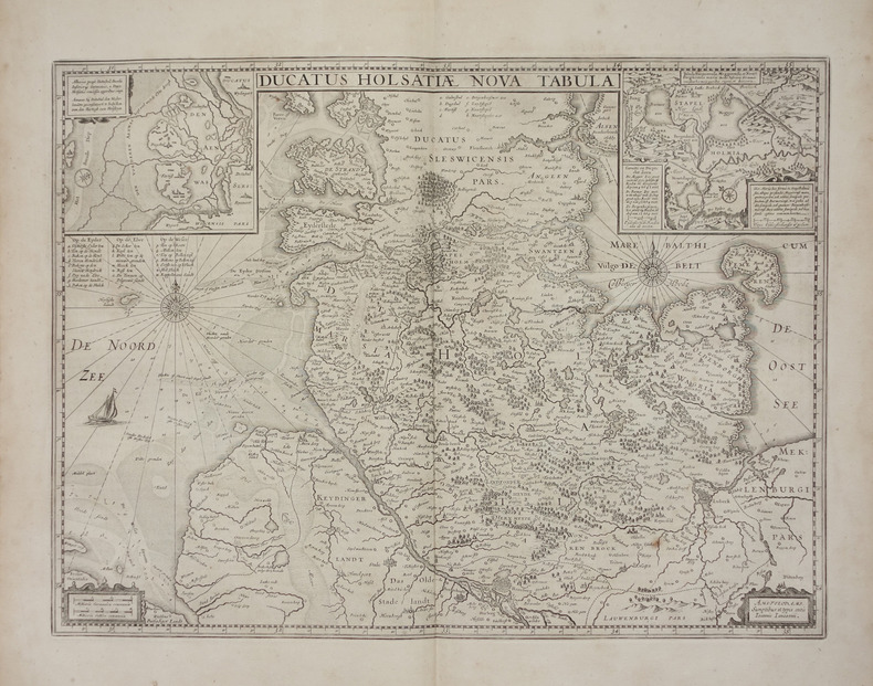
JANSSON (Joannes).
[SCHLESWIG-HOLSTEIN] Ducatus Holsatiae nova tabula.
Amsterdam, [1658]. 380 x 512 mm.
Referentie van de boekhandelaar : LBW-2846
|
|
|
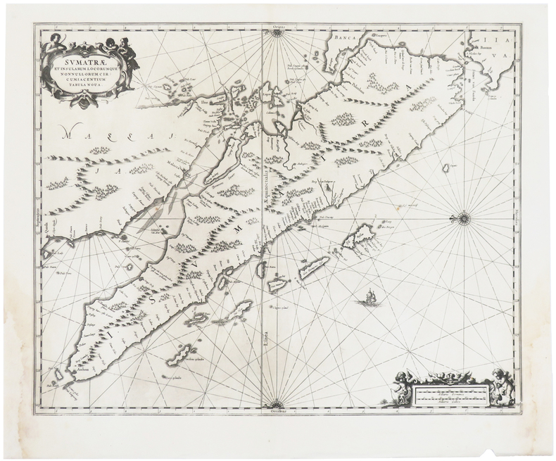
JANSSON (Johannes).
[SUMATRA] Sumatræ et insularum locorumque nonnullorum circumiacentium tabula nova.
[Amsterdam, 1657-1658]. 416 x 516 mm.
Referentie van de boekhandelaar : LBW-2960
|
|
|
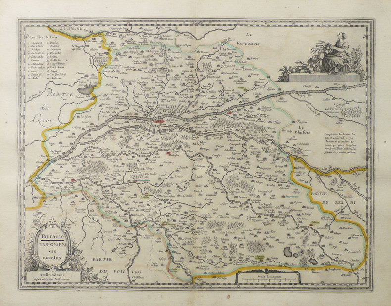
JANSSON (Joannes).
[TOURAINE] Touraine - Turonensis ducatus.
Amsterdam, [vers 1640]. 373 x 491 mm.
Referentie van de boekhandelaar : LBW-1480
|
|
|
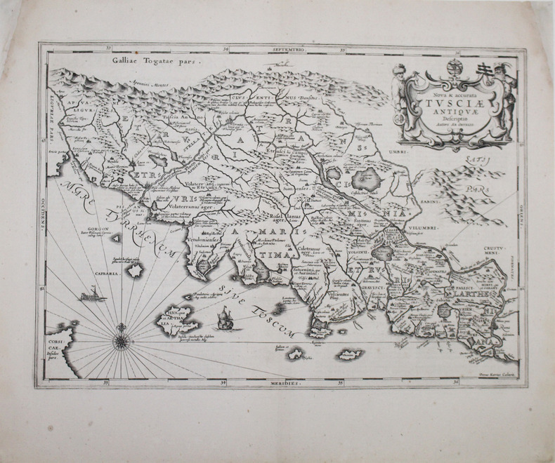
JANSSON (Johannes).
[TOSCANE] Nova & accurata Tusciæ antiquæ descriptio. Autore Ab. Ortelio.
[Amsterdam, 1657-1658]. 347 x 494 mm.
Referentie van de boekhandelaar : LBW-2962
|
|
|
JANSSONIUS Joannes (cartographe) - DUVAL Pierre, secrétaire de Monseigneur lévesque dAire
Carte de "LÉVESCHÉ D'AIRE" tracé par le Sieur Pierre du Val, secrétaire de Monseigneur lévesque dAire [circa 1680]
Amsterdam JANSSONIUS Joannes 1658 une carte ancienne gravée sur cuivre (Copper etching) en noir et couleurs d'Epoque. Format : 44,5 cm de haut x 55 cm de large, pli central vertical normal venant d'un atlas( horizontal centerfold), texte en latin au verso, carte ornée de 4 cartouches richement ornés de 20 angelots et dun paysan entrain de ramasser des pommes. carte double page gravée et colorée à la main d'époque, provenance : "Atlas novus, sive theatrum orbis terrarum : In quo Galliae, Helvetiae(Volume II)", 1658 Amsterdam JANSSONIUS Joannes Editeur,
Referentie van de boekhandelaar : 24912
|
|
|
JANVIER GÉOGRAPHE
CARTE DU ROYAUME DE HONGRIE DIVISÉ EN HAUTE ET BASSE HONGRIE,TRANSILVANIE, ESCLAVONIE ET CROATIE, dressé par le Sieur JANVIER GÉOGRAPHE - 1771
Paris Lattré 1771 carte ancienne colorée d'époque en vert , rouge et jaune, cartouche non coloré, gravée par Arrivet. Format total : 50 centimètres de haut par 39 centimètres de large, 1771 Paris Lattré Editeur,
Referentie van de boekhandelaar : 27418
|
|
|
JANET (G.);
Chasse au lasso.
Paris circa 1860 124 x 165 mm.
Referentie van de boekhandelaar : LBW-1256
|
|
|
JANTON Henri
Les emplois non postaux des timbres-poste des territoires français
Le Monde des Philathélistes 1956 1956, Le Monde des Philatélistes, in-12 agrafé de 8 pages, quelques figures noir et blanc exemplaire sur papier ordinaire n°232/500. | Etat : Bon état général (Ref.: J4097)
Referentie van de boekhandelaar : 6787
|
|
|
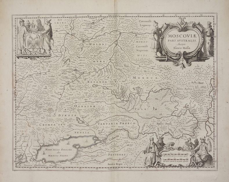
JANSSON (Joannes).
Moscoviae pars australis.
[Amsterdam, 1658]. 382 x 501 mm.
Referentie van de boekhandelaar : LBW-2661
|
|
|
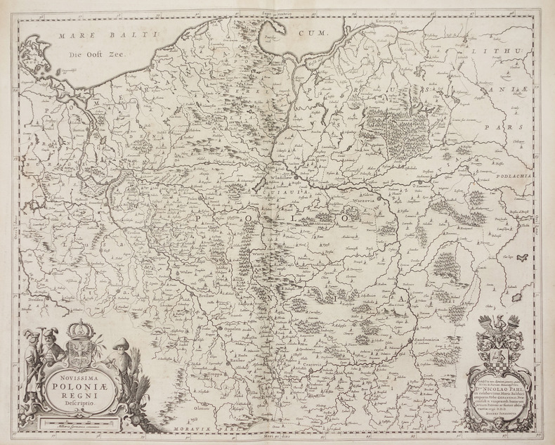
JANSSON (Joannes).
Novissima Poloniae regni descriptio.
[Amsterdam, 1658]. 432 x 539 mm.
Referentie van de boekhandelaar : LBW-2739
|
|
|
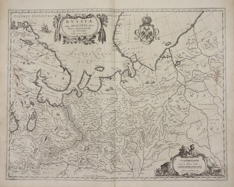
JANSSON (Joannes).
Russiae, vulgo Moscovia dictae, partes septentrionalis et orientalis.
[Amsterdam, 1658]. 438 x 540 mm.
Referentie van de boekhandelaar : LBW-2722
|
|
|
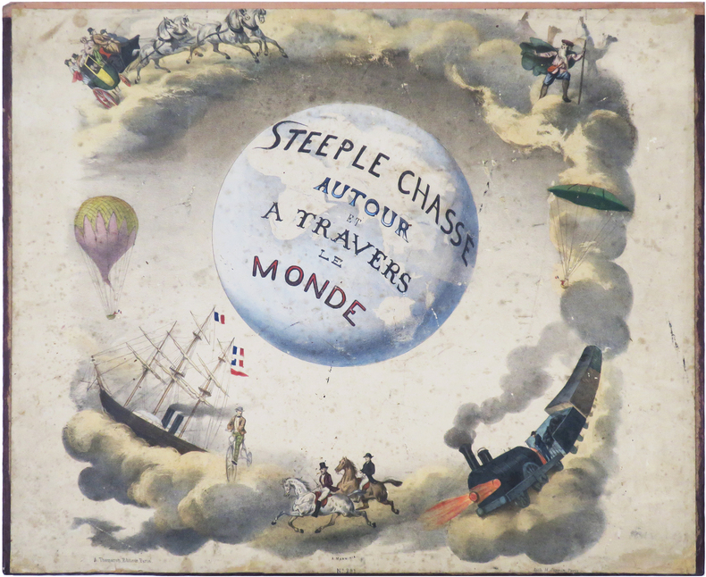
JANNIN (Nicolas Henri).
Steeple chasse autour et à travers le monde - Steeple chasse round the World.
Paris, A. Thomaron, [1860]. 40,5 x 80,7 cm, replié 40 x 48,8 cm, monté sur carton fort ; cabochons au dos du second plat.
Referentie van de boekhandelaar : LBW-8957
|
|
|
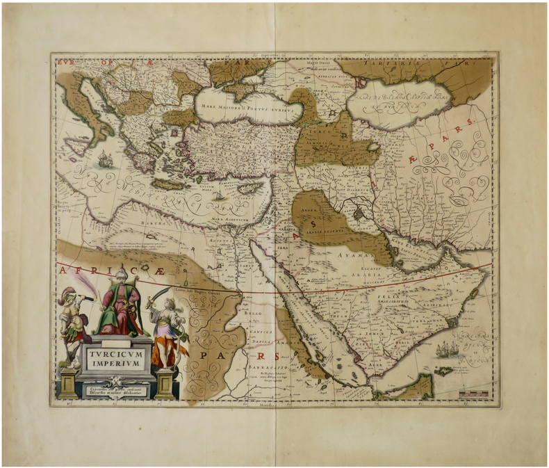
JANSSON (Johannes).
Turcicum Imperium.
[Amsterdam, circa 1640]. 410 x 517 mm.
Referentie van de boekhandelaar : LBW-6792
|
|
|
Jansson, Jan
Nobilis Fluvius Albis maximâ curâ, ex variis famosisque Auctoribus collectus, et in lucem editus. Zweigeteilte in Kupfer gestochene Elbkarte auf 1 Blatt.
[Frankfurt am Main, Merian, 1637]. Je Darstellung 17,5 x 51,5 cm. Fachmännisch gerahmt 56,5 x 65,5 cm (Flachgoldleiste 3,5 cm breit).
Referentie van de boekhandelaar : 84923

|
|
|
JANSSONIUS Johannes (1588-1664)
Aegyptus Antiqua divisa in Nomos. Authore P. Duval Abbeviliense…
Orientata con il Nord a destra, la mappa raffigura nel dettaglio la regione compresa tra la valle del Nilo e il Mar Rosso. Dall'Atlas MajorDoppio cartiglio, uno per il titolo e uno per la dedica in francese a "A Monsieur Monsieur Doviat Sgr. de Montreuille, Con.er du Roy, et Maistre Ordinaire en sa Chambre des Comptes Par son Très humble et obéisant Serviteur P. Duval Géographe de sa Maiesté". Johannes Janssonius, figlio dell'editore di Arnhem Jan Janssen, sposò Elisabeth Hondius, figlia di Jodocus Hondius, ad Amsterdam nel 1612. Dopo il suo matrimonio, si stabilì in questa città come libraio ed editore di materiale cartografico. Nel 1618 si stabilì ad Amsterdam accanto alla libreria di Willem Jansz. Blaeu, entrando in una seria competizione. Le sue attività non riguardavano solo la pubblicazione di atlanti e libri, ma anche di mappe singole e un vasto commercio di libri con filiali a Francoforte, Danzica, Stoccolma, Copenaghen, Berlino, Koningsbergen, Ginevra e Lione. Nel 1631 iniziò a pubblicare atlanti insieme a Henricus Hondius. Nei primi anni 1640 Henricus Hondius lasciò l'attività di pubblicazione di atlanti completamente a Janssonius. La concorrenza con Joan Blaeu, figlio e successore di Willem, nella produzione di atlanti spinse Janssonius ad ampliare il suo Atlas Novus finalmente in un'opera di sei volumi, in cui furono inseriti un atlante marino e un atlante del Vecchio Mondo. Dopo la morte di Joannes Janssonius, il negozio e la casa editrice furono continuati dagli eredi sotto la direzione di Johannes van Waesbergen (c. 1616-1681), genero di Joannes Janssonius. Le matrici degli atlanti di Janssonius furono in seguito vendute a Schenk e Valck. Map oriented with north on the right. It presents a colorful and detailed picture of the region between the fertile Nile River valley and the Red Sea. The map is adorned with a strapwork title cartouche with a credit to Pierre du Val. Includes a note in a decorative cartouche: "A Monsieur Monsieur Doviat Sgr. de Montreuille, Con.er du Roy, et Maistre Ordinaire en sa Chambre des Comptes Par son Très humble et obéisant Serviteur P. Duval Géographe de sa Maiesté".Published in Janssonius' Atlas Major. Johannes Janssonius (Arnhem, 1588-1664), son of the Arnhem publisher Jan Janssen, married Elisabeth Hondius, daughter of Jodocus Hondius, in Amsterdam in 1612. After his marriage, he settled down in this town as a bookseller and publisher of cartographic material. In 1618 he established himself in Amsterdam next door to Blaeu’s book shop. He entered into serious competition with Willem Jansz. Blaeu.. His activities not only concerned the publication of atlases and books, but also of single maps and an extensive book trade with branches in Frankfurt, Danzig, Stockholm, Copenhagen, Berlin, Koningsbergen, Geneva, and Lyon. In 1631 he began publishing atlases together with Henricus Hondius. In the early 1640s Henricus Hondius left the atlas publishing business completely to Janssonius. Competition with Joan Blaeu, Willem’s son and successor, in atlas production prompted Janssonius to enlarge his Atlas Novus finally into a work of six volumes, into which a sea atlas and an atlas of the Old World were inserted. After the death of Joannes Janssonius, the shop and publishing firm were continued by the heirs under the direction of Johannes van Waesbergen (c. 1616-1681), son-in-law of Joannes Janssonius. The copperplates from Janssonius’s atlases were afterwards sold to Schenk and Valck. Van der Krogt 1

|
|
|
JANSSONIUS Johannes (1588-1664)
Antiqua Urbis Roma Imago Accuratissima…
Grande pianta della città stampata su due fogli, ispirata alla celebre carta del Pirro Ligorio del 1561.Questa straordinaria ricostruzione di Roma durante il regno di Augusto, arricchita da una cospicua legenda con 269 richiami, costituisce il lavorò più ambizioso contenuto nel Civitates Orbis Terrarum, del quale oltretutto è una delle sole tre mappe a doppio foglio. Incisione in rame, finemente colorata a mano, in eccellente stato di conservazione. Opera tratta dal "Theatrum praecipuarum urbium" celebre teatro delle città del Janssonius, sullo stile del "Civitates Orbis Terrarum" di Braun & Hogenberg. La raccolta, pubblicata ad Amsterdam tra il 1652 ed il 1657, contiene 500 tavole raffiguranti città di ogni parte del mondo. Contrariamente al lavoro degli acerrimi rivali Blaeu, Janssonius si servì per la realizzazione dell'opera delle lastre di precedenti cartografi ed editori. In particolare nel 1653 egli acquisto da Abraham Hogenberg le lastre del "Civitates orbis Terrarum" che incorporò nella sua opera, ristampandole, con alcune modifiche. Per le piante delle città olandesi, ordinò delle nuove lastre basate sull'atlante che Johannes Blaeu diede alla luce nel 1649. Per molte delle opere contenute nel 5° volume, quello dedicato all'Italia e denominato "Theatrum celebriorum urbium Italiae..", si servì delle lastre realizzate da Jodocus Hondius per l'opera "Italia Hodierna.." del 1627. Nella pianta di Roma antica cambia il decoro del cartiglio in alto, mentre in basso ai lati del cartiglio sono aggiunte dei personaggi. Incisione in rame, finemente colorata a mano, in ottimo stato di conservazione. Map of the city printed on two sheets, inspired by the famous work by Pirro Ligorio, printed by Michele Tramezzino in 1561. This extraordinary reconstruction of Rome during the reign of Augustus, enriched by a conspicuous legend with 269 references, constitutes the most ambitious work contained in the Civitates Orbis Terrarum, of which it is one of only three double-sheet maps. Work taken from the "Theatrum praecipuarum urbium" famous theatre of the cities of Janssonius, in the style of Braun & Hogenberg's "Civitates Orbis Terrarum". The collection, published in Amsterdam between 1652 and 1657, contains 500 plates depicting cities from all over the world. Janssonius used the plates of previous cartographers and publishers to create the work. In particular, in 1653 he bought the plates of the "Civitates orbis Terrarum" from Abraham Hogenberg, who incorporated them into his work and reprinted them with some modifications. For many of the works contained in the 5th volume, the one dedicated to Italy and called "Theatrum celebriorum urbium Italiae...", he used the plates made by Jodocus Hondius for the work "Italia Hodierna..." of 1627. In the map of ancient Rome the decoration of the cartouche at the top changes, while at the bottom at the sides of the cartouche are added characters. Copper engraving, finely coloured by hand, in excellent condition.

|
|
|
JANSSONIUS Johannes (1588-1664)
Argonautica
Carta storico/geografica tratta dall'atlante di Georgius HORNIUS "Accuratissima orbis antiqui delineatio sive Geographia vetus sacra & profana", per la prima volta edito nel 1653. Le carte derivano da quelle di Ortelius, pubblicata nel "Parergon". Mappa dei viaggi di Giasone e degli Argonauti, mostra il Mediterraneo e il Mar Nero con specifico riferimento al percorso dell'Argo, seguendo principalmente la linea temporale e la geografia delle Argonautiche di Apollonio di Rodi. Molti degli elementi più fantastici del mito sono anche tracciati, tra cui le Symplegades o 'Rocce Erranti' all'imboccatura del Bosforo del Mar Nero, i mostri Scilla e Cariddi su entrambi i lati dello Stretto di Messina, l'isola di Eea casa della strega Circe al largo della costa napoletana, l'isola della ninfa Calipso al largo della costa calabrese meridionale, il paradisiaco Giardino delle Esperidi sulla costa settentrionale dell'Africa, e le città della Colchide sul Mar Nero, casa della futura moglie di Giasone, Medea, e del famoso Vello d'oro. Johannes Janssonius, figlio dell'editore di Arnhem Jan Janssen, sposò Elisabeth Hondius, figlia di Jodocus Hondius, ad Amsterdam nel 1612. Dopo il suo matrimonio, si stabilì in questa città come libraio ed editore di materiale cartografico. Nel 1618 si stabilì ad Amsterdam accanto alla libreria di Willem Jansz. Blaeu, entrando in una seria competizione. Le sue attività non riguardavano solo la pubblicazione di atlanti e libri, ma anche di mappe singole e un vasto commercio di libri con filiali a Francoforte, Danzica, Stoccolma, Copenaghen, Berlino, Koningsbergen, Ginevra e Lione. Nel 1631 iniziò a pubblicare atlanti insieme a Henricus Hondius. Nei primi anni 1640 Henricus Hondius lasciò l'attività di pubblicazione di atlanti completamente a Janssonius. La concorrenza con Joan Blaeu, figlio e successore di Willem, nella produzione di atlanti spinse Janssonius ad ampliare il suo Atlas Novus finalmente in un'opera di sei volumi, in cui furono inseriti un atlante marino e un atlante del Vecchio Mondo. Dopo la morte di Joannes Janssonius, il negozio e la casa editrice furono continuati dagli eredi sotto la direzione di Johannes van Waesbergen (c. 1616-1681), genero di Joannes Janssonius. Le matrici degli atlanti di Janssonius furono in seguito vendute a Schenk e Valck. Incisione in rame, finemente colorata a mano, in buone condizioni. Map taken from the HORNIUS, Georgius"Accuratissima orbis antiqui delineatio sive Geographia vetus sacra & profana" first published in Amsterdam in 1653. After Ortelius' map published in the "Parergon". Map of the journeys of Jason and the Argonauts, shows the Mediterranean and Black Sea with specific reference to the path of the Argo, mainly following the timeline and geography of Apollonius of Rhodes' Argonautica. Many of the myth's more fantastical elements are also plotted, including the Symplegades or 'Wandering Rocks' at the Bosporus mouth of the Black Sea, the monsters Scylla and Charybdis on either side of the Straits of Messina, the island of Aeaea home of the witch Circe off the Neapolitan coast, the island of the nymph Calypso off the southern Calabrian coast, the paradisiacal Garden of the Hesperides on the northern coast of Africa, and the cities of Colchis on the Black Sea, home of Jason's future wife Medea and the famous Golden Fleece. Johannes Janssonius (Arnhem, 1588-1664), son of the Arnhem publisher Jan Janssen, married Elisabeth Hondius, daughter of Jodocus Hondius, in Amsterdam in 1612. After his marriage, he settled down in this town as a bookseller and publisher of cartographic material. In 1618 he established himself in Amsterdam next door to Blaeu’s book shop. He entered into serious competition with Willem Jansz. Blaeu.. His activities not only concerned the publication of atlases and books, but also of single maps and an extensive book trade with branches in Frankfurt, Danzig, Stockholm, Copenhagen, Berlin, Koningsbergen, Geneva, and Lyon. In 1631 he began publishing atlases together with Henricus Hondius. In the early 1640s Henricus Hondius left the atlas publishing business completely to Janssonius. Competition with Joan Blaeu, Willem’s son and successor, in atlas production prompted Janssonius to enlarge his Atlas Novus finally into a work of six volumes, into which a sea atlas and an atlas of the Old World were inserted. After the death of Joannes Janssonius, the shop and publishing firm were continued by the heirs under the direction of Johannes van Waesbergen (c. 1616-1681), son-in-law of Joannes Janssonius. The copperplates from Janssonius’s atlases were afterwards sold to Schenk and Valck. Copperplate with fine later hand colour, in good conditions.

|
|
|
JANSSONIUS Johannes (1588-1664)
Erythraei Sive Rubri Maris Periplus
Carta storico/geografica tratta dall'atlante di Georgius HORNIUS "Accuratissima orbis antiqui delineatio sive Geographia vetus sacra & profana", per la prima volta edito nel 1653. Le carte derivano da quelle di Ortelius, pubblicata nel "Parergon". Un'insolita e attraente mappa del 1658 dell'Oceano Indiano, o Mare Eritreo, come era nell'antichità. Composta da Jan Jansson ispirandosi alla carta molto simile del 1597 pubblicata da A. Ortelius nel suo Parergon. Copre dall'Egitto e la valle del Nilo verso est passando per l'Arabia e l'India, fino al sud-est asiatico e Java. Cartograficamente, India, Arabia e Africa corrispondono approssimativamente alle convenzioni del periodo. Il sud-est asiatico è meno riconoscibile, ma la penisola malese, Sumatra e Giava sono chiaramente indicate. La maggior parte dei nomi dei luoghi utilizzati sono derivati da Tolomeo, che ha basato la sua descrizione della regione sulle registrazioni delle conquiste di Alessandro Magno. Due mappe più piccole nei quadranti superiore sinistro e destro sono di eccezionale interesse. La carta in alto a sinistra mostra l'Africa nord-occidentale ed è intitolata "Annonis Periplus". Questo è un riferimento alle leggendarie spedizioni del re cartaginese Hanno, che si dice sia stato il primo ad accedere all'Oceano Indiano navigando intorno alla punta meridionale dell'Africa. Per inciso, durante il viaggio, si dice anche che sia stato il primo a domare un leone. La carta in alto a destra mostra le regioni polari settentrionali come erano percepite all'epoca. Una massa che copre la calotta polare è identificata come "Hyperborea". A sinistra di questa, più o meno dove si trova oggi il Nord America, appare l'isola di Atlantide; mentre la Scizia, l'Europa (Thule) e l'Asia sono sulla destra. La Groenlandia e forse l'Islanda appaiono in basso. Questa mappa ha lo scopo di indicare la possibilità di un passaggio a nord-est verso l'Asia, che all'epoca era attivamente ricercato dai navigatori olandesi, inglesi e russi. Johannes Janssonius, figlio dell'editore di Arnhem Jan Janssen, sposò Elisabeth Hondius, figlia di Jodocus Hondius, ad Amsterdam nel 1612. Dopo il suo matrimonio, si stabilì in questa città come libraio ed editore di materiale cartografico. Nel 1618 si stabilì ad Amsterdam accanto alla libreria di Willem Jansz. Blaeu, entrando in una seria competizione. Le sue attività non riguardavano solo la pubblicazione di atlanti e libri, ma anche di mappe singole e un vasto commercio di libri con filiali a Francoforte, Danzica, Stoccolma, Copenaghen, Berlino, Koningsbergen, Ginevra e Lione. Nel 1631 iniziò a pubblicare atlanti insieme a Henricus Hondius. Nei primi anni 1640 Henricus Hondius lasciò l'attività di pubblicazione di atlanti completamente a Janssonius. La concorrenza con Joan Blaeu, figlio e successore di Willem, nella produzione di atlanti spinse Janssonius ad ampliare il suo Atlas Novus finalmente in un'opera di sei volumi, in cui furono inseriti un atlante marino e un atlante del Vecchio Mondo. Dopo la morte di Joannes Janssonius, il negozio e la casa editrice furono continuati dagli eredi sotto la direzione di Johannes van Waesbergen (c. 1616-1681), genero di Joannes Janssonius. Le matrici degli atlanti di Janssonius furono in seguito vendute a Schenk e Valck. Incisione in rame, finemente colorata a mano, in buone condizioni. Map taken from the HORNIUS, Georgius"Accuratissima orbis antiqui delineatio sive Geographia vetus sacra & profana" first published in Amsterdam in 1653. After Ortelius' map published in the "Parergon". An unusual and attractive 1658 map of the Indian Ocean, or Erythraean Sea, as it was in antiquity. Composed by Jan Jansson after a similar 1597 map published by A. Ortelius in his Parergon. Covers from Egypt and the Nile valley eastward past Arabia and India, to Southeast Asia and Java. Cartographically, India, Arabia, and Africa roughly correspond to the conventions of the period. Southeast Asia is less recognizable, but the Malay Peninsula, Sumatra, and Java are clearly noted. Most of the place names used throughout are derived from Ptolemy, who himself based his description of the region heavily on records from Alexander the Great's conquests. Two smaller maps in the upper left and right quadrants are of exceptional interest. The upper left chart shows northwestern Africa and is titled 'Annonis Periplus.' This is a reference to the legendary expeditions of the Carthaginian King Hanno, said to have been the first to access the Indian Ocean by sailing around the southern tip of Africa. Incidentally, en route, he is also said to have been the first to tame a lion. The upper right chart shows the northern polar regions as they were perceived at the time. A landmass covering the polar ice cap is indentified as 'Hyperborea.' To the left of this, roughly where North America rests today, the island of Atlantis appears; while Scythia, Europe (Thule) and Asia are on the right. Greenland and possibly Iceland appear at the bottom. This map is intended to point out the possibility of a Northeast Passage to Asia, which was at the time being actively sought after by Dutch, English, and Russian navigators. Johannes Janssonius (Arnhem, 1588-1664), son of the Arnhem publisher Jan Janssen, married Elisabeth Hondius, daughter of Jodocus Hondius, in Amsterdam in 1612. After his marriage, he settled down in this town as a bookseller and publisher of cartographic material. In 1618 he established himself in Amsterdam next door to Blaeu’s book shop. He entered into serious competition with Willem Jansz. Blaeu.. His activities not only concerned the publication of atlases and books, but also of single maps and an extensive book trade with branches in Frankfurt, Danzig, Stockholm, Copenhagen, Berlin, Koningsbergen, Geneva, and Lyon. In 1631 he began publishing atlases together with Henricus Hondius. In the early 1640s Henricus Hondius left the atlas publishing business completely to Janssonius. Competition with Joan Blaeu, Willem’s son and successor, in atlas production prompted Janssonius to enlarge his Atlas Novus finally into a work of six volumes, into which a sea atlas and an atlas of the Old World were inserted. After the death of Joannes Janssonius, the shop and publishing firm were continued by the heirs under the direction of Johannes van Waesbergen (c. 1616-1681), son-in-law of Joannes Janssonius. The copperplates from Janssonius’s atlases were afterwards sold to Schenk and Valck. Copperplate with fine later hand colour, in good conditions.

|
|
|
JANSSONIUS Johannes (1588-1664)
Insularum Britannicarum acurata delineatio ex Geographicis Conatibus Abrahami Ortelii
Mappa realizzata da Jansson delle antiche Isole Britanniche, così come si presentavano durante il terzo e il quarto secolo, che include un cartiglio decorativo con il titolo, navi a vela e un mostro marino.Sono presenti nomi di storici siti d'epoca romana, tra cui il muro di Adriano e il muro di Pio. Incisione di Peter Van Den Keere, preparata da Ortelius. Ortelius divide l'intera isola in Britannia Maior (le attuali Inghilterra, Galles e Cornovaglia) e Britannia Minor (Scozia). Joannes Janssonius, figlio dell'editore di Arnhem Jan Janssen, sposò Elisabeth Hondius, figlia di Jodocus Hondius, ad Amsterdam nel 1612. Dopo il suo matrimonio, si stabilì in questa città come libraio ed editore di materiale cartografico. Nel 1618 si stabilì ad Amsterdam accanto alla libreria di Willem Jansz. Blaeu, entrando in una seria competizione. Le sue attività non riguardavano solo la pubblicazione di atlanti e libri, ma anche di mappe singole e un vasto commercio di libri con filiali a Francoforte, Danzica, Stoccolma, Copenaghen, Berlino, Koningsbergen, Ginevra e Lione. Nel 1631 iniziò a pubblicare atlanti insieme a Henricus Hondius. Nei primi anni 1640 Henricus Hondius lasciò l'attività di pubblicazione di atlanti completamente a Janssonius. La concorrenza con Joan Blaeu, figlio e successore di Willem, nella produzione di atlanti spinse Janssonius ad ampliare il suo Atlas Novus finalmente in un'opera di sei volumi, in cui furono inseriti un atlante marino e un atlante del Vecchio Mondo. Dopo la morte di Joannes Janssonius, il negozio e la casa editrice furono continuati dagli eredi sotto la direzione di Johannes van Waesbergen (c. 1616-1681), genero di Joannes Janssonius. Le matrici degli atlanti di Janssonius furono in seguito vendute a Schenk e Valck. Scarce first state of Jansson's map of the Ancient British Isles as seen during the third and fourth centuries.. Includes decorative cartouche, sea monstersa and 7 sailing vessels. Roman place names as well as Hadrian's Wall and the Wall of Pius appear on the map, identifying the era represented. Engraved by Peter Van Den Keere. Prepared by A.Ortelius. Ortelius divides the entire island into Britannia Maior (present day England, Wales and Cornwall) and Britannia Minor (present day Scotland). Joannes Janssonius (Arnhem, 1588-1664), son of the Arnhem publisher Jan Janssen, married Elisabeth Hondius, daughter of Jodocus Hondius, in Amsterdam in 1612. After his marriage, he settled down in this town as a bookseller and publisher of cartographic material. In 1618 he established himself in Amsterdam next door to Blaeu’s book shop. He entered into serious competition with Willem Jansz. Blaeu.. His activities not only concerned the publication of atlases and books, but also of single maps and an extensive book trade with branches in Frankfurt, Danzig, Stockholm, Copenhagen, Berlin, Koningsbergen, Geneva, and Lyon. In 1631 he began publishing atlases together with Henricus Hondius. In the early 1640s Henricus Hondius left the atlas publishing business completely to Janssonius. Competition with Joan Blaeu, Willem’s son and successor, in atlas production prompted Janssonius to enlarge his Atlas Novus finally into a work of six volumes, into which a sea atlas and an atlas of the Old World were inserted. After the death of Joannes Janssonius, the shop and publishing firm were continued by the heirs under the direction of Johannes van Waesbergen (c. 1616-1681), son-in-law of Joannes Janssonius. The copperplates from Janssonius’s atlases were afterwards sold to Schenk and Valck.

|
|
|

 De zoekresultaten per email ontvangen
 Zoekresultaten downloaden als PDF
 RSS feed
 Permanente link


