|
|
|
Tozzi,MArio.
Piri Reis. Carta dell'Atlantico 1513.
<br/> STATO: USATO, COME NUOVO.<br/> TITOLO: Piri Reis. Carta dell'Atlantico 1513. <br/> AUTORE: Tozzi,MArio.<br/> CURATORE: Guida alla consultazione della carta.<br/> EDITORE: Progetto Editoriale Editions<br/> DATA ED.: 2002,<br/>
|
|
|
TRAIN (W.).
Spain and Portugal.
Sin lugar ni año (Siglo XIX), mapa grabado en acero, contornos coloreados, 20 x 24'5 cm.
|
|
|
TRAMEZINO o TRAMEZINI Francesco & Michele
Candido lectori. Haec est illa insignis insula Creta : in medio ponto sita, centum urbibus clara, ab incolis iam curete dict
Acquaforte e bulino, 1559, firmata e datata in lastra in basso. Magnifica prova, impressa su carta vergata coeva con filigrana “tre tulipani in un cerchio con stella” (Woodward 121 databile al 1558), con ampli margini, in perfetto stato di conservazione.Magnifica e rarissima carta geografica dell’isola di Creta, caratterizzata dalla curiosa ed inusuale rappresentazione del mare, inciso da marcate linee realizzate al bulino. Il risultato è quello di una mare vivo, probabilmente nel tentativo di rappresentarlo come agitato. La carta è la prima rappresentazione in rame dell’isola e segue il modello silografico di Matteo Pagano, realizzato a Venezia nel 1538. L’opera è datata 1559 ed è intagliata da Sebastiano dal Re. Il Tooley cita un esemplare della collezione Beans con la data 1554, ma ci sentiamo di asserire che si tratti di un refuso. Probabile invece che della mappa esista un esemplare del 1558, data l’evidente correzione della data nella lastra.Sebastiano di Re, alle volte latinizzato con il nome di Sebastianus a Regiubus, era originario di Chioggia come lui setto amava firmarsi con l’aggettivo Clodiensis. La sua attività calcografica si svolge principalmente a Roma tra il 1557 ed il 1563. La sua prima opera cartografica è una mappa di Roma, copia dell’incisione di Beatricetto edita dal Lafrery. Il suo nome è associato dal 1558 all’editore e mercante veneziano, ma attivo nella capitale, Michele Tramezzino, e di Pirro Ligorio. Successivamente lavora anche per il figlio del Salamanca e per Bartolomeo Faleti. Nel 1560 diviene membro della Congregazione dei Virtuosi al Pantheon.Tutte le opera cartografiche del Re sono relative al periodo 1557-1563 e sono relative alla collaborazione con il Tramezzino. Francesco e Michele Tramezzino, editori nativi di Venezia ma attivi in entrambe le città tra il 1526 ed il 1576. La loro bottega calcografica era rivale di quella, egemone, di Salamanca e Lafrery. Pertanto le mappe edite dalla tipografia Tramezzino ebbero una tiratura assolutamente ristretta.Bibliografia: a) Borroni Salvadori (1980): n. 113; Ruge (1904-16): I, n. 67.58 e IV, n. 90.115b; Wieder (1915): p. 29, n. 51; Alberti (2005): p. 15, n. 21; Mostra Bergamo (2016): n. 33; Tooley (1939): n. 174; Zacharakis (1992): n. 2153 & 2154; Zacharakis (2004): n. 14.Esemplari noti: Dillingen, Studienbibliothek; Firenze, Biblioteca Nazionale; Madrid, Biblioteca Nacional; Parigi, Bibliothèque Nationale; Roma, Alessandrina; Roma, Biblioteca Apostolica Vaticana; Rostock, Universitatsbibliothek. Etching and engraving, 1559, signed and dated in the plate at the bottom. Magnificent proof, printed on contemporary laid paper with watermark "three tulips in a circle with a star" (Woodward 121 dating back to 1558), with wide margins, in perfect condition.Magnificent and rare map of the island of Crete, characterized by the curious and unusual representation of the sea, engraved by strong lines built with the burin. The result is that of a sea vivo, probably in an attempt to represent it as agitated. The map is the first copper plate of Crete and follows the woodcut model by Matteo Pagano, made in Venice in 1538. The work is dated 1559 and is carved by Sebastiano del Re. Tooley cites an example of the collection Beans with the date 1554. Sebastiano di Re, sometimes Latinized as the Sebastianus to Regiubus, was a native of Chioggia as he liked to sign his septum with the adjective Clodiensis. Its activity is mainly intaglio in Rome between 1557 and 1563. His first work is a cartographic map of Rome, a copy of the engraving published by Beatricetto Lafrery. His name is associated, from 1558, with the editor and merchant Venetian, but active in the capital, Michele Tramezzino, and Pirro Ligorio. He later worked for the son of Salamanca and Bartolomeo Faleti. In 1560 he became a member of the Congregazione dei Virtuosi al Pantheon.All cartographic works by Di Re covered the period 1557-1563 and relate to the collaboration with Tramezzino. Francesco and Michele Tramezzino, editors native of Venice, but active in both cities between 1526 and 1576. Their workshop was rival of the hegemonic printers Salamanca and Lafrery. Therefore the maps published by the typography Tramezzino had a circulation absolutely restricted.An extremely rare and fascinating map of Crete.Literature: Borroni Salvadori (1980): n. 113; Ruge (1904-16): I, n. 67.58 e IV, n. 90.115b; Wieder (1915): p. 29, n. 51; Alberti (2005): p. 15, n. 21; Mostra Bergamo (2016): n. 33; Tooley (1939): n. 174; Zacharakis (1992): n. 2153 & 2154; Zacharakis (2004): n. 14.Known example: Dillingen, Studienbibliothek; Firenze, Biblioteca Nazionale; Madrid, Biblioteca Nacional; Parigi, Bibliothèque Nationale; Roma, Alessandrina; Roma, Biblioteca Apostolica Vaticana; Rostock, Universitatsbibliothek.

|
|
|
TRANIE CARMIGNANI
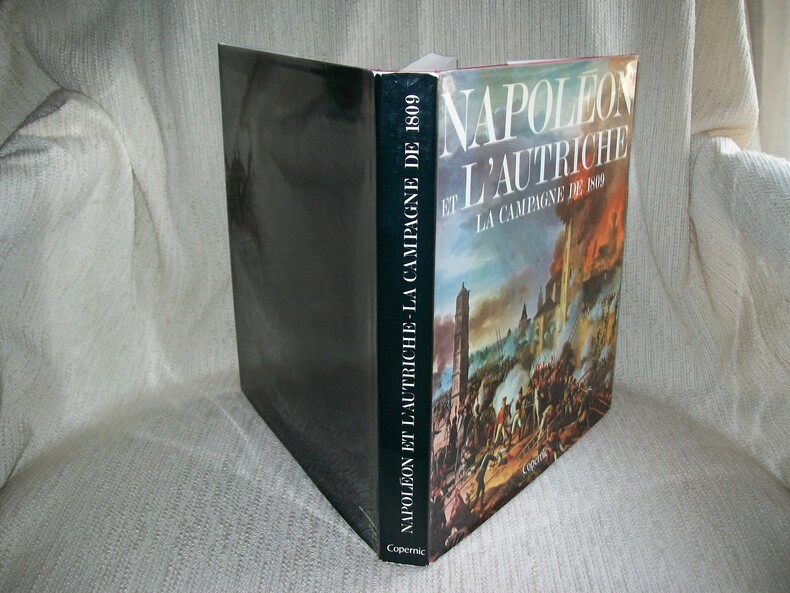
NAPOLEON ET L'AUTRICHE la Campagne de 1809.
Editions Copernic 1979. In-4 carré 239pp imprimées sur 2 colonnes. Reliure éditeur de toile rouge bradel, titre doré sur le dos, jaquette illustrée. Abondante et belle illustration dans le texte, à pleine page, en noir et en couleurs d'après Louis de Beaufort et des documents anciens, cartes du Colonel Michalon. Bel exemplaire frais et complet. Excellente documentation d'après les notes et documents du Commandant Henry Lachouque, très bien illustrée.
書籍販売業者の参照番号
: GITj298
|
|
|
TRASMIGRAZIONI ED INVASIONI DE' BARBARI donde provennero, vie da essi percorse, paesi che occuparono, o dove furono distrutti.
Carta incisa in rame e acquarellata a mano.
Carta di cm 37,5 x 51 alla battuta, più i margini, su tav. piegata a metà. Tratta da 'Atlante storico, geografico, genealogico, cronologico e letterario di M. A. Le Sage in ogni sua parte corretto, ampliato e proseguito sino all'anno corrente. Prima Veneta Edizione'. Aloncini d'umido al centro delle due metà della tavola.
|
|
|
Traversi C
Tecnica cartografica
leggeri danni

|
|
|
TRAVERSI Carlo -
Cartografia e topografia.
Firenze, IGM, 1976, 8vo stralcio con copertina posticcia muta, pp. 325/351 con numerose illustrazioni e carte.. - !! ATTENZIONE !!: Con il termine estratto (o stralcio) intendiamo riferirci ad un fascicolo contenente un articolo, completo in se, sia che esso sia stato stampato a parte utilizzando la stessa composizione sia che provenga direttamente da una rivista. Le pagine sono indicate come "da/a", ad esempio: 229/231 significa che il testo è composto da tre pagine. Quando la rivista di provenienza non viene indicata é perché ci è sconosciuta. - !! ATTENTION !!: : NOT A BOOK : “extract” or “excerpt” means simply a few pages, original nonetheless, printed in a magazine. Pages are indicated as in "from” “to", for example: 229/231 means the text comprises three pages (229, 230 and 231). If the magazine that contained the pages is not mentioned, it is because it is unknown to us.

|
|
|
TRAVERSI Carlo -
I plastici in materiale polivinilico, o carte in rilievo alla scala 1:200.000, dell'Istituto Geografico Militare.
Firenze, 1957, 8vo stralcio con copertina posticcia muta, pp. 609/612 con 2 illustrazioni in nero e 2 a colori nel testo. - !! ATTENZIONE !!: Con il termine estratto (o stralcio) intendiamo riferirci ad un fascicolo contenente un articolo, completo in se, sia che esso sia stato stampato a parte utilizzando la stessa composizione sia che provenga direttamente da una rivista. Le pagine sono indicate come "da/a", ad esempio: 229/231 significa che il testo è composto da tre pagine. Quando la rivista di provenienza non viene indicata é perché ci è sconosciuta. - !! ATTENTION !!: : NOT A BOOK : “extract” or “excerpt” means simply a few pages, original nonetheless, printed in a magazine. Pages are indicated as in "from” “to", for example: 229/231 means the text comprises three pages (229, 230 and 231). If the magazine that contained the pages is not mentioned, it is because it is unknown to us.

|
|
|
TRAVERSI Carlo -
L'alternativa della carta numerica.
Firenze, IGM, 1974, 8vo stralcio con copertina posticcia muta, pp. 639/648. - !! ATTENZIONE !!: Con il termine estratto (o stralcio) intendiamo riferirci ad un fascicolo contenente un articolo, completo in se, sia che esso sia stato stampato a parte utilizzando la stessa composizione sia che provenga direttamente da una rivista. Le pagine sono indicate come "da/a", ad esempio: 229/231 significa che il testo è composto da tre pagine. Quando la rivista di provenienza non viene indicata é perché ci è sconosciuta. - !! ATTENTION !!: : NOT A BOOK : “extract” or “excerpt” means simply a few pages, original nonetheless, printed in a magazine. Pages are indicated as in "from” “to", for example: 229/231 means the text comprises three pages (229, 230 and 231). If the magazine that contained the pages is not mentioned, it is because it is unknown to us.

|
|
|
TRAVERSI Carlo -
La Carta d'Italia alla scala 1:200.000.
Firenze, 1957, 8vo stralcio con copertina posticcia muta, pp. 389/392 con una carta a colori a pagina doppia nel testo. - !! ATTENZIONE !!: Con il termine estratto (o stralcio) intendiamo riferirci ad un fascicolo contenente un articolo, completo in se, sia che esso sia stato stampato a parte utilizzando la stessa composizione sia che provenga direttamente da una rivista. Le pagine sono indicate come "da/a", ad esempio: 229/231 significa che il testo è composto da tre pagine. Quando la rivista di provenienza non viene indicata é perché ci è sconosciuta. - !! ATTENTION !!: : NOT A BOOK : “extract” or “excerpt” means simply a few pages, original nonetheless, printed in a magazine. Pages are indicated as in "from” “to", for example: 229/231 means the text comprises three pages (229, 230 and 231). If the magazine that contained the pages is not mentioned, it is because it is unknown to us.

|
|
|
TRAVERSI Carlo -
Le carte tematiche e l'interpretazione tra la geografia e altre scienze.
Firenze, IGM, 1974, 8vo stralcio con copertina posticcia muta, pp. 335/346 con illustrazioni e grafici. - !! ATTENZIONE !!: Con il termine estratto (o stralcio) intendiamo riferirci ad un fascicolo contenente un articolo, completo in se, sia che esso sia stato stampato a parte utilizzando la stessa composizione sia che provenga direttamente da una rivista. Le pagine sono indicate come "da/a", ad esempio: 229/231 significa che il testo è composto da tre pagine. Quando la rivista di provenienza non viene indicata é perché ci è sconosciuta. - !! ATTENTION !!: : NOT A BOOK : “extract” or “excerpt” means simply a few pages, original nonetheless, printed in a magazine. Pages are indicated as in "from” “to", for example: 229/231 means the text comprises three pages (229, 230 and 231). If the magazine that contained the pages is not mentioned, it is because it is unknown to us.

|
|
|
Traversi,Carlo.
Tecnica cartografica.
<br/> STATO: USATO, MOLTO BUONO.<br/> TITOLO: Tecnica cartografica. <br/> AUTORE: Traversi,Carlo.<br/> EDITORE: Istituto Geografico Militare<br/> DATA ED.: 1968,<br/>
|
|
|
Tresoldi Lucia
Viaggiatori tedeschi in Italia. 1452-1870. Saggio bibliografico. Volume secondo [1800-1869] [Attenzione: solo secondo volume]
illustrazioni

|
|
|
Trippini Sergio - Valerio Vladimiro
L'America vista dall'Italia. Carte e atlanti dal XVI al XIX secolo. Civitella del Lago (Tr), 6/8 settembre 2013.
Bross., cm 24x21,5, pp 77, tavv. e ill. a col..

|
|
|
Troll, C. (Hrsg.)
Der große Handatlas.
Wiesbaden, Suchier u. Englisch, o.J. (ca. 1970). Fol. M. zahlr. (meist farb.) Ktn. u. Abb. 200 S. OLwd. M. Rsign. St. a. Tit.
書籍販売業者の参照番号
: 136630
|
|
|
Trudel, Marcel
Atlas de la Nouvelle-France / An Atlas of New France
Les Presses de l'Université Laval Couverture rigide illustrée Québec 1968
書籍販売業者の参照番号
: 45654
|
|
|
TRYSTRAM Forence
"Le procès des étoiles; récit de la prestigieuse expédition de trois savants français en Amérique du Sud et des mésaventures qui s'ensuivirent (1735-1771)."
Paris, Seghers, 1979. "16 x 25, 269 pp., quelques illustrations en N/B, quelques dessins, reliure d'édition carton + jaquette, bon état (cachet d'ex-propriétaire; jaquette légèrement défraîchie)."
書籍販売業者の参照番号
: 90924
|
|
|
TUCCI Michele -
Lavori e contributi dell'Amministrazione del Catasto nel campo della fotogrammetria aerea.
Roma, Ministero delle Finanze, 1936, 8vo brossura originale, pp. 4.

|
|
|
TUNUSLU HACI AHMET [AHMED], (16th century).
Dünya haritasi ve cografya risalesi.
New Turkish Paperback. Demy 8vo. (22 x 15 cm). In Turkish. 174 p., ills. Dünya haritasi ve cografya risalesi. Haci Ahmet was a purported Muslim cartographer linked to a 16th-century map of the world. Ahmet appended a commentary to the map, outlining his own life and an explanation for the creation of the map. But it is not clear whether Ahmet created the map, or whether he simply translated it into Turkish for use in the Ottoman world. Haci Ahmet appended a lengthy commentary to a 16th-century map of the world annotated in the Turkish language, known as The Ottoman Mappa Mundi of Haci Ahmet, amongst other titles, which opens with "Whoever wishes to know the true shape of the world, their minds shall be filled with light and their breast with joy.". The map is heart shaped, otherwise known as a "cordiform projection," a style that was popular in sixteenth century Europe, and the extant copy was printed from wooden blocks in Venice, Italy, in 1559. It was kept until the late 18th century in the archives of the Venetian Council of Ten. The map is now part of the Heritage Library in the Qatar National Library. Known as the "Mappamondo Haci Ahmet", the map outlines legends and place-names in Turkish, and it may be the first map in Turkish ever published for sale to an Ottoman audience. Whether the map is original, or was simply a translation into Turkish, it helps show how the people of the Ottoman Empire perceived themselves in relation to the wider world. Three small spheres appear below the main map at the bottom of the page - the central graphic represents Earth and a number of satellite planets, while the left and right depict constellations. Within the accompanying text of the map, Haci Ahmet explains that the map was created to share knowledge of the shape of the world, especially of the New World. Specifically, Ahmet points out that the classical philosophers, such as Plato and Socrates, did not know about the newly discovered continent, which he says shows that the world is round. He says that the New World demonstrates the "extent to which the Ottomans were participants in their own right in the process of physical expansion abroad and intellectual ferment at home that characterized the period of history commonly referred to as the Age of Exploration". Ahmet also assigns the Ottoman Empire's rulers and kingdoms to the celestial bodies represented in the lower quadrant of the map, a maneuver which has been interpreted as an effort to impose a hierarchical geopolitical system that preferences Ottoman rule above all other world powers. The map is considered unlikely to be original, and was probably translated into Turkish by Ahmet. The map has specific European characteristics, in that it includes the use of Western terms, suggesting Ahmet translated an older map into Turkish. In fact, throughout the map's accompanying text, Ahmet emphasizes translation, stating that he "translated it from the language and alphabet of the Europeans into that of the Muslims". A further argument made against Ahmet's authorship is that the "heart-shaped form of the map had already been used by earlier European cartographers". The map is "heart-shaped" and is constructed by a cordioform projection developed by 16th century cartographers and mathematicians including Johannes Werner (1468-1522), a German mathematician and geographer. The map has been tentatively linked to several other geographers, including Giovanni Battista Ramusio (1485-1557). It has also been argued that it shares similarities with a map by the French cartographer Orontius (1494-1555), published in 1534. Ahmet claimed the map was made for Ottoman princes, and some of the sons of Suleyman the Magnificent were interested in maps of the world and had looked to Venice for their production. This resulted in the development of Ottoman-Venetian relations, which offered "new interpretations of Venetian attitudes to the production of world maps for Ottoman clients".The map's printing in Venice hel
|
|
|
TURNER D.
Ordnance Survey Historical Guides. Surrey.
4to., First Edition, with a frontispiece, numerous coloured and monochrome photographs and maps throughout, and pictorial endpapers; grey cloth, backstrip lettered in silver, a very good, clean copy in unclipped dustwrapper.

|
|
|
Turri Eugenio.
L'ITALIA. Una nuova geografia. [a cura di Eugenio Turri, con la collaborazione di Umberto Bonapace]
(Codice CU/6273) In 4° (cm 36,5) 408 pp. Grande volume illustrato con centinaia di foto in nero e a colori, molte cartine e tabelle. Legatura similpelle editoriale, titolo oro, sovraccoperta con strappetti riparati, astuccio usato. Volume in ottimo stato. ~~~ SPEDIZIONE IN ITALIA SEMPRE TRACCIATA

|
|
|
Tyrrell G.W.
LA TERRA E I SUOI MISTERI.
(Codice GL/0055) In 16° 312 pp. Prima edizione italiana a cura di Alfredo Pollini. Con numerose foto su 14 tavole fuori testo e 54 figure nel testo. Brossura originale. Ottimo. ~~~ SPEDIZIONE IN ITALIA SEMPRE TRACCIATA

|
|
|
Töpfer, F
Kartographische Generalisierung.
Gotha, Haack, 1979. M. zahlr. (teils farb.) Abb. 336 S. OLwd. m. Originalschutzumschlag (kl. Randläsuren) (Petermanns geogr. Mitteil. Erg.-H. 276).
書籍販売業者の参照番号
: 604440
|
|
|
U.S.A.-
Carte illustrée des États-Unis d'Amérique
montrant les ressources, produits, topographie et principales ressources régionales. Publiée par l'Office d'Information de Guerre des États-Unis. s.l.n.d. Grande carte couleurs (810 x 607mm) plusieurs fois repliée, comprenant un texte Quelques faits sur les États-Unis et 3 petites cartes: voies ferrées, routes aériennes, grandes routes nationales. Petits accident minimes aux coins de pliage sinon bon état de cette carte très décorative.
書籍販売業者の参照番号
: ORD-10521
|
|
|
Ubujuh, J
Velika jezera Balkanskoia Poluostrva. Jezera Makedonije stare Srbije i Epira. Izdanie Akademije Nauka.
Belgrad, 1902. Gr.-Fol. 10 farb.(teils gef.) Ktn. In OHlwd.-Mappe m. 3 Stoffschließen. Rücken angerissen. Vorderdeckel fleckig. 1 Karte m. Einriss. St. verso Tit.
書籍販売業者の参照番号
: 183242
|
|
|
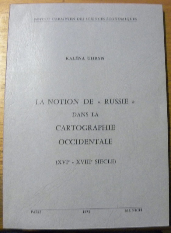
UHRYN, Kaléna.
La Notion de “Russie” dans la Cartographie Occidentale (XVIe - XVIIIe siècle). Préface de Michel Korzan.
Paris - Münich, Institut Ukrainien des Sciences Economiques 1975, 240x170mm, 144pages, broché. Bel exemplaire.
書籍販売業者の参照番号
: 31501
|
|
|
UMUR-I NAFIA VEKÂLETI.
[FIRST COMPLETE ROAD MAP OF TURKISH REPUBLIC] Türkiye Devleti Nafia Vekâleti Umur-i Nafia haritasidir. [i.e. The map by Ministry of Public Works of the Turkish State].
Very Good Turkish, Ottoman (1500-1928) Original chromo-lithograph map. Oblong: 63x95 cm. In Ottoman script (Turkish with Arabic letters). Folded. Chipped on extremities and slightly foxing. Otherwise a good map. Scale: 1:2.000.000. Detailed legends panel. This extremely rare huge map includes all railways, highways and other roads; Turkish borders with Iran, Russia, Greece, cities and their borders, printed shortly after the declaration of the republic in 1923. This is the first complete road map of the Republican period. The Ministry of Environment and Urban Planning is a government ministry office of the Republic of Turkey, responsible for the environment, public works, and urban planning in Turkey. The Ministry was formed in 1983 through the merger of the Ministry of Public Works (Turkish: Bayindirlik Bakanligi, formed 3 May 1920) and the Ministry of Development and Housing (Turkish: Imar ve Iskan Bakanligi, formed 1958). Antonio Zelic (Zellich) of Brela was one of many Dalmatians who left his homeland in pursuit of a better life during the 19th century. However, instead of going west, he set out toward the East, to the Ottoman imperial capital - Istanbul. Upon arrival in the city on the Bosphorus, Zelic found employment at the lithographic print house of Henri Cayol, the first of its kind in the Ottoman Empire. In 1869, Zelic opened his own lithographic print house called "Zellich and Sons" (A. Zellich et fils). His descendants continued his work with great success, and the Zellich Print House, now known as "Zellich Brothers" (Zellich frères), became one of the most renowned in the Empire. Zellich Brothers won recognition due to the high quality of their products, and, above all, the amazing beauty of their postcards and posters. Their crowning achievement was an order for the printing of the Ottoman Turkish Lira banknotes in 1914. Zellichs received many Ottoman and international awards, including medals conferred by the Pope, the Persian shah, and the Serbian king.". (Source: Documentary film "Zelic- Printers to the Empire", Levantineheritage). Extremely rare. Not in TBMM Library.; Not in OCLC.; Not in Turkish National Library.
|
|
|
UNION GEOGRAPHIQUE INTERNATIONALE
Comptes rendus du Congrès International de Géographie Lisbonne 1949. Tome premier seul : Actes du congrès, travaux de la section I (cartographie). Articles en différentes langues. Carte hors texte du Portugal à l'échelle 1 10 000.
Couverture souple. Broché. 335 pages.
書籍販売業者の参照番号
: 95284
|
|
|
UNION GEOGRAPHIQUE INTERNATIONALE
Comptes rendus du Congrès International de Géographie Paris 1931. Tome premier seul : Actes du congrès, travaux de la section I (cartographie).
Couverture souple. Broché. 360 pages.
書籍販売業者の参照番号
: 95285
|
|
|
UNION GEOGRAPHIQUE INTERNATIONALE
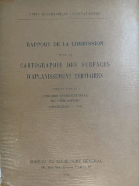
RAPPORT DE LA COMMISSION POUR LA CARTOGRAPHIE DES SURFACES D'APLANISSEMENT TERTIAIRES PREPARE POUR LE CONGRES INTERNATIONAL DE GEOGRAPHIE D'AMSTERDAM . 1938.
Paris 1938, In-8 broché, 94 pages. Cartes dépliantes. Trés bon état.
|
|
|
Union géographique internationale
Rapport de la commission pour la cartographie des surfaces d'aplanissement tertiaire préparé pour le congrés international de géographie d'Amsterdam - 1938
Sans nom Paris, 1938. In-8 broché de 94 pages. Cartes dépliantes. Très bon état.
書籍販売業者の参照番号
: 177162
|
|
|
US Department of State, Division of Map Intelligence and Cartography U S
Atlas: Administrative Subdivisions of Japan
Washington DC: U.S. Department of State 1946-1947. fair. 47 maps cardboard covers 47 fold-out maps stain on fore-edge covers worn & scuffed: small tears creases ink name on front cover. Oversized volume measuring approximately 14.25" 36 cm by 20.5" 52.5 cm. This volume was an appendix to "Administrative Subdivisions of Japan " Department of State Publications 2749 Far Eastern Series 19. There is one map for each of the 47 subdivisions on Hokkaido Honshu Shikoku and Kyushu. U.S. Department of State unknown
書籍販売業者の参照番号
: 6825
|
|
|
UZIELLI G. e AMAT DI S. FILIPPO P.
MAPPAMONDI, CARTE NAUTICHE, PORTOLANI ED ALTRI MONUMENTI CARTOGRAFICI SPECIALMENTE ITALIANI DEI SECOLI XIII - XVII
IN 8°, pp. XXVI, 325. LEGATTURA EDITORIALE IN PIENA TELA RIGIDA MARRONE CON TITOLO SOVRAIMPRESSO IN ORO RIPORTATO ANCHE AL DORSO ENTRO TASSELLO NERO.IL VOLUME, E' LA RISTAMPA ANASTATICA DELL'EDIZIONE DEL 1882.. L'OPERA PRENDE IN ESAME I REPERTI GEOCARTOGRAFICI PARTENDO DALL'XI SECOLO FINO AL SECOLO XVII. OTTIMA CONSERVAZIONE. ESAURITA ANCHE LA RISTAMPA ANASTATICA. ID 5484

|
|
|
Uzielli G. e Amat P. di S. Filippo
Studi biografici e bibliografici sulla storia della geografia in Italia pubblicati in occasione del III° congresso geografico internazionale. Vol. I: biografia dei viaggiatori italiani colla bibliografia delle loro opere. - Appendice...
<p>3 volumi legati assieme, 21 cm, rilegatura editoriale in piena tela verde, titolo in oro su tassello al dorso, p. XI, 742; XIII, 85; XXVI, 325. Con 3 carte geografiche a colori più volte ripiegate f.t. Edizione anastatica su quella di Roma del 1882.</p>

|
|
|
VACCARI Carlo -
Attività del Dipartimento del territorio nel settore della georeferenzazione delle informazioni territoriali.
Firenze, 1998, 8vo stralcio con copertina posticcia muta, pp. 669/672 con una carta a colori. - !! ATTENZIONE !!: Con il termine estratto (o stralcio) intendiamo riferirci ad un fascicolo contenente un articolo, completo in se, sia che esso sia stato stampato a parte utilizzando la stessa composizione sia che provenga direttamente da una rivista. Le pagine sono indicate come "da/a", ad esempio: 229/231 significa che il testo è composto da tre pagine. Quando la rivista di provenienza non viene indicata é perché ci è sconosciuta. - !! ATTENTION !!: : NOT A BOOK : “extract” or “excerpt” means simply a few pages, original nonetheless, printed in a magazine. Pages are indicated as in "from” “to", for example: 229/231 means the text comprises three pages (229, 230 and 231). If the magazine that contained the pages is not mentioned, it is because it is unknown to us.

|
|
|
Vaccaro, Gioacchino
La Cartografia Europea tra il XVI ed il XVIII Secolo
Mm 235x220 Catalogo della mostra di Palermo, Museo Archeologico Regionale, 15 novembre - 12 dicembre 1984. Volume nella sua brossura originale, 154 pagine con 124 illustrazioni a colori comprese nel testo. Libro in buono stato. SPEDIZIONE IN 24 ORE DALLA CONFERMA DELL'ORDINE.
|
|
|
Vagnon Emmanuelle
Cartographie Et Representations de L'Orient Mediterraneen En Occident (Du Milieu Du Xiiie a la Fin Du Xve Siecle) (Terrarum Orbis Band 11)
BREPOLS PUBL 2013 453 pages 3x27x21cm. 2013. Cartonné. 453 pages.
書籍販売業者の参照番号
: 100148325

|
|
|
Vaissière (Bruno) Groshens ( Jean-Claude ) - Mullender ( Jacques ) - Macchi ( Guilio )...Agache ( Roger ) - Augoyard (Jean-François ) - Barthès (Véronique) -
CARTES ET FIGURES DE LA TERRE
Centre Georges Pompidou, Centre de création industrielle, 1980 - Fort volume in quarto ( 300 x 210 mm) , brochure solide et dense aux plats illustrés, 479 pages, une centaines de notices bibliographiques rédigée par Bruno Vaissière. Glossaire sur trois colonnes in fine, repères (...). Imposante iconographie en noir et couleurs in texte en général. Bel exemplaire.
書籍販売業者の参照番号
: 17075

|
|
|
Valbrune Gérard de
Nell'Arcipelago dei Tifoni (Viaggio alle Filippine)
alcune tavole in bianco e nero fuori testo

|
|
|
Valdrè,Giovanni.
Nomen loci. Per la conservazione della memoria della toponomastica antica e recente di Pratolino.
Approfondita ricerca sui nomi dei luoghi del famoso Parco mediceo, che compaiono ripetutamente nei carteggi dell’Archivio Storico di Villa Demidoff, ma difficilmente identificabili in quanto non raccolti nei cataloghi pubblicati. Gli ultimi custodi della A thorough investigation of the place names of the famous Medicean park, which appear frequently in documents in Villa Demidoff’s historical arch <br/> STATO: NUOVO.<br/> TITOLO: Nomen loci. Per la conservazione della memoria della toponomastica antica e recente di Pratolino. <br/> AUTORE: Valdrè,Giovanni.<br/> EDITORE: Olschki Ed.<br/> DATA ED.: 1999,<br/> COLLANA: Coll.Cultura e memoria,17.<br/> EAN: 9788822247674
|
|
|
VALEGIO Francesco (1570 ca. – 1643 ca.)
Dissegno del Territorio et Stato di Mantova, con gli Stati confinanti cioe Cremonese, Bozolo, Modonese, Guastalla...
Rarissima carta del territorio mantovano basata sul Ducato di Mantova di Giovanni Antonio Magini (1603 circa), ma raffigurante anche i territori circostanti. Si estende a nord dove include Verona e parte del Lago di Garda; ad ovest include Cremona mentre ad est è pressoché identica ed addirittura meno estesa s sud, tagliata poco oltre il confine con i territori di Modena e Mirandola. “Di modesto livello esecutivo, la carta porta la firma dello stampatore lungo il margine inferiore: Stefano Scolari F in Venetia a S Zulian. Stefano Mozzi Scolari è noto per aver stampato contraffazioni e riedizioni di rami già usati da altri, ed è ricordato anche per aver pubblicato alcune carte maginiane più o meno corrette e rimodernate. Tuttavia, questa carta è riconducibile solo indirettamente al modello maginiano; essa comprende un’area più vasta e presenta notevoli diradazioni e contraffazioni nella toponomastica. Ad esempio, Guastalla è stato raschiato dalla posizione originaria, ancora leggibile, e riscritto arbitrariamente poco più a nord-ovest; manca inoltre la graduazione delle coordinate geografiche e il prospetto della città è abbozzato in modo sommario. L’approssimazione esecutiva del prodotto è subordinata ai facili intenti commerciali dello stampatore a scapito della qualità” (D. Ferrari, Mantova nelle stampe, p. 151). Come fa notare la Ferrari, sono presenti nella lastra numerose abrasioni nella toponomastica, indice che Stefano Mozzi Scolari non incise la carta ma utilizzò un rame più antico al quale apportò numerose modifiche. Pertanto, non può essere additato come l'autore della mappa ma solo di questa edizione – un secondo stato – della carta. Numerose le correzioni presenti anche nel cartiglio ornamentale con il titolo, dove si nota una grande abrasione di quello che poteva essere uno stemma nobiliare o un cappello cardinalizio, del dedicatario dell’opera. Lo stile grafico del cartiglio – riconducibile al primo Seicento - ricorda chiaramente quello di altre opere di Francesco Valegio, che per vari motivi ci sembra come il probabile autore di questa mappa. Del resto, Valegio aveva a disposizione diverso materiale cartografico sull’area; non da ultimo era il possessore della lastra della Geografia Particolare della Lombardia (1559) di Giacomo Gastaldi, della quale aveva pubblicato una ristampa all’inizio del ‘600, per poi venderne i rami allo stesso Stefano Mozzi Scolari (cfr. S. Bifolco – F. Ronca, Cartografia e topografia italiana del XVI secolo, 2018, pp. 1858-1859). Sebbene non sia conosciuto nessun esemplare di questa mappa privo dell’indirizzo di Scolari, è altamente probabile che la tesi sopra formulata sia attendibile, anche in relazione al fatto che molte delle lastre di Valegio furono poi acquistate dallo Scolari. Una datazione intorno al 1620 ci sembra consona con le altre mappe del Valegio. Francesco Valegio (Verona 1570 circa – 1650 circa) nasce a Verona da famiglia originaria di Valeggio sul Mincio. Un nucleo si trasferì a Venezia dalla prima metà del Cinquecento. Impossibile verificare sul lacunoso Registro dei battezzati la data di nascita tramandata, 1560, posticipata dal Salsi al 1570; quella di morte è stabilita a dopo il 1650. Definito un vero e proprio “imprenditore dell’immagine”: pittore, disegnatore, incisore, stampatore, editore e, a Venezia, anche venditore di stampe (bottega in Spadaria, al Segno della Sorte), ha prodotto moltissime opere, ritratti, soggetti storici e religiosi, comprese stampe devozionali e illustrazioni per libri, con soggetti altrui o incisi da lui stesso. Pubblicò soprattutto carte geografiche, piante di città (tra quelle venete, Padova e territorio, Vicenza, Verona). Spesso collaborava con altri stampatori, tra questi Catarino Dorino (o Doino) con cui entrò in società e con il quale pubblicò una pianta della città di Venezia nel 1611. Secondo Roberto Almagià, Valegio avrebbe messo in commercio un gran numero ... Very rare map of the Mantuan territory based on the Ducato di Mantova by Giovanni Antonio Magini (c. 1603), but depicting the surrounding territories as well. It extends to the north where it includes Verona and part of Lake Garda; to the west it includes Cremona while to the east it is almost identical and even less extensive south, cut just beyond the border with the territories of Modena and Mirandola. “Di modesto livello esecutivo, la carta porta la firma dello stampatore lungo il margine inferiore: Stefano Scolari F in Venetia a S Zulian. Stefano Mozzi Scolari è noto per aver stampato contraffazioni e riedizioni di rami già usati da altri, ed è ricordato anche per aver pubblicato alcune carte maginiane più o meno corrette e rimodernate. Tuttavia, questa carta è riconducibile solo indirettamente al modello maginiano; essa comprende un’area più vasta e presenta notevoli diradazioni e contraffazioni nella toponomastica. Ad esempio, Guastalla è stato raschiato dalla posizione originaria, ancora leggibile, e riscritto arbitrariamente poco più a nord-ovest; manca inoltre la graduazione delle coordinate geografiche e il prospetto della città è abbozzato in modo sommario. L’approssimazione esecutiva del prodotto è subordinata ai facili intenti commerciali dello stampatore a scapito della qualità” (D. Ferrari, Mantova nelle stampe, p. 151). As Ferrari points out, there are numerous abrasions in the plate in the toponymy, an indication that Stefano Mozzi Scolari did not engrave the map but used an older copper to which he made numerous modifications. Therefore, he cannot be named as the author of the map, but only editor of this edition-a second state-of the map. Numerous corrections are also present in the ornamental cartouche with the title, where there is a large abrasion of what could have been a noble coat of arms or a cardinal's hat, of the dedicatee of the work. The graphic style of the cartouche-which can be traced back to the early seventeenth century-is clearly reminiscent of that of other works by Francesco Valegio, who for various reasons appears to us as the probable author of this map. After all, Valegio had at his disposal various cartographic material on the area; not least, he was the possessor of the plate of Giacomo Gastaldi's Geografia Particolare della Lombardia (1559), of which he had published a reprint in the early 1600s, and then sold the plates to Stefano Mozzi Scolari himself (cf. S. Bifolco – F. Ronca, Cartografia e topografia italiana del XVI secolo, 2018, pp. 1858-1859). Although no specimen of this map without Scolari's address is known, it is highly probable that the above thesis is reliable, also in relation to the fact that many of Valegio's plates were later purchased by Scolari. Francesco Valegio (Verona c. 1570 - c. 1650) was born in Verona to a family originally from Valeggio sul Mincio. A nucleus moved to Venice from the first half of the sixteenth century. Impossible to verify on the lacunose Register of Baptized the date of birth handed down, 1560, postponed by Salsi to 1570; that of death is set to after 1650. Described as a true "entrepreneur of the image": painter, draughtsman, engraver, printer, publisher and, in Venice, also seller of prints (workshop in Spadaria, at the Segno della Sorte), he produced many works, portraits, historical and religious subjects, including devotional prints and illustrations for books, with subjects of others or engraved by himself. He mainly published maps, plans of cities (among those in the Veneto, Padua and its territory, Vicenza, Verona). He often collaborated with other printers, among them Catarino Dorino (or Doino) with whom he entered into partnership and with whom he published a map of the city of Venice in 1611. According to Roberto Almagià, Valegio allegedly marketed a large number of reproductions and forgeries of works by other engravers; in fact-as was the custom at the time-he bought several copperplates of oth...

|
|
|
VALEGIO Francesco (1570 ca. – 1643 ca.)
FRANCE. Nova Haec Tabula Galliae Lodovico XIII Christianis Simo Regi Franciae et Navarrae...
FRANCE. Nova Haec Tabula Galliae Lodovico XIIII Christianis Simo Regi Franciae et Navarrae Humillime Dedicatur a Nicolao Johanni de Visscher Eccellente esemplare di questa misteriosa e raffinata carte-à-figures della Francia, ispirata a Claes Jansz Visscher, e comprendente anche parte delle Fiandre, della Svizzera e dell’Italia, oltre che la raffigurazione delle principali città e borghi. La carta si basa sulla carta della Francia di Claesz Jansz Visscher, pubblicata inizialmente intorno al 1620 (senza data, una seconda edizione viene alla luce nel 1633, e poi ancora ristampata nel 1646, 1653 e 1660). Il titolo FRANCE compare al centro del bordo decorativo superiore, mentre un grande cartiglio con il secondo titolo in nove righe riempie l'angolo inferiore sinistro. In alto a destra si trova un cartiglio con la legenda dei simboli utilizzati sulla carta. La carta è circondata da un bordo decorativo con stemmi, vedute di città e figure in costume. In alto a destra e a sinistra si trovano i ritratti di Luigi XIII (1601- 1643) e della sua consorte Anna Maria Maurizia d'Asburgo (1601 – 1666); differiscono dal prototipo di Visscher, dove sono raffigurati in giovane età, per il fatto che qui compaiono in veste adulta. Si tratta dell’unico aggiornamento “cronologico”; la mappa, per la sua parte cartografica, sembra assolutamente inalterata. Gunther Shilder, nell'introduzione alla sua cartobibliografia delle carte olandesi in folio con bordi decorativi (talvolta definite carte-à-figures, o “carte a pannelli”), ha commentato: “questo genere deve essere considerato uno dei migliori prodotti dell'industria cartografica di Amsterdam. La combinazione vincente tra i progressi delle conoscenze geografiche e l'espressione delle capacità artistiche fece di queste mappe un bene prezioso sia sul mercato nazionale che su quello internazionale” (cfr. Günter Schilder, Monumenta Cartographica Neerlandici VI. "Nederlandse foliokarten met decoratieve randen, 1604-1640”. Il fatto che molte di queste mappe venissero vendute in fogli separati e inserite solo casualmente negli atlanti compositi dell'epoca ne spiega la rarità odierna, mentre il loro fascino estetico non è diminuito nel corso dei secoli, rendendole esempi altamente collezionabili dell'arte cartografica. Questa carta della Francia era ignota a Klaus Stopp, riconosciuto come la maggiore autorità in materia di carte-à-figures. Un esemplare di questa mappa (e di altre anonime carte-à-figures italiane) privo di data ed indicazioni editoriali è stato venduto all’asta, presso Sotheby's Londra, nel novembre del 2008 (lotto 162 e seguenti). Il catalogatore (all’epoca Catherine Slowther, Sotheby’s Senior Specialist), seppure in maniera dubitativa, attribuì la carta a Stefano Mozzi Scolari, datandola al 1642. L’ipotesi, più che attendibile, veniva basata sulla carta utilizzata per la mappa, una carta italiana come documentato dalla presenza della filigrana: “Seven of the maps following are hitherto unrecorded piracies taken from Dutch models by Pieter van den Keere or Jodocus Hondius Jr (re-)published by Johannes Janssonius in the 1630s and 1640s; one feature of the copying process is that the vast majority of the vignettes and costume figures, as also the armorials on the map of Germany, are reversed in engraving so what was on the left in the original now appears on the right. While this is commonly encountered for decorative features in maps, it is incongruous on the London plan, for example, to see the Tower of London placed on the west side of London and Westminster on the east. (However, all the vignettes on the map of France and three on that of Europe – Venice, Rome and Constantinople – are correctly orientated). Although copied from Dutch models, and assuming the engraved dates of 1641 or 1642 are broadly correct for the publication date of the set, it should be noted that the examples of the maps used were not acquired cont... FRANCE. Nova Haec Tabula Galliae Lodovico XIIII Christianis Simo Regi Franciae et Navarrae Humillime Dedicatur a Nicolao Johanni de Visscher Excellent example of this mysterious and refined carte-à-figures of France, inspired by Claes Jansz Visscher, and also including parts of Flanders, Switzerland and Italy, as well as depictions of major cities and towns. The map is based on Claesz Jansz Visscher's map of France, originally published around 1620 (undated, a second edition came to light in 1633, and then again reprinted in 1646, 1653 and 1660). The title FRANCE appears in the center of the upper decorative border, while a large cartouche with the second title in nine lines fills the lower left corner. In the upper right corner is a cartouche with a legend of the symbols used on the map, that is surrounded by a decorative border with coats of arms, city views, and costumed figures. On the upper right and left are portraits of Louis XIII (1601- 1643) and his consort Anne Marie-Maurice of Habsburg (1601 - 1666); they differ from Visscher's prototype, where they are depicted at a young age, in that here they appear in their adult guise. This is the only "chronological" update; the map, for its cartographic part, seems absolutely unchanged. Gunther Shilder, in the introduction to his cartobibliography of Dutch folio maps with decorative borders (sometimes referred to as carte-à-figures, or "panel maps"), commented, "this genre must be regarded as one of the best products of the Amsterdam cartographic industry. The successful combination of advances in geographical knowledge and the expression of artistic skills made these maps a valuable commodity in both the domestic and international markets" (see Günter Schilder, Monumenta Cartographica Neerlandici VI. "Nederlandse foliokarten met decoratieve randen, 1604-1640." The fact that many of these maps were sold in separate sheets and included only casually in the composite atlases of the time explains their rarity today, while their aesthetic appeal has not diminished over the centuries, making them highly collectible examples of cartographic art. This map of France was unknown to Klaus Stopp, recognized as the foremost authority on carte-à-figures. A specimen of this map (and other anonymous Italian carte-à-figures) devoid of date and editorial indications was sold at auction, at Sotheby's London, in November 2008 (lot 162 et seq.). The cataloguer (at the time Catherine Slowther, Sotheby's Senior Specialist), albeit dubiously, attributed the map to Stefano Mozzi Scolari, dating it to about 1642. The hypothesis, more than reliable, was based on the paper used for the map, an Italian map as documented by the presence of the watermark: “Seven of the maps following are hitherto unrecorded piracies taken from Dutch models by Pieter van den Keere or Jodocus Hondius Jr (re-)published by Johannes Janssonius in the 1630s and 1640s; one feature of the copying process is that the vast majority of the vignettes and costume figures, as also the armorials on the map of Germany, are reversed in engraving so what was on the left in the original now appears on the right. While this is commonly encountered for decorative features in maps, it is incongruous on the London plan, for example, to see the Tower of London placed on the west side of London and Westminster on the east. (However, all the vignettes on the map of France and three on that of Europe – Venice, Rome and Constantinople – are correctly orientated). Although copied from Dutch models, and assuming the engraved dates of 1641 or 1642 are broadly correct for the publication date of the set, it should be noted that the examples of the maps used were not acquired contemporaneously; the maps of the continents, for example were issued by Janssonius in 1632 with the lower panel removed. It is possible that these maps were engraved in Venice (the plan of Venice being one of the few vignette insets correctly orientate...

|
|
|
VALEGIO Francesco (1570 ca. – 1643 ca.)
Italiae, Sardiniae, Corsicae et confinium Regionum nova Tabula....
Italiae, Sardiniae, Corsicae et confinium Regionum nova Tabula effigies praecipuarum Urbiu[m] et habituum inibi sinul co[m]plectens Eccellente carte-à-figures della penisola italiana, riccamente decorata con la raffigurazione delle principali città e borghi e con i costumi tipici della nazione. Gunther Shilder, nell'introduzione alla sua cartobibliografia delle carte olandesi in folio con bordi decorativi (talvolta definite carte-à-figures, o “carte a pannelli”), ha commentato: “questo genere deve essere considerato uno dei migliori prodotti dell'industria cartografica di Amsterdam. La combinazione vincente tra i progressi delle conoscenze geografiche e l'espressione delle capacità artistiche fece di queste mappe un bene prezioso sia sul mercato nazionale che su quello internazionale” (cfr. Günter Schilder, Monumenta Cartographica Neerlandici VI. "Nederlandse foliokarten met decoratieve randen, 1604-1640”. Il fatto che molte di queste mappe venissero vendute in fogli separati e inserite solo casualmente negli atlanti compositi dell'epoca ne spiega la rarità odierna, mentre il loro fascino estetico non è diminuito nel corso dei secoli, rendendole esempi altamente collezionabili dell'arte cartografica. Questa carta dell’Italia era ignota a Klaus Stopp, riconosciuto come la maggiore autorità in materia di carte-à-figures. Un esemplare di questa mappa - oggi conservato presso una prestigiosa collezione privata - privo di data ed indicazioni editoriali fu venduto prima di finire all’asta, dove, presso Sotheby's Londra altre anonime carte-à-figures di produzione italiana della stessa tipologia vennero poste all’incanto nel novembre del 2008 (lotto 162 e seguenti). Il catalogatore (all’epoca Catherine Slowther, Sotheby’s Senior Specialist), seppure in maniera dubitativa, attribuì la carta a Stefano Mozzi Scolari, datandola al 1642 circa. L’ipotesi, più che attendibile, veniva basata sulla carta utilizzata per la mappa, una carta italiana come documentato dalla presenza della filigrana: “Seven of the maps following are hitherto unrecorded piracies taken from Dutch models by Pieter van den Keere or Jodocus Hondius Jr (re-)published by Johannes Janssonius in the 1630s and 1640s; one feature of the copying process is that the vast majority of the vignettes and costume figures, as also the armorials on the map of Germany, are reversed in engraving so what was on the left in the original now appears on the right. While this is commonly encountered for decorative features in maps, it is incongruous on the London plan, for example, to see the Tower of London placed on the west side of London and Westminster on the east. (However, all the vignettes on the map of France and three on that of Europe – Venice, Rome and Constantinople – are correctly orientated). Although copied from Dutch models, and assuming the engraved dates of 1641 or 1642 are broadly correct for the publication date of the set, it should be noted that the examples of the maps used were not acquired contemporaneously; the maps of the continents, for example were issued by Janssonius in 1632 with the lower panel removed. It is possible that these maps were engraved in Venice (the plan of Venice being one of the few vignette insets correctly orientated), perhaps by the little known publisher Stefano Scolari, who is known to have published other maps from Dutch originals, but as the maps are without any engraved attribution, this must be speculative. That the paper used in printing was too small for the printing plates may, however, point to a bookseller rather than map- or print-seller. Five of the maps have watermarks showing an anchor in a circle, surmounted by a six-pointed star (Heawood 8?) which indicates the paper to be Italian and of the period”. Il nostro esemplare – un secondo stato della lastra - presenta interventi di ritocco per la ristampa. Nel cartiglio con il titolo, viene aggiunta la firma Stefa... Italiae, Sardiniae, Corsicae et confinium Regionum nova Tabula effigies praecipuarum Urbiu[m] et habituum inibi sinul co[m]plectens Excellent carte-à-figures of the Italian peninsula, richly decorated with depictions of the main cities and towns and typical costumes of the nation. Gunther Shilder, in the introduction to his cartobibliography of Dutch folio maps with decorative borders (sometimes referred to as carte-à-figures, or "panel maps"), commented, "this genre must be regarded as one of the best products of the Amsterdam cartographic industry. The successful combination of advances in geographical knowledge and the expression of artistic skills made these maps a valuable commodity in both the domestic and international markets" (see Günter Schilder, Monumenta Cartographica Neerlandici VI. "Nederlandse foliokarten met decoratieve randen, 1604-1640." The fact that many of these maps were sold in separate sheets and included only casually in the composite atlases of the time explains their rarity today, while their aesthetic appeal has not diminished over the centuries, making them highly collectible examples of cartographic art. This map of Italy was unknown to Klaus Stopp, recognized as the foremost authority on carte-à-figures. A specimen of this map (and other anonymous Italian carte-à-figures) devoid of date and editorial indications was sold at auction, at Sotheby's London, in November 2008 (lot 162 et seq.). The cataloguer (at the time Catherine Slowther, Sotheby's Senior Specialist), albeit dubiously, attributed the map to Stefano Mozzi Scolari, dating it to about 1642. The hypothesis, more than reliable, was based on the paper used for the map, an Italian map as documented by the presence of the watermark: “Seven of the maps following are hitherto unrecorded piracies taken from Dutch models by Pieter van den Keere or Jodocus Hondius Jr (re-)published by Johannes Janssonius in the 1630s and 1640s; one feature of the copying process is that the vast majority of the vignettes and costume figures, as also the armorials on the map of Germany, are reversed in engraving so what was on the left in the original now appears on the right. While this is commonly encountered for decorative features in maps, it is incongruous on the London plan, for example, to see the Tower of London placed on the west side of London and Westminster on the east. (However, all the vignettes on the map of France and three on that of Europe – Venice, Rome and Constantinople – are correctly orientated). Although copied from Dutch models, and assuming the engraved dates of 1641 or 1642 are broadly correct for the publication date of the set, it should be noted that the examples of the maps used were not acquired contemporaneously; the maps of the continents, for example were issued by Janssonius in 1632 with the lower panel removed. It is possible that these maps were engraved in Venice (the plan of Venice being one of the few vignette insets correctly orientated), perhaps by the little known publisher Stefano Scolari, who is known to have published other maps from Dutch originals, but as the maps are without any engraved attribution, this must be speculative. That the paper used in printing was too small for the printing plates may, however, point to a bookseller rather than map- or print-seller. Five of the maps have watermarks showing an anchor in a circle, surmounted by a six-pointed star (Heawood 8?) which indicates the paper to be Italian and of the period”. Our copy - a second state of the plate - has been retouched for reprinting. In the title cartouche, is added to the signature Stefano Scolari Forma in Venetia. The fact certifies that the attribution was plausible. However, the hypothesis that seems most possible to us, that the author of the map can be traced back to Francesco Valegio. After all, it is widely documented how Scolari came into possession of a large number of Valegio's plates, reprinting...

|
|
|
VALEGIO Francesco (1570 ca. – 1643 ca.)
Nova Germaniae Descriptio
Nova Germaniae descriptio... Amstelodami apud Ioannem Ianssoniu[m] anno 1660. Eccellente carte-à-figures della Germania, comprendente anche parte delle Fiandre e di Svizzera, Italia, Polonia, Boemia e Ungheria, oltre che la raffigurazione delle principali città e borghi. Si tratta di una copia pirata della mappa di Pieter van der Keere (Kaerius) del 1615, esattamente della sua terza edizione pubblicta nel 1631 da Johannes Janssonius (cfr. Schilder MCN, VI, n. 33.3). Le vignette lungo i margini destro e sinistro raffigurano diversi modelli regionali e sociali, mentre quelle lungo i margini superiore e inferiore raffigurano vedute e piante delle città tedesche situate lungo i confini. Nel margine superiore è inserito anche un ritratto equestre di Ferdinando II, Santo Imperatore Romano e Re di Boemia, insieme ad altri duchi e arcivescovi con i loro rispettivi stemmi araldici nella parte superiore. Gunther Shilder, nell'introduzione alla sua cartobibliografia delle carte olandesi in folio con bordi decorativi (talvolta definite carte-à-figures, o “carte a pannelli”), ha commentato: “questo genere deve essere considerato uno dei migliori prodotti dell'industria cartografica di Amsterdam. La combinazione vincente tra i progressi delle conoscenze geografiche e l'espressione delle capacità artistiche fece di queste mappe un bene prezioso sia sul mercato nazionale che su quello internazionale” (cfr. Günter Schilder, Monumenta Cartographica Neerlandici VI. "Nederlandse foliokarten met decoratieve randen, 1604-1640”. Il fatto che molte di queste mappe venissero vendute in fogli separati e inserite solo casualmente negli atlanti compositi dell'epoca ne spiega la rarità odierna, mentre il loro fascino estetico non è diminuito nel corso dei secoli, rendendole esempi altamente collezionabili dell'arte cartografica. Questa carta della Germania era ignota a Klaus Stopp, riconosciuto come la maggiore autorità in materia di carte-à-figures. Un esemplare di questa mappa (e di altre anonime carte-à-figures italiane) privo di data ed indicazioni editoriali è stato venduto all’asta, presso Sotheby's Londra, nel novembre del 2008 (lotto 162 e seguenti). Il catalogatore (all’epoca Catherine Slowther, Sotheby’s Senior Specialist), seppure in maniera dubitativa, attribuì la carta a Stefano Mozzi Scolari, datandola al 1642 circa. L’ipotesi, più che attendibile, veniva basata sulla carta utilizzata per la mappa, una carta italiana come documentato dalla presenza della filigrana: “Seven of the maps following are hitherto unrecorded piracies taken from Dutch models by Pieter van den Keere or Jodocus Hondius Jr (re-)published by Johannes Janssonius in the 1630s and 1640s; one feature of the copying process is that the vast majority of the vignettes and costume figures, as also the armorials on the map of Germany, are reversed in engraving so what was on the left in the original now appears on the right. While this is commonly encountered for decorative features in maps, it is incongruous on the London plan, for example, to see the Tower of London placed on the west side of London and Westminster on the east. (However, all the vignettes on the map of France and three on that of Europe – Venice, Rome and Constantinople – are correctly orientated). Although copied from Dutch models, and assuming the engraved dates of 1641 or 1642 are broadly correct for the publication date of the set, it should be noted that the examples of the maps used were not acquired contemporaneously; the maps of the continents, for example were issued by Janssonius in 1632 with the lower panel removed. It is possible that these maps were engraved in Venice (the plan of Venice being one of the few vignette insets correctly orientated), perhaps by the little known publisher Stefano Scolari, who is known to have published other maps from Dutch originals, but as the maps are without any engraved attribution, this must be speculative. ... Excellent map-à-figures of Germany, also including parts of Flanders and Switzerland, Italy, Poland, Bohemia and Hungary, as well as depictions of major cities and towns. This is a pirated copy of Pieter van der Keere's (Kaerius) map of 1615, exactly its third edition published in 1631 by Johannes Janssonius (see Schilder MCN, VI, no. 33.3). The vignettes along the left and right margins depict various regional and social patterns, while those along the upper and lower margins depict views and plans of German cities located along the borders. Also included in the upper margin is an equestrian portrait of Ferdinand II, Holy Roman Emperor and King of Bohemia, along with other dukes and archbishops with their respective heraldic coats of arms at the top. Gunther Shilder, in the introduction to his cartobibliography of Dutch folio maps with decorative borders (sometimes referred to as carte-à-figures, or "panel maps"), commented, "this genre must be regarded as one of the best products of the Amsterdam cartographic industry. The successful combination of advances in geographical knowledge and the expression of artistic skills made these maps a valuable commodity in both the domestic and international markets" (see Günter Schilder, Monumenta Cartographica Neerlandici VI. "Nederlandse foliokarten met decoratieve randen, 1604-1640." The fact that many of these maps were sold in separate sheets and included only casually in the composite atlases of the time explains their rarity today, while their aesthetic appeal has not diminished over the centuries, making them highly collectible examples of cartographic art. This map of Germany was unknown to Klaus Stopp, recognized as the foremost authority on carte-à-figures. A specimen of this map (and other anonymous Italian carte-à-figures) devoid of date and editorial indications was sold at auction, at Sotheby's London, in November 2008 (lot 162 et seq.). The cataloguer (at the time Catherine Slowther, Sotheby's Senior Specialist), albeit dubiously, attributed the map to Stefano Mozzi Scolari, dating it to about 1642. The hypothesis, more than reliable, was based on the paper used for the map, an Italian map as documented by the presence of the watermark: “Seven of the maps following are hitherto unrecorded piracies taken from Dutch models by Pieter van den Keere or Jodocus Hondius Jr (re-)published by Johannes Janssonius in the 1630s and 1640s; one feature of the copying process is that the vast majority of the vignettes and costume figures, as also the armorials on the map of Germany, are reversed in engraving so what was on the left in the original now appears on the right. While this is commonly encountered for decorative features in maps, it is incongruous on the London plan, for example, to see the Tower of London placed on the west side of London and Westminster on the east. (However, all the vignettes on the map of France and three on that of Europe – Venice, Rome and Constantinople – are correctly orientated). Although copied from Dutch models, and assuming the engraved dates of 1641 or 1642 are broadly correct for the publication date of the set, it should be noted that the examples of the maps used were not acquired contemporaneously; the maps of the continents, for example were issued by Janssonius in 1632 with the lower panel removed. It is possible that these maps were engraved in Venice (the plan of Venice being one of the few vignette insets correctly orientated), perhaps by the little known publisher Stefano Scolari, who is known to have published other maps from Dutch originals, but as the maps are without any engraved attribution, this must be speculative. That the paper used in printing was too small for the printing plates may, however, point to a bookseller rather than map- or print-seller. Five of the maps have watermarks showing an anchor in a circle, surmounted by a six-pointed star (Heawood 8?) which indicates the paper to be Italian and ...

|
|
|
VALEGIO Francesco (1570 ca. – 1643 ca.)
Nova Hispaniae Descriptio
Eccellente carte-à-figures della Spagna (Penisola Iberica), riccamente decorata con la raffigurazione delle principali città e borghi e con i costumi tipici della nazione. La carta si basa sulla carta della Spagna di Pieter van den Keere pubblicata inizialmente nel 1616. Il titolo e l'imprint sono riuniti in un cartiglio in basso a destra, sotto il quale si trova una veduta di Madrid. In alto a destra si trova un semplice cartiglio con due barre di scala e una legenda con i simboli utilizzati sulla carta. L'immagine della carta è incorniciata da scale latitudinali e longitudinali; meridiani e paralleli sono disegnati ad ogni grado completo. La carta è circondata da vedute sul bordo superiore e inferiore, con un ritratto di Filippo IV e lo stemma della Spagna e figure ai lati. La carta fu successivamente acquistata da Johannes Janssonius che la ripubblicò con figure diverse nel 1626 e di nuovo nel 1632 (Schilder, Monumenta Cartographica, VI, 101.3). È su quest'ultimo stato che si basa la presente carta che, tuttavia, presenta tutte le figure e le vedute della bordura invertite; ad esempio, la veduta di Valladolid, che sull’originale è in alto a destra, in questa mappa finisce in alto a sinistra. Gunther Shilder, nell'introduzione alla sua cartobibliografia delle carte olandesi in folio con bordi decorativi (talvolta definite carte-à-figures, o “carte a pannelli”), ha commentato: “questo genere deve essere considerato uno dei migliori prodotti dell'industria cartografica di Amsterdam. La combinazione vincente tra i progressi delle conoscenze geografiche e l'espressione delle capacità artistiche fece di queste mappe un bene prezioso sia sul mercato nazionale che su quello internazionale” (cfr. Günter Schilder, Monumenta Cartographica Neerlandici VI. "Nederlandse foliokarten met decoratieve randen, 1604-1640”. Il fatto che molte di queste mappe venissero vendute in fogli separati e inserite solo casualmente negli atlanti compositi dell'epoca ne spiega la rarità odierna, mentre il loro fascino estetico non è diminuito nel corso dei secoli, rendendole esempi altamente collezionabili dell'arte cartografica. Questa carta della Spagna era ignota a Klaus Stopp, riconosciuto come la maggiore autorità in materia di carte-à-figures. Un esemplare di questa mappa (e di altre anonime carte-à-figures italiane) privo di data ed indicazioni editoriali è stato venduto all’asta, presso Sotheby's Londra, nel novembre del 2008 (lotto 162 e seguenti). Il catalogatore (all’epoca Catherine Slowther, Sotheby’s Senior Specialist), seppure in maniera dubitativa, attribuì la carta a Stefano Mozzi Scolari, datandola al 1642 circa. L’ipotesi, più che attendibile, veniva basata sulla carta utilizzata per la mappa, una carta italiana come documentato dalla presenza della filigrana: “Seven of the maps following are hitherto unrecorded piracies taken from Dutch models by Pieter van den Keere or Jodocus Hondius Jr (re-)published by Johannes Janssonius in the 1630s and 1640s; one feature of the copying process is that the vast majority of the vignettes and costume figures, as also the armorials on the map of Germany, are reversed in engraving so what was on the left in the original now appears on the right. While this is commonly encountered for decorative features in maps, it is incongruous on the London plan, for example, to see the Tower of London placed on the west side of London and Westminster on the east. (However, all the vignettes on the map of France and three on that of Europe – Venice, Rome and Constantinople – are correctly orientated). Although copied from Dutch models, and assuming the engraved dates of 1641 or 1642 are broadly correct for the publication date of the set, it should be noted that the examples of the maps used were not acquired contemporaneously; the maps of the continents, for example were issued by Janssonius in 1632 with the lower panel removed. It is possible that these m... Excellent carte-à-figures of Spain (Iberian Peninsula), richly decorated with depictions of the main cities and towns and typical costumes of the nation. The map is based on Pieter van den Keere's map of Spain originally published in 1616. The title and imprint are brought together in a cartouche at the lower right, below which is a view of Madrid. In the upper right is a simple cartouche with two scale bars and a legend with the symbols used. The map image is framed by latitudinal and longitudinal scales; meridians and parallels are drawn at each full degree. The chart is surrounded by views on the top and bottom edges, with a portrait of Philip IV and the coat of arms of Spain and figures on either side. The map was later acquired by Johannes Janssonius, who republished it with different figures in 1626 and again in 1632 (Schilder, Monumenta Cartographica, VI, 101.3). It is on the latter state that the present map is based, which, however, has all the figures and views of the bordure reversed; for example, the view of Valladolid, which on the original is on the upper right, ends up on the upper left in this map. Gunther Shilder, in the introduction to his cartobibliography of Dutch folio maps with decorative borders (sometimes referred to as carte-à-figures, or "panel maps"), commented, "this genre must be regarded as one of the best products of the Amsterdam cartographic industry. The successful combination of advances in geographical knowledge and the expression of artistic skills made these maps a valuable commodity in both the domestic and international markets" (see Günter Schilder, Monumenta Cartographica Neerlandici VI. "Nederlandse foliokarten met decoratieve randen, 1604-1640." The fact that many of these maps were sold in separate sheets and included only casually in the composite atlases of the time explains their rarity today, while their aesthetic appeal has not diminished over the centuries, making them highly collectible examples of cartographic art. This map of Spain was unknown to Klaus Stopp, recognized as the foremost authority on carte-à-figures. A specimen of this map (and other anonymous Italian carte-à-figures) devoid of date and editorial indications was sold at auction, at Sotheby's London, in November 2008 (lot 162 et seq.). The cataloguer (at the time Catherine Slowther, Sotheby's Senior Specialist), albeit dubiously, attributed the map to Stefano Mozzi Scolari, dating it to about 1642. The hypothesis, more than reliable, was based on the paper used for the map, an Italian map as documented by the presence of the watermark: “Seven of the maps following are hitherto unrecorded piracies taken from Dutch models by Pieter van den Keere or Jodocus Hondius Jr (re-)published by Johannes Janssonius in the 1630s and 1640s; one feature of the copying process is that the vast majority of the vignettes and costume figures, as also the armorials on the map of Germany, are reversed in engraving so what was on the left in the original now appears on the right. While this is commonly encountered for decorative features in maps, it is incongruous on the London plan, for example, to see the Tower of London placed on the west side of London and Westminster on the east. (However, all the vignettes on the map of France and three on that of Europe – Venice, Rome and Constantinople – are correctly orientated). Although copied from Dutch models, and assuming the engraved dates of 1641 or 1642 are broadly correct for the publication date of the set, it should be noted that the examples of the maps used were not acquired contemporaneously; the maps of the continents, for example were issued by Janssonius in 1632 with the lower panel removed. It is possible that these maps were engraved in Venice (the plan of Venice being one of the few vignette insets correctly orientated), perhaps by the little known publisher Stefano Scolari, who is known to have published other maps from Dutch originals, but as ...

|
|
|
VALEGIO Francesco (1570 ca. – 1643 ca.)
Segna
Acquaforte e bulino, 1616, firmata in lastra in basso a destra Franc.co Valegio forma. Esemplare di secondo stato, con imprint Stefano Scolari forma in Venetia a S. Zulian. Pianta prospettica della città fortificata di Senja (Senj) che si trova sulla costa della Croazia tra Rijeka-Fiume e Zara. Sovrasta la città la fortezza di Nehaj, si trova in direzione sud dal Porto, fuori le mura. Venne costruita nel 1558 quando Venezia e i Turchi erano all'apice del loro potere ed è alta 18m e larga 23m. Nella dedica al senatore veneziano Antonio Bragadin, nel cartiglio in alto al centro, il Valegio dichiara di essersi servito di un disegno di Zaccaria dal Pozzo, un medico di Feltre morto a 102 anni nel 1561. Probabile che il disegno non contenesse la fortezza – presente invece nell’incisione – che fu costruita solo nel 1558. Francesco Valegio (Valesio o Valeggio), nato a Verona da famiglia originaria di Valeggio sul Mincio (Verona). Definito un vero e proprio “imprenditore dell’immagine”: pittore, disegnatore, incisore, stampatore, editore e, a Venezia, anche venditore di stampe (bottega in Spadaria, al Segno della Sorte), ha prodotto moltissime opere, ritratti, soggetti storici e religiosi, comprese stampe devozionali e illustrazioni per libri e numerose carte geografiche. Stefano Mozzi Scolari, incisore e editore bresciano, è attivo a Venezia dal 1644 al 1687. La sua bottega era una delle migliori calcografie veneziane del ‘600. Esercitò l’arte delle stampe e del commercio di carte geografiche a S. Zulian all’insegna delle Tre Virtu. Si servì dei rami di Bertelli, Valegio e Van Aelst, curando anche le ristampe di importantissime carte quali la Lombardia del Gastaldi, e le carte dell’Italia di Greuter e Magini. L’opera è di grandissima rarità. Un esemplare è noto nella ex collezione di Franco Novacco; un altro è descritto da Marinelli nella raccolta del Museo Civico Correr. Magnifica prova, impressa su carta vergata coeva, con margini, in perfetto stato di conservazione. Bibliografia Marinelli, Saggio di cartografia veneta, n. 685. Etching and engraving, 1616, signed in plate at lower right Franc.co Valegio forma. Exemple of the second state, with the imprint Stefano Scolari forma in Venetia a S. Zulian. Perspective plan of the fortified city of Senja (Senj), located on the Croatian coast between Rijeka and Zadar. Overlooking the city is the fortress of Nehaj, which is located south of the Port, outside the walls. It was built in 1558 when Venice and the Turks were at the height of their power and is 18m high and 23m wide. In the dedication to the Venetian senator Antonio Bragadin, in the scroll at the top center, Valegio states that he used a drawing by Zaccaria dal Pozzo, a doctor from Feltre who died at the age of 102 in 1561. It is likely that the drawing did not contain the fortress - present instead in the engraving - which was built only in 1558. Francesco Valegio (Valesio or Valeggio), born in Verona to a family originally from Valeggio sul Mincio (Verona). Defined a true "entrepreneur of the image": painter, draftsman, engraver, printer, publisher and, in Venice, also seller of prints (workshop in Spadaria, at the Segno della Sorte), he produced many works, portraits, historical and religious subjects, including devotional prints and illustrations for books and numerous maps. Stefano Mozzi Scolari, engraver and publisher from Brescia, was active in Venice from 1644 to 1687. His workshop was one of the best Venetian chalcography of the '600. He practiced the art of printing and trading maps in S. Zulian at the sign of the Three Virtues. He used the plates of Bertelli, Valegio and Van Aelst, also taking care of the reprinting of very important maps such as Gastaldi's Lombardia, and the maps of Italy by Greuter and Magini. The work is extremely rare. One example is known in the former collection of Franco Novacco; another one is described by Marinelli in the collection of the Museo Civico Correr. Magnificent proof, printed on contemporary laid paper, with margins, in perfect condition. Bibliography Marinelli, Saggio di cartografia veneta, n. 685. Marinelli, Saggio di cartografia veneta, n. 685.

|
|
|
VALENTI PAOLA - VALERIO VLADIMIRO
APPARATI DECORATIVI. Figurazioni e decorazioni nella cartografia italiana dal '400 all'800.
Bross.con cop. ill., cm 24x23, pp 142, 54 tavv. in b/n..
|
|
|
Valentin-Smith (Joannès-Erhard; 1796-1891) :
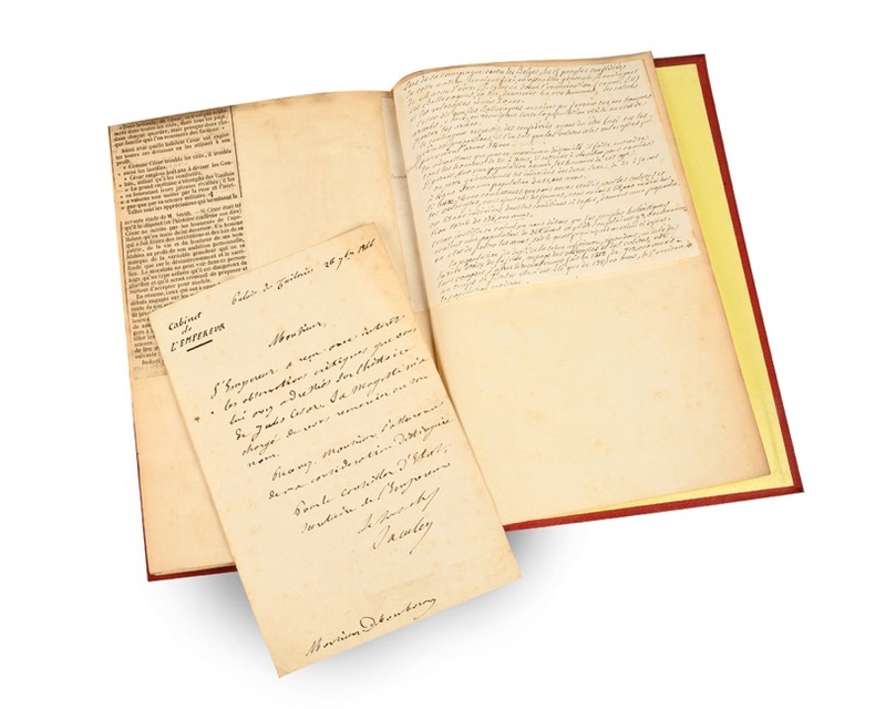
De l’origine des peuples de la Gaule transalpine et de leurs institutions politiques avant la domination romaine, avec une carte. Deuxième édition.
Paris, à l’Imprimerie Impériale, 1866 (Librairies Durand et Pedone Lauriel ; Franck) ; in-8, percaline rouge, dos à faux nerfs et titre dorés, double filet d’encadrement des plats (reliure de l’époque) ; 95 pp. (exemplaire de l’auteur, interfolié) et grande carte entoilée “de la Gaule Transalpine d’après les Commentaires de César, par M. Valentin-Smith, 1866.”
書籍販売業者の参照番号
: 22165
|
|
|
Valentini Norberto
Il dramma di due comunisti a Mosca
numerose foto in bianco e nero su tavole fuori testo

|
|
|
VALERIAN Isidore
L'ANTIQUE CITE DE PISAVIS de la Table de Peutinger découverte par Isidore Valérian Archéologue à Salon.
Bergerac Imprimerie Générale du Sud Ouest Castanet 1910. In-8 broché 14pp. Orné de 2 schémas en frontispice, 1 plan à pleine page et 2 planches réunissant 4 vues d'après des photographies. 2e plat de la couverture tachée, cachet ex-libris 1 feuillet blanc, intérieur en bon état. Ce site archéologique se trouve aux environs de Salon-de-Provence et de Pélissanne. (PLAQ 25)
書籍販売業者の参照番号
: GITk275

|
|
|

 検索結果のメールを受信する
 PDFファイルの検索結果をダウンロード
 RSSフィード
 パーマネントリンク


