|
|
|
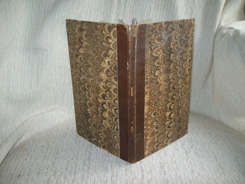
Saggi e schede di E. ERCOLANI COCCHI, IRMA PAGLAIRI, UGO BAZZOTTI
MANTOVA GONZAGHESCA NELLE STAMPE E NELLE MONETE - Mantua of the Gonzaga in prints and coins
Vol. in -8 obl. (24 x 17 cm.), brossura editoriale illustrata a colori, testo in italiano ed inglese, pp. 149, (1) con molte illustr. in b.n. nel testo e a p.pagina. In ottime condizioni. Catalogo delle Mostre realizzate a London, The Italian Institute (1981) e Mantova, Palazzo Te (1982) a cura del Comune di Mantova, Assessorato alla Cultura.

|
|
|
SAIGOKU SANJUSAN-SHO MAP.
[MAP - JAPAN] Saigoku Sanjusan-sho junrei ezu. [i.e. Map of Saigoku Kannon Pilgrimage Routes]. Published by Ezuya Shohachi.
Very Good Japanese Original woodblock print map on thin paper. 66x59,5 cm. In Japanese. Rare Japanese woodblock print route map of the Saigoku Sanjusan-Sho (The Saigoku Kannon Pilgrimage) which is a pilgrimage of thirty-three Buddhist temples and the oldest Kannon pilgrimage in Japan and said to have been devised in 718 by the head priest known as Tokudo Shonin, who was a head priest at Hase-dera Temple in the Nara prefecture, throughout the Kansai region of Japan, similar to the Shikoku Pilgrimage, printed in early 19th century. In addition to the official thirty-three temples, there are an additional three known as Bangai. The principal image in each temple is Kannon, known to Westerners as the Bodhisattva of Compassion (or sometimes mistranslated as 'Goddess of Mercy'); however, there is some variation among the images and the powers they possess. 33 temples of the pilgrimage are marked and shown on the map and listed in a panel on the lower left located in Kyoto, Osaka, Nara and surrounding areas.
|
|
|
SAINT-TROPEZ.-
Cartes d'Etat-Major au 1/20000. Carroyage kilométrique. Projection Lambert. Levées en 1907, révisées en 1931.-
Dressées, héliogravées et publiées par le Service Géographique de l'Armée en 1932. Paris. Institut Géographique National. (1932). Six feuilles d'environ 52 x 71 cm, cartes d'environ 42 x 56 cm. Courbes de relief colorées. Cartes numérotées 1, 2, 3, 5, 6 et 7 mais ensemble complet, les cartes qui porteraient les n°4 et 8 ne représenteraient que la mer et sont donc absentes. Menus défauts mais bon état.. .
Bookseller reference : ORD-17331
|
|
|
SALAMANCA Antonio (Milano ?, 1478 – Roma, 1562)
Civitella
Raro documento raffigurante l’asedio di Civitella. Nel 1557 la città fu posta d'assedio da parte del francese Duca di Guisa, generale di Enrico II e alleato del papa, Paolo IV; benché feroce e violento, l’assalto non riuscì a espugnare la città,. Proprio in questa guerra, tra Francesi e Spagnoli, Civitella cambiò il suo nome in Civitella del Tronto. La vittoriosa e valorosa resistenza che il popolo della cittadella riuscì a riportare venne ben visto nell'intero Regno, tanto che ai suoi cittadini furono tolti gli oneri fiscali da pagare al Regno, per quarant'anni, e a spese del demanio regio furono restaurati gli edifici e la Fortezza. La mappa viene prodotta a Roma, probabilmente nella bottega di Antonio Salamanca e Antoine de Lafrery, che dal 1553 al 1563 erano soci nella più importante calcografia romana. La lastra viene sicuramente ralizzata in occasione dell’avvenimento, quindi nel 1557, probabilmente commissionata da autorità ecclesiastiche, oppure nel tentativo commerciale dei due editori di produrre un nuvo foglio da immettere nel mercato. La mancata vittoria nell’assedio indusse i due editori a non terminare il lavoro, come dimostrano i numerosi ripensamenti presenti nella lastra e lo spazio bianco in basso a destra, lasciato libero per il titolo e la dedicatoria. Il foglio risulta pertanto in un solo stato e molto raro. Incisione al bulino, rifilata al rame e con margini coevi aggiunti, pieghe di carta al centro, nel complesso in ottimo stato di conservazione. Rarissima. Bibliografia: Tooley, p. 25, 154; Borroni Salvadori, 221; Cartografia Rara p. 38, 30. Dimensioni 380x300. A rare document depicting the siege of Civitella. In 1557 the city was assaulted by the French Duke of Guisa, the General of Enrico II and ally of pope Paul IV; though harsh and cruel, the siege could not overcome the city. Precisely after this war between the French and the Spanish, Civitella changed its name into Civitella del Tronto. The triumphant and valiant resistance of the population was much appreciated all over the Reign so that these citizens were allowed not to pay royal taxes for the following forty years and the buildings and the Fortress were repaired with the money of the public royal domain. The map has been published in Rome, very likely in the workshop of Antonio Salamanca and Antoine de Lafrery, who created the most important partnership in Rome between 1553 and 1563. The plate has been no doubt realized to celebrate the event, therefore in 1557, probably commissioned by the ecclesiastic authorities or maybe it was an attempt of the two publishers to create a new piece of work to sell. Since the siege did not succeed, Salamanca and Lafrery did not finished the plate, as the many changes on it and the white space mint for the dedication and title show. Therefore, this work presents only one state, very rare indeed. Engraving, trimmed to platemark and contemporary margins added afterwards, paper folds in the centre, otherwise in excellent condition. Extremely rare. Bibliografia: Tooley, p. 25, 154; Borroni Salvadori, 221; Cartografia Rara p. 38, 30. Dimensioni 380x300.

|
|
|
SALAMANCA Antonio (Milano ?, 1478 – Roma, 1562)
Tabula Moderna Poloniae Ungariae Boemiae Germaniae Russiae Lithuae
Rarissima versione romana della carta di Nicolò Cusano, stampata da Antonio Salamanca nel 1548. Niccolò da Cusa, noto come Niccolò Cusano (ted. Nikolaus Chrypffs o Krebs von Cues) è autore di una carta dell’Europa centro-orientale, stampata ad Eichstätt nel 1491. L’opera del Cusano influenzò tutta la produzione cartografica italiana del XVI secolo. La sua prima vera derivazione a stampa è rappresentata dalla tavola inserita nell’edizione romana della Geographia del 1507, curata da Marco Beneventano, mentre la prima carta "sciolta" della regione si deve a Giovanni Andrea Vavassore, ed è databile al terzo decennio del secolo. In alto, fuori dal margine graduato, è inciso il titolo: TABULA MODERNA POLONIAE UNGARIAE BOEMIAE GERMANIAE RUSSIAE LITHU[ANI]AE. Nell’angolo inferiore sinistro troviamo l’imprint editoriale: Ant. Sal. Excu. Al centro della carta, lungo il bordo inferiore e a destra del mare Adriatico, è impressa la data di stampa: 1548. Nel lato sinistro, fuori dal margine graduato, la divisione in climi e la durata del giorno alle diverse latitudini. Carta priva di orientazione e scala grafica. Graduazione ai margini di 10’ in 10’, da 44° 10’ a 56° 30’ di latitudine e da 24° a 58° di longitudine. Acquaforte e bulino, impressa su carta vergata coeva con filigrana “scala nel cerchio con stella” (Woodward nn. 238-242, che viene riscontrata su mappe datate o databili tra il 1540 e il 1561) con margini, in ottimo stato di conservazione. Esemplare nel primo stato di due. “La carta dell’Europa centrale edita dalla tipografia di Antonio Salamanca è basata sul modello di Niccolò Cusano. Si tratta, più verosimilmente, di una derivazione della mappa di Marco Beneventano Tabula Moderna Polonie Ungarie Boemie Germanie Russie Lithuanie edita sempre a Roma nel 1507 ed inserita nella Geographia di Tolomeo. Tuttavia, la carta del Salamanca mostra una migliore e più dettagliata descrizione dell’Europa orientale. Nella carta le informazioni sulla Polonia fornite da Bernhard Wapowski, già inserite nella carta del Beneventano si associano ai dati desunti dalla mappa della Sarmazia dello stesso Wapowski (1526). Il secondo stato della carta, privo dell’indirizzo di Salamanca, è conservato a Leida. Sebbene privo di dati editoriali, può essere ricondotto alla tipografia di Antonio Lafreri e datato dopo il 1562, anno della scomparsa del Salamanca e poco prima della fine del sodalizio tra i due editori” [cfr. S. Bifolco – F. Ronca, Cartografia e topografia italiana del XVI secolo (2018), p. 886]. Antonio Salamanca, milanese, si stabilì a Roma prima del Sacco del 1527, abitando nel rione di Parione. Stampatore, editore, mercante e anche incisore, anche se di pochissime tavole, tra cui la Pietà Vaticana (1547), firmata Antonius Salamanca quam potuti imitatus exsculpist. Nella sua produzione troviamo numerose stampe tratte da dipinti e disegni di Michelangelo e Raffaello. Salamanca aggiornava sempre il suo catalogo e stampava quello che il mercato al momento richiedeva. Ebbe anche il merito di aver ricercato, non solo per fini commerciali, i rami dispersi durante il Sacco di Roma, e di aver fatto ritoccare quelli deteriorati, salvando così opere importanti della tradizione calcografica italiana. La forte concorrenza nel campo calcografico e editoriale in quel periodo portò il Salamanca, nel 1553, ad associarsi ad Antonio Lafreri, concorrente giovane ed intraprendente che si trovava a Roma già dal 1544. Nel 1556 pubblicarono Historia de la compocicion del cuerpo humano di Joan de Valverde, con tavole incise dal Beatricetto. Nella società, la forza trainante era il Lafreri, infatti dopo il 1553 del Salamanca si conoscono poche stampe a suo nome. Il Salamanca morì nel 1562 e, gli subentrò nella società il figlio Francesco, ma per motivi a noi ignoti la società si sciolse dopo un solo anno. Francesco Salamanca, in seguito, vendette tutte le matrici al Lafreri. Bibliografia ... Very rare and early version of the map of Nicholas Cusanus, printed in Rome by Antonio Salamanca in 1548. Niccolò da Cusa, known as Niccolò Cusano (ted. Nikolaus Chrypffs or Krebs von Cues) is the author of a map of Central and Eastern Europe, printed in Eichstätt in 1491. Cusano's work influenced all Italian cartographic production in the 16th century. Its first real printed derivation is represented by the plate included in the 1507 Roman edition Geographia, edited by Marco Beneventano, while the first "loose" map of the region is due to Giovanni Andrea Vavassore, and can be dated to the third decade of the century. At the top, outside the graduated margin, is engraved the title: TABULA MODERNA POLONIAE UNGARIAE BOEMIAE GERMANIAE RUSSIAE LITHU[ANI]AE. In the lower left corner we find the editorial imprint: Ant. Sal. Excu. In the center of the paper, along the lower edge and to the right of the Adriatic Sea, is the imprint date: 1548. On the left side, outside the graduated margin, the division into climates and day length at different latitudes. Map lacks orientation and graphic scale. Graduation in the margins of 10' in 10', from 44° 10' to 56° 30' latitude and from 24° to 58° longitude. Etching and engraving, impressed on contemporary laid paper with watermark "scale in circle with star" (Woodward nos. 238-242, which is found on maps dated or datable between 1540 and 1561) with margins, in excellent condition. Example in the first state of two. “La carta dell’Europa centrale edita dalla tipografia di Antonio Salamanca è basata sul modello di Niccolò Cusano. Si tratta, più verosimilmente, di una derivazione della mappa di Marco Beneventano Tabula Moderna Polonie Ungarie Boemie Germanie Russie Lithuanie edita sempre a Roma nel 1507 ed inserita nella Geographia di Tolomeo. Tuttavia, la carta del Salamanca mostra una migliore e più dettagliata descrizione dell’Europa orientale. Nella carta le informazioni sulla Polonia fornite da Bernhard Wapowski, già inserite nella carta del Beneventano si associano ai dati desunti dalla mappa della Sarmazia dello stesso Wapowski (1526). Il secondo stato della carta, privo dell’indirizzo di Salamanca, è conservato a Leida. Sebbene privo di dati editoriali, può essere ricondotto alla tipografia di Antonio Lafreri e datato dopo il 1562, anno della scomparsa del Salamanca e poco prima della fine del sodalizio tra i due editori” (cfr. S. Bifolco – F. Ronca, Cartografia e topografia italiana del XVI secolo (2018), p. 886. Antonio Salamanca, from Milan, settled in Rome before the Sack of 1527, living in the Parione district. Printer, publisher, merchant and also engraver. In his production we find numerous prints taken from paintings and drawings by Michelangelo and Raphael. Salamanca was always updating his catalog and printing what the market at the time demanded. He also had the merit of having researched, not only for commercial purposes, the plates dispersed during the Sack of Rome, and of having those that had deteriorated retouched, thus saving important works of the Italian chalcographic tradition. Strong competition in the chalcographic and publishing field at that time led Salamanca, in 1553, to associate with Antonio Lafreri, a young and enterprising competitor who had been in Rome since 1544. In the society, the driving force was Lafreri, in fact after 1553 few prints under his name are known of Salamanca. Salamanca died in 1562 and, he was succeeded in the society by his son Francesco, but for reasons unknown to us the society dissolved after only one year. Francesco Salamanca later sold all the plates to Lafreri. Bibliografia S. Bifolco – F. Ronca, Cartografia e topografia italiana del XVI secolo (2018): pp. 886-887, tav. 322, I/II; Borroni Salvadori (1980): n. 69; Banfi (1947a): n. 5; Herrmann (1940): n. 7, tav. 12b; Karrow (1993): n. 23/1.8; Meurer (1983): n. 1b; Meurer (2001): p. 118, n. 1.4.2.a-b; Műller (1897): n. 14; Niewodmiczański (...

|
|
|
Salamon, Dr. B. (ed.) ; Kuchar, Dr. K. (ed.)
Soubor map ze skolniho zemepisneho atlasu ; Brunclikova ñ†Machatova 138 Map, Mapek a planu na 30 listech ; Pripusteno vynosem ministerstva skolstvi a osvety ze dne 4. listopadu 1946...
Small folio in printed paper boards; approx 80 pages, mainly double paged color maps. Scarce world atlas in the Czech language. No copies located in OCLC World Cat.
|
|
|
Salgaro S. (cur.)
Cristoforo Sorte e il suo tempo
ill., br.

|
|
|
SALINARI EMILIANI M. - PAPOCCHIA R.L. -
Nozioni di cartografia e avviamento alla lettura delle carte.
Roma, Edizioni Cremonese, 1959, 8vo br. pp. 186 con 114 ill. n.t. (sottolineature di biro)

|
|
|
Salisbury Rollin D.; & Wallace W. Atwood; from the library of Robert B. Sosman
The Interpretation of Topographic Maps
Washington D. C.: Government Printing Office GPO 1908. Very Good condition. Bound in sturdy green cloth with a gilt lettered spine. All text pages maps and plates are clean and unmarked. NO foxing. 9.5" wide by 11.5" tall. "United States Geological Survey� Professional Paper 60." 84pp 170 leaves 340 pages of maps and plates mostly in full-color many double-page one fold-out. All 170 plates are printed on the rectos only right-hand side of each page with the versos being blank. There are also 34 maps and figures in the text. This volume includes well over 100 beautiful full-color maps with examples from nearly every State and Territory of the United States Geology Survey. The maps also cover topics such as glaciation coast lines volcanism faulting lakes stream piracy alluviation wind and river erosion cycles etc. This copy is from the library of geologist and author Robert B. Sosman with his small ink-stamp on the front endpaper. Keywords: Cartography. Geology. First Edition. Oversize Hardcover heavy. Very Good condition. 84pp 170 leaves 340 pages . Government Printing Office (GPO) Hardcover
Bookseller reference : 013882
|
|
|
Salmon J.
ROAD PLAN OF SEVENOAKS
Sevenoaks: Joseph Salmon 85 & 87 High Street 1930. ND. C 1930Folding map printed in black and white. Cased in a card folder Neat hand drawn red line added to a couple of roads possibly depicting the route of a procession 45 x 58 cms. Scale about 10 inches to the mile. Priced 2d. paper wrappers. V.g. Folding map. Joseph Salmon 85 & 87 High Street Hardcover
Bookseller reference : Y348
|
|
|
SALMON T.
CARTA GEOGRAFICA DEL LEVANTE VENETO O SIA DELLE ISOLE DEL MAR IONIO NELLA GRECIA
SALMON T. CARTA GEOGRAFICA DEL LEVANTE VENETO O SIA DELLE ISOLE DEL MAR IONIO NELLA GRECIA. Venezia, Albrizzi 1750 ca., Buono (Good) Buon es.. Acquaforte <br> cm. 43 x 33 (inciso) <br> <br> <br>

|
|
|
SALMON T.
CARTA GEOGRAFICA DELL'ISTRIA
SALMON T. CARTA GEOGRAFICA DELL'ISTRIA. Venezia, Albrizzi 1750 ca., Buono (Good) Buon es.. Acquaforte <br> cm. 43 x 33 (inciso) <br> <br> <br>

|
|
|
Salneuve J.-F.
COURS DE TOPOGRAPHIE ET DE GEODESIE (PLANCHES)
(Codice OS/0199) Fascicolo con copertina rifatta e titolo a penna, macchie e scoloriture. Contiene 18 tavole ripiegate. Ingialliture, aloni, ma buono stato. Il testo è mancante. ~~~ SPEDIZIONE IN ITALIA SEMPRE TRACCIATA

|
|
|
SALUZZO Alessandro / SALUCES Alexandre
HISTOIRE MILITAIRE du PIEMONT. Deuxième édition revue, augmenté et ornées de PLANS. I primi due volumi (su 5; fino al 1588, ma con la vita dell'Autore - in italiano - la bibliogr., l'introd. "Sur l'ART de la GUERRE" e tutti gli eventi militari dal sec. XI al 1588.
2 volumi in-8° (cm. 19,8x12,6), pp. 448 + 1 grande TAVOLA più volte ripiegata (PLAN de la Bataille de MARSAGLIA); pp. 466 + 1 GRANDE tavola più VOLTE RIPIEGATA (PLAN de TURIN et de ses environs 1706). Alessandro SALUZZO di Monesiglio (Torino 1775-1851) fu Ministro della Guerra, Cavaliere dell'Annunziata, Senatore del Regno, ecc. Ogni vol. € 100. I due voll.
|
|
|
Salvatore R. A. Dust Wrapper painting by Jeff Easley cartography by Karen Wynn Fonstad
THE LEGACY FORGOTTEN REALMS FANTASY ADVENTURE
Lake Geneva: TSR Inc 1992. Very Good in Near Fine dust jacket. 1992. First Edition. Hardcover. 1560765291 . First edition. 316 pages map endpapers. VG/Near Fine copy in Near Fine Dust Wrapper. . TSR Inc [1992] hardcover
Bookseller reference : 54818 ISBN : 1560765291 9781560765295

|
|
|
SALVINI Enzo -
Firenze e l'Arno nella cartografia.
Firenze, 1988, 8vo stralcio con copertina posticcia muta, pp. 84/99 con illustrazioni e carte in nero e a colori (una a pagina doppia) . - !! ATTENZIONE !!: Con il termine estratto (o stralcio) intendiamo riferirci ad un fascicolo contenente un articolo, completo in se, sia che esso sia stato stampato a parte utilizzando la stessa composizione sia che provenga direttamente da una rivista. Le pagine sono indicate come "da/a", ad esempio: 229/231 significa che il testo è composto da tre pagine. Quando la rivista di provenienza non viene indicata é perché ci è sconosciuta. - !! ATTENTION !!: : NOT A BOOK : “extract” or “excerpt” means simply a few pages, original nonetheless, printed in a magazine. Pages are indicated as in "from” “to", for example: 229/231 means the text comprises three pages (229, 230 and 231). If the magazine that contained the pages is not mentioned, it is because it is unknown to us.

|
|
|
Salò Francesco di (attivo 1564 – 1574)
Brandici
UNICO ESEMPLARE CONOSCIUTO Nel piccolo cartiglio di destra troviamo il titolo: BRANDICI. Nel cartiglio di sinistra si legge: EL. VER. SITO. DI. BRANDICI. IM PUGLIA. STAMPATO IN VENETIA. PER. FRANCESCO. LIBRA[RIA] DALA. SPERANZA. A. M.DXXXVIII. Sulla tavola, priva di orientazione e scala grafica, sono presenti alcuni toponimi, che identificano i luoghi notevoli della città. Tavola silografica rappresentante la città di Brindisi, firmata da Francesco di Salò nel 1538. Conosciamo l’opera solo attraverso l’esemplare che - per la prima volta - Szathmáry pubblica nel primo numero di Cartographica Hungarica del 1992. La tavola era parte di una piccola raccolta di incisioni silografiche firmate da Matteo Pagano, Giovanni Andrea Vavassore e Tommaso di Salò, che lo studioso ungherese Tibor Szathmáry acquistò sul mercato antiquario di Arezzo nel 1987; le carte furono poi vendute separatamente. La tavola di Brindisi fu parte della famosa collezione di Fritz Hellwig, poi dispersa in varie aste. Come prova l’iscrizione nel mare ARMA DE ANDREA DORIA, l’opera fu realizzata probabilmente per illustrare il ritorno della flotta di Andrea Doria dalla battaglia di Prevesa (1538). Il 28 settembre 1538 una flotta cristiana della Lega Santa (la coalizione militare voluta da papa Paolo III per contrastare l’invadenza navale ottomana nel Mediterraneo, e sottoscritta nel febbraio di quell’anno da Spagna, Repubblica di Genova, Repubblica di Venezia ed i Cavalieri di Malta) era finalmente riuscita a bloccare il Barbarossa nel canale di Corinto presso Prevesa. La battaglia di Prevesa avrebbe probabilmente avuto un esito diverso, risolvendo definitivamente i problemi creati da Khayr al-Dīn Barbarossa, se Doria, ritiratosi dal combattimento, non avesse lasciato campo libero al corsaro ottomano. Lo sganciamento operato dall’ammiraglio era giustificato dalle difficoltà di manovra, per la mancanza di vento, dei velieri cristiani e in particolare della poderosa nave ammiraglia Galeone di Venezia, contrapposti all’agile e veloce naviglio avversario. Francesco di Salò (si firmava Francesco Tommaso di Salò) fu un tipografo attivo a Venezia, figlio di Tommaso e fratello di Alessandro. Lavorò quasi sempre con soci non identificati: “Poche notizie si hanno su questo editore che spesso si firmava con l’imprint In Venetia: per Francesco de Tomaso di Salo e compagni, in Frezzaria, al segno della Fede. Secondo Reinach la tipografia sarebbe attiva dal 1550, ma più studiosi concordano per il periodo 1564-74. Le date, tuttavia, sono in contrasto con alcune opere pubblicate nel nostro catalogo; la pianta di Brindisi, ad esempio, reca la data 1538” (cfr. Bifolco-Ronca, Cartografia e topografia italiana del XVI secolo, p. 2525). Come giustamente afferma Bagrow - Leo A. Bagrow, Matheo Pagano: a Venetian cartographer of the 16th century. A descriptive list of his maps, Jenkintown 1940 – il nome di Francesco di Salò appare su ristampe delle opere di Matteo Pagano, del quale probabilmente acquisì la tipografia. Silografia, impressa su carta vergata coeva, con sottili margini oltre la linea di demarcazione, restauri di tarlo perfettamente eseguiti alla piega centrale – come detto era parte di un piccolo album – per il resto in perfetto stato di conservazione. Prezioso documento sulla città. Bibliografia Bifolco-Ronca, Cartografia e topografia italiana del XVI secolo, p. 2129, tav. 1080; Shirley (1994): p. 29-32, n. 7; Szathmáry (1992): pp. 6-25, n. 5. THE ONLY KNOWN EXAMPLE In the small cartouche on the right we find the title: BRANDICI. In the left cartouche we read: EL. VER. SITO. DI. BRANDICI. IM PUGLIA. STAMPATO IN VENETIA. PER. FRANCESCO. LIBRA[RIA] DALA. SPERANZA. A. M.DXXXVIII. On the table, without orientation and graphic scale, there are some place names, which identify the remarkable places of the city. Silographic plate representing the city of Brindisi, signed by Francesco di Salò in 1538. We know the work only through the example that - for the first time - Szathmáry published in the first number of Cartographica Hungarica in 1992. The map was part of a small collection of silographic works signed by Matteo Pagano, Giovanni Andrea Vavassore and Tommaso di Salò, which the Hungarian scholar Tibor Szathmáry bought on the antiquarian market of Arezzo in 1987; the maps were then sold separately. This one of Brindisi was part of the famous collection of Fritz Hellwig, then dispersed in various auctions. As evidenced by the inscription in the sea ARMA DE ANDREA DORIA, the work was probably made to illustrate the return of Andrea Doria's fleet from the battle of Prevesa (1538). On September 28, 1538 a Christian fleet of the Holy League (the military coalition wanted by Pope Paul III to counter the Ottoman naval invasion in the Mediterranean, and signed in February of that year by Spain, the Republic of Genoa, the Republic of Venice and the Knights of Malta) had finally succeeded in blocking Barbarossa in the channel of Corinth at Prevesa. The battle of Prevesa would probably have had a different outcome, resolving once and for all the problems created by Khayr al-Dīn Barbarossa, if Doria, having withdrawn from combat, had not left the Ottoman corsair a free field. The disengagement operated by the admiral was justified by the difficulties of maneuver, due to the lack of wind, of the Christian sailing ships and in particular of the mighty flagship Galeone di Venezia, opposed to the agile and fast adversary ship. Francesco di Salò (signed Francesco Tommaso di Salò) was a typographer active in Venice, son of Tommaso and brother of Alessandro. He worked almost always with unidentified partners: "Little is known about this publisher who often signed his name with the imprint In Venetia: per Francesco de Tomaso di Salo e compagni, in Frezzaria, al segno della Fede. According to Reinach, the printing house would have been active since 1550, but more scholars agree on the period 1564-74. The dates, however, are at odds with some works published in our catalog; the plan of Brindisi, for example, bears the date 1538" (cf. Bifolco-Ronca, Cartografia e topografia italiana del XVI secolo p. 2525). As Bagrow rightly states - Leo A. Bagrow, Matheo Pagano: a Venetian cartographer of the 16th century. A descriptive list of his maps, Jenkintown 1940 - the name of Francesco di Salò appears on reprints of the works of Matteo Pagano, whose typography he probably acquired. Woodcut, printed on contemporary laid paper, with thin margins beyond the line of demarcation, perfectly executed woodworm restorations at the central fold - as mentioned it was part of a small album - otherwise in perfect condition. Bibliografia Bifolco-Ronca, Cartografia e topografia italiana del XVI secolo, p. 2129, tav. 1080; Shirley (1994): p. 29-32, n. 7; Szathmáry (1992): pp. 6-25, n. 5.

|
|
|
SAMAZEUILH
NOTES POUR LA CARTE DE L'ARRONDISSEMENT DE CONDOM.
Bordeaux Imprimerie de Suwerinck sans date vers 1838. In-8 70pp. Demi basane brune bradel, titre en long et fleurette dorée sur le dos, 1er plat de la couverture conservé, reliure de l'époque. Avec 8 tableaux à pleine page, sur double page ou courant sur plusieurs page + 1 grand tableau dépliant recto verso en fin d'ouvrage. Coiffe supérieure endommagée, intérieur en bon état et complet. Contient: histoire (p1 à 15), biographie (p15 à 27), monuments, ruines, châteaux églises etc (p28 à 32), géographie, géologie, statistiques (p33 à 43), tableaux (terriers, finances, justice, bénéfices des évêchés, liste des archiprêtres, contributions indirectes, routes et chemins, (p44 à 70), population, percepteurs, notaires, foires et marchés, gendarmeries, bureaux de poste... (sur le grand tableau dépliant). (4950)
Bookseller reference : GITj603
|
|
|
SAMORE' Antonio
LA SIGNORIA LANDI. Atlante storico dei territori di Bardi, Borgo Val di Taro e Compiano dalla fine del secolo XV all'inizio del secolo XIX.
In-4 (cm. 28.90), similpelle editoriale, titolo oro al dorso ed al piatto, pp. 87, (3), con illustrazioni in bianco e nero ed a colori nel testo. Esemplare di 350 copie numerate impresse. In ottimo stato (nice copy).
|
|
|
Sampson Low Marston & Company
THE 'DISTRICT' MAP OF GREATER LONDON & ENVIRONS
Sampson Low Marston & Co. Ltd. 1906. 67x106 cms. 42 x 26 inches. A large folding map laid on linen. The first issue of the map was 1902 and this is the second edition. The Franco-British Exhibition site is included on what became White City and covered 140 acres. The tube lines are updated and include approved and those under construction. A beautifully coloured map in green red and blue. The tube lines are inserted onto a geographical map. It covers a wide area of London and the Home Counties. Unfaded colour and in fine condition. Some folds a trifle split but not worn. The map folds to be enclosed in the original pictorial boardswhich is complete and sound but a trifle foxed and faded. PLEASE EMAIL FOR PHOTOS. 2nd edition. map. Fine. Sampson Low, Marston & Co. Ltd. Paperback
Bookseller reference : Map 753
|
|
|
SAMUEL ELIOT MORISON
Christophe Colomb amiral de la mer océane.
1974 Saint Clair, 1974, 422 pages, in 8 reliure éditeur cartonnée skaivertex noir, rouge et or, dos et mors skaivertex marron, titres or, état correct, quelques usures et frottements sur le dos.
Bookseller reference : 18615
|
|
|
SAMUEL J. HOUGH
THE ITALIANS AND THE CREATION OF AMERICA
IN 4°, pp. 83, COPERTINA EDITORIALE IN BROSSURA CON ILLUSTRAZIONE DORATA E<BR>TITOLO , RISGUARDI FIGURATI A COLORI RIPRODUCENTI BANDIERE, 14 TAVOLE f.t. CONTENENTI 29 fig. in b/n/col. DI CARTE, PLANISFERI E FRONTESPIZI.<BR>CONSERVATA LA FASCETTA DELLA MOSTRA ORGANIZZATA UN ANNO DOPO A FIRENZE A<BR>PALAZZO STROZZI AL GABINETTO G.P. VIEUSSEUX DAL 23 MAGGIO AL 22 GIUGNO 1981.<BR>TESTO IN INGLESE, OTTIMA CONSERVAZIONE. ID 2206

|
|
|
SAN FILIPPO (Pietro Amat di)
Bibliografia dei Viaggiatori Italiani colla Bibliografia delle loro opere. [With:] UZIELLI (G.) & SAN FILIPPON (Pietro Amat di) Mappamondi, Carte Nautiche, Portolani ed altri Monumenti Cartografice Specialmente Italiani dei Scoli XIII-XVII.
3 Vols., in one, 742;85;325; 3 maps, orig. cloth. Contains 717 chronologically arranged entries for Italian explorers from 1120 to 1881. The second work comprises 524 entries for maps of Italian exploration for the period indicated.
|
|
|
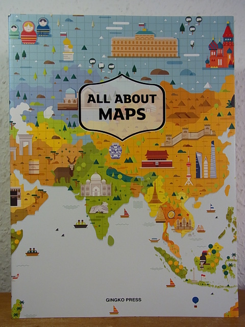
Sandu Publishing Co. and Wang Shaoqiang (Chief Editor)
All about Maps
Gingko Press, Berkeley, 2016. 240 S. ; 28,5 x 21 cm ; kart. ;
Bookseller reference : 124408
|
|
|
SANKEY H.R.
The Maps of the Ordnance Survey: a Mid-Victorian View.
8vo., First Edition, with illustrations in the text; printed wrappers, a near fine copy.
|
|
|
Sanmarchi Toni
Itinerari Alpini 8 - ALTA VIA DEI SILENZI Dalle sorgenti del Piave a Vittorio Veneto
ITINERARI ALPINI Guideper alpinisti ed escursionisti 8 - Premessa - Caratteristiche dell'Alta Via e avvertenze generali - Cartografia e bibliografia - L'accesso...- Alta Via... - Il Gruppo del Duranno 1 15,5x10,5 cm., brossura editoriale plastificata, in sguardie Itinerario completo, pp. 195 (5), numerose illustrazioni in bianconero, schizzi, grafici, tutto nel testo, prima edizione, in italiano, buone condizioni. RARO Ex libris
|
|
|
SANSON (Nicolas).
Espagne
(Paris, 1752), mapa grabado en madera de 14'5 x 16'5 cm.
|
|
|
SANSON (Nicolas).
l'Asie.
(Paris, 1752), mapa grabado en madera de 15 x 16'5 cm.
|
|
|
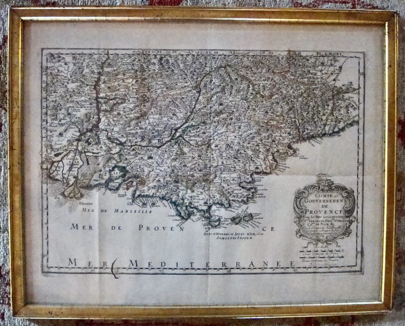
Sanson d'Abbeville
Comté et Gouvernement de Provence. Aveq les pays circonvoisins Comtat Venaiscin, Principauté d'Orange, Comtat de Nice, etc.
À Paris chez l'autheur. Encadré Très bon Paris 1669 1669 44 x 55 cm avec son cadre ancien.
Bookseller reference : 7613
|
|
|
Sanson d'Abbeville Nicolas
L'Europe / L'Asie, en plusieurs cartes nouvelles et exactes... / L'Afrique, en plusieurs cartes nouvelles et exactes... / L'Amérique, en plusieurs cartes nouvelles et exactes...
Chez L'auteur Relié 1662 "MAGNIFIQUE ENSEMBLE DES QUATRE CONTINENTS CARTOGRAPHIÉS PAR LE PREMIER CARTOGRAPHE FRANÇAIS, DANS UN ÉTAT DE FRAICHEUR INCOMPARABLE. Quatre volumes petit in-4 (18,5 x 25 cm), reliés en plein veau brun de l'époque. Les reliures sont toutes identiques, dos à 5 nerfs, titrés, roulettes dorées sur les coupes. Nicolas Sanson d'Abbeville est considéré comme le fondateur de la cartographie en France. En 1627, rencontrant Richelieu (il venait d'Abbeville et s'était installé à Paris), il fut présenté par lui à Louis XIII, qui le nomma Géographe Ordinaire du Roi. Il cartographia quatre continents (ici présents : l'Europe, l'Asie, l'Afrique et l'Amérique), et fut même le premier à cartographier certaines parties du globe (ainsi, par exemple, la région des grands lacs canadiens, avec sa carte ""Le Canada ou Nouvelle France"" (carte datant de 1656)). Il fut le premier Français à concevoir le plan d'un atlas mondial. Les cartes et le texte de chaque volume sont entièrement montés sur onglets. Chaque carte reçoit un commentaire explicatif, avec informations sur l'économie, les habitants et les moeurs du pays décrit, tiré des auteurs anciens (Pline, Strabbon...), de récits de voyageurs ou de rapports des missions des jésuites. De plus, chacune des cartes présente les tracés de contours des pays ou régions aquarellés. Les volumes s'organisent comme suit : L'Europe (sans date) : Titre et dédicace gravés sur double page, 12 cartes doubles et 30 feuillets imprimés au recto. L'Asie (1662) : 108 pages (avec erreurs connues de chiffrage et inversion de feuillets) et 17 cartes doubles. L'Afrique (1662) : 96 pages et 17 planches doubles, proposant 18 cartes (car l'une des planches porte deux cartes) (ce volume est le seul à présenter une petite mouillure sur les quelques premières pages). L'Amérique (1662) : non paginé (80 pages) et 15 cartes doubles. Nos exemplaires sont en TRÈS BEL ÉTAT. Les pages sont très fraiches, sans aucune réelle trace, tache, piqûre ni mouillure. Les cartes, particulièrement, sont dans un vraiment très bel état de fraîcheur, avec des couleurs extrêmement éclatantes. Les reliures présentent des traces peu visibles de réparations anciennes. Les volumes ont étés reliés avec contre-gardes, mais sans pages de garde. Ce rare ensemble est véritablement en TRÈS BEL ÉTAT. Livraison a domicile (La Poste) ou en Mondial Relay sur simple demande."
Bookseller reference : bf4740
|
|
|
SANSON, NICOLAS (D'ABEVILLE) - ALEXIS HUBERT JAILLOT.
Partie du Duché de Milan, la Principauté de Piémont, le Montferrat et la Republique de Genes.
Dalla “Cartes générales de toute les parties du Monde”, Parigi, 1654. Paris, H. Iaillot primi anni del XVIII secolo. Incisione in rame, confini in col. d’epoca, cm 55 x 73,5 (alla lastra). Sopra l’originale didascalia, è stata riportata, fuori del margine superiore della parte incisa e a ricoprire la battuta della lastra, entro la quale si trova l’originale didascalia, una ulteriore scritta esplicativa. Una lieve gora d’umido all'angolo superiore bianco, peraltro esemplare fresco, in bella coloritura, con una bella impressione e grandi margini, in ottimo stato di conservazione.

|
|
|
SANSON, NICOLAS (D'ABEVILLE).
Les estats de Savoye, Piemont et le Comté de Nice.
Amsterdam, Pierre Scenk, 1654 circa. Tratta da “Cartes générales de toute les parties du Monde” (Parigi, 1654), incisione in rame, colore d’epoca, cm 49 x 58 (alla lastra). Leggermente rifilato al margine superiore, esemplare fresco, in bella impressione e in bella coloritura. .

|
|
|
SANSON, NICOLAS - PEYROUNIN, ABRAHAM.
Carte generalle du Royaume de Danemarc.
Paris, Pierre Mariette, Rue S. Jacques a l'Esperance, 1646. Incisione in rame all'acquaforte, confini in colore d'epoca, in basso a destra, in lastra, "A. Peyrounin fecit 1646". La carta è anteriore a quella di Pierre Du Val che reca il titolo "Carte du Royaume de Danemarq, et de la partie Meridionale de la Gotie", del 1686. Abraham Peyrounin (1620 – 1666 circa), incisore francese attivo a Parigi durante la metà del XVII secolo. Della sua vita poco sappiamo e il suo nome resta legato a quello dei più noti Nicolas Sanson e Pierre Mariette, con i quali collaborò per la realizzazione di carte e mappe. Esemplare stampato su carta fine, smarginato, una mancanza all'angolo superiore destro, sgualciture della carta, inciso buono e leggibile. .

|
|
|
SANSON, ROBERT.
Les Indes orientales où sont distingués les Empires et Royaumes qu'elles continnent tirées du Neptune Oriental. Par le S. Robert Géographe ordinaire du Roy.
Avec Privilege, (Paris), 1751. Incisione in rame all'acquaforte, confini in colore d'epoca, cm 50 x 58,5 (alla lastra) più margini. Cartiglio in cornice floreale in alto a sn, scala delle miglia in basso in riquadro. Sono segnalati le Golfe de Bengale, l'Ocean Indien e le Isles Maldives con tutte le numerose isole. Piega editoriale e un minimo accenno di foxing, leggermente rifilato il margine superiore, tenue e assai piacevole coloritura, buona conservazione.

|
|
|
SANTAREM Manuel Francisco de Barros e Sousa, vicomte de
Estudos de cartographia antiga
Lisbonne Alfredo Lamas, Motta & Cie s.d. [1919-1920] 2 vol. in-8 carrés demi-chagrin cerise à coins, dos à nerfs, têtes dorées, couverture conservée [Rel. de l'époque]
Bookseller reference : 26285
|
|
|
Santarem Visconde de
Estudos de cartographia antiga
Broché 1919 Deux volumes in-8 broché, CCLVIII, 260 pp. XVII cartes hors-texte, blasons hors-texte, deuxième volume : 318 pp., XLI planches hors-texte, exemplaire de la bibliothèque de t'Sersteven qui note en début d'ouvrage 'c'est un pieux recueil des notes qui avaient été prise par Santarem pour son histoire de la cosmogrpahie, précieux en ce qu'il nous donne une sorte de tableau chronologique des plus anciennes cartes, avec commentaires interessant, Pp 51 et 11, envoi de l'auteur à un certain H. Vallée, ouvrage en grande partie en portugais ; dos fragiles, bon état. Livraison a domicile (La Poste) ou en Mondial Relay sur simple demande.
Bookseller reference : bb3198
|
|
|
Santini Francesco; Bellin Jacques-Nicolas
Partie Meridionale de Portugal…
Incisione su rame all'acquaforte e bulino in due fogli incollati di mm 563 x 489. Bella vergata veneziana. Filigrana FV sormontate da tre stelle. Foglio a larghi margini in bellissima carta veneziana. Titolo entro ricco cartiglio in alto a destra. Toponimi e descrizioni geografiche nella mappa. Proveniente da: "Atlas universel dressé sur les meilleures cartes modernes", Venezia 1784. Gli Atlanti stampati da Francesco Santini, che, come indicato spesso nelle carte, teneva bottega a Santa Giustina, nel Sestiere di Castello, riutilizzano le lastre incise da Lattrè e disegnate da Janvier per l' "Atlas Moderne" stampato a Parigi nel 1771. L'Atlante di Janvier ebbe un immediato apprezzamento, sia per la precisione geografica, che per i ricchi cartigli molto decorativi. Robert (Jean) Janvier: working in Paris in the second half of the eighteenth century, Jean Janvier (1746 – 1776) produced a series of maps in the later half of the century. While there is some confusion about his Christian name, his maps usually were inscribed “Le Sieur Janvier”. He is best known for his collaboration with engraver Jean Lattre for an Atlas Moderne first released in 1762 and in several later editions some by C. F. Delamarche and by Chez Remondini. He also produced several maps used in general atlases by William Fadan and P. Santini.

|
|
|
Santini Francesco; Bellin Jacques-Nicolas
Partie Septentrionale de Portugal…
Incisione su rame all'acquaforte e bulino in due fogli incollati di mm 563 x 489. Bella vergata veneziana. Filigrana tre lune. Foglio a larghi margini in bellissima carta veneziana tre lune. Titolo entro ricco cartiglio in alto a destra. Toponimi e descrizioni geografiche nella mappa. Proveniente da: "Atlas universel dressé sur les meilleures cartes modernes", Venezia 1784. Gli Atlanti stampati da Francesco Santini, che, come indicato spesso nelle carte, teneva bottega a Santa Giustina, nel Sestiere di Castello, riutilizzano le lastre incise da Lattrè e disegnate da Janvier per l' "Atlas Moderne" stampato a Parigi nel 1771. L'Atlante di Janvier ebbe un immediato apprezzamento, sia per la precisione geografica, che per i ricchi cartigli molto decorativi. Robert (Jean) Janvier: working in Paris in the second half of the eighteenth century, Jean Janvier (1746 – 1776) produced a series of maps in the later half of the century. While there is some confusion about his Christian name, his maps usually were inscribed “Le Sieur Janvier”. He is best known for his collaboration with engraver Jean Lattre for an Atlas Moderne first released in 1762 and in several later editions some by C. F. Delamarche and by Chez Remondini. He also produced several maps used in general atlases by William Fadan and P. Santini.

|
|
|
Santini Francesco; D'Anville, Jean Baptiste
Gallia Antiqua ex Aevi Romani Monumentis Eruta et Ser.mi Carnutum Ducis Munifcientia Publicis iuris facta.
Incisione su rame all'acquaforte e bulino in due fogli incollati di mm 572 x 482. Bella vergata veneziana. Filigrana AS. Foglio a larghi margini in candida e spessa carta di filo veneziana. Titolo entro ricco cartiglio in alto a destra. Elenco delle province antiche. Toponimi e descrizioni geografiche nella mappa. Proveniente da: "Atlas universel dressé sur les meilleures cartes modernes", Venezia 1776 (ma 1760). Gli Atlanti stampati da Francesco Santini, che, come indicato spesso nelle carte, teneva bottega a Santa Giustina, nel Sestiere di Castello, riutilizzano le lastre incise da Lattrè e disegnate da Janvier per l' "Atlas Moderne" stampato a Parigi nel 1771. L'Atlante di Janvier ebbe un immediato apprezzamento, sia per la precisione geografica, che per i ricchi cartigli molto decorativi. Robert (Jean) Janvier: working in Paris in the second half of the eighteenth century, Jean Janvier (1746 – 1776) produced a series of maps in the later half of the century. While there is some confusion about his Christian name, his maps usually were inscribed “Le Sieur Janvier”. He is best known for his collaboration with engraver Jean Lattre for an Atlas Moderne first released in 1762 and in several later editions some by C. F. Delamarche and by Chez Remondini. He also produced several maps used in general atlases by William Fadan and P. Santini.

|
|
|
Santini Francesco; De Vaugondy, Robert
Britannicae Insulae in quibus Albion seu Britannia Major, et Ivernia seu Britannia Minor…"
Incisione su rame all'acquaforte e bulino in due fogli incollati di mm 556 x 485. Bella vergata veneziana. Filigrana AV e stelle. Foglio a larghi margini. Una gora pesante sul margine bianco sinistro e tre più lievi entro la battuta. Titolo entro ricco cartiglio in alto a sinistra. Toponimi e descrizioni geografiche nella mappa. Proveniente da: "Atlas universel dressé sur les meilleures cartes modernes", Venezia 1784 (ma 1780). Gli Atlanti stampati da Francesco Santini, che, come indicato spesso nelle carte, teneva bottega a Santa Giustina, nel Sestiere di Castello, riutilizzano le lastre incise da Lattrè e disegnate da Janvier per l' "Atlas Moderne" stampato a Parigi nel 1771. L'Atlante di Janvier ebbe un immediato apprezzamento, sia per la precisione geografica, che per i ricchi cartigli molto decorativi. Robert (Jean) Janvier: working in Paris in the second half of the eighteenth century, Jean Janvier (1746 – 1776) produced a series of maps in the later half of the century. While there is some confusion about his Christian name, his maps usually were inscribed “Le Sieur Janvier”. He is best known for his collaboration with engraver Jean Lattre for an Atlas Moderne first released in 1762 and in several later editions some by C. F. Delamarche and by Chez Remondini. He also produced several maps used in general atlases by William Fadan and P. Santini.

|
|
|
Santini Francesco; De Vaugondy, Robert
Royaume de Danemarck qui comprend le Nort-Jutland …le Sud-Jutland… et le Isles de Fionie, Sélande, Laland, & c.
Incisione su rame all'acquaforte e bulino in due fogli incollati di mm 575 x 486. Bella vergata veneziana. Filigrana trelune. Foglio a larghi margini. Una gora leggera nella parte centrale. Titolo entro ricco cartiglio in alto a destra. Toponimi e descrizioni geografiche nella mappa. Proveniente da: "Atlas universel dressé sur les meilleures cartes modernes", Venezia 1776. Gli Atlanti stampati da Francesco Santini, che, come indicato spesso nelle carte, teneva bottega a Santa Giustina, nel Sestiere di Castello, riutilizzano le lastre incise da Lattrè e disegnate da Janvier per l' "Atlas Moderne" stampato a Parigi nel 1771. L'Atlante di Janvier ebbe un immediato apprezzamento, sia per la precisione geografica, che per i ricchi cartigli molto decorativi. Robert (Jean) Janvier: working in Paris in the second half of the eighteenth century, Jean Janvier (1746 – 1776) produced a series of maps in the later half of the century. While there is some confusion about his Christian name, his maps usually were inscribed “Le Sieur Janvier”. He is best known for his collaboration with engraver Jean Lattre for an Atlas Moderne first released in 1762 and in several later editions some by C. F. Delamarche and by Chez Remondini. He also produced several maps used in general atlases by William Fadan and P. Santini.
|
|
|
Santini Francesco; Remondini Giuseppe
Carte du Grand-Duchè de Toscane par le Sr. Robert Geographe ordin. Du Roy
Incisione su rame all'acquaforte e bulino, foglio di 630 x 540 mm alla battuta mm 576 x 490. Bella vergata veneziana. Ottimo foglio a larghi margini. Titolo entro ricco cartiglio in basso a sinistra. Toponimi e descrizioni geografiche nella mappa. Proveniente da: "Atlas universel dressé sur les meilleures cartes modernes", Venezia 1776. Gli Atlanti stampati da Francesco Santini, che, come indicato spesso nelle carte, teneva bottega a Santa Giustina, nel Sestiere di Castello, riutilizzano le lastre incise dai migliori geografi francesi dell'epoca.

|
|
|
Santini Francesco; Remondini Giuseppe
Frontespizio allegorico dell'Atlas Universel dresseè sur les meilleures cartes modernes
Incisione all'acquaforte di mm 366 x 498 su bella carta di filo veneziana. Si tratta del magnifico frontespizio per l'Atlante di Santini pubblicato da Remondini nel 1784. In realtà non è chiaro l'autore di questa bellissima tavola, per cui si sono fatti i nomi dei più grandi incisori veneziani dell'epoca. Foglio privo di difetti.

|
|
|
Santini Francesco; Remondini Giuseppe
Partie Meridionale de la Russie Europeenne ou sont distinguees exactament toutes le Provinces d'apres le detail de l'Atlas Russien.
Incisione su rame all'acquaforte e bulino in due fogli uniti di mm 652 x 490.Bella vergata veneziana. Filigrana "R". Ottimo foglio a larghi margini. Titolo entro ricco cartiglio in alto a destra. Toponimi e descrizioni geografiche nella mappa. Proveniente da: "Atlas universel dressé sur les meilleures cartes modernes", Venezia 1776. Gli Atlanti stampati da Francesco Santini, che, come indicato spesso nelle carte, teneva bottega a Santa Giustina, nel Sestiere di Castello, riutilizzano le lastre incise dai migliori geografi francesi dell'epoca.

|
|
|
SANTINI PAOLO
ASIA MINOR IN SUAS PARTES SEU PROVINCIAS DIVISA
SANTINI PAOLO ASIA MINOR IN SUAS PARTES SEU PROVINCIAS DIVISA. Venezia, Remondini Seconda metà XVIII sec., Dall' "Atlas Universel" stampato a Venezia nel 1776 e nel 1784. Il soggetto riprende la precendete carta di R. De Vaugondy. Buono (Good) Buon es.. acquaforte acquerellata a mano <br> cm. 62,3 x 50 (inciso) <br> <br> <br>

|
|
|
SANTINI Paolo
ATLAS UNIVERSEL DRESSE' SUR LES MEILLEURES CARTES MODERNES.
chez P. Santini rue Ste Justine, Venise, 1776. In folio gr. (mm. 512x365), 2 volumi, mz. pelle coeva (restaurata ai dorsi). Questo prestigioso Atlante contiene: bel frontespizio calcografico figurato, 1 c. incisa Table des cartes gographiques de la premire partie du Nouvel Atlas con l'elenco su due colonne delle 60 carte geografiche a doppia pagina; la prima tav. ha per titolo Mappemonde ou description du globe terrestre assujettie aux observations astronomiques par le Sr. Janvier Gographe / par Franois Santini, Rue Ste Justine, chez M. Remondini - la seconda tav. Nouvelle Mappemonde ddi au progrs de nos connoissances, Venise chez Franois Santini, Rue Ste. Justine. Nel bordo inferiore un lungo commento sul nuovo mappamondo.Nel secondo vol.: 1 c. incisa Table des cartes gographiques de la seconde partie du Nouvel Atlas con l'elenco delle 63 carte geografiche a doppia pagina. Le ultime 10 tavv. sono raggruppate sotto il titolo Cartes de la Gographie ancienne, da Orbis veterum notus a Terra Sancta. Le carte geografiche sono datate dal 1775 al 1780, per lo pi con l'indicazione par P. Santini, chez M. Remondini.Il grande atlante di Santini (cartografo, incisore ed editore, 1729-1793) rappresenta uno dei pi significativi esempli di Atlante universale stampato nel 700 in Italia. Le carte, tutte con i confini finemente acquarellati d'epoca, con il titolo entro ricco cartiglio, sono firmate da Paolo Santini (20 dal fratello Franois) e riprese dai migliori geografi del suo tempo: d'Anville, Bellin, Bonne, Boscovich, Clarici, De L'isle, Hritiers Homan, Jaillot, Janvier, Robert de Vaugondy, Rizzi Zannoni. Oltre ai due mappamondi, da segnalare le 23 carte dedicate all'Italia, quelle relative al Giappone, alla Cina, all'Africa e alle Americhe.Paolo Santini e il fratello Franois avevano sostanzialmente copiato nel disegno e fatto incidere, mantenendo toponimi e iscrizioni in lingua francese, l'Atlas Universel pubblicato a Parigi nel 1757 a cura di Gilles e Didier Robert de Vaugondy, e le modifiche riguardano soprattutto le carte delle regioni italiane. L'Atlante non ebbe una grande fortuna editoriale e usc in poche copie (di qui la rarit dell'opera). Nel 1777 il Santini cedette i diritti di pubblicazione all'editore Giuseppe Remondini di Bassano del Grappa che nel 1781 acquist le matrici in rame per ristampare ampliato - nel 1784 - l'Atlas Universel.Cfr. Tooley, p. 541 e 559. Un certo numero di carte geografiche hanno margini brevi (per lo pi super. o infer.), con qualche alone e tracce d'uso marginali ma complessivam. esemplare ben conservato.
Bookseller reference : 145003
|
|
|
SANTINI PAOLO
CARTE DE L'EGYPTE ANCIENNE ET MODERNE
SANTINI PAOLO CARTE DE L'EGYPTE ANCIENNE ET MODERNE. Venezia, Remondini 1779, Dall' "Atlas Universel" stampato a Venezia nel 1776 e nel 1784. Il soggetto riprende la precendete carta di R. De Vaugondy. Buono (Good) Buon es.. acquaforte acquerellata a mano <br> cm. 48,3 x 65 (inciso) <br> <br> <br>

|
|
|
SANTINI PAOLO
CARTE DE L'EMPIRE DE PERSE DRESSEE SUR LES CARTES DU S. D'ANVILLE
SANTINI PAOLO CARTE DE L'EMPIRE DE PERSE DRESSEE SUR LES CARTES DU S. D'ANVILLE. Venezia, Remondini 1779, Dall' "Atlas Universel" stampato a Venezia nel 1776 e nel 1784. Buono (Good) Buon es.. acquaforte acquerellata a mano <br> cm. 62,8 x 49,9 (inciso) <br> <br> <br>

|
|
|
SANTINI PAOLO
CARTE DE LA BARBARIE, CONTENANT LES ROYAUMES DE MAROC, DE FEZ, D'ALGER, DE TUNIS ET DE TRIPOLI AVEC LES DESERTS LIMITROPHES DE L'INTERIEUR DE L'AFRIQUE
SANTINI PAOLO CARTE DE LA BARBARIE, CONTENANT LES ROYAUMES DE MAROC, DE FEZ, D'ALGER, DE TUNIS ET DE TRIPOLI AVEC LES DESERTS LIMITROPHES DE L'INTERIEUR DE L'AFRIQUE. Venezia, Remondini 1775, Dall' "Atlas Universel" stampato a Venezia nel 1776 e nel 1784. Il soggetto riprende la precendete carta di R. De Vaugondy e J. B. D'anville Buono (Good) Buon es.. acquaforte acquerellata a mano <br> cm. 56,6 x 47,5 (inciso) <br> <br> <br>

|
|
|
SANTINI PAOLO
CARTE DE LA GEORGIE ET DES PAYS SITUES ENTRE LA MER NOIRE ET LA MER CASPIENNE
SANTINI PAOLO CARTE DE LA GEORGIE ET DES PAYS SITUES ENTRE LA MER NOIRE ET LA MER CASPIENNE. Venezia, Remondini 1775, Dall' "Atlas Universel" stampato a Venezia nel 1776 e nel 1784. Buono (Good) Buon es.. acquaforte acquerellata a mano <br> cm. 68 x 50 (inciso) <br> <br> <br>

|
|
|
 Receive by email
 Download as PDF document
 RSS feed


