|
|
|
Touring Club Italiano
GOLFO di NAPOLI. Foglio I. Napoli, il Vesuvio, i Campi Flegrei, Ischia + Foglio II. La Penisola Sorrentina, Salerno, Capri. Scala 1:50.000. Carta delle zone turistiche d'Italia. A COLORI.
Due carte geografiche di cm. 54,6x80,2 a colori, ripiegate ciascuna nella sua busta editoriale in pergamino e valina quadrettata (rinforzo in carta trasparente - ma non scotch! - ai bordi della busta). ALLEGATO a ogni carta l'opuscolo di 8 pagine di INDICI e istruzioni, di cm 19,4x14,3, ilano, Capriolo e Massimino. Le due carte sono come nuove.
|
|
|
Touring Club Italiano
Guida delle strade di grande comunicazione. Italia insulare, possedimenti e colonie
16°, 17 cm, pp. 258, numerose figure nel testo, rilegatura editoriale in tela, titolo al piatto, esemplare ottimo

|
|
|
TOURING CLUB ITALIANO
Indice generale della Carta d'Italia del T.C.I. alla scala 1:250.000 compilato sotto la direzione di L.V. Bertarelli
1 Vol. In-4 t. editoriale. Bello stemma a col. sovrappl. al piatto pag. 487 una cartina ripiegata in fine PROG 42899 CATT_ATT 57
|
|
|
TOURING CLUB ITALIANO
N. 4 Carte delle zone turistiche d'Italia (scala 1:50.000): 1) IL CERVINO E IL MONTE ROSA - 2) BOLZANO E DINTORNI - 3) MERANO E DINTORNI - 4) VAL GARDENA, CATINACCIO, GRUPPO DI SELLA, MARMOLADA
N. 4 carte topografiche a colori più volte ripiegate in scala 1: 50.000, dim. ripiegate (entro buste in carta con titoli in nero) L. 16 x 20,5 cm. - Dim. delle singole carte: 1) IL CERVINO E IL MONTE ROSA (dim. 79,5 x 54 cm.) - 2) BOLZANO E DINTORNI (dim. L. 54 x 40 cm.) - 3) MERANO E DINTORNI (dim. L. 54 x 40 cm.) - 4) VAL GARDENA, CATINACCIO, GRUPPO DI SELLA, MARMOLADA (dim. L. 78,5 x 54 cm.) - Ogni carta è corredata da 4-8 pag. di fogli sfusi con indici dei nomi. Disponibilità: 2 serie di 4 carte.

|
|
|
TOURING CLUB ITALIANO
N. 4 carte delle zone turistiche d'Italia (scala 1.50.000): 1) GOLFO DI NAPOLI (foglio 1) NAPOLI, IL VESUVIO, I CAMPI FLEGREI, ISCHIA - 2) GOLFO DI NAPOLI (foglio 2) LA PENISDOLA SORRENTINA, SALERNO, CAPRI - 3) LA RIVIERA DI LEVANTE DA GENOVA A SESTRI - 4) ROMA E DINTORNI (scala 1:200.000)
N. 4 carte topografiche a colori più volte ripiegate in scala 1: 50.000, dim. ripiegate (entro buste in carta con titoli in nero) L. 16 x 20,5 cm. - Dim. delle singole carte: 1) GOLFO DI NAPOLI (foglio 1) NAPOLI, IL VESUVIO, I CAMPI FLEGREI, ISCHIA (dim. L. 79,5 x 54 cm.) - 2) GOLFO DI NAPOLI (foglio 2) LA PENISDOLA SORRENTINA, SALERNO, CAPRI (dim. L. 79,5 x 54 cm.) - 3) LA RIVIERA DI LEVANTE DA GENOVA A SESTRI (dim. L. 79,5 x 40 cm.) - 4) ROMA E DINTORNI (scala 1:200.000) dim. L. 79,5 x 59,5 cm. - Ogni carta è corredata da 4-8 pag. di fogli sfusi con indici dei nomi. Disponibilità: 2 serie di 4 carte.

|
|
|
TOURING CLUB ITALIANO
N. 5 carte delle zone turistiche d'Italia (scala 1.50.000): 1) GOLFO DI NAPOLI (foglio 1) NAPOLI, IL VESUVIO, I CAMPI FLEGREI, ISCHIA - 2) GOLFO DI NAPOLI (foglio 2) LA PENISDOLA SORRENTINA, SALERNO, CAPRI - 3) LA RIVIERA DI LEVANTE DA GENOVA A SESTRI - 4) ROMA E DINTORNI (scala 1:200.000) - 5) PALERMO, LA CONCA D'ORO E DINTORNI
N. 5 carte topografiche a colori più volte ripiegate in scala 1: 50.000, dim. ripiegate (entro buste in carta con titoli in nero) L. 16 x 20,5 cm. - Dim. delle singole carte: 1) GOLFO DI NAPOLI (foglio 1) NAPOLI, IL VESUVIO, I CAMPI FLEGREI, ISCHIA (dim. L. 79,5 x 54 cm.) - 2) GOLFO DI NAPOLI (foglio 2) LA PENISDOLA SORRENTINA, SALERNO, CAPRI (dim. L. 79,5 x 54 cm.) - 3) LA RIVIERA DI LEVANTE DA GENOVA A SESTRI (dim. L. 79,5 x 40 cm.) - 4) ROMA E DINTORNI (scala 1:200.000) dim. L. 79,5 x 59,5 cm. - 5) PALERMO, LA CONCA D'ORO E DINTORNI (dim. L. 79,5 x 45 cm.) - Ogni carta è corredata da 4-8 pag. di fogli sfusi con indici dei nomi.

|
|
|
TOURING CLUB ITALIANO.
Carta delle zone turistiche d'Italia. Bolzano e dintorni.
Con il classico astuccio in carta.
|
|
|
TOURING CLUB ITALIANO.
Carta delle zone turistiche d'Italia. Cortina D'Ampezzo, Dolomiti Cadorine.
Con il classico astuccio in carta.
|
|
|
TOURING CLUB ITALIANO.
Carta delle zone turistiche d'Italia. Golfo di Napoli – Foglio II La Penisola Sorrentina, Salerno, Capri.
Con il classico astuccio in carta. € 10.
|
|
|
TOURING CLUB ITALIANO.
Carta delle zone turistiche d'Italia. La Riviera di Levante da Genova a Sestri.
Con il classico astuccio in carta.
|
|
|
TOURING CLUB ITALIANO.
Carta delle zone turistiche d'Italia. Roma e dintorni.
Con il classico astuccio in carta.
|
|
|
TOURING CLUB ITALIANO.
Grande Carta automobilistica 1: 300.000. Foglio 6. Roma, Campobasso, Bari, Napoli, Lecce, Potenza.
1925 circa. In 8vo lungo, grande carta ripiegata dentro cartonatura con ill. pubblicitarie sia all'interno che all'esterno di entrambi i piatti di chiusura, quindi sui quattro lati. La carta contiene l'area di Roma, Campobasso, Bari, Napoli, Lecce, Potenza. Tranne usuali e minimi difetti molto buono lo stato di conservazione. .

|
|
|
Touring Club Italiano.touring Club Italiano.
IL NUOVISSIMO ATLANTE DEL TOURING. Volume 1: Italia ed Europa - Volume 2: Paesi extraeuropei.
(Codice CV/2037) In 4º (35 cm) 2 volumi, XII-263, XII-167 pp. Opera completa. Con 238 carte a colori in scale diverse di cui 66 pp. di cartografia tematica con 75 cartogrammi, ecc. Con molte fotografie, alcune immagini satelitari di grande formato e 132 pp. di indici. Legatura cartone editoriale illustrato. Ottimo e fresco esemplare. ~~~ SPEDIZIONE IN ITALIA SEMPRE TRACCIATA

|
|
|
Touwaidse R.H.
La Cartographie dans les éditions belges de la Description de tous les Pays-Bas de Lodovico Guicciardini.
Bross., cm 23,5x15, pp 55, 27 carte in b/n.. Tirés à part du Bullettin de la Societé Royale de Géographie d'Anvers. volume LXXXVI, 1975-1976. Tiré à 80 esemplaires distribués.

|
|
|
Tozer Henri Fanshawe.
GEOGRAFIA CLASSICA. Traduzione e note di Iginio Gentile. Quinta edizione riveduta e corretta.
(Codice MH/1054) In 16° 168-24 pp. Tela editoriale, lettera "H" impressa alla copertina sguardia e frontespizio. Buono stato. ~~~ SPEDIZIONE IN ITALIA SEMPRE TRACCIATA

|
|
|
Tozer,H.F.
Geografia classica.
<br/> TITOLO: Geografia classica. <br/> AUTORE: Tozer,H.F.<br/> CURATORE: Traduzione e note di Igino Gentile. Quarta edizione riveduta e coretta.<br/> EDITORE: Ulrico Hoepli Ed.<br/> DATA ED.: 1890,<br/> COLLANA: Coll.Manuali.<br/>
|
|
|
TOZZI Pierluigi
LA CITTA’ E IL MONDO IN OPICINO DE CANISTRIS. (1296-1350 ca.).
In-4 (cm. 30.70), cartonato editoriale, sovracoperta editoriale illustrata, pp. 127, (1), con illustrazioni in bianco e nero e a colori nel testo. Contiene biglietto con dedica del Presidente dell’Associazione Docenti e Ricercatori Ateneo Ticinense. Il precedente proprietario ha posto una plastica trasparente a protezione del volume. Minime, puntiformi macchie al taglio basso dell’antiporta; peraltro, volume in ottimo stato (nice copy).
|
|
|
Tozzi,MArio.
Piri Reis. Carta dell'Atlantico 1513.
<br/> STATO: USATO, COME NUOVO.<br/> TITOLO: Piri Reis. Carta dell'Atlantico 1513. <br/> AUTORE: Tozzi,MArio.<br/> CURATORE: Guida alla consultazione della carta.<br/> EDITORE: Progetto Editoriale Editions<br/> DATA ED.: 2002,<br/>
|
|
|
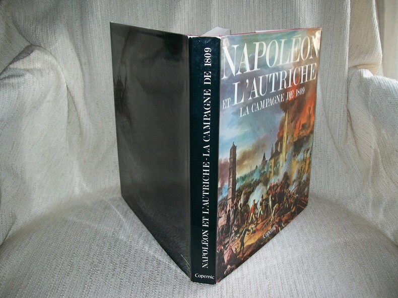
TRANIE CARMIGNANI
NAPOLEON ET L'AUTRICHE la Campagne de 1809.
Editions Copernic 1979. In-4 carré 239pp imprimées sur 2 colonnes. Reliure éditeur de toile rouge bradel, titre doré sur le dos, jaquette illustrée. Abondante et belle illustration dans le texte, à pleine page, en noir et en couleurs d'après Louis de Beaufort et des documents anciens, cartes du Colonel Michalon. Bel exemplaire frais et complet. Excellente documentation d'après les notes et documents du Commandant Henry Lachouque, très bien illustrée.
Bookseller reference : GITj298
|
|
|
TRAIN (W.).
Spain and Portugal.
Sin lugar ni año (Siglo XIX), mapa grabado en acero, contornos coloreados, 20 x 24'5 cm.
|
|
|
TRAMEZINO o TRAMEZINI Francesco & Michele
Candido lectori. Haec est illa insignis insula Creta : in medio ponto sita, centum urbibus clara, ab incolis iam curete dict
Acquaforte e bulino, 1559, firmata e datata in lastra in basso. Magnifica prova, impressa su carta vergata coeva con filigrana “tre tulipani in un cerchio con stella” (Woodward 121 databile al 1558), con ampli margini, in perfetto stato di conservazione.Magnifica e rarissima carta geografica dell’isola di Creta, caratterizzata dalla curiosa ed inusuale rappresentazione del mare, inciso da marcate linee realizzate al bulino. Il risultato è quello di una mare vivo, probabilmente nel tentativo di rappresentarlo come agitato. La carta è la prima rappresentazione in rame dell’isola e segue il modello silografico di Matteo Pagano, realizzato a Venezia nel 1538. L’opera è datata 1559 ed è intagliata da Sebastiano dal Re. Il Tooley cita un esemplare della collezione Beans con la data 1554, ma ci sentiamo di asserire che si tratti di un refuso. Probabile invece che della mappa esista un esemplare del 1558, data l’evidente correzione della data nella lastra.Sebastiano di Re, alle volte latinizzato con il nome di Sebastianus a Regiubus, era originario di Chioggia come lui setto amava firmarsi con l’aggettivo Clodiensis. La sua attività calcografica si svolge principalmente a Roma tra il 1557 ed il 1563. La sua prima opera cartografica è una mappa di Roma, copia dell’incisione di Beatricetto edita dal Lafrery. Il suo nome è associato dal 1558 all’editore e mercante veneziano, ma attivo nella capitale, Michele Tramezzino, e di Pirro Ligorio. Successivamente lavora anche per il figlio del Salamanca e per Bartolomeo Faleti. Nel 1560 diviene membro della Congregazione dei Virtuosi al Pantheon.Tutte le opera cartografiche del Re sono relative al periodo 1557-1563 e sono relative alla collaborazione con il Tramezzino. Francesco e Michele Tramezzino, editori nativi di Venezia ma attivi in entrambe le città tra il 1526 ed il 1576. La loro bottega calcografica era rivale di quella, egemone, di Salamanca e Lafrery. Pertanto le mappe edite dalla tipografia Tramezzino ebbero una tiratura assolutamente ristretta.Bibliografia: a) Borroni Salvadori (1980): n. 113; Ruge (1904-16): I, n. 67.58 e IV, n. 90.115b; Wieder (1915): p. 29, n. 51; Alberti (2005): p. 15, n. 21; Mostra Bergamo (2016): n. 33; Tooley (1939): n. 174; Zacharakis (1992): n. 2153 & 2154; Zacharakis (2004): n. 14.Esemplari noti: Dillingen, Studienbibliothek; Firenze, Biblioteca Nazionale; Madrid, Biblioteca Nacional; Parigi, Bibliothèque Nationale; Roma, Alessandrina; Roma, Biblioteca Apostolica Vaticana; Rostock, Universitatsbibliothek. Etching and engraving, 1559, signed and dated in the plate at the bottom. Magnificent proof, printed on contemporary laid paper with watermark "three tulips in a circle with a star" (Woodward 121 dating back to 1558), with wide margins, in perfect condition.Magnificent and rare map of the island of Crete, characterized by the curious and unusual representation of the sea, engraved by strong lines built with the burin. The result is that of a sea vivo, probably in an attempt to represent it as agitated. The map is the first copper plate of Crete and follows the woodcut model by Matteo Pagano, made in Venice in 1538. The work is dated 1559 and is carved by Sebastiano del Re. Tooley cites an example of the collection Beans with the date 1554. Sebastiano di Re, sometimes Latinized as the Sebastianus to Regiubus, was a native of Chioggia as he liked to sign his septum with the adjective Clodiensis. Its activity is mainly intaglio in Rome between 1557 and 1563. His first work is a cartographic map of Rome, a copy of the engraving published by Beatricetto Lafrery. His name is associated, from 1558, with the editor and merchant Venetian, but active in the capital, Michele Tramezzino, and Pirro Ligorio. He later worked for the son of Salamanca and Bartolomeo Faleti. In 1560 he became a member of the Congregazione dei Virtuosi al Pantheon.All cartographic works by Di Re covered the period 1557-1563 and relate to the collaboration with Tramezzino. Francesco and Michele Tramezzino, editors native of Venice, but active in both cities between 1526 and 1576. Their workshop was rival of the hegemonic printers Salamanca and Lafrery. Therefore the maps published by the typography Tramezzino had a circulation absolutely restricted.An extremely rare and fascinating map of Crete.Literature: Borroni Salvadori (1980): n. 113; Ruge (1904-16): I, n. 67.58 e IV, n. 90.115b; Wieder (1915): p. 29, n. 51; Alberti (2005): p. 15, n. 21; Mostra Bergamo (2016): n. 33; Tooley (1939): n. 174; Zacharakis (1992): n. 2153 & 2154; Zacharakis (2004): n. 14.Known example: Dillingen, Studienbibliothek; Firenze, Biblioteca Nazionale; Madrid, Biblioteca Nacional; Parigi, Bibliothèque Nationale; Roma, Alessandrina; Roma, Biblioteca Apostolica Vaticana; Rostock, Universitatsbibliothek.

|
|
|
TRASMIGRAZIONI ED INVASIONI DE' BARBARI donde provennero, vie da essi percorse, paesi che occuparono, o dove furono distrutti.
Carta incisa in rame e acquarellata a mano.
Carta di cm 37,5 x 51 alla battuta, più i margini, su tav. piegata a metà. Tratta da 'Atlante storico, geografico, genealogico, cronologico e letterario di M. A. Le Sage in ogni sua parte corretto, ampliato e proseguito sino all'anno corrente. Prima Veneta Edizione'. Aloncini d'umido al centro delle due metà della tavola.
|
|
|
Traversi C
Tecnica cartografica
leggeri danni

|
|
|
TRAVERSI Carlo -
Cartografia e topografia.
Firenze, IGM, 1976, 8vo stralcio con copertina posticcia muta, pp. 325/351 con numerose illustrazioni e carte.. - !! ATTENZIONE !!: Con il termine estratto (o stralcio) intendiamo riferirci ad un fascicolo contenente un articolo, completo in se, sia che esso sia stato stampato a parte utilizzando la stessa composizione sia che provenga direttamente da una rivista. Le pagine sono indicate come "da/a", ad esempio: 229/231 significa che il testo è composto da tre pagine. Quando la rivista di provenienza non viene indicata é perché ci è sconosciuta. - !! ATTENTION !!: : NOT A BOOK : “extract” or “excerpt” means simply a few pages, original nonetheless, printed in a magazine. Pages are indicated as in "from” “to", for example: 229/231 means the text comprises three pages (229, 230 and 231). If the magazine that contained the pages is not mentioned, it is because it is unknown to us.

|
|
|
TRAVERSI Carlo -
I plastici in materiale polivinilico, o carte in rilievo alla scala 1:200.000, dell'Istituto Geografico Militare.
Firenze, 1957, 8vo stralcio con copertina posticcia muta, pp. 609/612 con 2 illustrazioni in nero e 2 a colori nel testo. - !! ATTENZIONE !!: Con il termine estratto (o stralcio) intendiamo riferirci ad un fascicolo contenente un articolo, completo in se, sia che esso sia stato stampato a parte utilizzando la stessa composizione sia che provenga direttamente da una rivista. Le pagine sono indicate come "da/a", ad esempio: 229/231 significa che il testo è composto da tre pagine. Quando la rivista di provenienza non viene indicata é perché ci è sconosciuta. - !! ATTENTION !!: : NOT A BOOK : “extract” or “excerpt” means simply a few pages, original nonetheless, printed in a magazine. Pages are indicated as in "from” “to", for example: 229/231 means the text comprises three pages (229, 230 and 231). If the magazine that contained the pages is not mentioned, it is because it is unknown to us.

|
|
|
TRAVERSI Carlo -
L'alternativa della carta numerica.
Firenze, IGM, 1974, 8vo stralcio con copertina posticcia muta, pp. 639/648. - !! ATTENZIONE !!: Con il termine estratto (o stralcio) intendiamo riferirci ad un fascicolo contenente un articolo, completo in se, sia che esso sia stato stampato a parte utilizzando la stessa composizione sia che provenga direttamente da una rivista. Le pagine sono indicate come "da/a", ad esempio: 229/231 significa che il testo è composto da tre pagine. Quando la rivista di provenienza non viene indicata é perché ci è sconosciuta. - !! ATTENTION !!: : NOT A BOOK : “extract” or “excerpt” means simply a few pages, original nonetheless, printed in a magazine. Pages are indicated as in "from” “to", for example: 229/231 means the text comprises three pages (229, 230 and 231). If the magazine that contained the pages is not mentioned, it is because it is unknown to us.

|
|
|
TRAVERSI Carlo -
La Carta d'Italia alla scala 1:200.000.
Firenze, 1957, 8vo stralcio con copertina posticcia muta, pp. 389/392 con una carta a colori a pagina doppia nel testo. - !! ATTENZIONE !!: Con il termine estratto (o stralcio) intendiamo riferirci ad un fascicolo contenente un articolo, completo in se, sia che esso sia stato stampato a parte utilizzando la stessa composizione sia che provenga direttamente da una rivista. Le pagine sono indicate come "da/a", ad esempio: 229/231 significa che il testo è composto da tre pagine. Quando la rivista di provenienza non viene indicata é perché ci è sconosciuta. - !! ATTENTION !!: : NOT A BOOK : “extract” or “excerpt” means simply a few pages, original nonetheless, printed in a magazine. Pages are indicated as in "from” “to", for example: 229/231 means the text comprises three pages (229, 230 and 231). If the magazine that contained the pages is not mentioned, it is because it is unknown to us.

|
|
|
TRAVERSI Carlo -
Le carte tematiche e l'interpretazione tra la geografia e altre scienze.
Firenze, IGM, 1974, 8vo stralcio con copertina posticcia muta, pp. 335/346 con illustrazioni e grafici. - !! ATTENZIONE !!: Con il termine estratto (o stralcio) intendiamo riferirci ad un fascicolo contenente un articolo, completo in se, sia che esso sia stato stampato a parte utilizzando la stessa composizione sia che provenga direttamente da una rivista. Le pagine sono indicate come "da/a", ad esempio: 229/231 significa che il testo è composto da tre pagine. Quando la rivista di provenienza non viene indicata é perché ci è sconosciuta. - !! ATTENTION !!: : NOT A BOOK : “extract” or “excerpt” means simply a few pages, original nonetheless, printed in a magazine. Pages are indicated as in "from” “to", for example: 229/231 means the text comprises three pages (229, 230 and 231). If the magazine that contained the pages is not mentioned, it is because it is unknown to us.

|
|
|
Traversi,Carlo.
Tecnica cartografica.
<br/> STATO: USATO, MOLTO BUONO.<br/> TITOLO: Tecnica cartografica. <br/> AUTORE: Traversi,Carlo.<br/> EDITORE: Istituto Geografico Militare<br/> DATA ED.: 1968,<br/>
|
|
|
Tresoldi Lucia
Viaggiatori tedeschi in Italia. 1452-1870. Saggio bibliografico. Volume secondo [1800-1869] [Attenzione: solo secondo volume]
illustrazioni

|
|
|
Trippini Sergio - Valerio Vladimiro
L'America vista dall'Italia. Carte e atlanti dal XVI al XIX secolo. Civitella del Lago (Tr), 6/8 settembre 2013.
Bross., cm 24x21,5, pp 77, tavv. e ill. a col..

|
|
|
Troll, C. (Hrsg.)
Der große Handatlas.
Wiesbaden, Suchier u. Englisch, o.J. (ca. 1970). Fol. M. zahlr. (meist farb.) Ktn. u. Abb. 200 S. OLwd. M. Rsign. St. a. Tit.
Bookseller reference : 136630
|
|
|
TRYSTRAM Forence
"Le procès des étoiles; récit de la prestigieuse expédition de trois savants français en Amérique du Sud et des mésaventures qui s'ensuivirent (1735-1771)."
Paris, Seghers, 1979. "16 x 25, 269 pp., quelques illustrations en N/B, quelques dessins, reliure d'édition carton + jaquette, bon état (cachet d'ex-propriétaire; jaquette légèrement défraîchie)."
Bookseller reference : 90924
|
|
|
TUCCI Michele -
Lavori e contributi dell'Amministrazione del Catasto nel campo della fotogrammetria aerea.
Roma, Ministero delle Finanze, 1936, 8vo brossura originale, pp. 4.

|
|
|
TUNUSLU HACI AHMET [AHMED], (16th century).
Dünya haritasi ve cografya risalesi.
New Turkish Paperback. Demy 8vo. (22 x 15 cm). In Turkish. 174 p., ills. Dünya haritasi ve cografya risalesi. Haci Ahmet was a purported Muslim cartographer linked to a 16th-century map of the world. Ahmet appended a commentary to the map, outlining his own life and an explanation for the creation of the map. But it is not clear whether Ahmet created the map, or whether he simply translated it into Turkish for use in the Ottoman world. Haci Ahmet appended a lengthy commentary to a 16th-century map of the world annotated in the Turkish language, known as The Ottoman Mappa Mundi of Haci Ahmet, amongst other titles, which opens with "Whoever wishes to know the true shape of the world, their minds shall be filled with light and their breast with joy.". The map is heart shaped, otherwise known as a "cordiform projection," a style that was popular in sixteenth century Europe, and the extant copy was printed from wooden blocks in Venice, Italy, in 1559. It was kept until the late 18th century in the archives of the Venetian Council of Ten. The map is now part of the Heritage Library in the Qatar National Library. Known as the "Mappamondo Haci Ahmet", the map outlines legends and place-names in Turkish, and it may be the first map in Turkish ever published for sale to an Ottoman audience. Whether the map is original, or was simply a translation into Turkish, it helps show how the people of the Ottoman Empire perceived themselves in relation to the wider world. Three small spheres appear below the main map at the bottom of the page - the central graphic represents Earth and a number of satellite planets, while the left and right depict constellations. Within the accompanying text of the map, Haci Ahmet explains that the map was created to share knowledge of the shape of the world, especially of the New World. Specifically, Ahmet points out that the classical philosophers, such as Plato and Socrates, did not know about the newly discovered continent, which he says shows that the world is round. He says that the New World demonstrates the "extent to which the Ottomans were participants in their own right in the process of physical expansion abroad and intellectual ferment at home that characterized the period of history commonly referred to as the Age of Exploration". Ahmet also assigns the Ottoman Empire's rulers and kingdoms to the celestial bodies represented in the lower quadrant of the map, a maneuver which has been interpreted as an effort to impose a hierarchical geopolitical system that preferences Ottoman rule above all other world powers. The map is considered unlikely to be original, and was probably translated into Turkish by Ahmet. The map has specific European characteristics, in that it includes the use of Western terms, suggesting Ahmet translated an older map into Turkish. In fact, throughout the map's accompanying text, Ahmet emphasizes translation, stating that he "translated it from the language and alphabet of the Europeans into that of the Muslims". A further argument made against Ahmet's authorship is that the "heart-shaped form of the map had already been used by earlier European cartographers". The map is "heart-shaped" and is constructed by a cordioform projection developed by 16th century cartographers and mathematicians including Johannes Werner (1468-1522), a German mathematician and geographer. The map has been tentatively linked to several other geographers, including Giovanni Battista Ramusio (1485-1557). It has also been argued that it shares similarities with a map by the French cartographer Orontius (1494-1555), published in 1534. Ahmet claimed the map was made for Ottoman princes, and some of the sons of Suleyman the Magnificent were interested in maps of the world and had looked to Venice for their production. This resulted in the development of Ottoman-Venetian relations, which offered "new interpretations of Venetian attitudes to the production of world maps for Ottoman clients".The map's printing in Venice hel
|
|
|
TURNER D.
Ordnance Survey Historical Guides. Surrey.
4to., First Edition, with a frontispiece, numerous coloured and monochrome photographs and maps throughout, and pictorial endpapers; grey cloth, backstrip lettered in silver, a very good, clean copy in unclipped dustwrapper.

|
|
|
Turri Eugenio.
L'ITALIA. Una nuova geografia. [a cura di Eugenio Turri, con la collaborazione di Umberto Bonapace]
(Codice CU/6273) In 4° (cm 36,5) 408 pp. Grande volume illustrato con centinaia di foto in nero e a colori, molte cartine e tabelle. Legatura similpelle editoriale, titolo oro, sovraccoperta con strappetti riparati, astuccio usato. Volume in ottimo stato. ~~~ SPEDIZIONE IN ITALIA SEMPRE TRACCIATA

|
|
|
Tyrrell G.W.
LA TERRA E I SUOI MISTERI.
(Codice GL/0055) In 16° 312 pp. Prima edizione italiana a cura di Alfredo Pollini. Con numerose foto su 14 tavole fuori testo e 54 figure nel testo. Brossura originale. Ottimo. ~~~ SPEDIZIONE IN ITALIA SEMPRE TRACCIATA

|
|
|
Töpfer, F
Kartographische Generalisierung.
Gotha, Haack, 1979. M. zahlr. (teils farb.) Abb. 336 S. OLwd. m. Originalschutzumschlag (kl. Randläsuren) (Petermanns geogr. Mitteil. Erg.-H. 276).
Bookseller reference : 604440
|
|
|
U.S.A.-
Carte illustrée des États-Unis d'Amérique
montrant les ressources, produits, topographie et principales ressources régionales. Publiée par l'Office d'Information de Guerre des États-Unis. s.l.n.d. Grande carte couleurs (810 x 607mm) plusieurs fois repliée, comprenant un texte Quelques faits sur les États-Unis et 3 petites cartes: voies ferrées, routes aériennes, grandes routes nationales. Petits accident minimes aux coins de pliage sinon bon état de cette carte très décorative.
Bookseller reference : ORD-10521
|
|
|
Ubujuh, J
Velika jezera Balkanskoia Poluostrva. Jezera Makedonije stare Srbije i Epira. Izdanie Akademije Nauka.
Belgrad, 1902. Gr.-Fol. 10 farb.(teils gef.) Ktn. In OHlwd.-Mappe m. 3 Stoffschließen. Rücken angerissen. Vorderdeckel fleckig. 1 Karte m. Einriss. St. verso Tit.
Bookseller reference : 183242
|
|
|
UGO PIZZARELLO ANTONIO MAURO
Bateaux à Venise, Nous et la Vogalonga.
L'Alta Riva cooperativa editoriale, 1984, 69 pages, format à l'italienne, état correct, légèrement taché et sali.
Bookseller reference : 10023
|
|
|
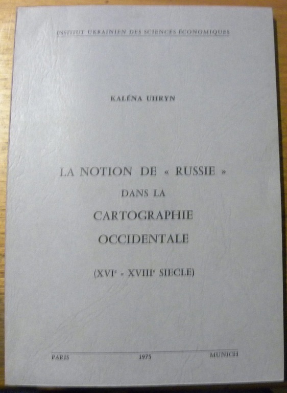
UHRYN, Kaléna.
La Notion de “Russie” dans la Cartographie Occidentale (XVIe - XVIIIe siècle). Préface de Michel Korzan.
Paris - Münich, Institut Ukrainien des Sciences Economiques 1975, 240x170mm, 144pages, broché. Bel exemplaire.
Bookseller reference : 31501
|
|
|
UMUR-I NAFIA VEKÂLETI.
[FIRST COMPLETE ROAD MAP OF TURKISH REPUBLIC] Türkiye Devleti Nafia Vekâleti Umur-i Nafia haritasidir. [i.e. The map by Ministry of Public Works of the Turkish State].
Very Good Turkish, Ottoman (1500-1928) Original chromo-lithograph map. Oblong: 63x95 cm. In Ottoman script (Turkish with Arabic letters). Folded. Chipped on extremities and slightly foxing. Otherwise a good map. Scale: 1:2.000.000. Detailed legends panel. This extremely rare huge map includes all railways, highways and other roads; Turkish borders with Iran, Russia, Greece, cities and their borders, printed shortly after the declaration of the republic in 1923. This is the first complete road map of the Republican period. The Ministry of Environment and Urban Planning is a government ministry office of the Republic of Turkey, responsible for the environment, public works, and urban planning in Turkey. The Ministry was formed in 1983 through the merger of the Ministry of Public Works (Turkish: Bayindirlik Bakanligi, formed 3 May 1920) and the Ministry of Development and Housing (Turkish: Imar ve Iskan Bakanligi, formed 1958). Antonio Zelic (Zellich) of Brela was one of many Dalmatians who left his homeland in pursuit of a better life during the 19th century. However, instead of going west, he set out toward the East, to the Ottoman imperial capital - Istanbul. Upon arrival in the city on the Bosphorus, Zelic found employment at the lithographic print house of Henri Cayol, the first of its kind in the Ottoman Empire. In 1869, Zelic opened his own lithographic print house called "Zellich and Sons" (A. Zellich et fils). His descendants continued his work with great success, and the Zellich Print House, now known as "Zellich Brothers" (Zellich frères), became one of the most renowned in the Empire. Zellich Brothers won recognition due to the high quality of their products, and, above all, the amazing beauty of their postcards and posters. Their crowning achievement was an order for the printing of the Ottoman Turkish Lira banknotes in 1914. Zellichs received many Ottoman and international awards, including medals conferred by the Pope, the Persian shah, and the Serbian king.". (Source: Documentary film "Zelic- Printers to the Empire", Levantineheritage). Extremely rare. Not in TBMM Library.; Not in OCLC.; Not in Turkish National Library.
|
|
|
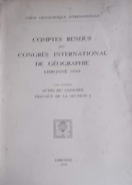
UNION GEOGRAPHIQUE INTERNATIONALE
Comptes rendus du Congrès International de Géographie Lisbonne 1949. Tome premier seul : Actes du congrès, travaux de la section I (cartographie). Articles en différentes langues. Carte hors texte du Portugal à l'échelle 1 10 000.
Couverture souple. Broché. 335 pages.
Bookseller reference : 95284
|
|
|
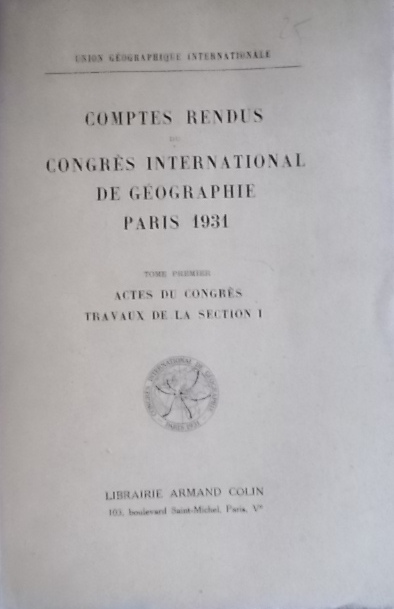
UNION GEOGRAPHIQUE INTERNATIONALE
Comptes rendus du Congrès International de Géographie Paris 1931. Tome premier seul : Actes du congrès, travaux de la section I (cartographie).
Couverture souple. Broché. 360 pages.
Bookseller reference : 95285
|
|
|
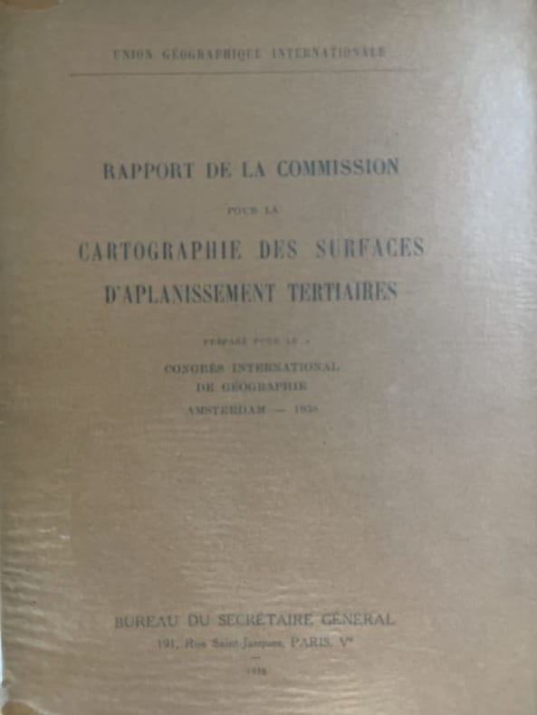
Union géographique internationale
Rapport de la commission pour la cartographie des surfaces d'aplanissement tertiaire préparé pour le congrés international de géographie d'Amsterdam - 1938
Sans nom Paris, 1938. In-8 broché de 94 pages. Cartes dépliantes. Très bon état.
Bookseller reference : 177162
|
|
|
UNION GEOGRAPHIQUE INTERNATIONALE
RAPPORT DE LA COMMISSION POUR LA CARTOGRAPHIE DES SURFACES D'APLANISSEMENT TERTIAIRES PREPARE POUR LE CONGRES INTERNATIONAL DE GEOGRAPHIE D'AMSTERDAM . 1938.
Paris 1938, In-8 broché, 94 pages. Cartes dépliantes. Trés bon état.
|
|
|
United States. Federal Interagency Coordinating Committee on Digital Cartography.
Coordination of digital cartographic activities in the federal government : third annual report to the Director Office of Management and Budget / submitted by the Federal Interagency Coordination Committee on Digital Cartography. 1985 Leather Bound
2020. Leather Bound. New. SPECIAL DISCOUNTED PRICE DURING COVID PANDEMIC. Leather Binding on Spine and Corners with Golden Leaf Printing on round Spine. Reprinted in 2020 with the help of original edition published long back 1985. This book is printed in black & white sewing binding for longer life Printed on high quality Paper re-sized as per Current standards professionally processed without changing its contents. As these are old books we processed each page manually and make them readable but in some cases some pages which are blur or missing or black spots. If it is multi volume set then it is only single volume if you wish to order a specific or all the volumes you may contact us. We expect that you will understand our compulsion in these books. We found this book important for the readers who want to know more about our old treasure so we brought it back to the shelves. Hope you will like it and give your comments and suggestions. Lang: - eng Pages 134. EXTRA 10 DAYS APART FROM THE NORMAL SHIPPING PERIOD WILL BE REQUIRED FOR LEATHER BOUND BOOKS. FOLIO EDITION IS ALSO AVAILABLE. hardcover
Bookseller reference : LB1111016759404
|
|
|
United States. Federal Interagency Coordinating Committee on Digital Cartography. Standards Working Group.
Federal geographic exchange format : a standard format for the exchange of spatial data among federal agencies version 01.08 : final draft / prepared by the Standards Working Group Federal Interagency Coordinating Committee on Digital Cartography. 1986 Leather Bound
2020. Leather Bound. New. SPECIAL DISCOUNTED PRICE DURING COVID PANDEMIC. Leather Binding on Spine and Corners with Golden Leaf Printing on round Spine. Reprinted in 2020 with the help of original edition published long back 1986. This book is printed in black & white sewing binding for longer life Printed on high quality Paper re-sized as per Current standards professionally processed without changing its contents. As these are old books we processed each page manually and make them readable but in some cases some pages which are blur or missing or black spots. If it is multi volume set then it is only single volume if you wish to order a specific or all the volumes you may contact us. We expect that you will understand our compulsion in these books. We found this book important for the readers who want to know more about our old treasure so we brought it back to the shelves. Hope you will like it and give your comments and suggestions. Lang: - eng Pages 68. EXTRA 10 DAYS APART FROM THE NORMAL SHIPPING PERIOD WILL BE REQUIRED FOR LEATHER BOUND BOOKS. FOLIO EDITION IS ALSO AVAILABLE. hardcover
Bookseller reference : LB1111017416719
|
|
|
 Receive by email
 Download as PDF document
 RSS feed


